July 14 -19
I never had any idea that there was real tundra in Washington State, I thought I’d have to go to Alaska to have a tundra experience. So when I read (in the book “Backpacking Washington”)that there was a part of the Pasayten Wilderness sporting REAL tundra my interest was piqued.
The Pasayten Wilderness is in Washington State. Its northern boundary is the US/Canada border. To the west is Ross Lake and North Cascades National Park and it extends 50 miles to the east expanding across almost half a million acres.
The trail guide I was reading described a trek through the eastern Pasayten, along the Boundary Trail, running east/west parallel to the Canadian border, to a place called Upper Cathedral Lake. This section of trail is part of America’s newest long trail, the PNT. Along the way, the author wrote, you will pass through Horseshoe Basin and there, LO! You will experience True Tundra!!
The route in the book began at Thirty Mile trailhead and went north along the Chewuch River. I bought the topos, studied the route, got all provisioned up and hoped for nice weather. About a week before the trip I visited the US Forest Service web site (Okanagan National Forest) and discovered that the first four and a half miles of trail were littered with more than 550 down trees!
Two years before I’d hiked 18 miles on an almost-abandoned trail, also in the Pasayten, aptly called the Three Fools Trail.


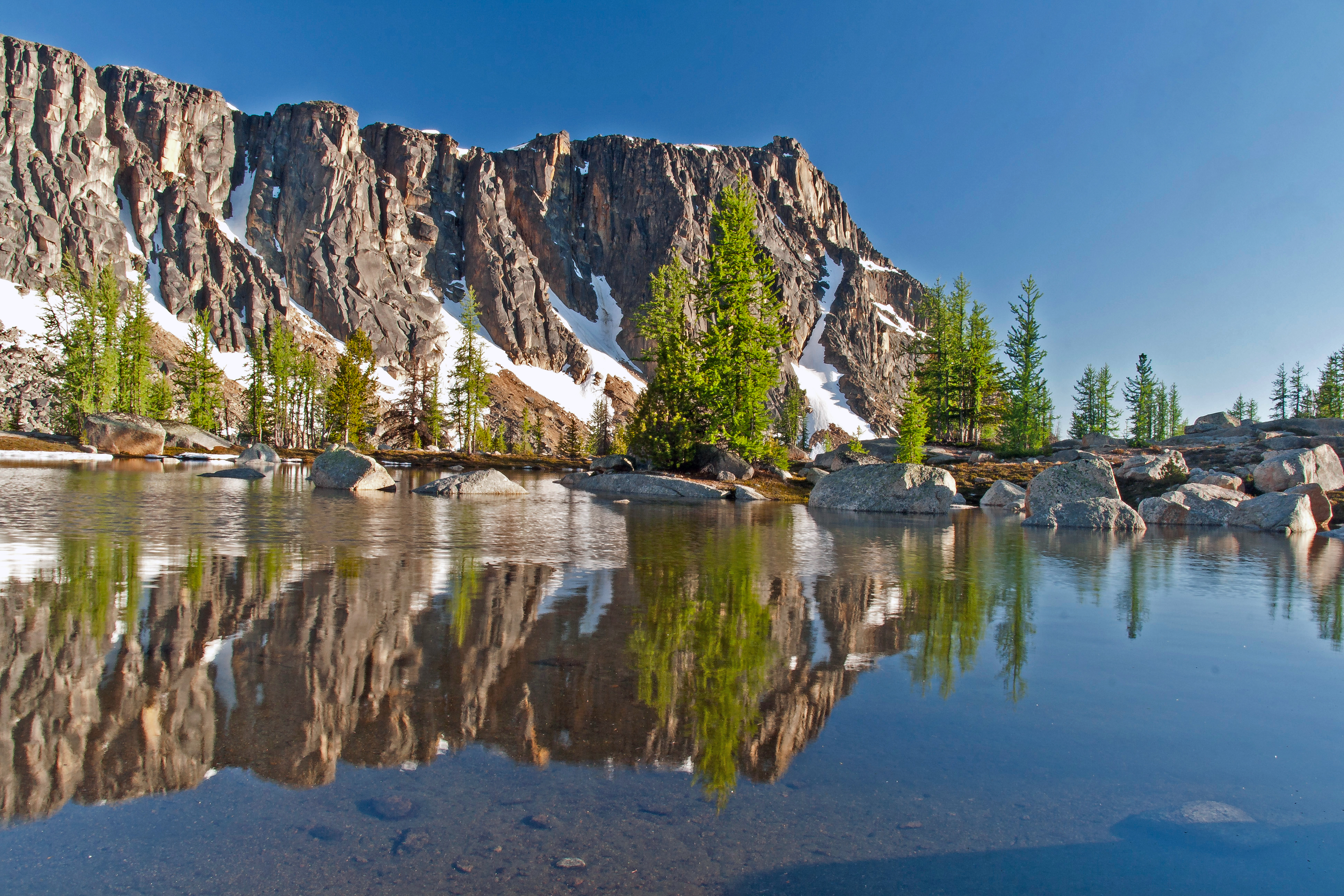
This was taken from the Three Fools Trail (AKA the Castle Pass Trail) as the trail traverses the side of the hill, just before the steep (and brushy!) descent to Big Face Creek. Pasayten Wilderness.
I say aptly named because the “trail” is non-existent in many places, and more importantly, two of my most foolish friends accompanied me.

The trail had about the same number of blow-downs (500 to 600) and was literally covered in thick brush. Hiking a trail like that is only fun AFTER you’re done, when you’re sitting at the restaurant enjoying a great meal, never before!
I located an alternate trail, it was 29 miles one way to Cathedral Lake, maintaining an elevation of 6,100 to 7,800 ft and promised great views.
The only downside was that we would need to drive nearly an extra 3 hours, but that was a much more appealing than clambering over 450 dead trees!
Our new route took us over Loup Loup Pass and through the towns of Omak, Tonasket and into the small town of Loomis. From there we headed up the Toats Coulee Road to the trailhead. The road was easy to follow, and not a challenge for our 4 wheeled friend.
We arrived rather late in the day and by 6pm we had arrived in Horseshoe Basin and tundra! We looked and looked and all we could see were acres of meadows carpeted with wildflowers. Where was the Tundra?


We consulted the map and then the copied pages of the trail guide, and then the map again. Yep, we were where the Tundra was supposed to be. Right smack-dab in the middle of Horseshoe Basin.
We were just happy to be there meadow, tundra, or what ever you called it, the place was magnificent.
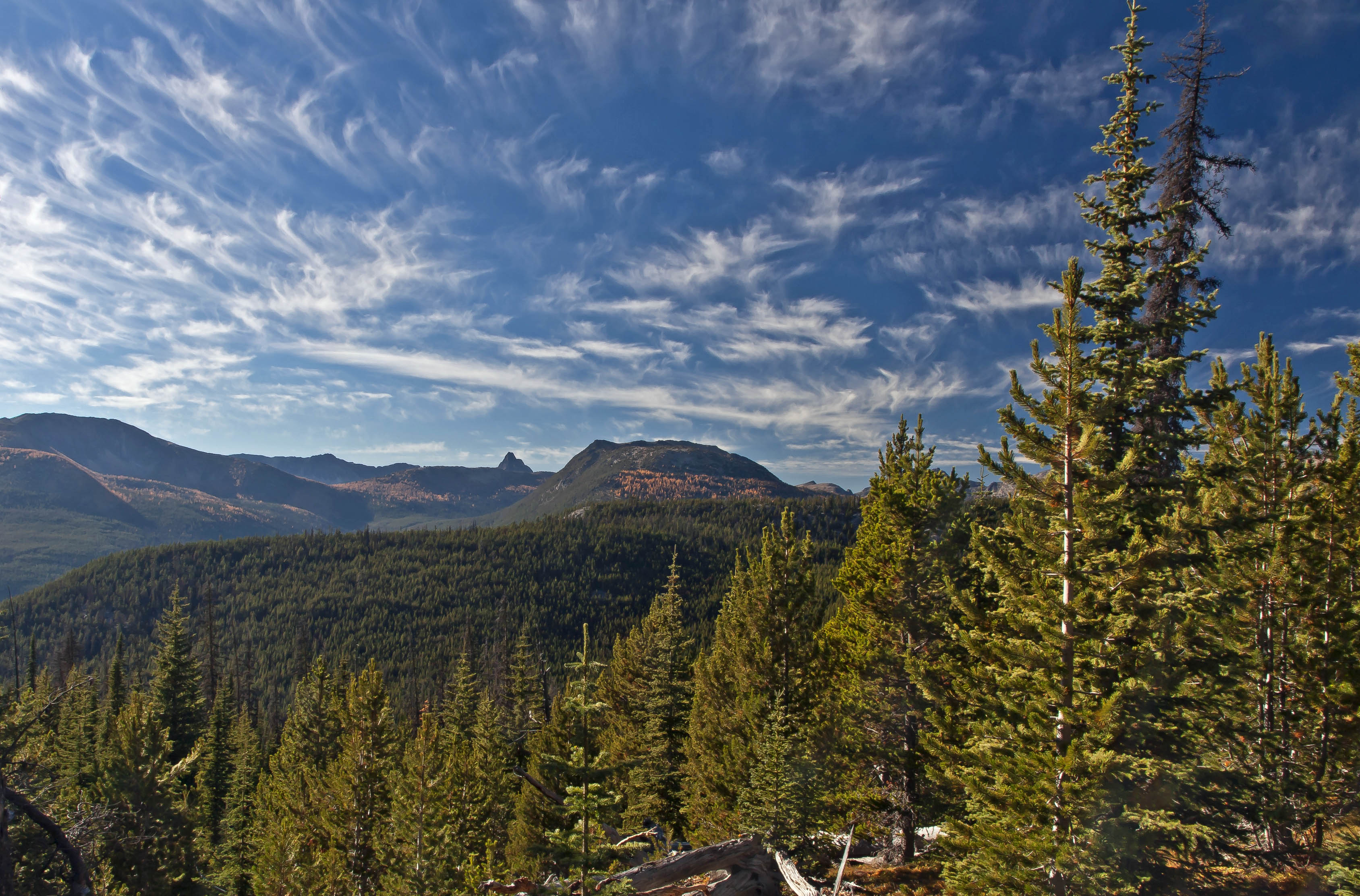
I love hiking in the Pasayten. One reason is that I love views and the Pasayten provides plenty.
With many trails following the crest of long ridges you can hike for days and have spectacular scenery damn near every minute.


Further west, in the North Cascades National Park most hikes start at a rather low elevation, involve a longish hike through forests and then rise up to a spectacular pass.
Some examples are Easy Pass, Park Creek Pass and Cascade Pass.
All of these places are breathtaking in the extreme. However you cannot camp at the top of any of them. So you go up and then quickly down the other side, back in to the forest.
Not in the Pasayten! Not only are there long and wonderful ridges to hike, but there are less trees and immense meadows. Endless meadows. And in July and early August the meadows are carpeted in flowers.


“Upholstered in herbaceous wildflowers” is what one of the guidebooks said. I have been to many places in the Cascades and seen lots of flowers. But nothing like the Pasayten. In other places there would be a meadow and clumps of flowers here and there.
In the Pasayten the entire meadow, as far as you can see is completely filled with flowers. Columbine, paintbrush, lupines and countless others blanket the ground.
It is really something to see an entire mountainside literally covered in flowers.
And the trees. Interspersed between the rocky summits and explosion of flowers are perfect clumps of trees. Each element serves to offset the other. The result is that the Pasayten is like a Zen Garden.

Every stand of trees, rock outcropping, and flower display has a special feel, like it was all painstakingly handcrafted. Nothing looks out of place.


There were literally miles and miles of flowers…
Our first night we camped in the middle of Horseshoe Basin, right on the tundra and anticipated our journey the next day. This was our first long hike of the year and we were not acclimated yet.
The next day’s hike took us by Louden Lake


and around Rock Mountain. We lazed at a fine looking creek and enjoyed a hot lunch, and made it as far as Teapot Dome to camp.
Our campsite was another meadowy-tundra-like concoction full of flowers and bugs, LOTS of bugs.

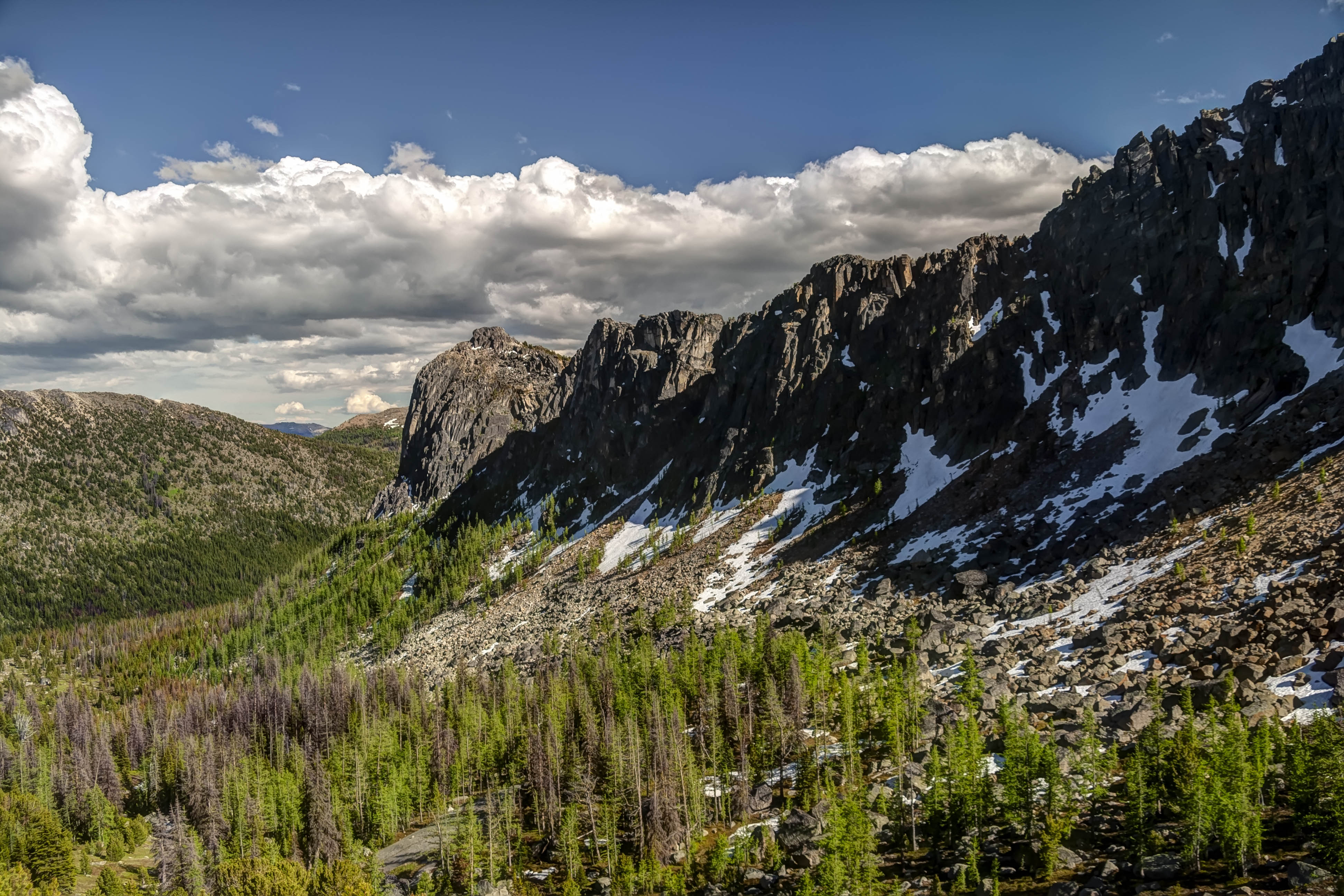
Early the next morning we were on our way, we stayed on the Boundary Trail, which maintains its elevation, traversing along the western side of Bauerman Ridge, through Scheelite pass and again traversing along Wolframite Mountain.
The weather so far was perfect, cool at night (we had a few nights with frost) and warm in the day. The entire route on this day was on south facing slopes.

It was clear that the trail was normally quite dry, but as we were so early in the season there was a flourish of small almost desert like flowers all over the ground.
Approaching Tungsten Creek we passed a couple hiking the opposite direction, with what appeared to the reincarnation of Lassie. Lassie was happily leading the way, with her heavy pack.
Following were a couple; I would say 65 to 70 years old, cruising right along.
Both had old sneakers, external frame backpacks, with super big canvas-looking sacks and looked like they could out-hike us any day of the week.
We continued our traverse and saw some wooden posts made into sort of an A-frame welcoming us to the Tungsten Mine.
Just at that moment by friend gave me a sort of garbled hush noise and pointed up the hillside. It was a huge bear, much bigger than any I’d ever seen, I would guess 800 lbs or more.
Both of us thought it sure looked like a Grizzly. She sure had the face of one, she was there maybe 20 yards off the trail in plain view. She got a good look at us and vamoosed off, up the hill.
We continued to the mine where there are all sorts of intact buildings and other human remains. There is an old long and low bunkhouse, which is empty now except for an old cast iron wood stove.
The walls and wood work inside are literally covered, almost every square inch with the carvings of the names of hikers who have passed through.
Nearby is a newer looking a-frame structure with an old bathtub sitting out front . It looked inhabited, and we looked around outside but didn’t see the miner or anyone else.


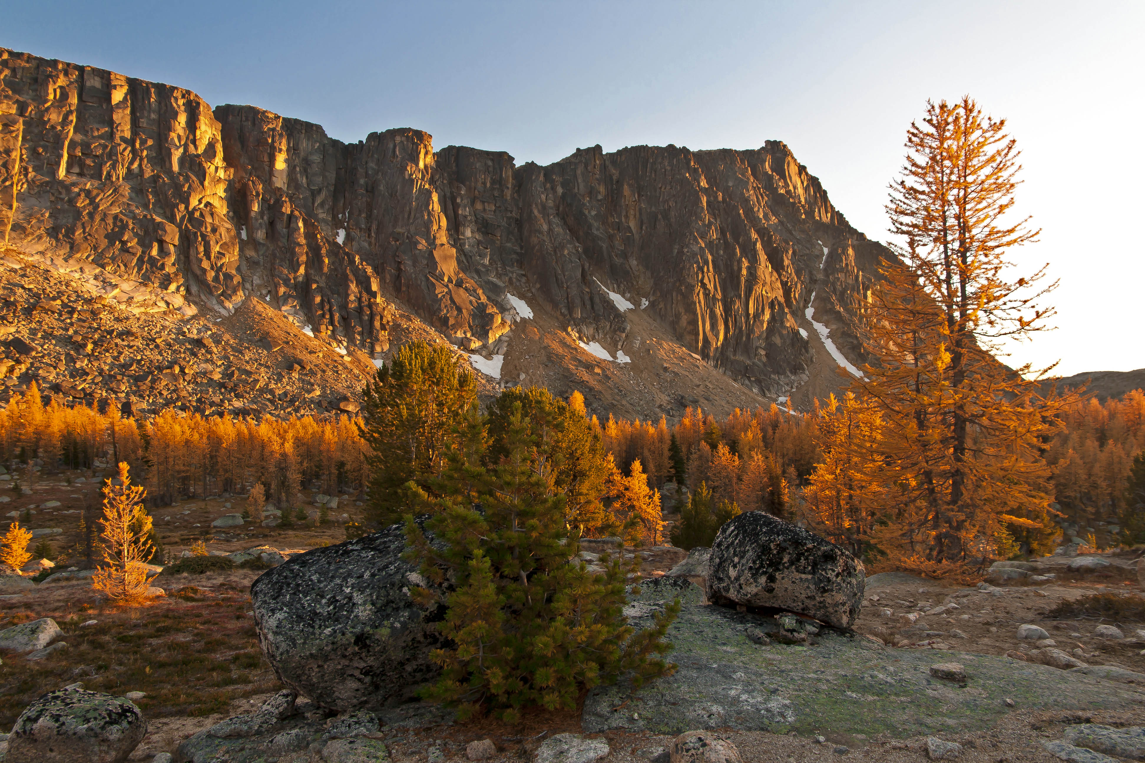
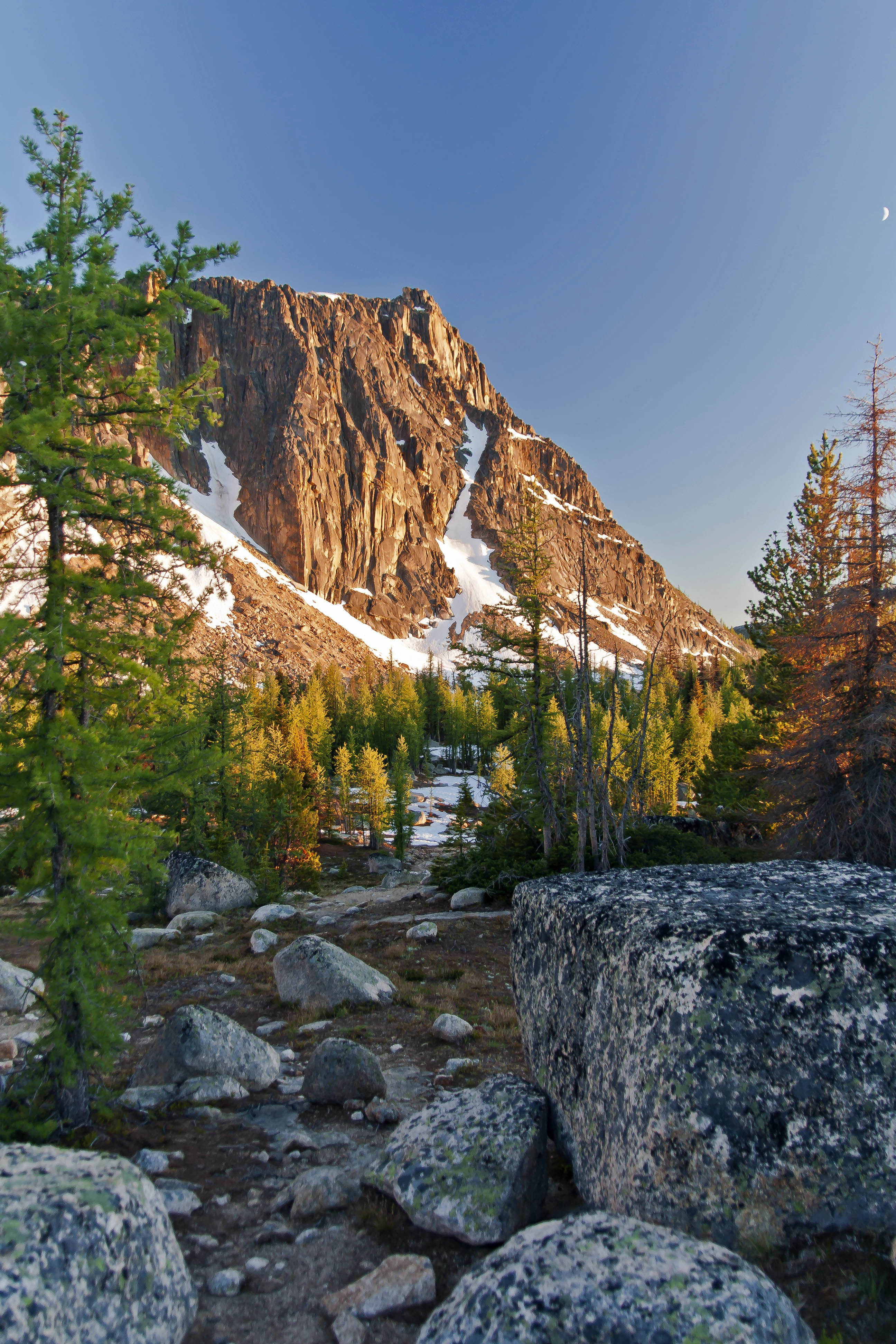
From the mine it was a relatively short and easy hike up to Apex Pass (7800 ft). Once we came out on the west side of the pass we were astounded, shocked, surprised and generally overwhelmed with the view.
The trail guide we had raved about the beautiful tundra and didn’t make much mention of Apex Pass or Cathedral Peak, so we weren’t expecting any thing special.
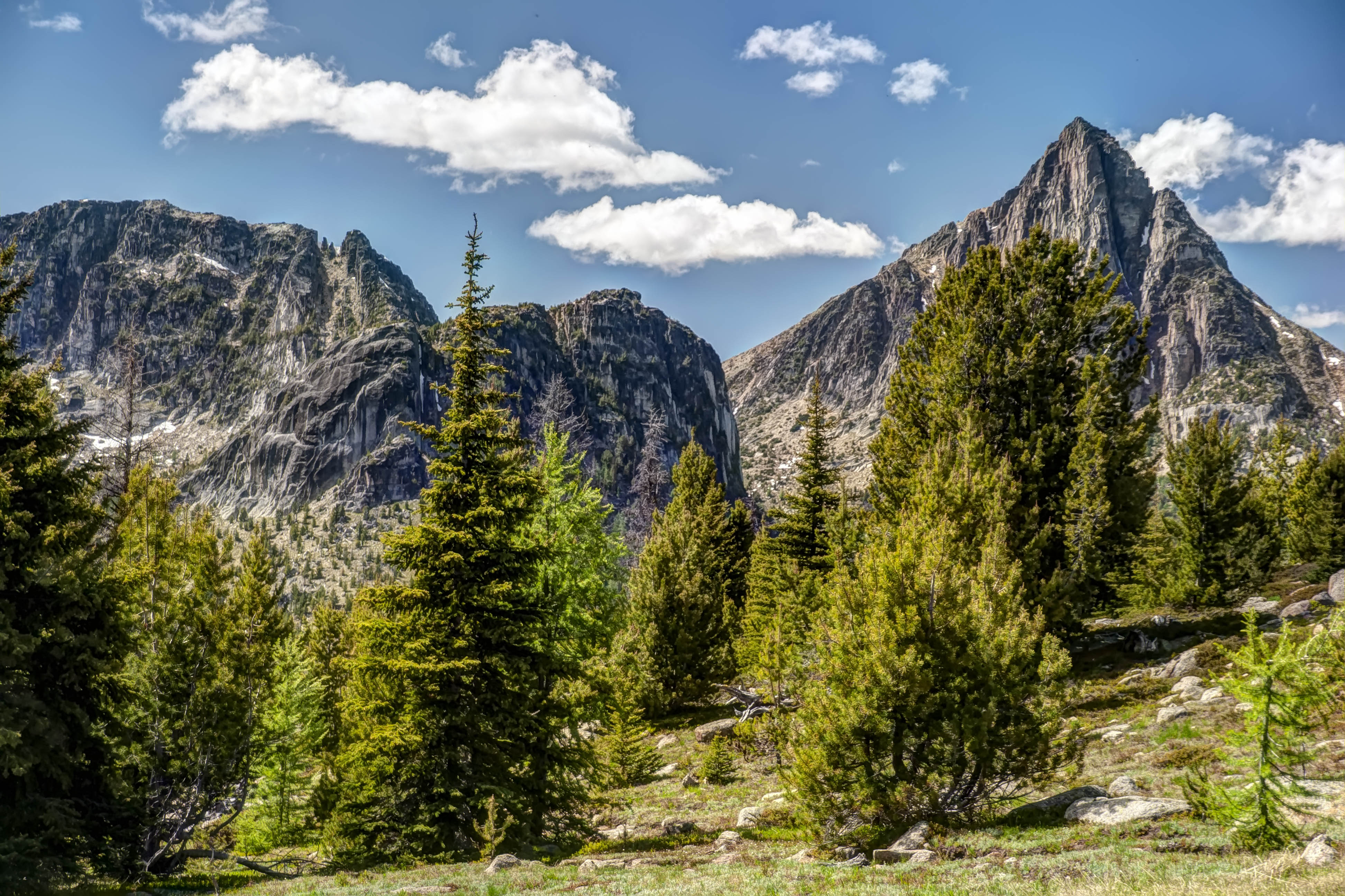
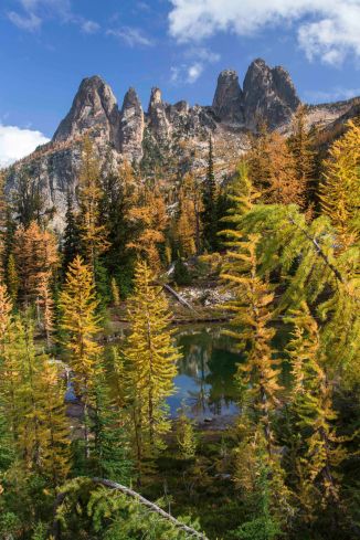
The view was astounding. We could see the eastside of Amphitheater Mountain, and next to it the triangular spire of Cathedral Peak.

Across the valley to the southwest Remmel Mountain reared up. There was a bright blue sky, white puffy clouds and lots of green meadows (tundra?) all around.

We just stopped there in awe, I was running all over like a 6 year old, taking pictures and exclaiming loudly how awesome a place it was.
After running out of cool sh## to say and taking maybe 200 pictures we saddled up to tackle the final two miles or so Cathedral Pass.
The closer you get to Cathedral Peak the more you stop and stare.

The southeast face of the peak is remarkably steep and actually looks out of place. The eastern Pasayten is better known for its rounded peaks than its jagged summits.
This entire area looked more like it belonged in the Southwest than the Northwest!

After untold numbers of stops for more picture taking we arrived at the pass. And there was heaven! Amphitheater Mountain on the south shoulder of the pass

and Cathedral on the north,

to the west a sweet basin containing Upper Cathedral Lake. Amphitheater Mountain is a very long (1.5 miles) sweeping, rocky ridge.
Viewed from Cathedral Pass its quite a sight, Amphitheater makes a 100 degree turn and so you can view both faces, or arms of the mountain from one spot.
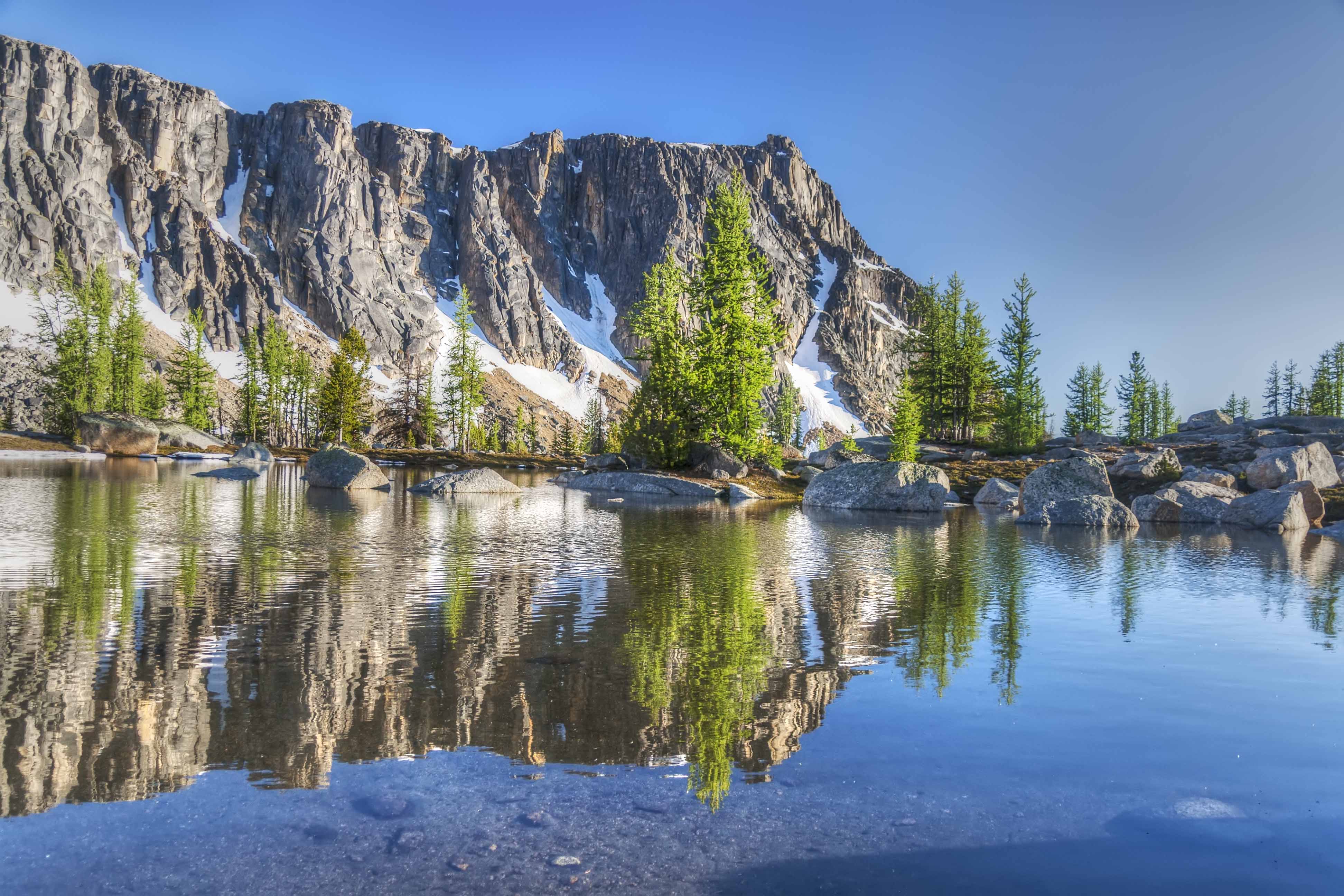
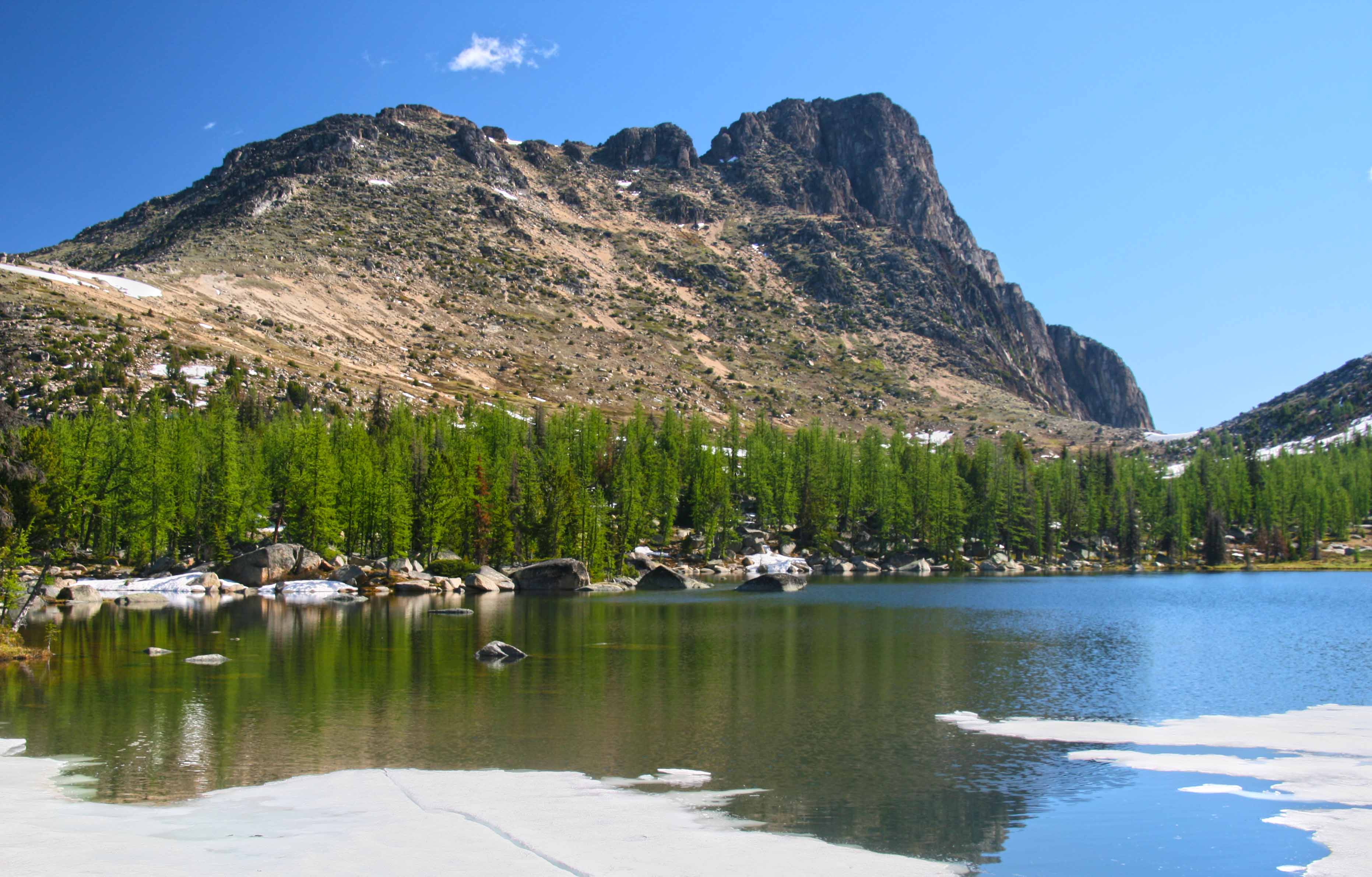
We strolled down into the upper basin where there was a large snowmelt pool.
The view from here of Cathedral and Amphitheater was so incredible we decided to camp right there and leave further exploring for the next day.
The pool provided many reflective photo opportunities when the sun started setting.


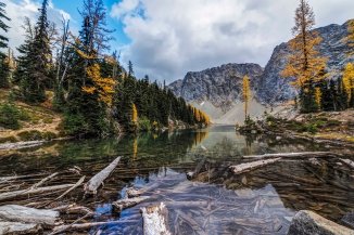
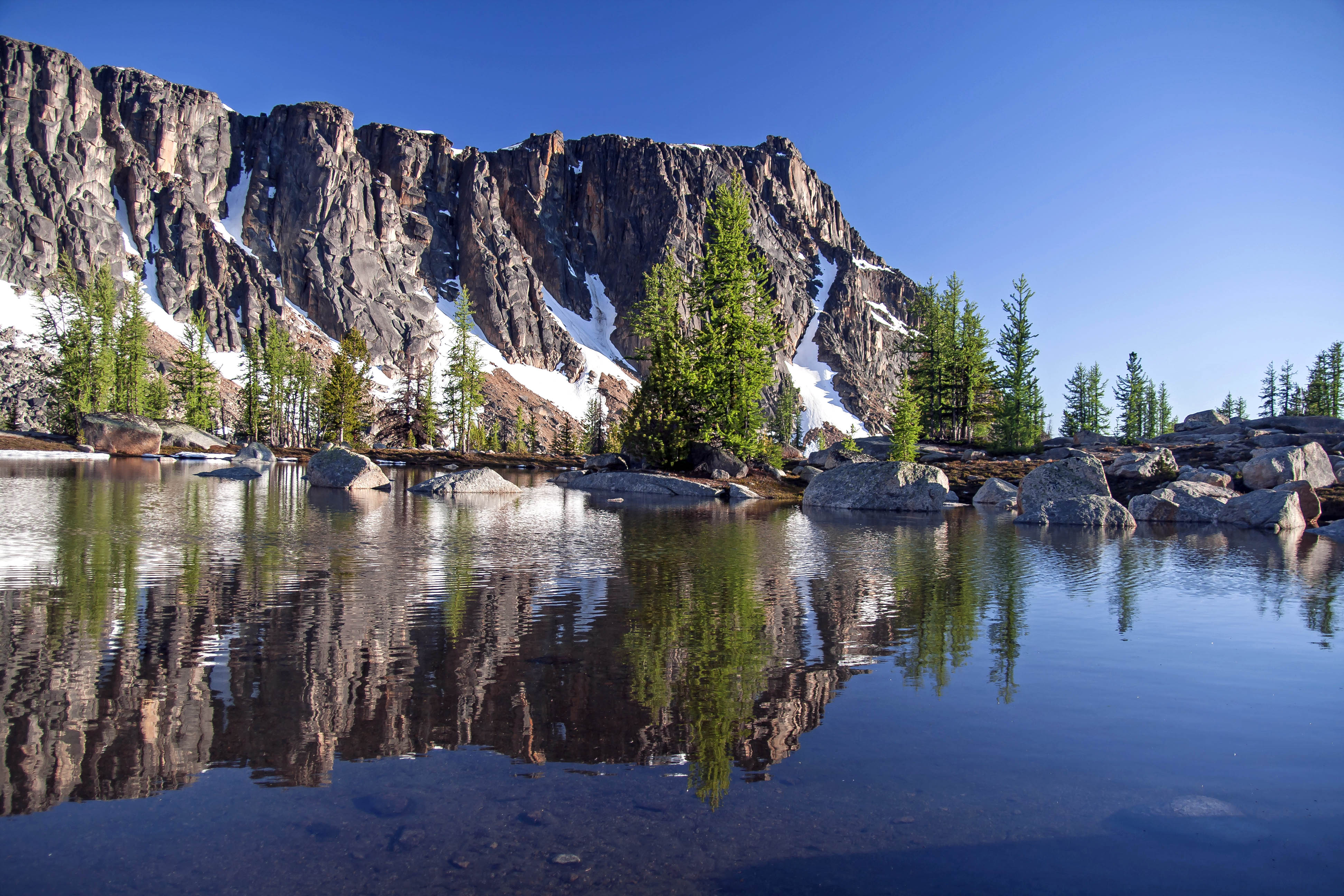
Before starting our trip back we took a few minutes to head over to Upper Cathedral Lake.
The lake was more than half covered in snow and ice, the southwestern end of the lake ripples at the sheer base of Amphitheater Mountain.
There are many great camping spots and we saw several anglers trying their luck.
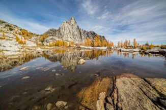
The classic view of Cathedral Peak is taken from this SW corner of the lake.

From here one can see that the entire basin is filled with larches. Coming back when they turn yellow will definitely be part of the plan for the fall!
Here is our camp site below Cathedral Peak, looking at Amphitheater Mountain…

The only single thing detracting from staying at Cathedral was the bugs. The incessant drone of mosquitoes compelled us to consider finding a new camp for the night.
The day before when we were at Apex Pass we hadn’t noticed many bugs, and the view was fantastic, so we packed up and headed back there to camp.
We arrived and found a place to set up the mesh tent in the shade, where we had a stupendous view.
It didn’t take long before we realized that a) there were even more bugs at Apex Pass, b) even with a mesh tent in the shade we were literally cooking in the tent.
Our view was beyond compare, but as the day got longer we grew hotter and grumpier from being held captive in out stupid tent.
There were a few more hours before it got dark, so we quickly packed and hit the trail.
Passing through the mine again did not reveal any more grizzlies and we made it back to Scheelite Pass as darkness fell.
Its always interesting to me that even when I have already hiked a trail my memory of it is can be so off.
No doubt my physical and emotional state alters my perception of the difficulty/beauty of the trail. In this case being hungry, tired, in a hurry to reach a new camping spot, and completely DONE with mosquitoes it seemed that the trail was MUCH longer.
The following day we hiked all the way back to the other side of Sunny Pass, passing through Horseshoe Basin. This time we spent some time at Louden Lake and got some great pictures of the lake and the wildflowers.
A couple of years ago I made a trip to Entiat Meadows, in the eastern part of Glacier Peak Wilderness. The fields/meadows/tundra in Horseshoe Basin didn’t look any different than Entiat.
But what do I know! I’m just glad that the mention of tundra caught my attention!
October 1 – 4
It took a little finagalin’ to get the time to go, but we did it! We left Thursday night, Sept 30 and headed up to Washington Pass. I wanted to get photos of Liberty Bell at sunrise/sunset,


so we camped out along the start of the Blue Lake trail and captured a few images.
We retraced our earlier trip, heading to Tonasket, up to Loomis and to Iron Gate Trail Head.
The road to the trail was itself spectacular, great fall colors.
There were very few cars at the trailhead…

We arrived and got started, we passed through Horseshoe Basin, with its now brownish tundra,

passed almost gone Louden Lake,

and made it to Teapot Dome by night fall.
During the entire trip we did not see one other person.

Our plan was to do about 14 miles a day, 4 days total there and back.
The nights were COLD and the days perfect, blue skies and no clouds. It is really so much more pleasant to hike with NO bugs! I need to do more fall hiking.
We had some concern that there may not be water available along the trail, now that it was fall, but we found an abundance of water all along the trail.
Hiking along the Boundary trail is such a pleasant experience, easy grades, great views,


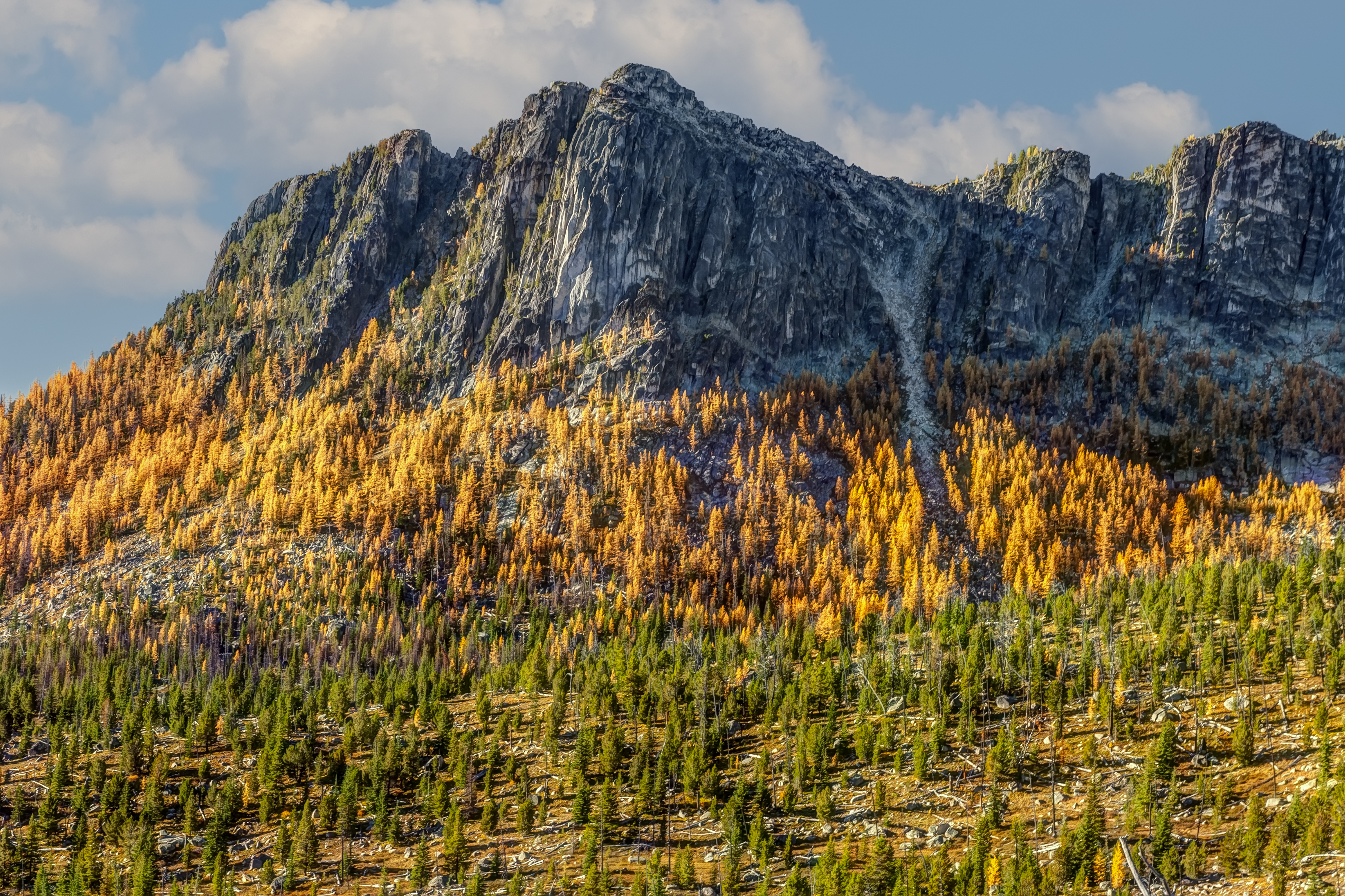
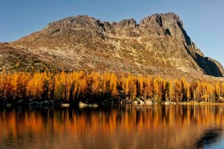
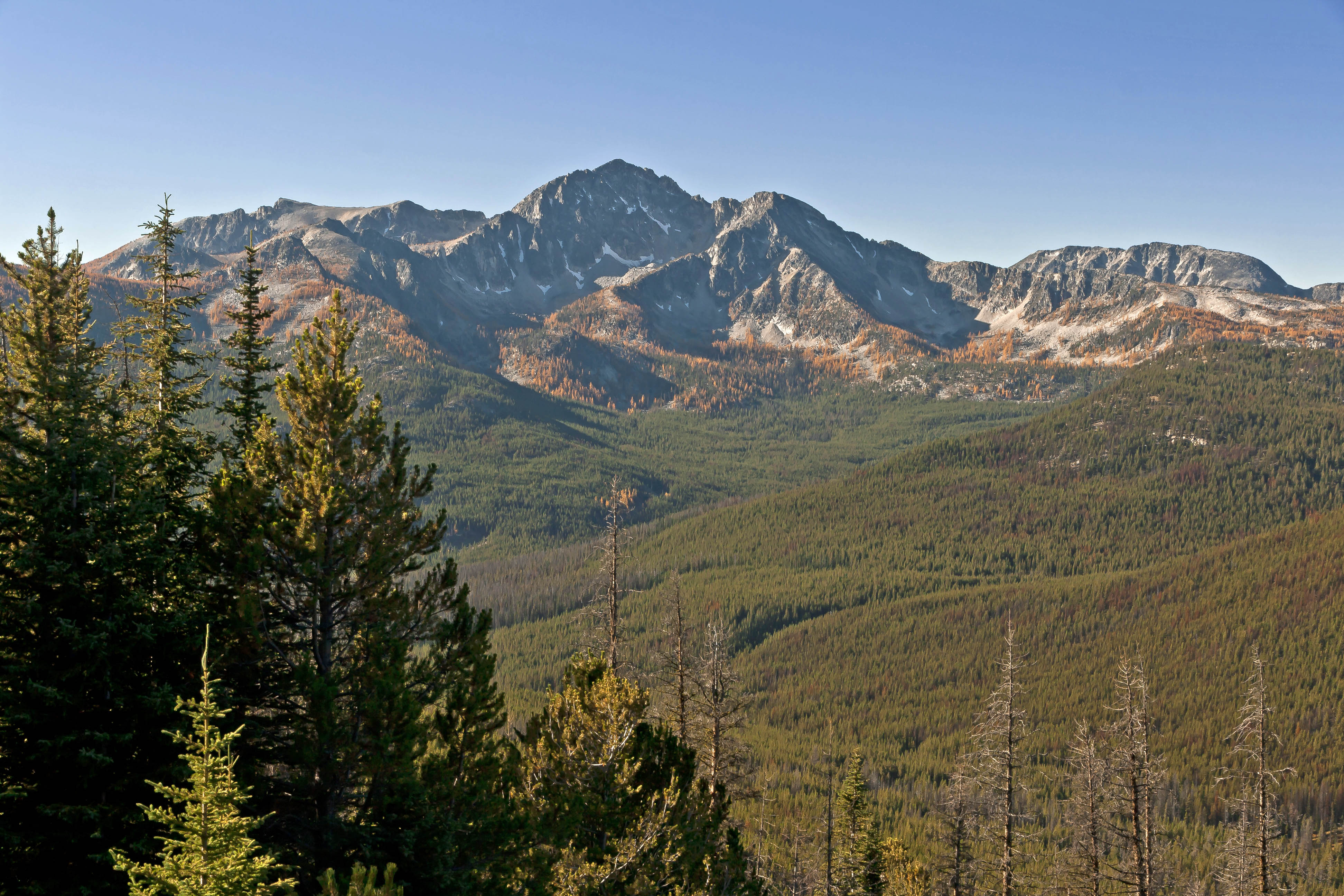
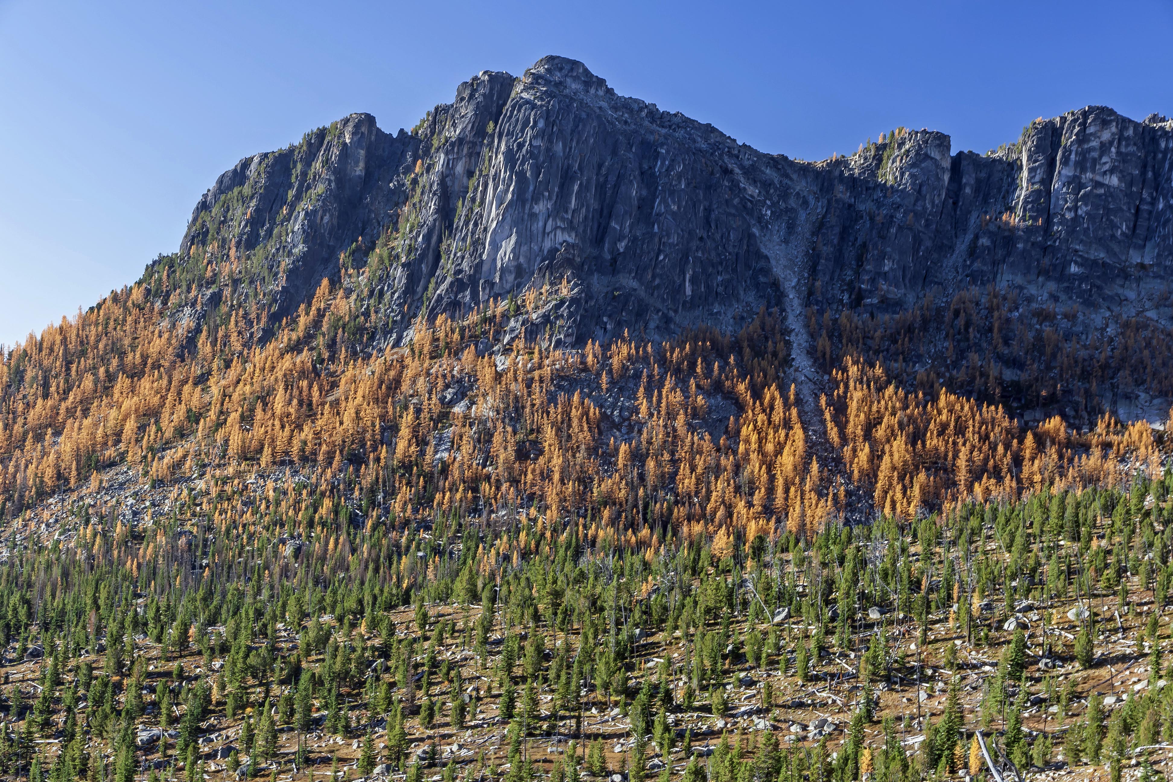
lots of sun. We could see the band of larches across the valley, on the side of Windy Peak.
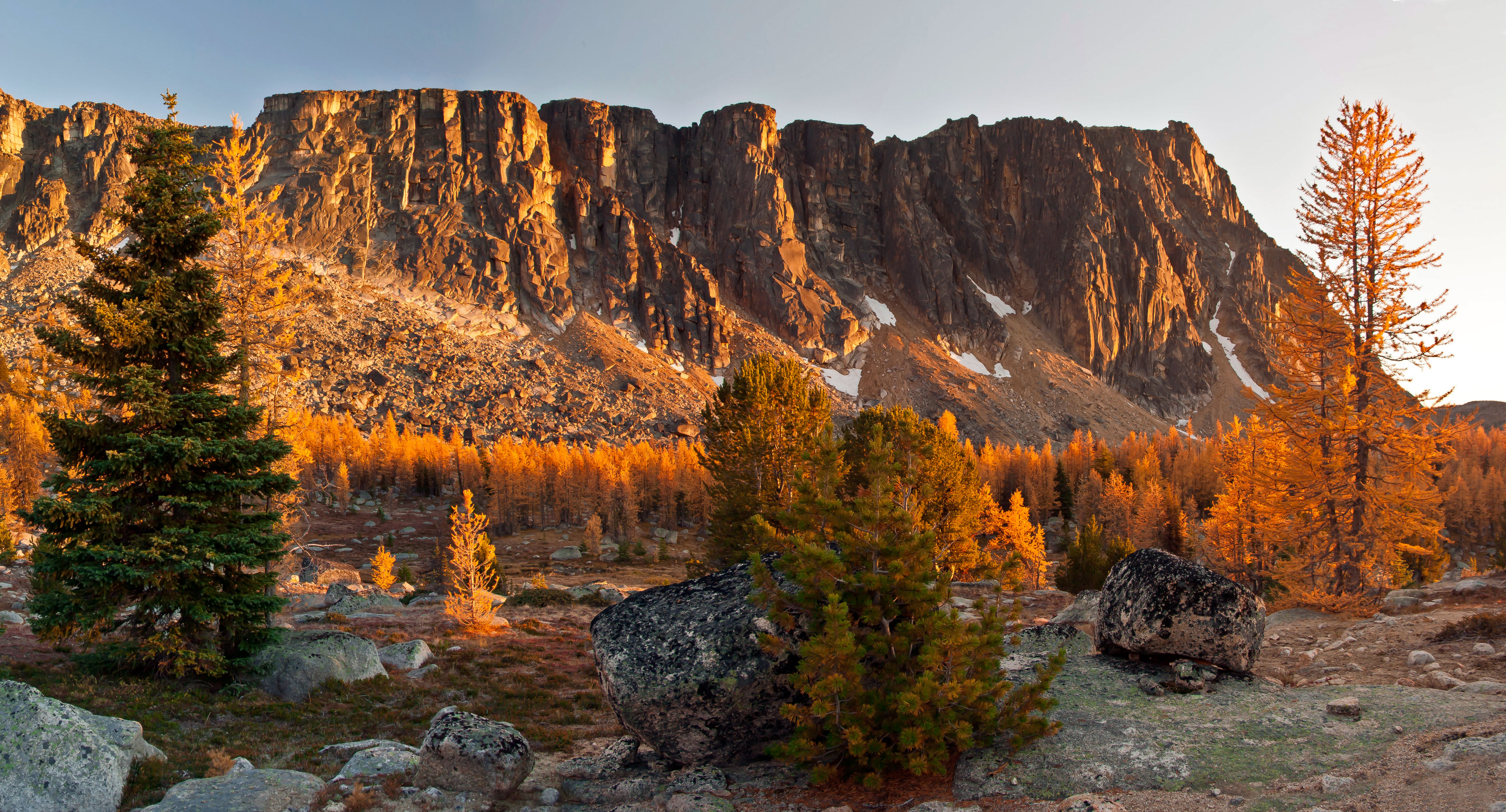
As we approached Apex Pass we were again awestruck with the views,
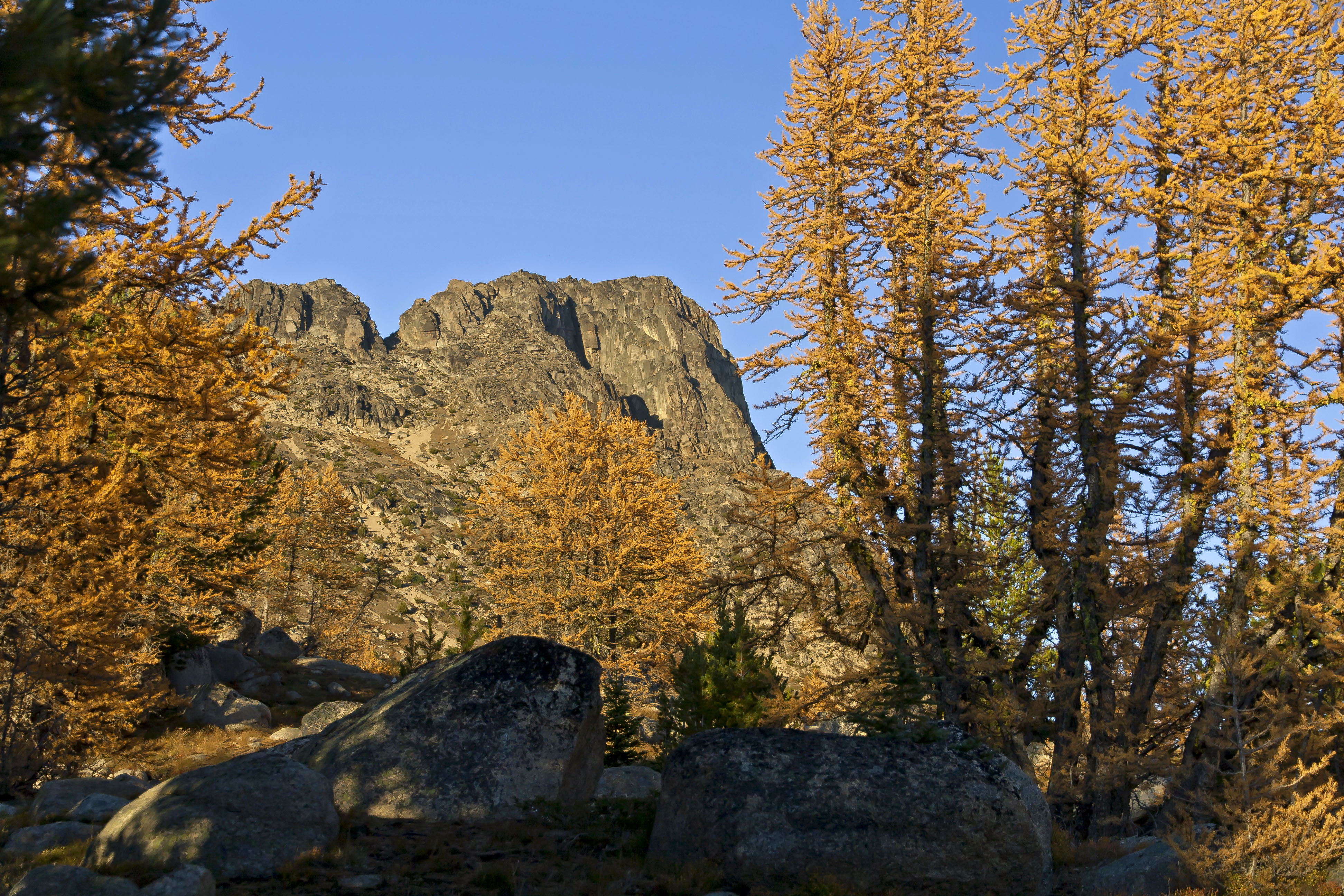
only this time the larches added so much color to the experience.
The larches look like a swath of orange painted across the mountains…

The larches seemed to find a specific elevation, creating a swath of outrageous color…

Its interesting to compare the images from early summer to fall…
Remmel Mountain from the Boundary Trail, Pasayten Wilderness

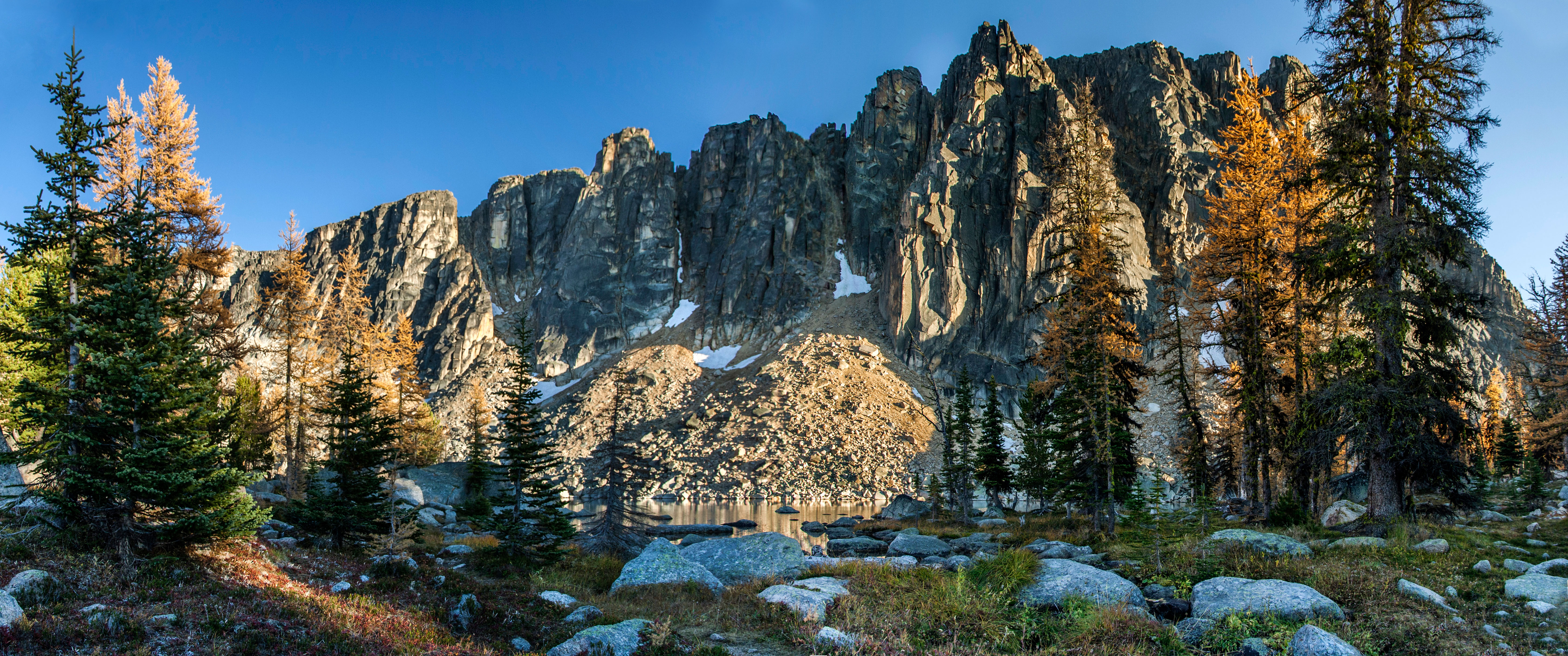
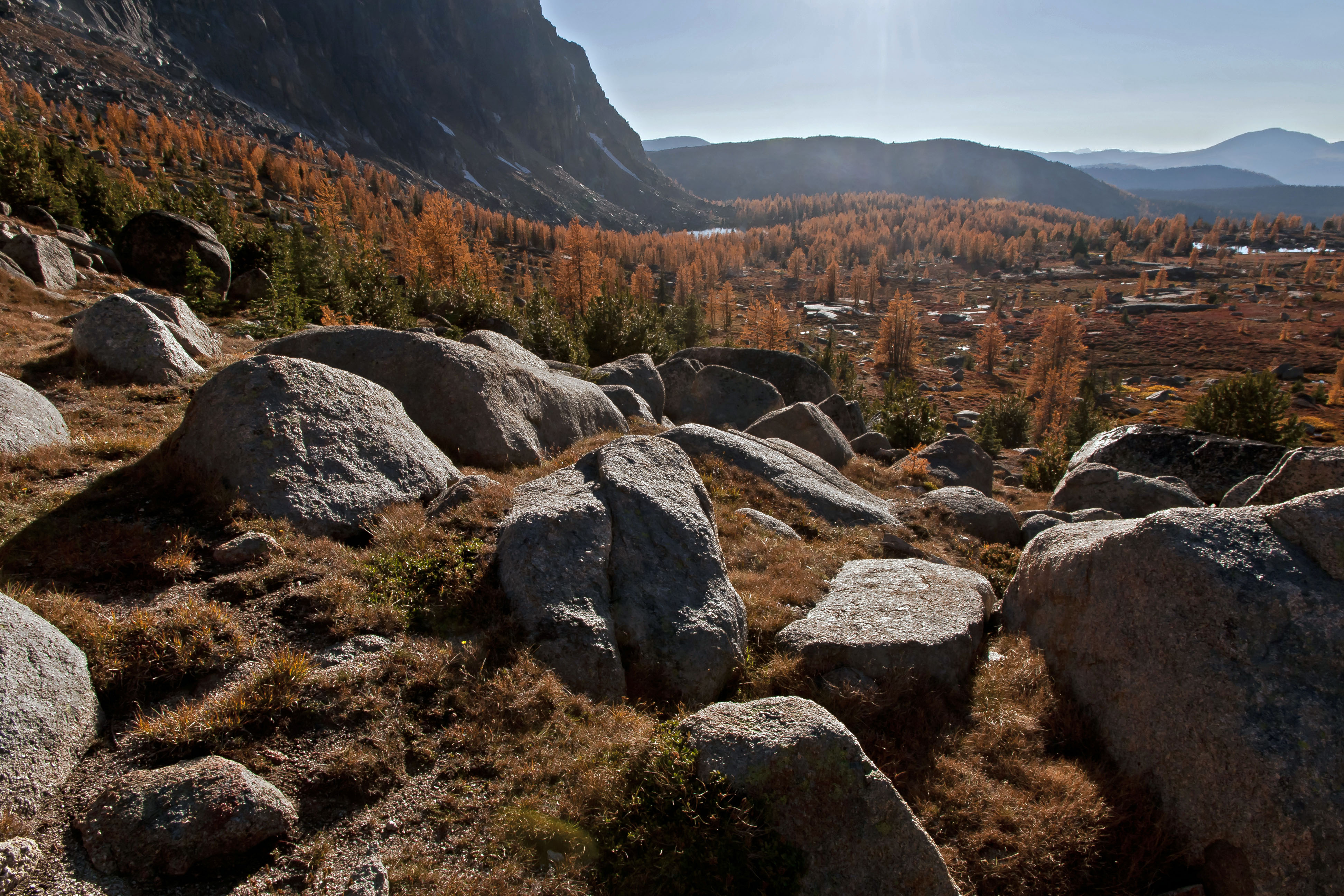
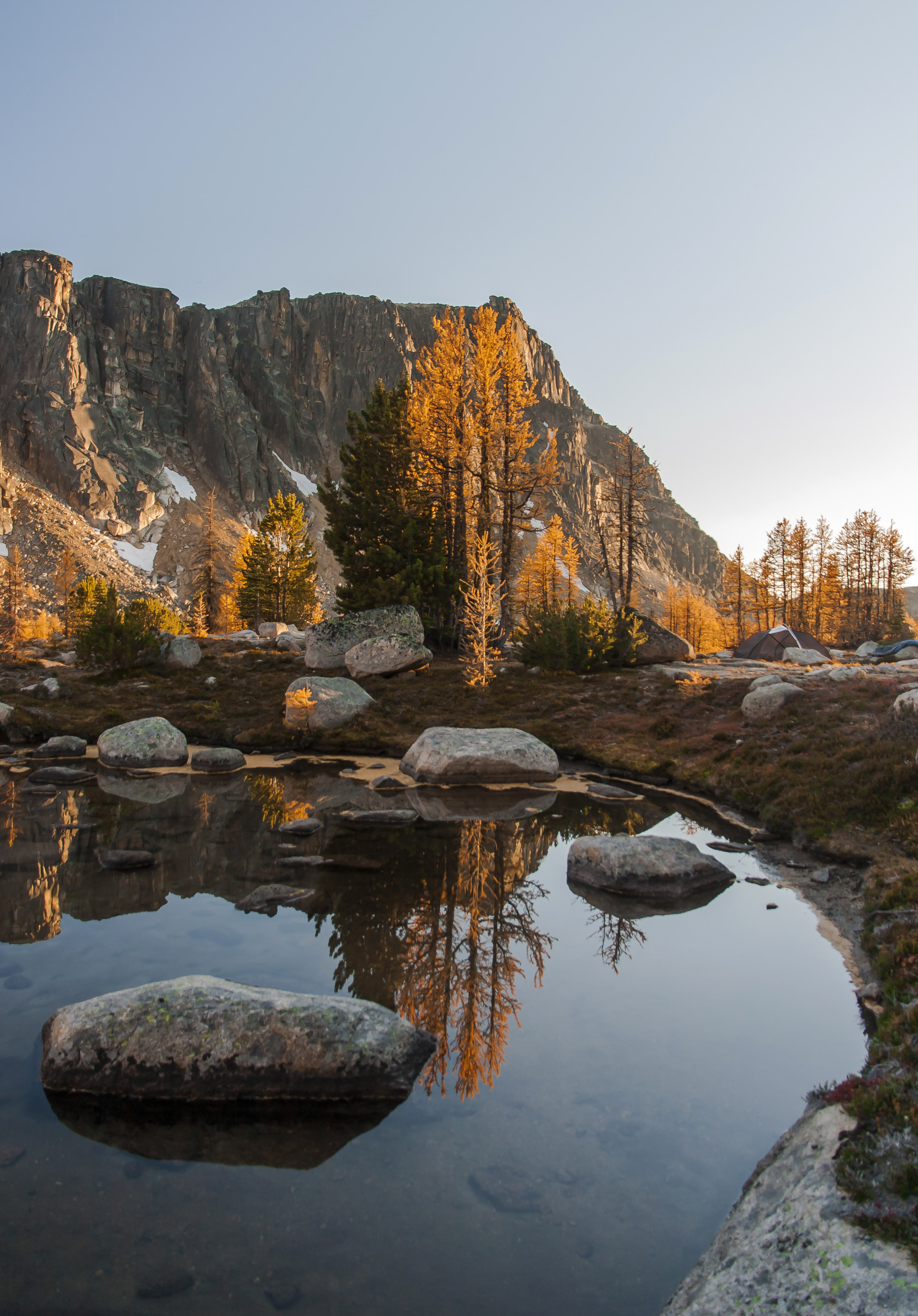
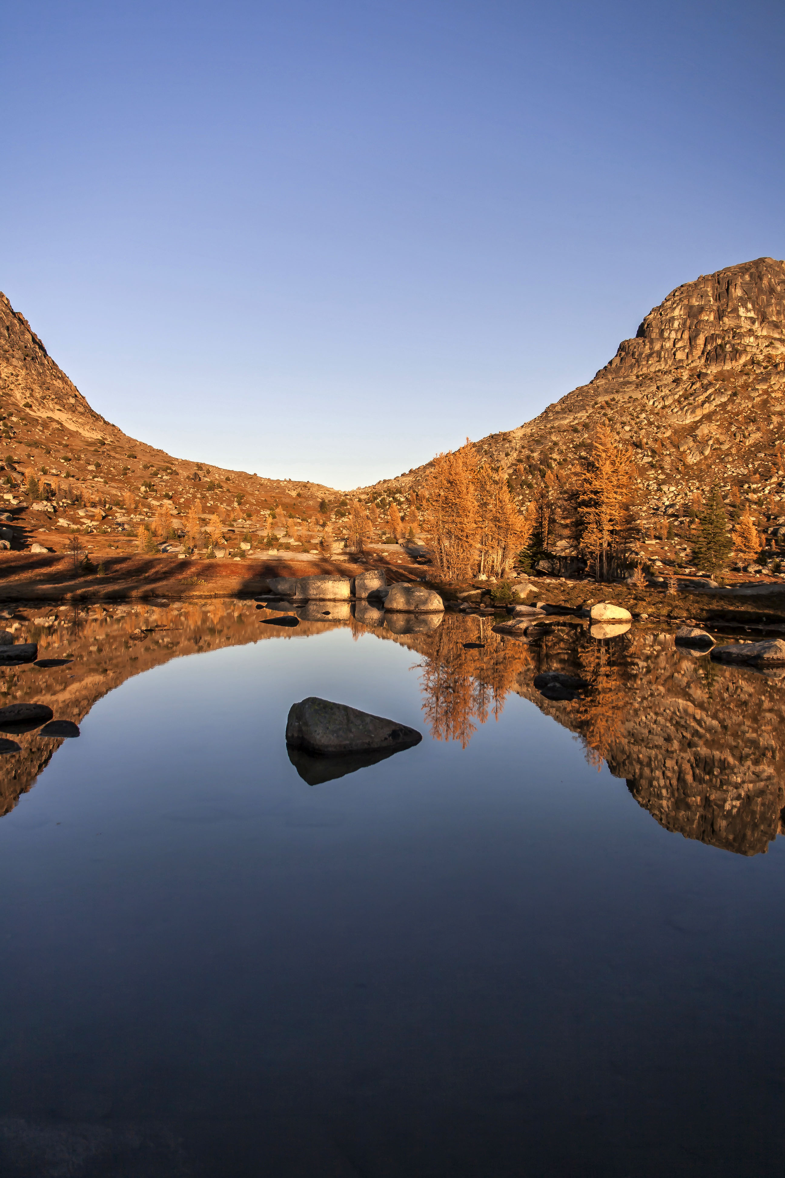
We reached Upper Cathedral Basin about an hour before sunset,
almost 30 miles in two days, its a good feeling to reach the final pass!
Any lack of energy I was feeling soon disappeared as we reached the pass and looked down towards Cathedral Lake

Luckily we had about 2 hours yet until sunset.
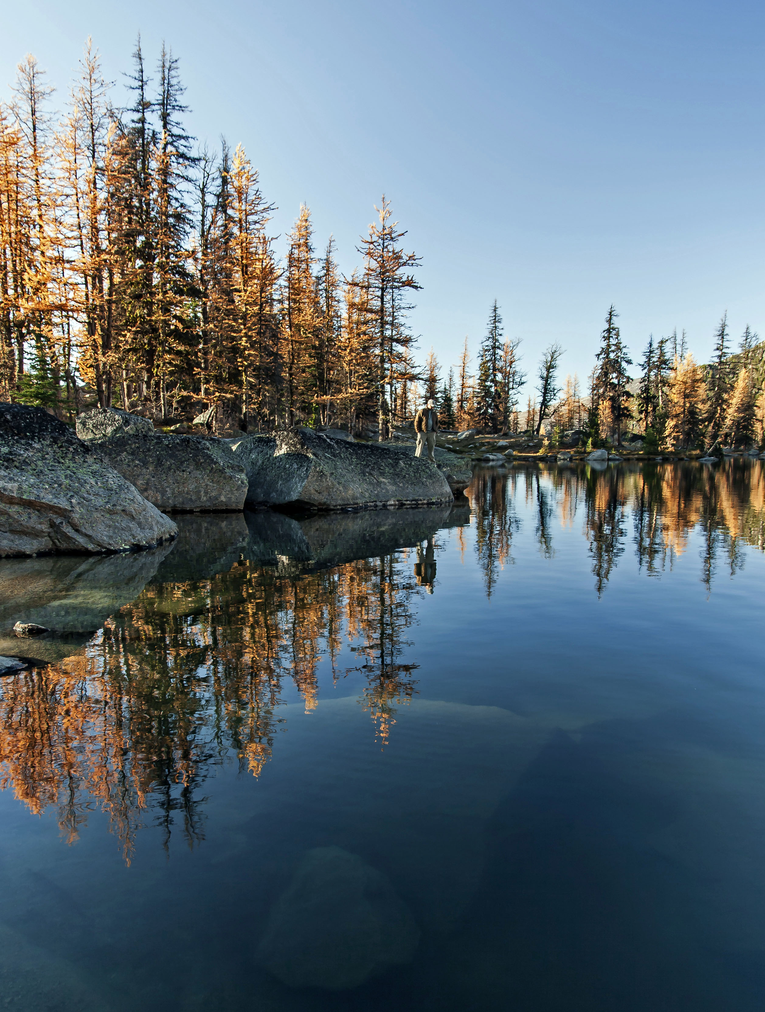
We hurriedly set a camp and rushed down to the lake to get images of the sunset.
The orgy of photo taking ended a few hours later.
I was definitely in sensory overwhelm!

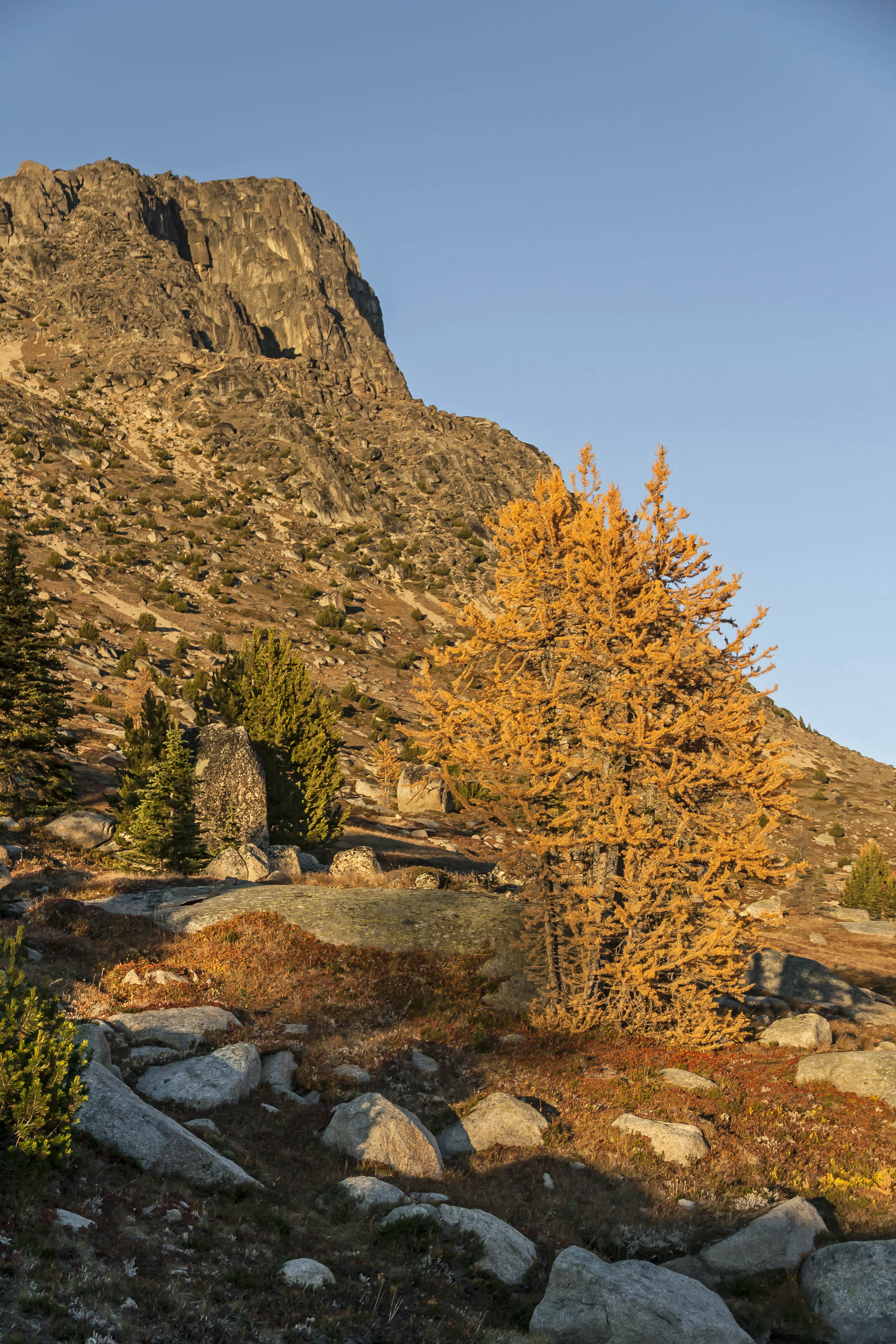
The larches looked like they were plugged in.

The Upper Cathedral Lake Basin was filled with them.
It was a perfect evening: blue skies, orange larches and no bugs!

The entire basin was afire.

Amphitheater Mountain was stunning.
Blue, black, green and orange…
As the sun set the larches became even more rich in color.

The trees made perfect frames for the peaks.

I definitely took many pictures!
After an hour or so it was hard to continue, the sensory shock was upon me!

We finally made it back to camp and had some dinner while the final rays of sun shone in the basin…
and we slept very well!
We arose early the next day and started our journey back.

Late Sunday afternoon as we approached Sunny Pass it got cloudy and cold, and we flew down the trail and off to Tonasket for some dinner and started the long drive back.
One of the most pleasant and scenic trips I have ever taken in the North cascades, both in spring, and fall!