
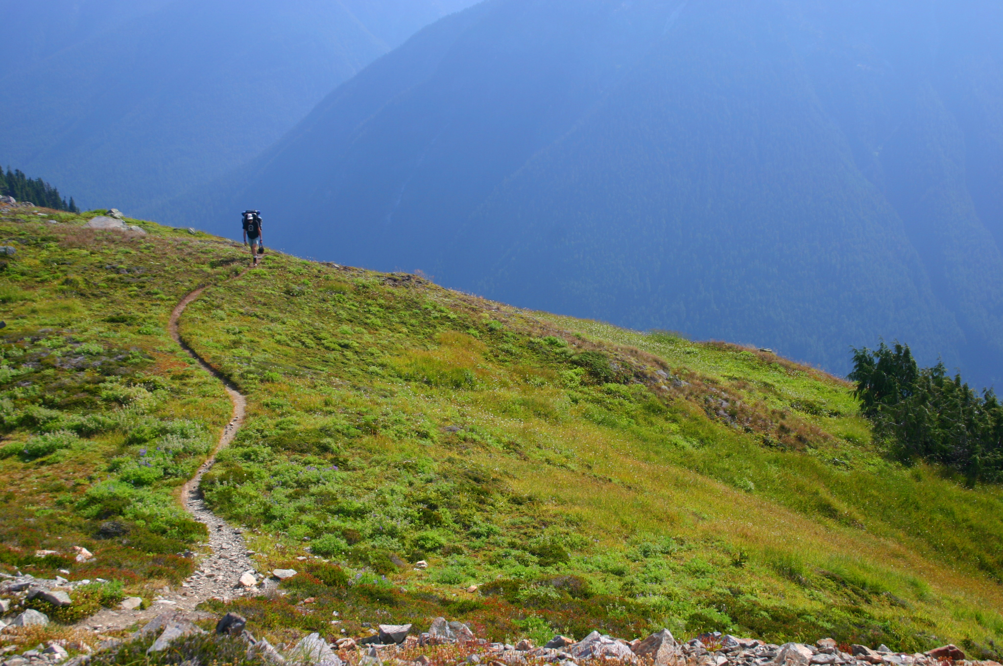
Copper Ridge is located in the northern section of the North Cascades National Park, in Washington. To get there from Bellingham you drive east on Highway 542, the Mount Baker Highway, past the town of Glacier and turn left on Forest Road 32, for Hannegan Pass. The road ends at a parking area and here your hike begins. The first 4 miles climb 2,000 ft. up to Hannegan Pass. Along the right are nice views of Nooksack Ridge. 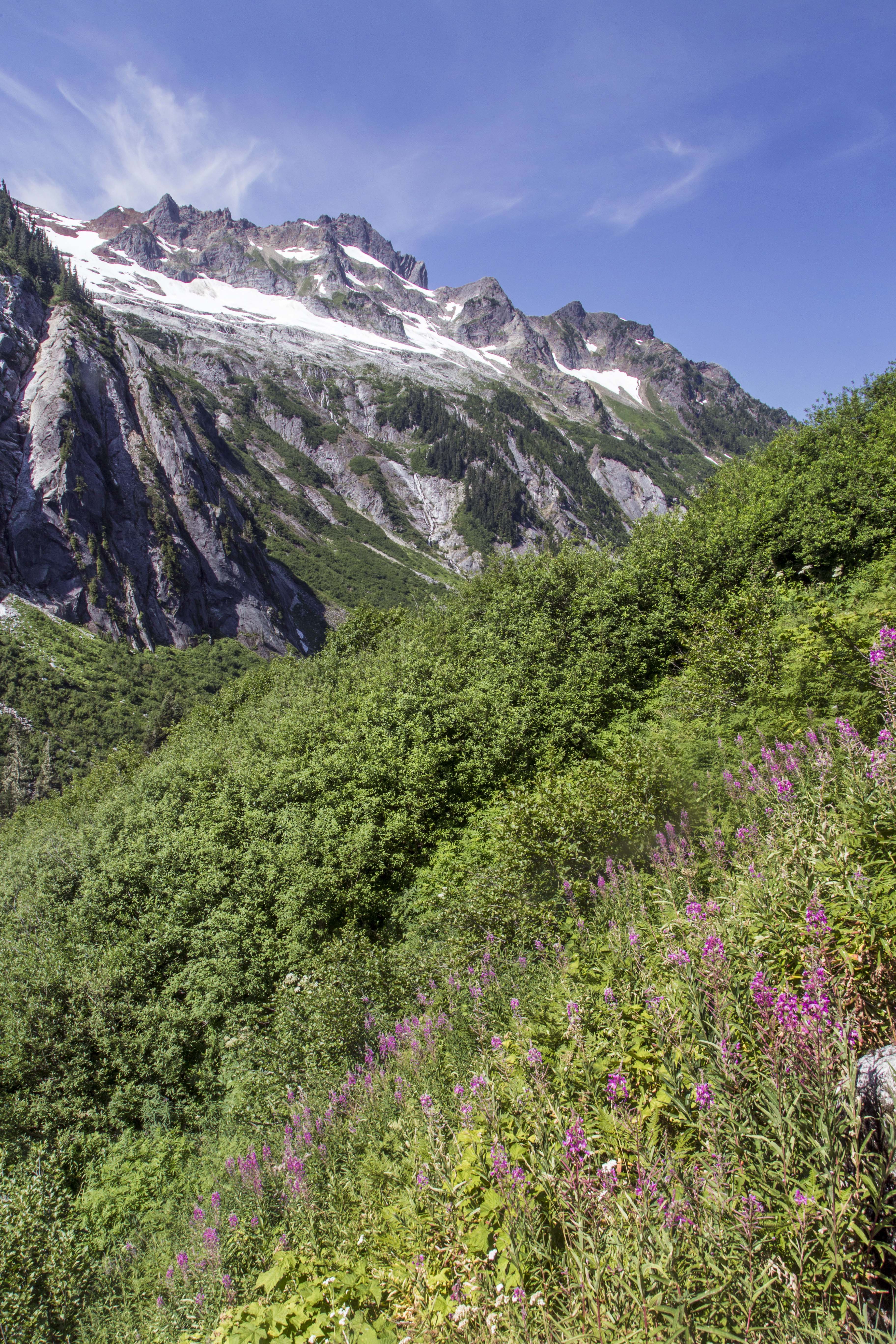 From the pass the trail descends and after 1 mile you reach boundary of North Cascades National Park and the trail junction with the Copper Ridge Trail.
Any overnight stay in the National Park requires a permit, which you can obtain from the Ranger Station in Glacier. Permits are limited and first come first serve, be sure to get there at the crack of dawn (or even better right when the Ranger Station opens…) to snag a permit. Also, one little known tip is that you can get a permit one day before you start your trip, so if you can arrive and get a permit to camp at Selesia camp the next night then on your first night you can camp at the site just west of Hannegan Pass (which is not in the park, no permit needed).
From the trail junction you head north and up to Copper Ridge. Its another 3 miles until you reach Selesia Camp which is perches out along the ridge commanding fantastic views east towards Whatcom Peak and Mount Challenger 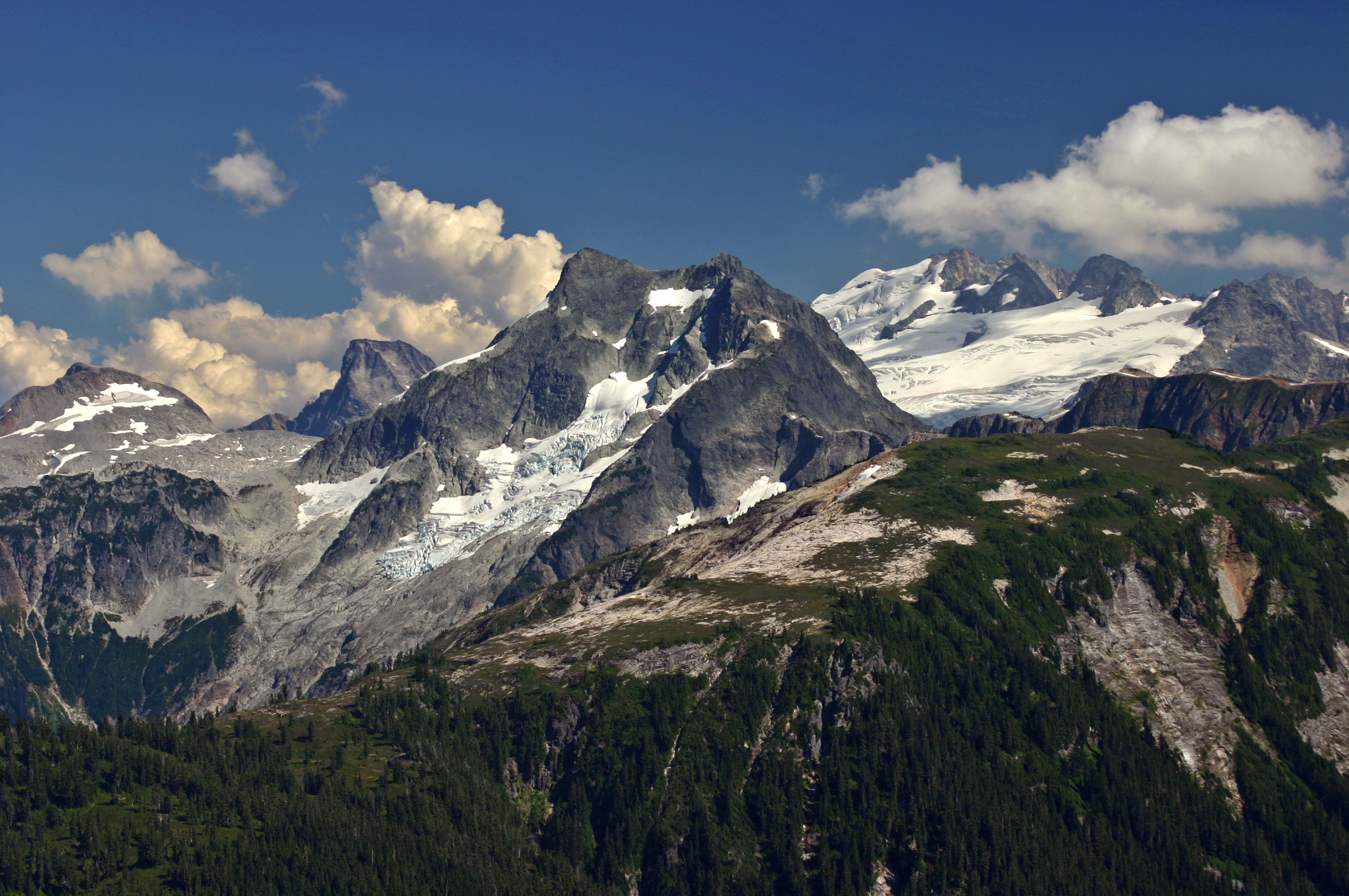 and south towards Mount Shuksan and Mount Baker.
No matter which wy you look from here the views are smashing. 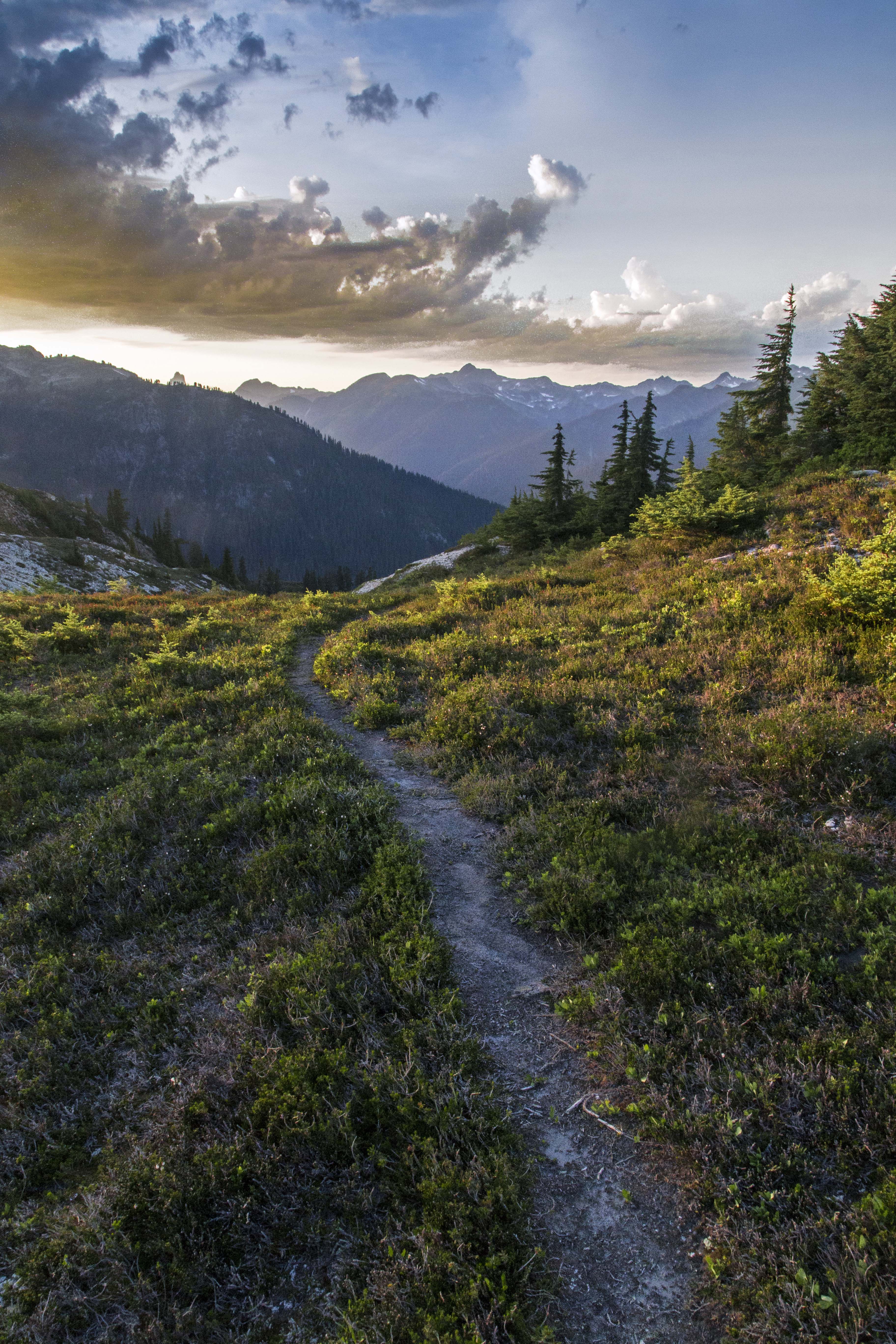


Continuing the hike north along the ridge (2 miles and 1,000 ft EG) soon brings you to the Copper Ridge Lookout, the highest point along the route commanding a sweeping view in all directions. 
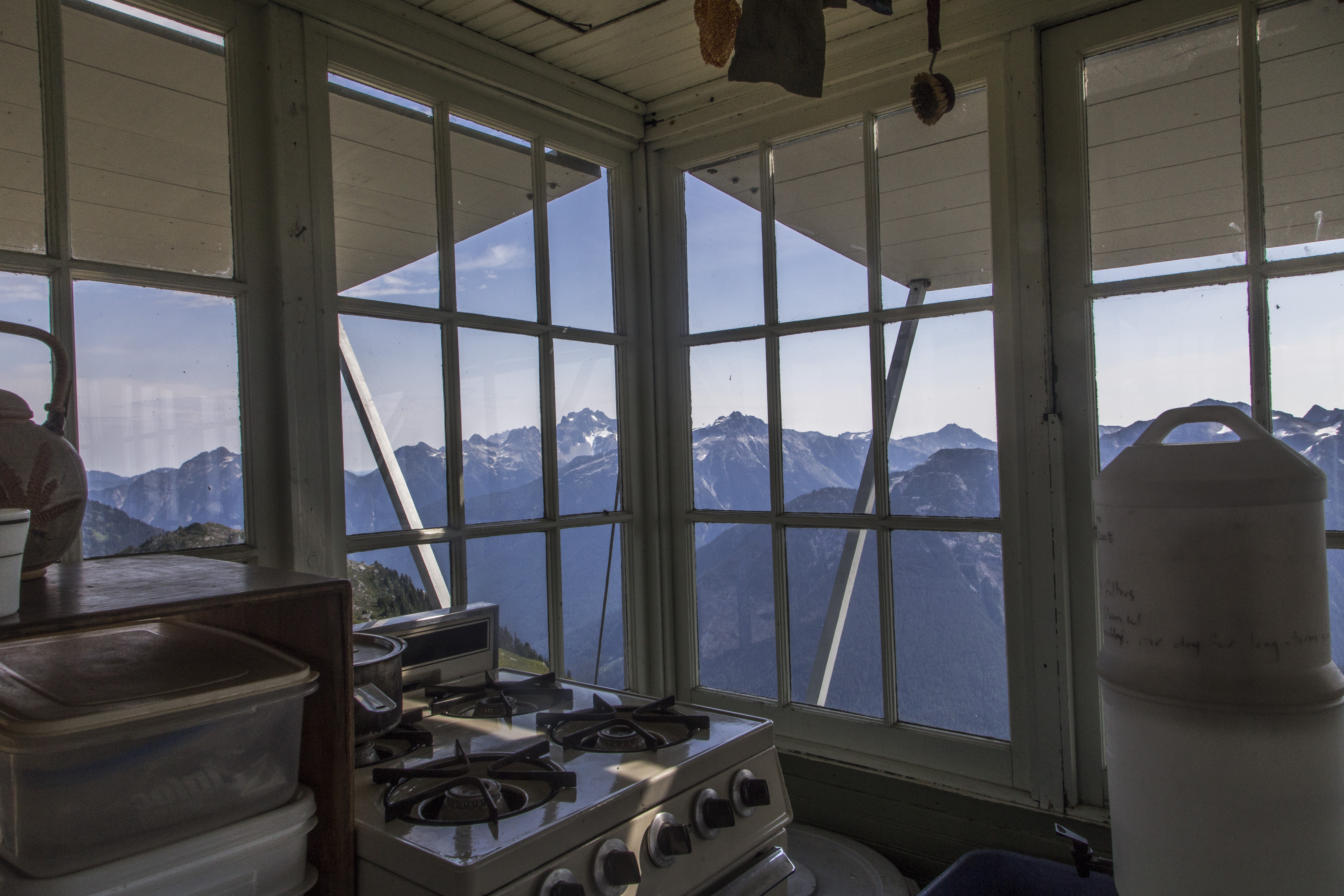 The lookout is regularly manned with Park Rangers. Make sure to have your map available to spend time locating peaks all around.
After soaking in the sun and views at the look out the trail now traverses over some rocky slopes for another 2 miles as it heads down to Copper Lake. Nestled in a nook along the ridge the lake sports a small island/peninsula offering a wonderful place for a swim. There is an official campground here, the last one before you exit Copper Ridge and plunge down to the Chilliwack. 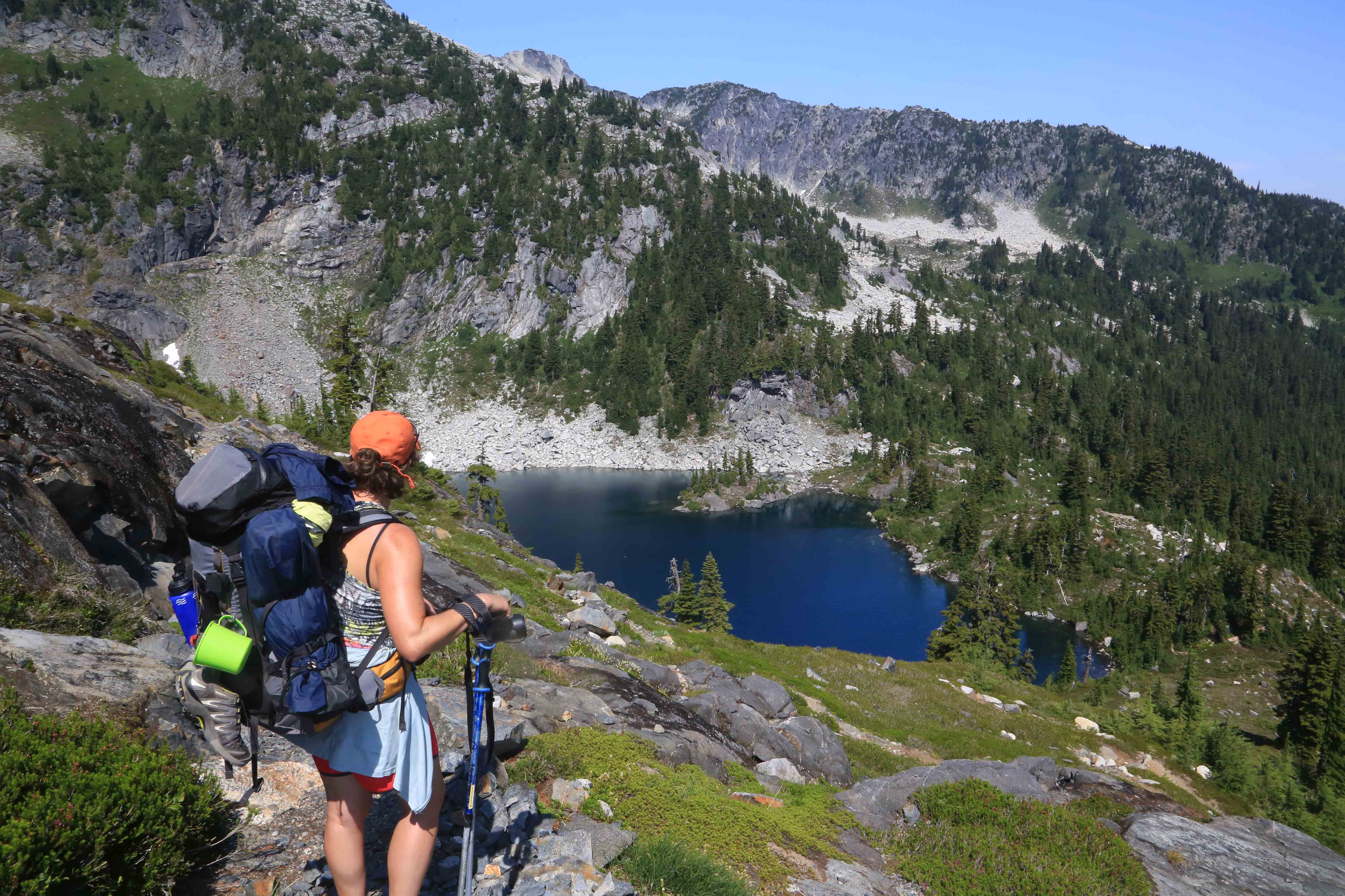
From Copper Lake your ridge hike continues another 5 miles of spectacular views. Waterfalls, meadows and gorgeous vistas abound. 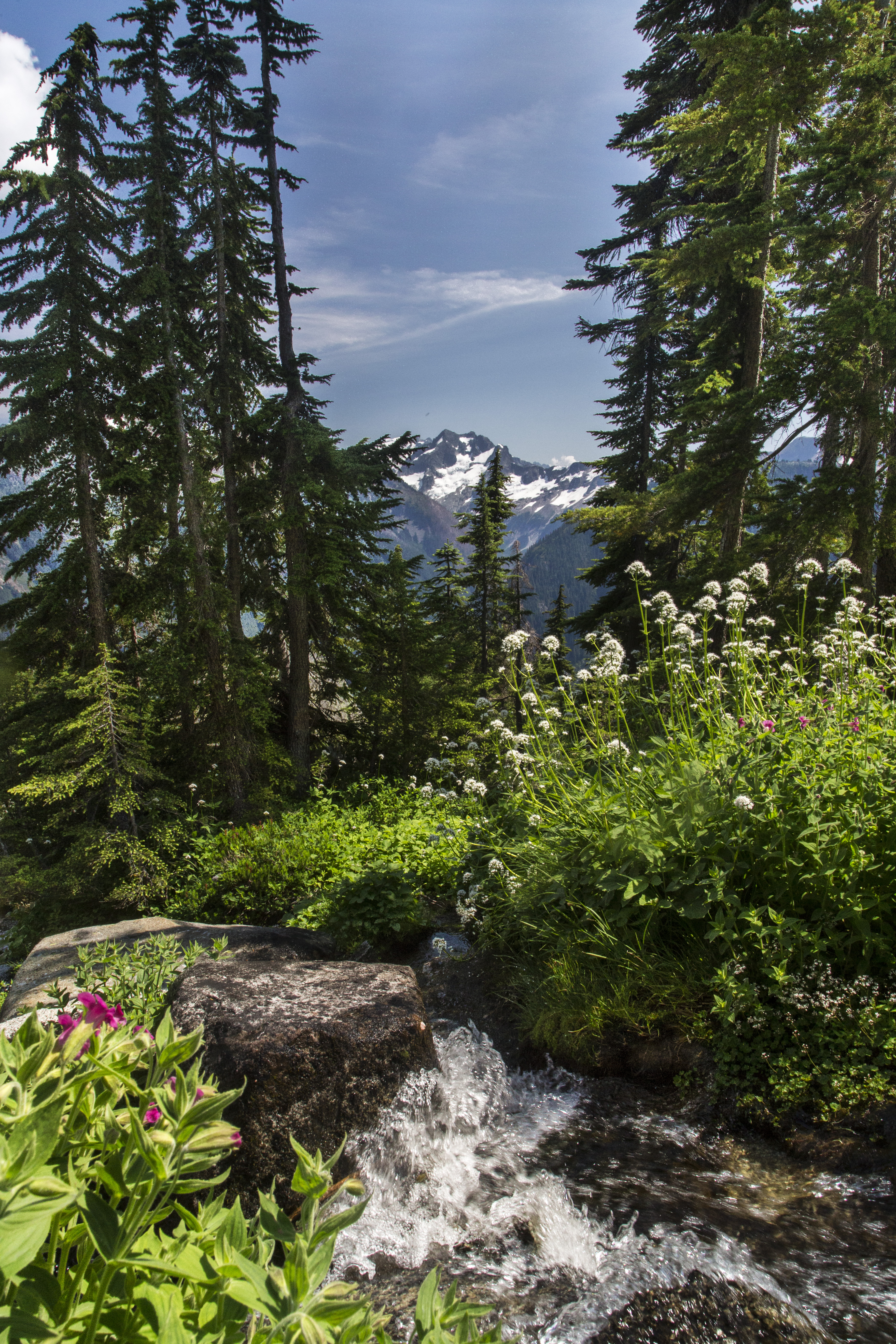

 At about 11 miles from the start of the Copper Ridge Trail (16 miles from the car) the ridge hike ends and the trail plunges down more than 3,000 feet in less than three miles to the Chilliwack River with its sparkling waters and levitating salmon, but that’s a story for another day!

Spectacular photos! When I have enough free time (and money) I want to do a trip around the U.S. with WA as one of the places on my travel itinerary. It looks wild and beautiful.
Holy Mackerel. Those are a bunch of unbelievably scenic scenes, you offered a super nice look at the terrain in that area with that collection of images. Is that entry also the way to Whatcom Pass? It has been quite a while since I did my daydreaming and study about that trip, but it’s someplace I want to go to, someday.
-Jason
Hey Jason, Yes, this is the west side approach to Whatcom Pass. Once you hit Hannegan Pass if you head down the Chilliwck a few miles you’ll intersect the Brush Creek Trail and can head up to Whatcom Pass. It’s really a magical place.
Beautiful pics as always. Got to love those mountains! Great post.
Thanks, Jesse!
Me tomé la molestia de armar un archivo con sus tomas y es extraordinaria las fotos que han publicado. Gracias por permitir conocer un pedazo del mundo.
I took the trouble to put together a file with the photos. It’s fantastic landscapes showing humanity. Thanks for sharing.