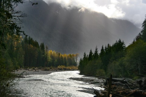
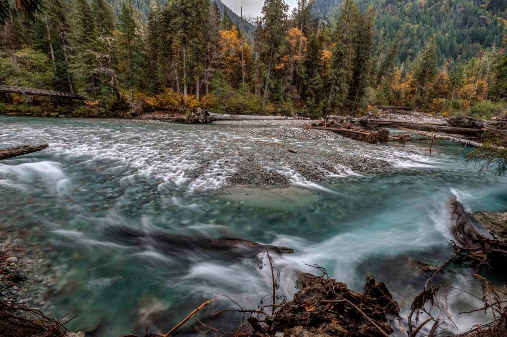
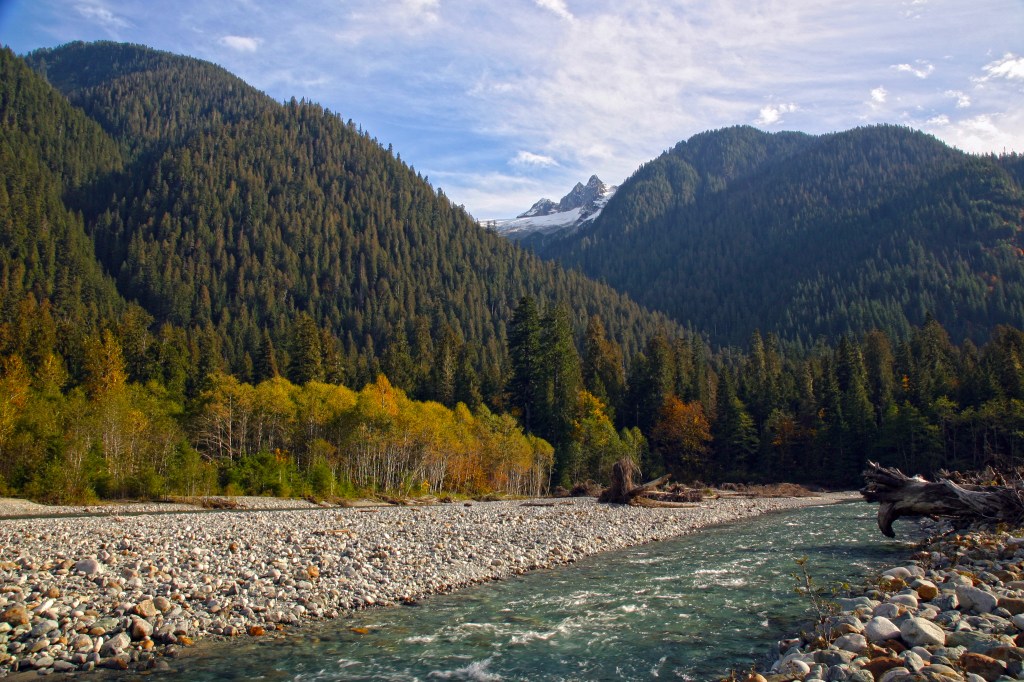
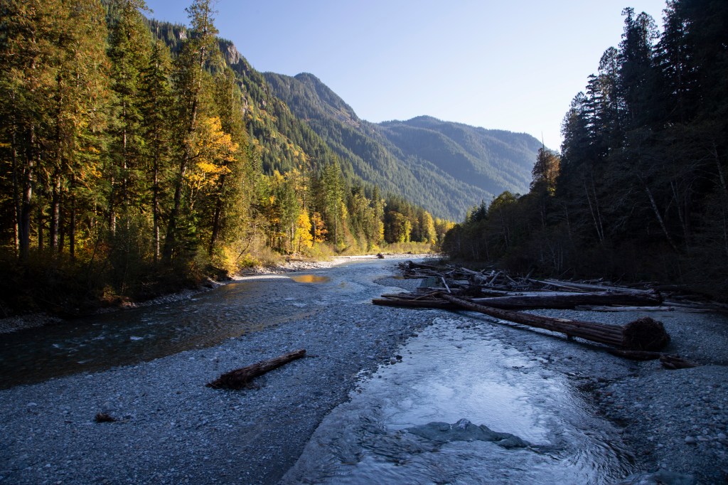
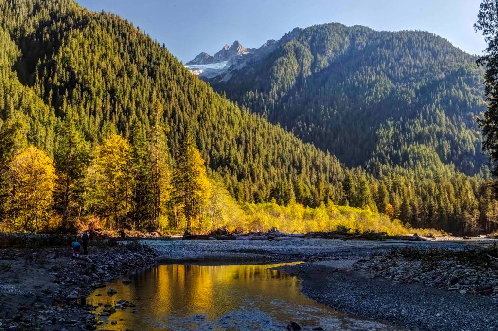
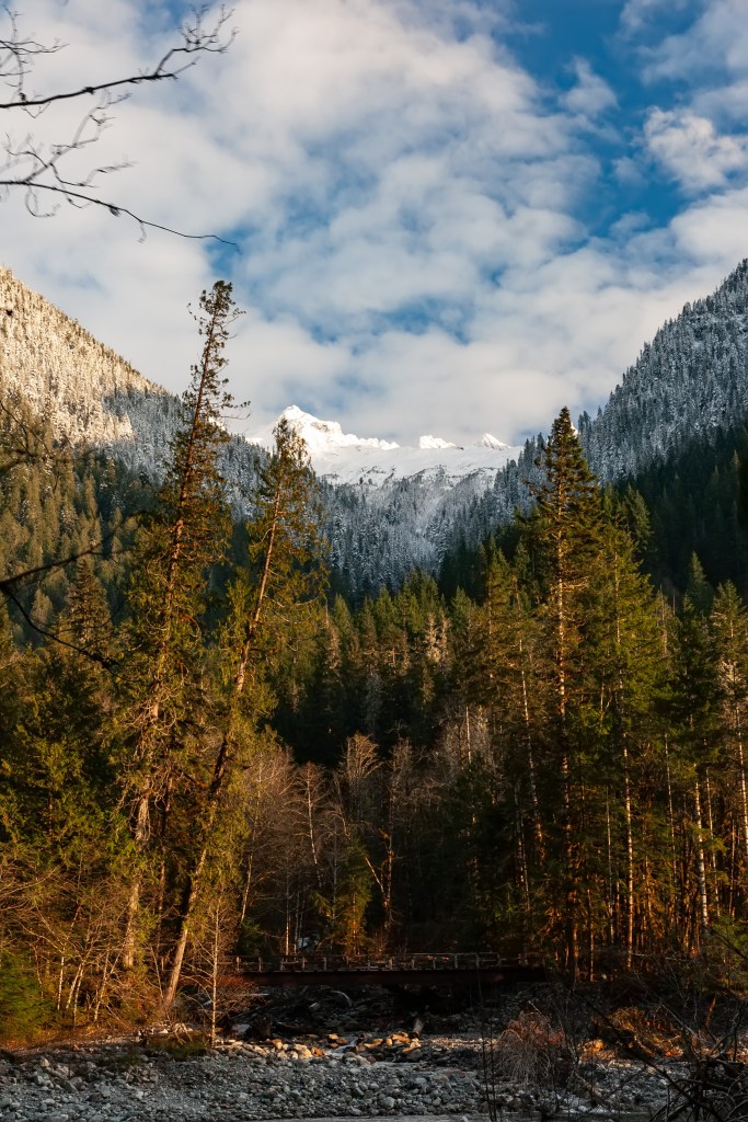
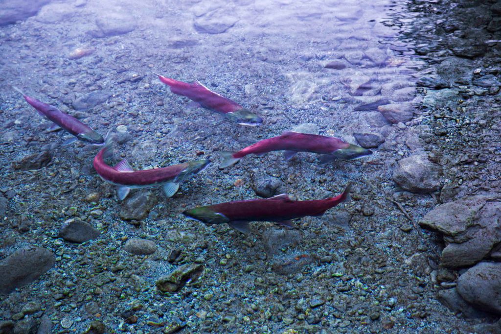
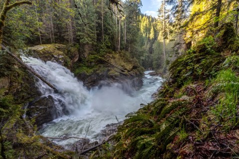
The Baker River drains the west side of the North Cascades range, merging with the Skagit River near Concrete.
There are two dams on the river, creating Baker Lake and Lake Shannon.
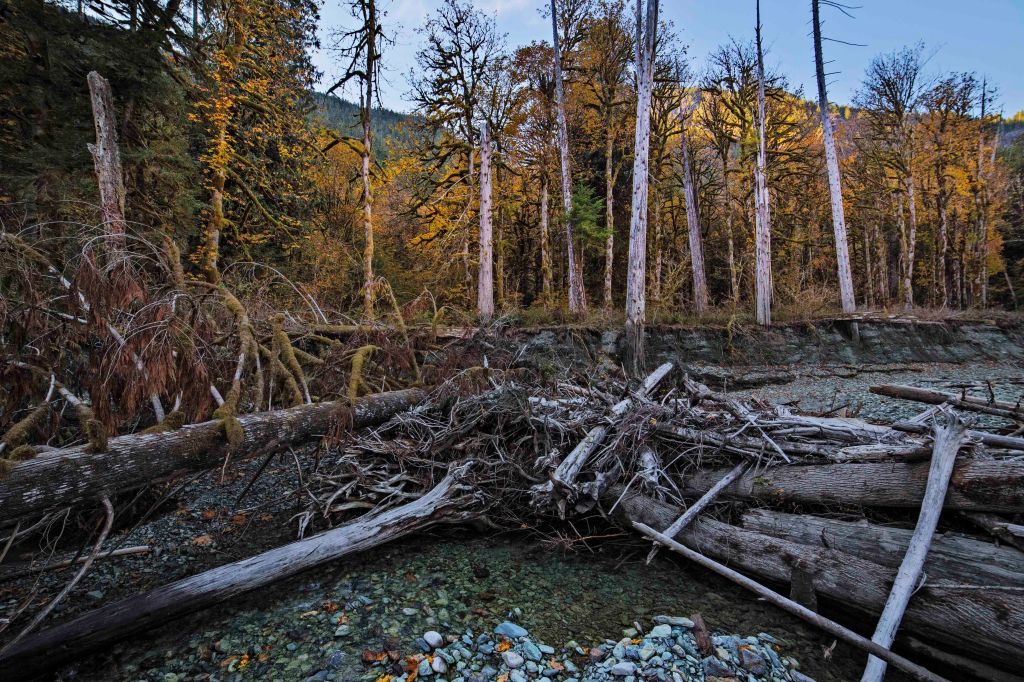
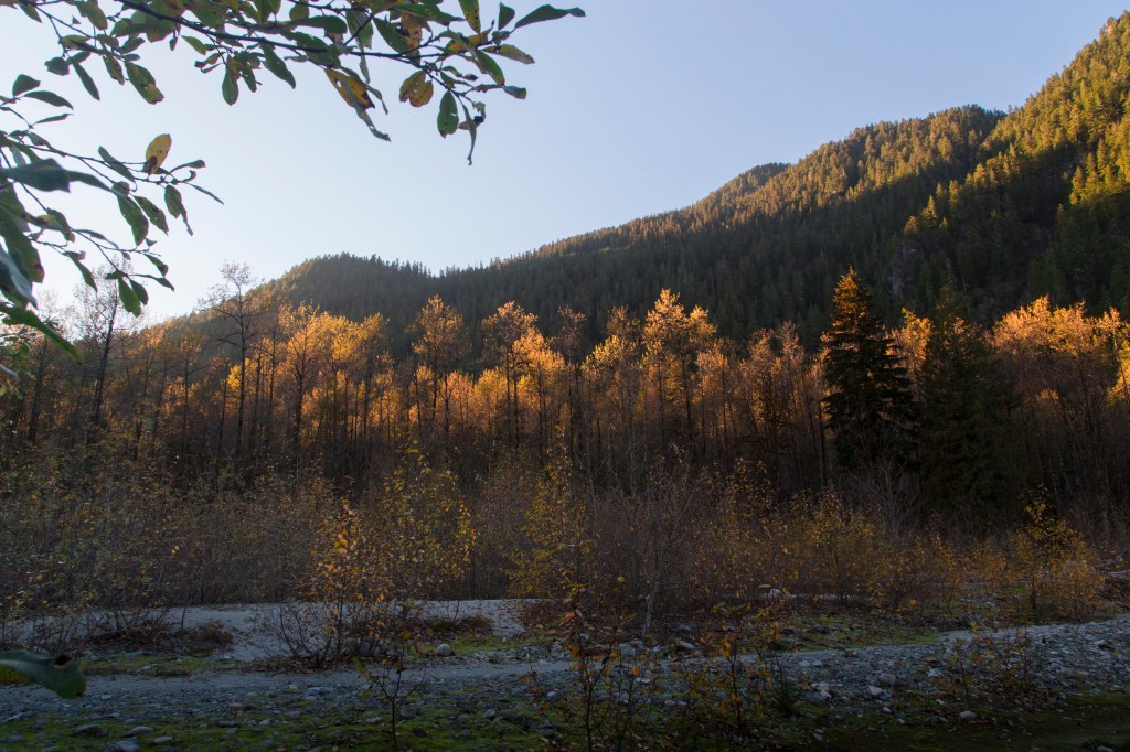
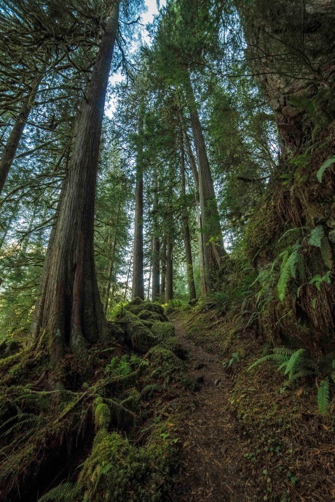
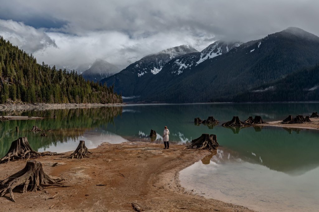
The Baker Lake Road extends 25 miles North from Highway 20 ending in a parking area along side Baker River. There are trails along the Baker River and around the lake.
I’ve been visiting Baker River for 20 years, been there in every season and weather condition. Here are a few images!
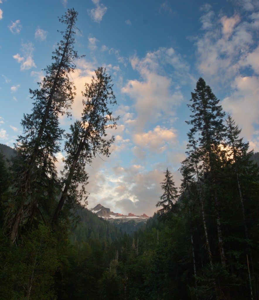
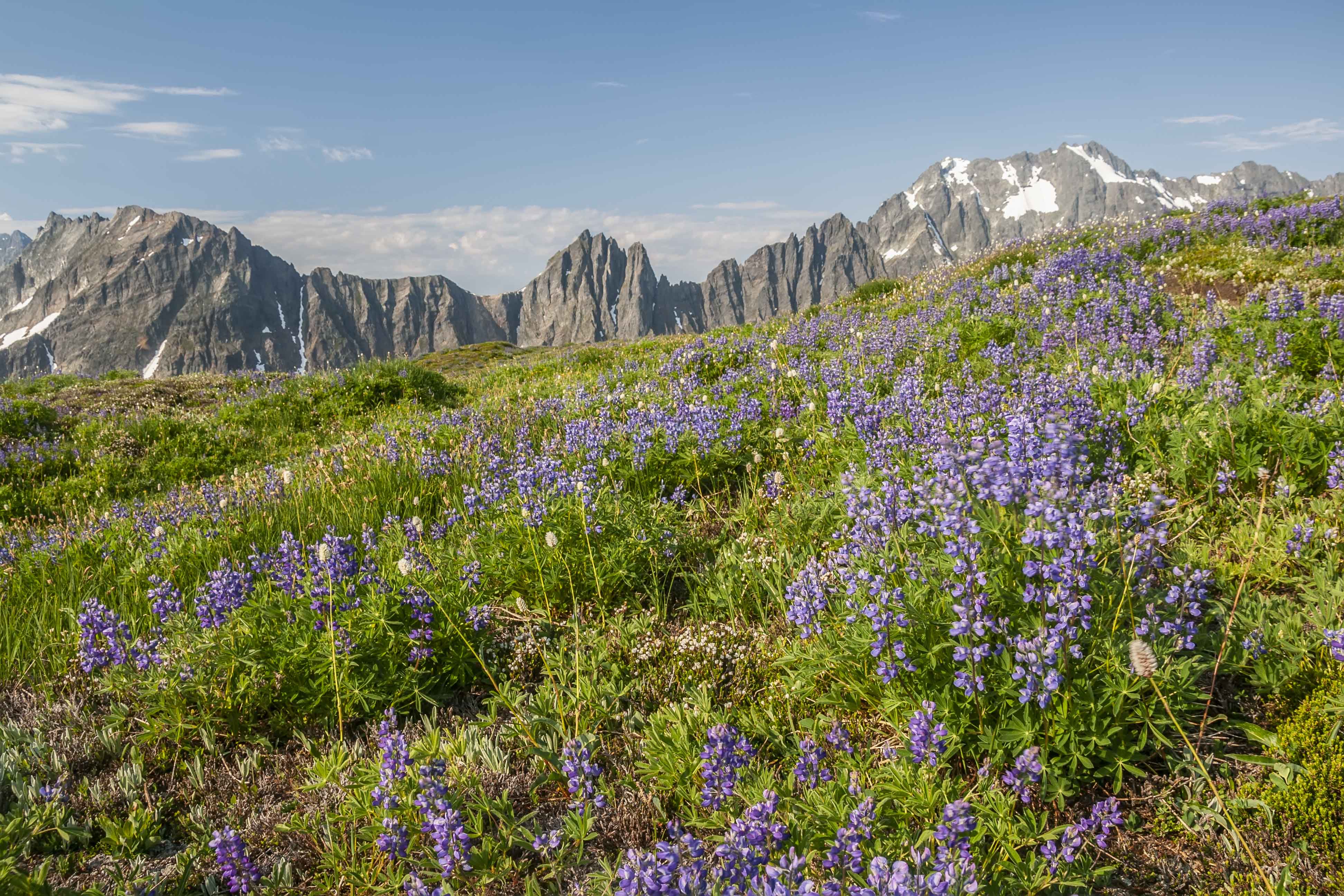
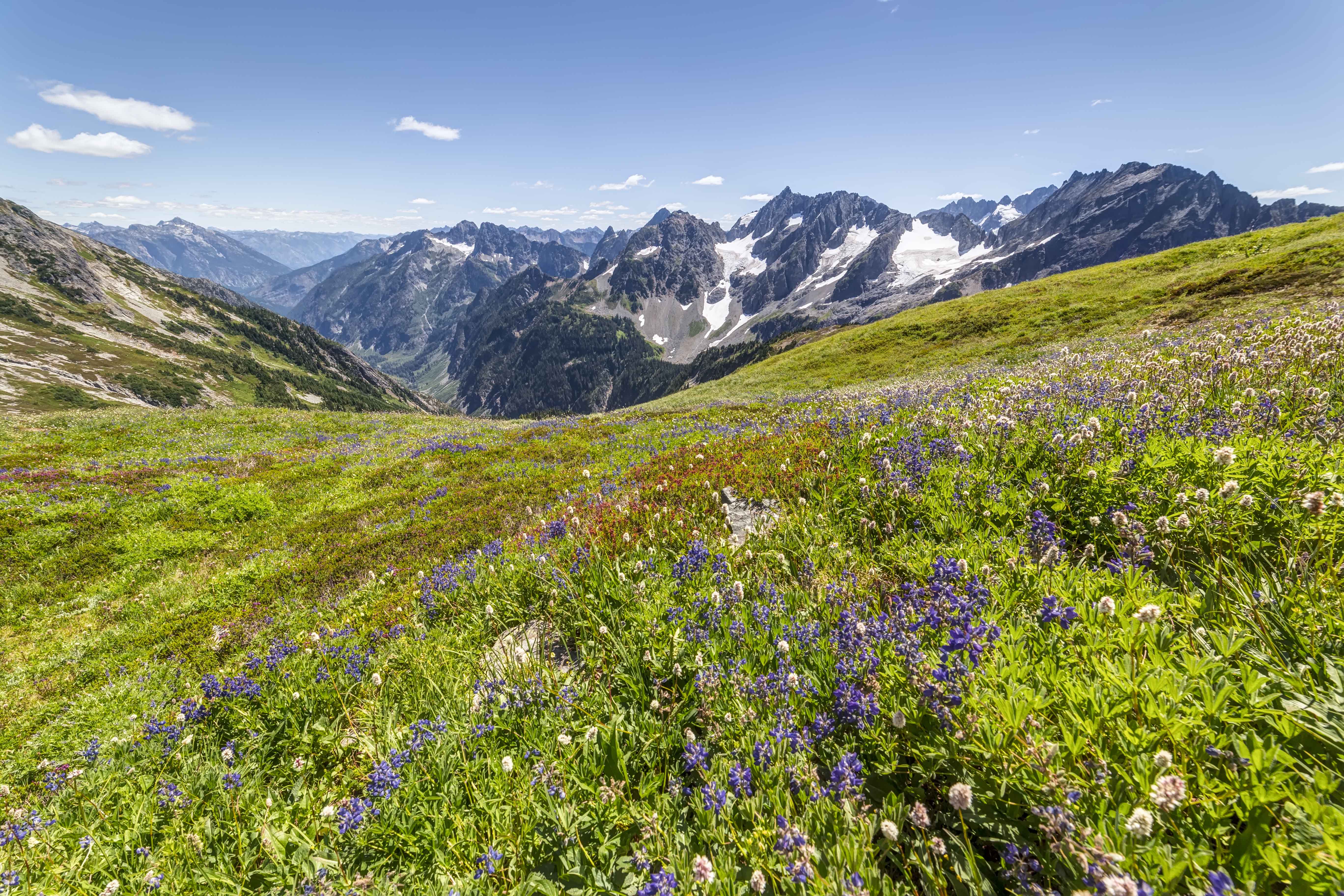
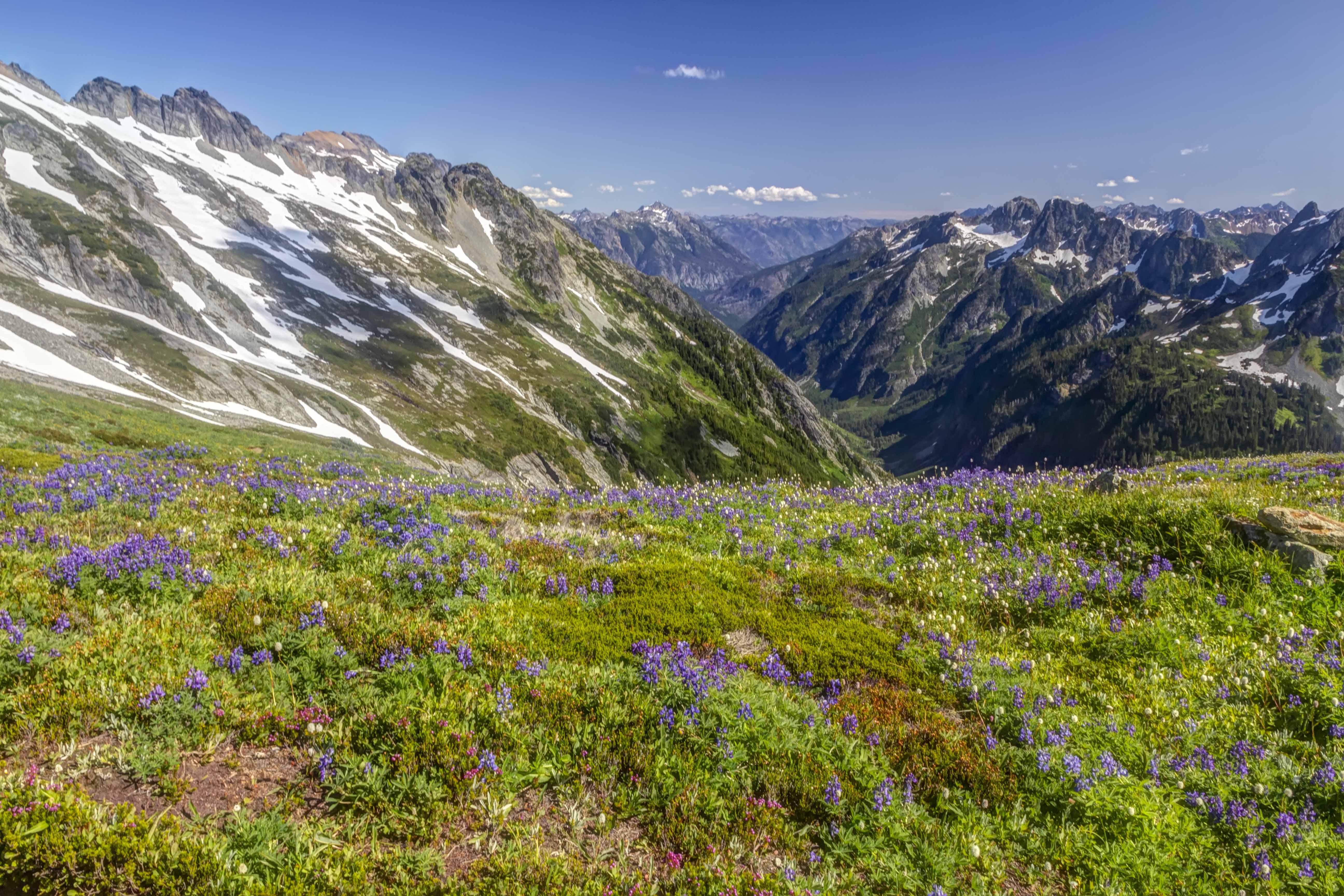
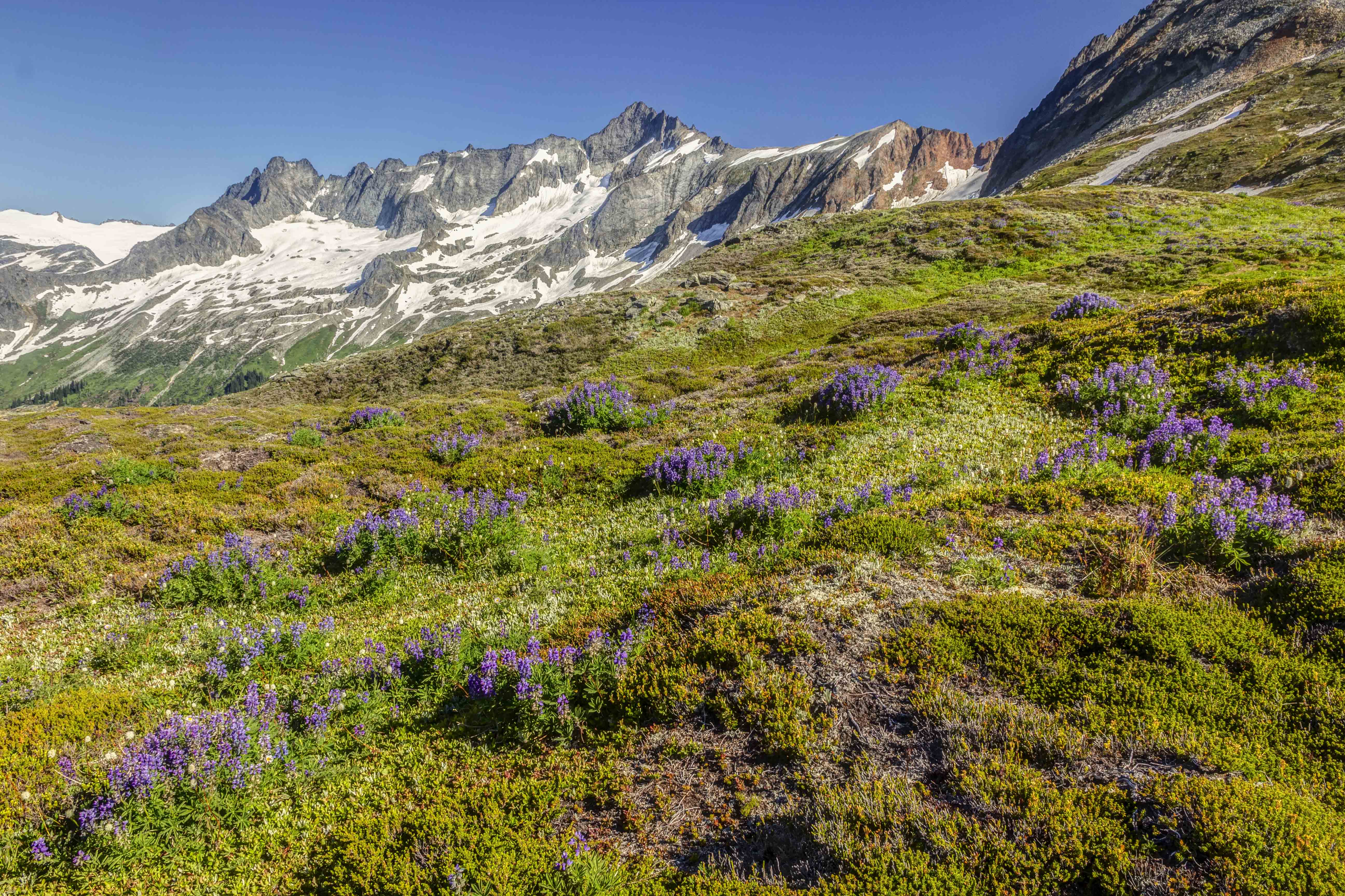
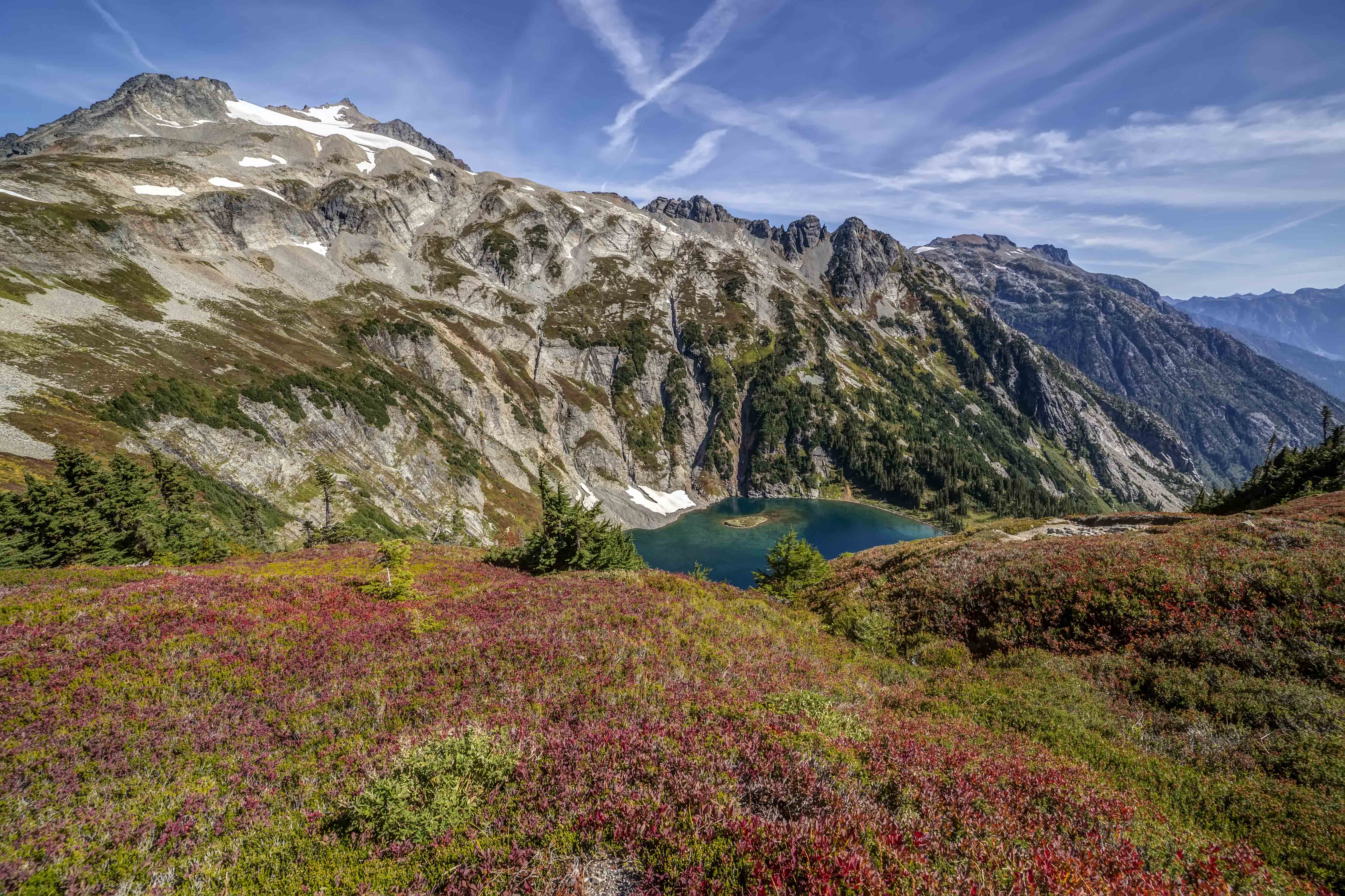
The route follows the Cascade River and ascends to Cascade Pass, then swings onto Sahale Arm, a giant curving slope carpeted in grasses and wildflowers. The overall elevation gain is 4,000 feet.
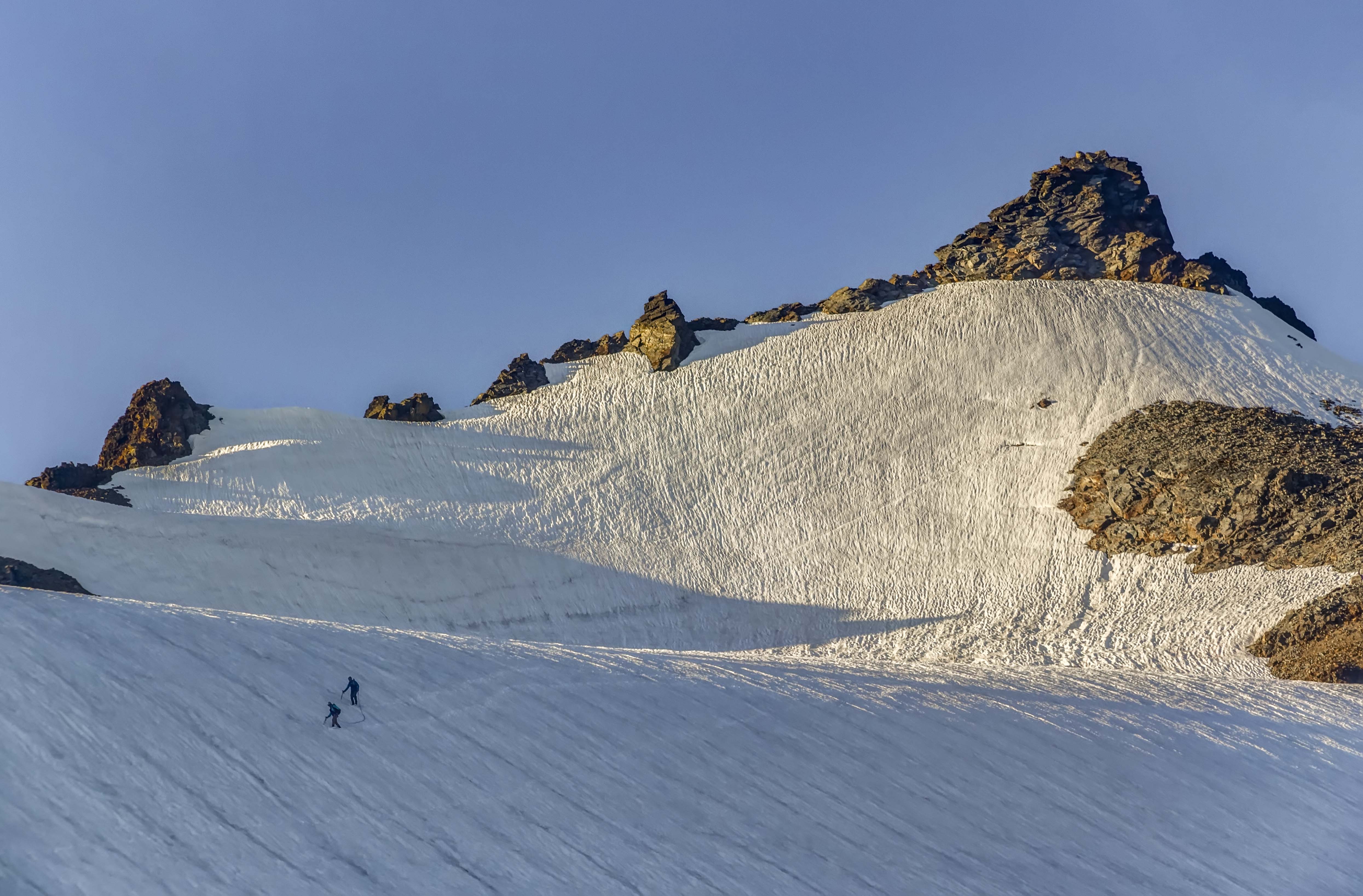
The camp sits atop 3 mounds of glacial rubble, at the base of Sahale Peak.
To spend the night there is sublime. Over 12 years I was lucky enough to spend 15 nights there at the camp.
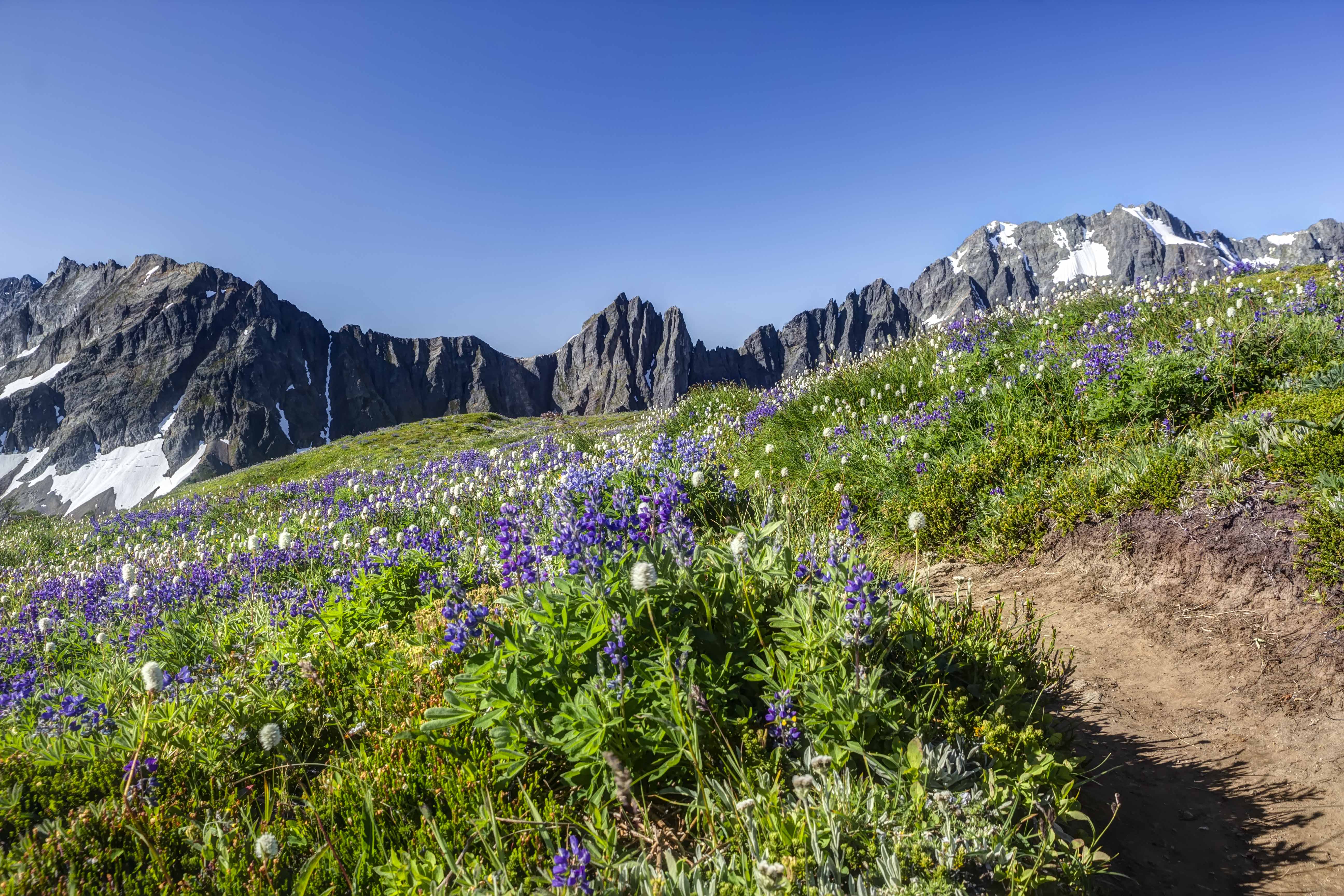
Here are some pictures from the trail.
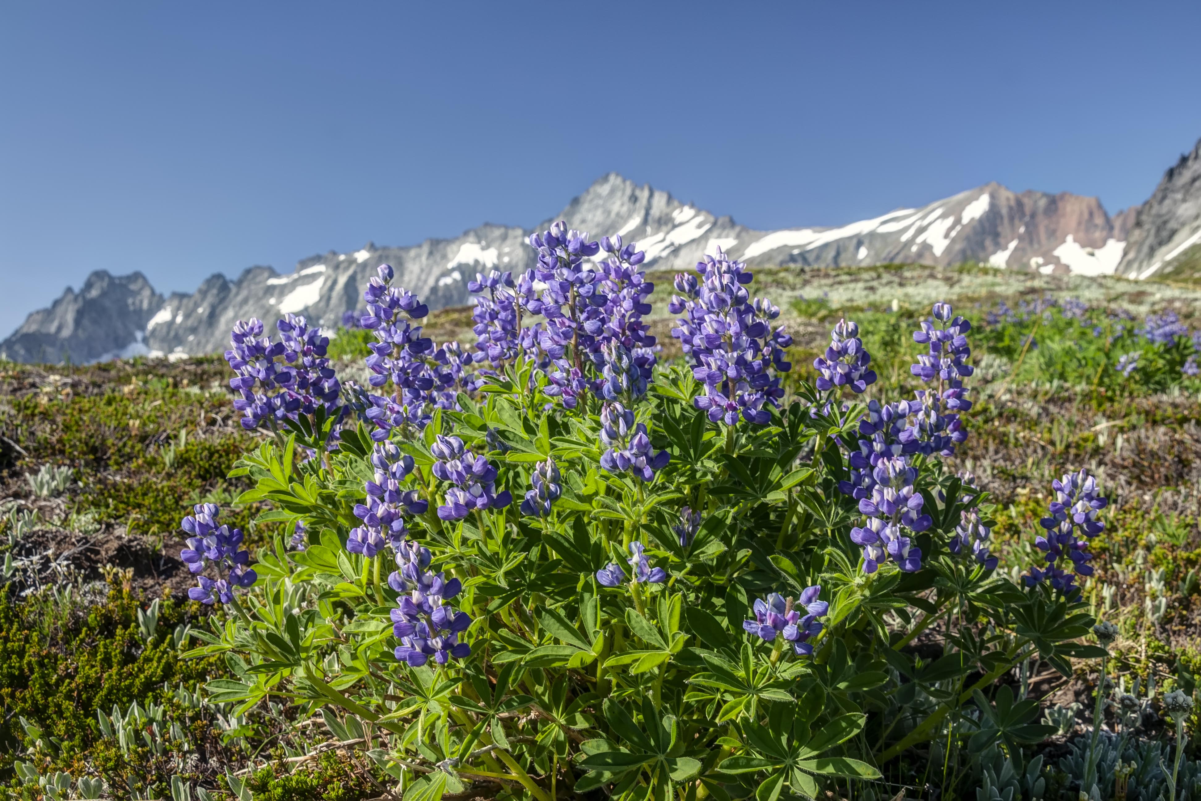
Wildflowers. Sahale Arm is truly upholstered in bright, crazy colorful wildflowers.
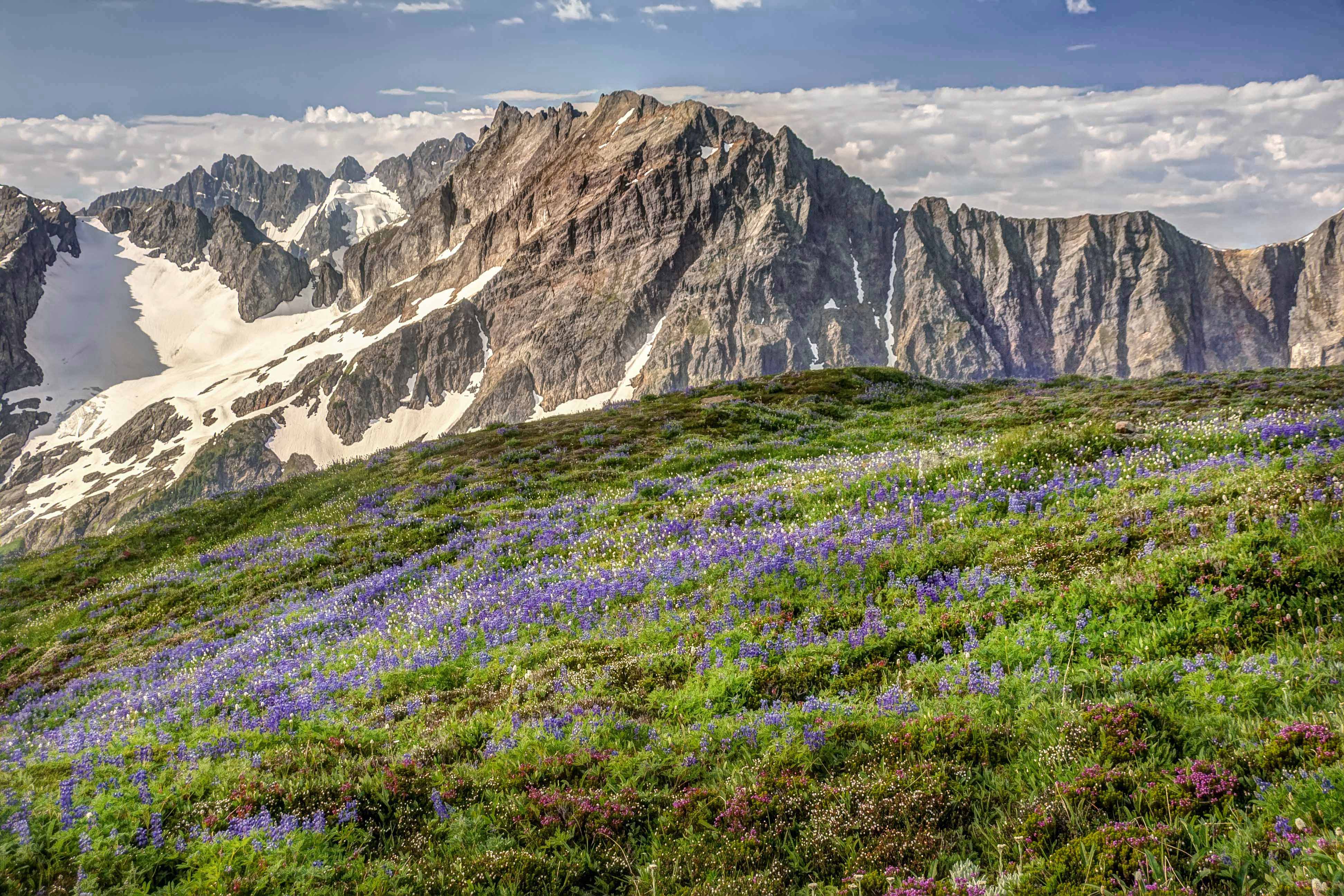
In the fall the Arm comes alive again with color.
There are many magical moments to be had, there at the camp.
The trip started at Highway 20. My friend dropped the three of us off at the trail head and we ascended up through Devils Garden along the Jackita Ridge Trail. We were on a 12 day trip, heading north, along the Pacific Crest Trail, near the Canadian border, west to Ross Lake and south, back to the highway.
Devils Garden
The trail afforded many wonderful views of Jack Mountain.
We arrived atop Devils Dome late in the afternoon and set up camp. Though we were atop the peak snow fields nearby supplied us with water.
Jack Mtn
The sunset was magnificent, but we watched it from inside our tent mesh because the mosquitoes were ravenous.
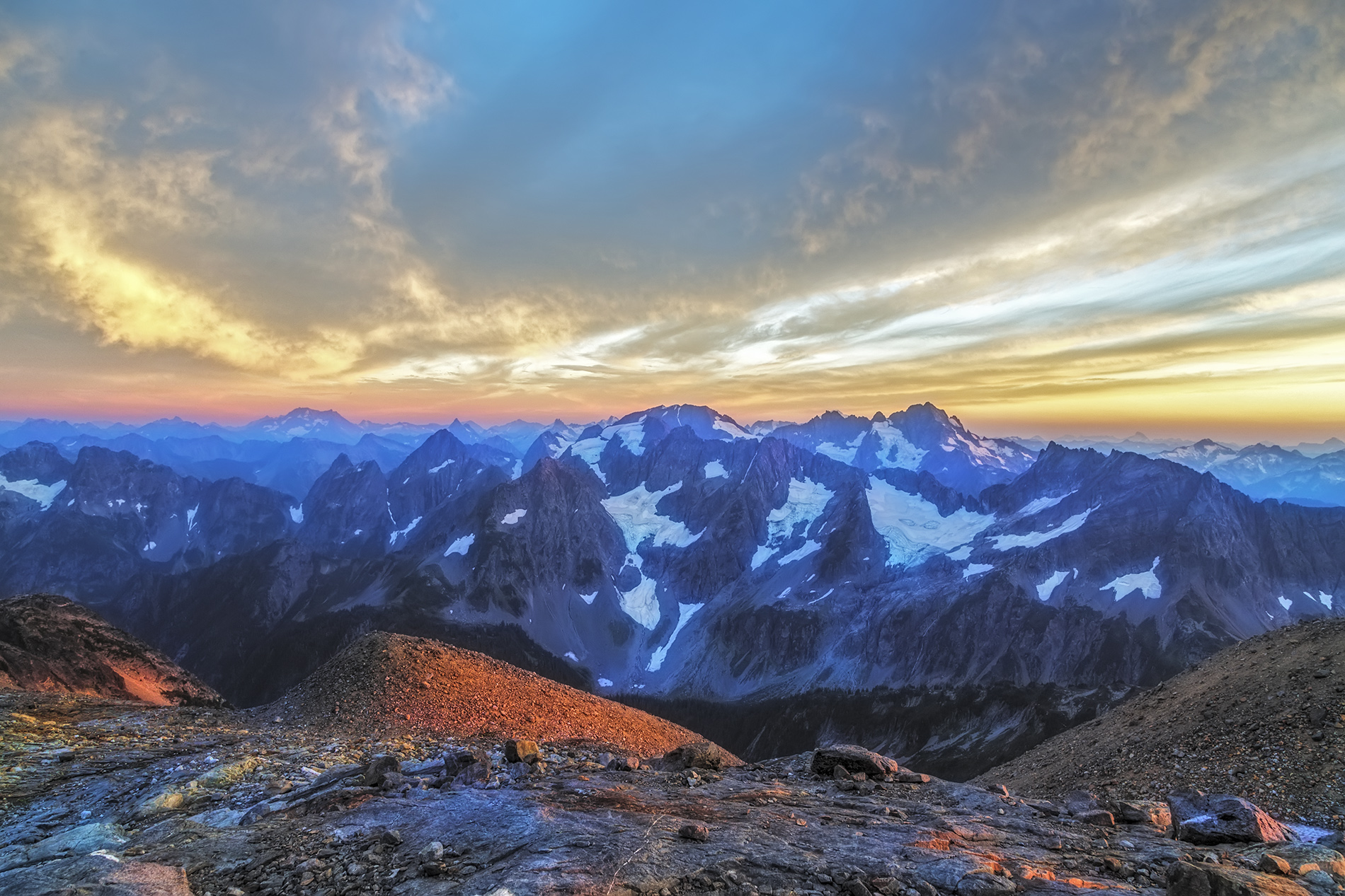
Devils Dome affords a 360 degree view of Jack Mountain, to the south, Hozomeen to the north.
The glaciated peaks of North Cascades National Park rose to the west and a broad expanse of the Pasayten lay to the east.
After a wonderful dinner we quickly went to sleep excited about the beauty tomorrow promised.
Something woke me up. I lay for a moment with eyes closed, sensing. There was a stillness, which was odd seeing that I was camped on a mountain top, and the smell of rain in the air. Suddenly opening my eyes I saw that the sky was clouded over. I lay for another moment reluctantly picturing myself getting up and putting the rain fly on the tent when I saw the flicker of lightning in the eastern sky. I sat up looking…there was another flash…and another.
Quickly exiting the tent I stood scanning the sky. There was lightning to the east…then to the south, then again, to the west…the dark tumultuous sky was alive with flashes, the peaks briefly illuminated and then again black shapes…I looked on in wonder…and then it stated raining.
I quickly awoke my two companions and let them know that they needed to get up, get dressed and get out of the tent and give me a hand. At first they were both saying, “why don’t you just put on the rain fly and get back in, go back to sleep…” and I replied that if they stayed in the tent that they would miss the lightning show…that provided sufficient motivation and they were soon out of the tent, looking at the skies. The lightning was getting more intense, more frequent…we could see the glow of a fire to the west, over towards Ross Lake and the National Park boundary.
My plan was simple: get the rain fly on the tent, throw all our stuff in it, don our rain gear and then lie on the grass and watch the show. But my two friends had other ideas. One strongly advised that we immediately depart and head down the mountain to find shelter from the lightning. My other friend insisted on a more simple approach: do nothing and simply enjoy the storm. I started with the rain fly and loading the tent and soon they came to assist me.
Someone came up with the idea of planting our trekking poles in the ground, well away from the tent, to act as lightning rods (!). And so, now somewhat content with our preparations, we all watched.
The rain started to come down now. The wind picked up, strong gusts blowing across the summit. The flashes became more insistent, more frequent. With each flash the ridges between us suddenly appeared out of darkness, and then…gone back to my imagination, leaving lasting imprints of what had just been illuminated. From our vantage point we could see what looked like 6 or so fires burning…
On three sides of us there were regular flashes, every few seconds, another, and then another. The wind and rain continued unabated. In fact they increased along with the regularity of the lightning, each building to a crescendo. The lightning now seemed to take on a reddish hue, then green or blue (was it just my imagination?)
Transfixed by the sheer beauty, we had front row seats for nature’s own fireworks show, the best we had ever seen. Just as I was starting to edge towards getting the hell out of there the tempest began to lessen, the wind shifted. The lightning to the west, which seemed to head towards us, stopped.
And that was it! The storm cell had passed us by. The lightning to the east faded out and in its place we could now see the faint hint of the sun.
The date was 08/08/08. This was the opening night of the Olympics in Beijing, and we mused that the fireworks we had just seen surpassed theirs, hands down. It was also the scheduled date for the startup of the Large Hadron Collider and we considered that the lightning storm was a direct result of the resultant black holes now devouring earth. These points we avidly debated, but all agreed that the peak was rightly named: Devils Dome.
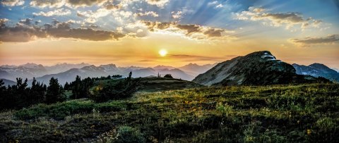
As the excitement died down my friends retired to sleep and I ventured forth to catch some of the morning light.
The Pasayten Wilderness is one of my favorite places in Washington, a land of mountains and rivers, steep valleys and meadows, wildflowers and Zen like peace. This experience was on day 6 of our twelve day trek which started at the Canyon Creek Trail head on the North Cascades Highway.
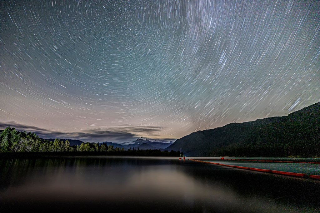
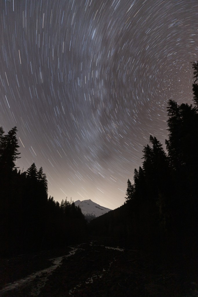
The New Moon is marked on all my calendars, year-round. This is when there is NO moon in the sky. Dark skies are what you need to capture clear images of the Milky Way. The sunlight reflected by the moon washes out the stars… You also need clear skies, and a location away from the lights of civilization.
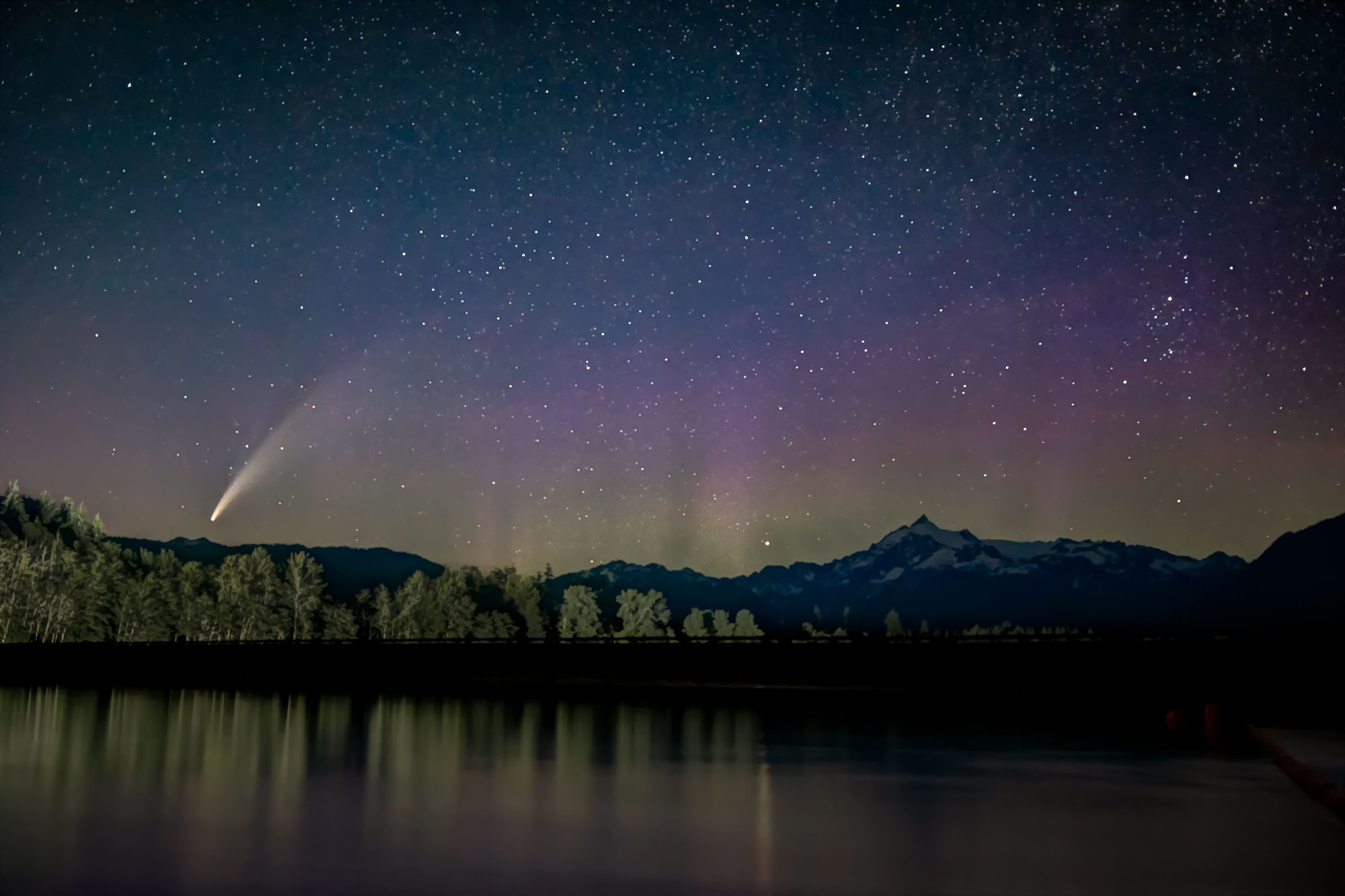
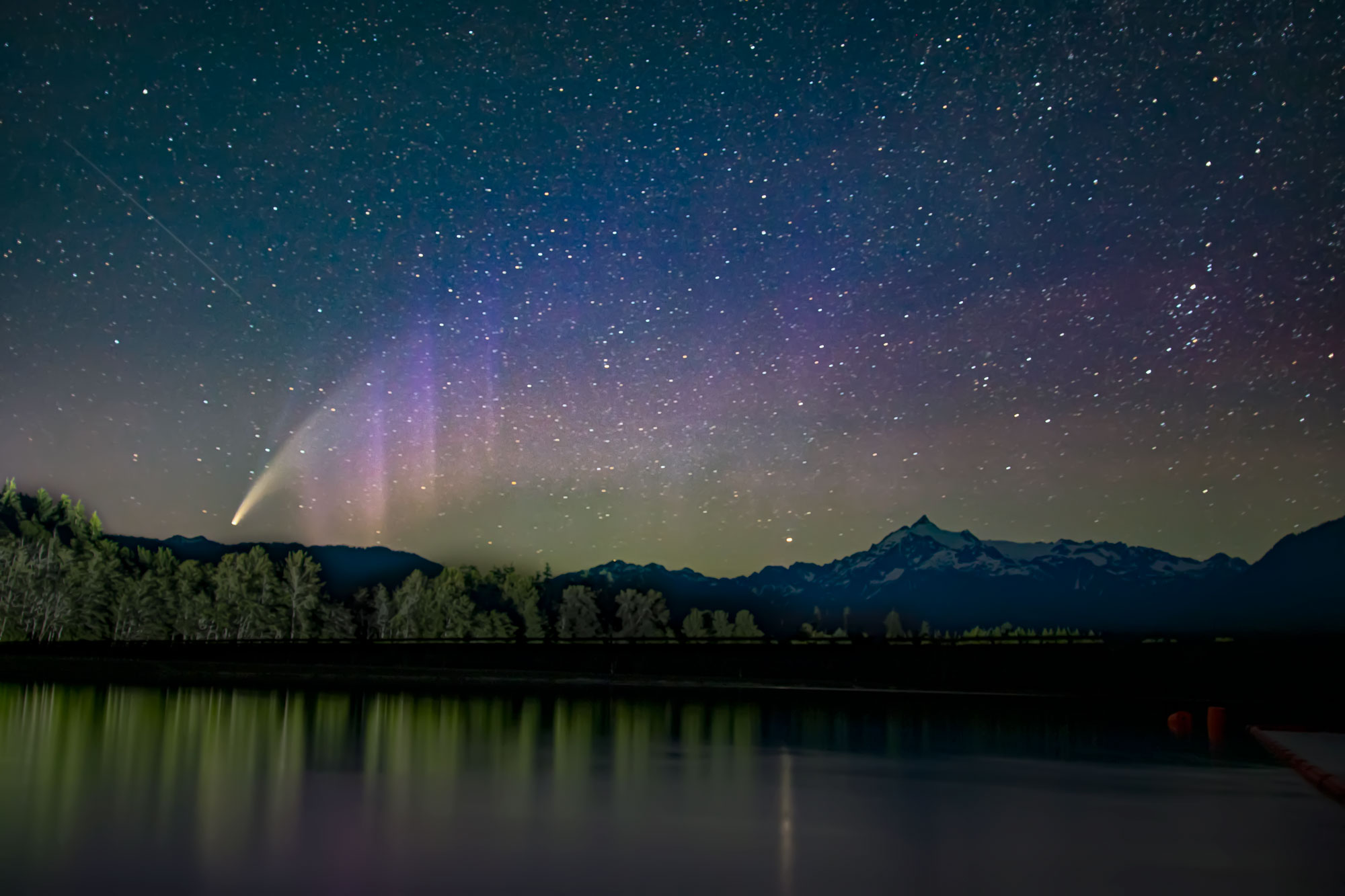
Last month the new moon was July 20th, the skies were clear and Comet NEOWISE paid us a visit.
These first 4 images are from Baker Lake, at the boat launch. Mt Baker is close by and Mt Shuksan not far off to the north. As the night progressed the comet rose in the sky and then the Aurora Borealis showed up!
Encouraged by these images I went next up the Mt Baker Highway. It took a bit to find a good vantage point, but managed to get the comet as well as several other interesting night sky phenomena!
Comet Neowise
Comet Neowise
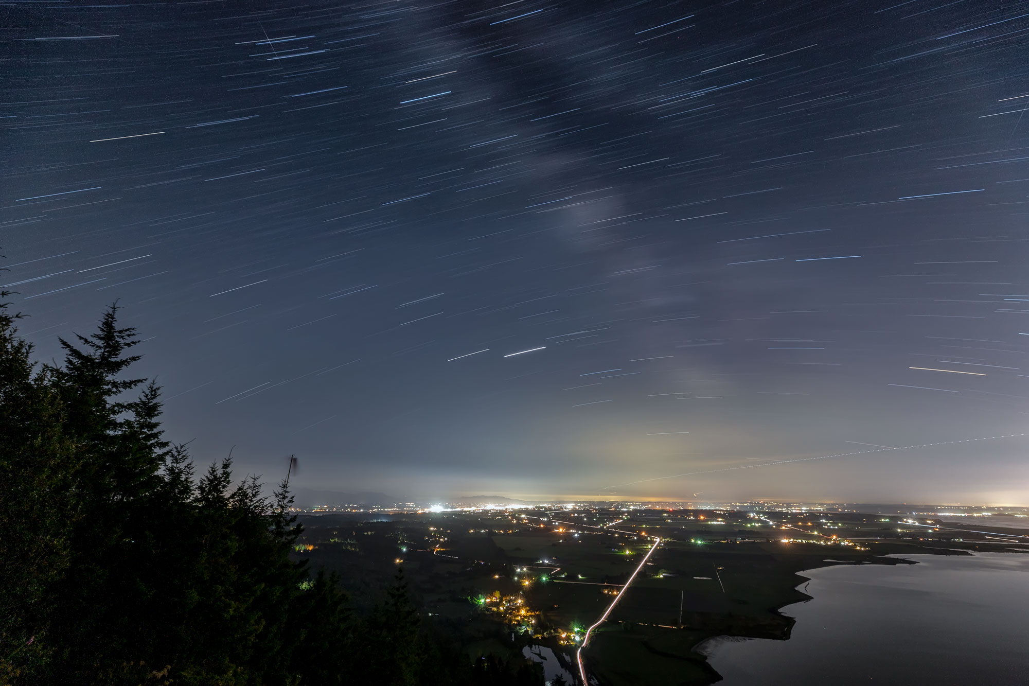
Next I decided to try the Samish Overlook and try for more NEOWISE images. I was never able to find a good vantage for the comet, but to my surprise the Milky Way was visible from there. The lights from the valley wash out the stars, especially close to the horizon, but it was clearly visible to the naked eye!
30 second exposure
20 minute exposure
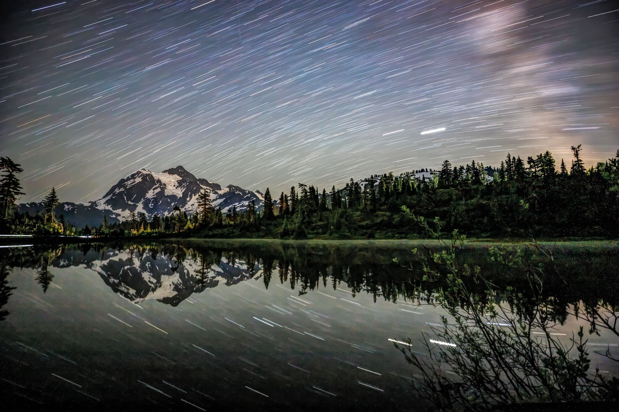
Picture Lake, on the Mt Baker Highway is a fantastic spot for Milky Way images, high elevation, dark skies and what a reflection! Notice how clear the stars are, especially close to the horizon at Picture Lake and Mt Rainier compared to the Samish Overlook…
30 second exposure
20 minute exposure
My final destination for July Night Sky was Mt Rainier! The Sunrise area of Mt Rainier Nat Park is famous for its night sky views. The glaciers seem to emanate light of their own at night and the mountain glows…
30 Sec
20 Min
The August New Moon is on the 18th! I am excited to go find new vistas!
Night Sky Photo Tours are available on a limited basis! Here is a link with more info.
Prints are for sale at several locations! The Sedro-Woolley Chamber currently has a display of more then 15 large canvas prints, some are in a floating frame! You can also see and purchase new prints at Peace Health Hospital in Sedro-Woolley, I have a large display of my prints for sale in the lobby.
Prints of all kinds and sizes are also available anytime on my web site. Find a gallery and look for the perfect image…
IF you find something you love, use the Coupon Code: SUMMER for 50% OFF ANY purchase.
This first set of images was taken on Monday, July14, at the Baker Lake Boat Launch. Mount Baker looms nearby and Mt Shuksan is off to the north, across the lake.
The Boat Launch has one very big, bright light, high up on a poll, illuminating the area at night. This is the source of the light on the trees.
About 11:30 pm the Northern Lights were visible and I was able to get a few pics.
For the most part I used the following settings: Shutter speed: 30 sec; f/2.8 and 1600-2000 ISO. I used a very long exposure on one of these shots and you can see the stars stretched a bit.
The next night I ventured up the Mt Baker Highway, heading to Picture Lake, but the comet was rising in the Northwest…the road is gated a bit past the Heather Meadows Ranger Station, again, view blocked…so we wound up along the road! Got a few decent pics…
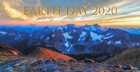
Earth Day evokes images of wild places: broad vistas of desert, ocean and mountains.
The Wilderness Act of 1964 defines wilderness as “an area where the earth and its community of life are untrammelled by man, where man himself is a visitor who does not remain.”[29]
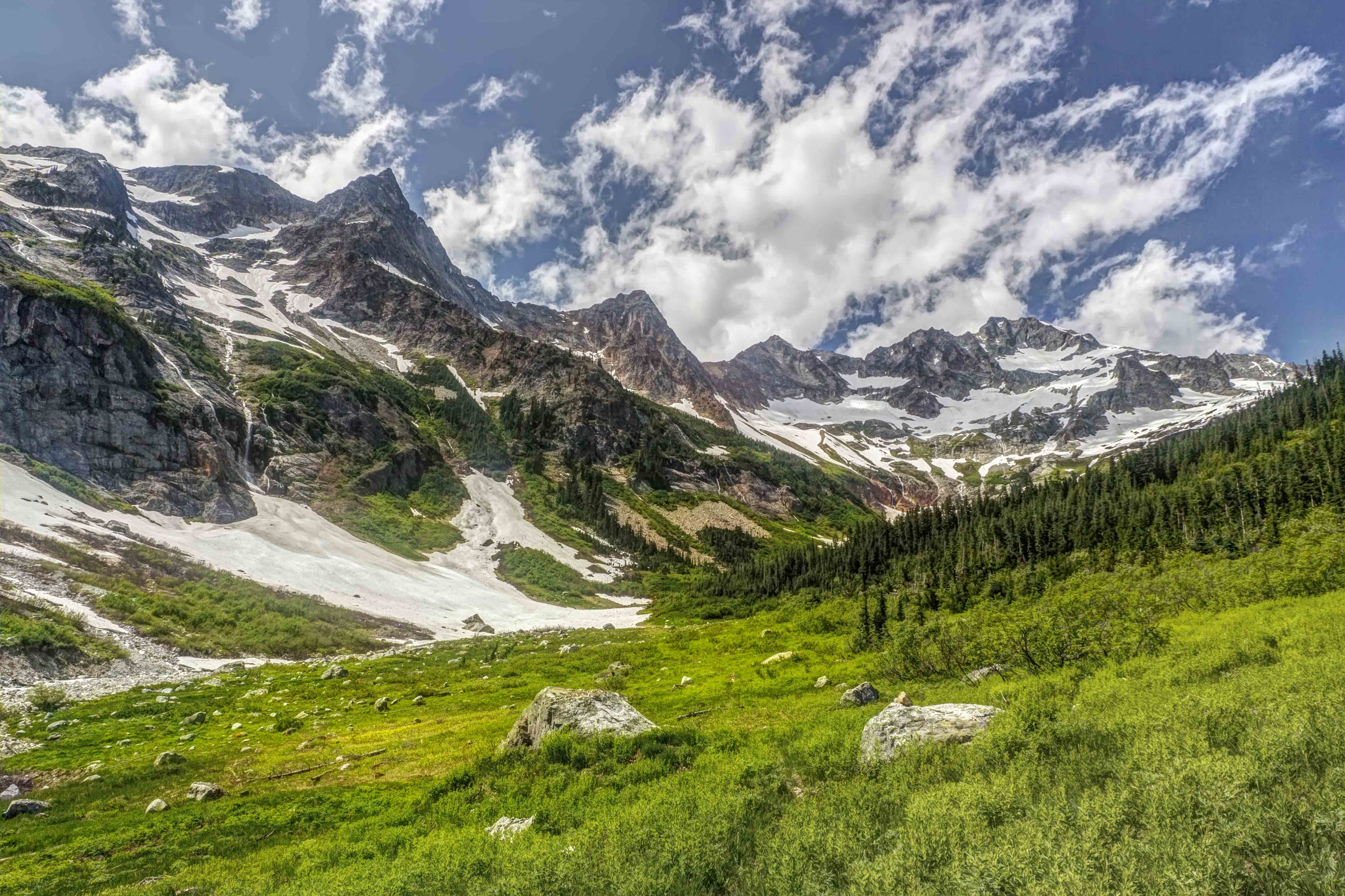
North Fork Meadows, North Cascades National Park
In the Subway, Zion National Park, Utah
Point of the Arches, Olympic National Park
Earth Day is about protecting these places and keeping them wild.
The raw nature of wilderness and its inherent aesthetic beauty often leave me short of breath, amazed at what I see and grateful for the chance to be a part of it.
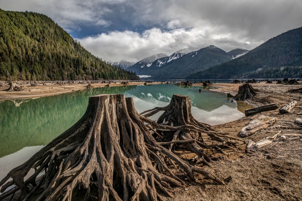
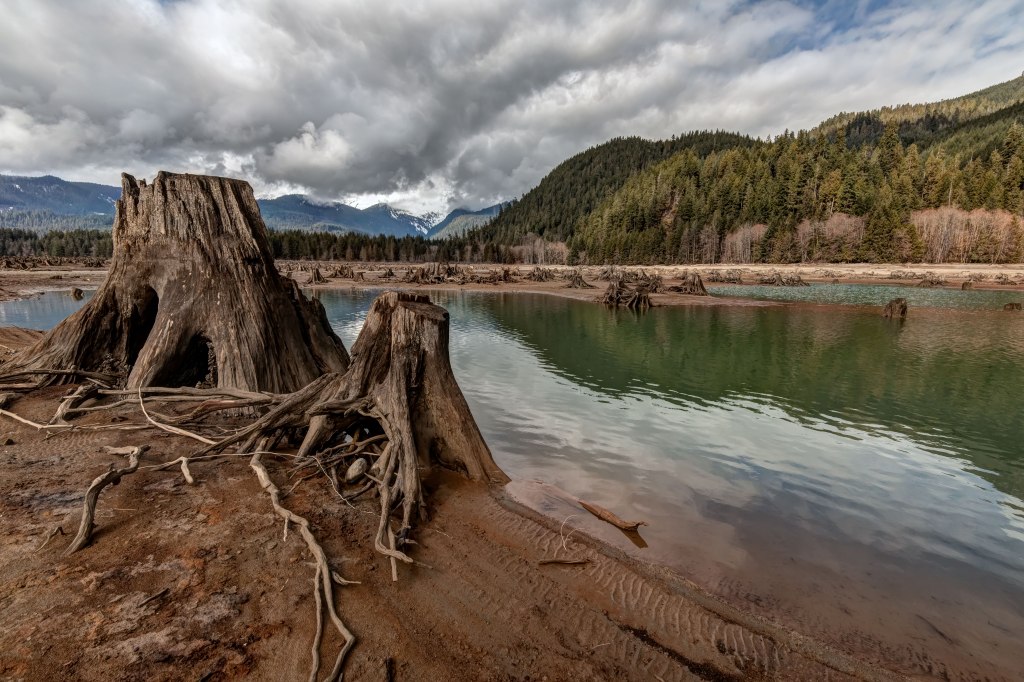
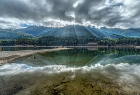
Baker Lake, North Cascades
Prussik Peak, Enchantments
Point of the Arches, Olympic National Park
In the wilderness is freedom. There is no one to tell you what to do. Knowing these untrammled places are there, and that you can go visit them is integral to sanity, to survival. They say that wilderness can heal a person and I believe it’s true.
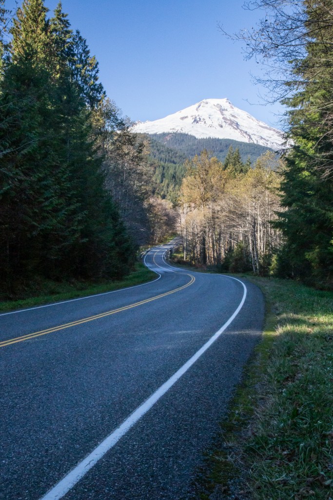
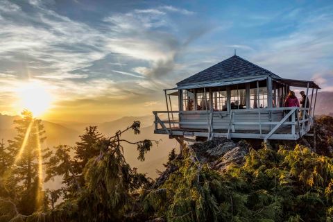
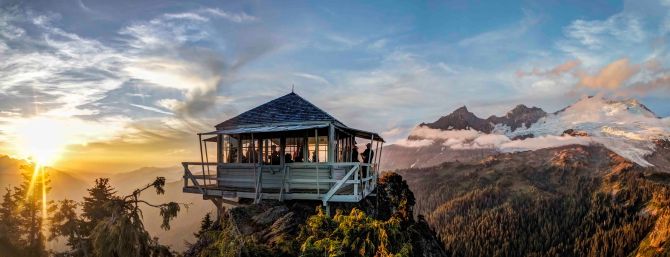
Park Butte Lookout is located on the south side of Mount Baker. Access is via Baker Lake Road. Here is the link with details. The hike in is about 3.5 miles. It usually opens in July, depends upon snow melt. You can spend the night in the Lookout, its a first come first serve sort of thing…if you plan to stay the night, be certain to bring a tent because it most likely be full!
I’ve spent 14 nights in or near the lookout, with other people and several times alone. It always magical, even in a storm.
Here are a few images from recent trips.
Over the years I have managed a few decent shots of the night sky from the lookout.
Park Butte Lookout and Mt Baker
Views of Mount Baker and the Sisters are beyond spectacular for both sunrise and sunset.
Mt Baker at sunrise
Mt Baker at sunset
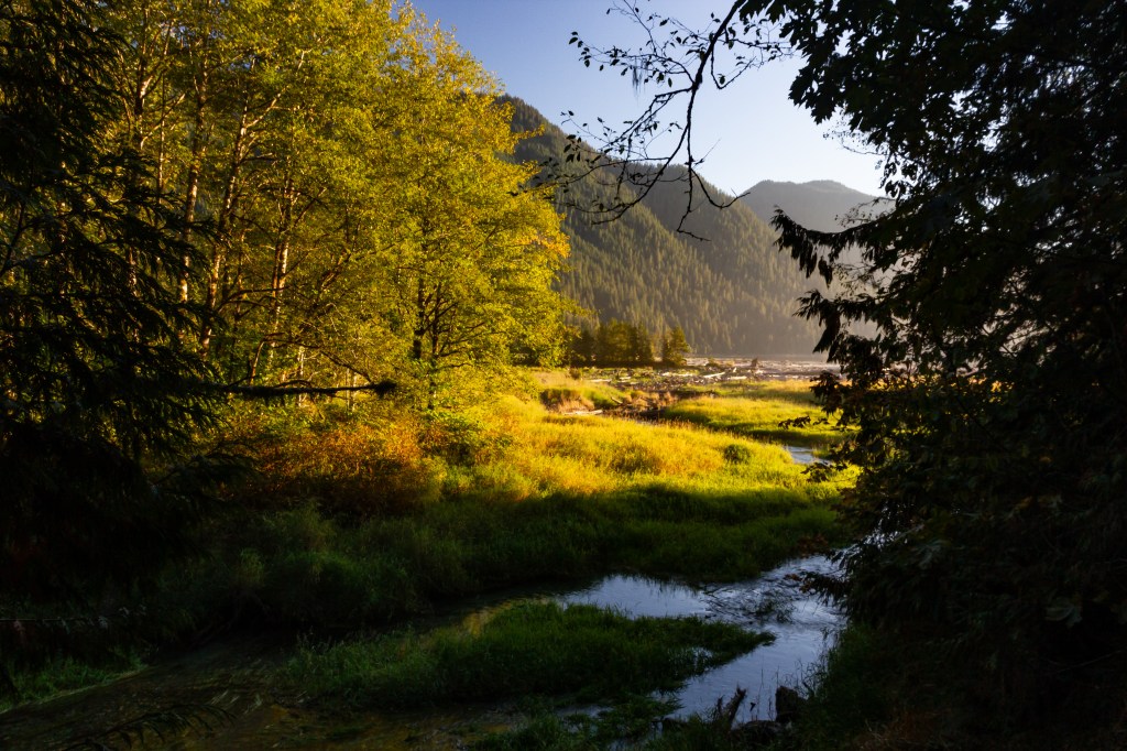
Looking down the Middle Fork of the Nooksack River


")


