Liberty Bell from the Washington Pass Overlook along the North Cascades Highway, Washington

Tag Archives: washington
Sahale Camp Photomerge
Photomegre is one of the multitude of Photoshop Tools. It is a system of merging 2 or more images into a panorama.
Here are two original jpeg images from Sahale Glacier Camp. I took these with the thought in mind to later merge them. using a tripod I captured one image and carefully swung the camera on the tripod and lined up the second one. It wasn’t any fancy movement, I made note in my mind of where the frame’s edge was and pointed the camera in the approximate place to take up where the first image left off, planning for some overlap. I was using a 24 mm lens. I set my image quality when capturing the images so that I would have both a RAW file and a jpeg of the shots.


Once back home I opened both of the raw files together in Photoshop CS6 and synchronized them so that what ever changes I made to one were duplicated on the other. I worked to lighten the foreground and darken the sky. Using the sliders for highlights, shadows, exposure, clarity, whites and contrast I played around until I liked the result.
I also used the brush tool on the foreground to bring out more details on the rocks.
I saved the images as jpeg files. Here they are. 

Once this was done and images saved I went to Photomerge, selected the two modified images and let Photoshop work its magic. 
Opening the panorama as a jpeg image I filled in the corners using the clone stamp tool and tweaked the levels settings a bit, and Viola! Here is the final image.

I have printed the image as a 40″ x 15″ canvas print and it is very stunning.
Nighttime Imaging Along Baker Lake Road
Baker Lake Road heads north from Highway 20. Skirting Lake Shannon, Baker Lake and finally the Baker River the road leads to darkness! About 20 miles up the road makes a sweeping curve over a cement bridge and this view of Mount Baker opens up.
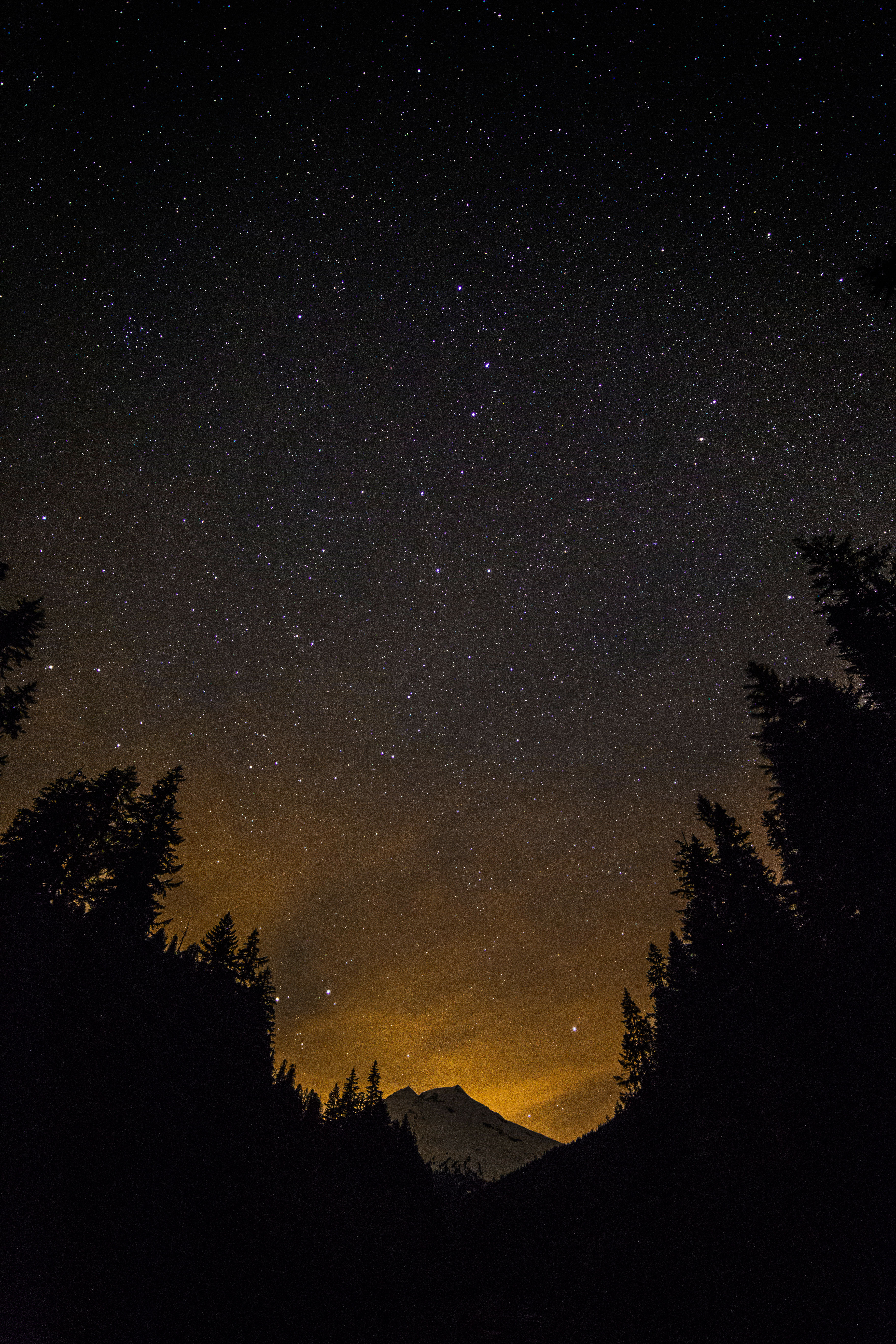 Mount Baker under the Big Dipper
The roads end soon follows and a short hike in the darkness offered this view of Baker River.
 Baker River, North Cascades
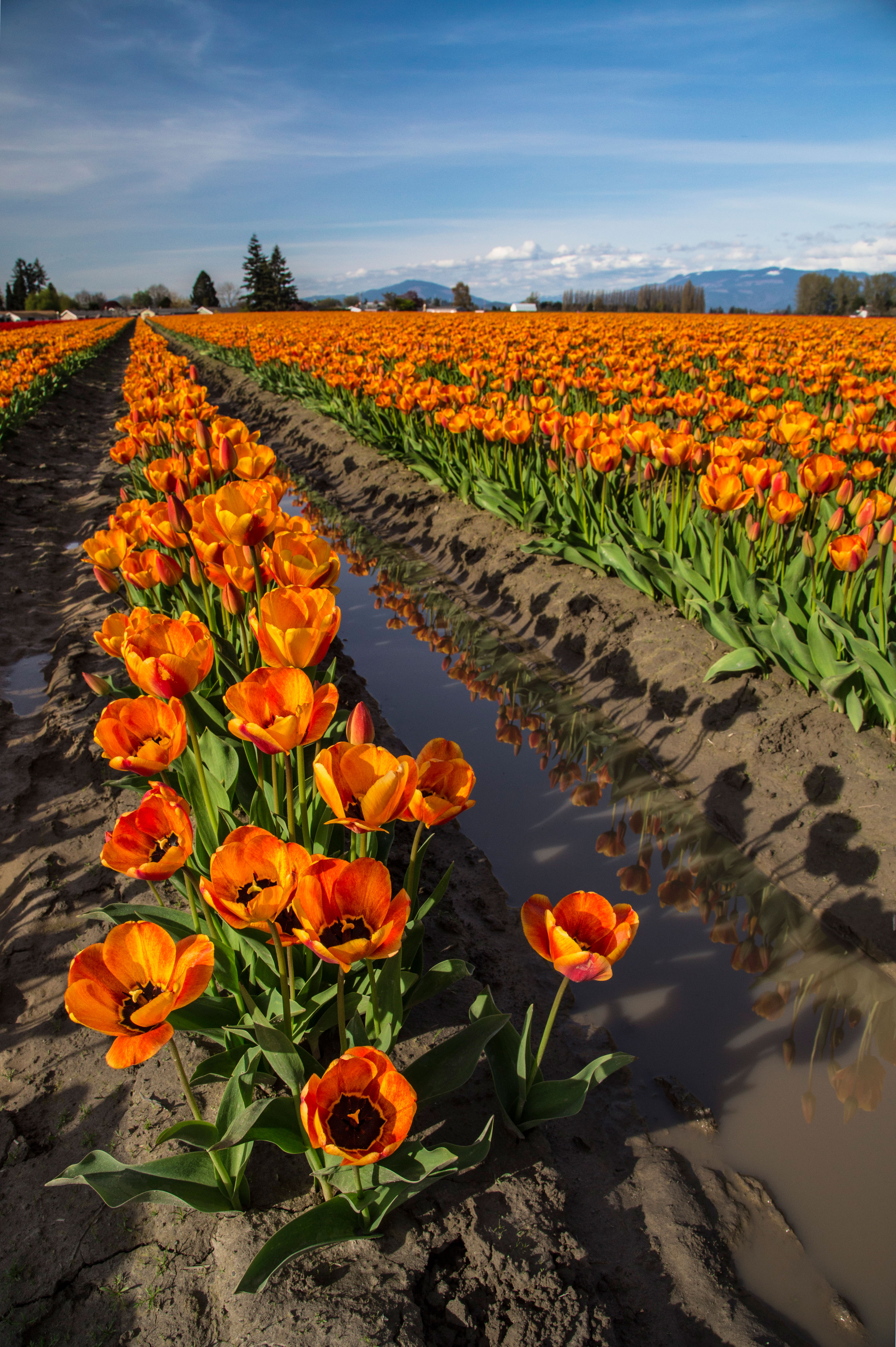
Skagit Valley Tulips: 2014
There are 3 good reasons that I take so many pictures of the Tulip Festival each year:
1. Tulips are incredibly colorful!
2. They are very close by!
3. The mountains are still covered with snow!
So, here is a sampling of my favorite images of the Tulips (and Daffodils!) from this year!


On the Cover of Northwest Travel magazine
Here is an image I captured and it is now on the cover of the May/June Issue of Northwest Magazine! The image is Mount Logan and a waterfall on the North Fork Bridge Creek Trail, North Cascades National Park. One of my favorite places in the North Cascades…Here is a link describing how to get there!

Here is my full sized original image:
“Wilderness 50” Celebration
2014 marks the 50th anniversary of the signing of the Wilderness Act. In September of 1964 President Johnson signed into law the Wilderness Act, one of the most important pieces of legislation in the US regarding protection and preservation of Wilderness.
Wilderness 50 “The 50th Anniversary National Wilderness Planning Team (Wilderness50) is a growing coalition of federal agencies, non-profit organizations, academic institutions, and other wilderness user groups whose purpose is to plan and eventually implement local, regional, and national events and projects, specifically designed to elevate the profile of wilderness during the 50th anniversary celebration.”
One of their programs was to hold a photo contest and use the winning images as a part of their plans to inform people about the significance of the Wilderness Act.
More than 50 images were chosen and these will be displayed as large format prints in the Smithsonian Museum, in Washington DC starting in September!
I submitted several images to the competition and this image, here was chosen as an Honorable Mention in the People in Wilderness Category and will be used on signage for the various events and displayed in the museum.
 Sahale Glacier Camp in the Steven Mather Wilderness in North Cascades National Park, in Washington.
As a part of the process I was asked to submit a personal story about the image. Here it is:
“My connection with wilderness began when I was 16. I spent a month in the Sawtooth Wilderness in Idaho, learning how to backpack, climb and survive. The trip changed my life and encouraged me to continue. Treks along the Pacific Crest Trail and the Andes followed.
Then my life changed again and I was off on a different purpose. For almost 20 years I followed the light only to wind up in the darkness. And then I felt the wilderness call to me again, beckoning me back into her arms.
I had packed my old life in boxes and uncovering them produced an old hiking guide. I scoured it and found the most exciting sounding trip in there, recruited a few friends to accompany me and off we started.
I had forgotten what mileage and elevation gain portended and as we began our trip up to Sahale Camp. It slowly came back to me, what sweat and struggle were all about.
We finally made it to the camp well after dark and collapsed in our tent.
This image was captured the next morning. My life was changed anew; I had found a new purpose. Wilderness had rescued me again.”
I am excited and proud that any image of mine would be used to promote and protect wilderness!
Sahale Camp Panoramas
Sahale Glacier Camp sits at the base of Sahale glacier atop 3 piles of rubble each crowned with a ring of stone. The views are breathtaking: a 180 degree sweeping view of the North Cascades, a sea of peaks stretching out to the horizon.


I have visited many times and tried to capture the feel of the view. Here are several panoramas, some from sunrise, and several from sunset, each comprised of two or more images merged.


North Cascades Book
I just got word that these three images will be included in a new book about the North Cascades, due out in the Fall of 2014.
More details coming soon!
 Camping under the stars
 Mount Baker and Coleman Glacier
 Hikers on Sahale Arm
Tulips of Skagit Valley
March has arrived and it’s not too long now (hopefully!) until it gets a little warmer and the flowers start to arrive.
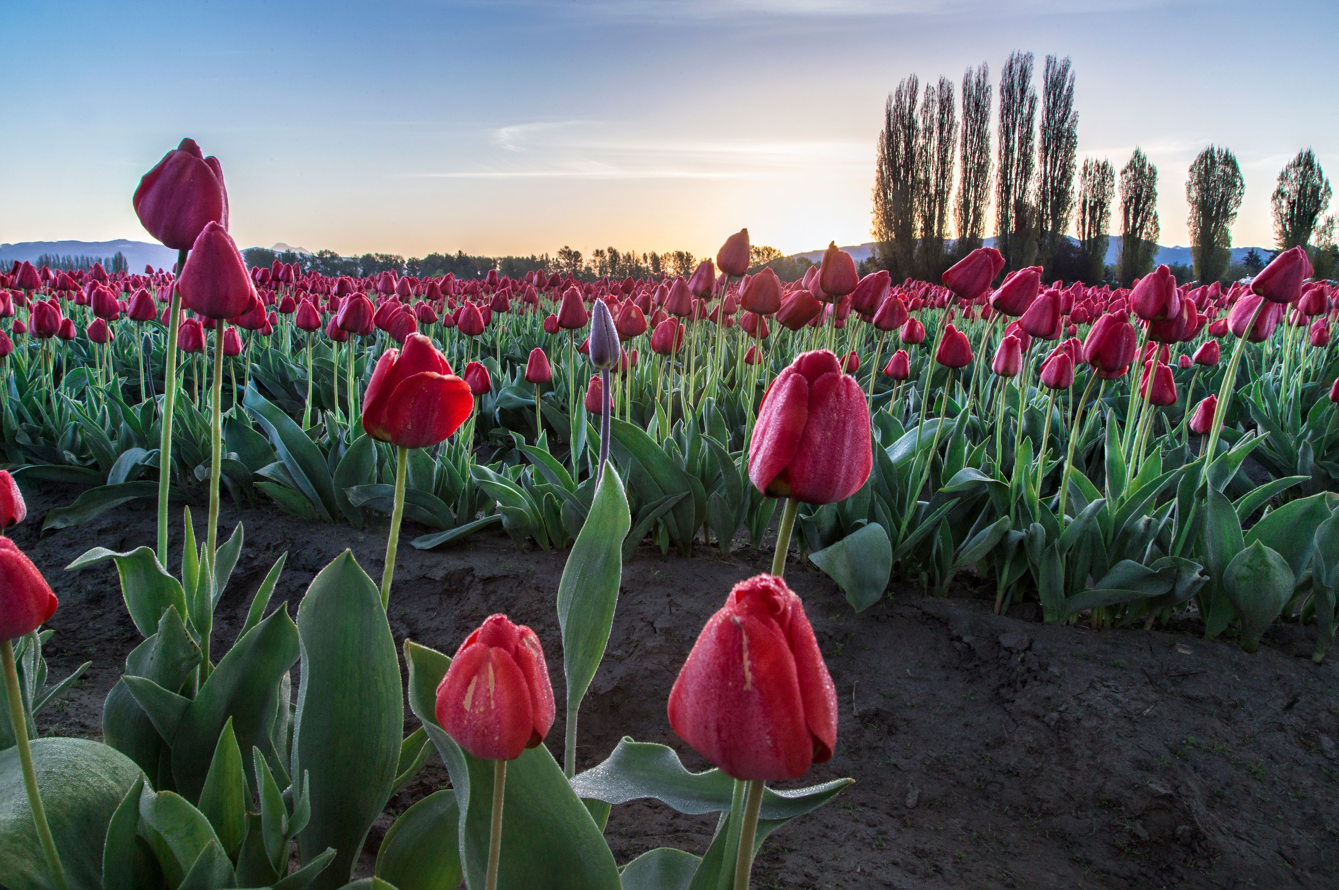
 Rows of Reds, Reflected
 This months issue of NW Travel Mag with one of my images on the cover!
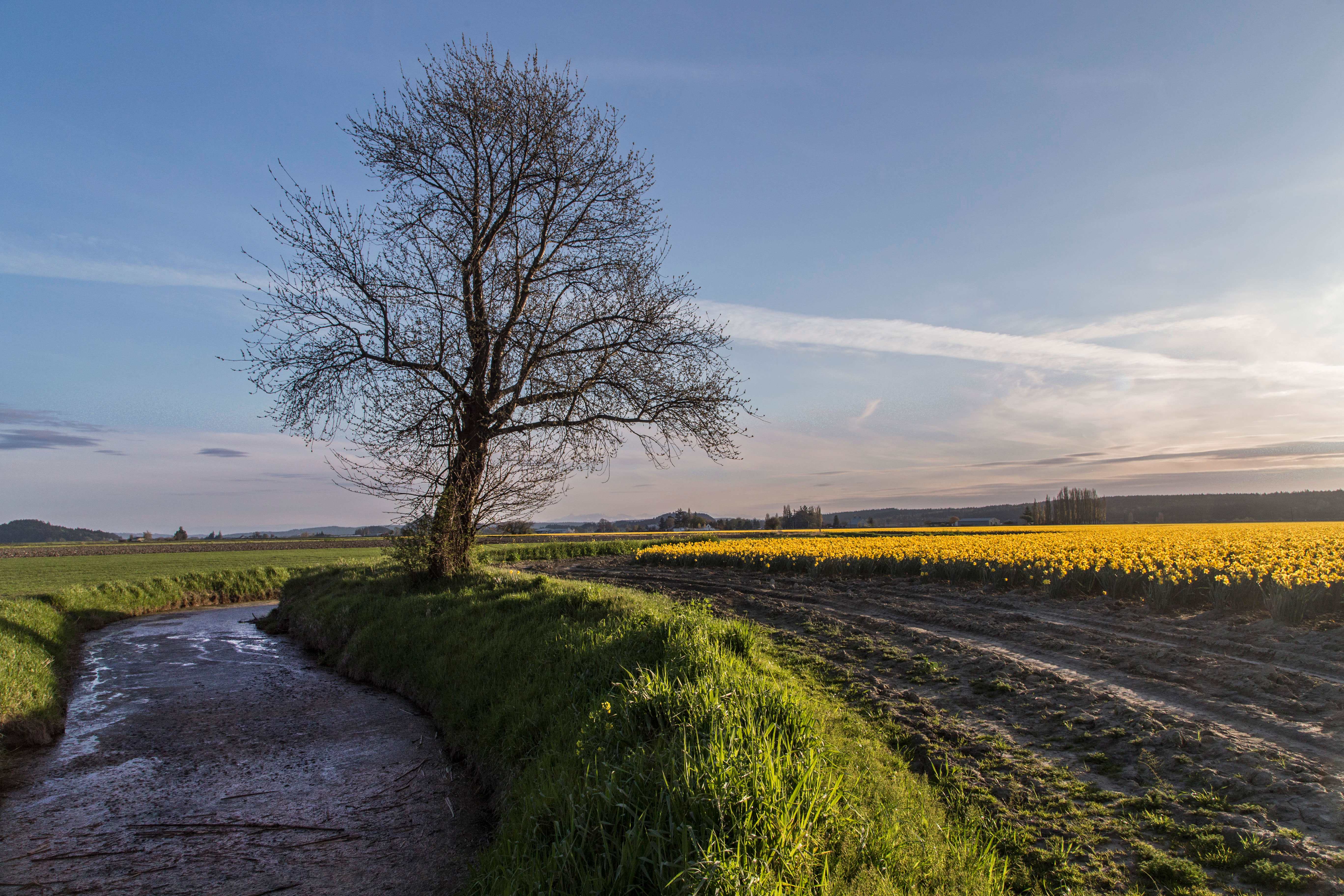
I live in Skagit County, named after the Skagit Indians and Skagit River) in the NW corner of Washington State. And among its other striking features such as the North Cascades and Puget Sound we have the Tulip Festival every April.  Yellows at sunset
I understand that outside of Holland there are more tulips grown here than anywhere. The valley floor has a wide expanse of fertile, flat farmland and near the towns of Mount Vernon and La Conner there are fields and fields of bright tulips.  Infinite Pinks
Each year the bloom times change, but generally its mid April when they are at their height of color.
This is a web site that has a link for a map showing exactly where the fields are and when they are abloom.
 Rows and people
Every Saturday and Sunday the roads are crammed with cars forming long lines. This is not a good time to come! If you do come on the weekend make sure to arrive for either sunrise or sunset. I am often out for the sunrise and the fields are bright a crisp, a few workers and photographers are there, and that’s about it.
Weekdays are the best, plan to arrive about 5 or 6. The tulipy stores are closed and the manicured gardens. But the huge expansive fields are alive with the hue of low light and alive with vibrance!
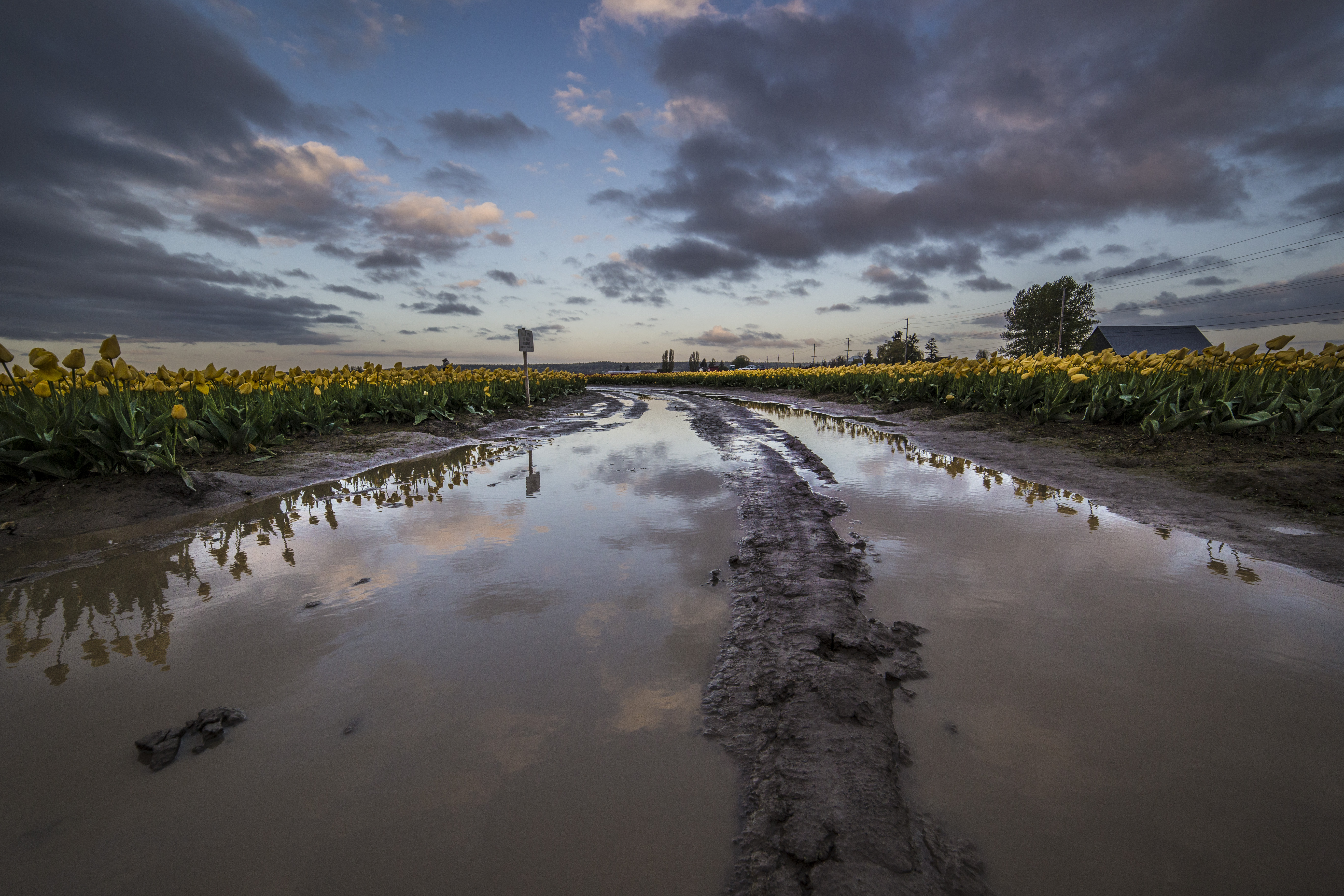
 Yellowy mud!
Make sure to dress for mud, and bring your tripod and polarizer!
 Reds and a dramatic sky
If you decide to make the trip for a sunrise or sunset and want a tour guide, make sure to let me know! I am always happy to have company!
Cutthroat Pass, North Cascades
 Cutthroat Pass Panorama
The hike to Cutthroat Pass is an easy one, both to get to and to hike. The trail leaves from the parking area at the north side of Rainy Pass, along the North Cascades Highway. It’s about 5 miles or so to the top. Along the way there are streams, meadows and higher up, camps.
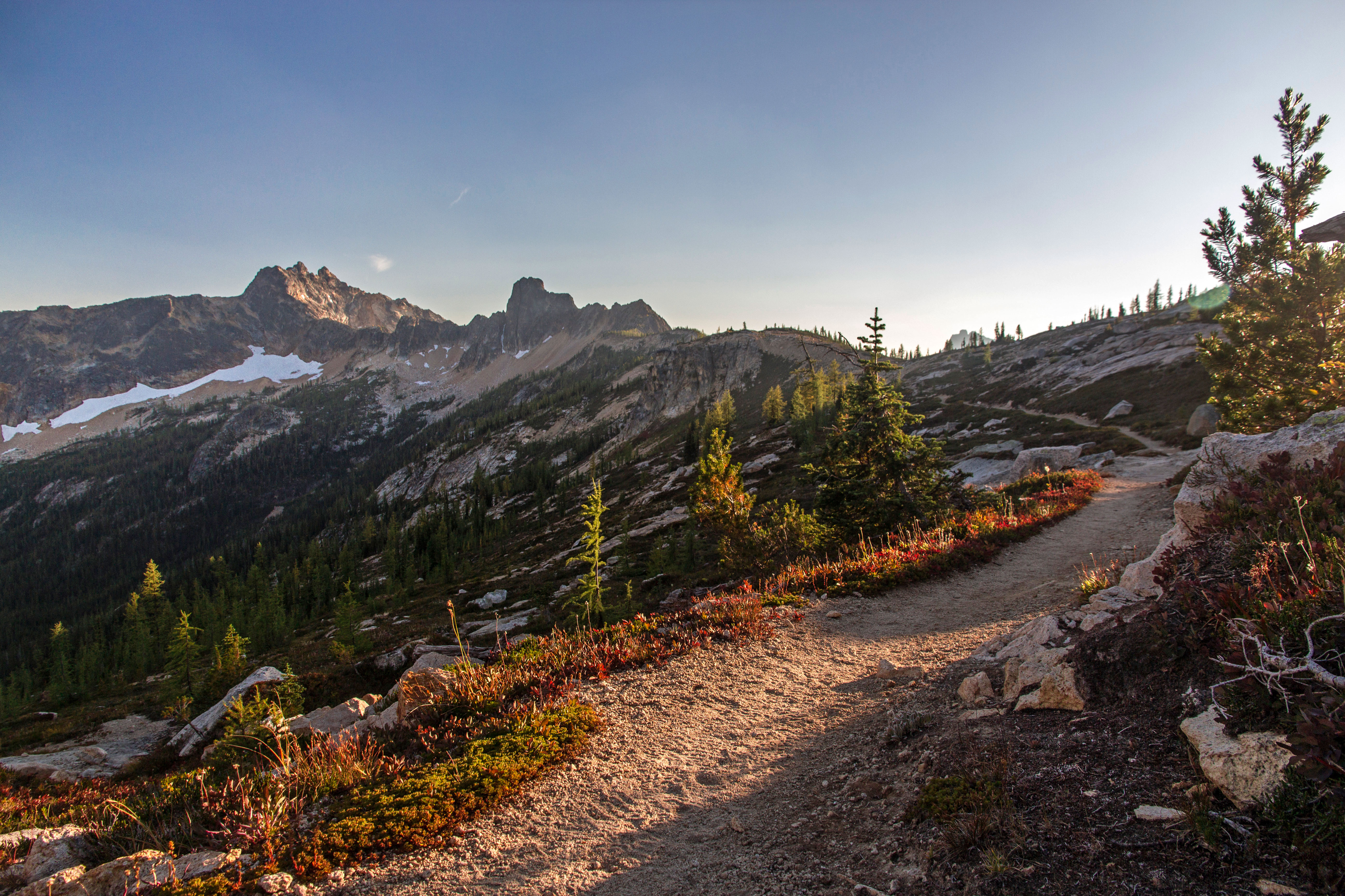 Cutthroat Pass Trail
 Sunrise at Cutthroat Pass
I made the jaunt up to capture some fall colors. We slept on slabs at the top of the pass.
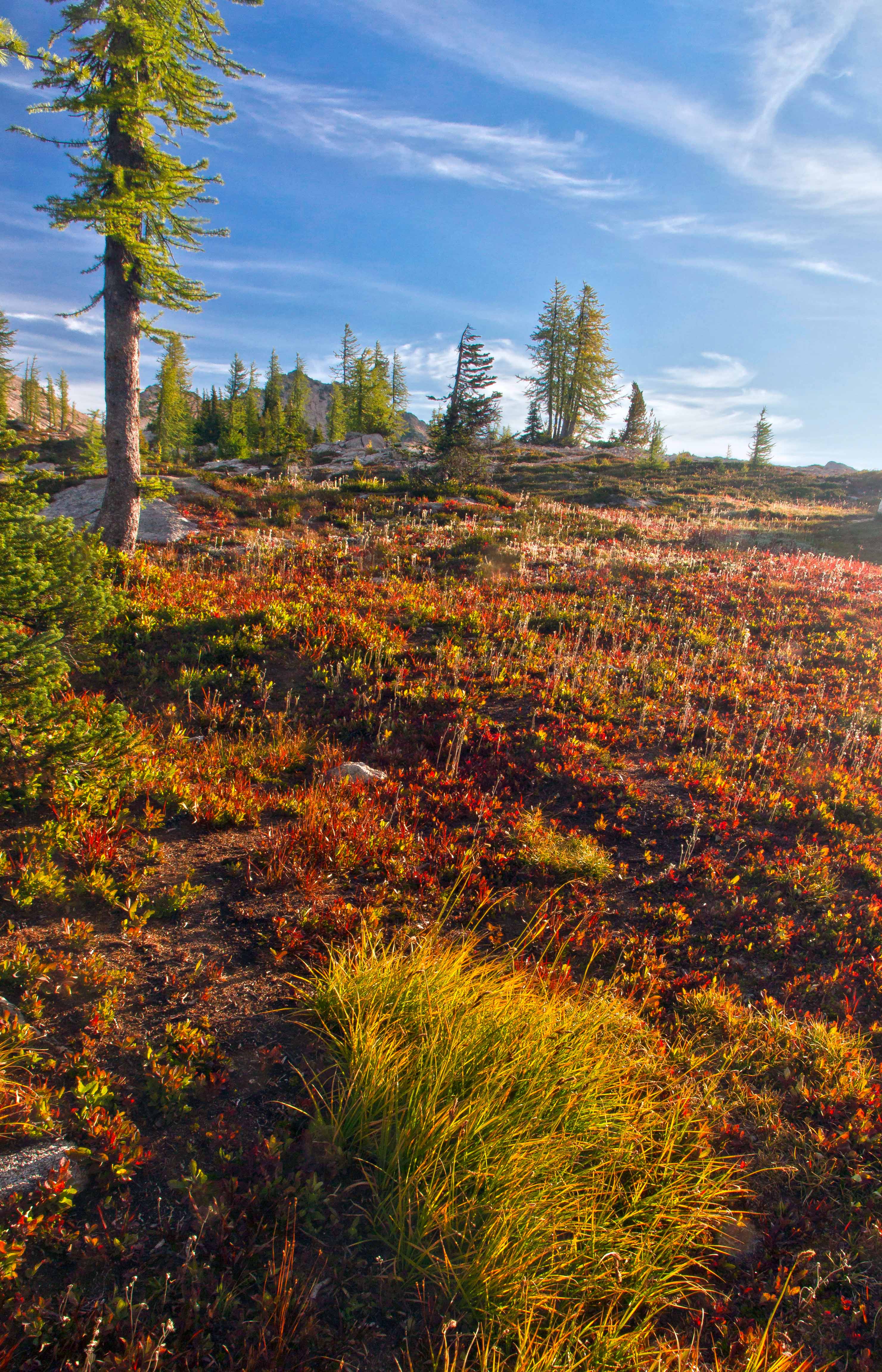
 View from camp atop Cutthroat Pass
 View from camp atop Cutthroat Pass
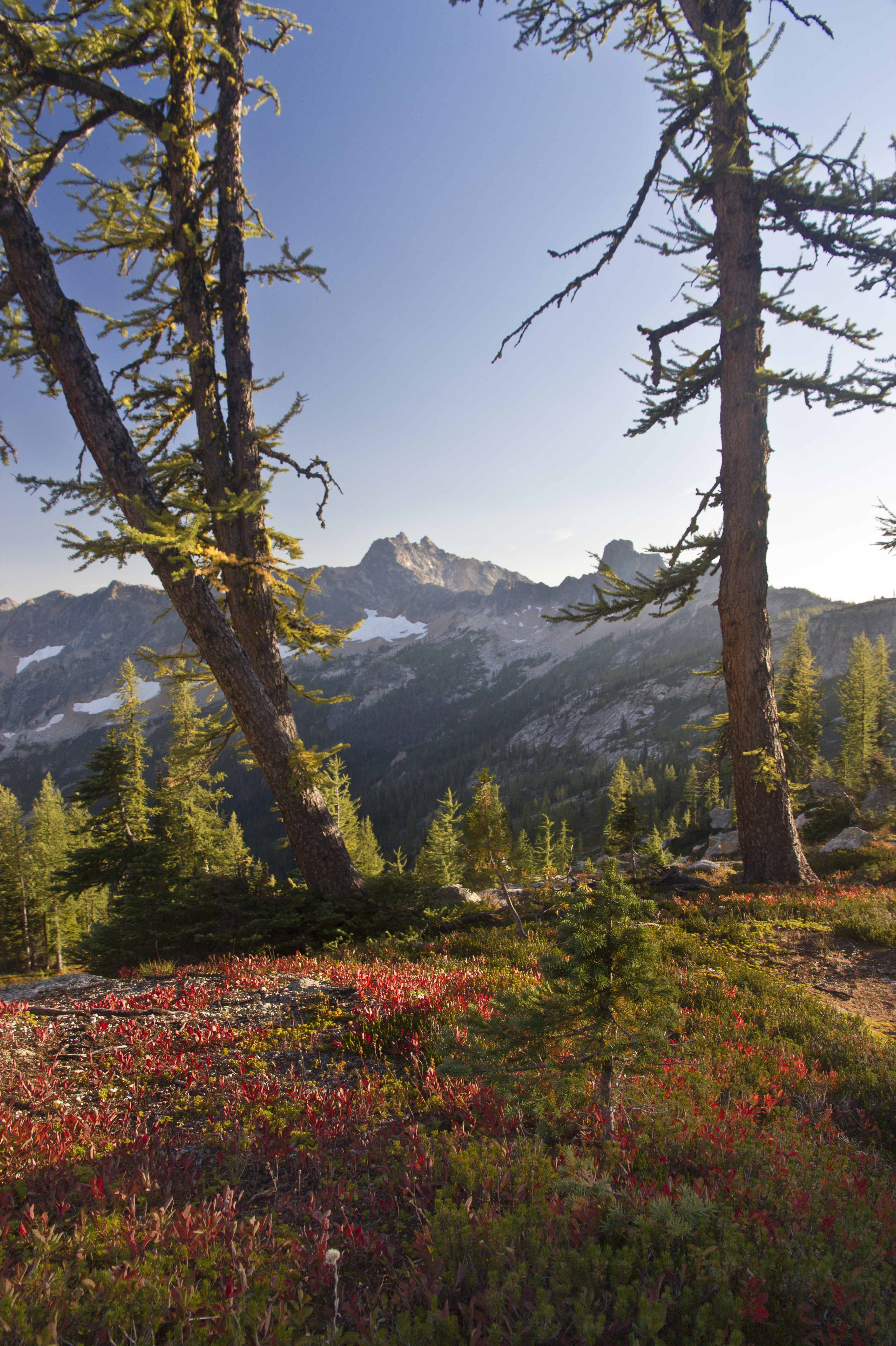
 Cutthroat Peak
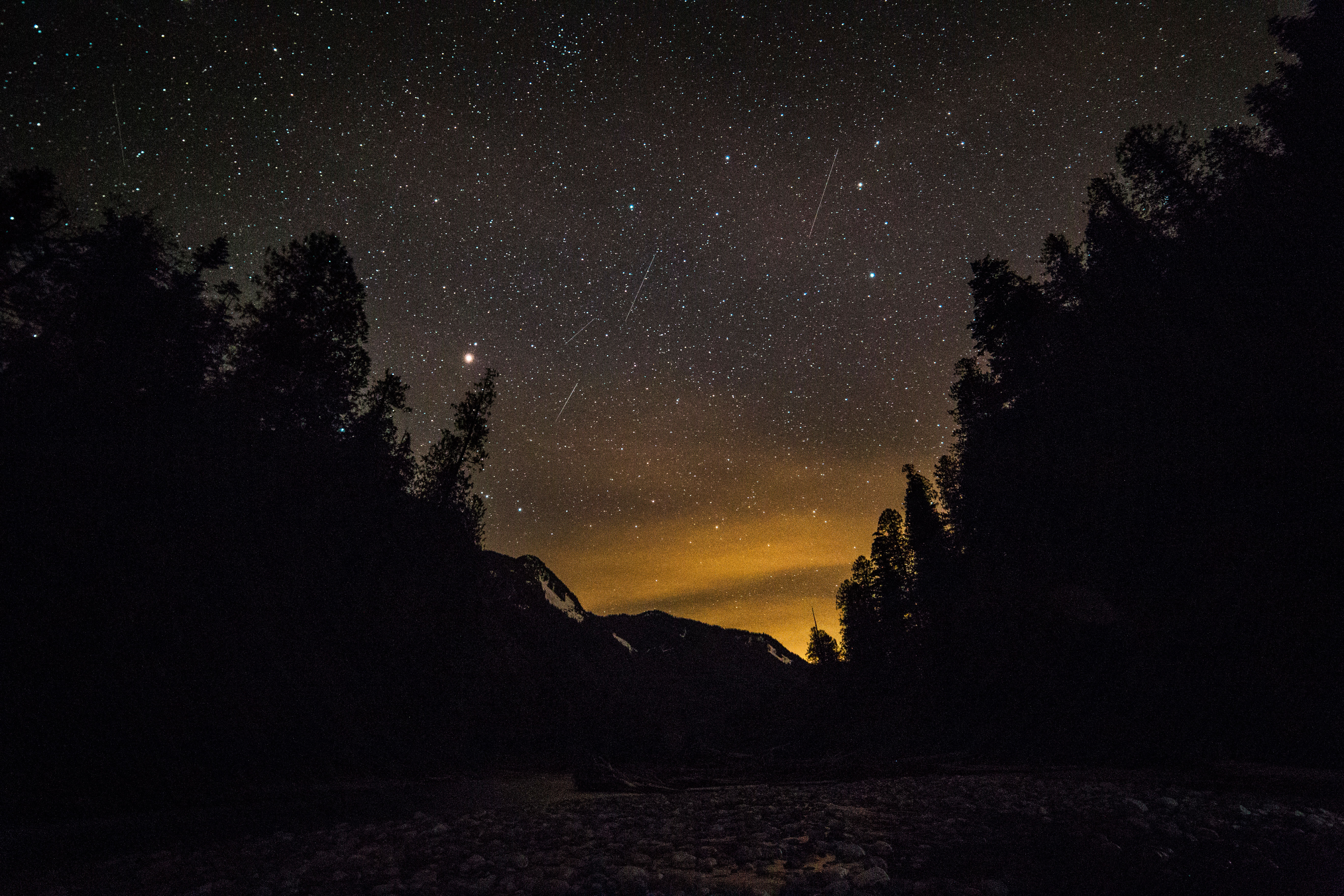
 Milky Way from Cutthroat Pass
