Vistas of Skagit Valley

Skagit valley stretches a long way from Ross Lake to Anacortes. Along the way there are many promontory spots from which to view its magnificence!

Diablo Lake is a emerald jewel at the foot of Colonial Peak.

Sauk Mountain rises more than 5,000 feet above the valley

Samish Overlook affords spectacular views of the valley.

Mount Erie and Cap Sante in Anacortes are wonderful vistas.

2021 Washington State Scenic Calendars are now on sale! Here is the link to see the images and order your copy!

An evenings walk near Conway

There is a boat ramp and you can walk atop the dike, along Dike Road, near Conway.

The South Fork of the Skagit River is nearby.

Several of the farms nearby have wonderful old barns…

Here are a few images.

Skagit River Images

The Skagit River plays a very big role in life here in the valley. Transportation; electricity; salmon; irrigation; and more are centered around the river.

The early days of white settlers along the Skagit River are chronicled here quite well, in the Skagit River Journal.

Traveling along and across the river affords some good opportunities to capture images, from time to time. These are some recent images, some over the last few years of journeys.

Fir Island Sunrise

Its always good to start any day with a colorful sunrise. Some nice clouds, water for reflections, a wide panoramic view…maybe some mountains off in the distance all make the scene perfect.

These images are from two very recent visits to Fir Island sunrise.

Sunday, November 24

Thursday, November 28

The broad expanse of sky, over the ocean and mouth of the Skagit River. There are several vista spots alone Fir Island Road, most require a Discover Pass.

2020 Night Sky Calendars are available here.

Interested in a Photo Tour? Tulip Photo Tours in April are now filling up fast. 

Night Sky Photo Tours are my favorite! More info here. 

Skagit River and Mount Baker

Not long ago I saw an image of Skagit River with Mt Baker looming above. It was a gorgeous image and started me on a hunt.

I have been here in Skagit Valley for 15 years now and have never encountered a vista that encompassed both the Mountain and the River. Skagit River runs east to west through the valley and Baker sits about 10 miles to the north.

A short study of the map revealed that there are several spots where the Skagit turns back on itself so that you can look “down the river” and right at Mt Baker. I started my search along the Concrete Sauk Valley Road, looking to visit the confluence of the Sauk and Skagit Rivers. It was a lot of fun tooling about, on both sides of the river, scouting for views, vistas, and access trails down to the gravel bars along the river.

Here are a few pics from my endeavors:

After a bit of search I finally found a spot along the Concrete-Sauk Valley Road where you can scramble down to the gravel bar and out to this view: Looking north to Mt Baker, from the Skagit River


Vistas of Skagit Valley

Always in the hunt for new vistas of Skagit Valley, here are some of the vistas I’ve visited in the last few years.

Fir Island Sunset

Fir Island is located at the mouth of the Skagit River. You can get there from Best Road, go west on Rawlins until the road stops and start walking. Its very wet and soggy, in the best of times.

There is sort of a trail that leads out to the closest mound of rock. Its an easy relaxing walk. The sky is filled with sounds.

I make it to the small hill and climb up for the view. The mouth of the Skagit River sweeps out to the sound.

The sun is starting to set and so I head back.

Soon I am assaulted by waves of color.

Its hard to keep walking.

Sunset over the Skagit River

Bridge over Skagit River

Bridge over Skagit River

Getting out to capture cool pics is about cloud watching. Days when its clear or overcast lack interest for me. The trick is that you need to pay attention! I have seen many days here in Skagit Valley when it poured rain all day and was miserable, only to partially clear in the late afternoon/early evening and produce some of the best skies ever. Today for example the sky was completely clear all day, but late in the afternoon the clouds appeared and we had a magnificent sunset. I was rather late getting out with the camera and so opted for a spot about 5 minutes drive from my house: The Highway 9 bridge over the Skagit River. I shot with a fast shutter speed to compensate for all the shakin’ goin’ on from the traffic over the bridge. This produced some interesting lines from the currents in the water.
Skagit River at Sunset

Skagit River at Sunset

Tulips of Skagit Valley

March has arrived and it’s not too long now (hopefully!) until it gets a little warmer and the flowers start to arrive.
Row of Red Tulips em Rows of Reds, Reflected

NW Travel Magazine March-April 2014 This months issue of NW Travel Mag with one of my images on the cover!

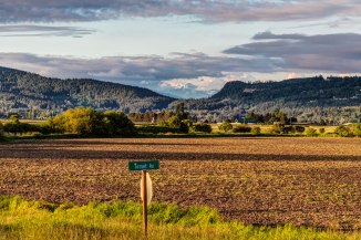
I live in Skagit County, named after the Skagit Indians and Skagit River) in the NW corner of Washington State. And among its other striking features such as the North Cascades and Puget Sound we have the Tulip Festival every April. Yellow tulips Yellows at sunset

I understand that outside of Holland there are more tulips grown here than anywhere. The valley floor has a wide expanse of fertile, flat farmland and near the towns of Mount Vernon and La Conner there are fields and fields of bright tulips. infinite pink tulips Infinite Pinks

Each year the bloom times change, but generally its mid April when they are at their height of color.
This is a web site that has a link for a map showing exactly where the fields are and when they are abloom.
rows and people Rows and people
Every Saturday and Sunday the roads are crammed with cars forming long lines. This is not a good time to come! If you do come on the weekend make sure to arrive for either sunrise or sunset. I am often out for the sunrise and the fields are bright a crisp, a few workers and photographers are there, and that’s about it.

Weekdays are the best, plan to arrive about 5 or 6. The tulipy stores are closed and the manicured gardens. But the huge expansive fields are alive with the hue of low light and alive with vibrance!
tulips 2014 6em Yellowy mud!
Make sure to dress for mud, and bring your tripod and polarizer!
red tulips blue and orange sky 
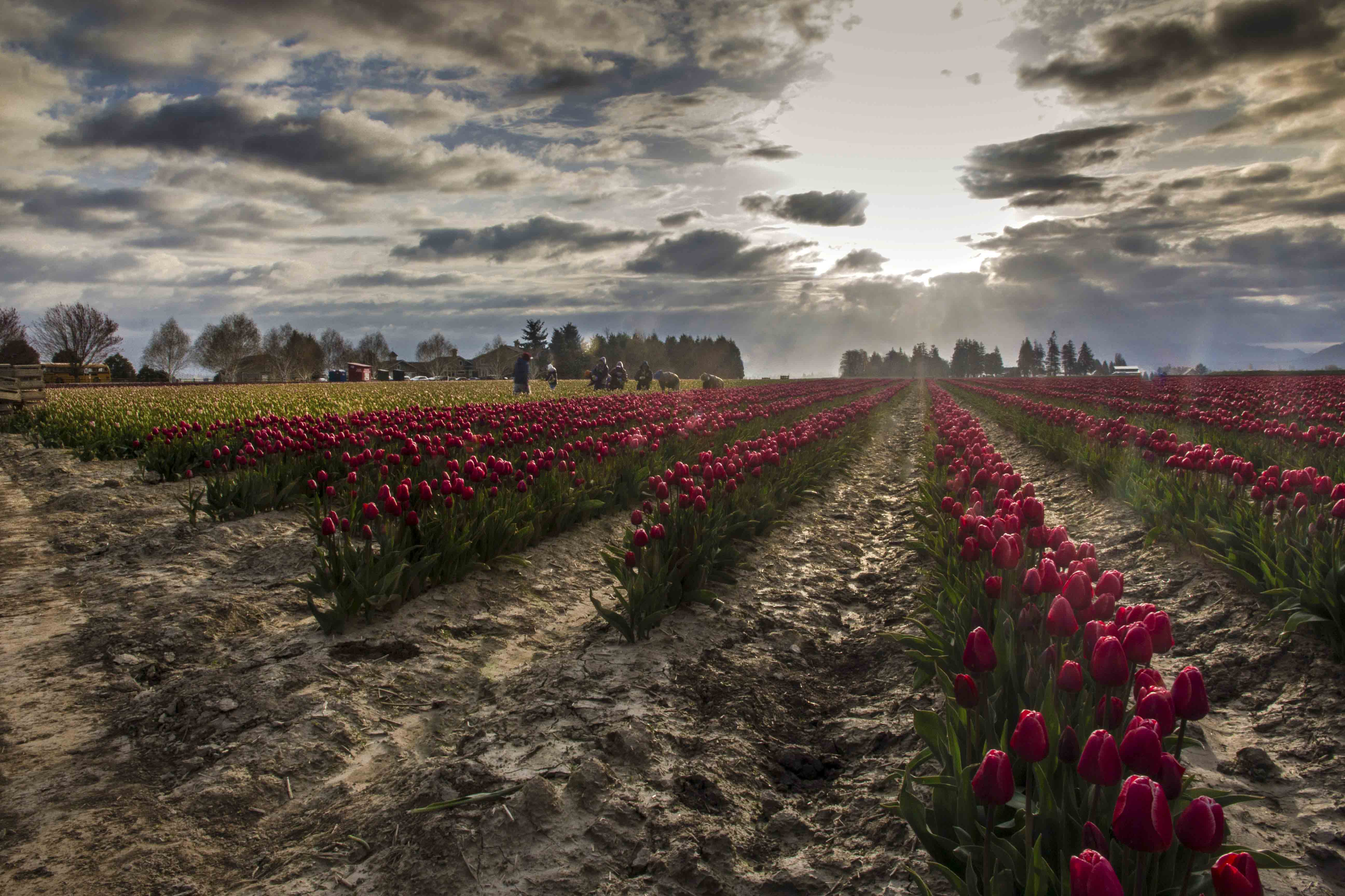
Reds and a dramatic sky
If you decide to make the trip for a sunrise or sunset and want a tour guide, make sure to let me know! I am always happy to have company!

Sauk Mountain, Skagit Valley

Sauk Mountain rises more than 5,000 feet about the lower reaches of Skagit Valley. It’s nearness to the North Cascades Highway makes it a popular day hike. All of the times I’ve been there before its been partly couldy at best but I saw enough to know that it would afford great views at sunset. So, on Thursday I made my way up and captured these images of the sweet light over the Skagit River and valley…
skagit valley 1emm

skagit valley 2em

skagit valley 3em

skagit valley 4em

skagit valley 7em

skagit valley 9em

skagit valley 10em

skagit valley 11em

skagit valley 12em