Bryce Canyon National Park, Utah
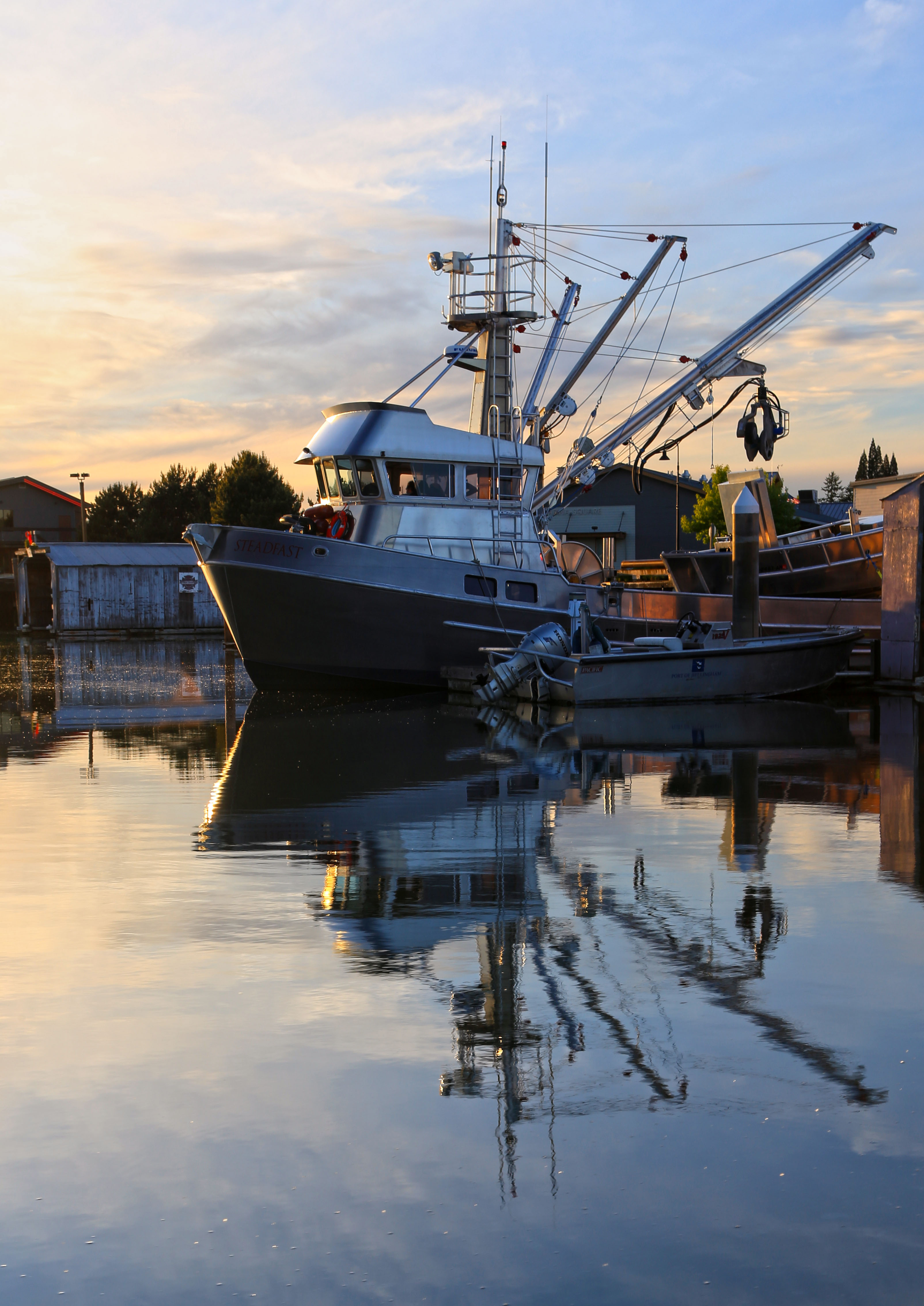
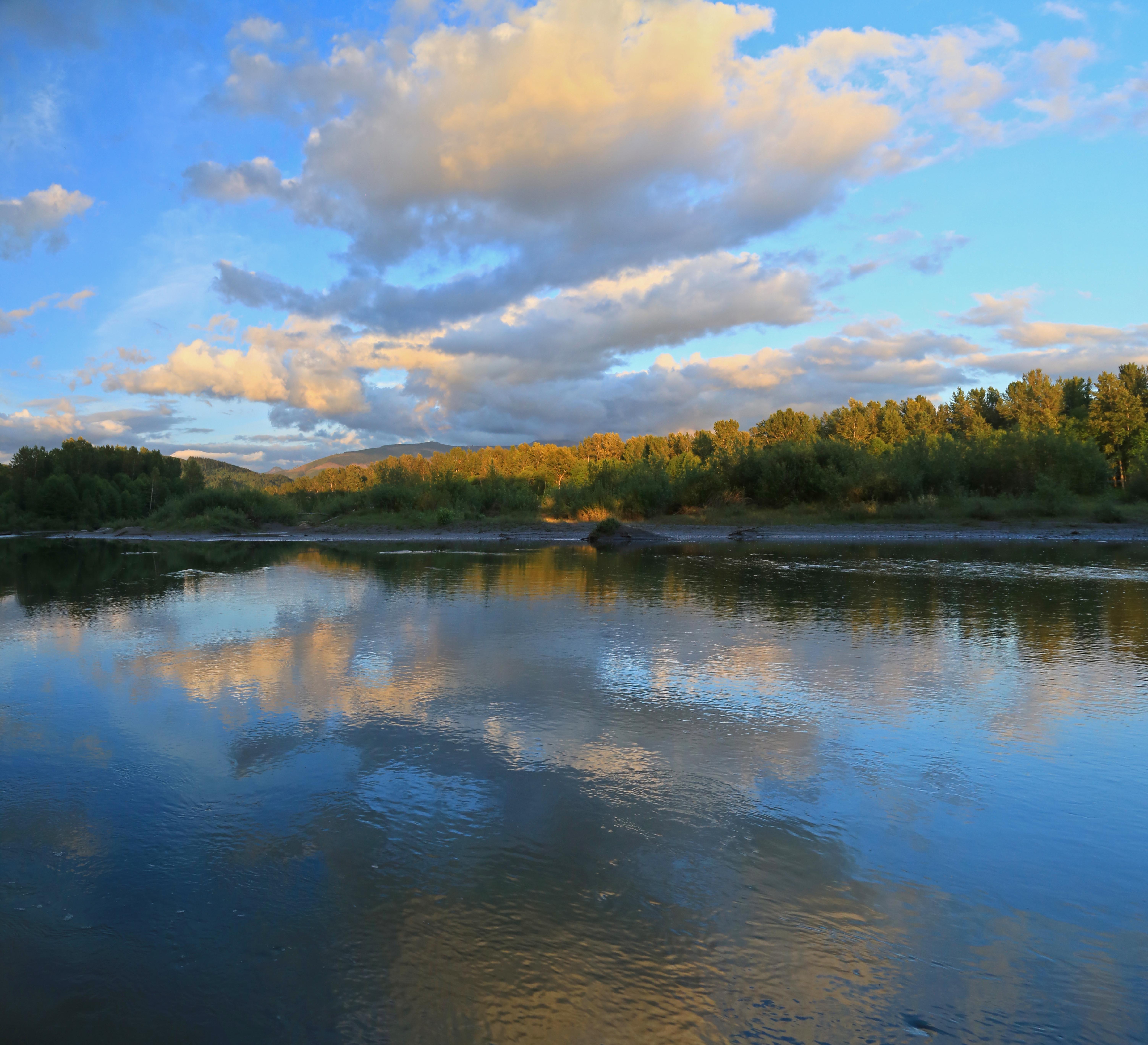
The Skagit River made the national news last week when the interstate highway bridge across it in Mount Vernon collapsed after getting struck by an over-sized truck.
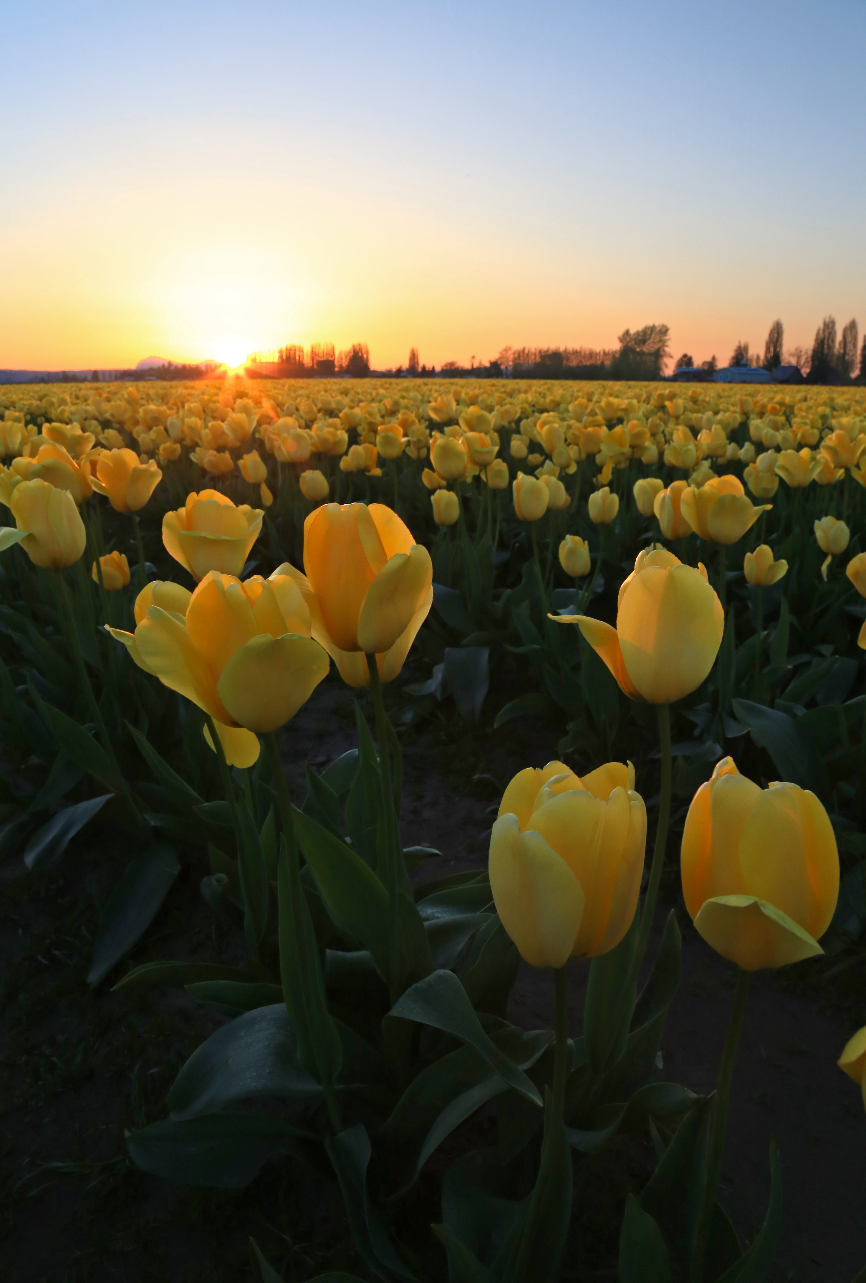
Draining a large swath of the western slopes of the North Cascades, the Skagit River winds through some of the most strikingly beautiful scenery in the US. From glaciated peaks to tulip fields the river winds its way west towards Puget Sound.
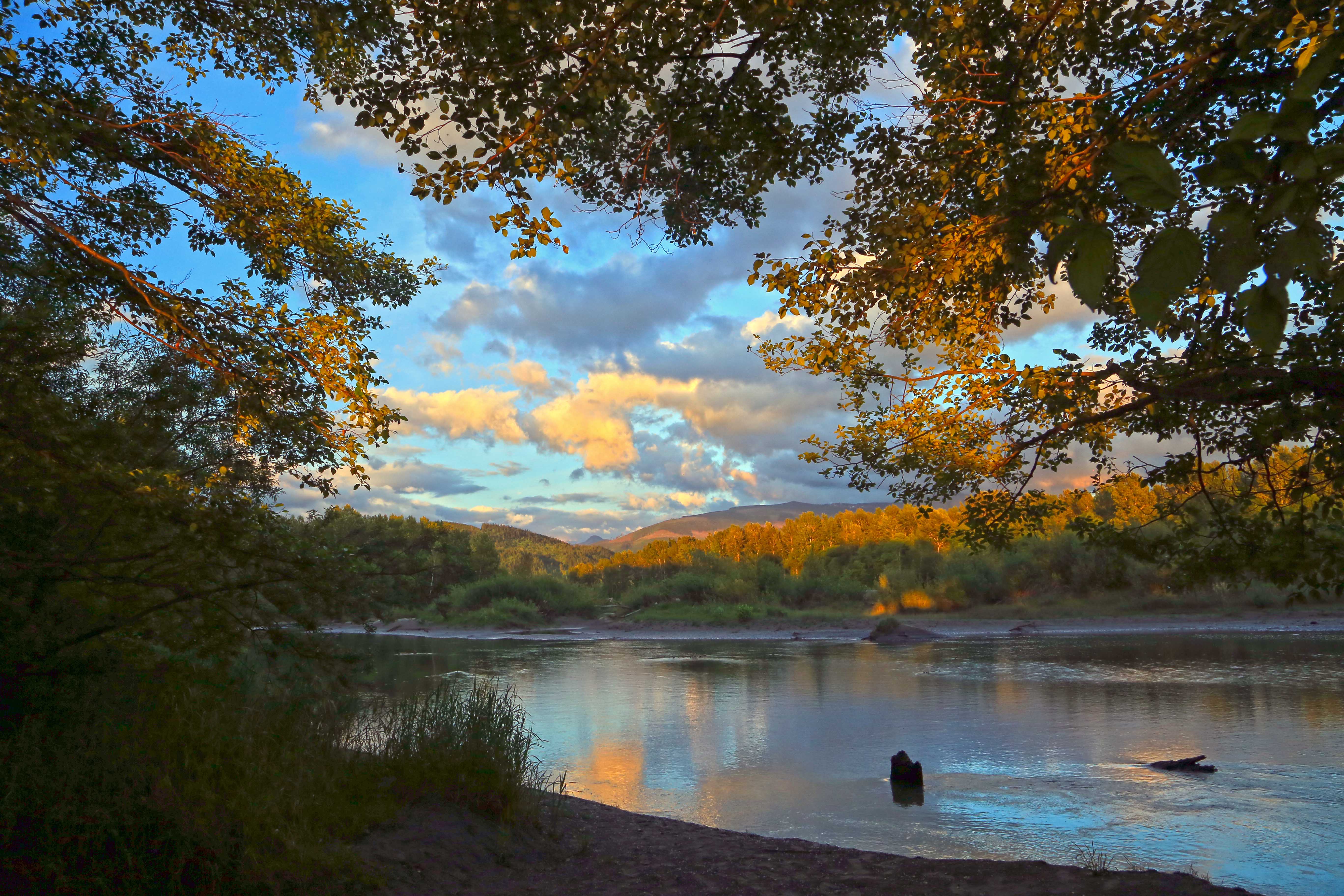
Settlements and towns dot the banks, interspersed with stretches free of any human signs.
Recently I went out look for such a spot and found this vantage point just before sunset.


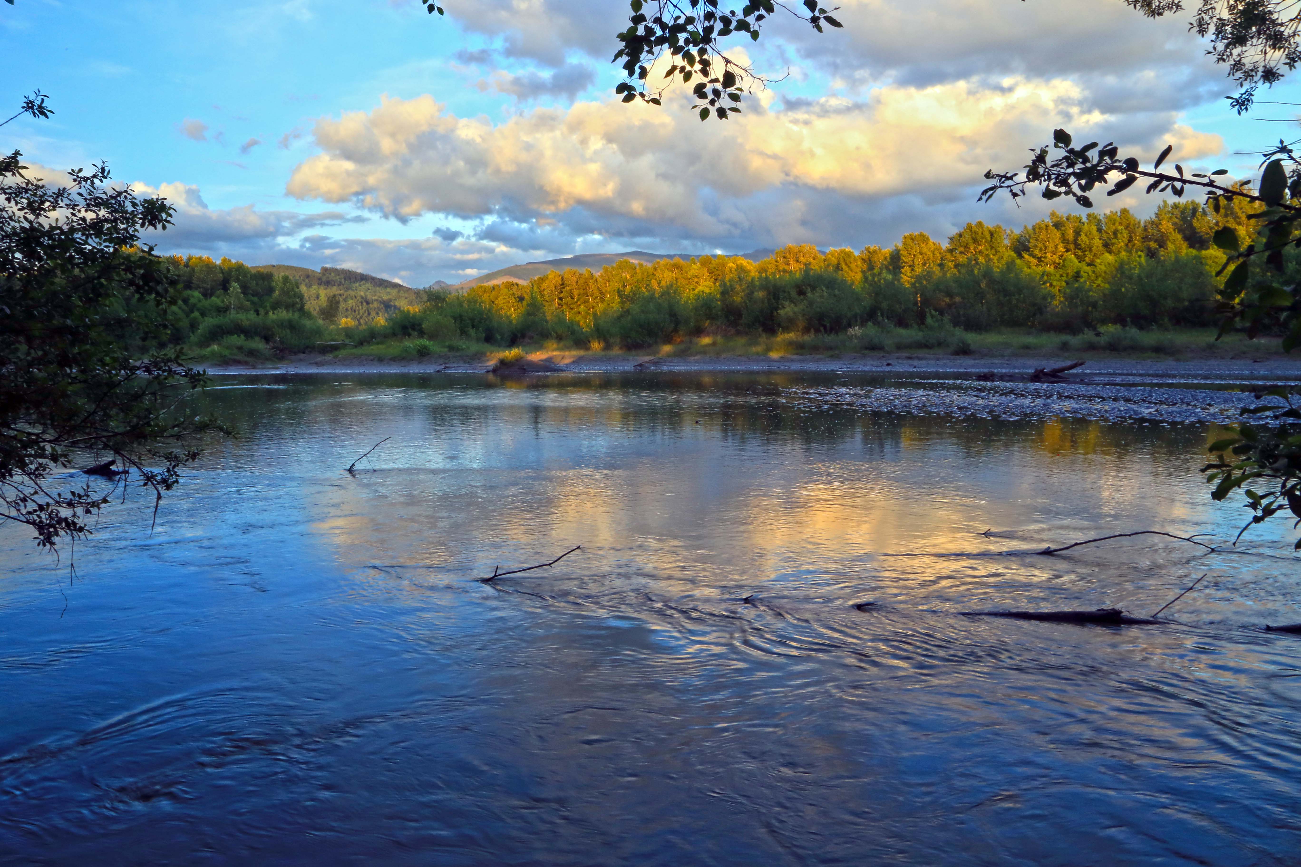
 Baker River, fall
The Baker River flows south into the Skagit draining the western slopes of the North Cascades. There are two dams along the river, the largest of which forms Baker Lake.
 Baker Lake
On the North Cascades Highway (Hwy 20) drive about 15 miles east of Sedro-Woolley to the Baker Lake Road. The road heads north-east following along side of tiny Grandy Lake, then passing Lake Shannon and then skirting the west side of Baker Lake. There are numerous campsites along the way and many logging roads branching off. There is a large concrete bridge crossing Park Creek providing great views of Mount Baker.

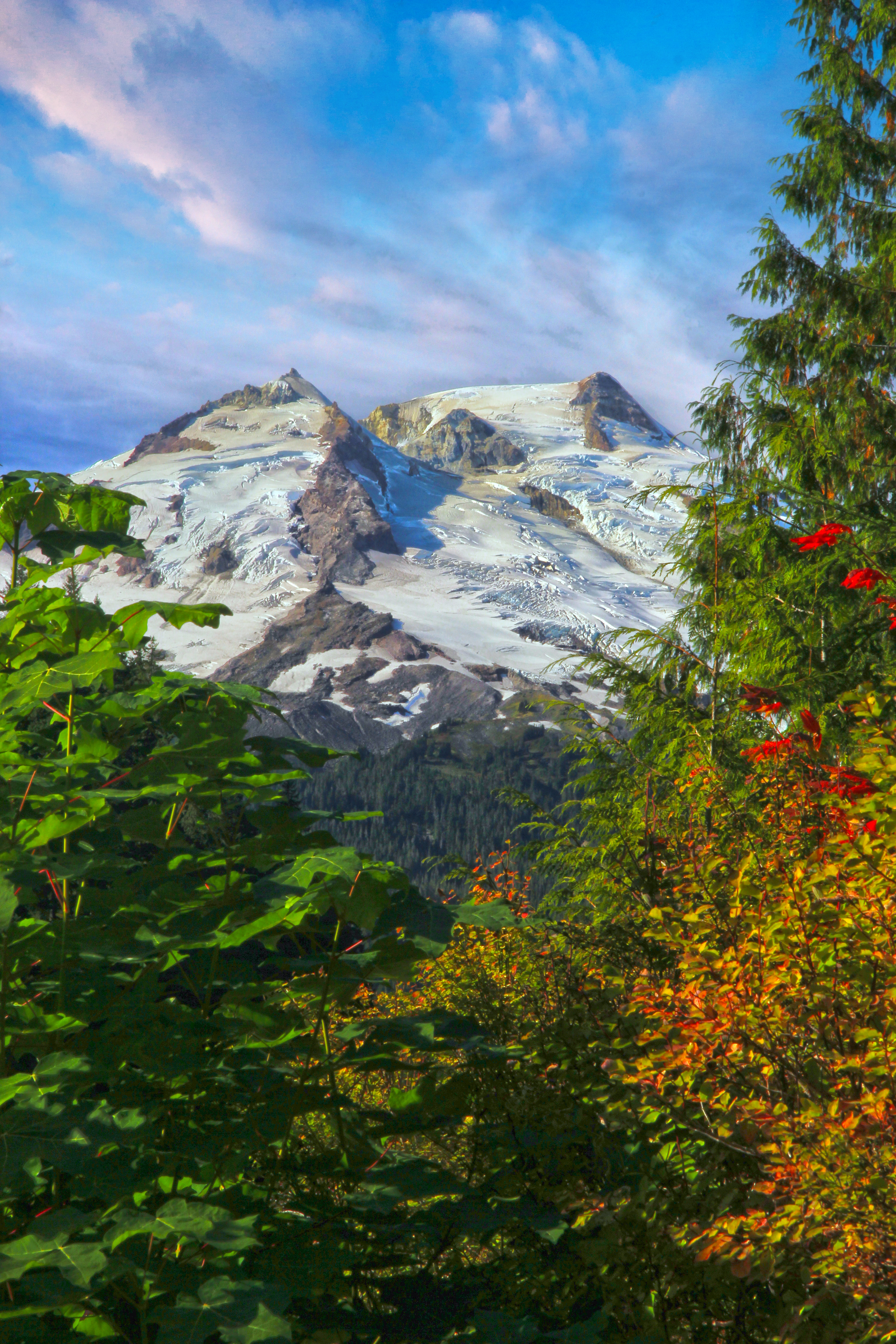 Mt Baker from the Baker Lake Road
After 20 miles of good paved road you’ll pass Shannon Creek Campground. From here on the road is gravel as it winds the last 5 miles along side the upper reaches of Baker Lake. Depending on the season of your visit and the water level in the lake one can see numerous stumps along the edge of this man-made lake. In the fall when the water level is low there are beautiful marshes along the lakes northern end.
 North end of Baker Lake
The road ends at a large parking area where there are bathrooms and to the right a trail head. You can scramble down to the gravel bar and have a look at the river here.
It is required to have a Northwest Forest pass to park, these can be obtained at the Baker Lake Grocery store, back on Highway 20 or in Sedro-Woolley at the Forest Service national park Headquarters.
The trail is in both the North Cascades National Park and the Mount Baker National Forest. Here is a link to a web site describing the trail.
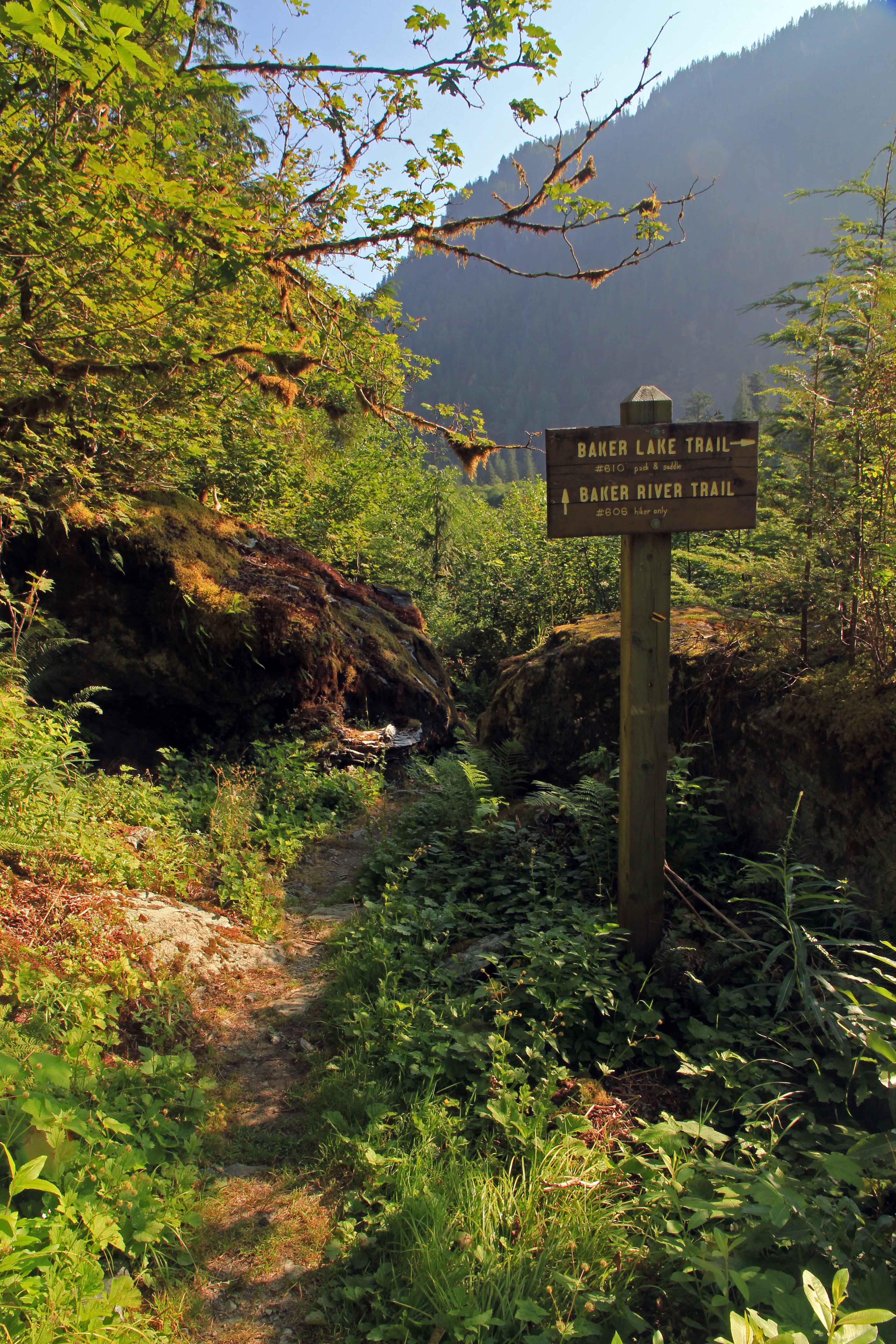
At the edge of the parking area there a big wooden reader board and from there the wide trail passes a few campsites and between two big boulders.
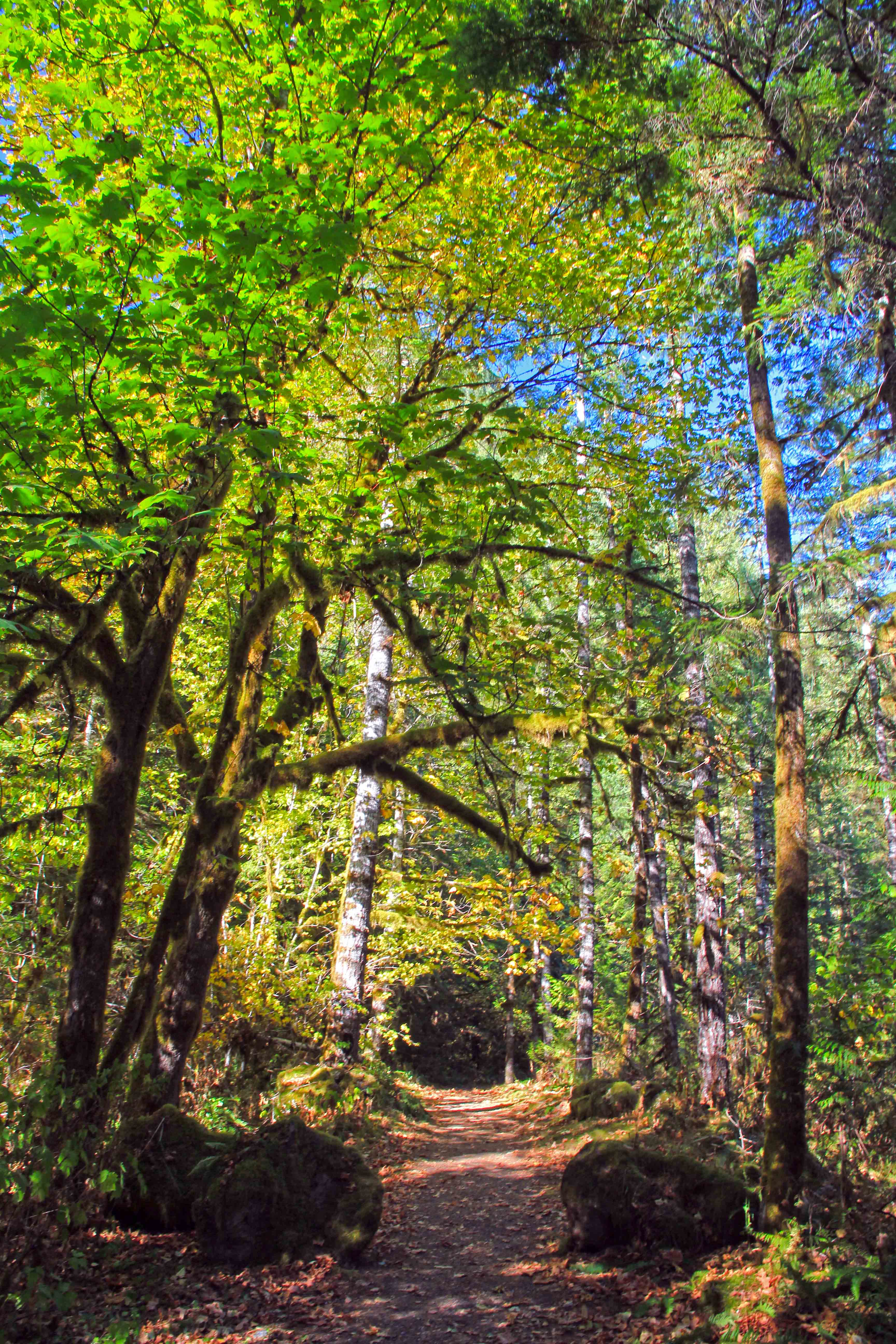 The trail starts here…
Passing through the forest there are more camps and an old horse corral between the trail and the river and soon the trail arcs east and views of the river and mountains appear.
 Baker River Trees
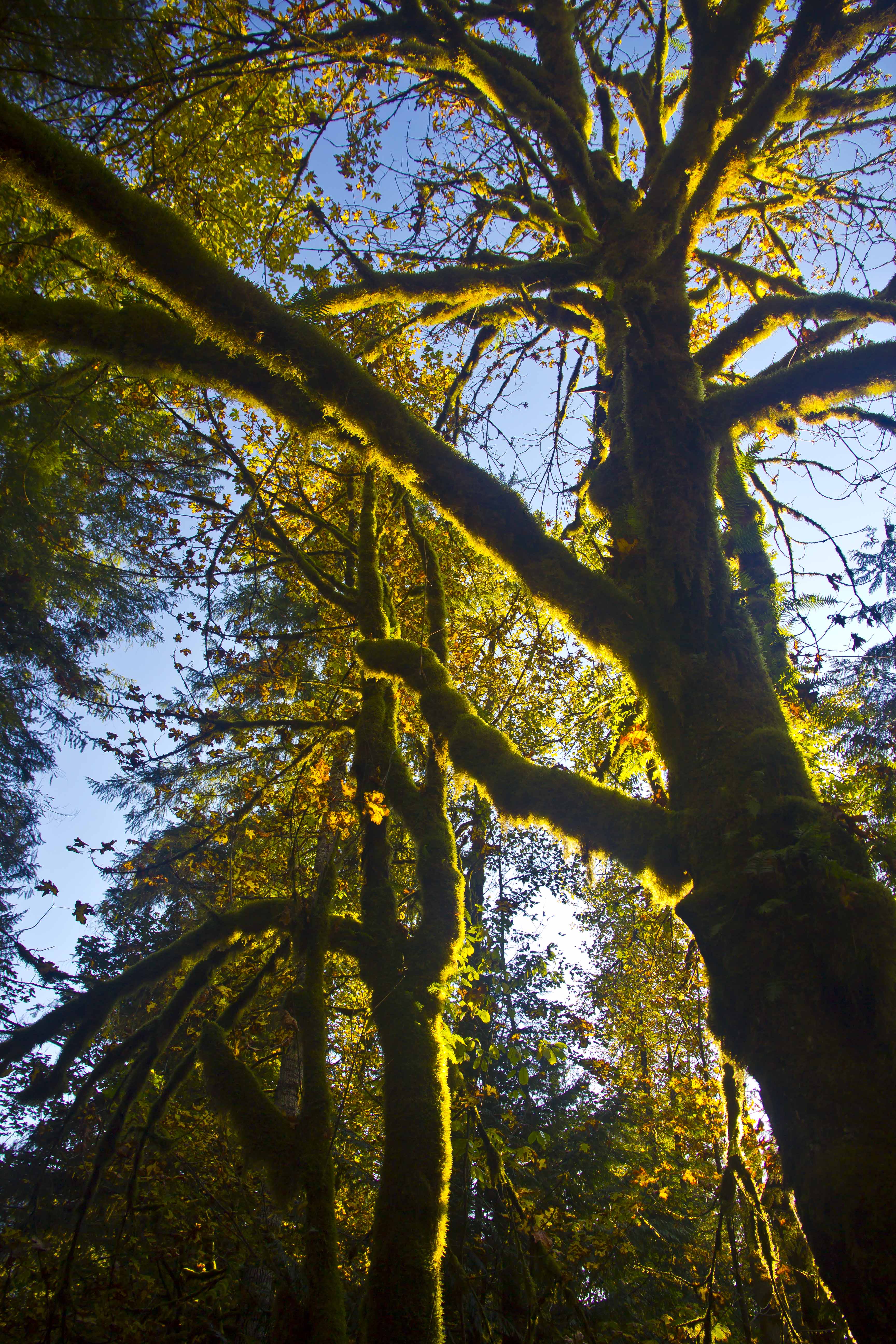
Now the pathway re-enters the canopy.
 Green Moss and Blue skies
And passes a sign in box for the hike.
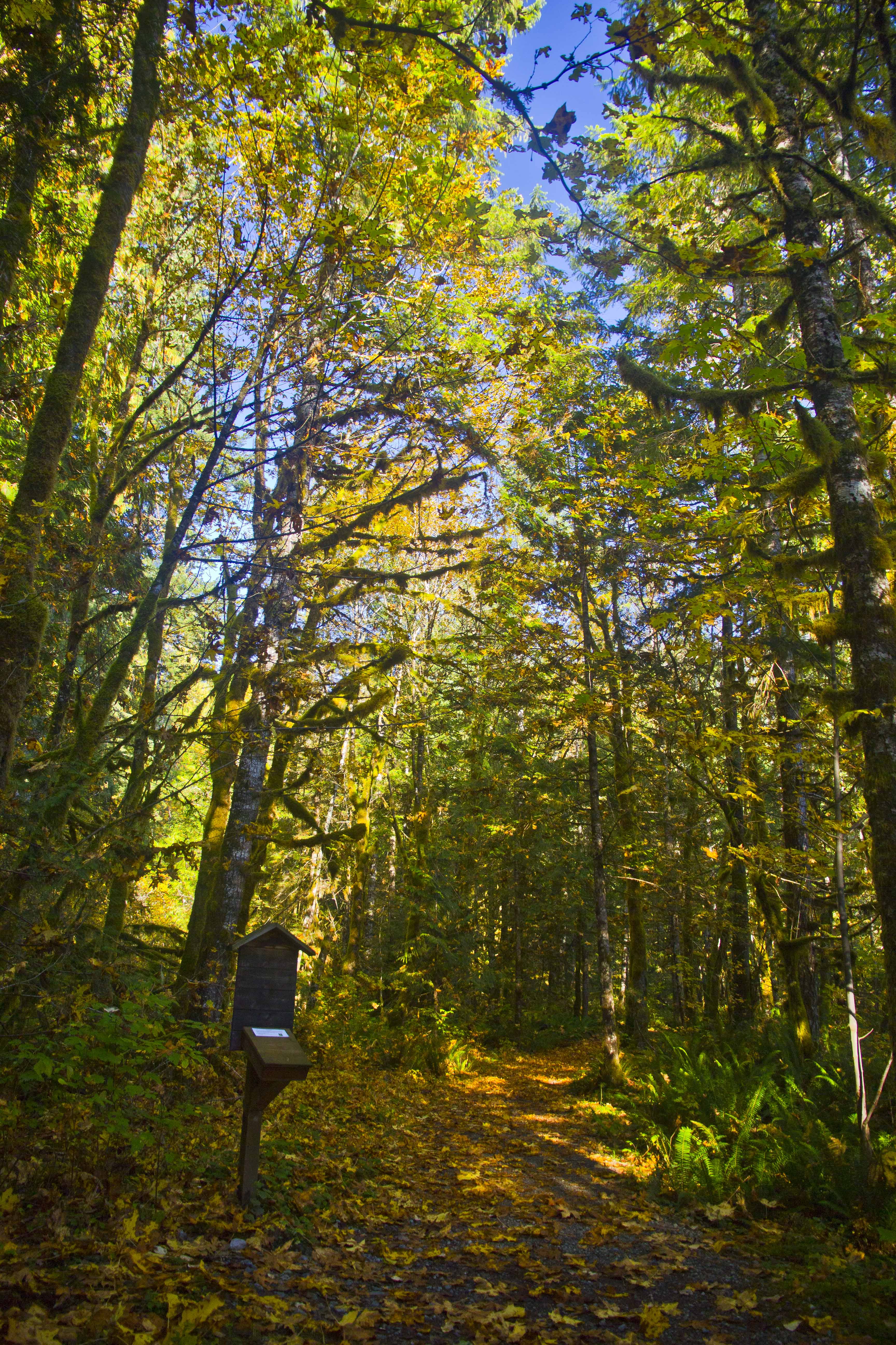 Sign-in box
Skirting along side the river you pass several mammoth old-growth trees.
 Old Growth
The greens are rich and bright.
 Mount Baker Forest
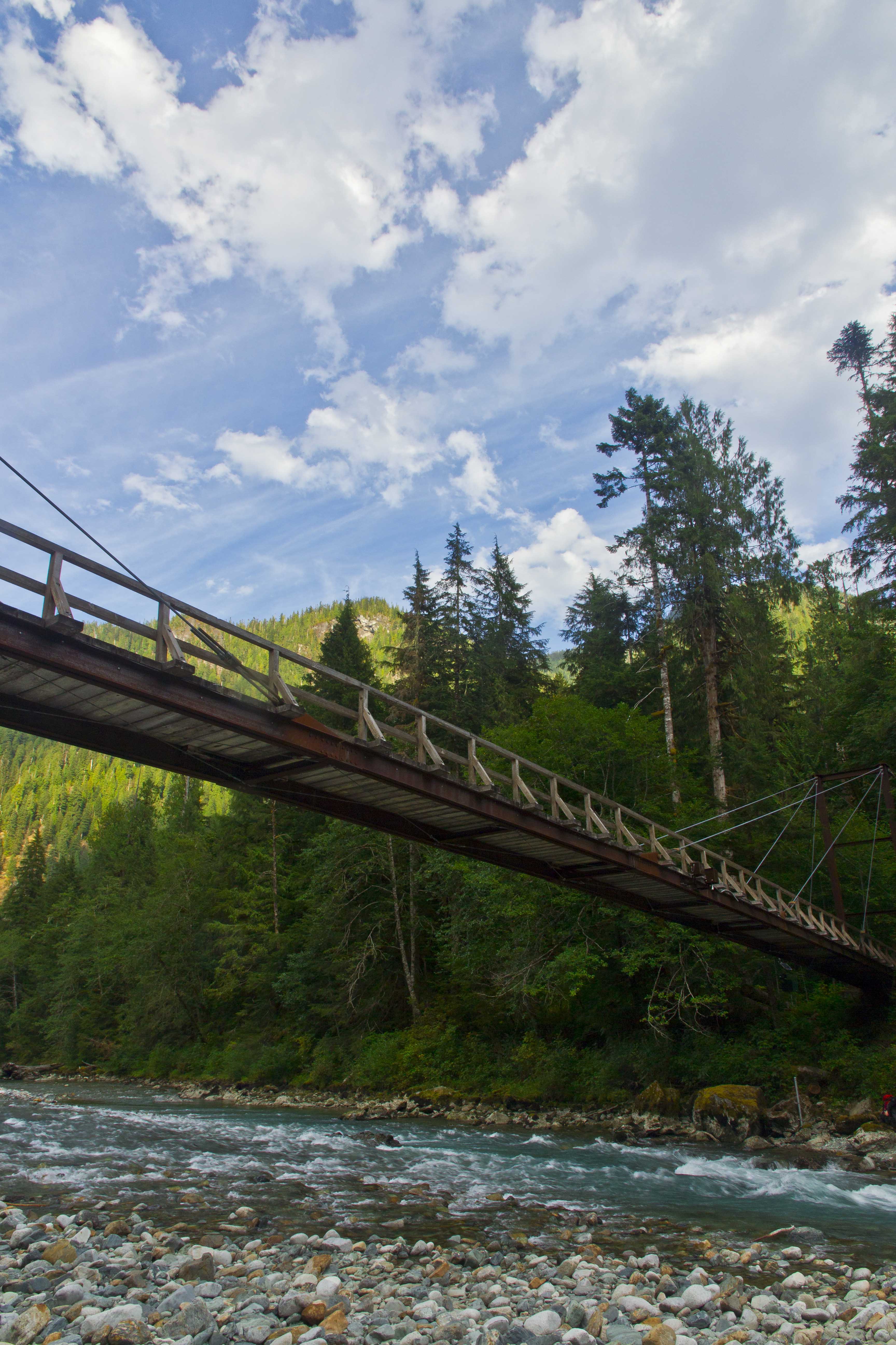
About half a mile from the parking area a suspension bridge appears on the right, spanning the river.
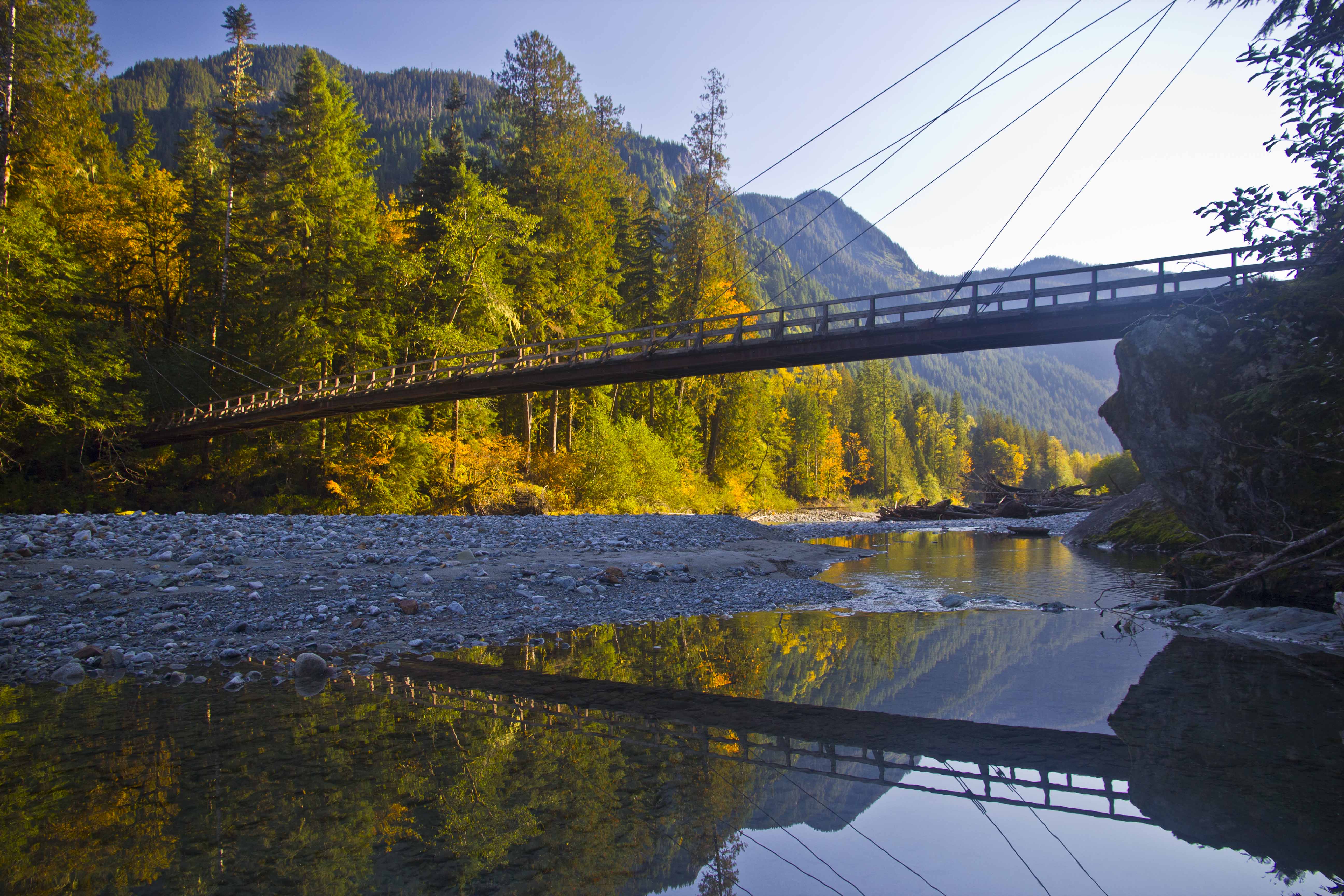 Baker River Bridge
The Baker River Trail continues along the west side of the river while the east bank trail crosses the bridge heading back south along the river and along the shore of Baker Lake.
 Trail junction
 Blum Creek
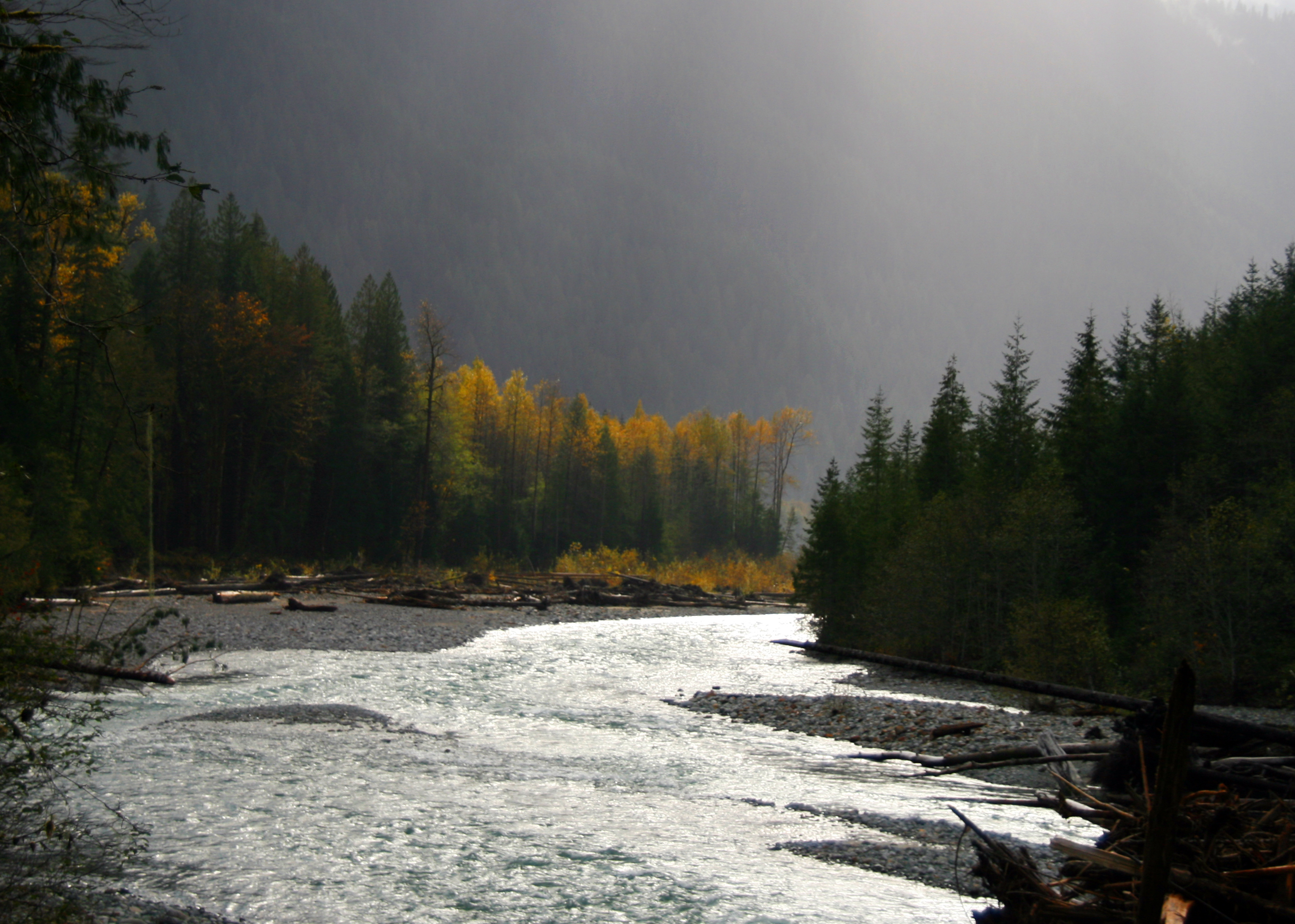
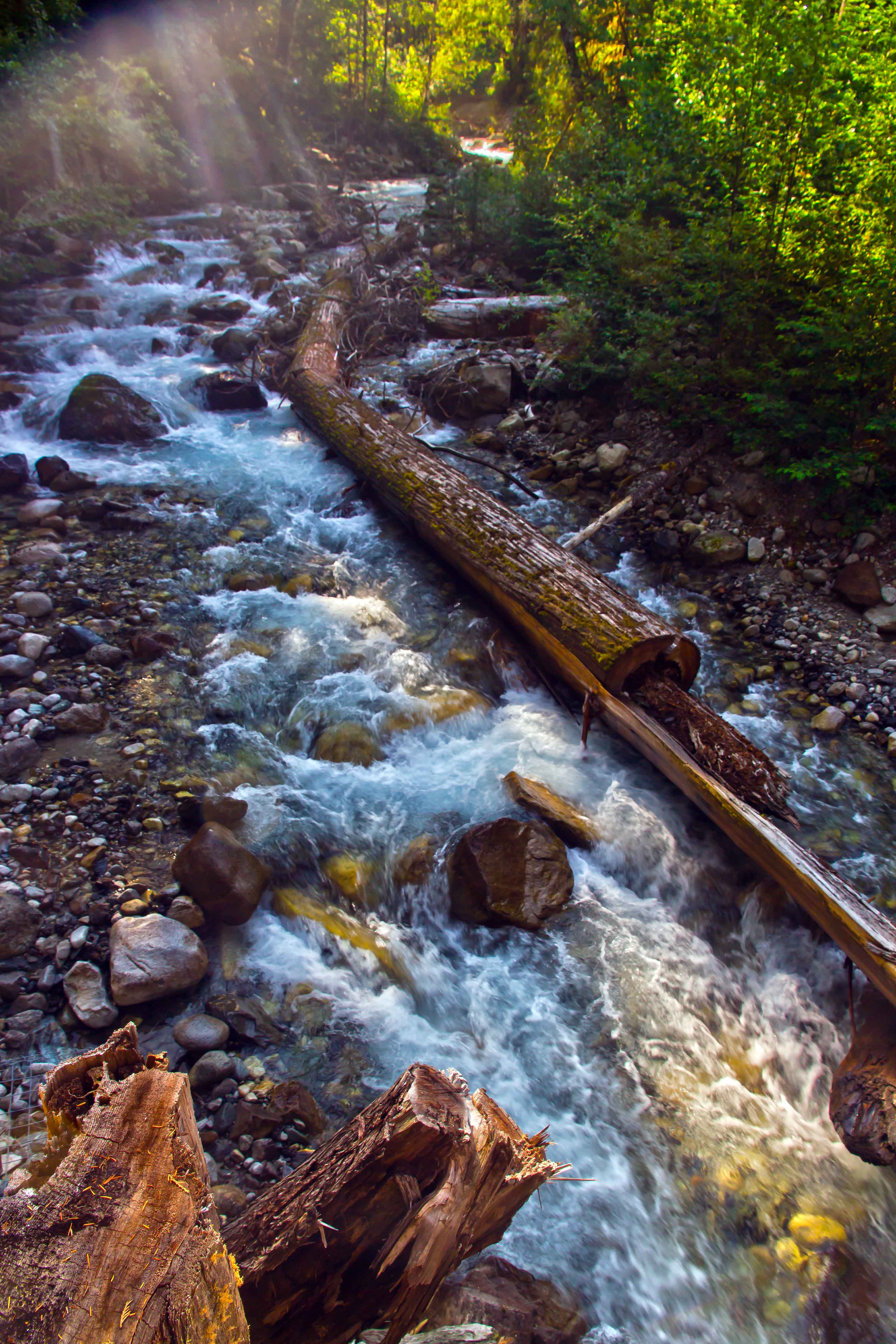
Free of dams and roads the river regains its wild countenance. There are gravel bars and huge snags of trees along the shore.
 Baker River
The trail is accessible year round. Fall and spring are great times for a visit. And the trail is perfect for young children.
 Bridge Running
Fall colors are my favorite
 Fall River
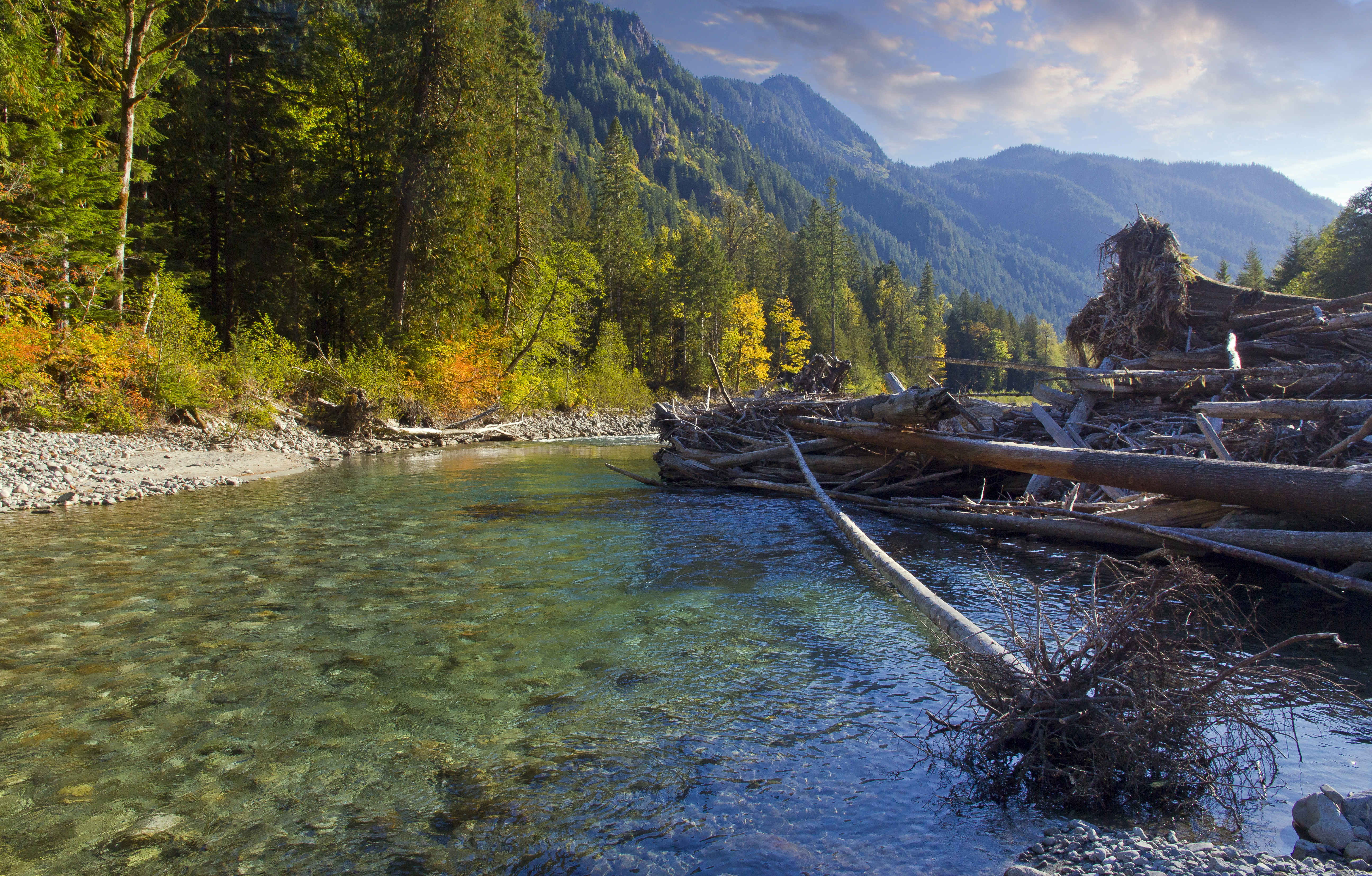
Staying on the main trail, you soon pass several huge jumbles of boulders on the left, forming all sorts of caves and cool places to explore. My favorite place along the trail soon appears on the right, a short scramble down to the river bed and bushwack through brush out onto the gravel bar. The river makes a long sweeping curve.
 Baker River and Hagan Mountain
Across the river rises the jagged summit of Hagan Mountain. Looking upstream is Jagged Ridge extending from the summit of Mount Shuksan.
 Jagged Ridge
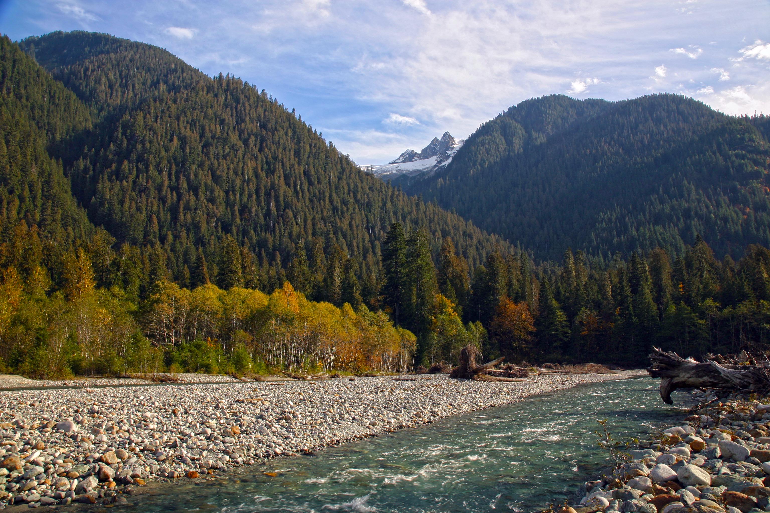
This is a perfect place to play. the gravel bar is wide and a great place to camp. There are fire rings and many huge logs and debris for building forts and side channels for swimming.
 Autumn Fun along Baker River
This stretch of the river is in the National Forest and no permit is needed for camping.
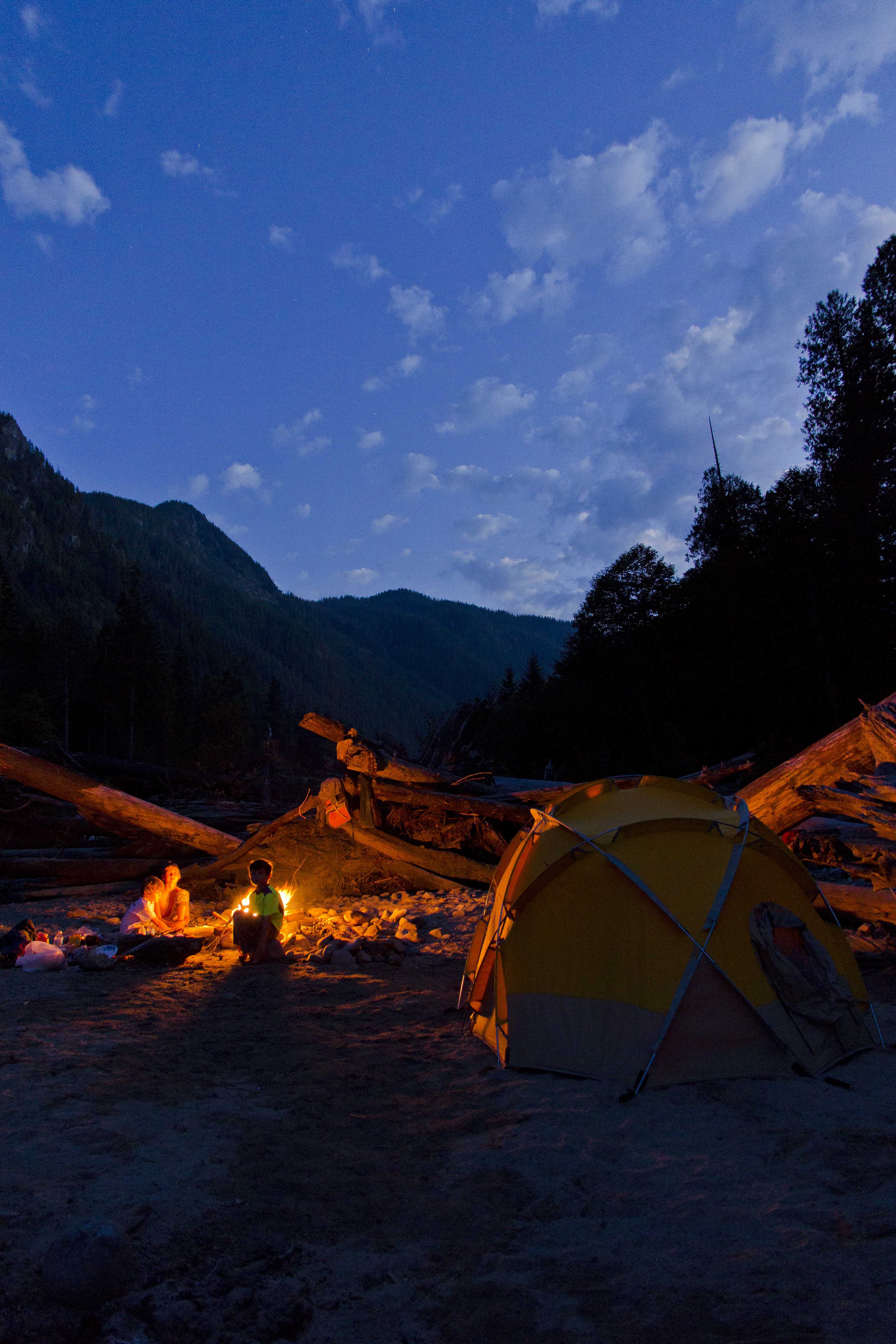 Camped along the river
 Tent and Stars, Baker River
The suspension bridge is a wonderful photographic subject!
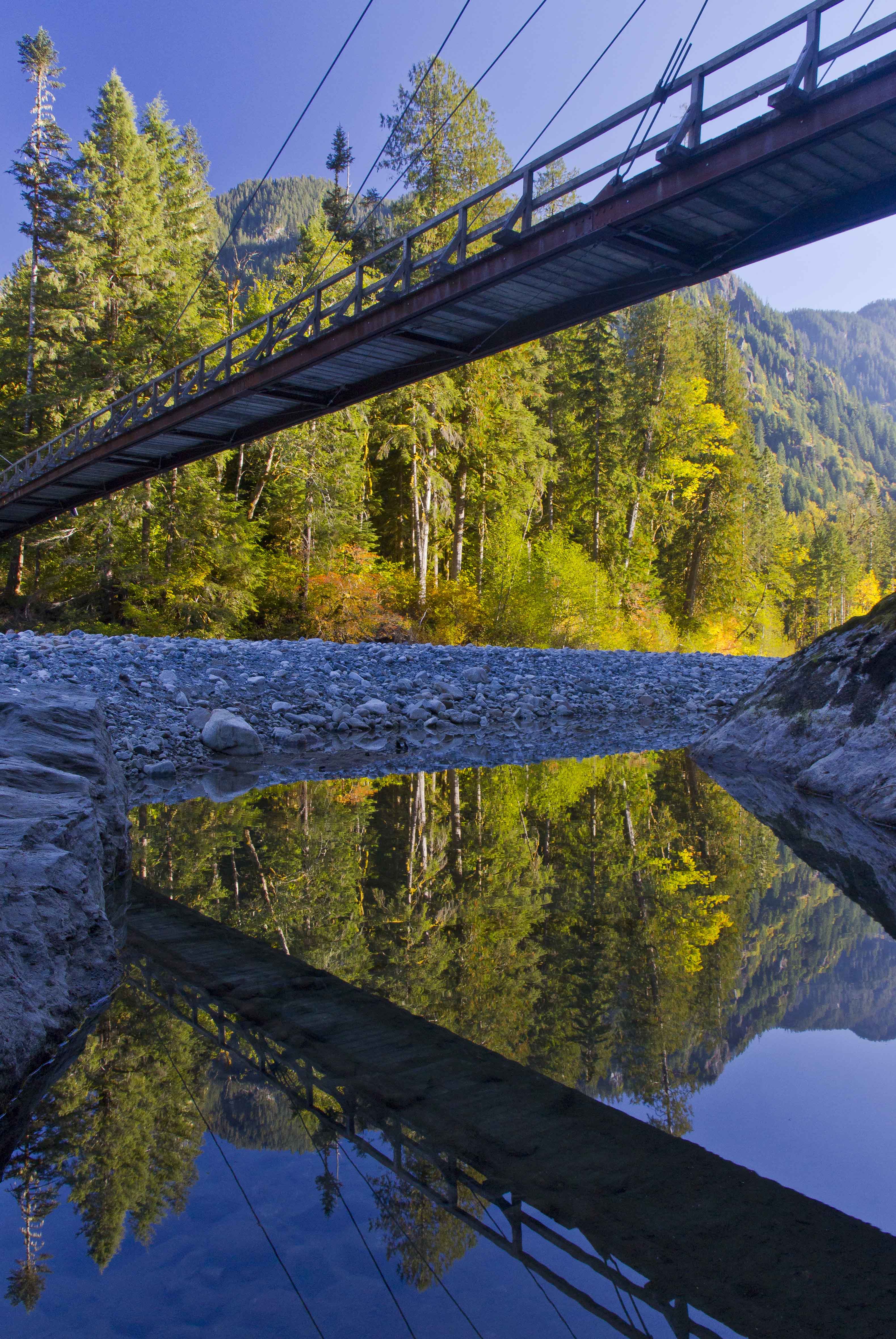 Baker River Bridge
 Looking up Blum Creek
 Sunset along the northern end of Baker Lake
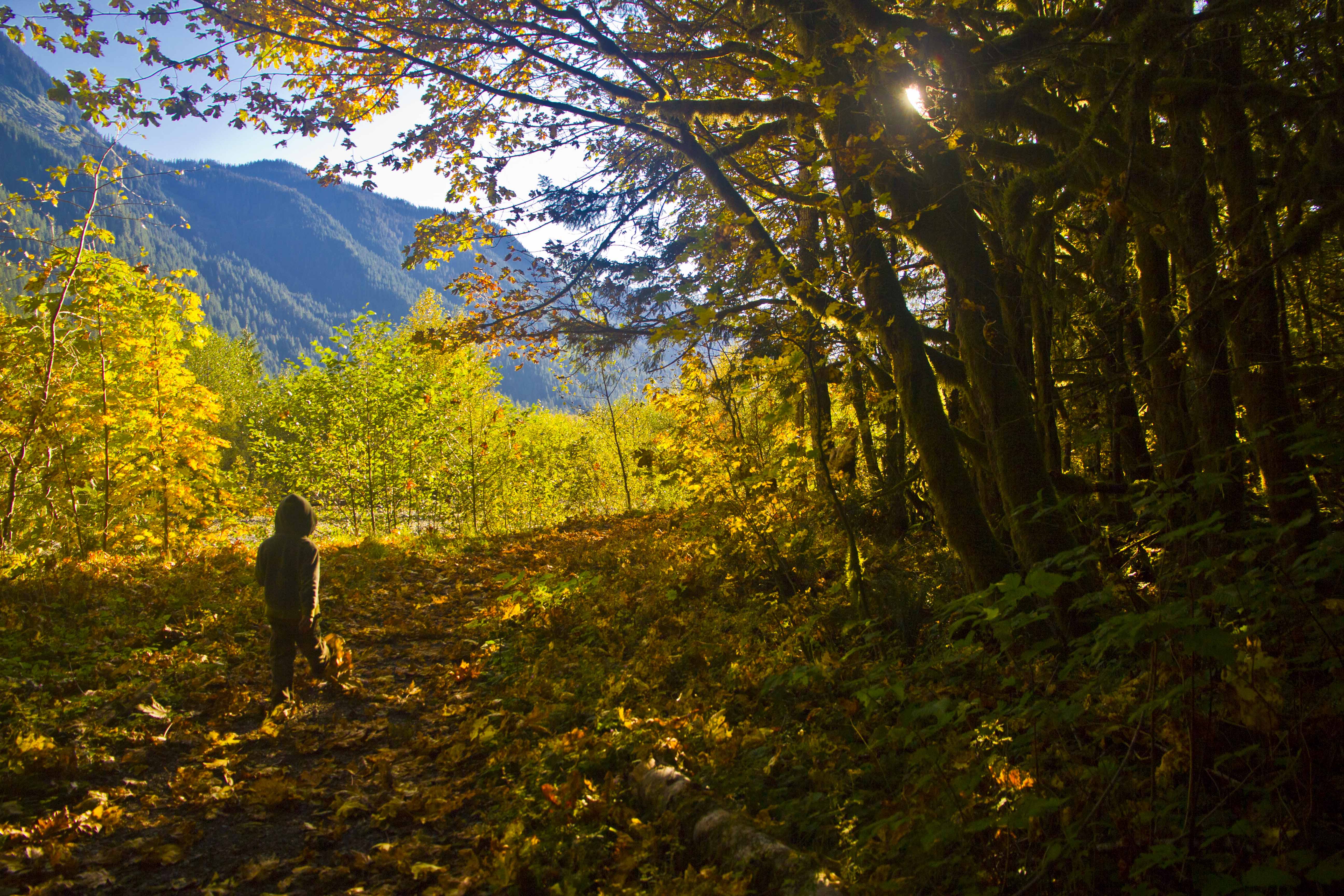 On the trail, headed home
The Wind River Range is in Wyoming, south of Jackson. The closest town is Pinedale. It’s an easy place to drive to and so has many visitors. The Cirque of the Towers is a sweeping arc of sheer granite pinnacles along the spine of the continental divide. Here are a few images:
 Cirque of the Towers Panorama from Jackass Pass
 Pingora Peak in the Morning Light
 Steeple Peak and Lost Temple Spire from the trail to Deep Lake
 Cirque of the Towers and wildflowers
 Warrior Peak in the Moonlight
 Pingora Peak Close-up
 Warbonnet Peak from Jackass Pass
 Pingora Peak and Lonesome Lake from Jackass Pass
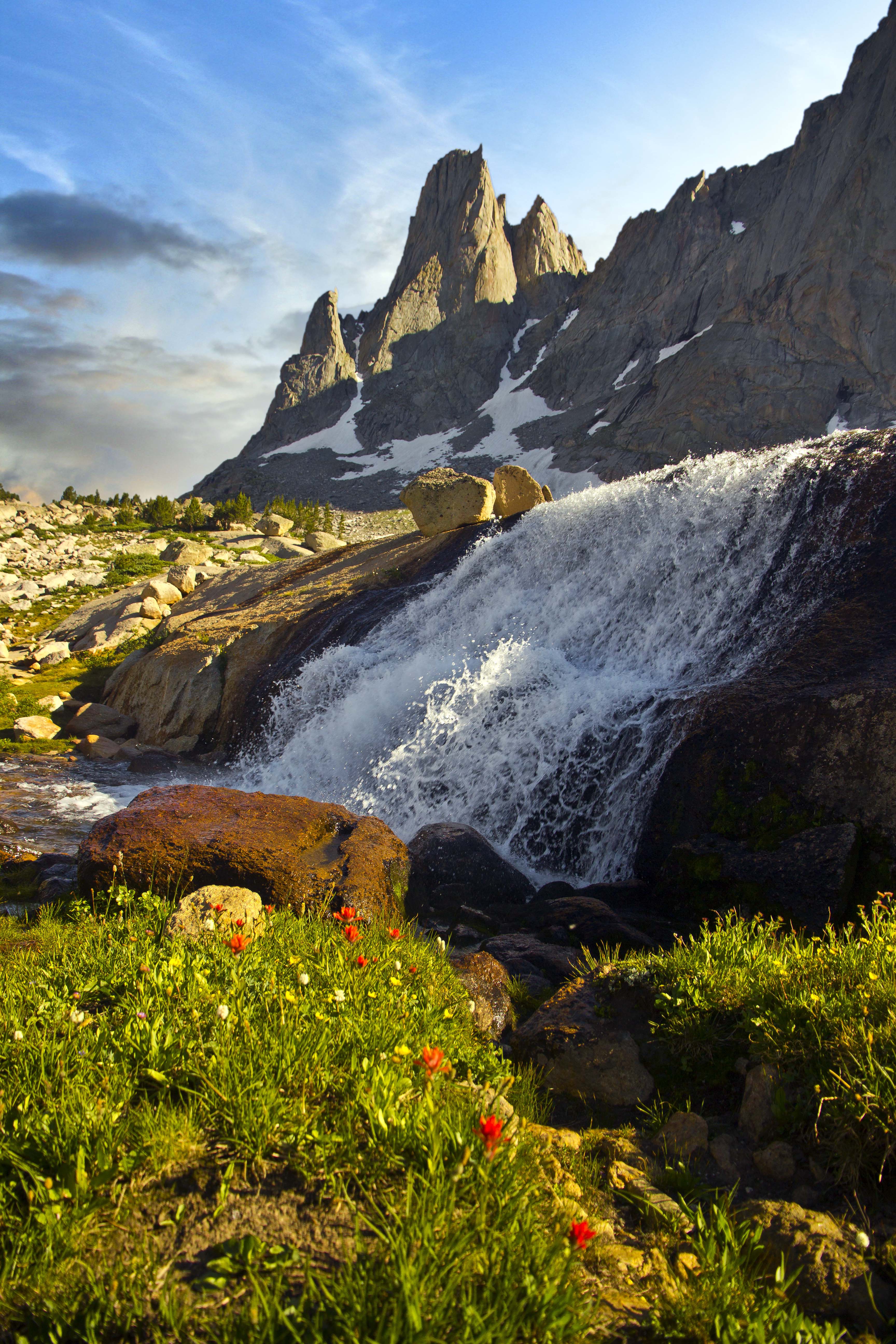 Warbonnet Peak and Waterfall from the upper cirque basin
Fantastic weather and a waning moon brought me to the coast on Saturday in another attempt to capture some decent nighttime images.

Sunset comes before starlight.
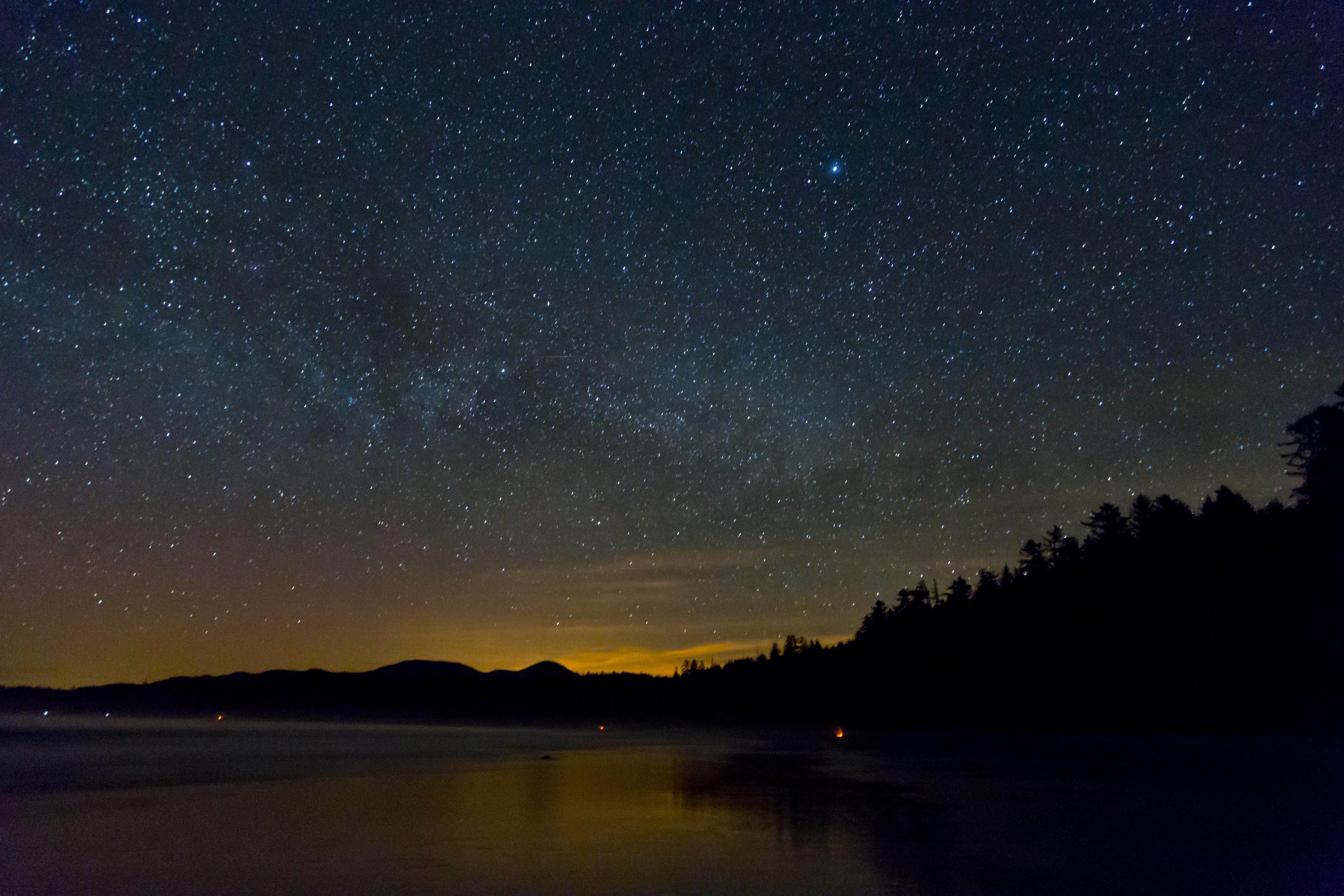
This image is facing north along Shi Shi Beach. There were probably 30 people camping along its arc. Several campfires interspersed…The orange glare is from the settlement of Neah Bay.

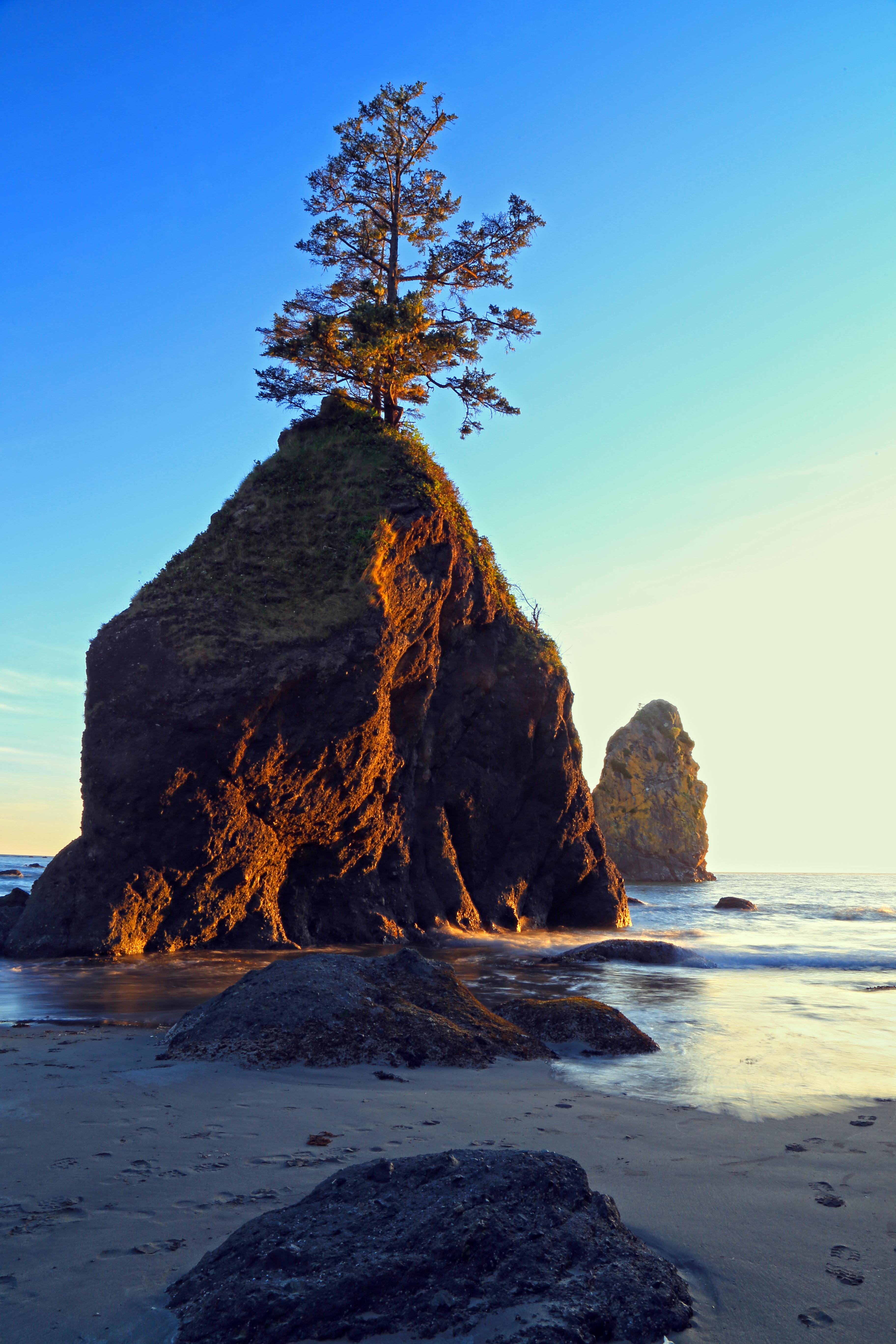
Here are the sea stacks of Point of the Arches with a starry crown.
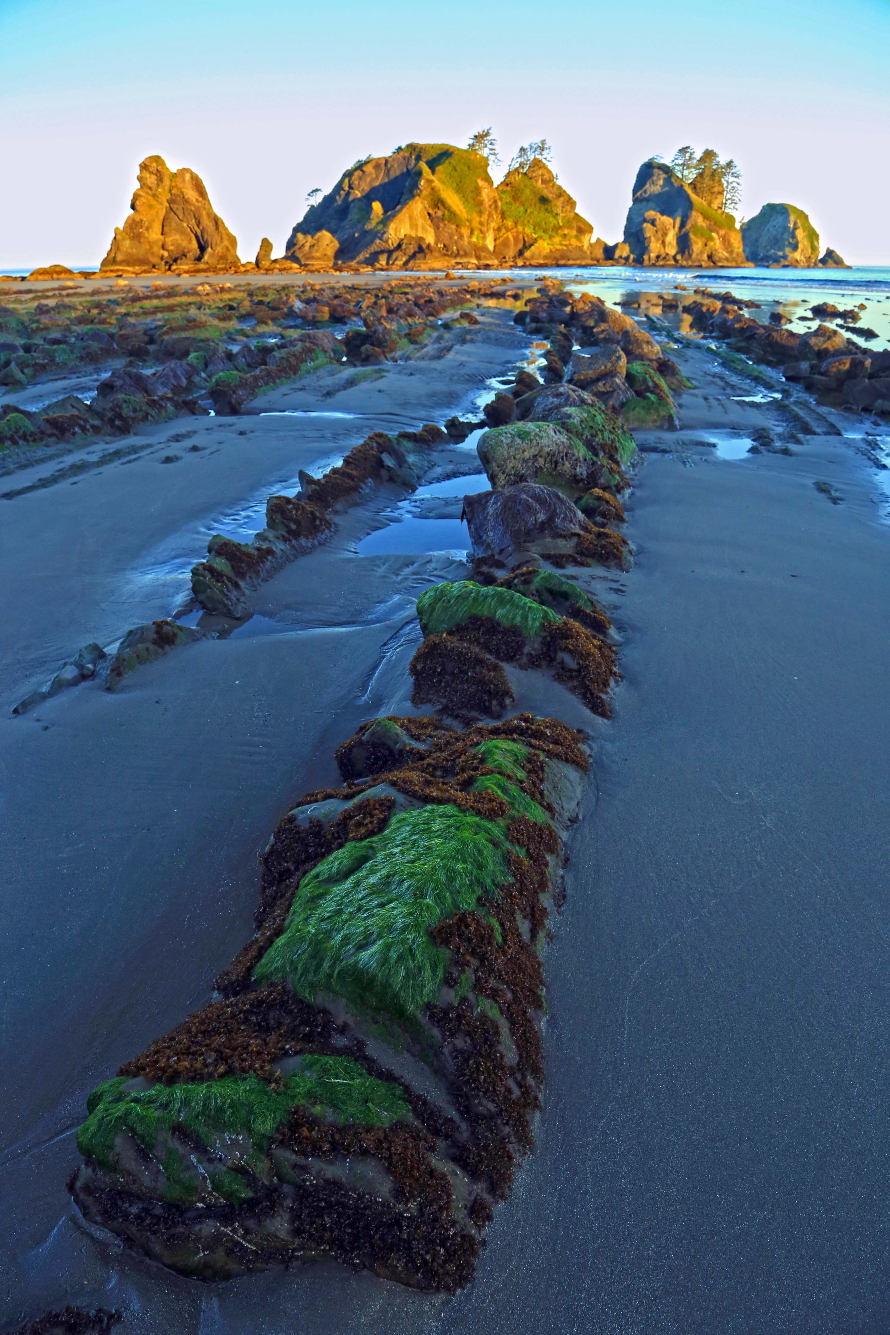
Morning presented some sumptuous lighting…


Along Zion Valley Road the tourist bus makes many stops. Trailheads lead up to all sorts of fabulous places. One of the stops, “Weeping Rock” has trails leading to Observation Point, Weeping Rock and Hidden Valley.
Climbing up the switchbacks which have been cleverly crafted into the cliff face one reaches a junction and veers right, up into Hidden Canyon.
What a wonderful place to spend an afternoon exploring! A sandy floor hemmed in by wonderfully colored rock walls…Zion is truly a gem, a fantastically diverse park full of surprises. 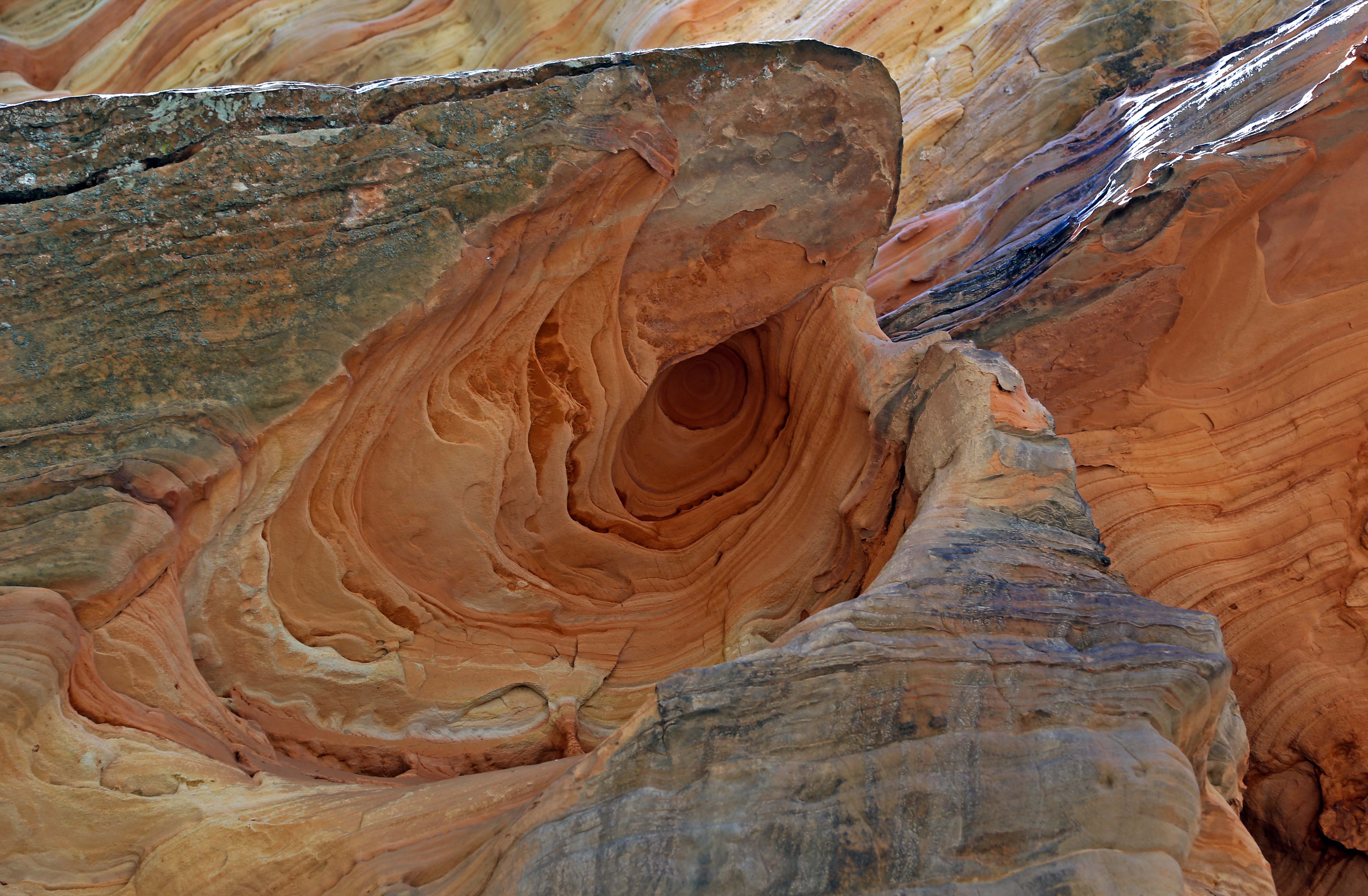 This formation is on the underside of a rock overhang…not sure how it got there…
 Walls in Hidden Canyon
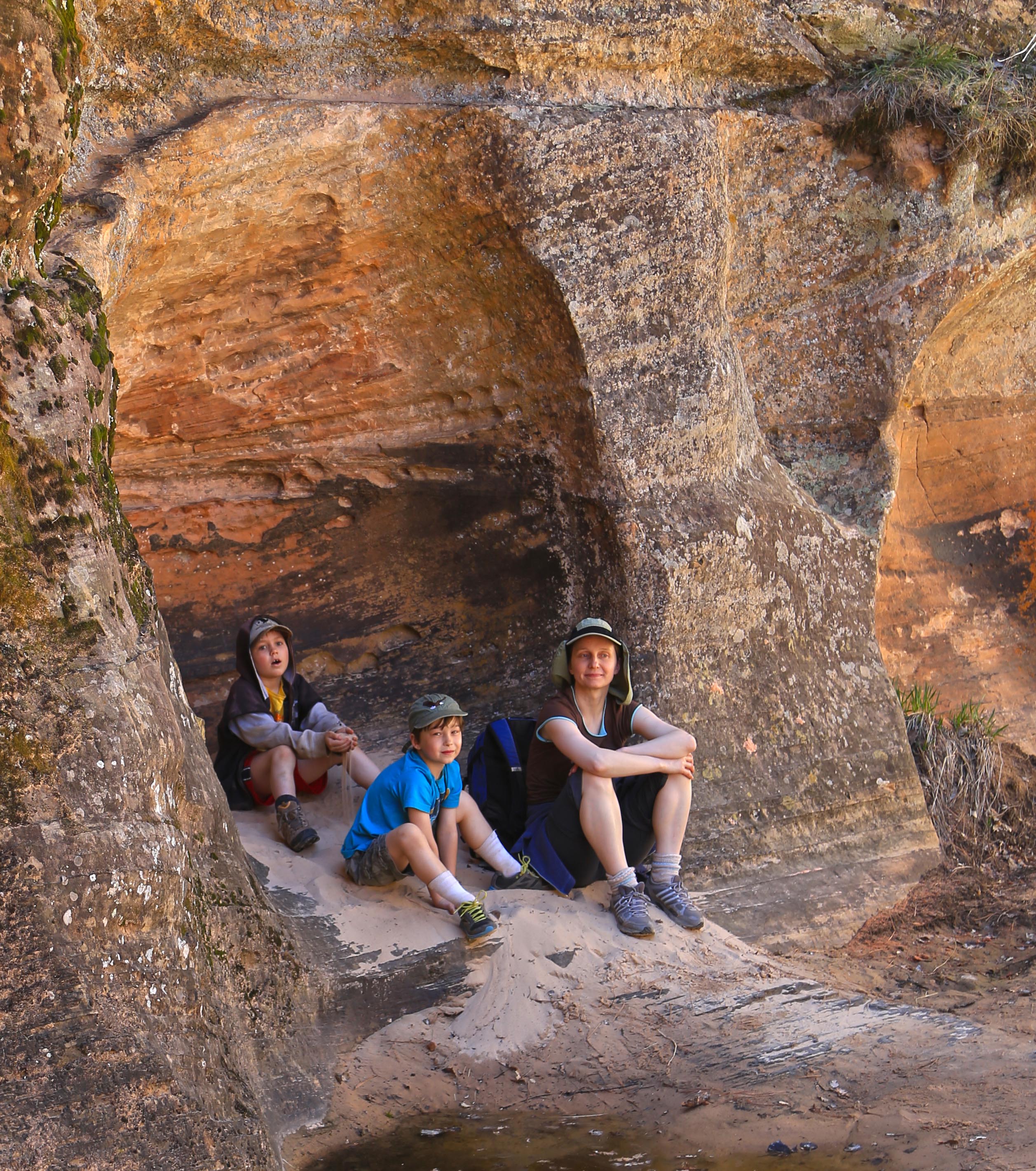 Grotto full of hikers: Joe, Max and Sveta
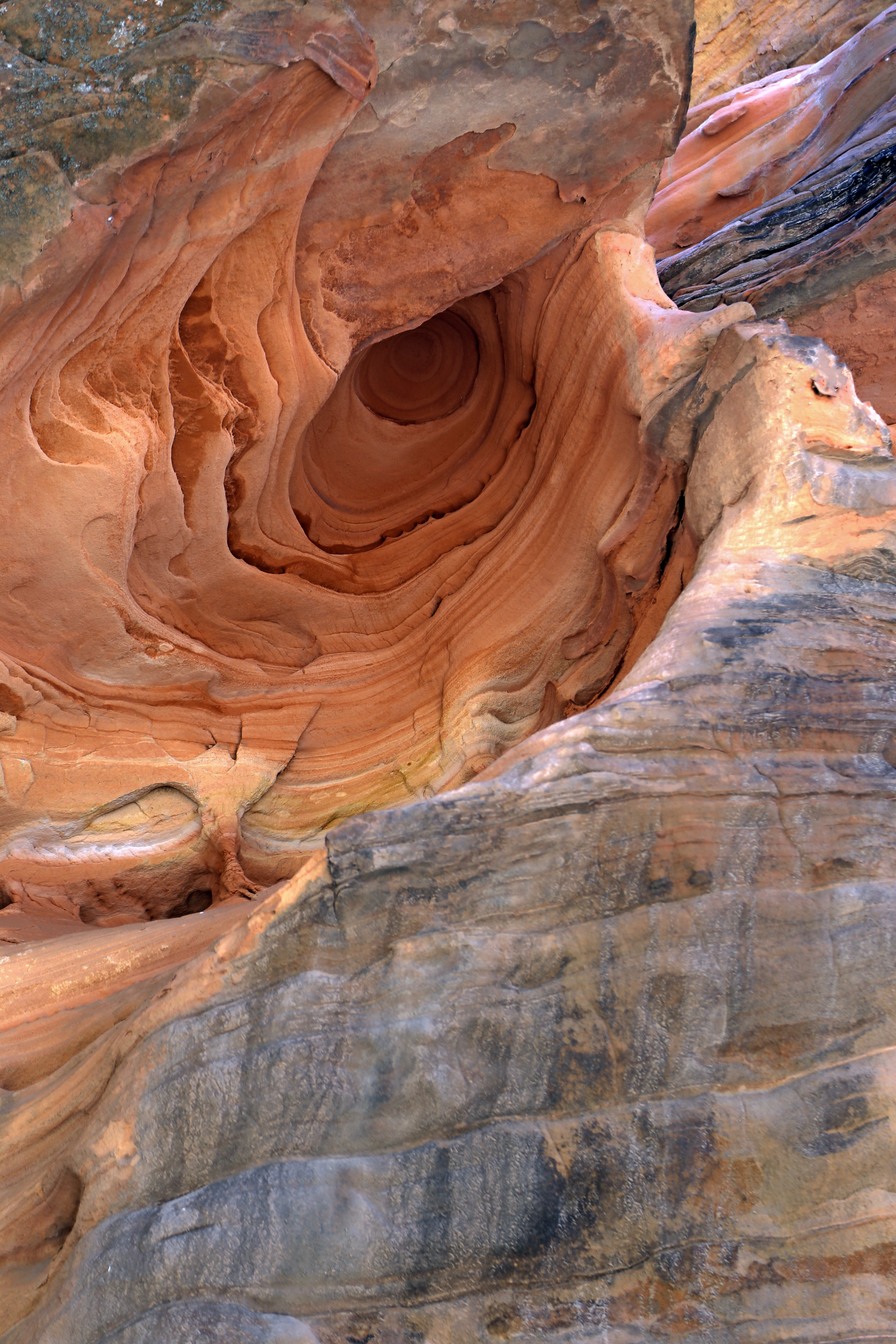 Close-up of the upside-down hole…