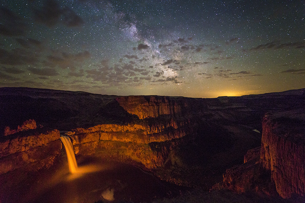
Palouse Falls State park is in the south-eastern part of Washington State. I had seen many stunning pictures of it and decided to drive there last Saturday to try my luck. The skies were predicted to be mostly clear and the moon was just starting it’s new cycle, and I was hoping to get some decent images of the Milky Way over the falls. 
I camped there at the Park and awoke at 1am, peeked out of the tent, saw stars and excitedly hurried over to the edge for a look.
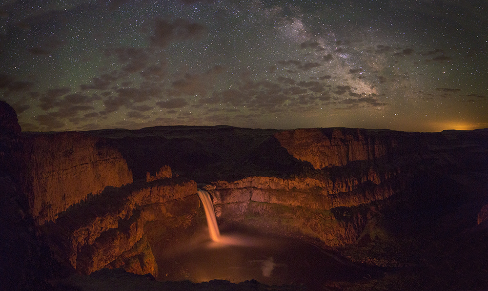
Much to my surprise someone was down in the basin, near the base of the falls, and had started a camp fire! The red fire illuminated the falls with an ethereal glow. 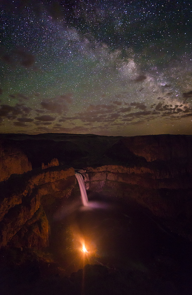 The entire canyon was lit up perfectly.
As for camera specs: I used a Canon 6D (full size sensor), a Rokinon 14mm lens, 30 sec. exposure, f/2.8 and had the ISO set at 4000.
Author Archives: Andy Porter
Images of green, orange and blue
All of these images were from last Friday night, along the Samish River and the farm fields nearby.


Skagit Valley Sunsets
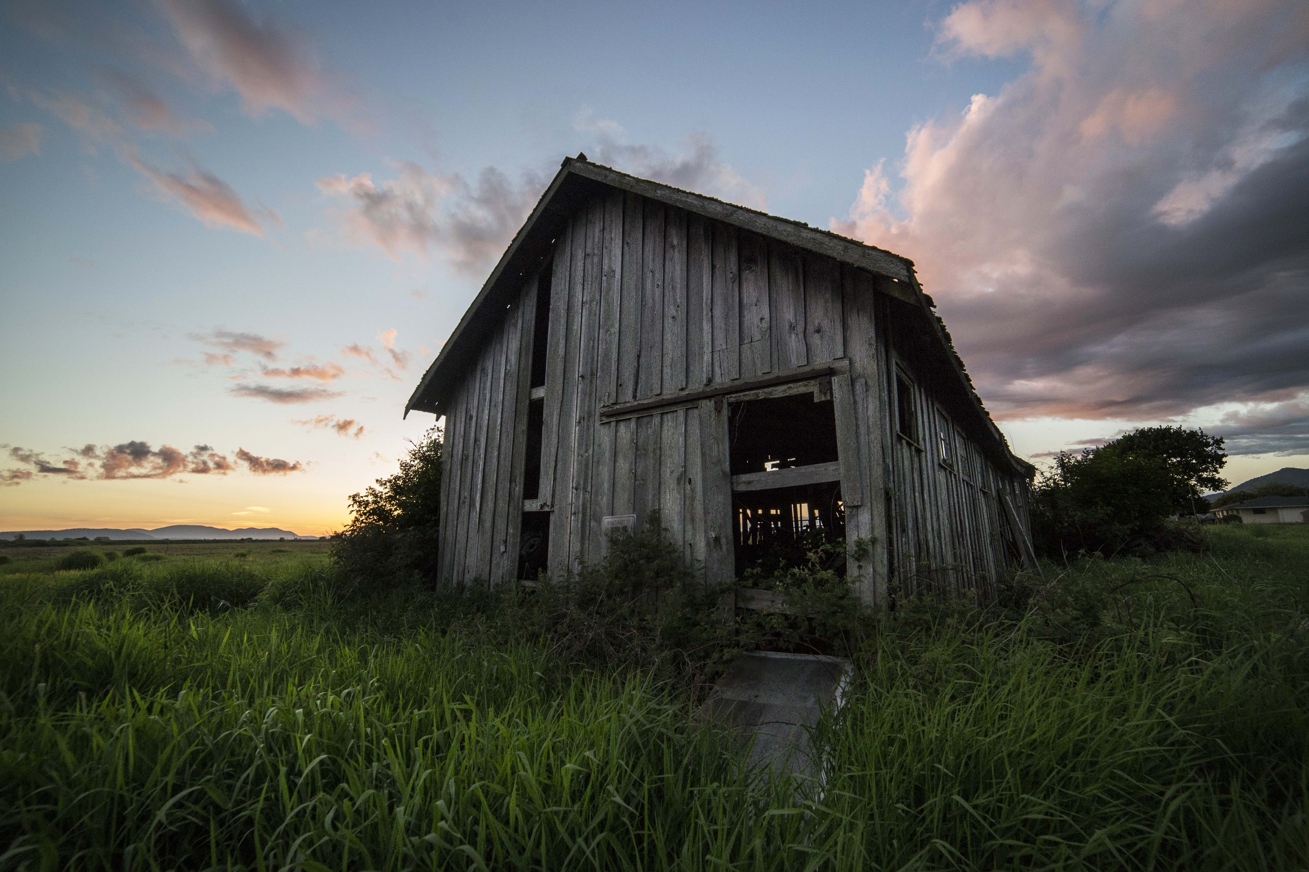
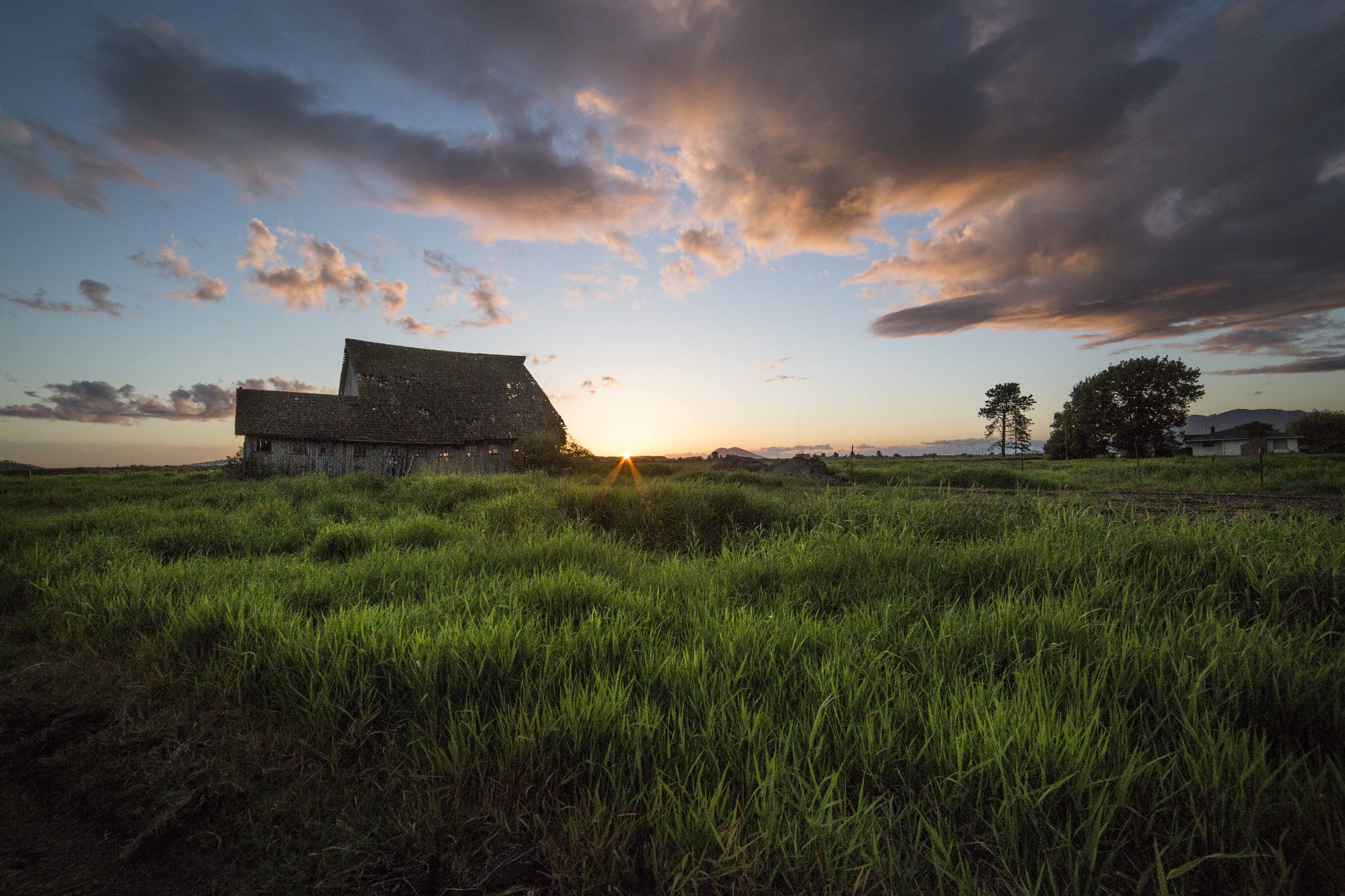
These first three images were taken along Cook Road, just east of I-5. There is a barn here, with no house nearby and the views are expansive. Of course landscapes and skies are always better with stuff in the foreground! 

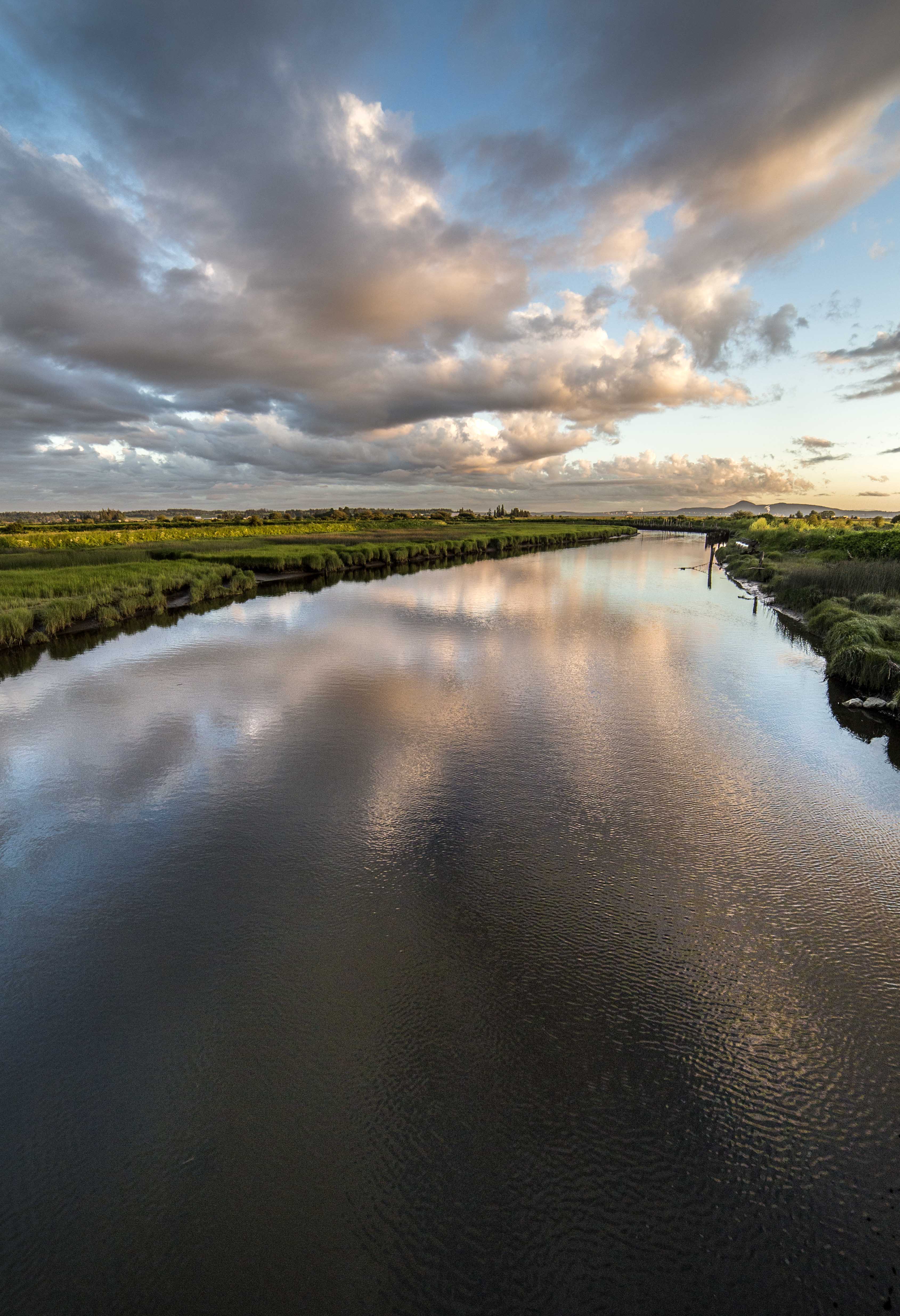
This next set of three images was taken 2 nights later, out along the Bayview-Edison Road, just west of Edison. That’s the Samish River there.


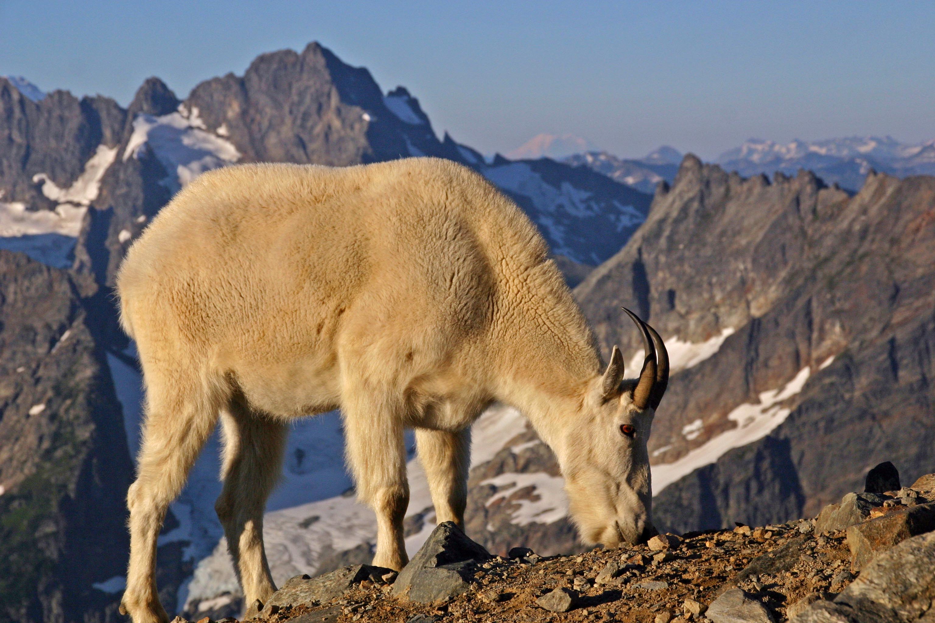
Mountain Goat

This mountain goat came early one morning to visit at Sahale Glacier Camp in North Cascades National Park. 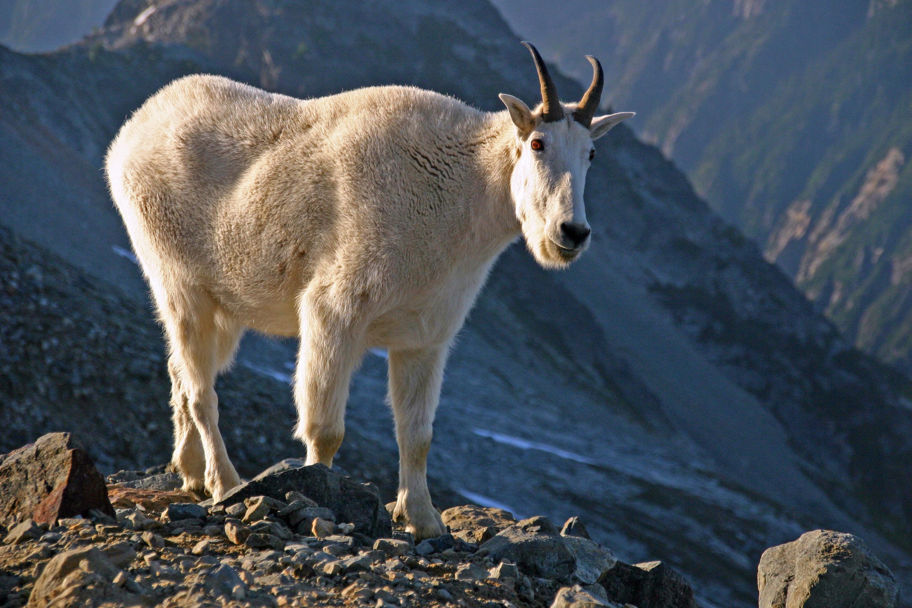
The tent sites are atop three big piles of rubble, from the glacier above.
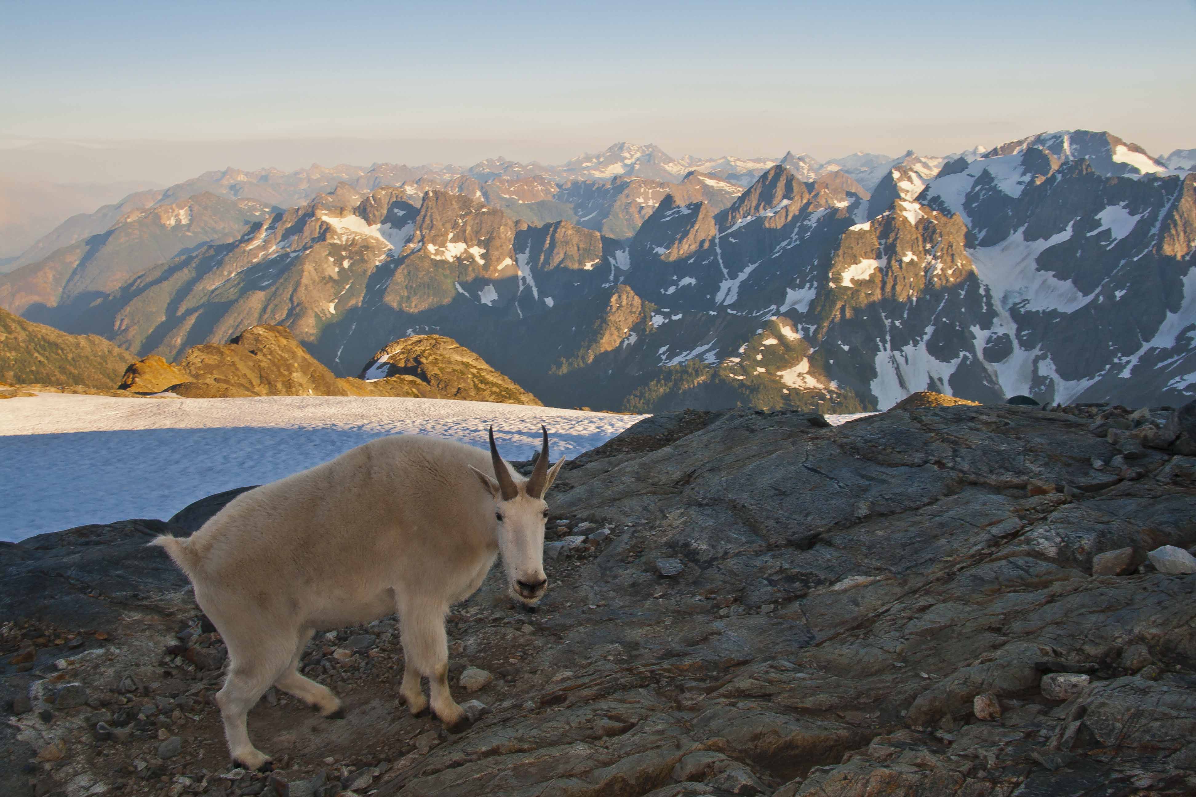
The goat was hanging out looking for places where someone had peed so that he could get some salt!
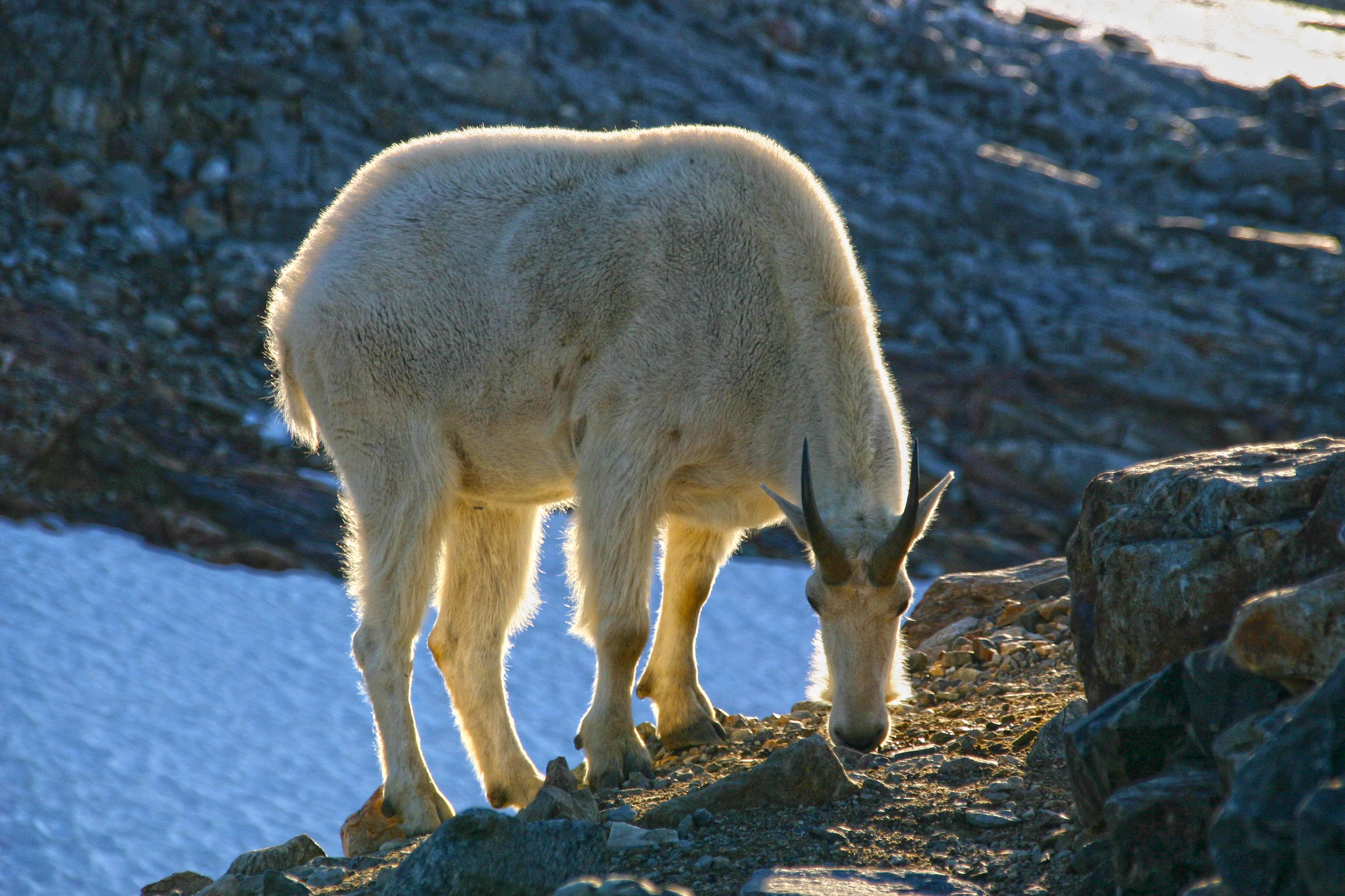
The goat had a minimum safe distance of about 10 feet. He was happy to be that close, but if I took one step closer he would back off that same distance.
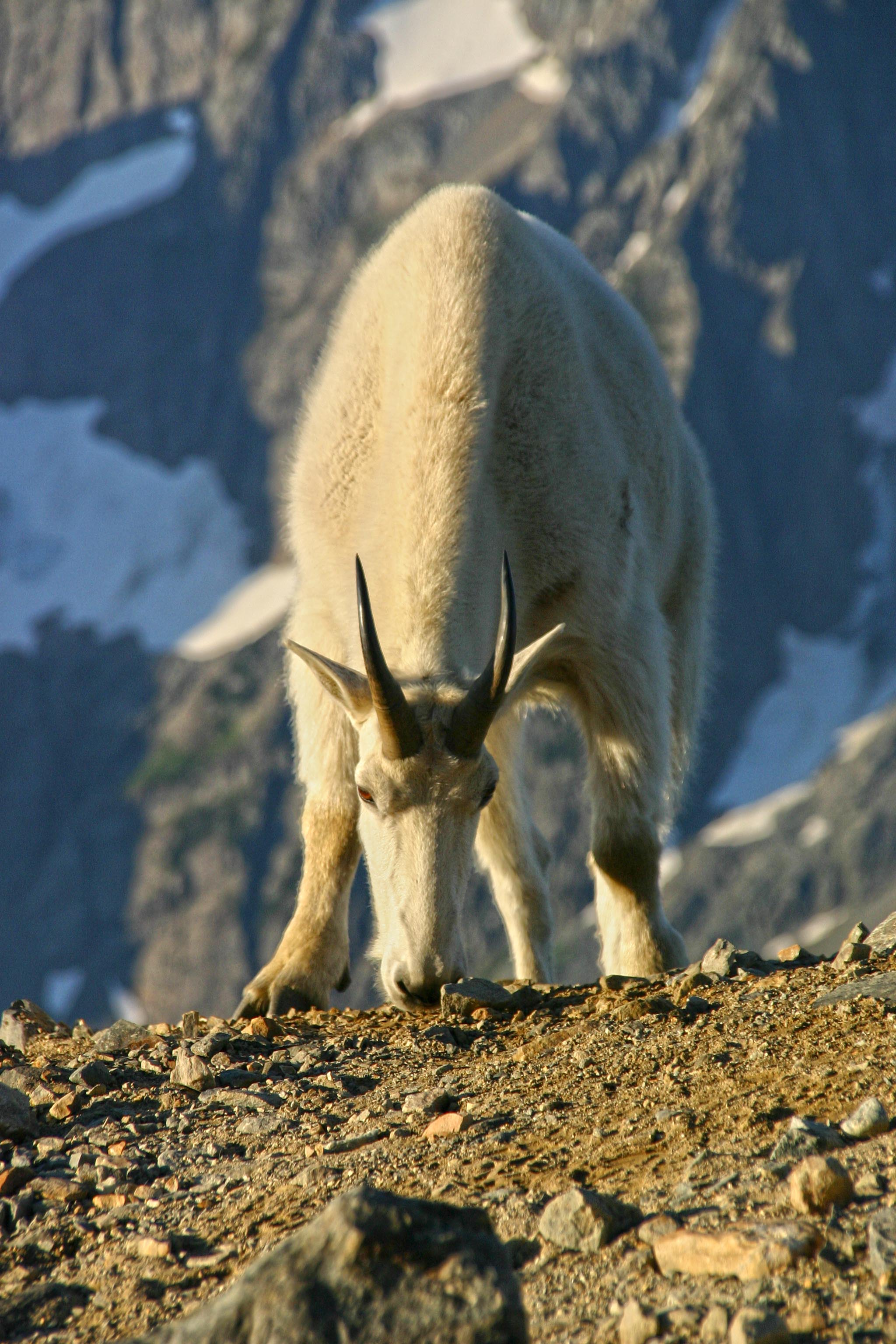
The large white mountain way in the distance here is Mount Rainier.
Delicate Arch, image in Backpacker Magazine
I captured this image of Delicate Arch in Arches National Park 2 years ago.

It is gracing the pages of the new issue of Backpacker Magazine this month! I was lucky to get some nice light and good color on the arch and mountains in the background!
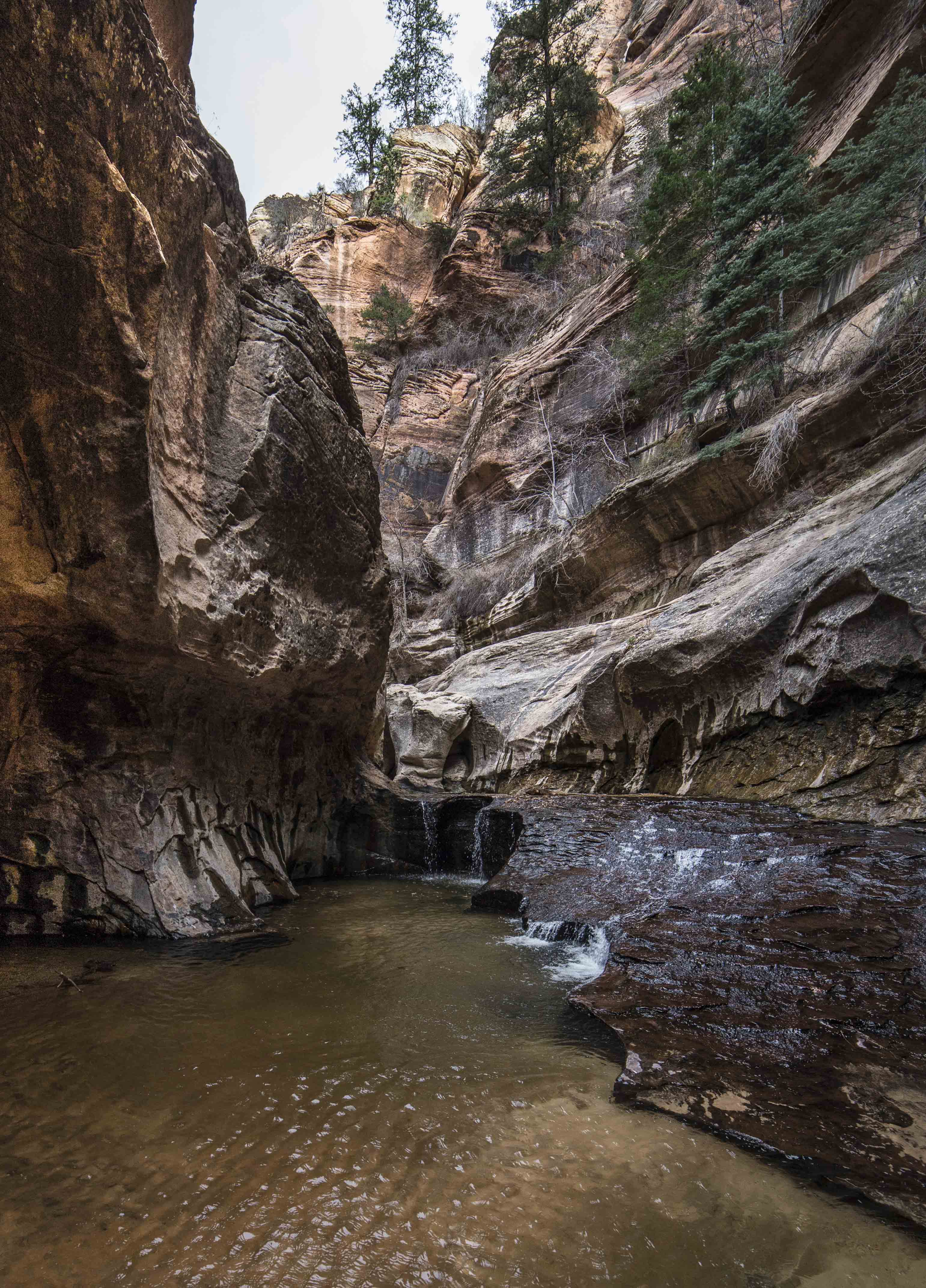
Left Fork Canyon and the Subway, Zion National Park
 Panorama of the “Subway”, Zion National Park
Most Zion visitors stay in the valley.
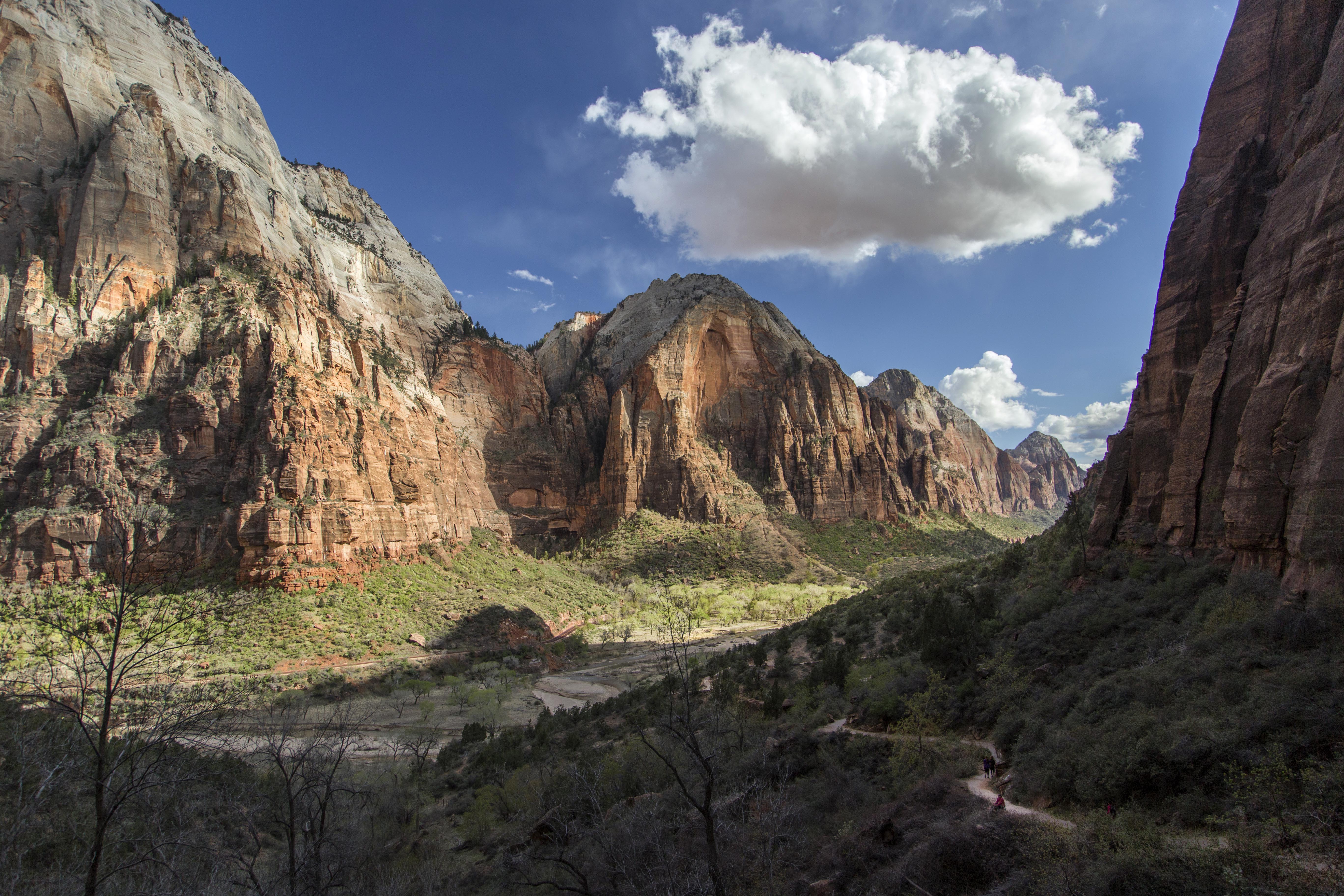 Zion Valley from the Angel’s Landing Trail
There are other parts of the park to visit. In order to not let some of these other areas become as overrun as the main valley a permit system is in place to limit the number of people. I am quite happy for this, solitude is one of my most valued commodities.
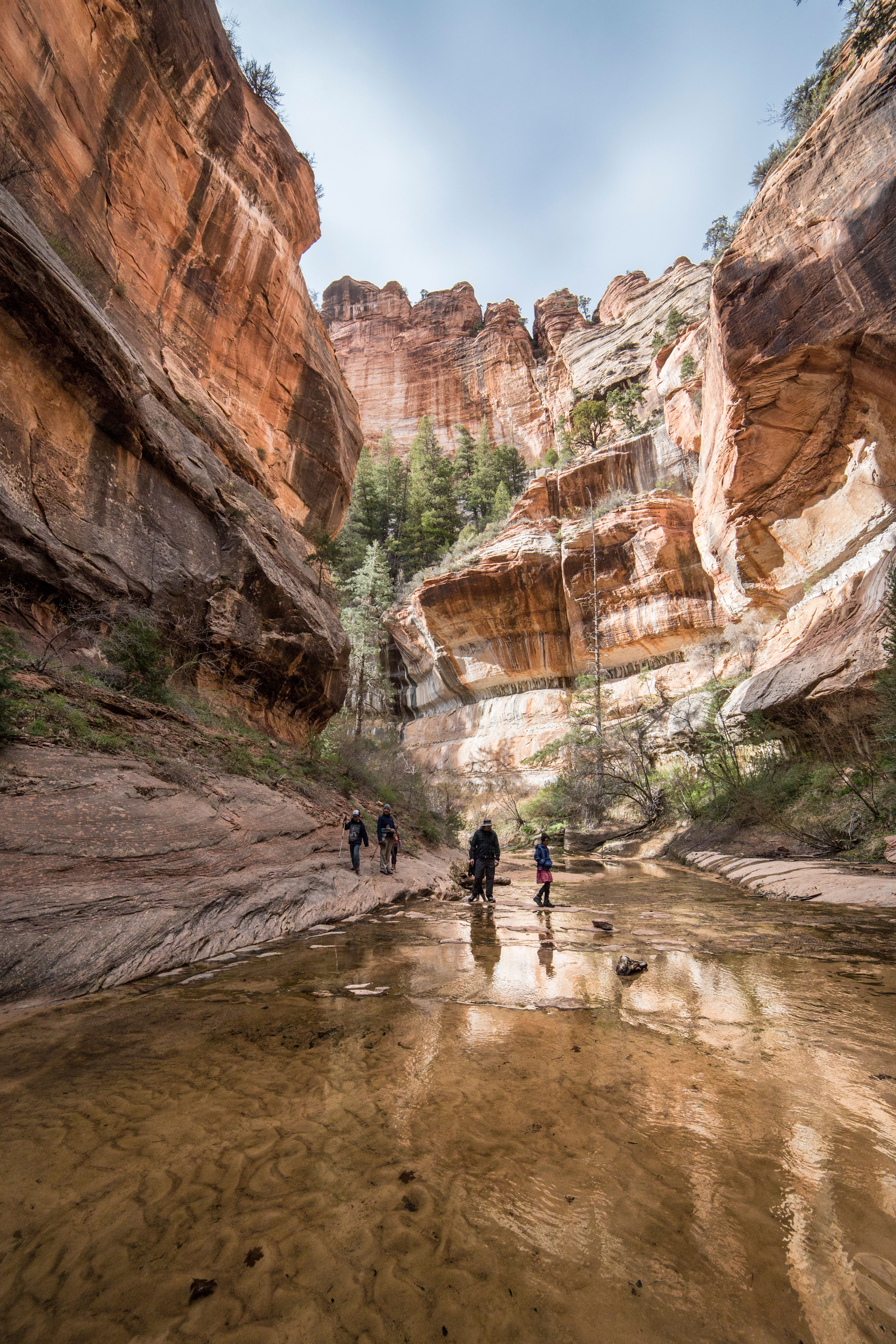
 Admiring the canyon…
One hike available is called Left Fork Canyon, aka “The Subway”. The subway name is from a short section of the hike (the entire trip is 9 miles) where the canyon walls curve and it looks like you’re inside a subway tunnel.
 Subway
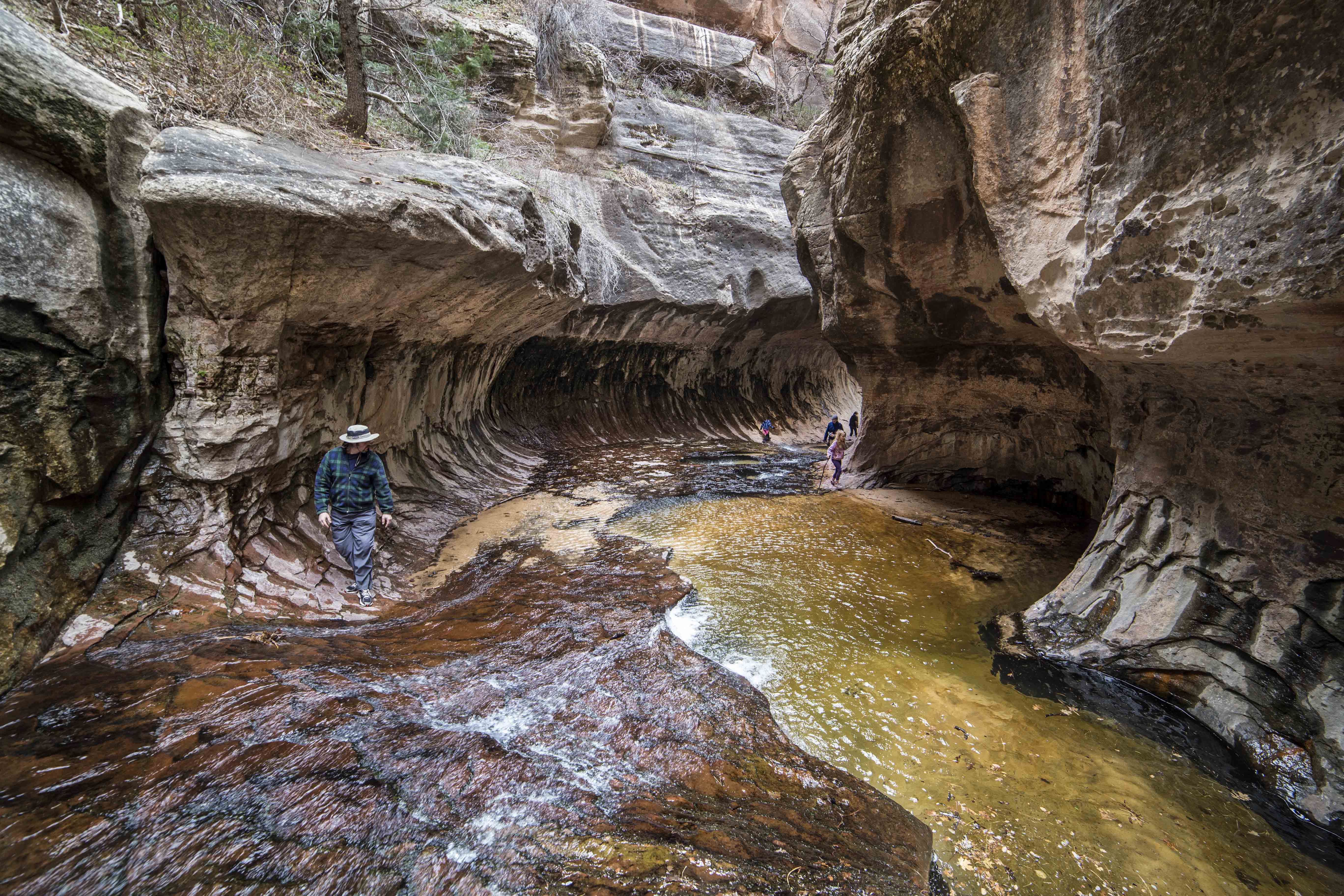
The hike can be done two ways: From top to bottom as a through hike, you’ll need to cars, one to park at each end. This also necessitates that you have experience in rappelling, climbing and in many seasons, you’ll need to bring a wet suit. 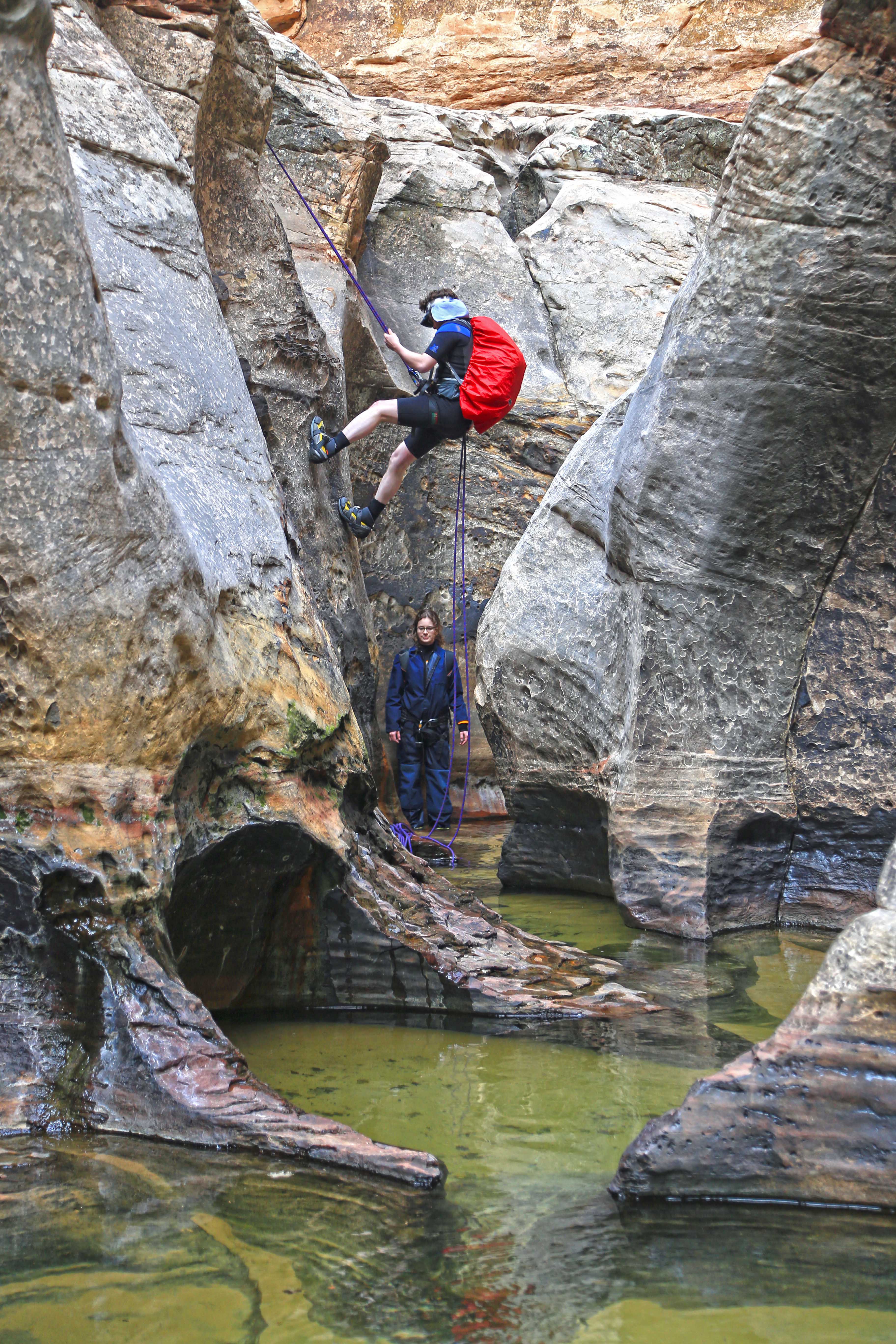 Rappelling down into the Subway section of the hike
The other option is to hike the trail from the bottom up, to the Subway entrance, and then turn around and hike back. This trip is also 9 miles (4.5 miles each way), but does not require climbing skills or a wet suit.  Entrance to the Subway
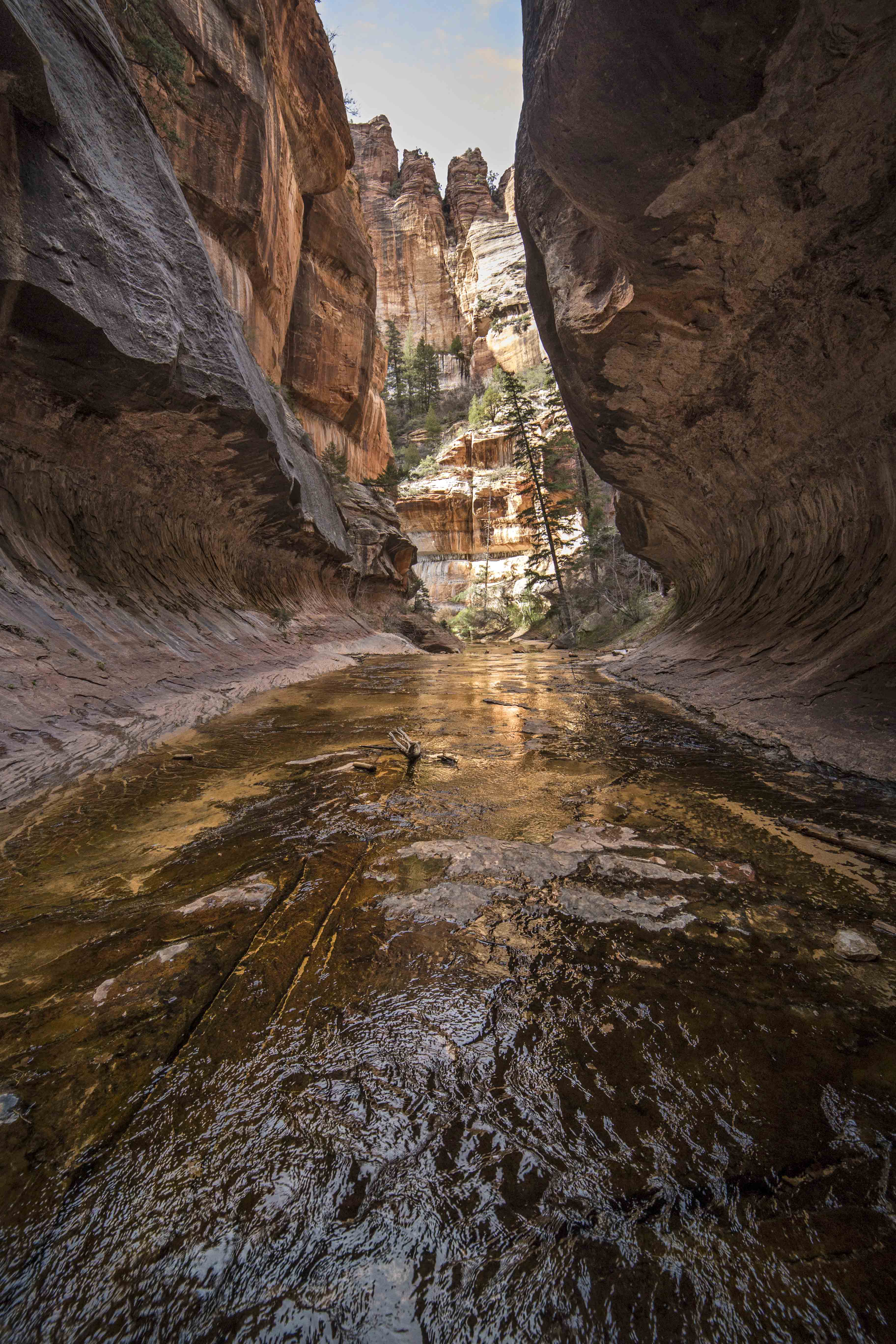
The bottom up hike starts with a scramble from the parking area down to the creek. From there you just follow the water course until you come to the subway entrance. 
Along the way are a myriad of pools, grottoes and fantastic views as the canyon becomes more and more narrow.  Grotto along Left Fork Canyon
 Trees in the canyon
There are also a very well preserved set of dinosaur tracks right along the trail.  Dinosaur Prints Fossilized
The Subway itself is a true wonder of nature, the smooth, etched walls of the canyon curve overhead while emerald green pools of water glisten. 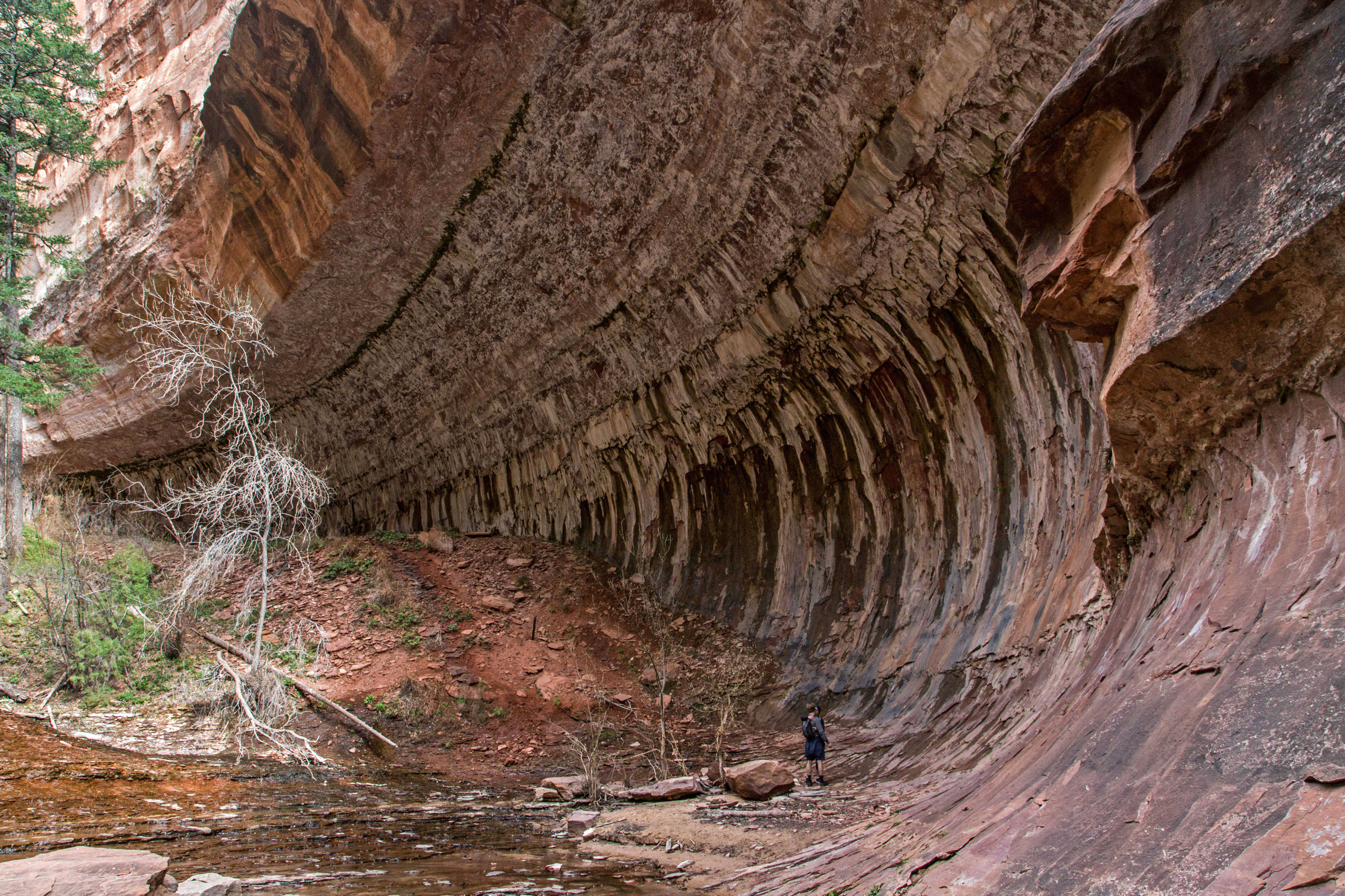
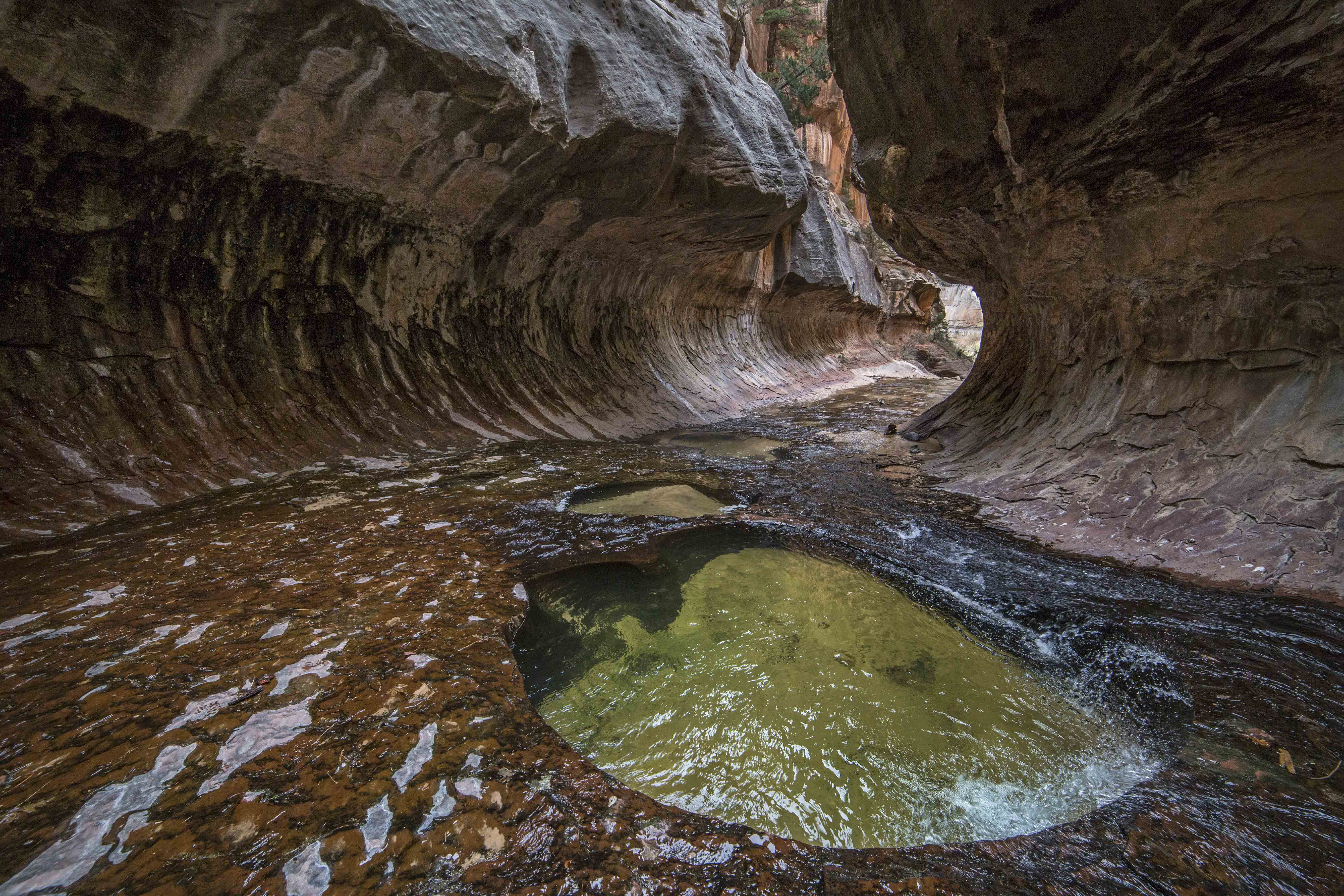

The canyon itself arcs with a slit above revealing beautiful red rock towers jutting over the floor striated with luscious hues.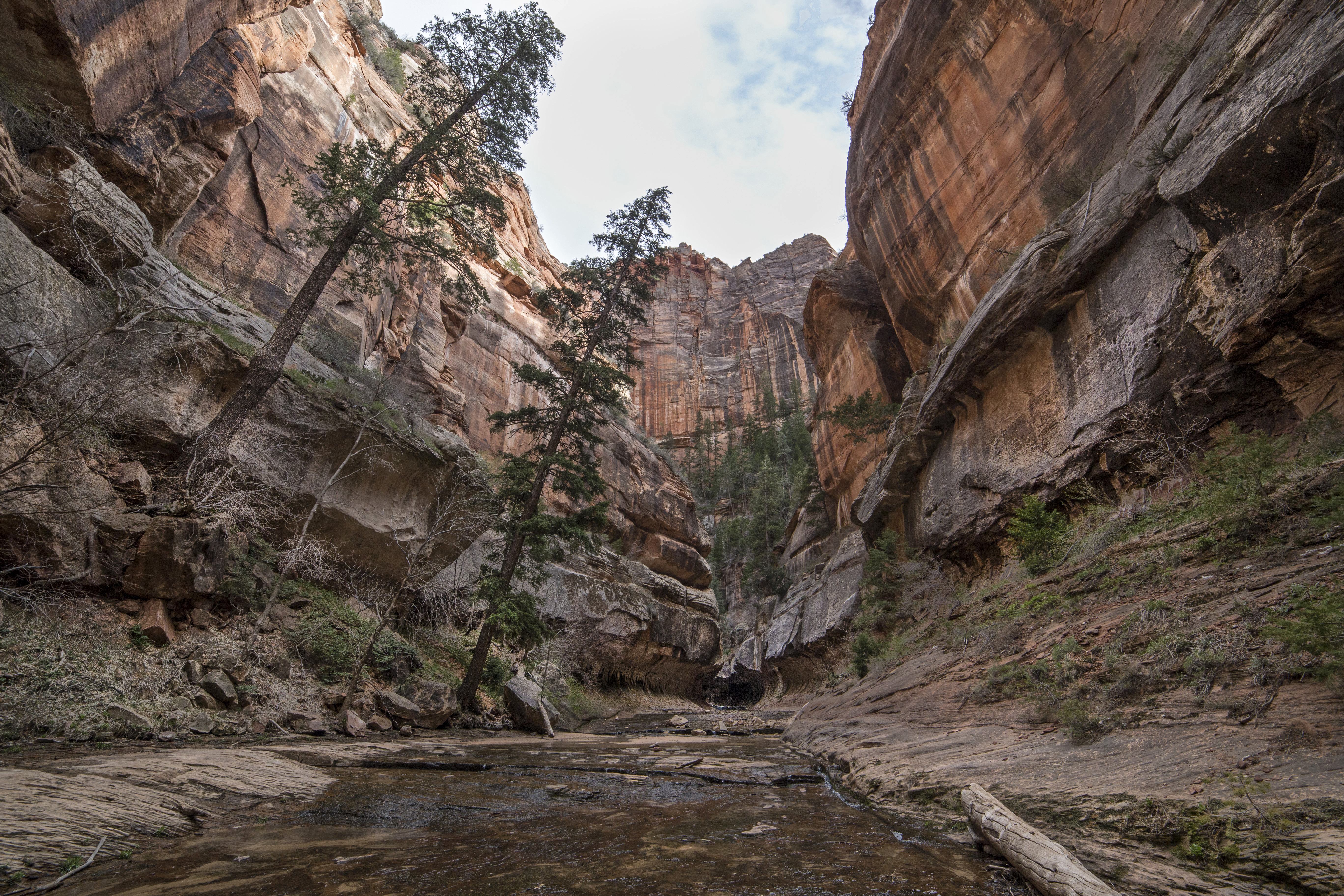


If you want to pay this holy canyon a visit, go on line and apply for a permit WELL in advance of your trip.
This is a hike you will not soon forget!
Sahale Camp Photomerge
Photomegre is one of the multitude of Photoshop Tools. It is a system of merging 2 or more images into a panorama.
Here are two original jpeg images from Sahale Glacier Camp. I took these with the thought in mind to later merge them. using a tripod I captured one image and carefully swung the camera on the tripod and lined up the second one. It wasn’t any fancy movement, I made note in my mind of where the frame’s edge was and pointed the camera in the approximate place to take up where the first image left off, planning for some overlap. I was using a 24 mm lens. I set my image quality when capturing the images so that I would have both a RAW file and a jpeg of the shots.


Once back home I opened both of the raw files together in Photoshop CS6 and synchronized them so that what ever changes I made to one were duplicated on the other. I worked to lighten the foreground and darken the sky. Using the sliders for highlights, shadows, exposure, clarity, whites and contrast I played around until I liked the result.
I also used the brush tool on the foreground to bring out more details on the rocks.
I saved the images as jpeg files. Here they are. 

Once this was done and images saved I went to Photomerge, selected the two modified images and let Photoshop work its magic. 
Opening the panorama as a jpeg image I filled in the corners using the clone stamp tool and tweaked the levels settings a bit, and Viola! Here is the final image.

I have printed the image as a 40″ x 15″ canvas print and it is very stunning.
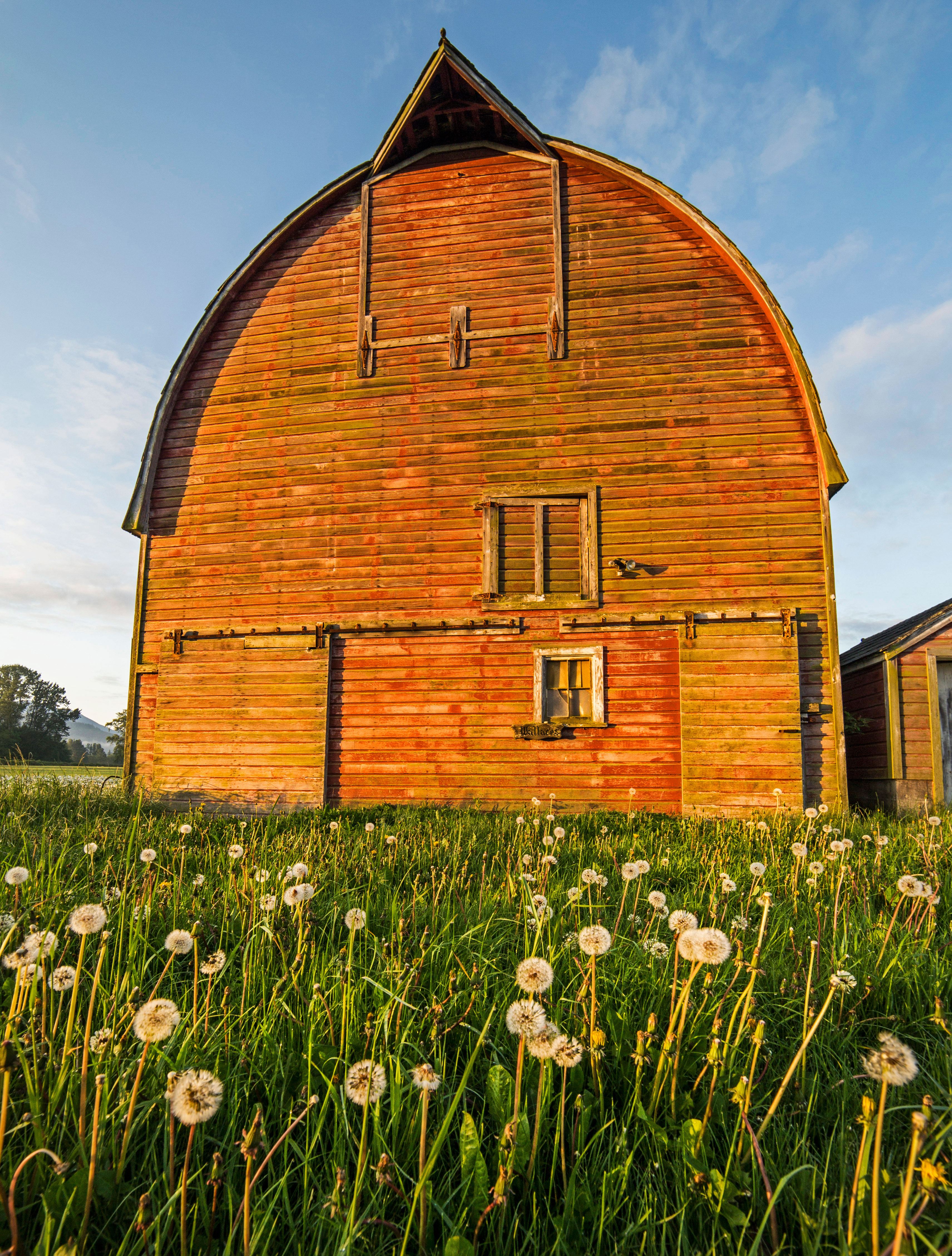
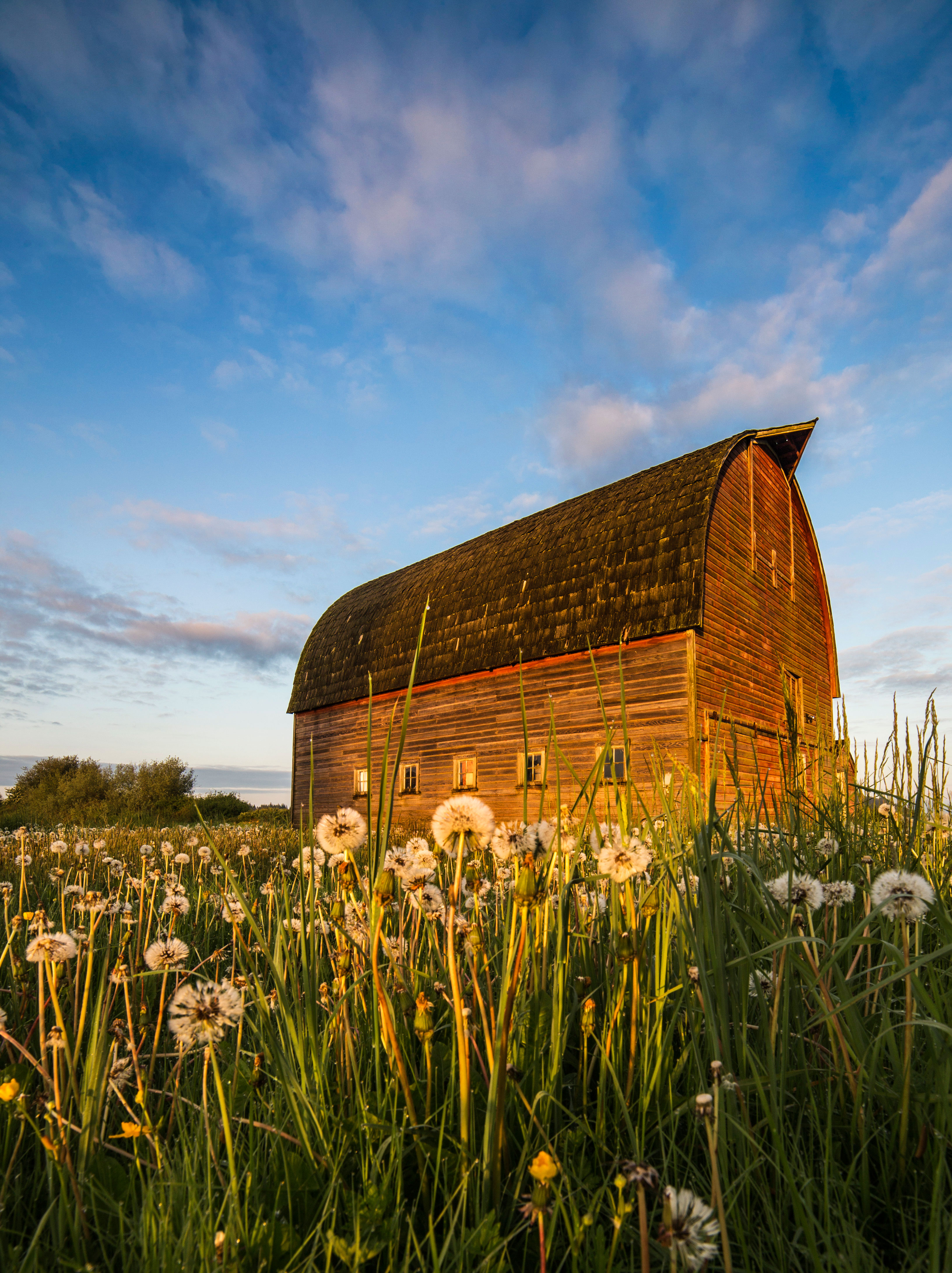
Barn at Sunrise
I awoke at 5:30am to take sunrise pictures, but I was almost too late! As I was driving to the ocean I espied this barn and diverted, partly because of the dandelions and mostly because I could see I was late to make it to the shore in time…not that I’m complaining!


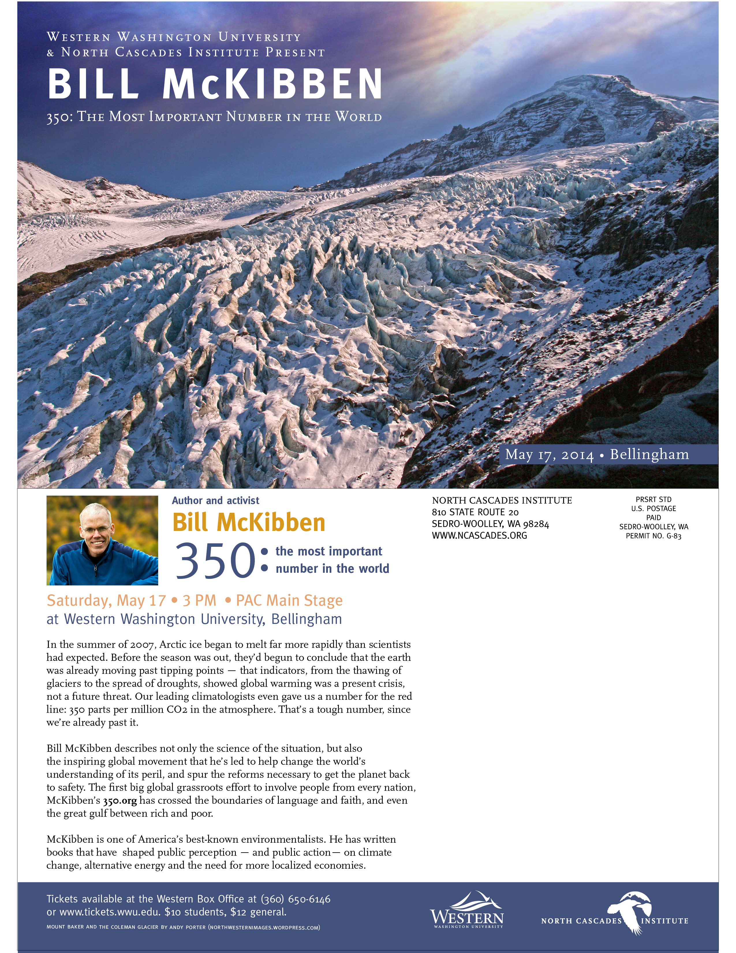
Bill McKibben at WWU in Bellingham, May 17th
For some time now I have donated use of my images to various groups. Washington Trails Association, North Cascades Institute, The Sierra Club, Washington Wild, National Resources Defense Fund, National Park Foundation, Cascade Loop Magazine and others have all used my images to help promote their message(s) of conservation, environmental protection and tourism.
This the first time one of my images has been used directly to promote something very important to me, namely, Global Warming and Climate Change! I am excited to attend the event.
This image is of Mount Baker and the Coleman Glacier from the Heliotrope Trail, on the north side of Mount Baker, in the North Cascades, in Washington State.
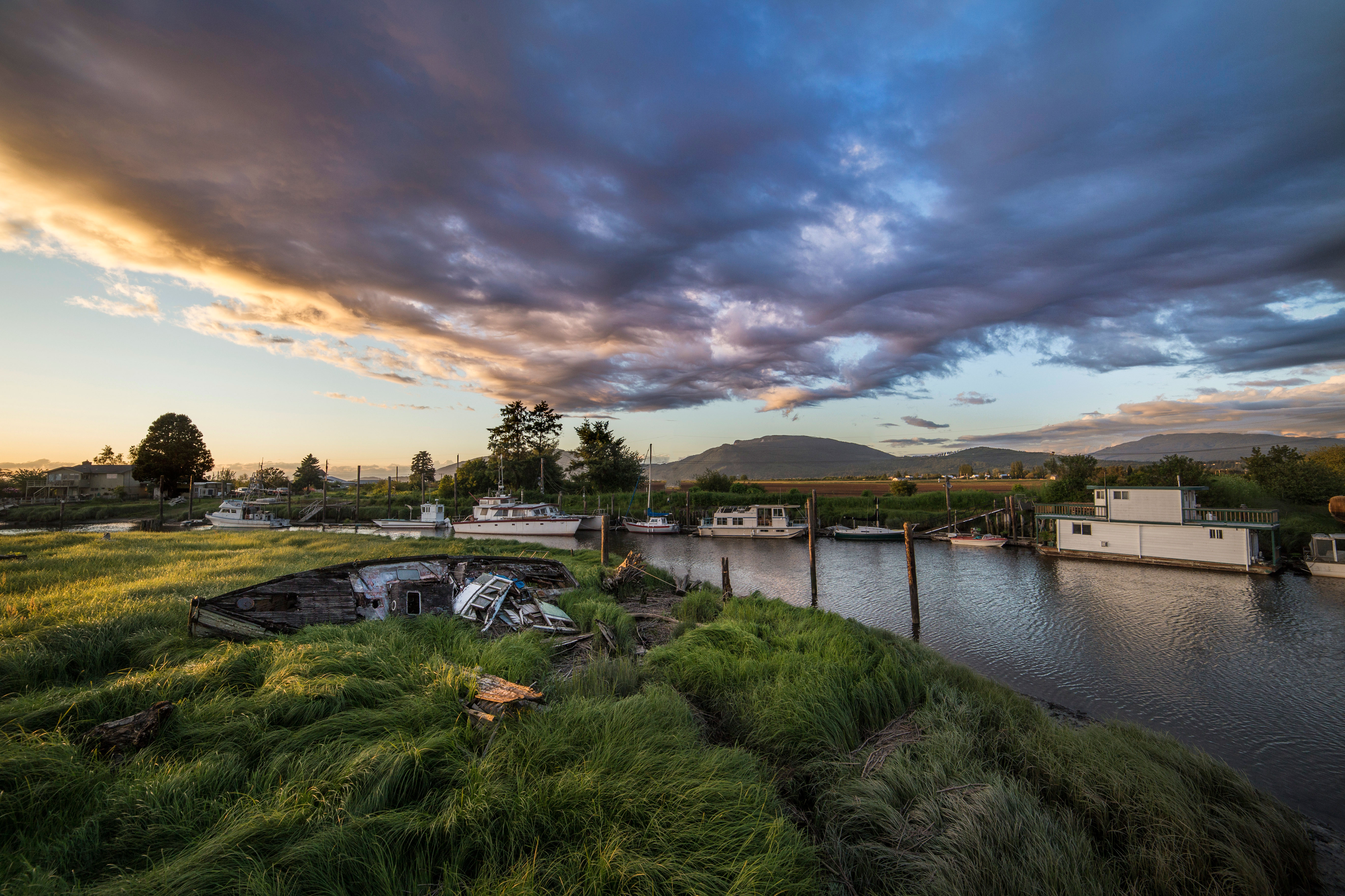
Samish River Sunset
This has become one of my go-to places for sunsets…the way the sun hits the horizon illuminating the water and boats is sumptuous.
One advice is to scour your neck of the woods and find vantage points for sunrise and sunset. Ideally they would be no more than 20 minutes drive from your home. When the sky is beginning to look crazy grab your gear and head out.
I am always on the lookout for more spots like this. There is not much worse than seeing an incredible sky and not having a spot to make for. Well, actually there is a LOT worse than that, but you get the idea.
This first shot really does it for me, and to be perfectly honest I did not even see the light shining into the boat cabin until I got home! 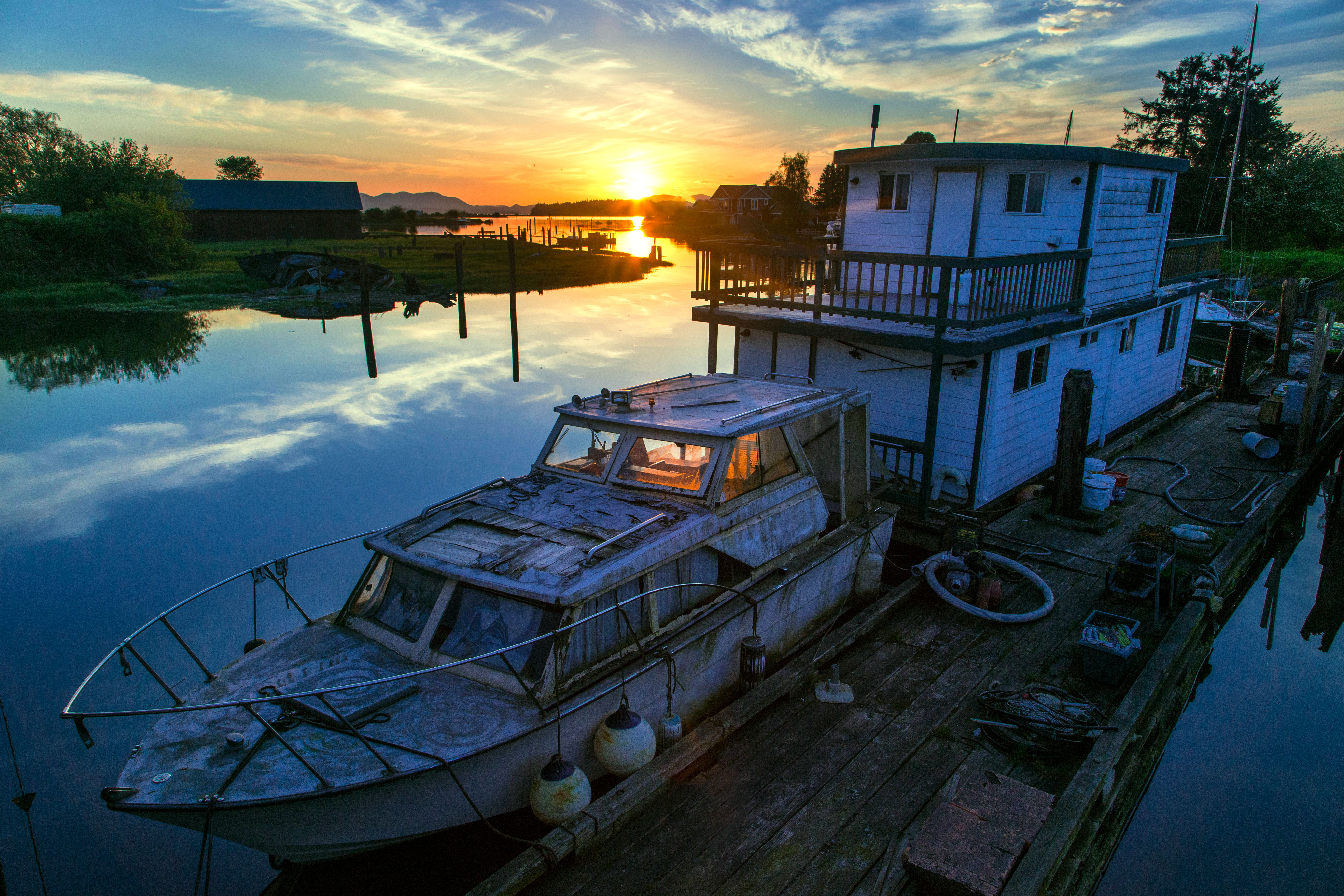
The thing that I love about this image is the markings on the deck of the boat. I am guessing that they are from ropes which had been coiled there. 
This last shot…what to say? The abandoned boat in the foreground has been pictured by me many times…and yet I am sure to return! 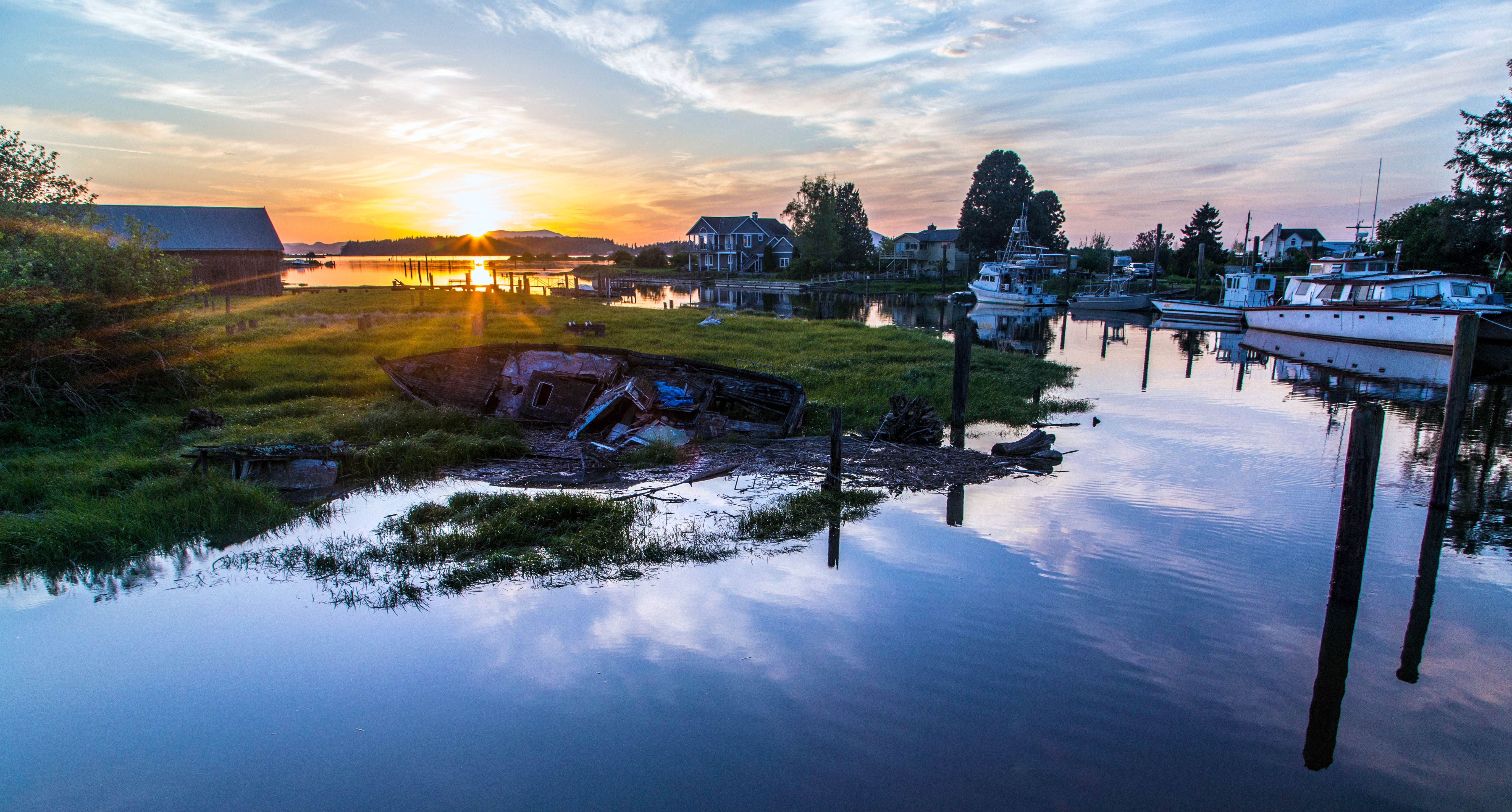
Oh, and by the way, this location is on the Bayview-Edison Road, Here is the map.
