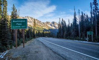

Washington Pass
North Cascades Photography – Washington Pass
Washington Pass is one of the most scenic spots along the entire Cascade Loop Scenic Highway.
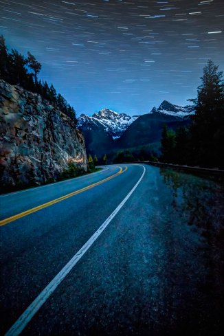
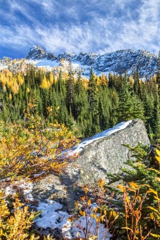
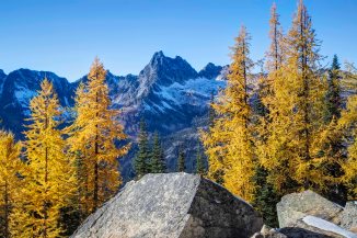
Washington Pass is the highest point along the North Cascades Highway, at an elevation of 5477 ft./1669 m. Liberty Bell Mountain towers over the thin ribbon of pavement. Heading east, the highway plunges down to Mazama and Winthrop. The upper slopes are filed with Larch, which turn bright orange in October. Its a very scenic place!
There is a trail nearby, the Blue Lake Trail. The trailhead is on the south side of the highway. It leads around the Liberty Bell Group to Blue Lake. Fantastic views of Early Winter Spires and larch in the fall, but that’s for another post! .
There is so much snow each winter and the avalanche shoots so steep here that the highway closes for winter, usually in November, and opens again in April or May.
Today, April 18th, 2019 the North Cascades Highway opened for the season, one of the earliest openings I recall. There is still a bit of snow there, along the road, and the trailheads are still snowed in, they wont be open until May or June, earliest. But the road is open!
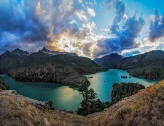
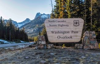
The Washington Pass Overlook, is one of those places I most always stop when I drive along the North Cascades Highway.

Washington Pass Overlook
Most overlooks are a one time deal, once you’ve seen it, no need to go back!
Not the case here.
The Washington Pass Overlook is in the Okanagon National Forest, and maintained out of the office in Winthrop. The Overlook is well marked, and the parking area is about 1/4 mile off the highway. There is ample parking, several rest rooms and some lights. There is a 200 yard paved path to the overlook, and lots of railings preventing a plunge.
NOTE: Even though the North Cascades Highway is opened, the Washington Pass Overlook may not open until May or June. The 1/4 mile road from the Highway to the Overlook parking is gated at the highway. You can park at the highway (there are usually many spots near the gate) and you can walk to the Overlook.
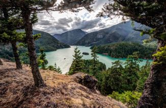
Here are a few pics from the Overlook.
-
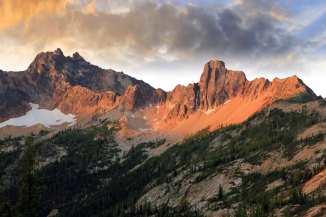
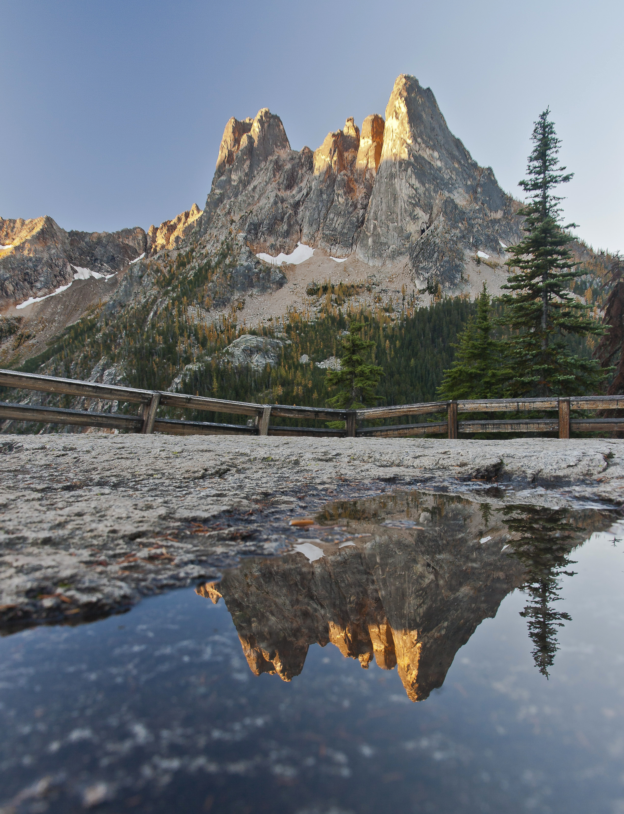
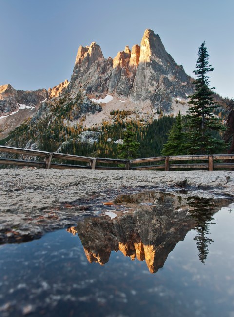
- Liberty Bell
-

- Liberty Bell from the Washington Pass Overlook
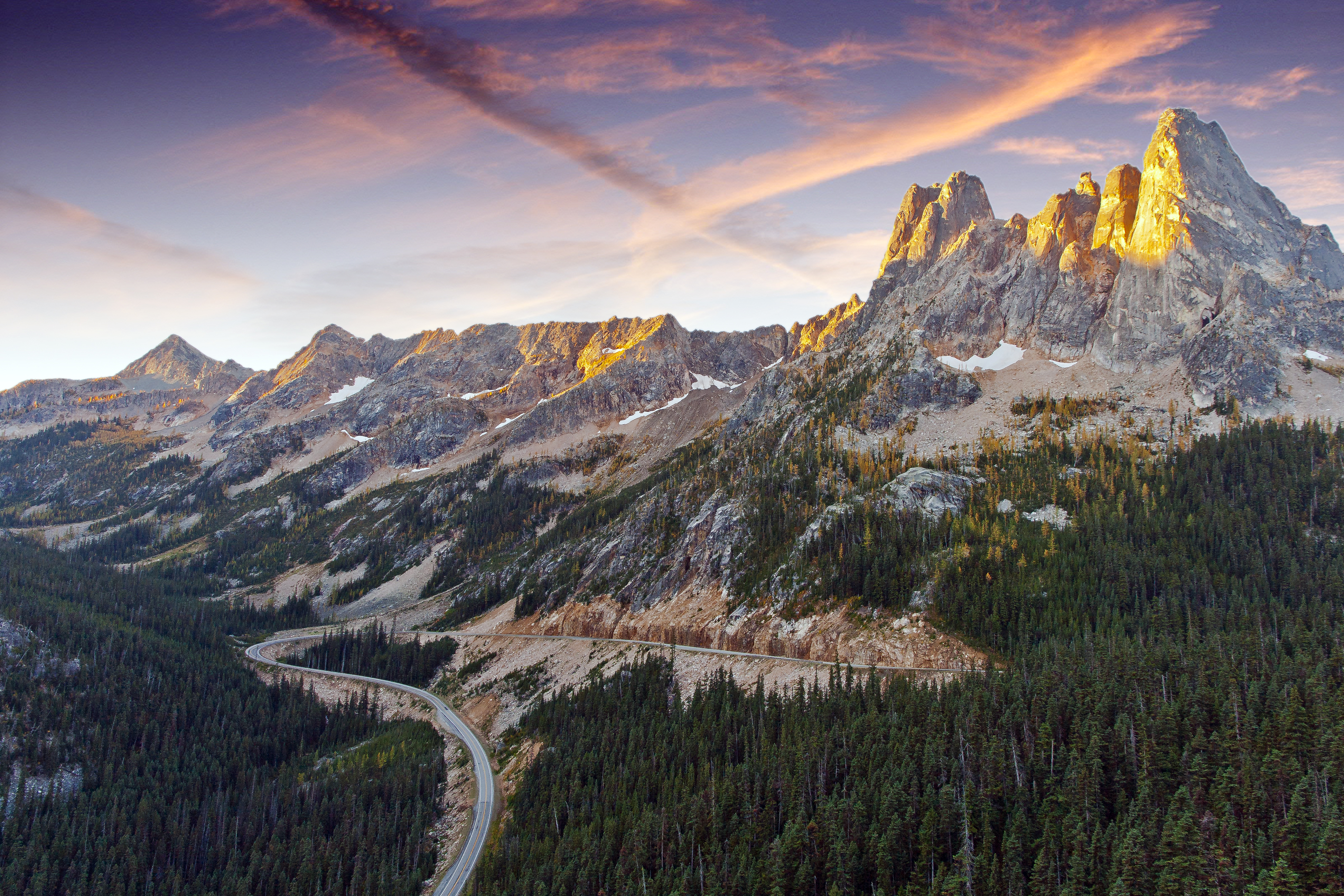
The best time to get a shot of Liberty Bell is sunrise. The early light illuminates the sheer rock faces wonderfully… Its a long drive, from Sedro-Woolley to Washington Pass is a 2 hour drive! But worth it!
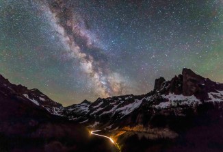
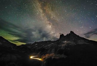
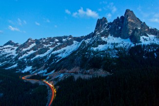
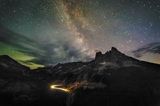
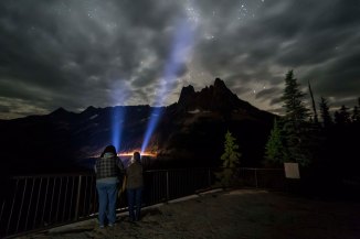
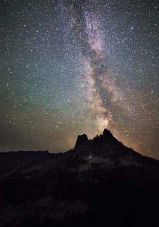
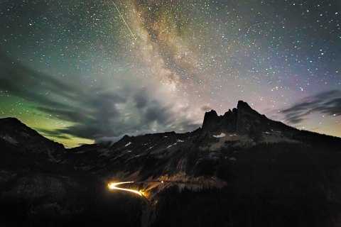
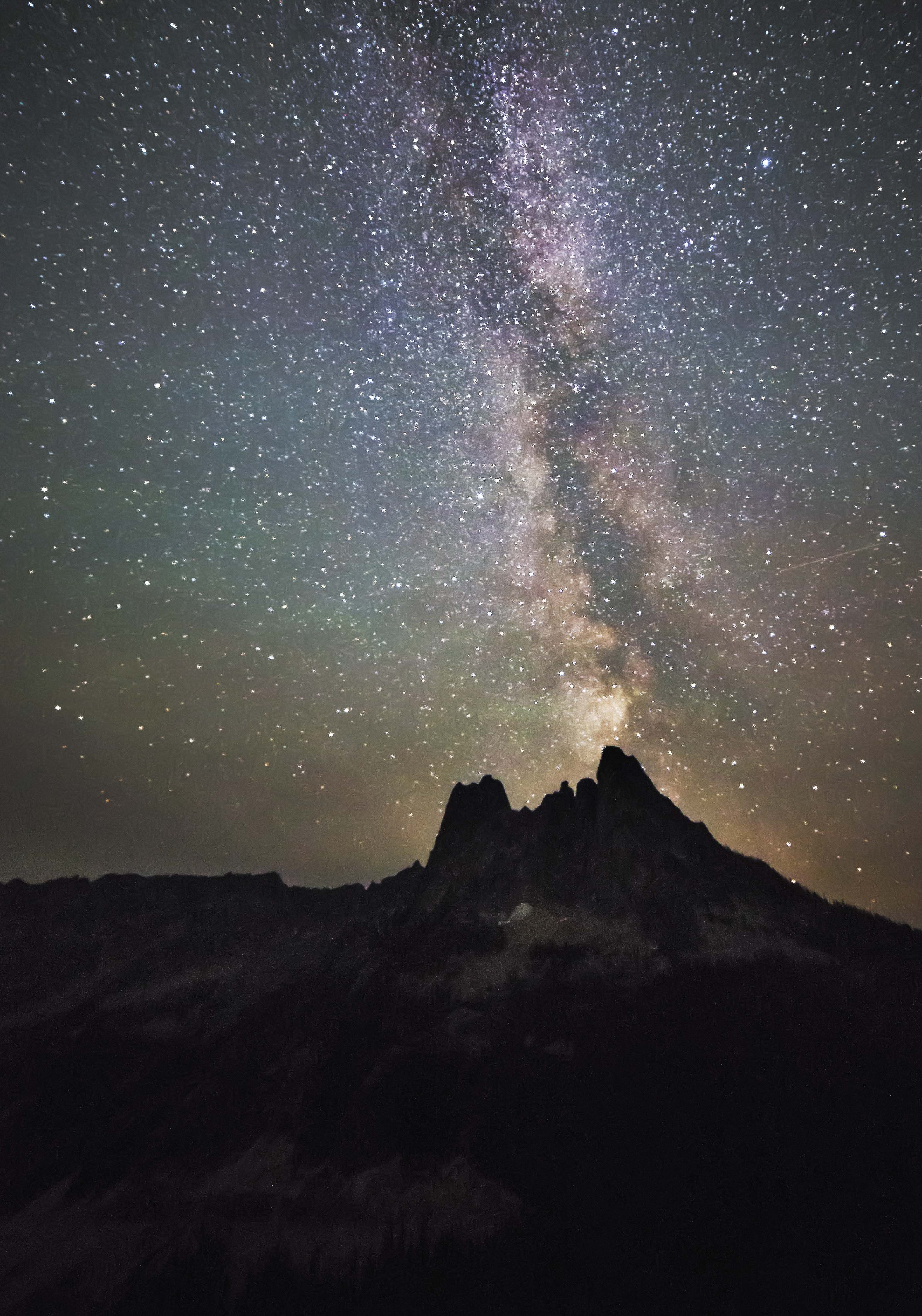
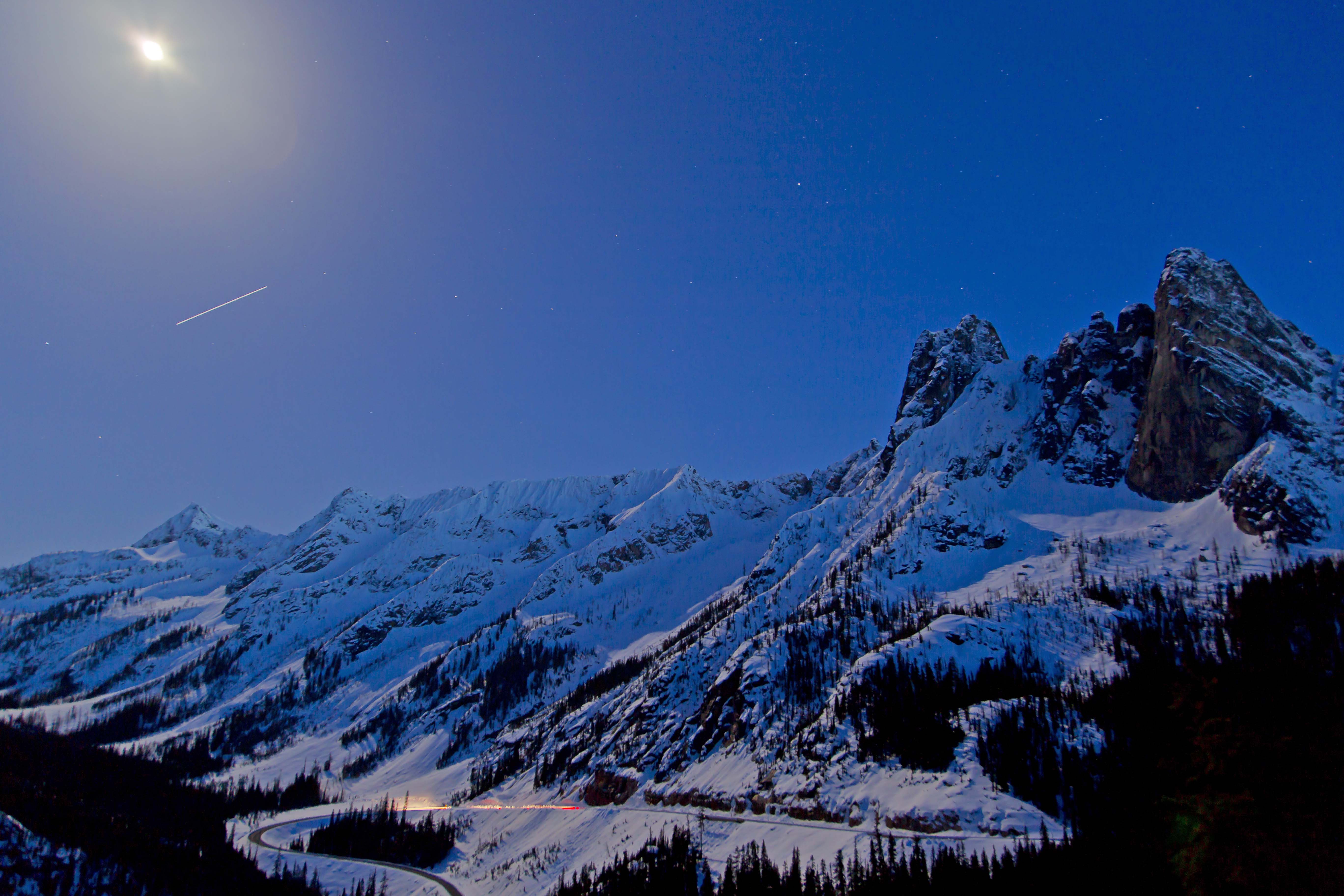
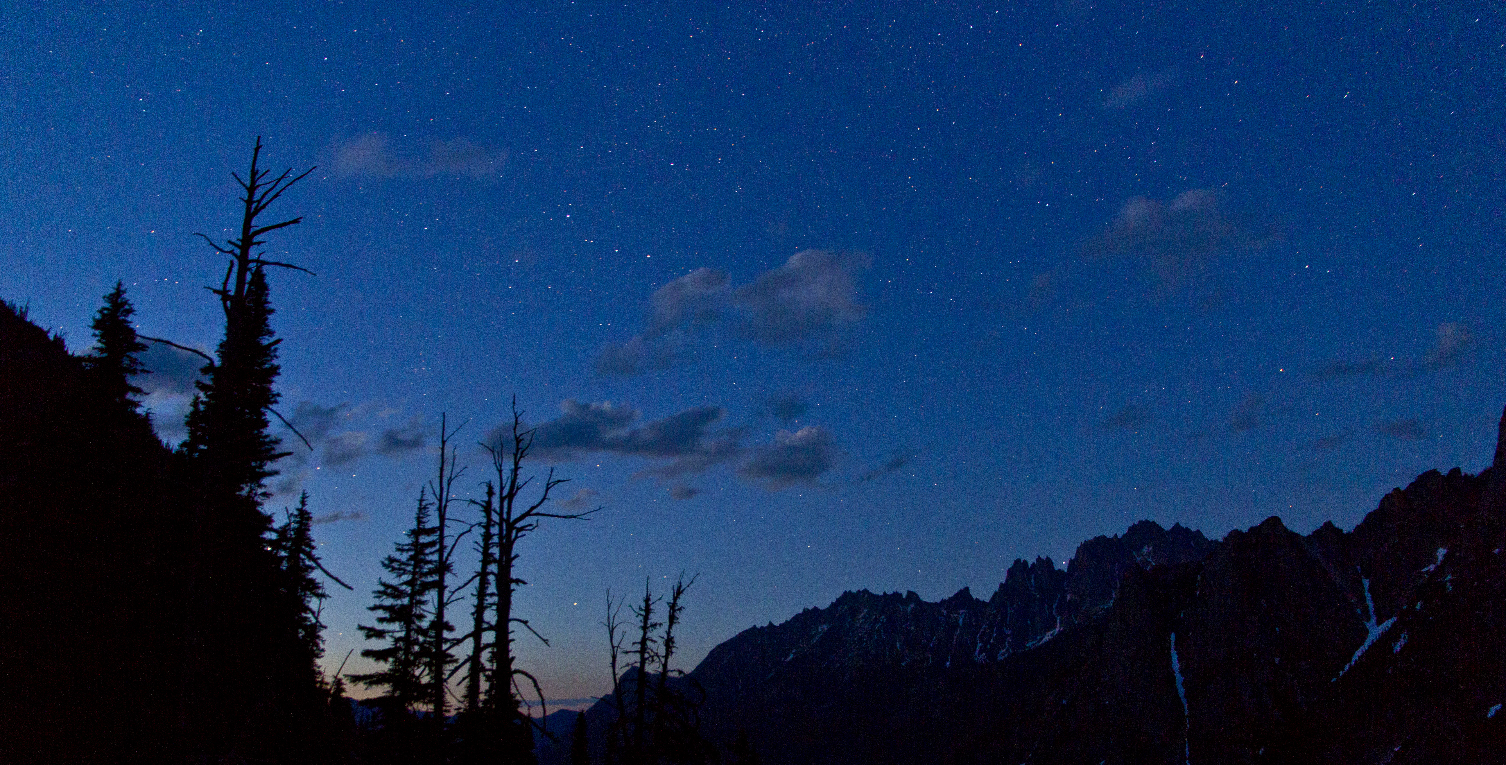
Washington Pass Overlook is also a fantastic spot for Night Sky Imaging. Its deep in the mountains, as there is low light pollution, the Lookout faces south, and you have Liberty Bell as a foreground, but also the hairpin turn of the North Cascades Highway below…
Here are a few images from my many night time visits! This is one of the locations for the Drive-In Night Sky North Cascades Photo Tours.
-

- Liberty Bell and the North Cascades Highway
-

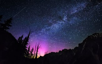
- Liberty Bell and the Milky Way
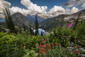
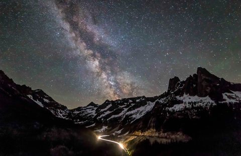
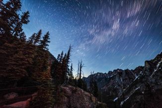
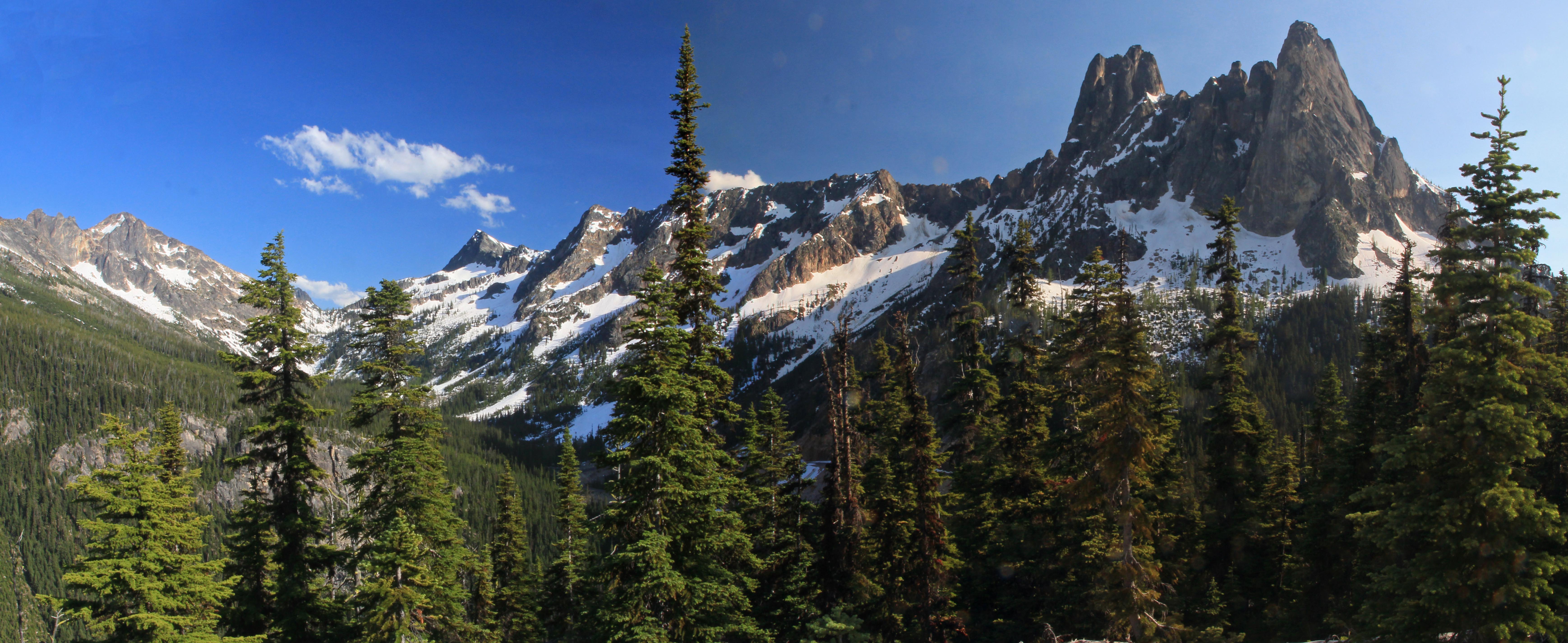
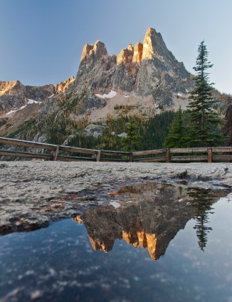
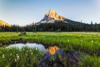
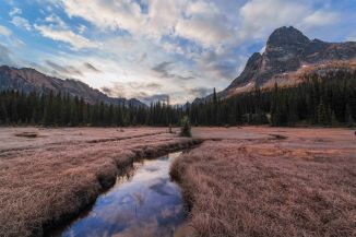
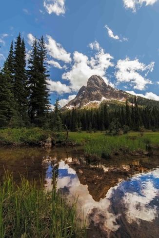
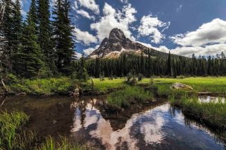
Here are a few more images of Liberty Bell from Washington Pass.
-
- Liberty Bell and Washington Pass
-

- Liberty Bell and Washington Pass
-
- Liberty Bell and Washington Pass
-

- Liberty Bell and Washington Pass
-
- Liberty Bell and Washington Pass
-

- Liberty Bell and Washington Pass
-
- Liberty Bell and Washington Pass
-

- Liberty Bell and Washington Pass