These boats are deserted, moored and docked along a small inlet from Samish Bay, part of Puget Sound in Skagit County, Washington. 


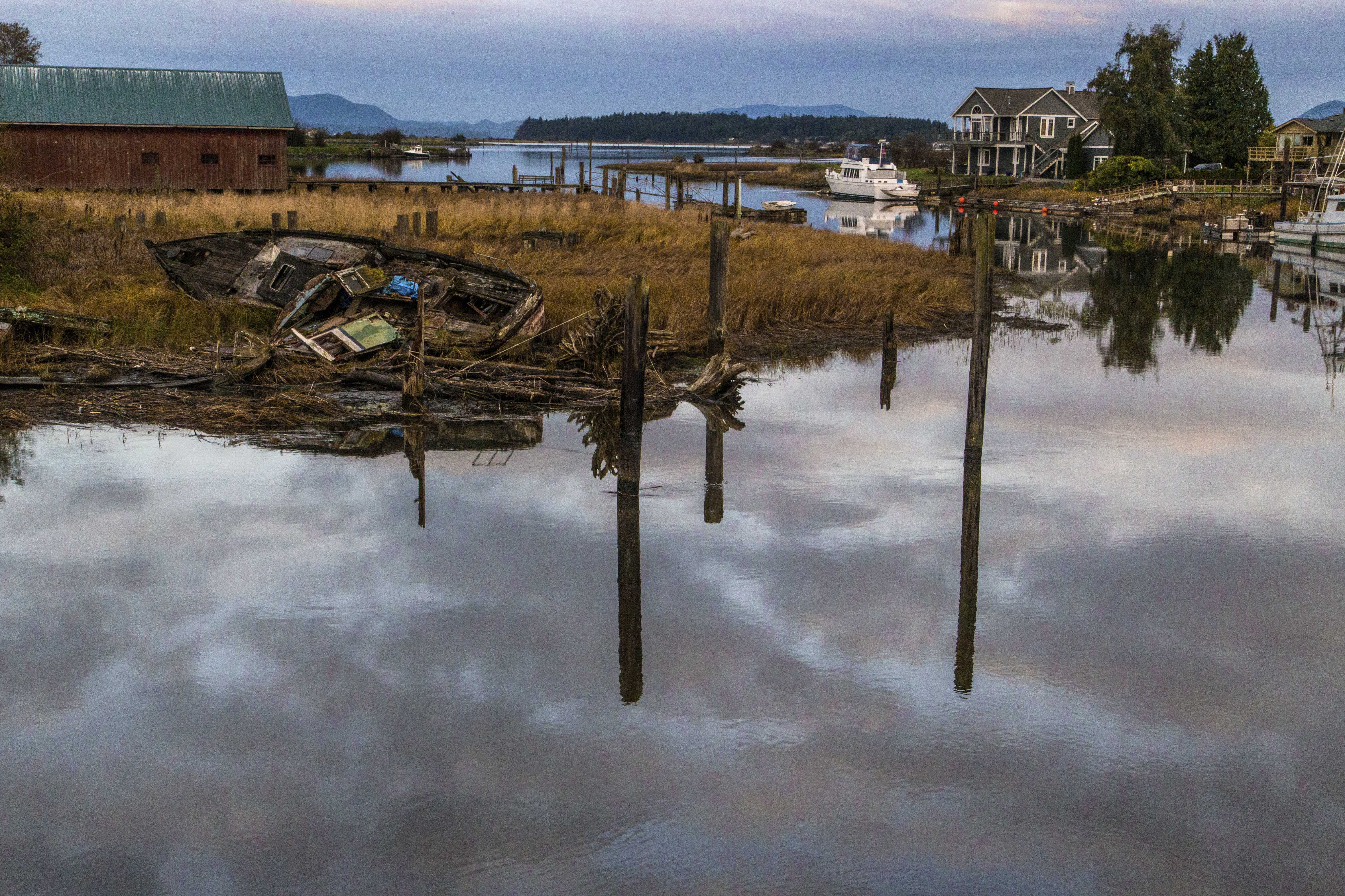

These boats are deserted, moored and docked along a small inlet from Samish Bay, part of Puget Sound in Skagit County, Washington.
When I plan a backpacking trip and am working out where to camp each night my main consideration is “Where can I take the best pictures?” I think about the best views and which angle of light I want. And so my camp sites and hiking goals each day are based upon trying to be at the right place at the right time.
Capturing images of wildlife is not as easy to predict. Bear, goats, deer and marmots are all doin’ their own thing. One never knows when you’ll cross paths, so I simply hope for a magical moment and that my camera will be ready!
This summer I hiked the Copper Ridge – Whatcom Pass Loop, in North Cascades National Park. I planned camp sites atop Copper Ridge and Tapto Lakes. But the most magical part of the trip was my encounter with salmon spawning in Indian Creek at its confluence with the Chilliwack River.
The trek began at the Hannegan Pass trail head; we hiked up into the park and out along Copper Ridge. Silesia Camp, atop the ridge is unbelievably stunning.
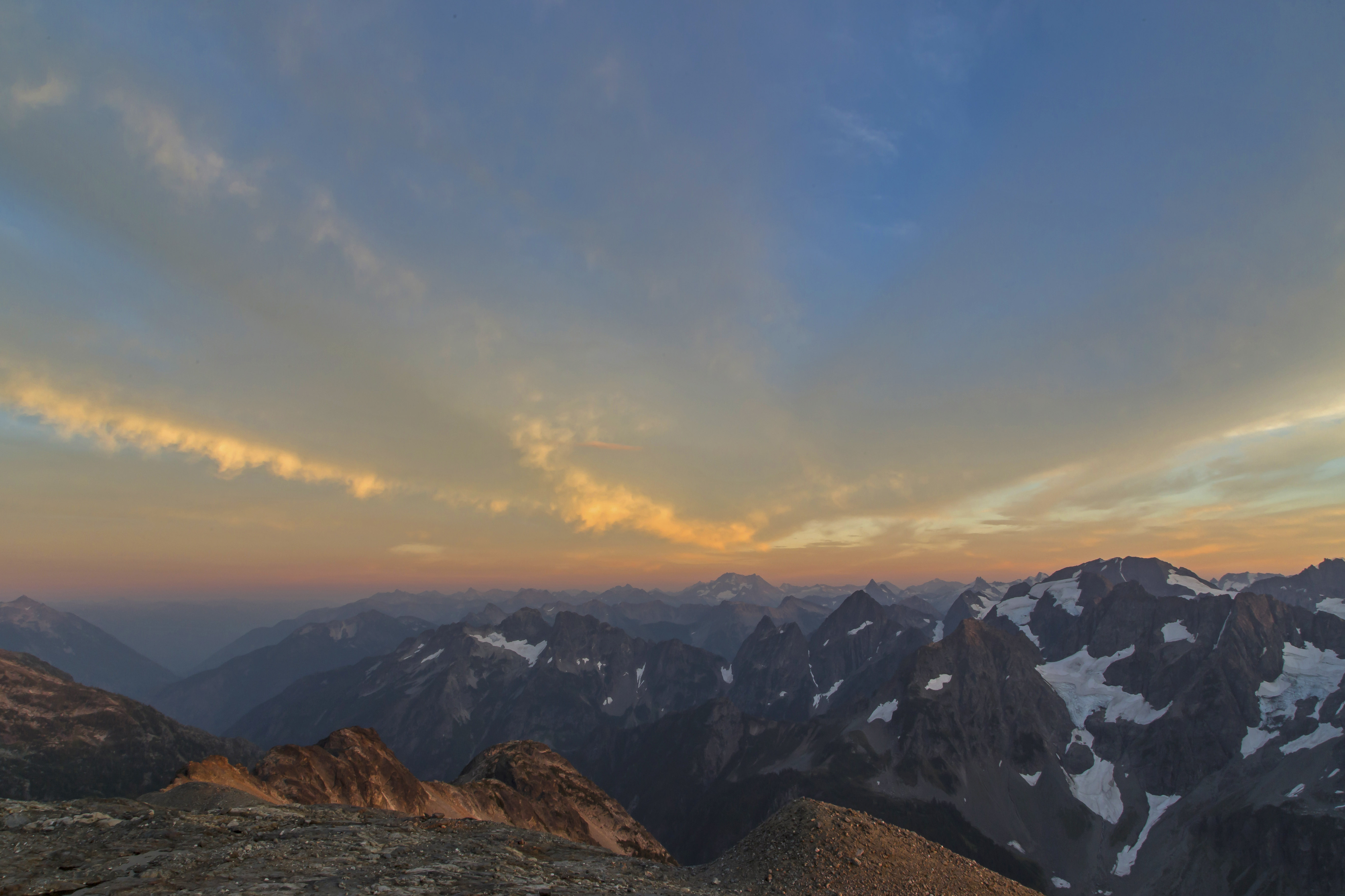
 Copper Ridge Sunset Panorama
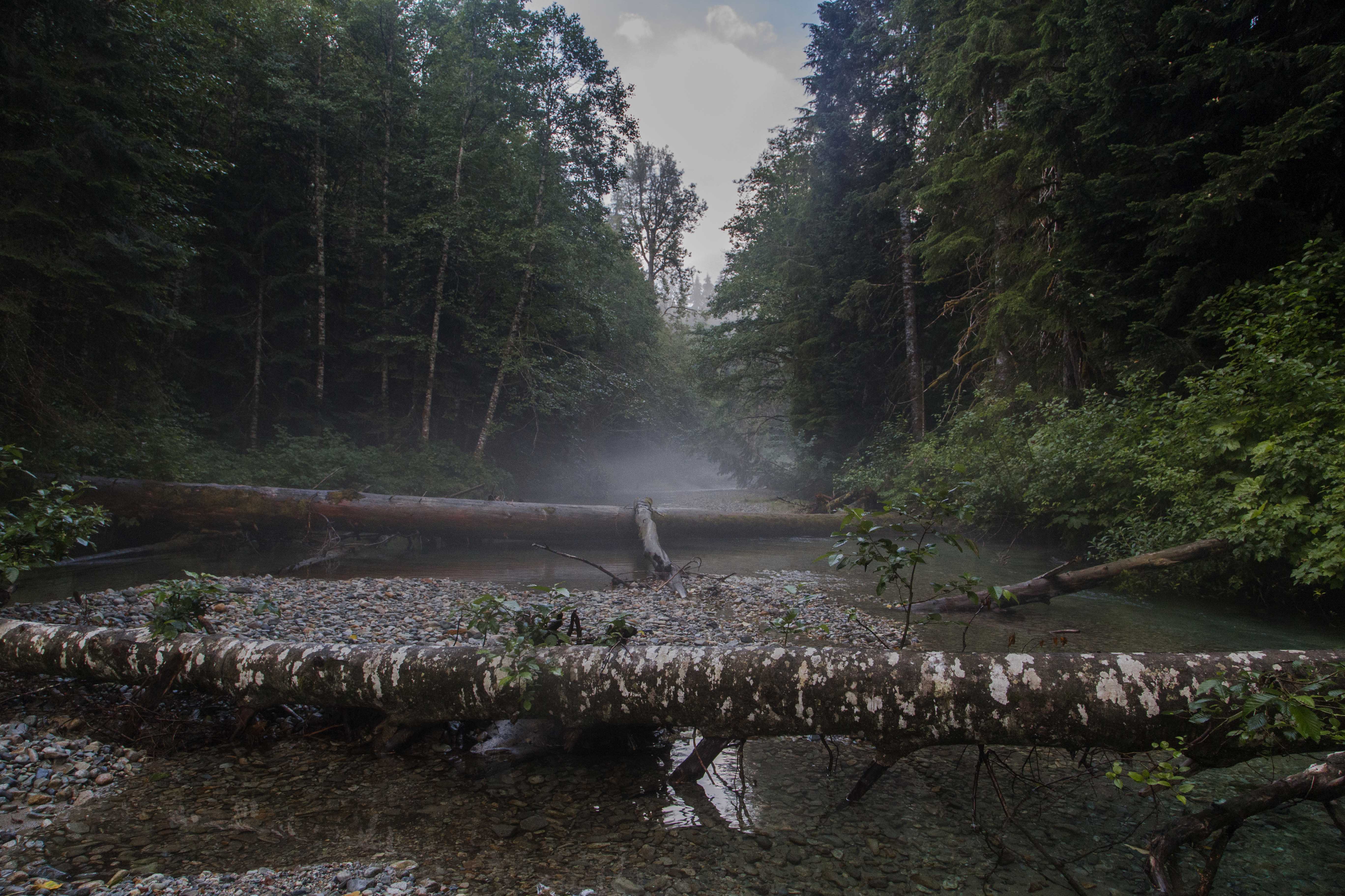
The long descent down to the ford of the Chilliwack River provides a wonderful opportunity to observe striking changes in flora. Pine forests slowly transform into rain forest as one nears the valley bottom. The forest is wet, humid, different…
Then come the two fords, first the Chilliwack. My sore aching feet welcome the cold fresh waters…then I hobble across a short section of wet forest and come to Indian Creek.
The creek was full of salmon, bright orange in color, hovering in the crystal clear water. Here Indian Creek is about 10 meters across, its banks enveloped with dark green. The sky is a narrowing strip curving away.

Looking up steam, back towards the North Cascades, Indian Creek is choked with fallen trees.
 Indian Creek
The river bed is here soft silt and there brightly colored stones, adding to the illusion of the salmon practicing a form of Jedi levitation.  Floating Fish
The view north, towards Canada is equally alluring, the confluence of the two streams creates an opening. The sky is now blue with dark clouds gathering.
 Confluence
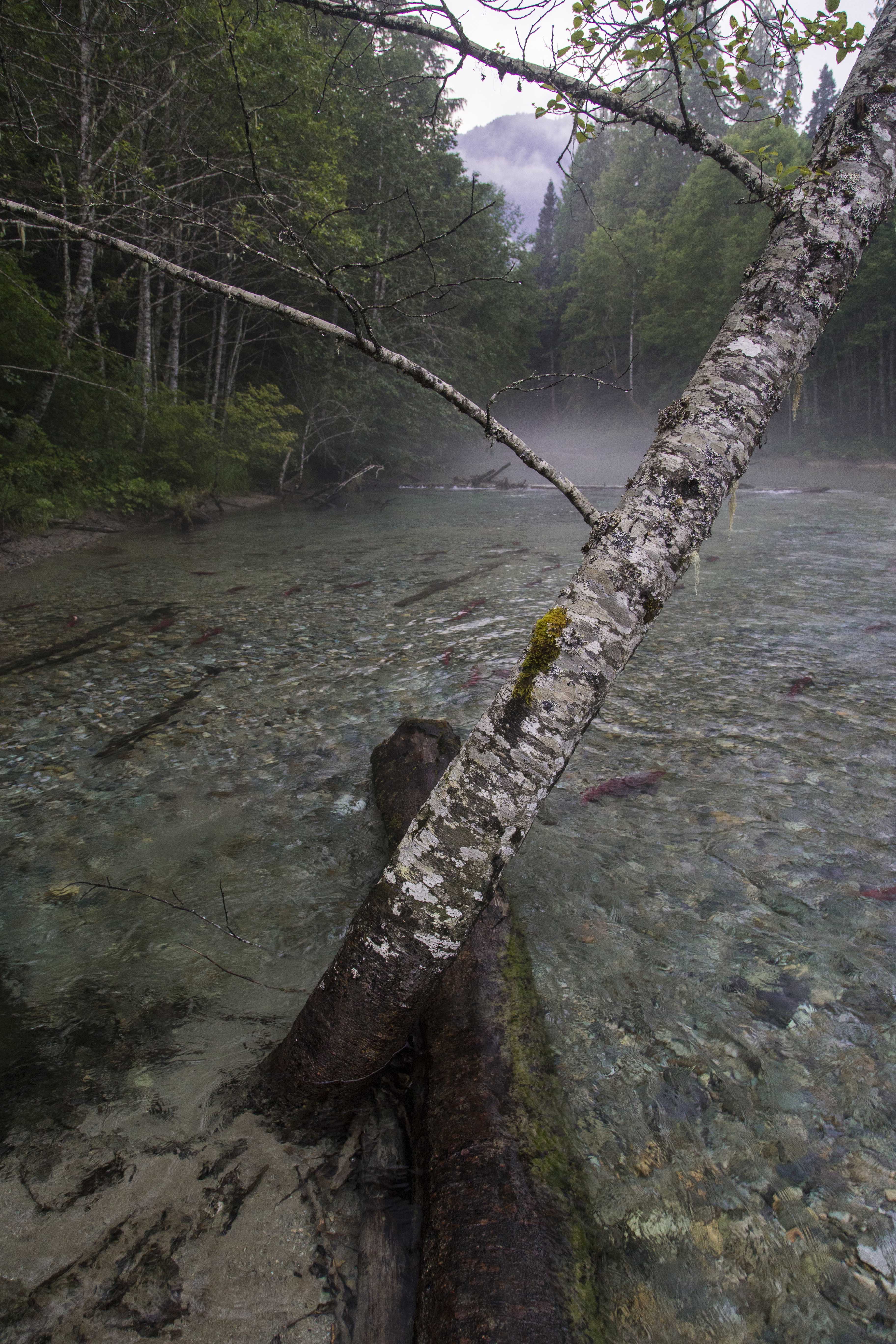
I feel like I have been transported to an entirely different point of the globe. Time seems to stand still. There is a fallen tree stretching out in the middle of the stream and I make my way there. A birch provides some support as I try to balance myself and marvel at the majesty of the fish. Some seem playful, darting here and there, others simply hangin’ out, languidly gliding in the waters.
 Vantage Point
As I wander around the banks I sense some motion up stream. Looking up I see a huge brown bear, maybe 800 lbs along the right side of the creek. I freeze, as does the bear. My racing heart slows after a few minutes, my thoughts reactively consider flight, then a millisecond later I am calculating how far the camera is and how brave I will be to approach such a huge bear.
The allure of photographing such a magnificent creature snacking on salmon easily wins the moment. Gathering the camera I start up stream towards the bear. My partner, seeing our visitor, lets out a scream, and off he goes, back into the forest.
I stand still for a while, reviewing the image of the bear in my mind…wow, what a fantastic place!
 Crystal Clear
The night brings horrific storms, heavy rain, incessant thunder and lightening envelope our tiny tent. But here in this deep gash of a valley we are protected. With all the noise I wonder if our giant furry friend will come visit us, maybe hungry for some of our food, but I realize that he is likely very well fed and so not interested.
The early morning fog lies thick across the water. We linger for some gap in time. The crisp, fresh air and cold clear water sharpen my senses. I am quite happy to be alive!  Misty Morning
Every year the first weeks of August bring the salmon back to Indian Creek. Maybe next year I’ll see you there…
 Salmon swimming Indian Creek
Every year I make the trip from my home in Sedro-Woolley up to Sahale Glacier Camp. And every time I go I am astounded at the wonder of the place…

The road up offered this scene, we almost careened off the Cascade River Road so I could stop for this shot.

Cascade Pass is always a busy place, where lots of day-hikers, backpackers and climbers pause…


The trail up to the Sahale Camp from Cascade Pass is just stunning…

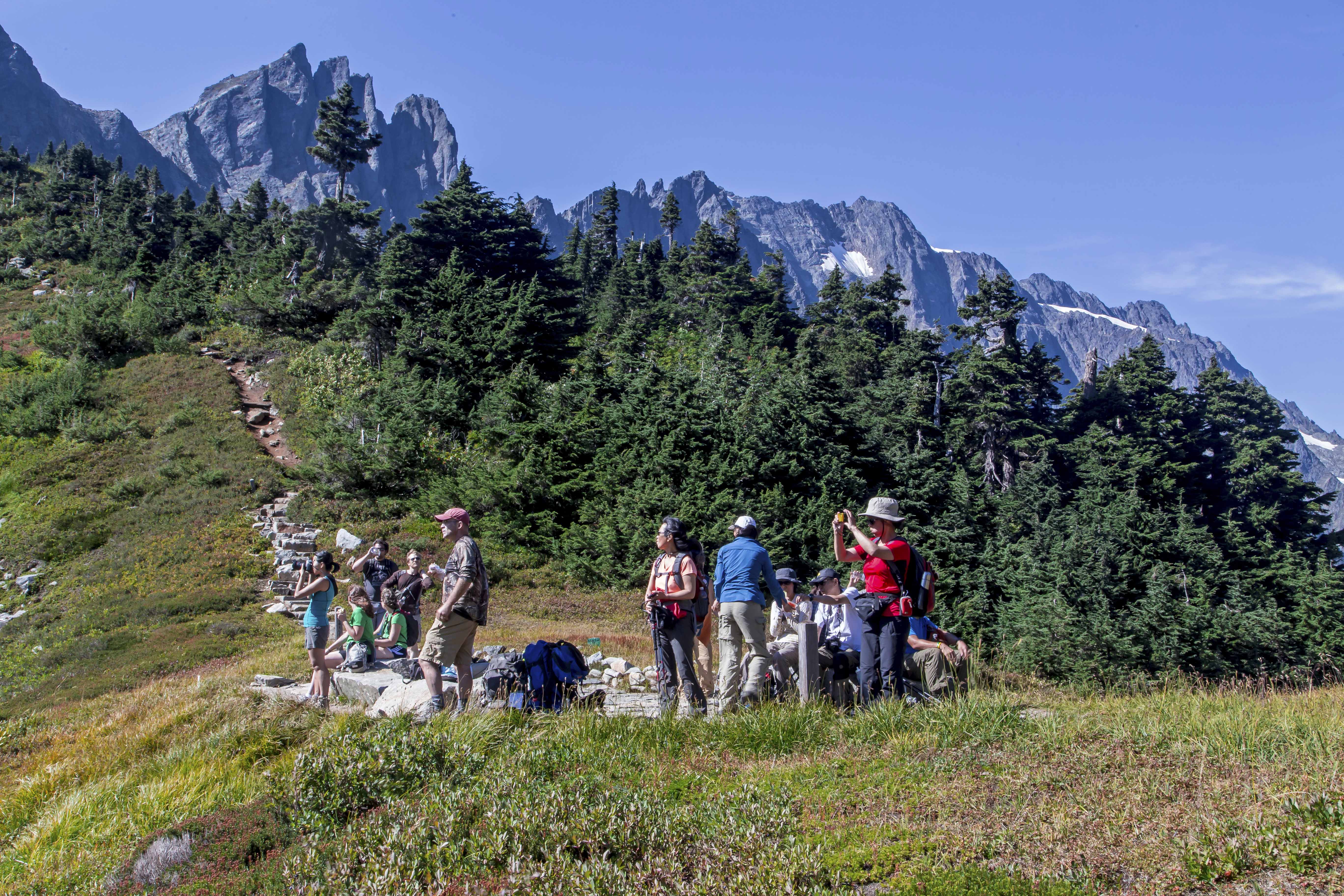
I met a group of hikers from Seattle who let me take their picture!


Each camp spot is surrounded with turret-like stone walls, there is no bad site, all are perfect.

The sunset was superb.


The night was mostly cloudy, but the morning was picture perfect!


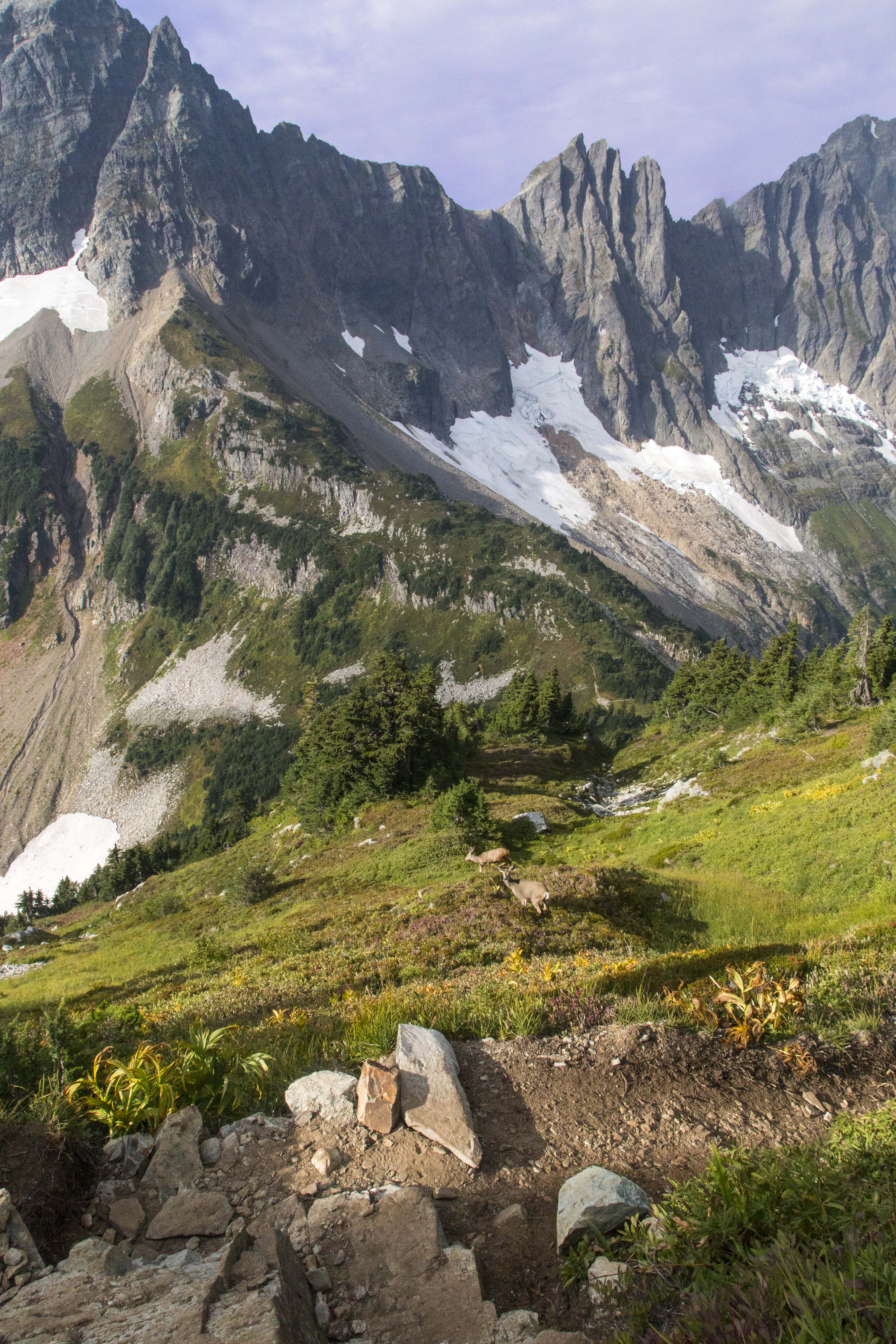
We encountered several black-tail deer on the way back down.
I can’t wait to return!
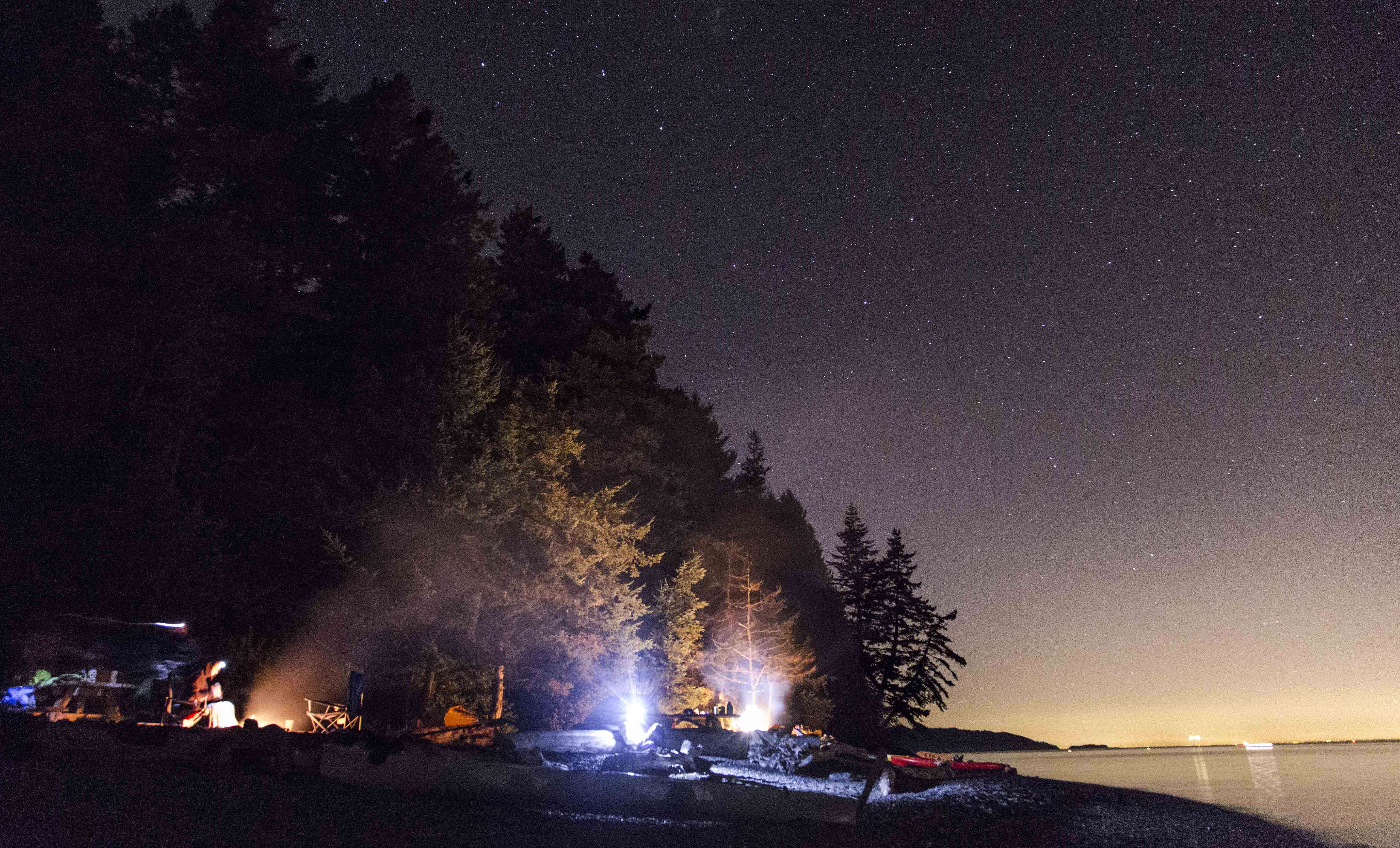
Visited Cypress Island this weekend. Took a few shots of the sun, moon and stars. Oh, and water and a few boats, too.


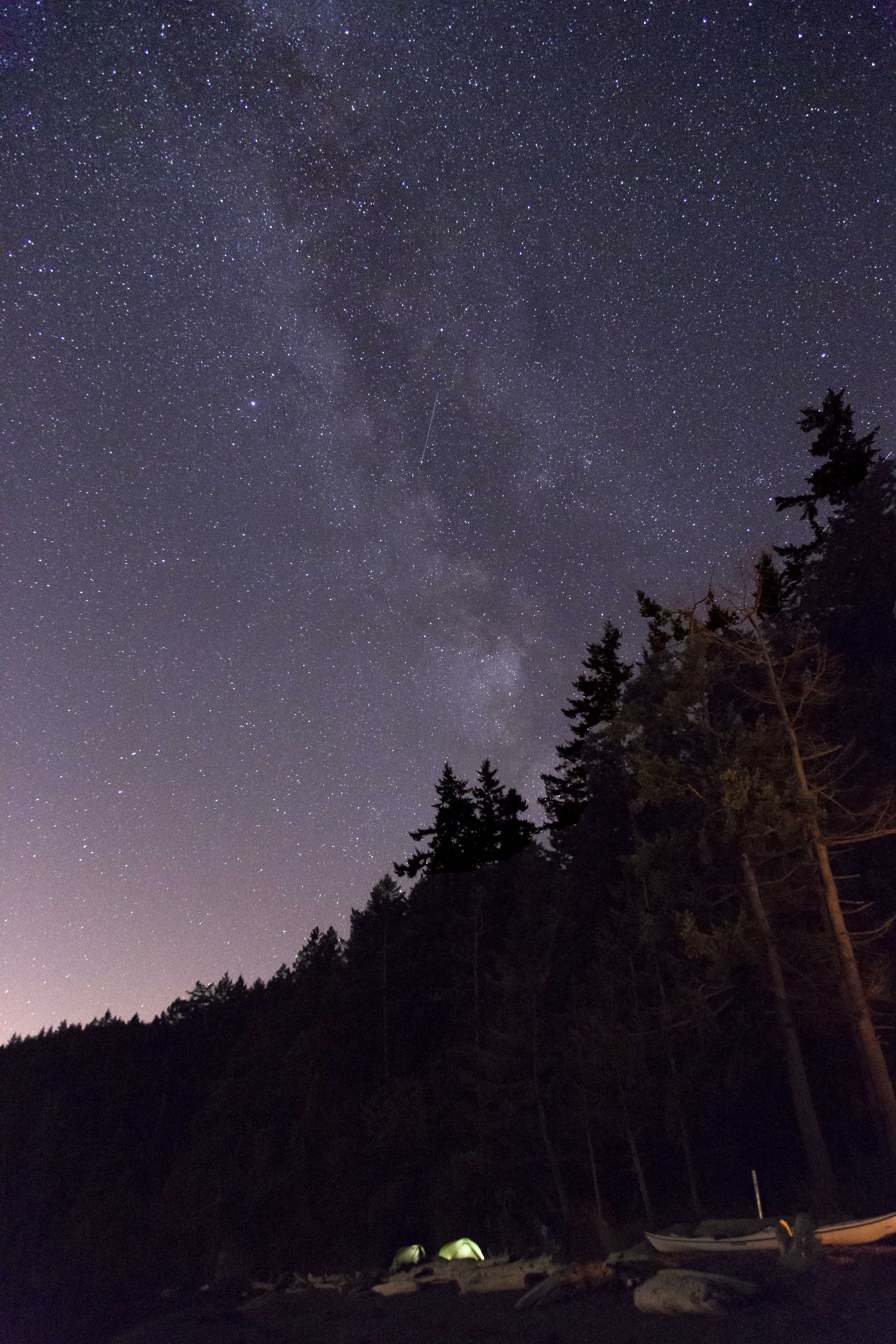


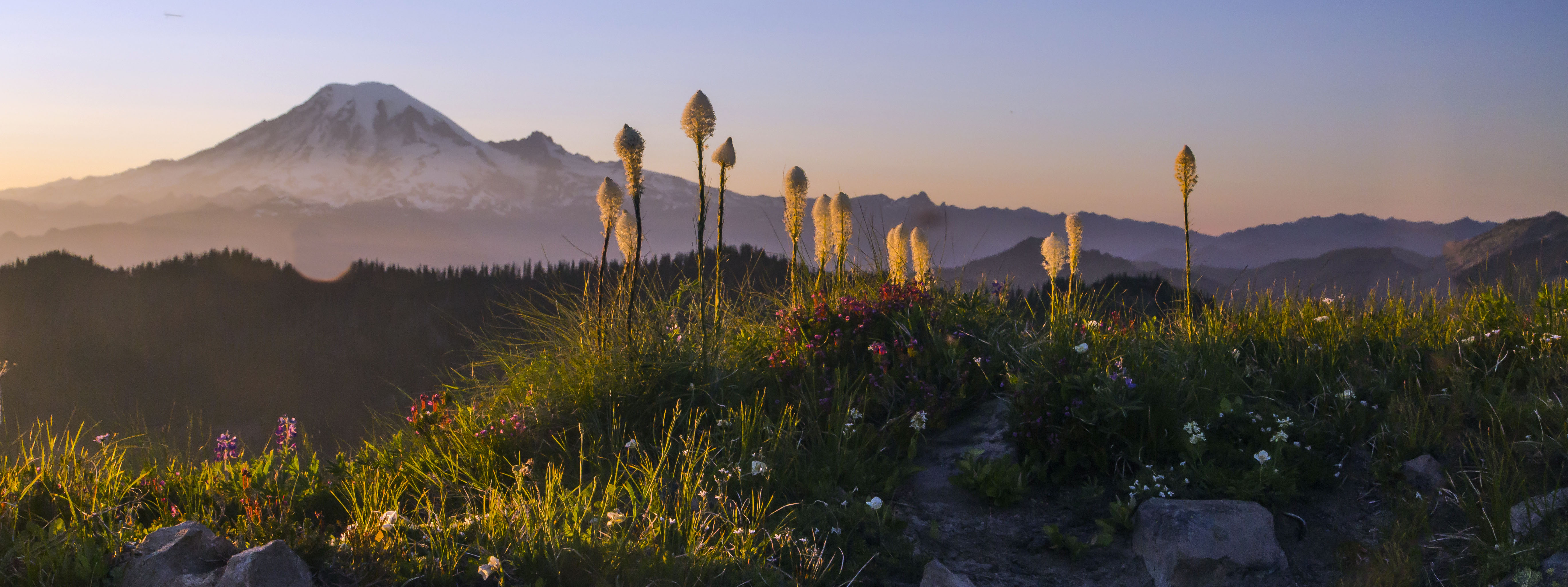
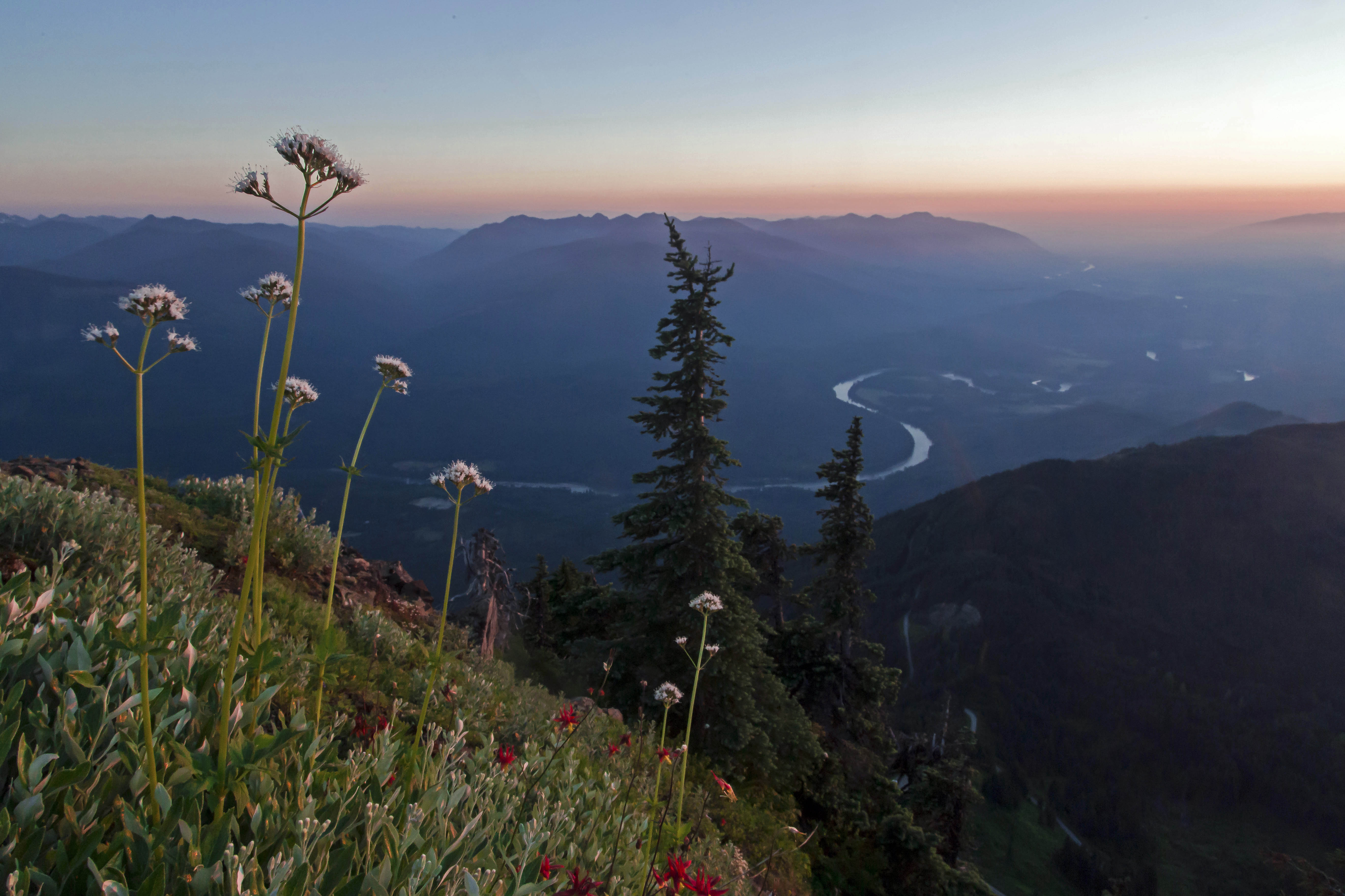
 Sunset from Copper Ridge
The trek started at the Hannegan Pass trail head. We arrived Friday morning to a full parking lot and sunny skies ready to tackle a hard 5-day loop through the North Cascades. Weather reports for the area called for dicey weather, partly sunny/cloudy with a high percentage of thundershowers. But like most fools I told myself that this forecast did not by some magical, mystical way, apply to me.
Actually the story started 7 years ago when I hiked the Copper Ridge trail forded the Chilliwack River and made acquaintance with a bunch of spawning salmon. The image of all those bright red salmon in the pristine waters, deep in the wilderness just pulled me back, that and the lure of making it to Tapto Lakes, above Whatcom Pass.
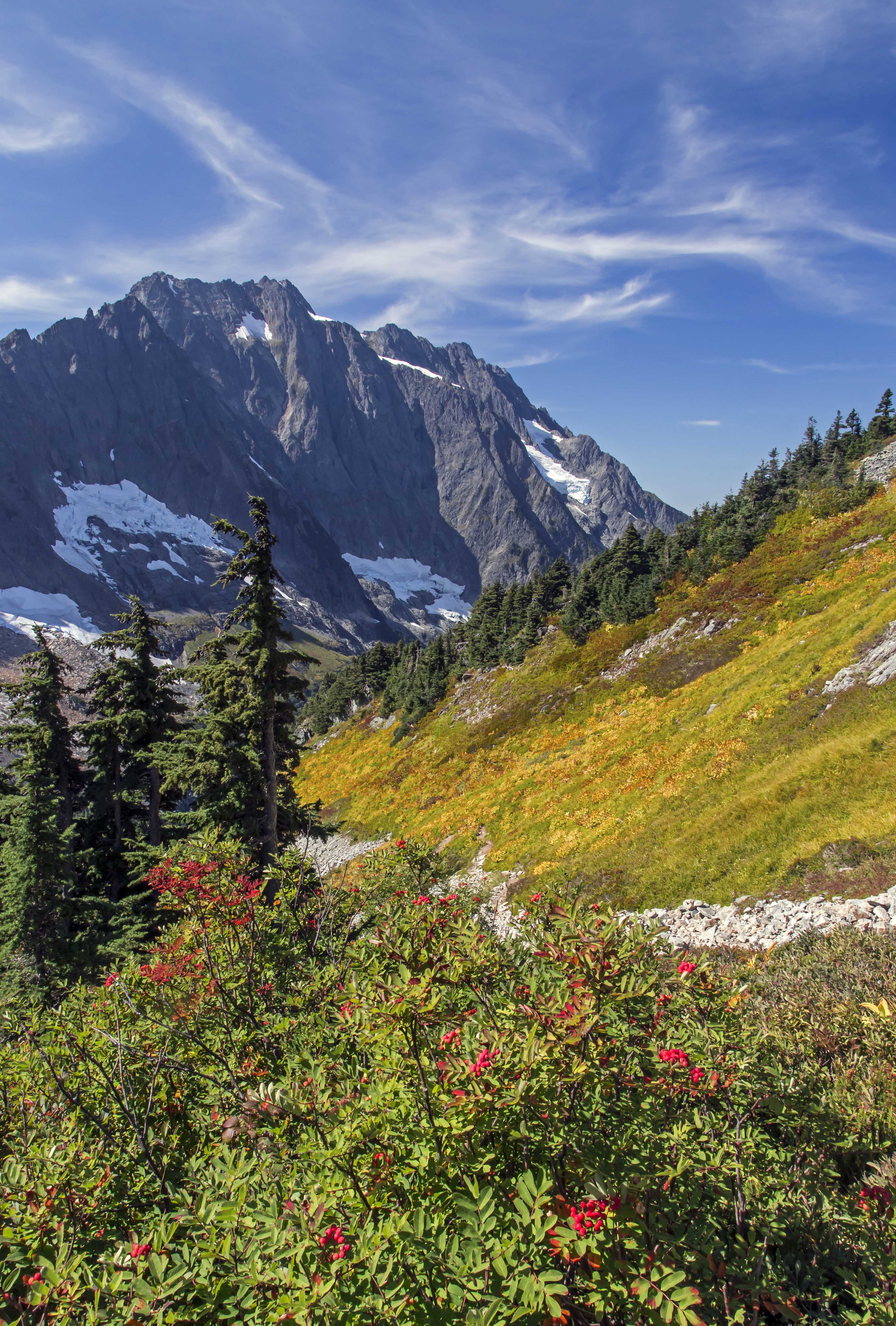
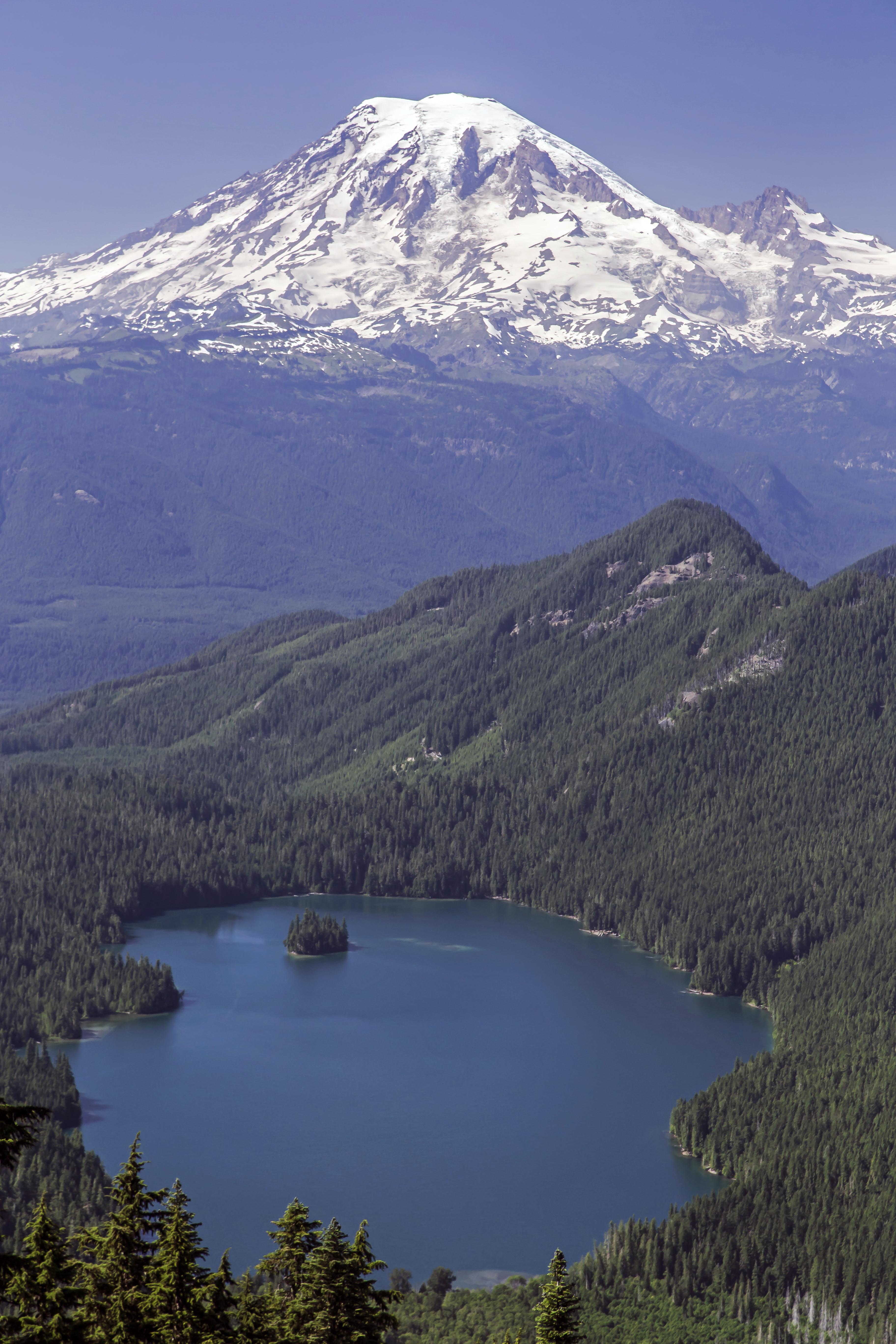
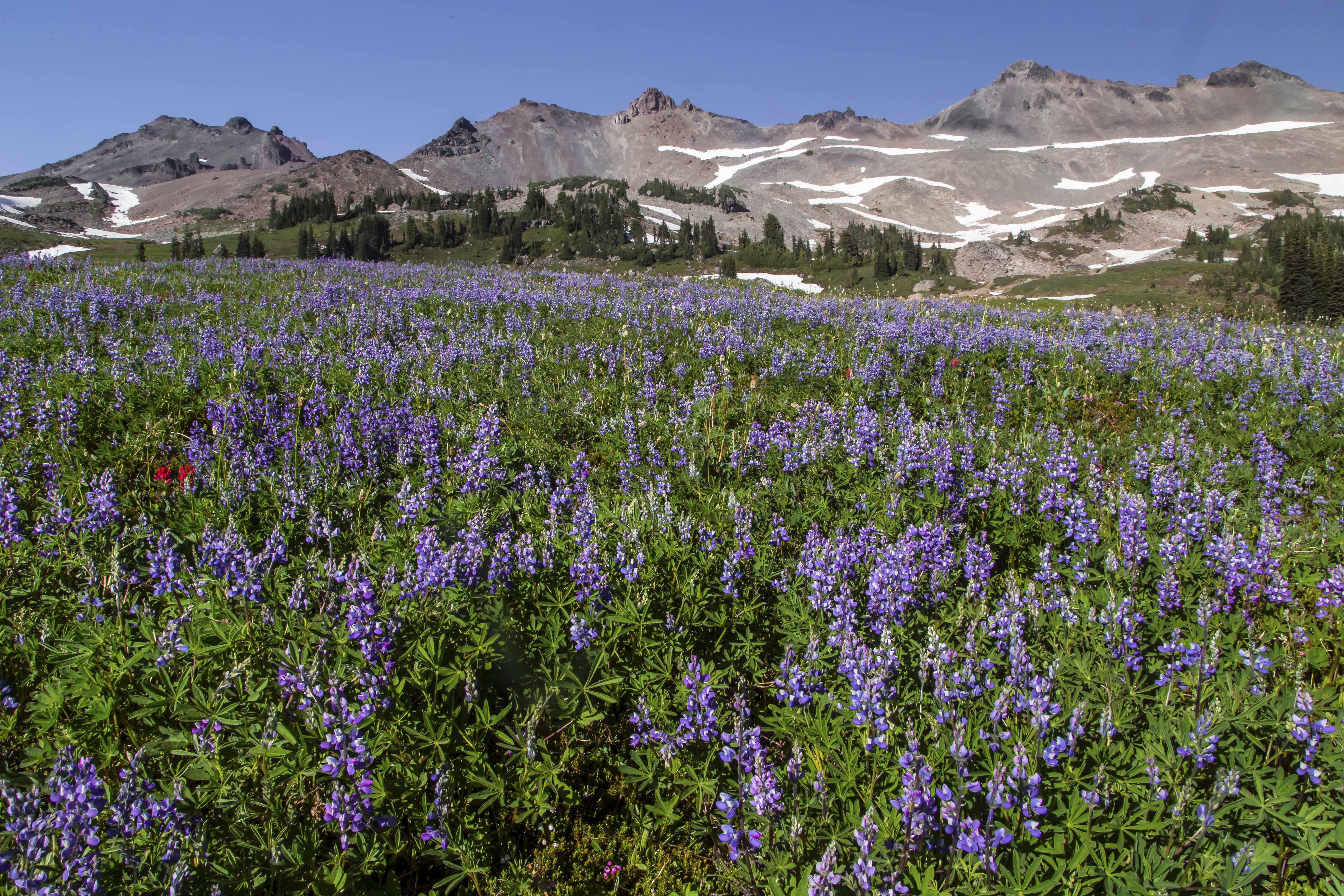
The first days hike took us up to Hannegan Pass and then, entering the North Cascades National Park, up to Selesia Camp on Copper Ridge. This is easily on my list of top 3 or 4 camp sites in the park, the views of Mount Shuksan, Ruth Mountain, Whatcom Peak and the Picket Range and many more are just breathtaking.
 The Picket Range under Storm Clouds
 Mount Shuksan from Selesia Camp
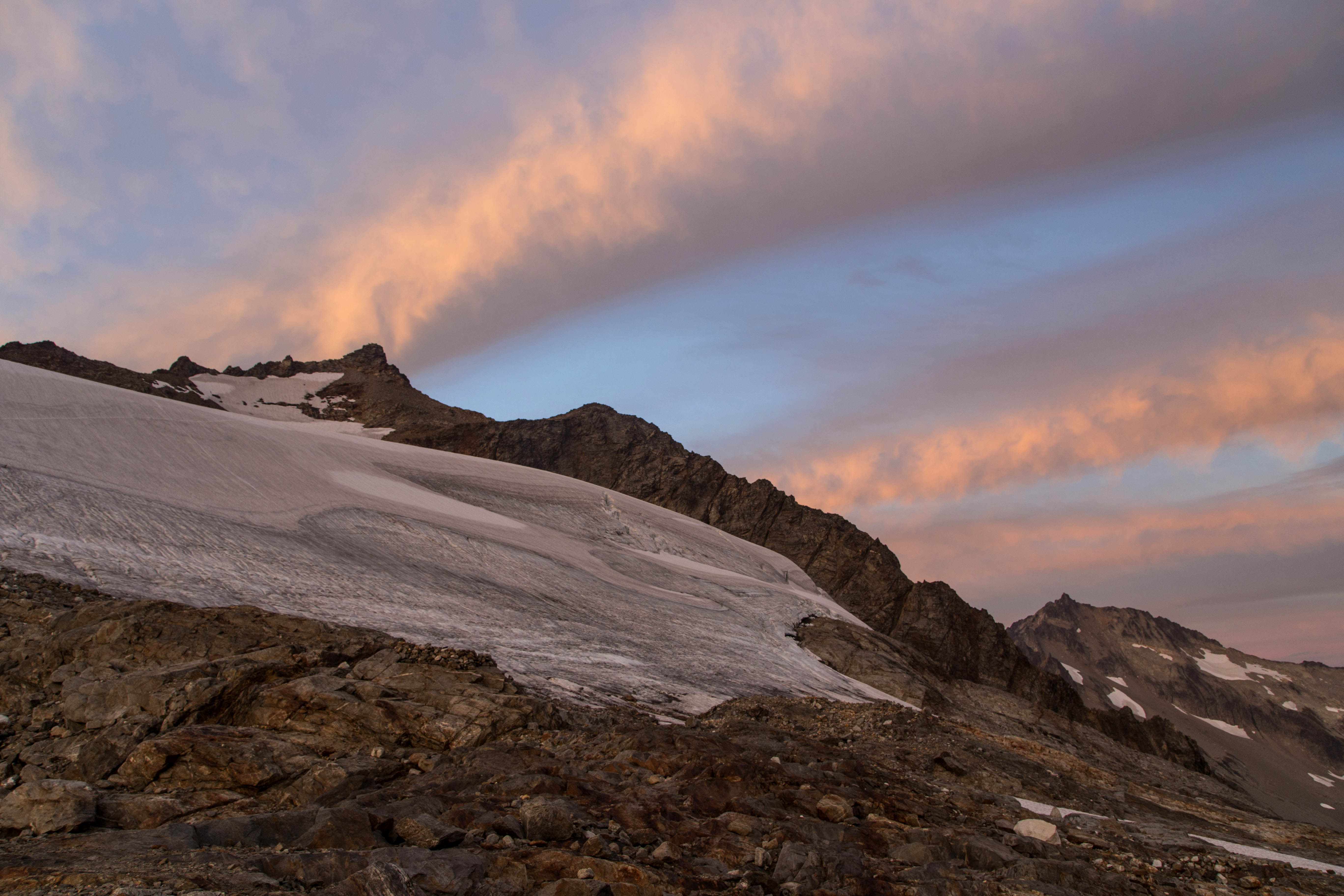
The night brought lightening and thunder and rain but the morning, to our surprise was clearing. We headed up to the Copper Ridge Lookout, at 6,600 ft the highest point along the trail. The park ranger was there to greet us and we toured the lookout while she pointed out the names of all the peak surrounding us. The trail ascending to the lookout from the north meanders through a bright green meadow in a sinuous s-curve just below the lookout. Years ago I captured a wonderful shot of a hiker climbing out of the abyss…
 Out of the abyss, Copper Ridge, North Cascades – 2006
 Hiker Approaching the Copper Ridge Lookout – 2013
Tanya, the Park Ranger commented that a lone hiker was approaching from Copper Lake and so now another chance was upon me to see about capturing again the silhouette against the backdrop of deep valleys.
Reluctantly departing from the views and company at the lookout we continued our ridge walk, descending to Copper Lake we stopped for lunch and a swim in its azure waters.
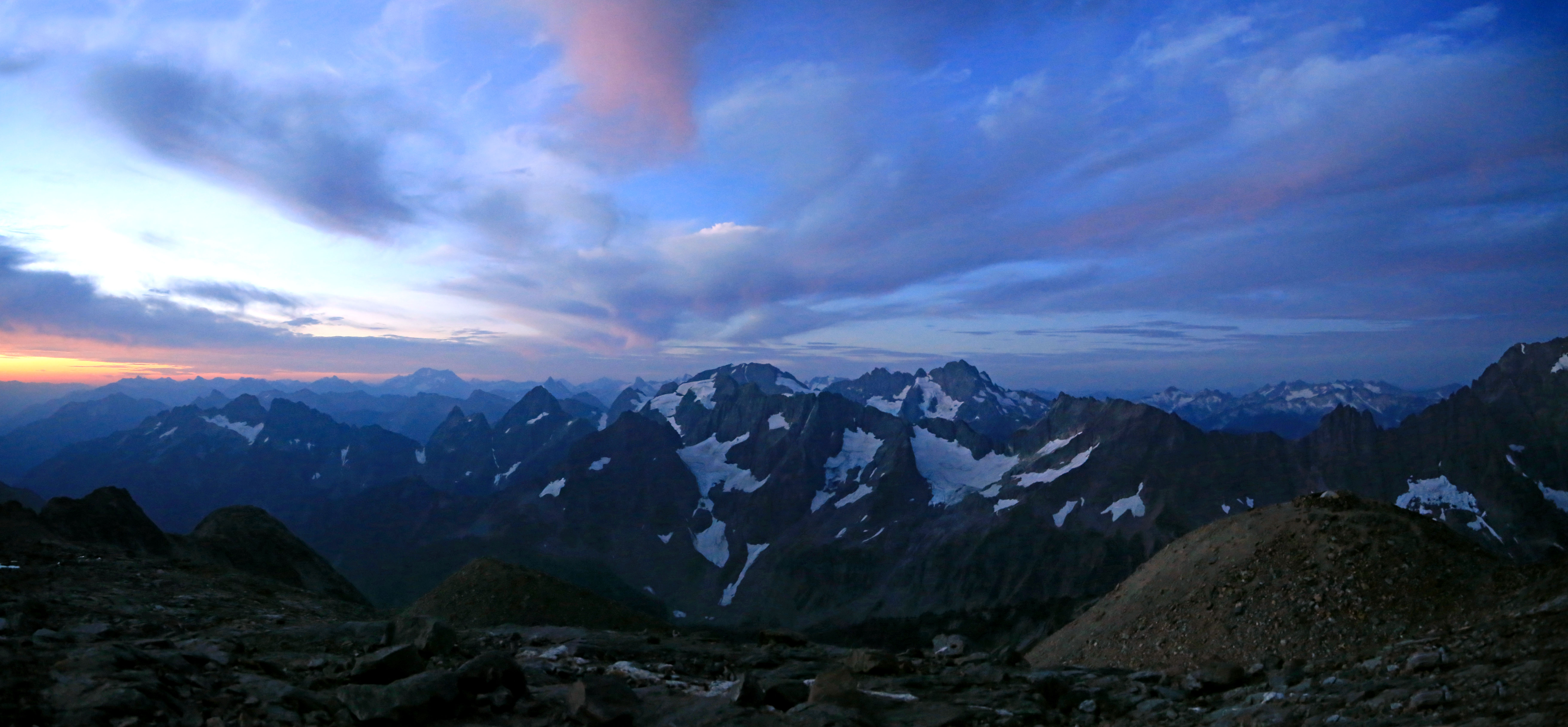
Surprisingly the weather held up and as we made the long traverse of the ridge the views were magnificent. Mount Redoubt and Bear Mountain stood out along the way.
 Copper Ridge Panorama
 Storm clouds over Mount Redoubt
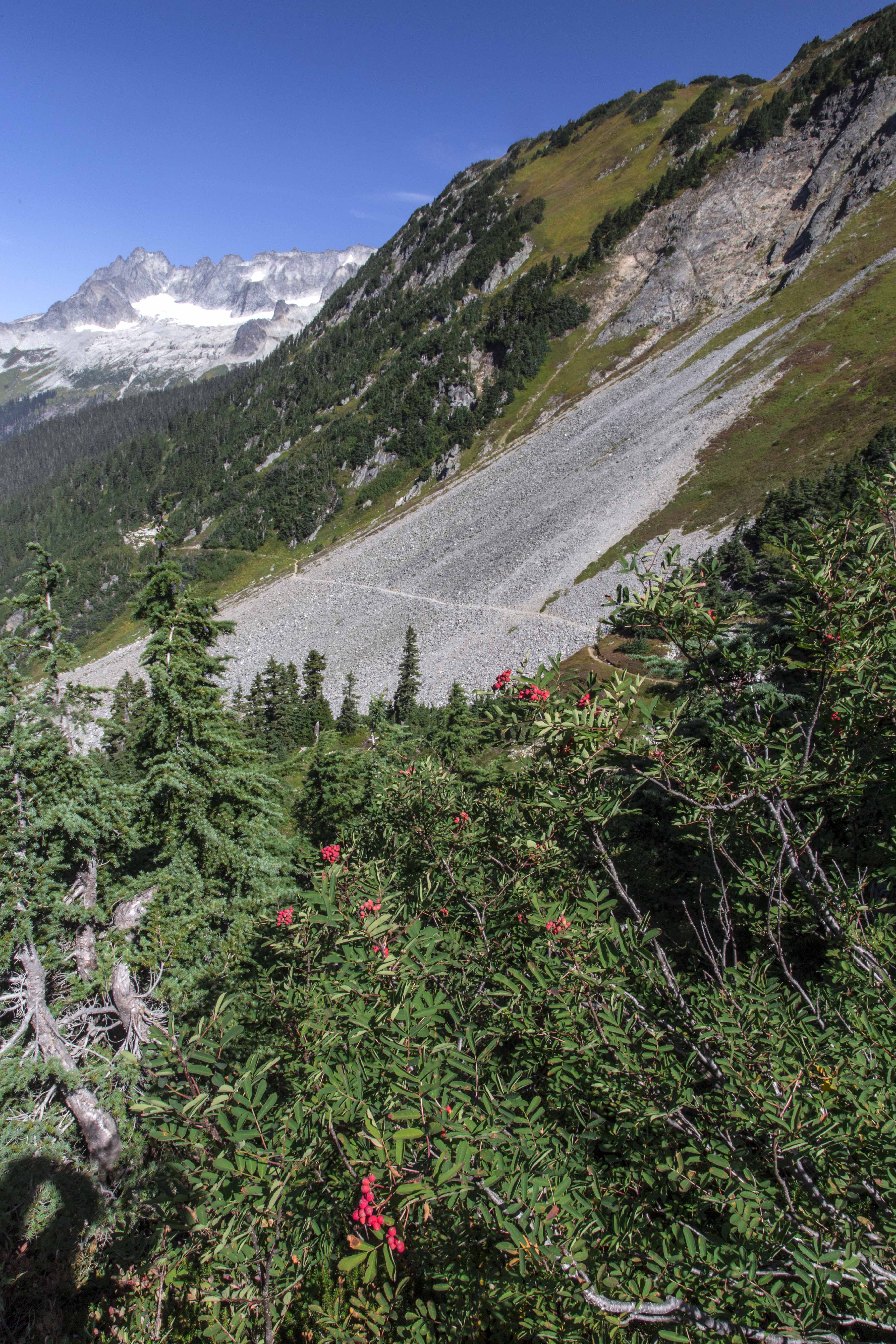
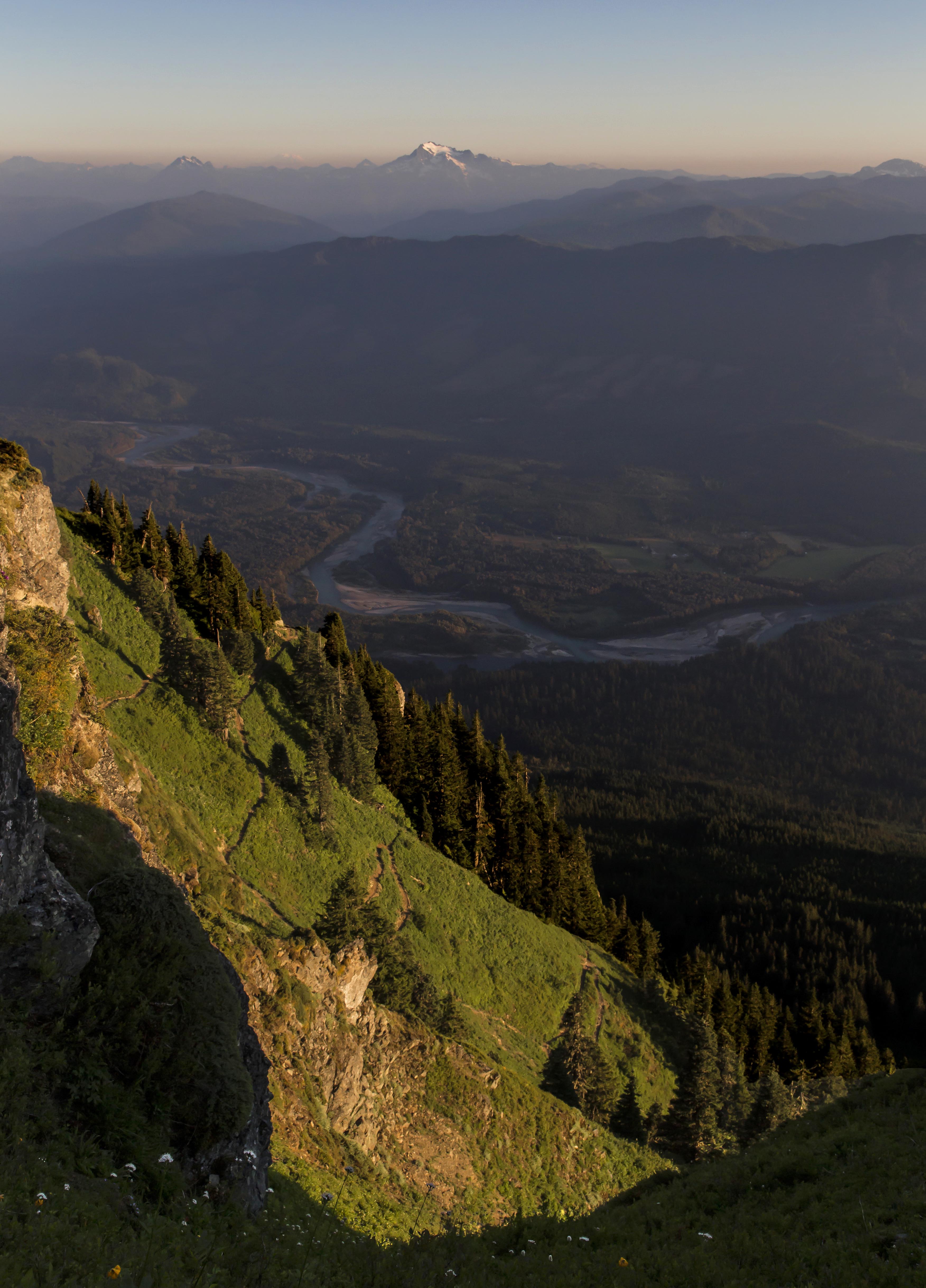
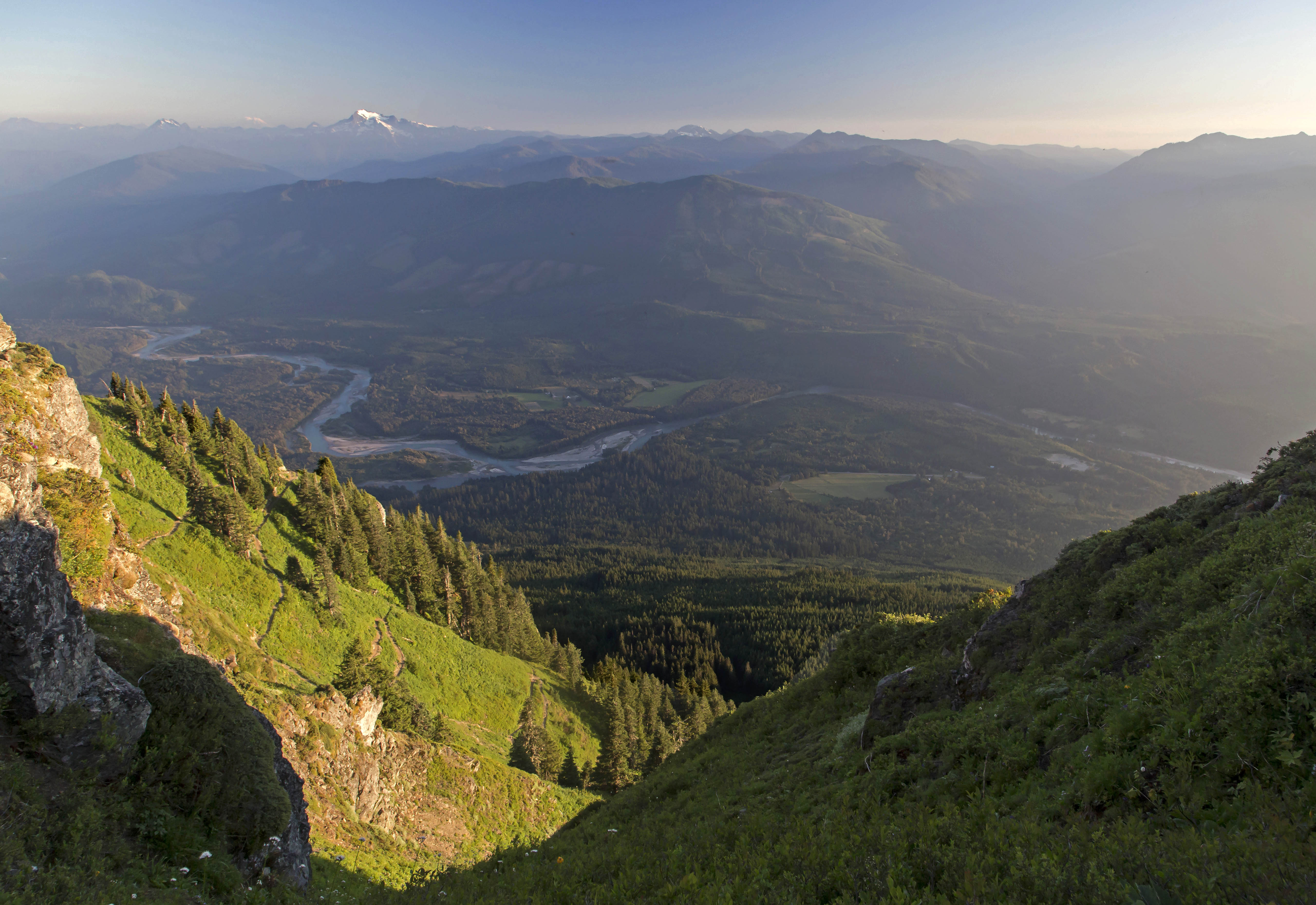
Reaching the end of the ridge we started down the long, seemingly endless series of switch backs towards the ford of the Chilliwack River and Indian Creek. The changes in the flora were dramatic as we descended from a bare forest floor carpeted with pine needles into a real rainforest, lush and green and wet.
The two channels are parallel for a short time here, first crossing the Chilliwack and then a short section of forested river bed we came at last to Indian Creek and behold, the salmon were there, spawning in great numbers. Taking off shoes and socks again we looked for a ideal spot to rest and relax to enjoy the wonder of the place. a gravel bar at the point of confluence between the two streams was a perfect place.
Indian Creek is not a big stream, maybe 80 feet across here as it spreads out along the valley floor and shallow, knee-deep with some nooks where the water is as deep as 3 to 5 feet.
 Salmon in the Creek
The salmon were there, just as before. They were not headed anywhere, the group of 70 or so simply treading water, looking happy to finally be back home.
Clambering out along logs and snags I tried to capture shots of the scene. the bright color of the fish is so impressive, they seemed to hover in the sparkling clear waters, the colorful stones looking like the ground far below while the salmon soared through the sky above.
 Flying Fish
The place is so remote, the forest envelopes you and it is like having gone back in time. Deep in that valley was like being in a different life, on a different planet.
 Indian Creek Salmon
I bounced between standing still in wonder, trying to get some food, wanting to capture images and the strong desire to do something to take care of my aching feet. About 100 feet upstream a large brown/black bear appeared along the shore. we both froze, considering each other. As I started towards the camera a sharp noise frightened him back into the forest, my dreams of imaging the bear snacking on salmon vanished…
Sunset came swiftly. reds and blues and pinks and purples painting the waters with their fantastic hues.
 Sunset at Indian Creek
Night brought even harsher weather than the night before. The crashing of thunder now muted by the deepness of our camp in the forest. I was again happily surprised to awaken to clearing skies and spent the next hour or so back in the stream with the salmon. Morning fog made the scene even more ethereal.
 Morning fog over Indian Creek
It was a struggle to pull away and start the long slog up to Whatcom Pass.
The suspension bridge above Indian Creek sways as you cross, the views up stream were captivating, the water coursing down in the dark green forest.
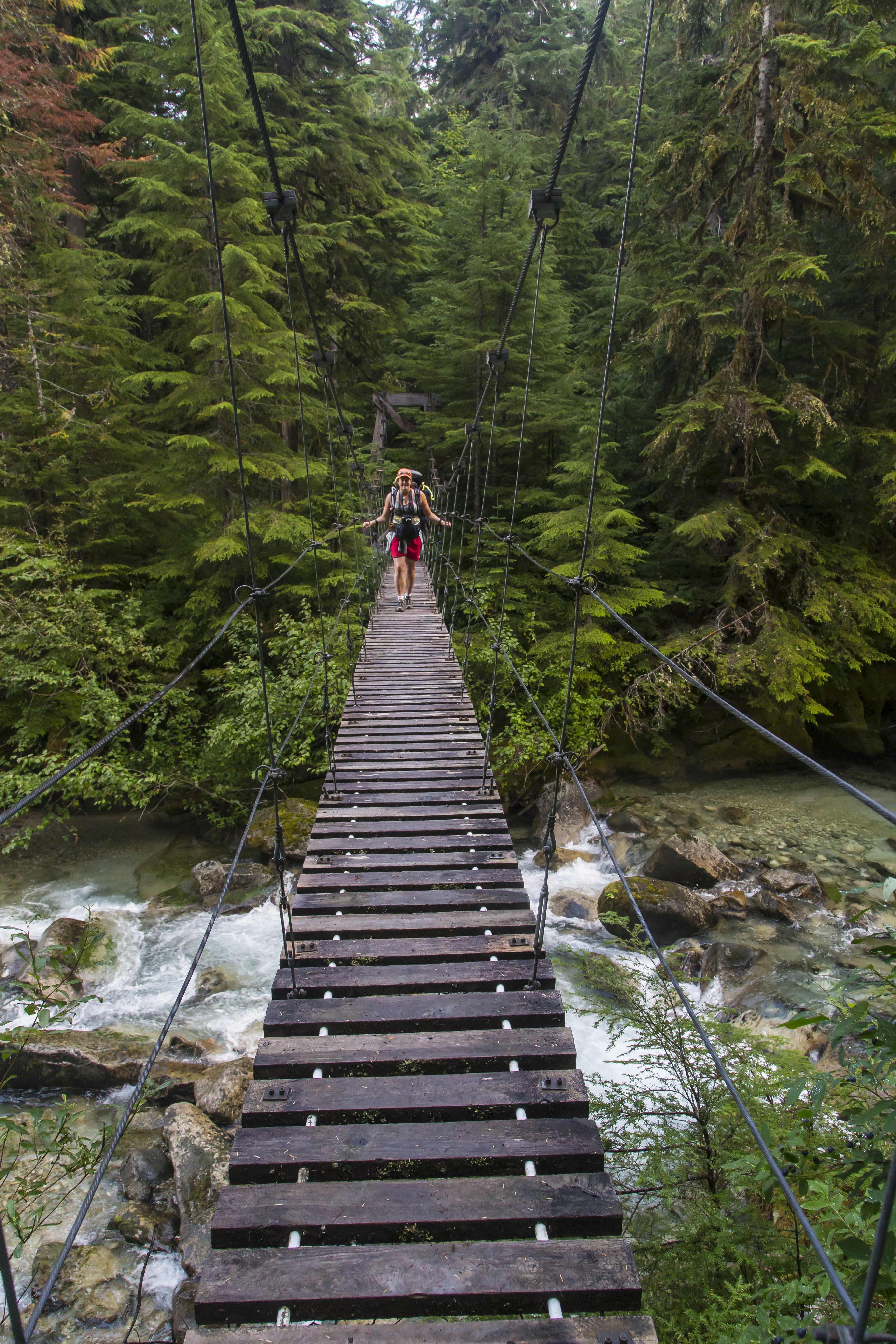 Suspension bridge over Indian Creek
 Indian Creek Waterfalls
During the days travel we encountered many people: day-hikers and mountaineers, young and old(er), lost and found. I advised one and all to make a point to take the time to go visit the salmon.
As we climbed up along Brush Creek the weather got gloomier and as we made it to the final climb at the valley head rain started. Our goal was Tapto Lakes that night, another hard 1,000 feet above the pass, but when we made it to Whatcom Camp the rains were pounding. Cold and wet we hurriedly set up the tent. Dry clothes, warm sleeping bags and hot food tend to improve the spirits quickly.
That night the storms really pounded. The tent was alight with flashes, the thunder and lightening coming simultaneously. Protected somewhat by the trees and the fact that we were a quarter mile down from the pass we lived through it, and awoke to an almost complete white out.
 Mt Challenger lost in clouds
My desire to hike another 1,000 vertical feet evaporated and I headed down the trail, back towards the Chilliwack.
Once back at the junction we’d passed the day before my path turned upstream, headed to Hannegan Pass to complete the loop. Fording the Chilliwack is now a more daunting proposition, the valley steeper and more narrow. Hikers are afforded two choices: to ford the waist-deep waters or to pull yourself across in an aerial cable-car!
 Chilliwack Cable Car
That choice was easy1 The cable car is in great shape, holding up to two backpackers (and their gear) the pulley system makes it easy to make the crossing, gliding 100 feet above the river below.
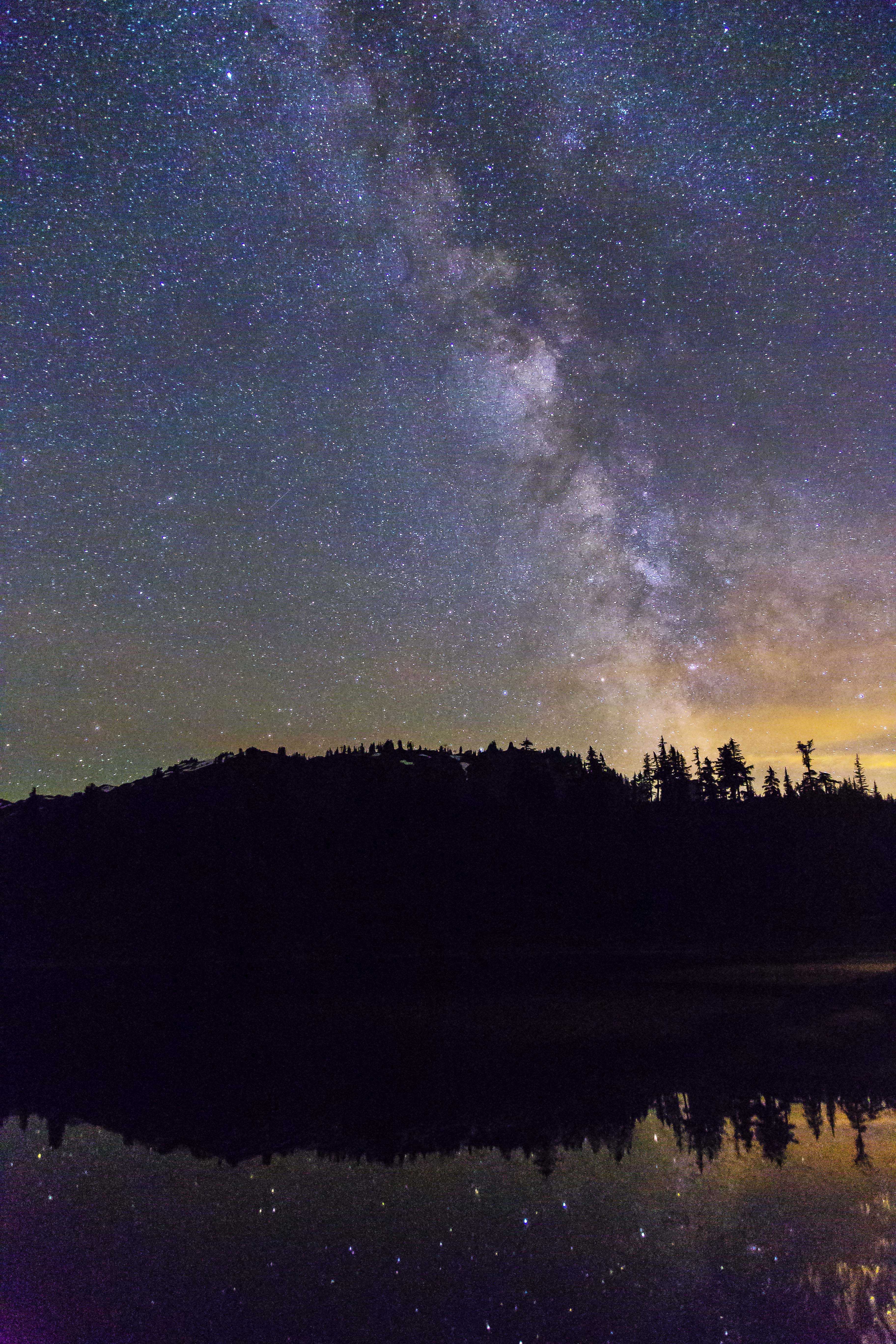
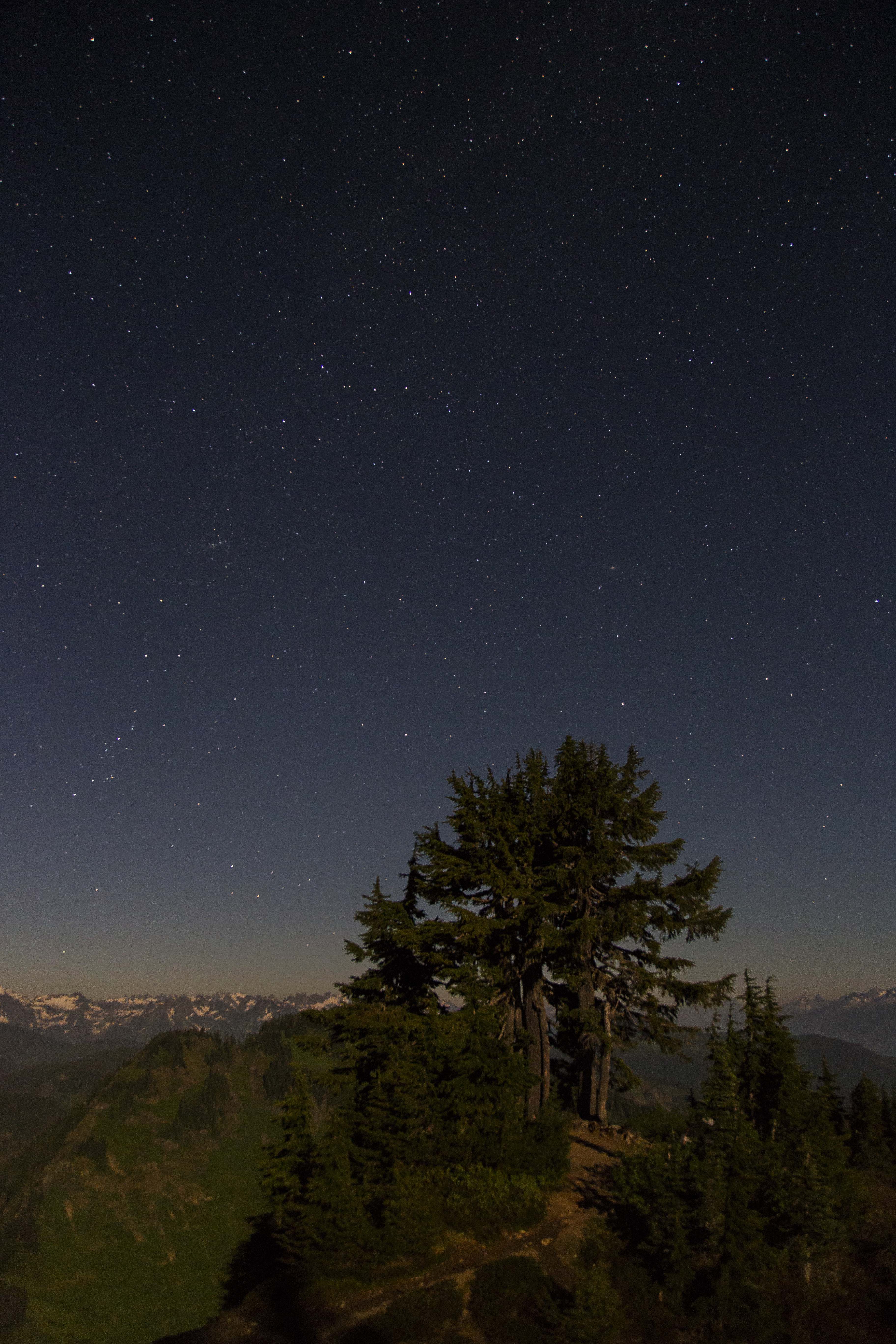
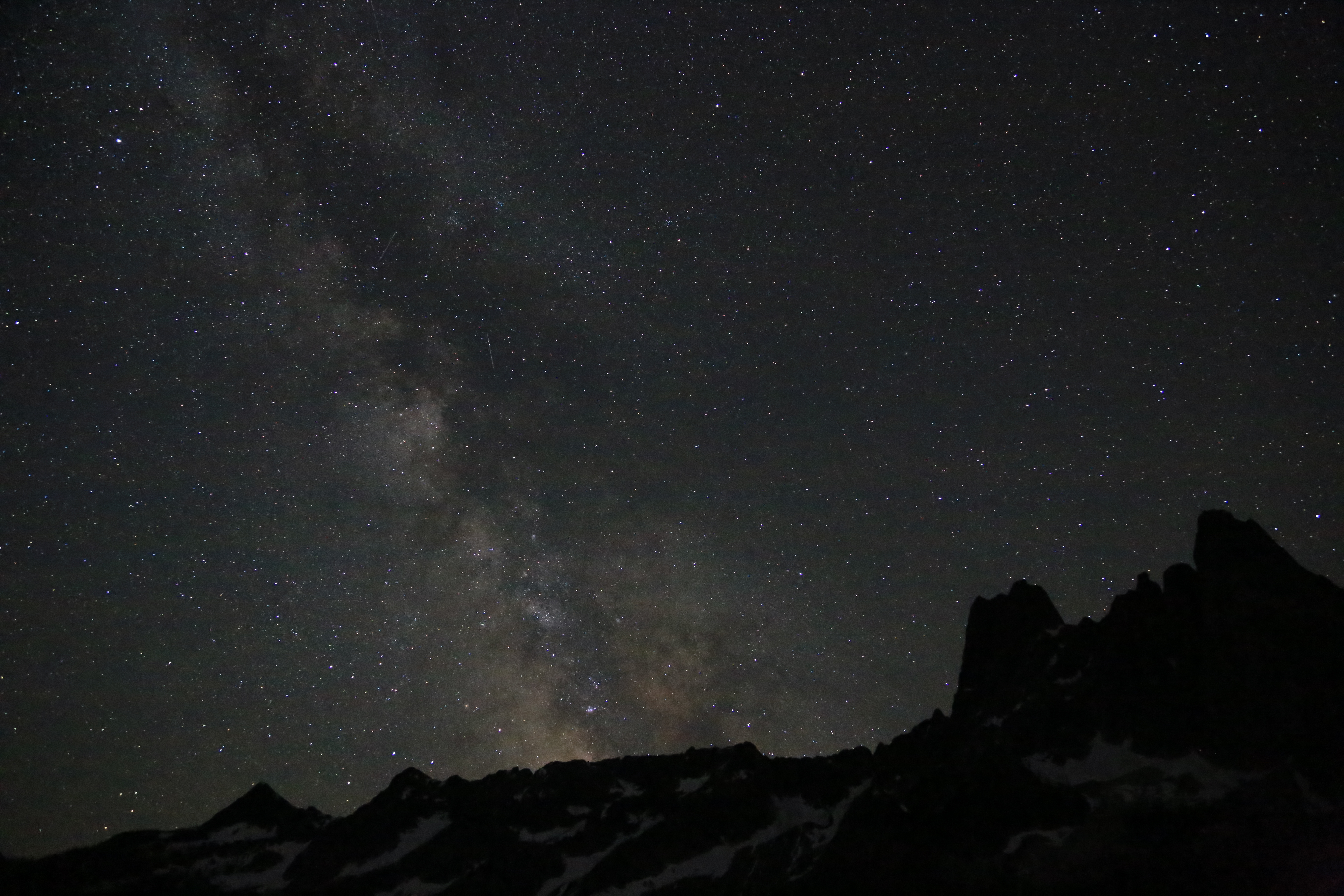
The last nights camp was at the Copper Creek camp, hoping to get a glimpse of meteors above we perched ourselves on the stones with w pie-sliced view of the heavens.
 Stars along the Chilliwack River
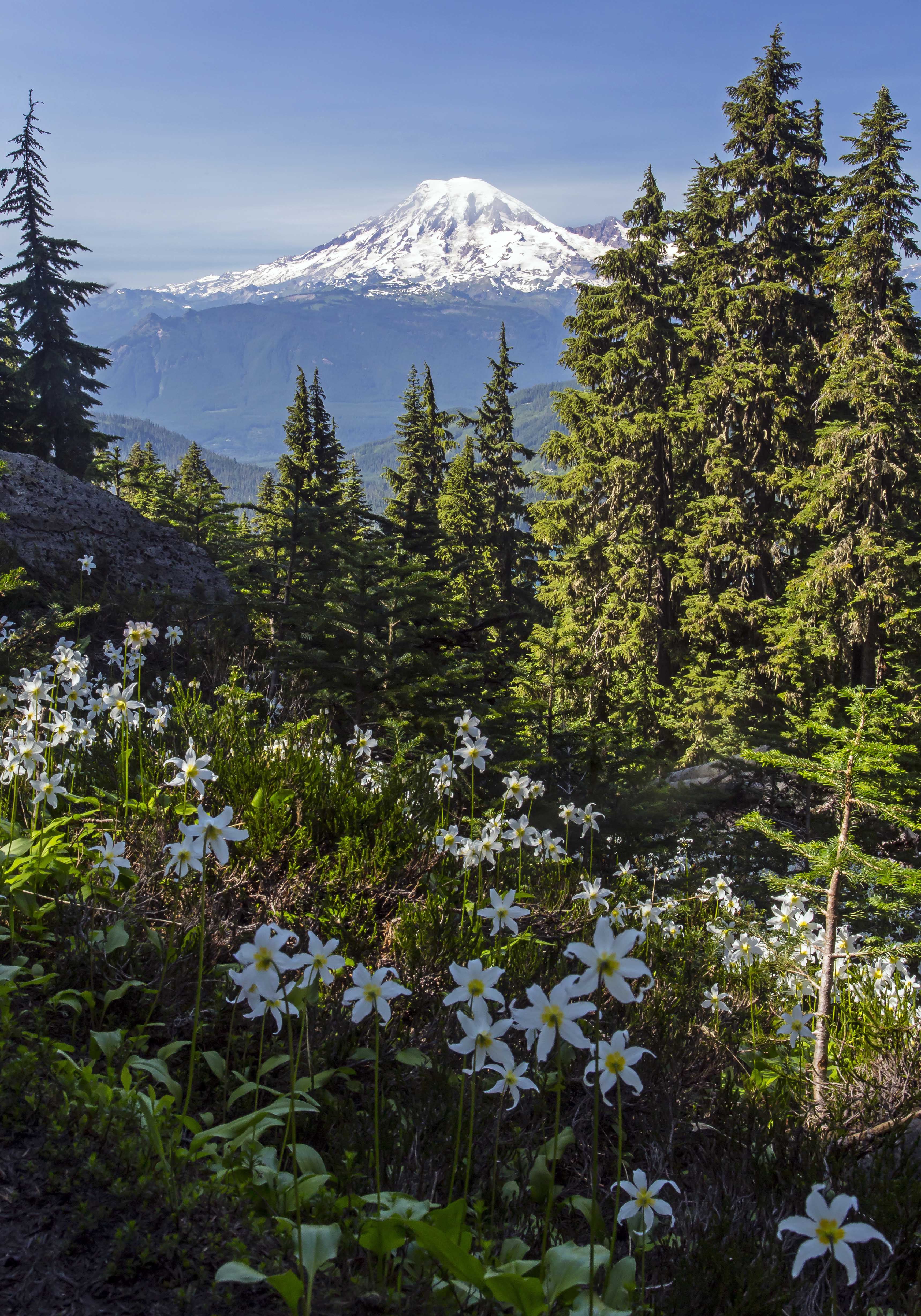
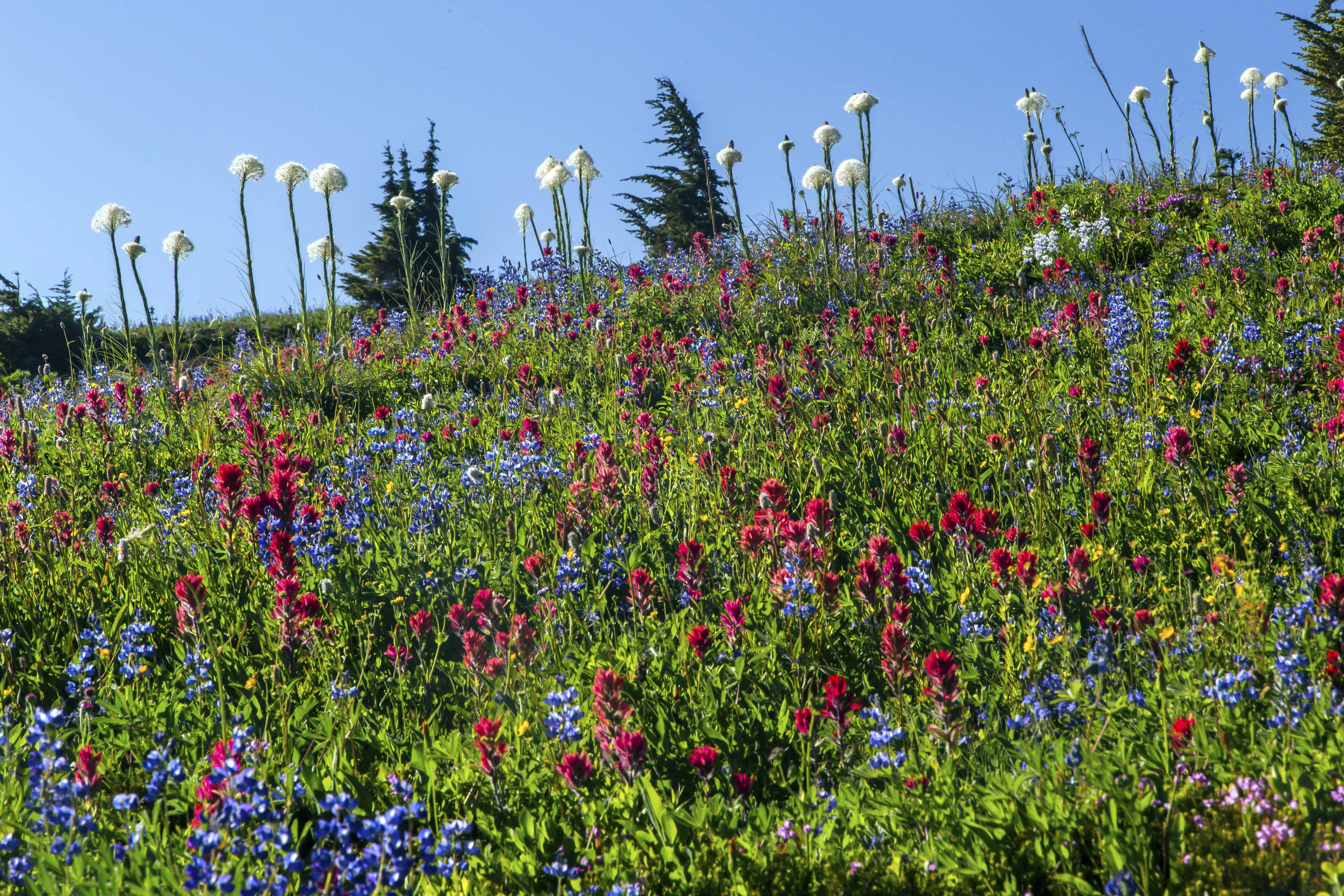
The last days hike up and over Hannegan Pass and back to the car was completed before lunch, the trails edge bordered with a carpet of herbaceous wildflowers.
As always my feelings are mixed at trips end: relief at the prospect of real food, a warm shower, soft bed and time off my throbbing feet but as we jump in the car for the drive back my heart is already longing for the cool, clear waters of the Chilliwack…
Copper Ridge Panorama
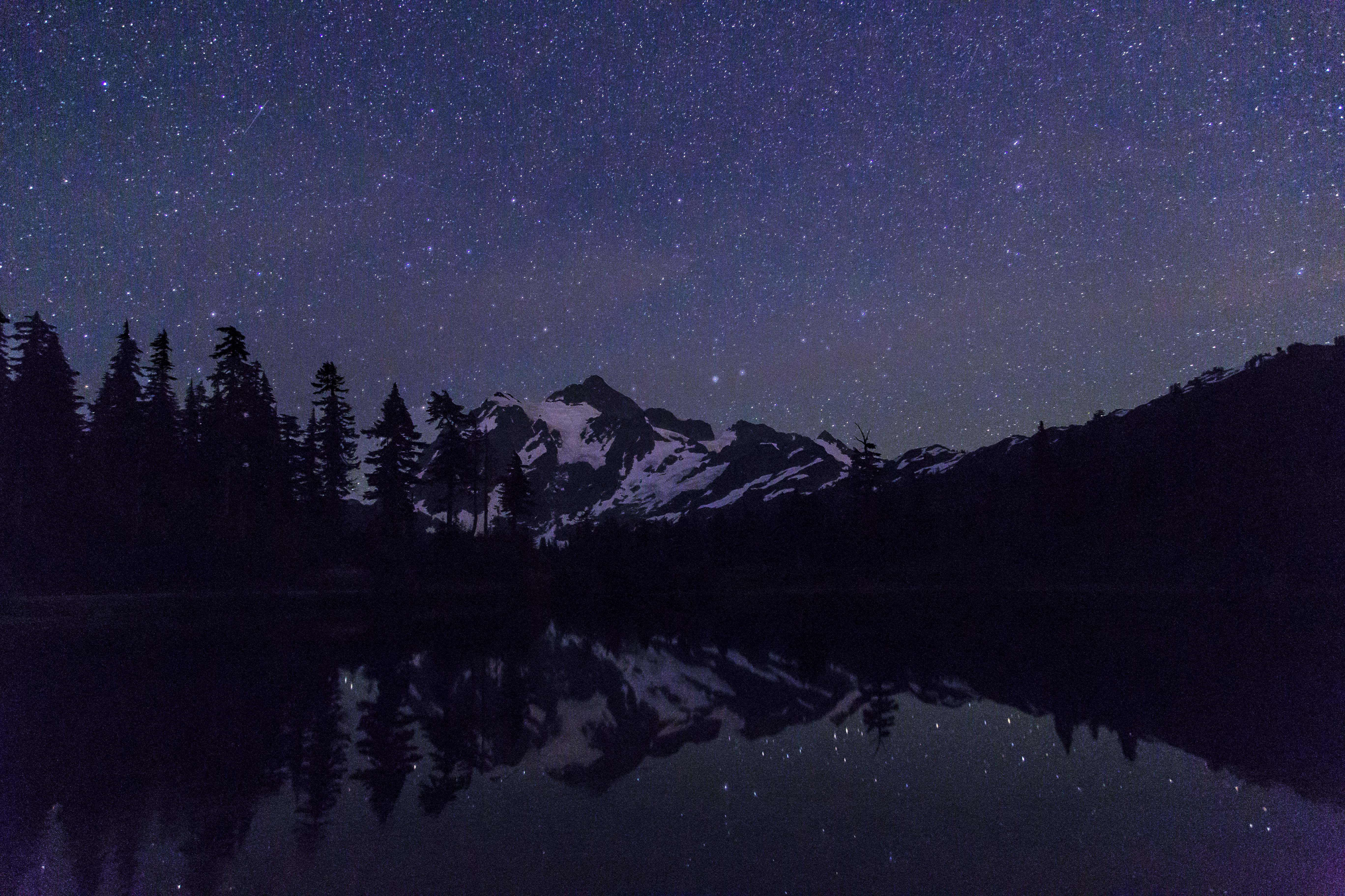
I made my way up the Mount Baker Highway to Artist Point and managed to capture a few images of the Milky Way…


The Goat Rocks Wilderness is located in South-Central Washington along the spine of the Cascades Mountains. The Goat Rocks are the remains of a volcano, their jagged peaks jutting above the forest. With Mount Adams to the south and Mount Rainier to the north, the views are always awesome!
July brings snow melt and wildflowers. The wilderness is easy to access, camp sites abound and no permits are needed! Here are a few pictures!


Sauk Mountain rises more than 5,000 feet about the lower reaches of Skagit Valley. It’s nearness to the North Cascades Highway makes it a popular day hike. All of the times I’ve been there before its been partly couldy at best but I saw enough to know that it would afford great views at sunset. So, on Thursday I made my way up and captured these images of the sweet light over the Skagit River and valley…


I have been working on nighttime imaging for a while, trying different exposures and post-capture processing.
This image was one of my first attempts. I hiked in to a location with very little ambient light, actually I went there to capture meteor images last August. I shot this at f3.5 at 30 sec and 800 ISO, using a Canon t2i and an 15-85mm lens. I tried using various settings of ISO, but had the idea that I should not get much above 800-1200iso. 
The image was shot in the RAW format, opening it in Photoshop I made several changes:
The noise reduction and sharpening was used heavily to reduce the graininess
Lens distortion correction
Fill light was used to brighten the image and Recovery to decrease the brightness on the tent
Vibrance, Clarity and Contrast were also significantly increased.
I saved the image as a jpeg and opened it in PS (I was using CS5 for this image) and went on to select the sky, and using Levels brought out the contrast by moving the slider to the right (to the start of the peak) and to the left down to 220. here is the result:

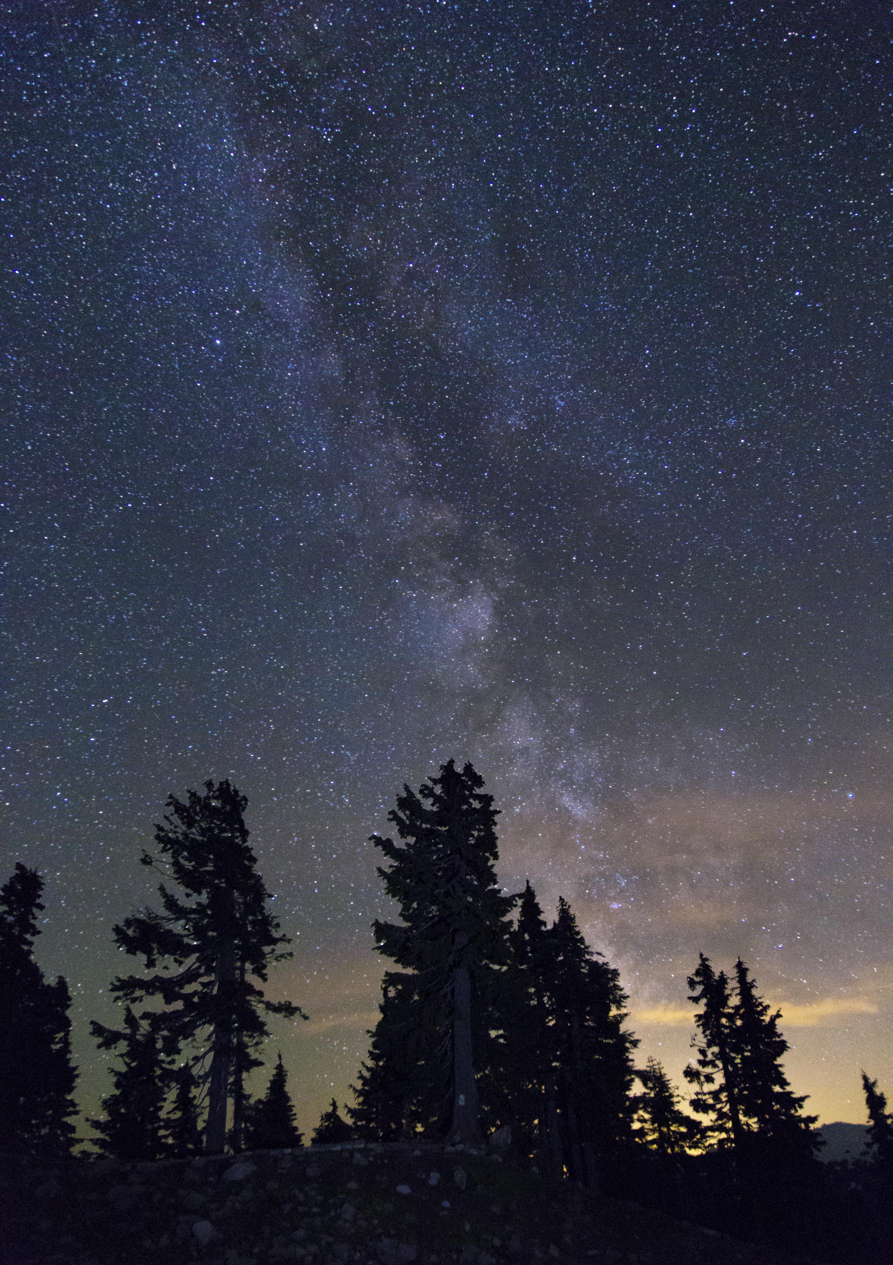
This year I got myself a new Canon 6D and went to Washington Pass, along the North Cascades Highway to take pictures. I was careful to choose a night with clear skies and very little moon.
This image was shot at 8sec, f4.0 and 25,600 iso. There is a setting on the camera for “High ISO Noise Reduction” and I set this to high. I tried to keep the shutter speed low, 10 sec or less, to make sure there was no blur from movement of the earth, etc.
Again, I shot this in the RAW format. Photoshop CS5 was not able to open the RAW images I shot with the new Canon 6D, so I had to upgrade to CS 6…
Here are the basic modifications made to the RAW image:
The sharpening was used heavily, BUT no Noise Reduction
Lens distortion correction
I increased Vibrance, Saturation and Highlights
Here is the result:

Going back to the image later I felt that there was still to much graininess and so I went back to the RAW image and greatly increased the Noise Reduction, then I saved the image as a jpeg and opened it in PS (I was using CS6 for this image) and went on to select the sky, and using Levels brought out the contrast by moving the slider to the right (to the start of the peak) and to the left down to 220. Here is the result:

I am much more satisfied with the version.
Please feel free to let me know which variation you like the most, and if you can, why!
And if you have any ideas, tips or suggestions, I am very interested.
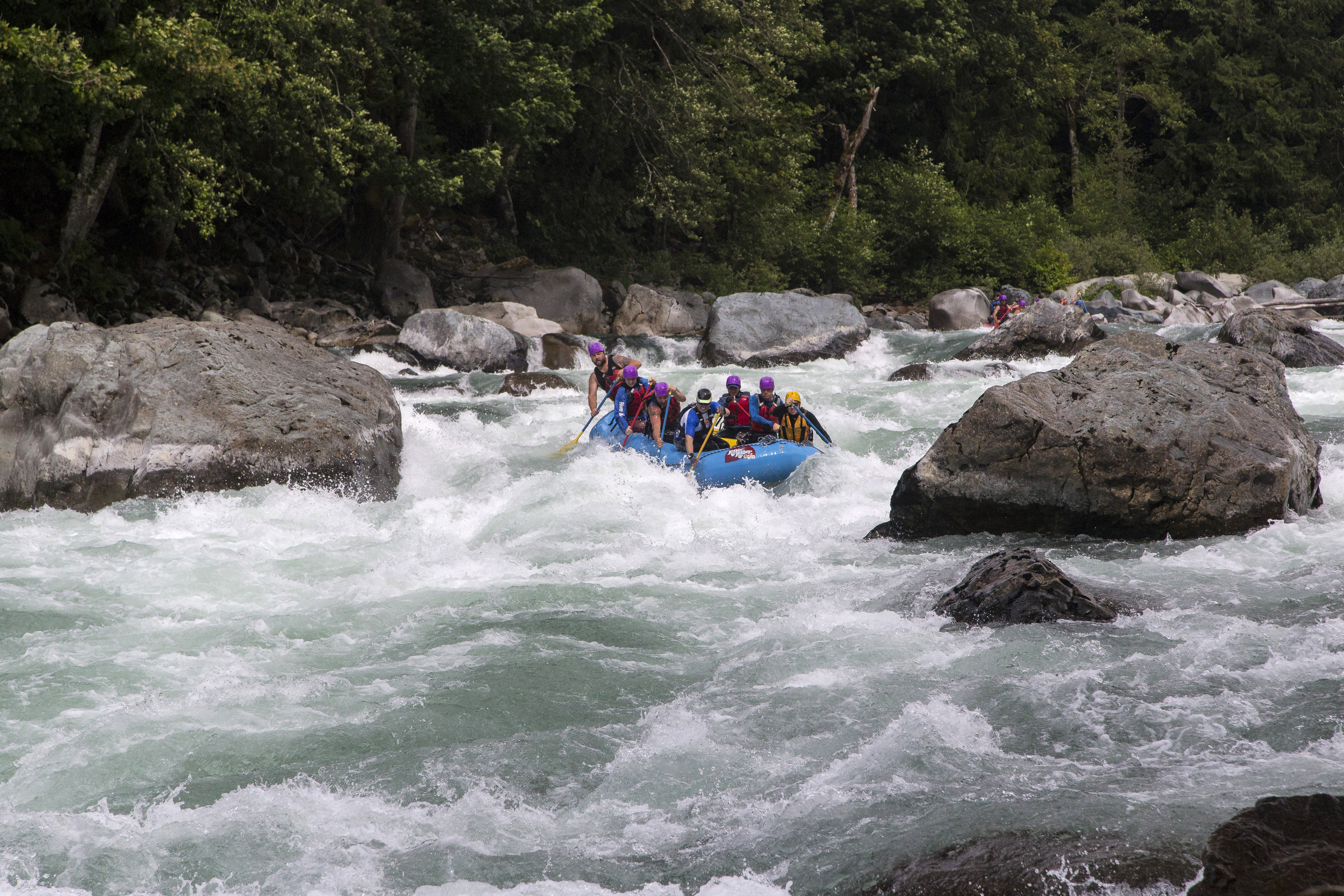
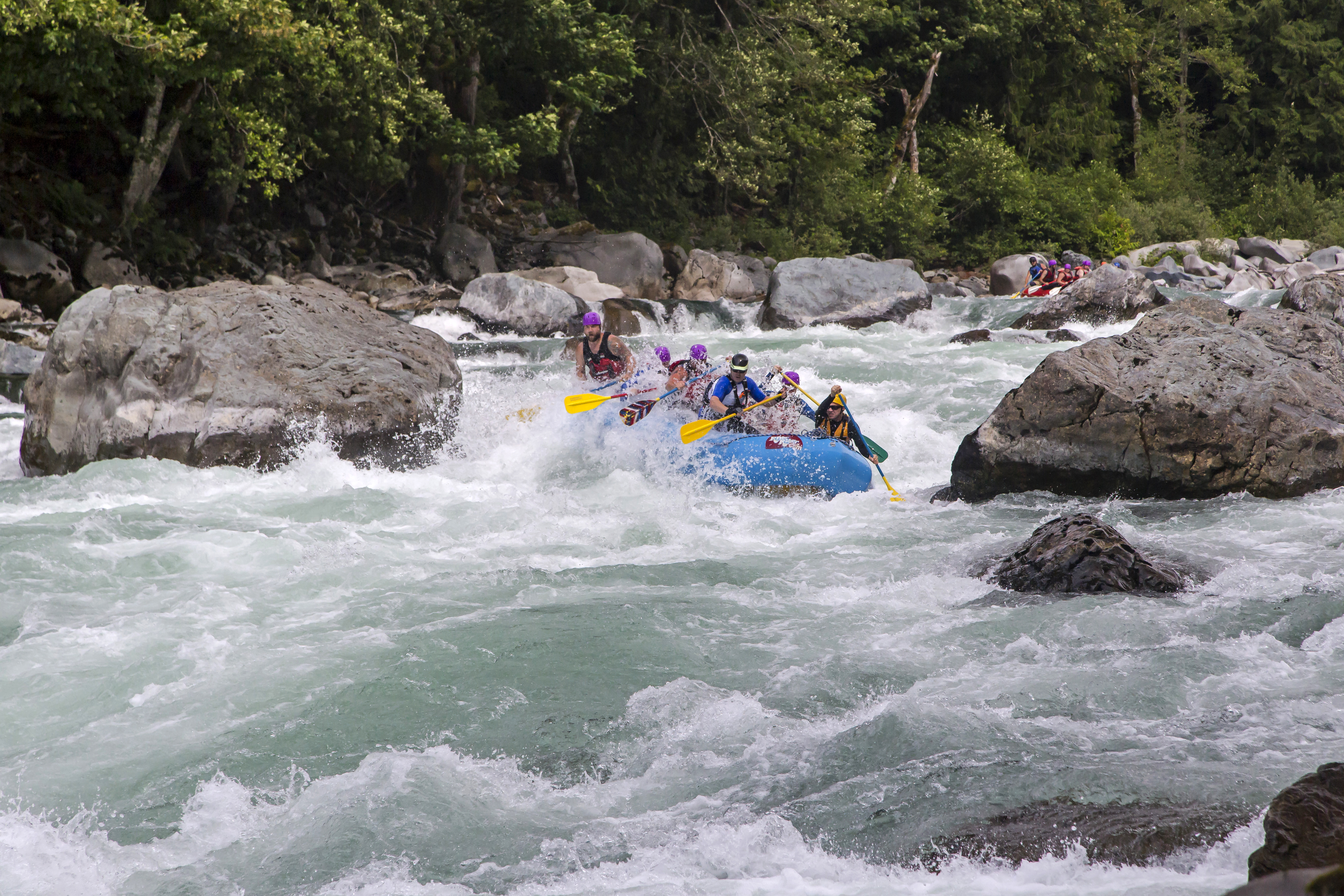
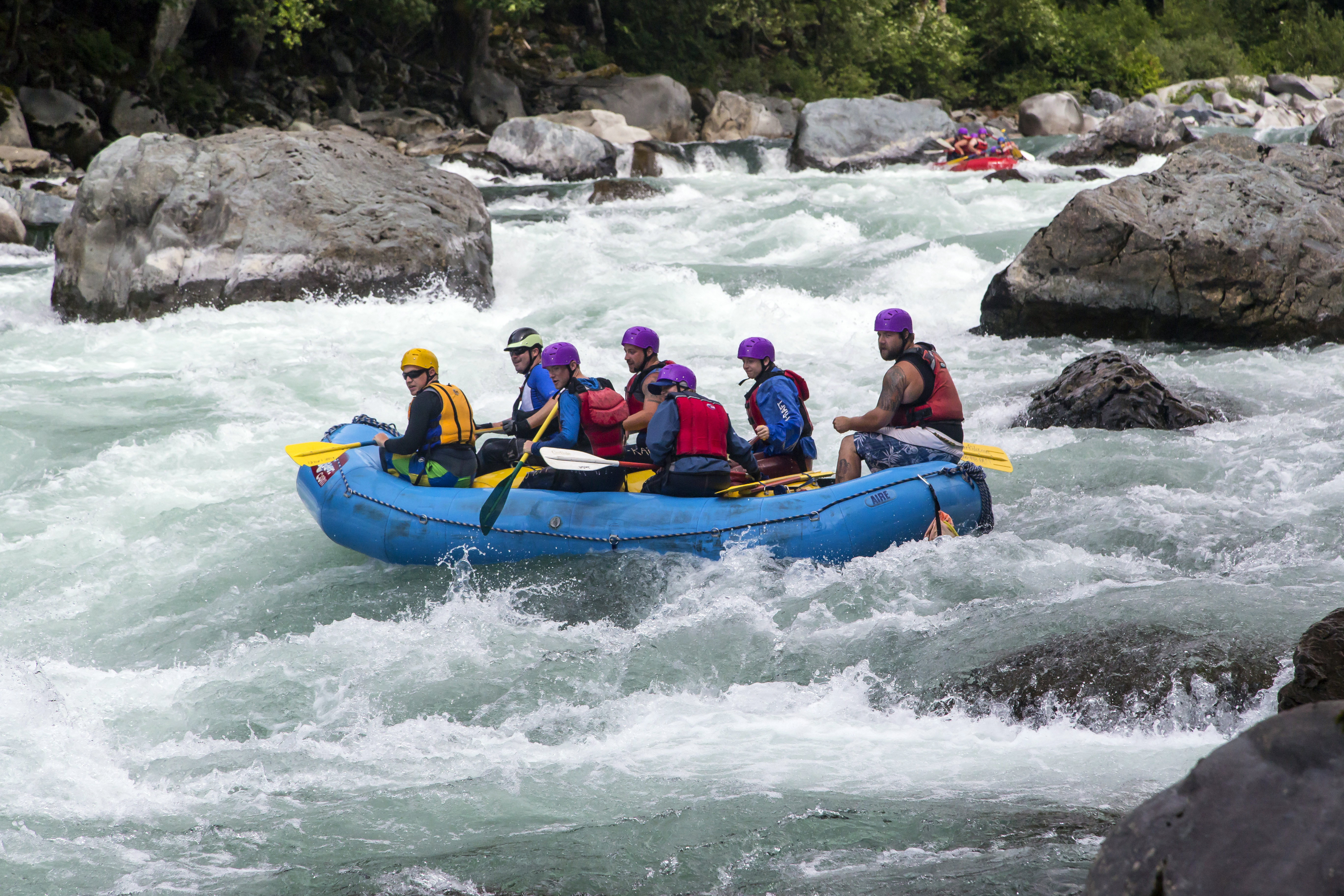
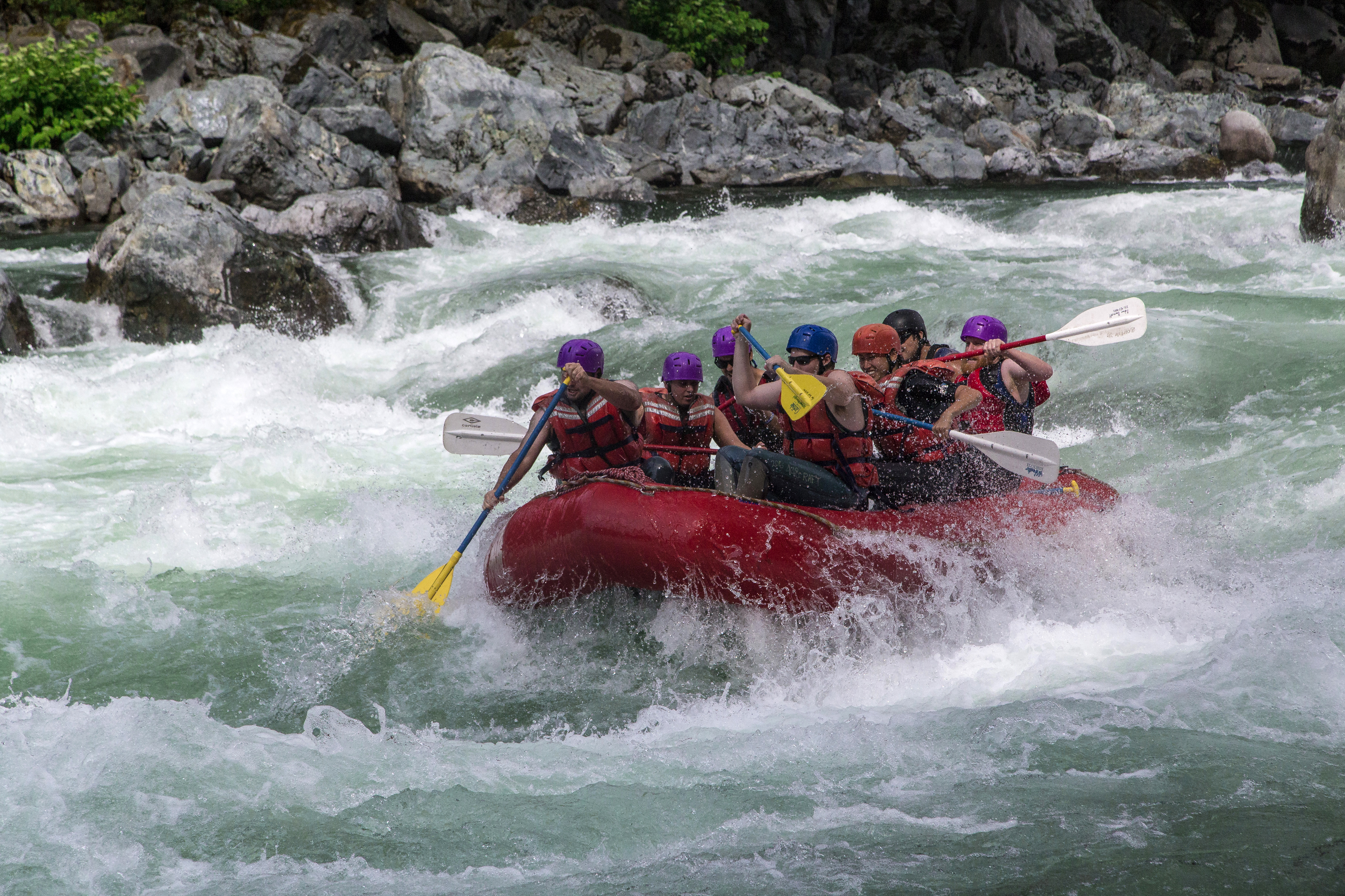
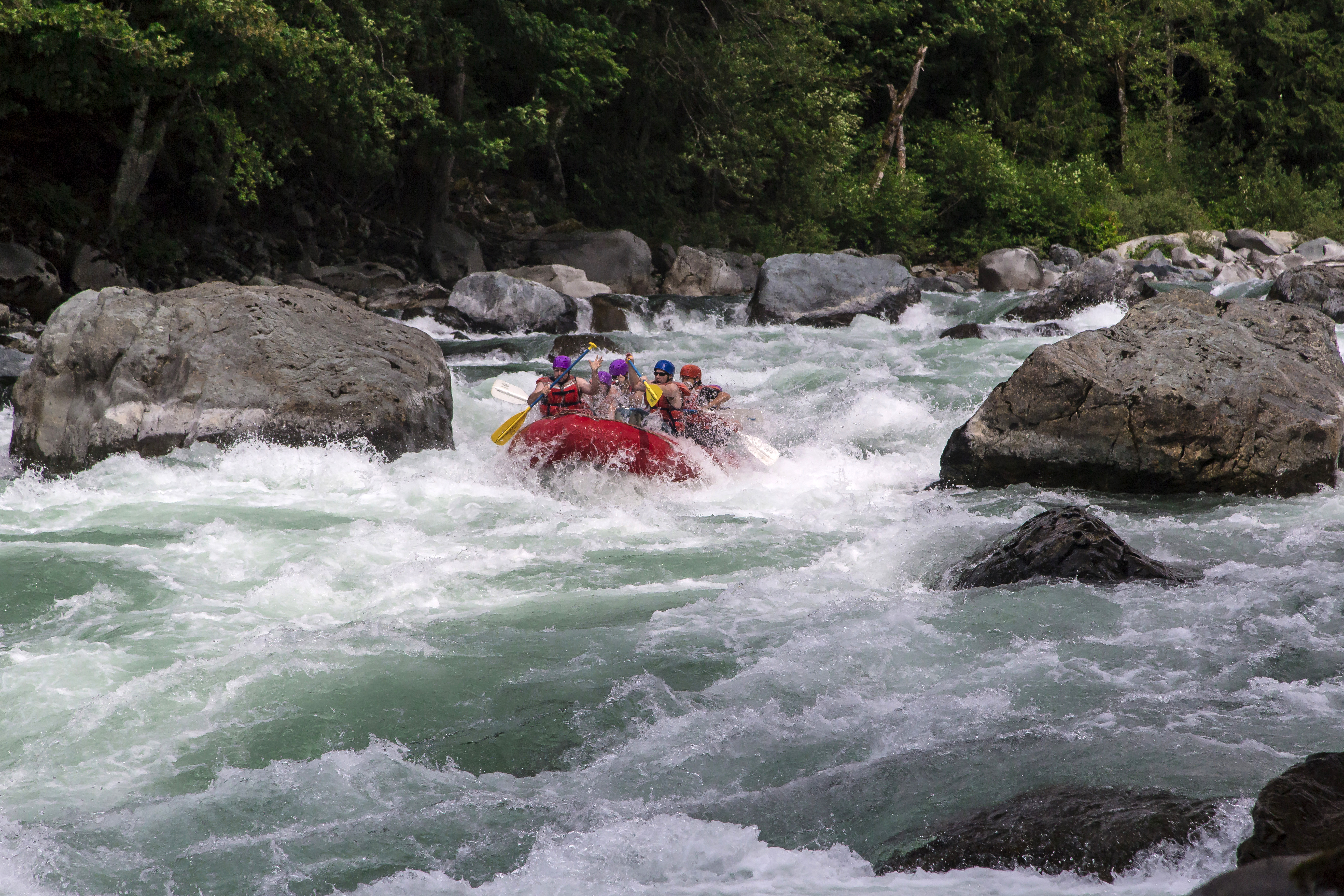
Boulder Drop is a Class V rapid on the Skykomish River. Located at mile marker 34 on Highway 2, east of Everett these rapids provide excitement and fun photo opportunities, as you can see here! I captured these images last Sunday (07/07/13) while on assignment at the Sky River Fest in Index…