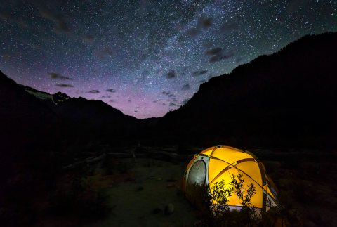
Diablo Overlook Night Sky

Last night I was leading a Night Sky Photography Class at the North Cascades Institute.

The class went very well, due in major part to the clear skies we were lucky enough to have.

I spent most of my time advising and helping people get their settings right and compose images, but I did manage to get a few cool images as well.

Diablo Dam January 2016

This image is of Diablo Lake and Ross Dam. The snow in the foreground adds a nice balance to the image.

As I awaited the students to return to the vans for the ride back to NCI I wandered out towards the highway and saw a sign for the Cascade Loop Scenic Highway.

Cascade Loop - Diablo Overlook

This and the road and starry sky presented a wonderful opportunity.

I lead Night Sky Photo Tours each month, when there is no moon. This link gives the dates for each month this year (through September) as well as other details and a way to register for your own adventure!

Night Sky and North Cascades Photo Tours are available for anyone. We can arrange to do a Drive-In tour, where we stop along the North Cascades Highway of the Mount Baker Highway to capture images, OR we can arrange hiking tours (both day hikes and overnights) to more remote locations in the North Cascades as well.

And lastly, spring is not too far off! Book your self a Skagit Valley Tulip Photo Tour!

North Fork Bridge Creek

North Fork Bridge Creek Waterfall and Mount Logan, North Cascades National Park 2015The North Fork Bridge Creek Trail is one of the most scenic trails in the North Cascades National Park.

Goode Mountain, North Cascades National Park

Goode Mountain, North Cascades National Park

Winding its way up the valley towards North Fork Meadows you will see fantastic views of Goode Mountain, the highest peak in the North Cascades National Park at 9,220 feet, rising over 6,000 feet from its footings, and almost 7,000 feet from the bottom of Bridge creek valley.

Sign to North Fork MeadowsThe often brushy trail is 7 miles long and gains about 1,700 feet from start to end. To get there hike 10 miles south on the Pacific Crest Trail from Highway 20 .

You’ll ford Grizzly Creek and then break out into the open with views like this one. North Fork MeadowsTo purchase prints of these images (as well as other stunning images of the North Cascades, visit our Photo Gallery.

Following the creek up towards the head of the valley into North Fork Meadows, Mount Logan looms above.

The lush green swards are filled with flowers, as well as hordes of flies in July and early August and often there are bears foraging along your way. Bear on the PCT Bear at Horseshoe Basin

No matter what the weather, you’ll get wet pushing through the brush.

Seven miles from the junction, the North Fork Trail ends at the base of a fantastic waterfall with Mount Logan as a spectacular back drop.

Camping is available at Grizzly Creek and Walker Park.

Or you can camp at the North Fork Camp, located at the trail Junction of the PCT and North Fork Trail.

If you would like information about a North Cascades Photo Tour, here is the place to start!


50% OFF NOVEMBER SALE

I am offering a special 50% OFF discount on all Canvas Wrapped Prints and Fine Art Prints.

Simply visit the Gallery Page (here) scroll through the images, find your favorite(s) click the image to see the sizes and options available and go to check out. Then enter the coupon code: NOVEMBER and you’ll receive 50% your entire order!!!!

SALE ENDS NOVEMBER 24th AT MIDNIGHT!
Winchester Lookout 3

We have recently expanded the options for Canvas Wrapped Prints.

New Product: Premium Canvas Wrap –

Try our newest canvas product! This 1.25 inch thick wrapped canvas is warp resistant.

  • Patented Lightweight Construction
  • Museum-Quality Canvas
  • Black Matboard Backing
  • Hanging Hardware

This new Premium Wrap product is available UP TO the 24″ x 36″ size.

Premium Wrap

Premium Wrap

Premium Wrap - Backing

Premium Wrap – Backing


New Size: Prints and wraps (But not Premium Wraps)are now available in the 40″ x 60″ size!


Baker River Trail – Fall Colors

The Baker River Trail is at its best in the fall. The cool, clean, crisp air refresh your mind while the bright colors enliven the soul.

The trail is easy to get to, just follow the Baker Lake Road north from Highway 20 to its end (You need a NW Forest Pass to park). The trail starts right there and meanders along the west side of the river. The leaves on the ground create a magic carpet for your feet.

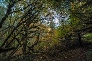
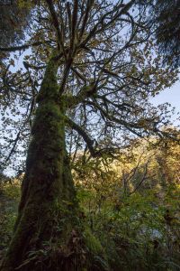
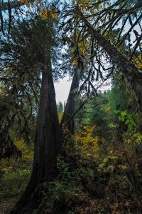
You’ll pass some huge grand trees, actually not just trees but patriarchs of the forest, old wise creatures standing guard over the River.

After only a quarter mile there is a suspension bridge spanning the azure waters. Go out on the span for wonderful views downstream as the river bends and the late afternoon light illuminates the colors on the east bank.

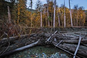
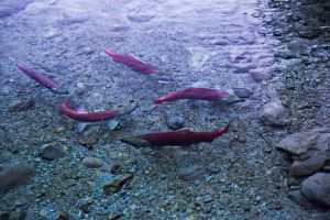
Continuing along your path the trail approaches the river at several points where you can easily scramble down 5 or 6 feet of embankment out on to gravel bars affording magnificent views of the wild river. Fall brings salmon to spawn and you can see their bright red bodies darting and splashing.

But don’t take my word for it, go see for yourself!

If you’d like to go on a Guided Fall Photo Tour, here are all the details!

Stars, Tent and Kids

Here is another shot from the other night along the Baker River.

Camped under the Milky Way 3

Camped under the Milky Way 3

I had in my mind several images, planning and scheming as we hiked in, having the kids in the tent illuminated with the I-Pad, having them look out of the tent, in awe at the stars.

Here is the i-pad shot. Not too bad! A little overexposed on the face of the kid (Dawson) holding the device.

Then I tried an image with them looking out of the tent. I used the red light function on my head lamp to illuminate their faces and this is what I got:

IMG_8179At first I didn’t even try to edit it, it looked so red.

But later I decided to give it a try. I edited (in photoshop, as a raw file) the foreground, then went back and edited the raw a second time, but edited just the sky.

Then I merged the two and did final editing.

That’s Joe on the left, wrapped in the sleeping bag. And my son, Max is the incredulous one on the right!

Not too bad!

I guess I’ll have to take the kids camping more often!

Looking at the stars

Looking at the stars

Isolation Lake, Enchantments Alpine Lakes Wilderness

Isolation Lake is the first or last lake you visit on your trip into the Enchantment Basin, depending upon which direction you are hiking the loop.

Campers along Isolation's shore

Campers along Isolation’s shore

If you managed to hike up Aasgard Pass (more than 2,000 ft. elevation gain in less that a mile) than its your first.

Camped at Isolation Lake, Enchantments, Alpine Lakes Wilderness

Camped at Isolation Lake, Enchantments, Alpine Lakes Wilderness

Isolation Lake Panorama

Isolation Lake Panorama

If took the long route past Snowy Lake, then Isolation will be your last lake in the high country before heading down and out.
But either way, its a fantastic place.

Isolation Lake

Isolation Lake

High above timber line it is a world of rocks and ice.

Isolation Lake, Enchantments

Isolation Lake, Enchantments

Blue, gray and white are the colors here.
The air is crisp, sharp, clean.
A meadow is nearby with a small copse of larch hiding the toilet.

Isolation Lake

Isolation Lake

Sunset brings new colors, reds and orange, magenta and violet.

Isolation Lake

Isolation Lake


Later the stars appear.

Prints are available here!

Camped at Isolation

Camped at Isolation

Dome in a moon scape

Dome in a moon scape

Isolation is a world of wonder.