North Cascades Photography – Hike to Stehekin
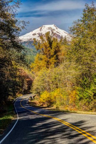
Along Cascade River Road
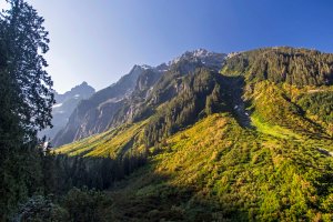
The hike from the Skagit Valley up and over Cascade Pass and down along the river to the remote village of Stehekin, on the northern shore of Lake Chelan is a magnificent journey. Sort of like crossing the Misty Mountains to get to Rivendell, there is a lot to see!
It is a 23 mile (37 km) hike from the Cascade Pass parking lot to High Bridge, where shuttle service is available to Stehekin. The entire trip falls with in the North Cascades National Park. Depending upon your level of motivation the basic trip can be done in 2 or 3 days.
However I would recommend 3 or 4 days for the trip. There are several detours along the way that are really to incredible to miss.
The journey starts along the Cascade Loop Highway in Marblemount. The North Cascades National Park Wilderness Information Center is located there. To camp anywhere in the park you need a permit. Here is all you need to know to obtain one! I highly recommend the trail guide: “Hiking the North Cascades” by Erik Molvar (Falcon Press). There are accurate and detailed descriptions of the trails and you’ll find a lot of useful info.
Once that’s all done you’ll be heading up the Cascade River Road to its end, at the parking lot for Cascade Pass. The road gets a bit sketchy at the end, and you wont be able to stop gawking at the views!
-

-
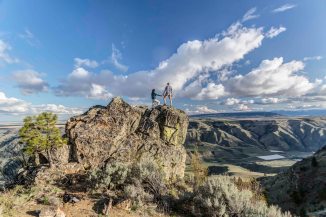
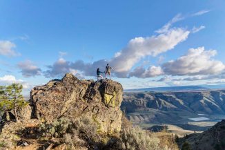
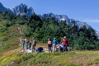
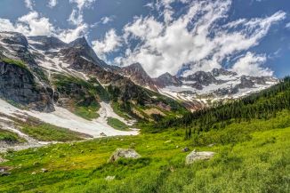
Cascade Pass
-
-
Cascade Pass
-
-
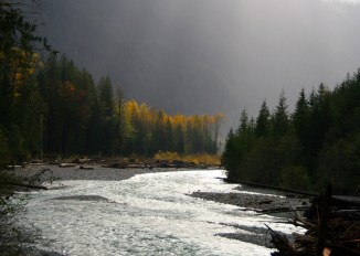
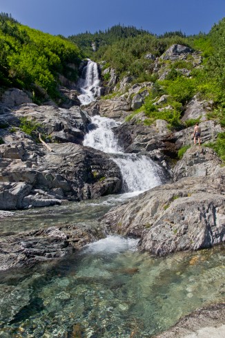
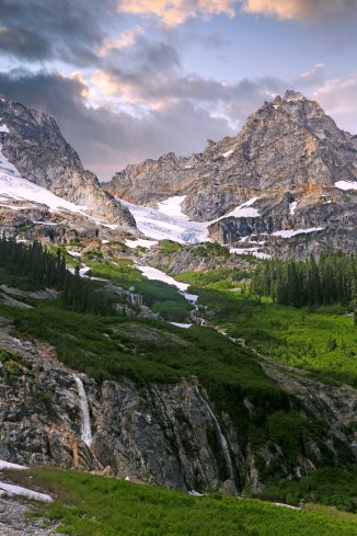
Doubtful Creek
-
-
Doubtful Creek
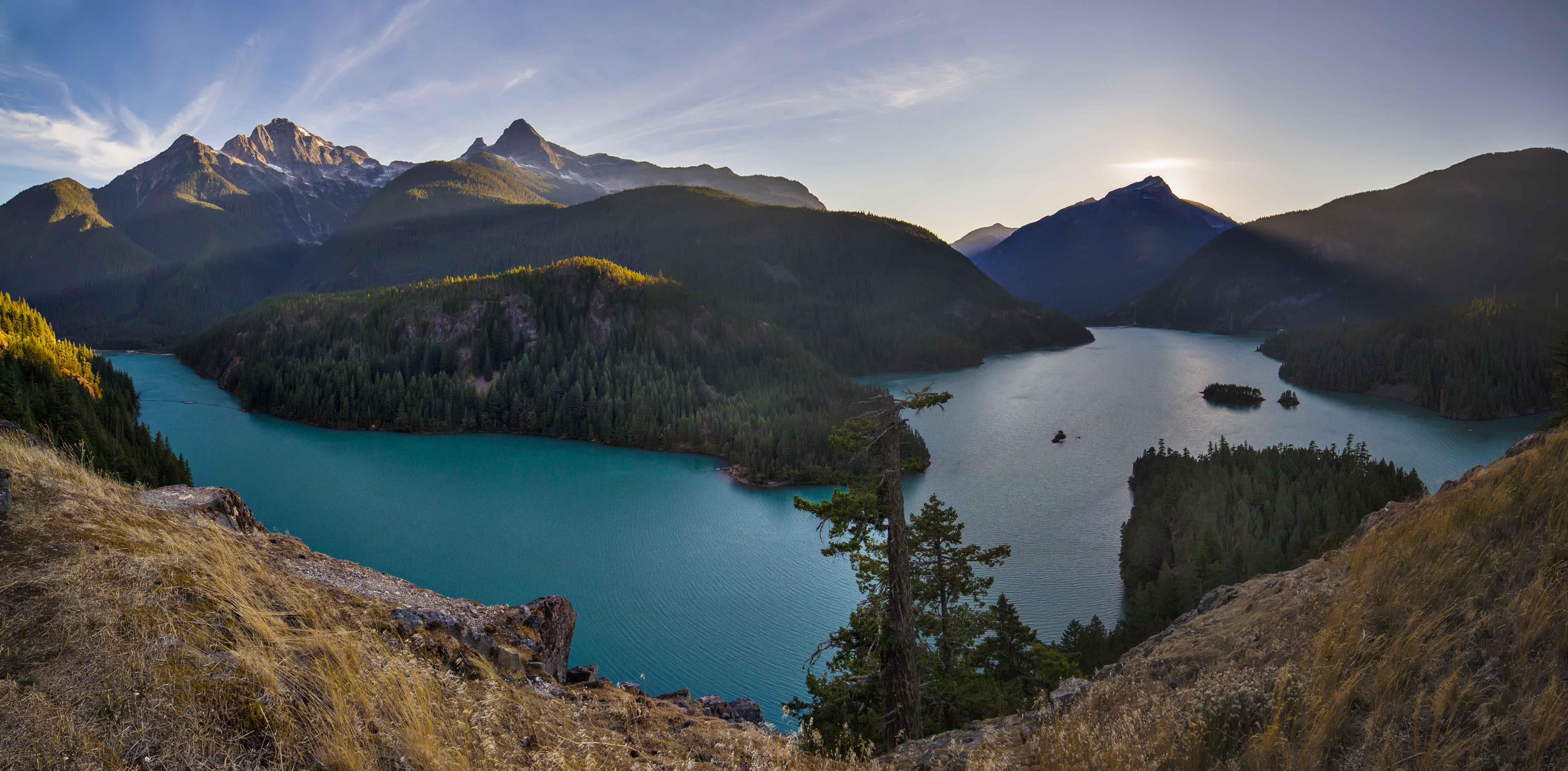
The trip has one up section, and this is it: 3.7 miles of switch backs to Cascade Pass, an elevation gain of 1,700 feet. The views start near the top, there is one last switchback and then the trail turns east and approaches the pass.
The Pass is a great place for a break, and you’ll see a lot of people there. From this spot, its all down hill to Stehekin!
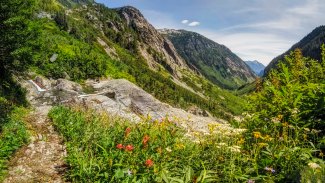
Dropping from Cascade Pass the trail navigates around the upper basin and soon passes the Pelton Basin campground. It’s not long before the switchbacks start. Whereas the trail up to the pass from the Skagit side is completely in forest, here the trail is exposed to the hot sun.
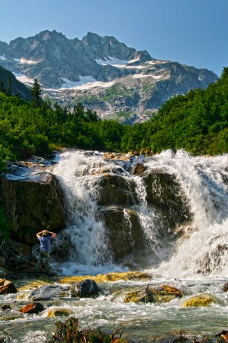
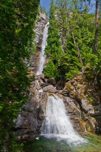
One nice surprise is the waterfall along Doubtful Creek as it bisects the trail on the east side of Cascade Pass, where there are small pools providing a much needed break and swim.
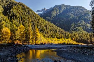
Many people who make the sojourn from Cascade Pass to Lake Chelan make a straight trip from the Cascade Pass parking area to Stehekin, with no side trips. But there is one of the most awesome valleys in all the North Cascades (Horseshoe Basin) that you should not pass up as you make your journey.
-

-
Glory Mountain from Horseshoe Basin, North Cascades National Park
-

-
Horseshoe Basin, North Cascades National Park
-

-
Horseshoe Basin, North Cascades National Park
-

-
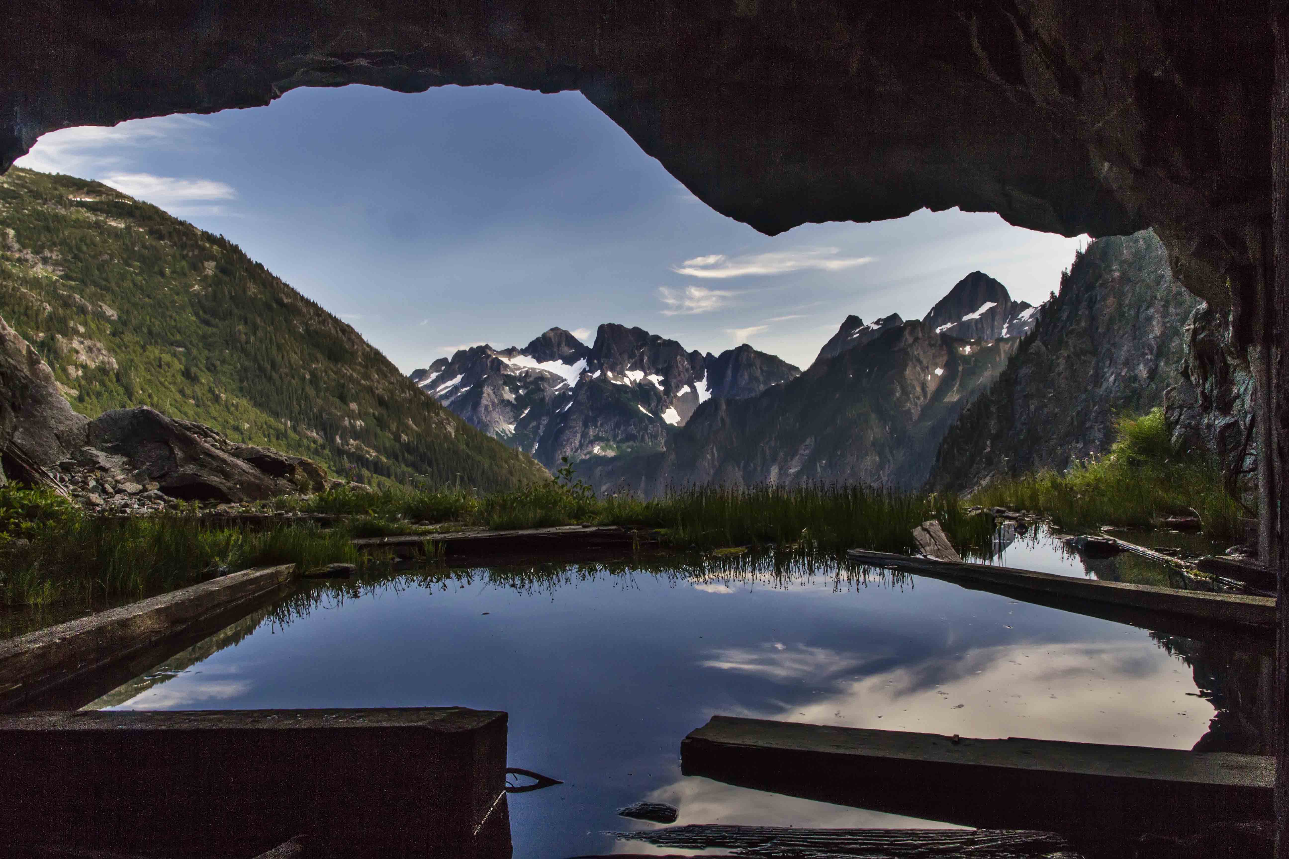
Black Warrior Mine
-

-
Black Warrior Mine
-

-
Black Warrior Mine
-

-
Black Warrior Mine
-

A short distance from Doubtful Creek is the trail to Horseshoe Basin. You can drop your big packs and day hike up to the Basin, or, if you scored a camp site at Basin Creek Camp, you can stay an extra day exploring Horseshoe Basin and the Black Warrior Mine.
The trail follows the stream up from the trail junction into Horseshoe Basin; it follows a course along the stream, across the stream and in the stream, brushy and wet. Shortly the trail emerges into a clearing where boulders dot the basin floor. Climbing up on the largest, the view is transfixing. The green bowl is surrounded with grandeur, full of color and drama.

Horseshoe Basin, North Cascades National Park
The Horseshoe Basin trail is less than 2 easy miles from the trail junction to the head of the valley and the Mine. 
The North Cascades are full of old mining claims; piles of colorful tailings and rusted remains of sluices and Pelton wheels littered about. But I had never visited a mine that I could enter and explore. The Black Warrior Mine operated until the mid-1950′s and is a National Historic Place. There is a sign at the entrance giving a brief history of the mine, the names of the prospectors and misled investors who poured their mostly futile efforts into this hole. There are two main cavernous rooms blasted into the mountain side which make the opening of the mine. One of these “rooms” served as a kitchen while the other was used for workbenches and tools. Wooden supports and floor boards are flooded with water. Old tables and remains of habitation litter the floor. The shaft of the mine runs deep; several miles of tunnel remain, open for any brave person to explore.
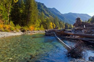
When you tire of the basin and continue on your way down the Stehekin Valley you’ll pass several camp sites: Cottonwood Camp was once the last stop on the bus route from Stehekin! Traveling is pretty easy, for the most part you are following along the road following the bus route to Stehekin. But the road has been washed away in several places, replaced by a foot trail.
At Park Creek is another camp and the trail (Park Creek Trail) heads up to Park Creek Pass and continues over and down to Colonial Creek camp, on Highway 20.
Bridge Creek is another large camp along your route and is where you meet the Pacific Crest Trail. From here its 5 miles to High Bridge. Many years ago the entire road washed away in a flood. So for the next 5 miles you’ll be hiking along the PCT!
IF you have the time and energy, plan another day here and make a day trip up the North Fork of Bridge Creek. Its too long to describe here and will be the subject of an entire post soon!
-
-
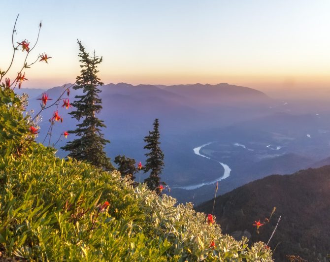
Mount Logan
-
-
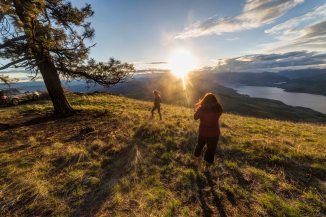
North Fork Meadows
-
-
Goode Mtn, from North Fork Trail
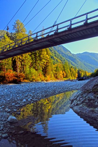
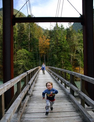
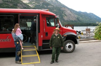
Walking along the Stehekin River Road is in itself fantastic. The river cuts a deep cleft through the cliffs at High Bridge and the confluence with Bridge Creek creates a wondrous series of cataracts and islands. From High Bridge there is a regular bus that takes you the last 10 miles to Stehekin. Check the Park Service site for the bus schedule.
Your hike must include a visit to the Stehekin Pastry Company. Delicious, fresh treats, ice cream, espresso, friendly staff and a comfortable place to relax…
-
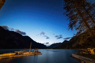
-
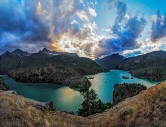
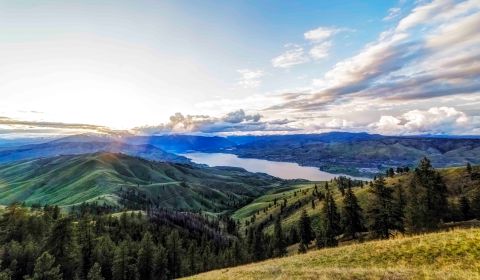
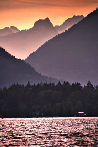
Lake Chelan
-
-
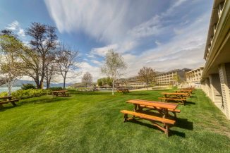
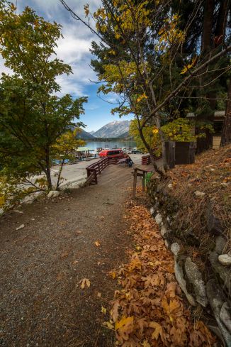
Stehekin
-

-
Pastry Heaven
-

-
Welcoming Committee
-

-
Organic Garden
-
-
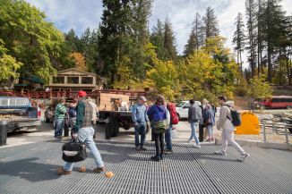
Arriving in Stehekin
Everything about Stehekin is awesome. Its remoteness (you can only reach it by hiking, ferry boat or float plane), the people are cool, scads of awesome things to see and do…even the Post Office is a neat place to just visit!
Beside the Pastry Company there is a restaurant, a lodge, and a post office. Thru hikers on the PCT mail resupply items to them selves at Stehekin. Its the last stop on the route to Canada. Late in the summer you will often run into some of the PCT hikers as they finish the last few days of their 2,400 mile trek!
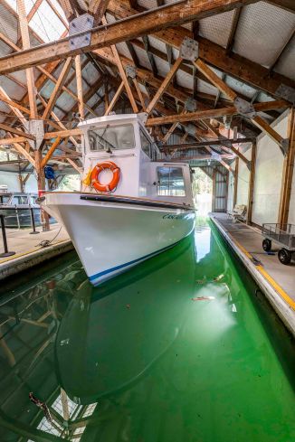
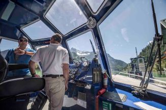
When you’re done restin’ and ready to go home you can either walk back the way you came, or catch the Lady of the Lake to Chelan!
Here are a few more images from the trail…
-

-
Sahale Peak from Stehekin River Trail
-
-
NCNP Bus
-
-
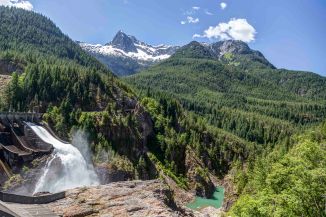
Rainbow Falls, Stehekin
-

-
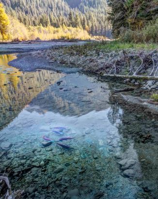
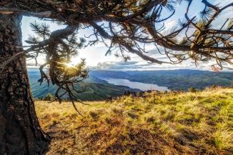
Along the Stehekin River Road
-
-
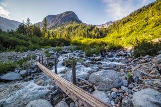
Bridge Creek
-
-
Lake Chelan