
Welcome to North Cascades Photography
Each week we will visit some place in the North Cascades. The best camp sites; day hikes and overnight trips; lookout towers, the best locations for sunrises, sunsets and night sky imaging. Whether you’re into a week long trip, or the best place for a drive-in view, I will cover the best times to go and How To Tips ranging from How to set exposure for a shot of the Milky Way to Where to see Mountain Goats?
Introduction
My fascination with the North Cascades started with a map.
In 1976 one of my friends read the Nat Geo article about a through hiker on the PCT. Several of us had recently finished a month long Outward Bound program in the Sawtooths, backpacking and rock climbing and we were excited for a new adventure.
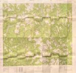
I still have the map, from 1976
A few glances at the images and I was sending away for maps. When they finally arrived in the mail I poured over them, tracing the PCT and looking at the terrain.

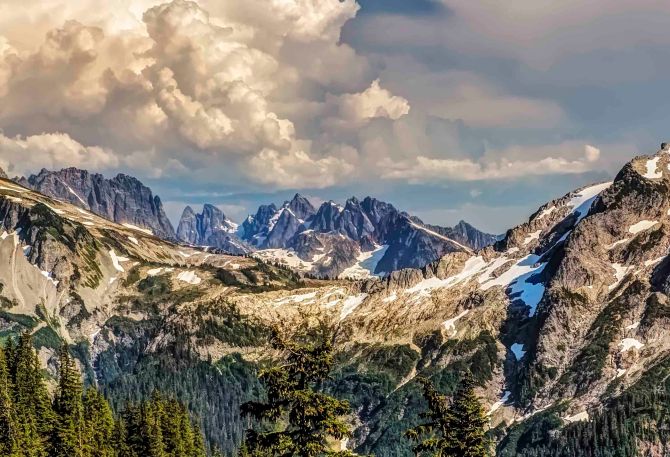
Pacific Crest Trail, Pasayten Wilderness
It was the first time I’d heard of places like the Pasayten Wilderness and Crater Lake. At that time there was little to read about the trail, most of the planning for a thru hike was up to you.
When you study a map, planning mileage, elevation gain and water sources you try to envision the place. There were more then 20 maps for Washington and Oregon I sorted through, tracing the PCT and making plans. The place I was most captivated with, the most excited about visiting was the North Cascades. I wanted to see the Picket Range and hike over Whatcom Pass.

Mt Adams and Pacific Crest Trail, Goat Rocks Wilderness
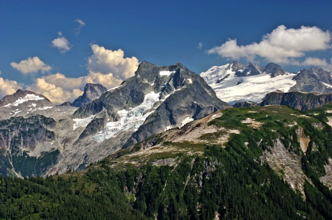
First of all, it was clearly the most rugged section. There were other sections with higher summits, like Mt Rainier and Mt Adams.
But these giant peaks were surrounded by much smaller mountains. The North Cascades boasted the greatest density of topographical map lines. I imagined wave after wave of serrated ridges; steep U-shaped valleys, cloaked in green and mantled with glaciers. The names of the places fueled my imagination: Mount Terror and Mount Fury, Desolation Peak, Diablo Lake and Forbidden Peak were just a few. I couldn’t wait to get there. The only problem was that it wasn’t the easiest place to get to!

Sunset at Sahale Camp, North Cascades National Park
In the end we decided to hike the PCT through Oregon. We hitchhiked from eastern Pennsylvania to Cascade Locks, Oregon, along the Columbia River and started our journey south.
My travels led me to many places, decades passed. But the allure and wonder of this place I’d never seen stuck with me.
-
- The Picket Range, from Copper Ridge
-

- Mt Challenger, from Whatcom Pass
-
- Easy Pass, Whatcom Peak and Mt Challenger
-

- Salmon in the Chilliwack River

Sahale Camp
It was 30 years before I made it back to see the places I’d dreamed of: Copper Ridge and the Chilliwack River, Mt Challenger and the Pickets…
I feel privileged to be able to see such things and humbled trying to capture some part of it in an image.
Now I live along the North Cascades Highway. Living on the doorstep of the mountains makes it easy to visit often. I truly feel at home.
Each week North Cascades Photography will visit some place in the North Cascades and share info on the best trails, camp sites, day hikes, long hikes, drive-in vistas, locations for Night Sky imaging and of course lots and lots of images.
You can always find out more about Trips, Classes, Photo Tours and more at my web site, AndyPorterImages.com
Next: The North Cascades Highway

Welcome to the North Cascades

Incredibly beautiful 😻
Really beautiful! The sort of photography that makes me wish I were there