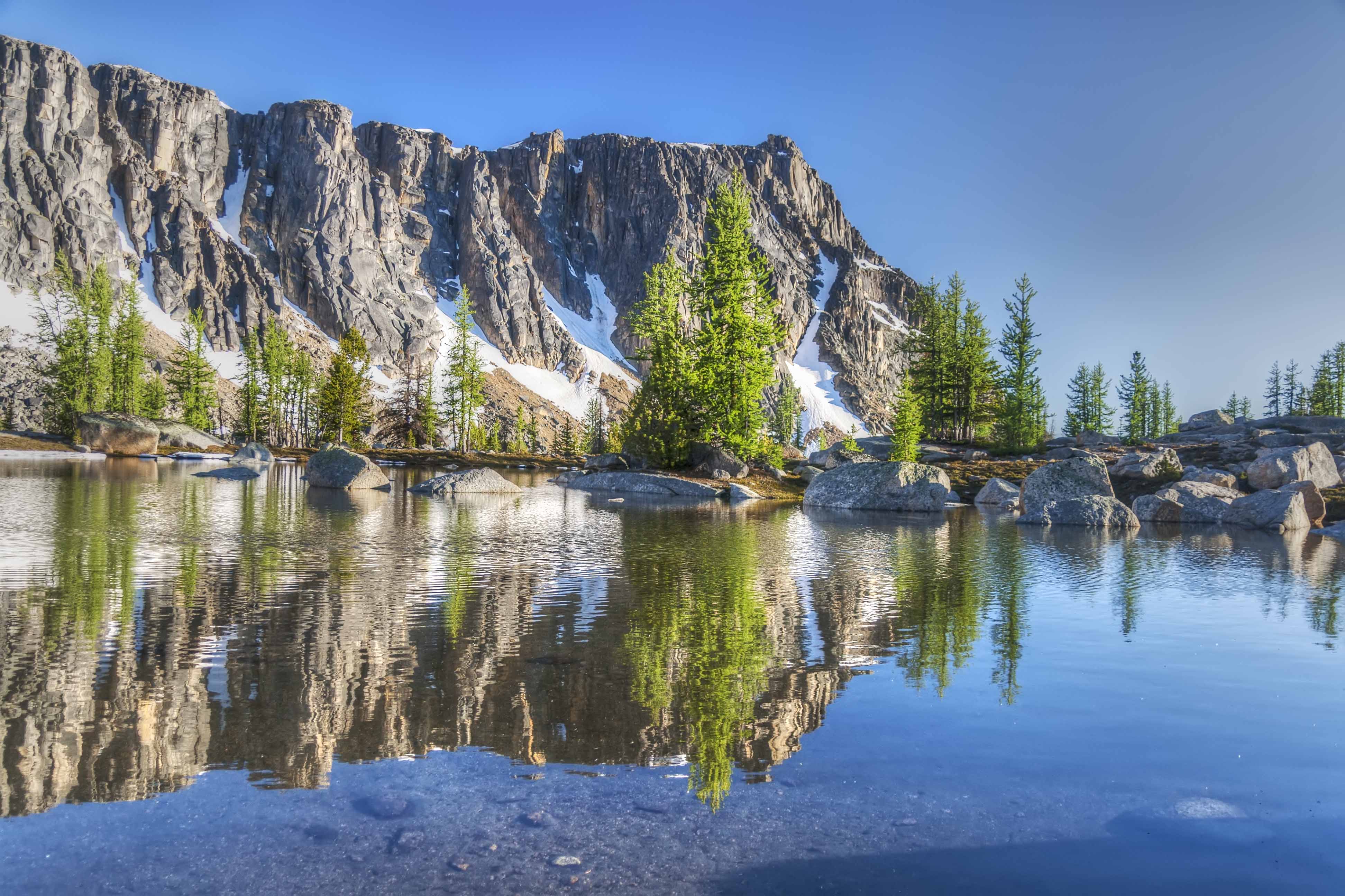
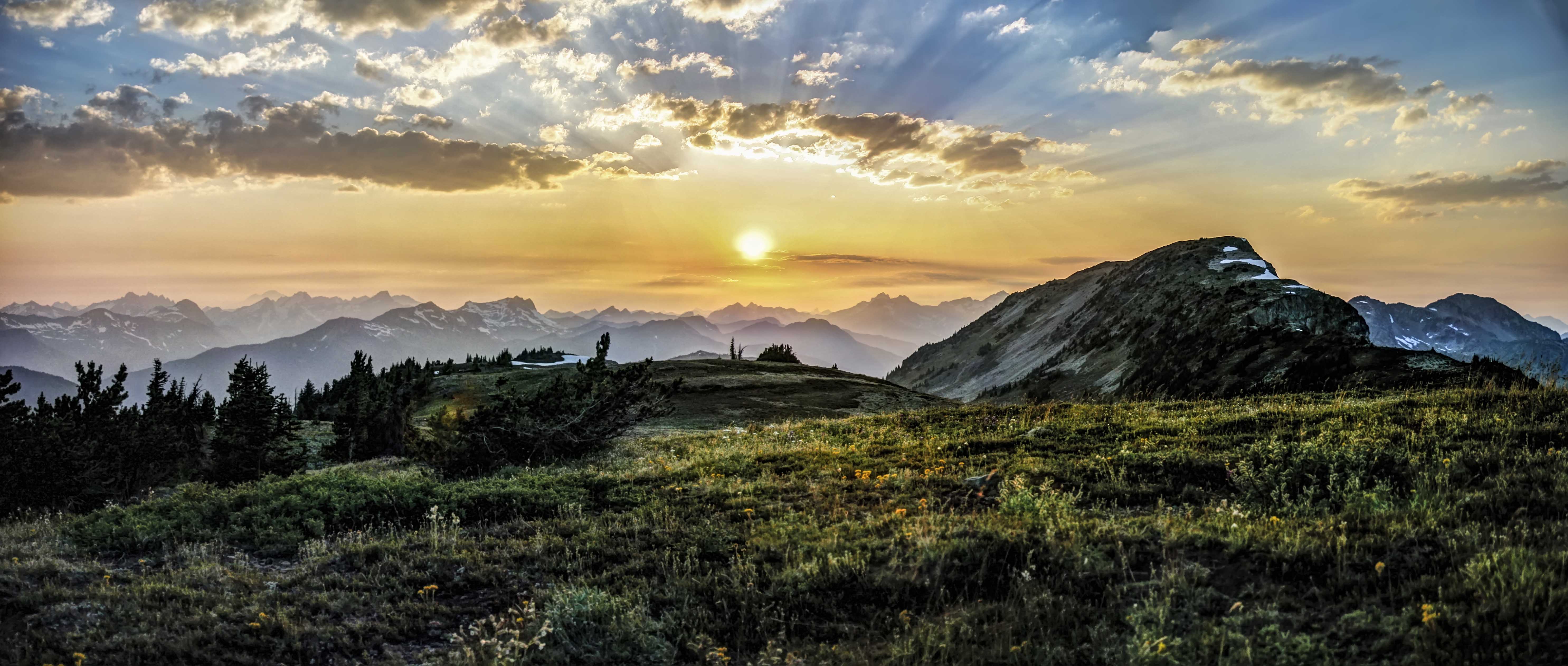
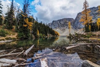
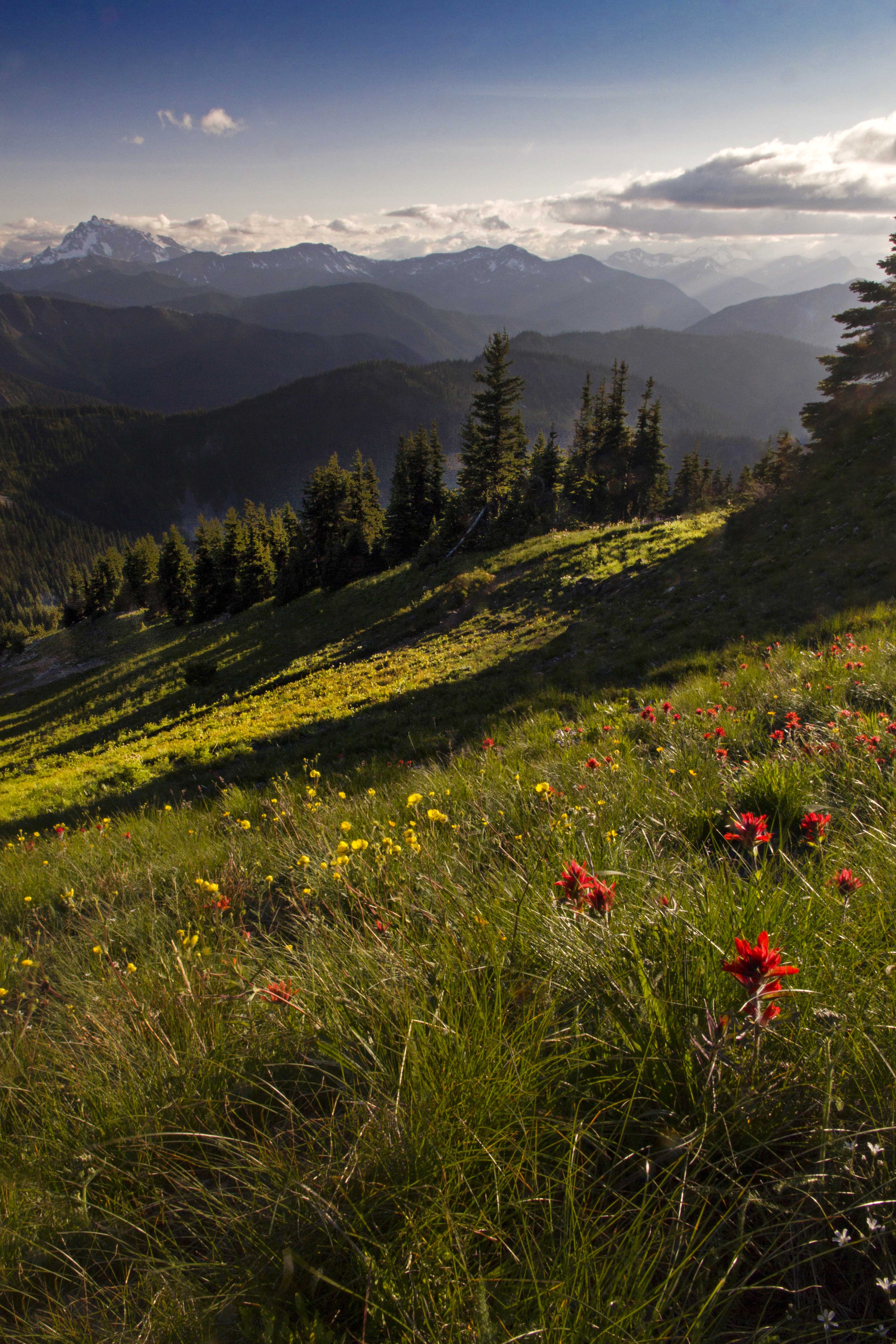
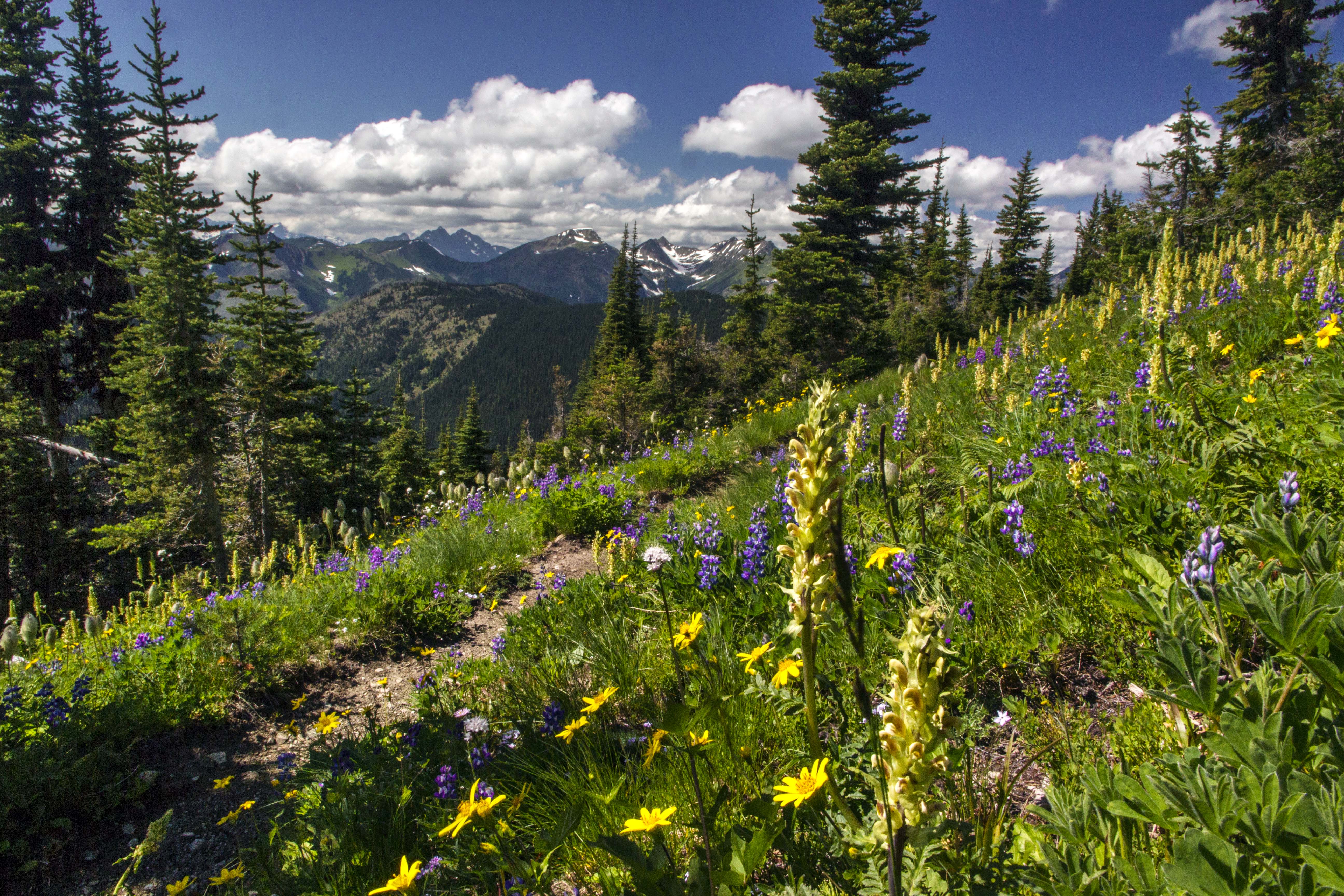
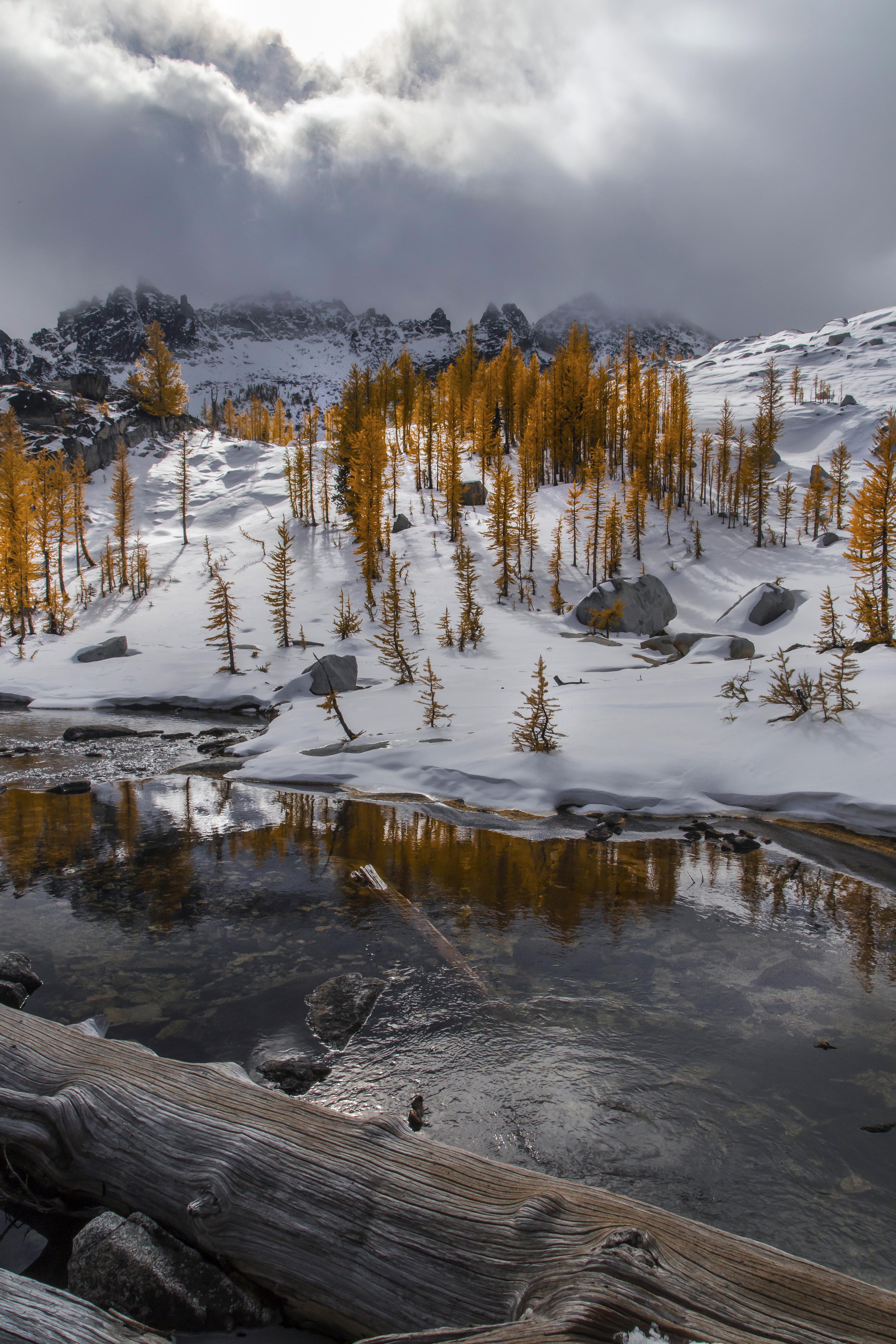
Amphitheater Mountain is located in the Pasayten Wilderness of Washington State. The Wilderness is located along the border with Canada.
Stretching east for 50 miles from Ross Lake and the Cascade Crest, the Pasayten Wilderness is some of the most remote and beautiful wilderness in Washington.
Ross Lake
Amphitheater Mountain is about 1 mile south of the Canadian Border, on the Boundary Trail. Depending upon your route, its about 25 miles, one way to get there.
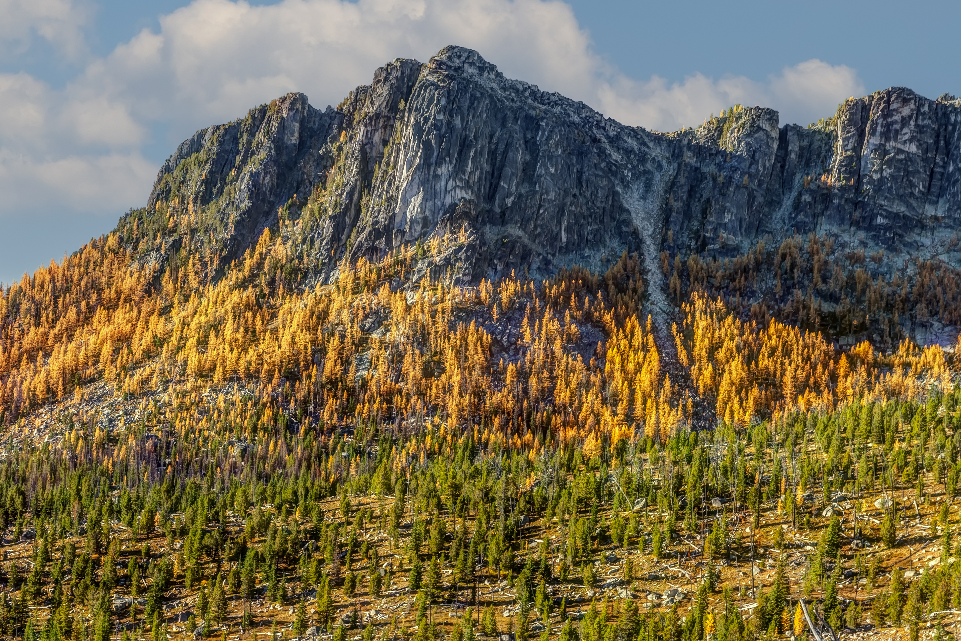
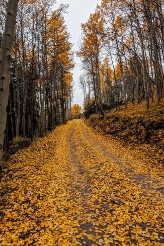
Amphitheater Mountain – JulyAmphitheater Mountain – Fall
I visited there twice, in July and then October of the same year.
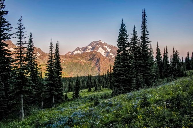
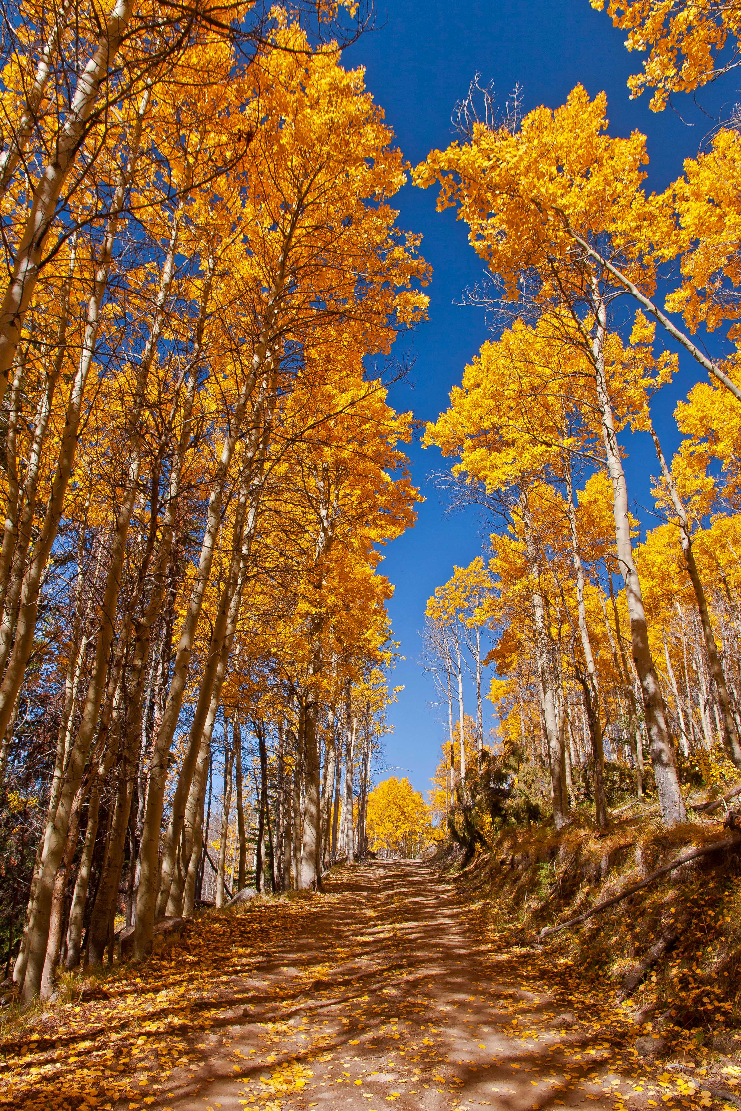
The orange needled trees in some of the pictures are Larch. In the summer the needles on the larch are bright green, like an evergreen…but in October they turn bright orange! Larch are found at an elevation of 5,000 to 7,000 feet.
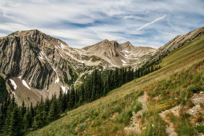
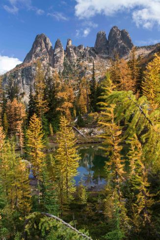
Amphitheater Mountain is huge! There are so many views!
Amphitheater from Cathedral PassAmphitheater from Upper Cathedral LakeAmphitheater Mountain on left, Cathedral Peak on rightAmphitheater Panorama
Prints on Aluminum, Canvas or Paper are available in many sizes for these and more magical images of the Pasayten and North Cascades. Here is the link to shop.
The Andy Porter Photography Gallery in La Conner is now open! See a wide display of Aluminum Prints, Night Lights, magnets and Cards! Classes are also available! 306 Morris Street, La Conner, WA 98257
The Pacific Crest Trail is 2,650 miles long and ends at the Northern Terminus monument about two feet south of Boundary Monument 78 on the US/Canada border.
The northernmost section of the PCT passes through the Pasayten Wilderness, in Washington State. Its one of most magnificent sections of the trail.
One place to access the trail is at Slate Peak. This is the highest place, elevation-wise, that you drive a passenger car in State of Washington topping out at about 7,600 ft. Check the road conditions first, its a white-knuckler for sure.
Starting a hike at its highest point is always a bit strange, but it sure make the first days hiking easy, all down hill! On the first day we hiked from Slate peak and the parking area down to Holman Pass and then started back up.
Heading North from the Slate Peak parking area
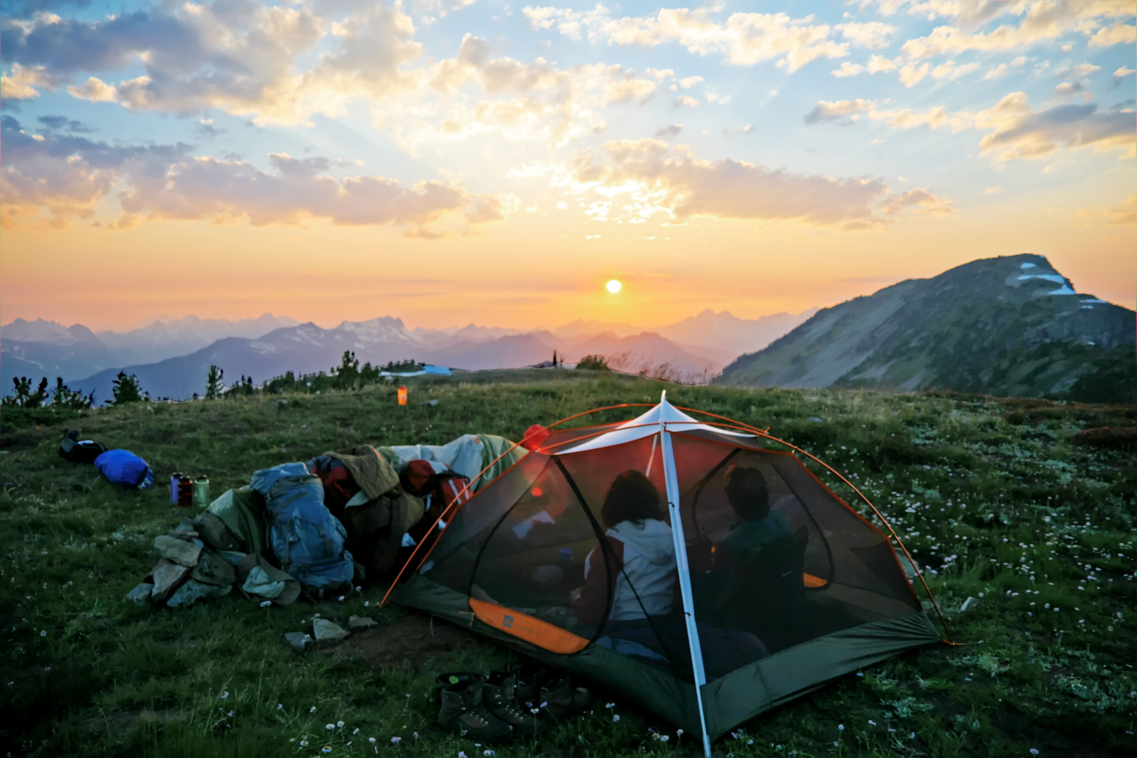
Here the trail passes through a glorious section on its way up to Rock Pass. The area is called the Parade Grounds, is a huge area, wide open meadows covered with flowers, interspersed with trees. There is a spring nearby and dispersed camping, and a short way off small Goat Lake.
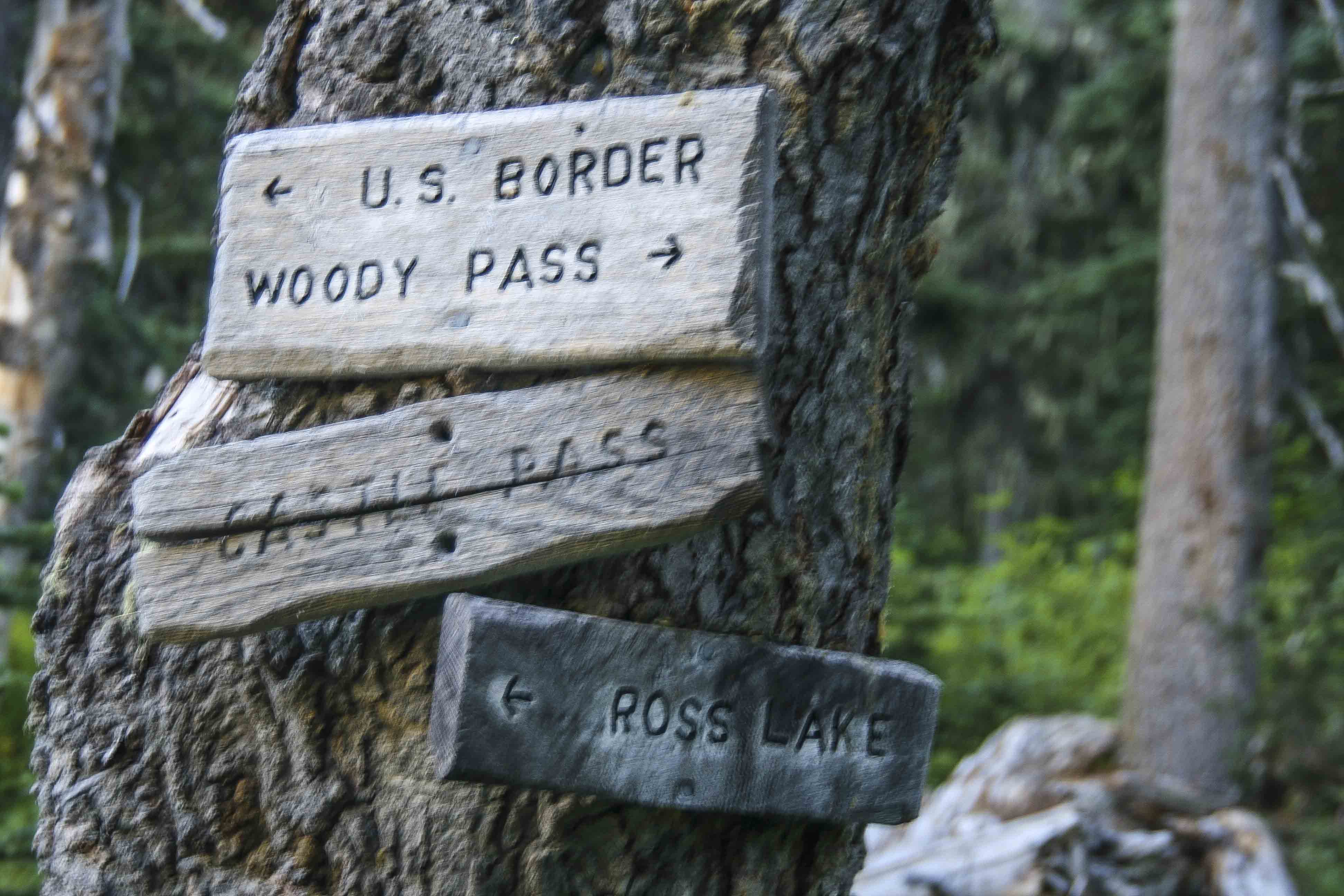
The crest of Rock Pass is truly stunning. The view below is looking north from Rock Pass. That’s Lakeview Ridge on the left. The PCT makes its way through Woody Pass (snow filled gap, left) crosses to the west side of Lakeview Ridge and continues north.
The PCT in past days traversed along the very top of the ridge here, from Rock Pass over to Woody Pass. But now the trail steeply switch backs down from Rock Pass, makes a creek crossing and then climbs laboriously back up to Woody Pass.
Pacific Crest Trail between Rock Pass and Woody Pass
From Woody Pass the PCT swings along the west side of the Cascade Crest as it makes its way north.
The ridge the trail follows is called Lakeview Ridge, and it offers some of the best views anywhere.
At the northern end of the ridge the trail descends the Devils Staircase to Hopkins Lake and then its only a few short, flat miles to Castle Pass and the Three Fools trail junction. The Canada Border lies just beyond.
The trip started at Highway 20. My friend dropped the three of us off at the trail head and we ascended up through Devils Garden along the Jackita Ridge Trail. We were on a 12 day trip, heading north, along the Pacific Crest Trail, near the Canadian border, west to Ross Lake and south, back to the highway.
Devils Garden
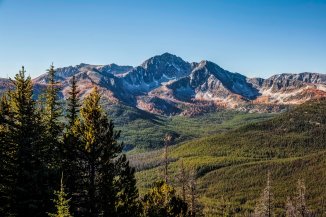
The trail afforded many wonderful views of Jack Mountain.
We arrived atop Devils Dome late in the afternoon and set up camp. Though we were atop the peak snow fields nearby supplied us with water.
Jack Mtn
The sunset was magnificent, but we watched it from inside our tent mesh because the mosquitoes were ravenous.
Devils Dome affords a 360 degree view of Jack Mountain, to the south, Hozomeen to the north.
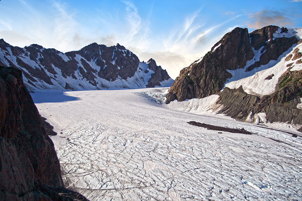
The glaciated peaks of North Cascades National Park rose to the west and a broad expanse of the Pasayten lay to the east.
After a wonderful dinner we quickly went to sleep excited about the beauty tomorrow promised.
Something woke me up. I lay for a moment with eyes closed, sensing. There was a stillness, which was odd seeing that I was camped on a mountain top, and the smell of rain in the air. Suddenly opening my eyes I saw that the sky was clouded over. I lay for another moment reluctantly picturing myself getting up and putting the rain fly on the tent when I saw the flicker of lightning in the eastern sky. I sat up looking…there was another flash…and another.
Quickly exiting the tent I stood scanning the sky. There was lightning to the east…then to the south, then again, to the west…the dark tumultuous sky was alive with flashes, the peaks briefly illuminated and then again black shapes…I looked on in wonder…and then it stated raining.
I quickly awoke my two companions and let them know that they needed to get up, get dressed and get out of the tent and give me a hand. At first they were both saying, “why don’t you just put on the rain fly and get back in, go back to sleep…” and I replied that if they stayed in the tent that they would miss the lightning show…that provided sufficient motivation and they were soon out of the tent, looking at the skies. The lightning was getting more intense, more frequent…we could see the glow of a fire to the west, over towards Ross Lake and the National Park boundary.
My plan was simple: get the rain fly on the tent, throw all our stuff in it, don our rain gear and then lie on the grass and watch the show. But my two friends had other ideas. One strongly advised that we immediately depart and head down the mountain to find shelter from the lightning. My other friend insisted on a more simple approach: do nothing and simply enjoy the storm. I started with the rain fly and loading the tent and soon they came to assist me.
Someone came up with the idea of planting our trekking poles in the ground, well away from the tent, to act as lightning rods (!). And so, now somewhat content with our preparations, we all watched.
The rain started to come down now. The wind picked up, strong gusts blowing across the summit. The flashes became more insistent, more frequent. With each flash the ridges between us suddenly appeared out of darkness, and then…gone back to my imagination, leaving lasting imprints of what had just been illuminated. From our vantage point we could see what looked like 6 or so fires burning…
On three sides of us there were regular flashes, every few seconds, another, and then another. The wind and rain continued unabated. In fact they increased along with the regularity of the lightning, each building to a crescendo. The lightning now seemed to take on a reddish hue, then green or blue (was it just my imagination?)
Transfixed by the sheer beauty, we had front row seats for nature’s own fireworks show, the best we had ever seen. Just as I was starting to edge towards getting the hell out of there the tempest began to lessen, the wind shifted. The lightning to the west, which seemed to head towards us, stopped.
And that was it! The storm cell had passed us by. The lightning to the east faded out and in its place we could now see the faint hint of the sun.
The date was 08/08/08. This was the opening night of the Olympics in Beijing, and we mused that the fireworks we had just seen surpassed theirs, hands down. It was also the scheduled date for the startup of the Large Hadron Collider and we considered that the lightning storm was a direct result of the resultant black holes now devouring earth. These points we avidly debated, but all agreed that the peak was rightly named: Devils Dome.
As the excitement died down my friends retired to sleep and I ventured forth to catch some of the morning light.
The Pasayten Wilderness is one of my favorite places in Washington, a land of mountains and rivers, steep valleys and meadows, wildflowers and Zen like peace. This experience was on day 6 of our twelve day trek which started at the Canyon Creek Trail head on the North Cascades Highway.
One of the most fabulous backpacking loops I have ever done was in the Pasayten Wilderness.
We began at Canyon Creek trailhead, along Highway 20, hiked up the Jackita Ridge Trail, visited Devils Dome, then connected with the Pacific Crest Trail at Holman Pass and headed north. At Castle Pass we took the Three Fools Trail west, to Ross Lake, where we got the water taxi to Ross Dam and hitchhiked back home.
Here are a few pics from the trip.
Sunset atop Devils Dome, Pasayten Wilderness, North Cascades
This first one is a sunset from atop Devils Dome. We spent the night there, (08/08/08) and were observers of a spectacle of lightning storms that swept through that night, starting innumerable fires throughout the park. Like three fools we stayed there, atop the Devils Dome, mouths agape, as the night sky erupted and just watched.
Jack Mountain from Devils Dome, Pasayten Wilderness, North Cascades
This is Jack Mountain, from Devils Dome. Hiking in the Pasayten Wilderness is wonderful, lots of views and flowers.
Cascade Crest from Jackita Ridge Trail, Pasayten Wilderness
This was taken from the Jackita Ridge Trail, looking west – southwest. That long green meadow inviting you is Devils Garden.
Here is another view from the trail.
Jack Mountain, Pasayten Wilderness
After Devils Dome we made our way to Holman Pass where we intersected the PCT and turned north. The image on the right is from a glorious meadow (with a spring) just before Rock Pass. And the Double Rainbows is at Rock Pass looking north. That’s Lakeview Ridge stretching to the distance.
Double Rainbows at Rock Pass, Pasayten Wilderness
Pacific Crest Trail, Pasayten Wilderness
The wildflowers are all over (assuming you’re there at the right time!)
The Three Fools Trail was a struggle. It hadn’t been maintained in more that a decade, there were more than 200 down trees between Elbow Basin and Three Fools Creek…it was brutal!
The sunsets, however, were magnificent. This is from Elbow Basin.
The Three Fools Trail lived up to its hype: Stunning scenery, no one to be seen anywhere and you’d have to be a fool to try!
Big Face Mountain from the Three Fools Trail, Pasayten Wilderness
Here is Big Face Mountain from the trail.
Ross Lake from the Lightning Creek Trail, North Cascades National Park
and lastly, Ross Lake, from the Lightning Creek Trail.
That was my first visit to the section of the PCT from Holman Pass, north to the border with Canada. I have revisited several times, access is not bad, at Slate Peak. You can park at a junction with the PCT, at 7,000 ft elevation to start your hike!
The views along Lakeview Ridge are to die for…that will be the subject of the next post!
Oh, the hitchhiking home part: When we debarked the water taxi and hiked up to Highway 20 we were more than a bit surprised to see hordes of cops. Not just regular ones, Border Patrol, guys in kevlar with nasty weapons, the place was swarming with them!
Eventually one of the cops came over to ID us sketchy looking hitchhikers and being polite and all the cop arranged a ride for us home. It turned out that a Park Employee had stumbled upon a huge marijuana farm, right there, near Ross Lake! So they came up with the swat team and got boats and went to raid the pot farm, but by the time they got there, the farmers had fled to parts unknown…
I regularly get requests from magazines asking for images, they specify which places, season, weather, or what ever fits their plans for upcoming issues. If you have any good images of say, Crater Lake at night, then you submit, if they like, your image gets published.
Best Fall Hikes, or October Hikes was one of the categories needed.
I love fall colors, love the lack of bugs and the crisp air for hiking. Its funny, in early July just when access to the high country is about to start, to be thinking ahead to fall. But I spent two days locating and editing images…
Best Fall Hikes in the North Cascades
The North Cascades offer a unique version of fall, The Larch. The mountain larch, or Tamarack, looks like a regular evergreen in the spring or summer, but in early October the needles turn bright orange, and then fall off.
The effect is stunning. The sharp orange, interspersed with greens and browns, maybe a few white clouds in an bright blue sky…are you getting the idea? Its a color junkies dream.
All of these hikes are along (or close to) the Cascade Loop. Check their web site for lots of ideas of more adventures, as well as food/lodging.
Here are the 3 Best Fall Hikes in the North Cascades
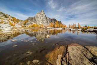
The Enchantments
How can you not start with the Enchantments? This is one of the most magical places to hike anywhere in the world. And in early October it just explodes. If you go, plan to spend several days. You’ll not soon forget it! Yes, its a pain to get a permit, and yes, it is a brutal approach to get up and into the Core of the Enchantments with photo gear and 5 days of food, but who ever said Perfection Lake was easily attained? Book a night or two at the Sleeping Lady Mountain Resort in Leavenworth to aid your recovery!
Here are a few images from a recent October trip.
Colchuck Lake from Aasgard Pass
Prusik Peak and Gnome Tarn
Goats
Isolation Lake – Upper Enchantments
Crystal Lake
Prusik Peak and Gnome Tarn
Perfection Lake and Prusik Peak
Isolation Lake – Upper Enchantments
Prusik Peak and Gnome Tarn
Perfection Lake and Larch
The next Best Fall Hike is another local favorite. Early October weekends will find this trail head packed to overflowing, with cars out along both sides of Highway 20.
Blue Lake and Washington Pass
Larch seem to like an elevation around 6,000 to 8,000 feet. You can see them here draped like a necklace over the neck line of Liberty Bell. Washington Pass, located on the North Cascades Highway offers spectacular views of Liberty Bell Mountain and the north side of Early Winter Spires.
The Blue Lake trail, located about a quarter mile from Washington Pass Overlook, is a short, moderate trail which skirts along the base and then along the back side of the monolith. Once you get to Blue Lake the views back to Early Winter Spires are impossibly beautiful.
Liberty Bell from the Washington Pass Overlook
Liberty Bell from the Washington Pass Overlook
Liberty Bell from the Washington Pass Overlook
Blue Lake
Liberty Bell and Early Winter Spires
Liberty Bell and Early Winter Spires
Liberty Bell and Early Winter Spires
Liberty Bell and Early Winter Spires over Blue Lake
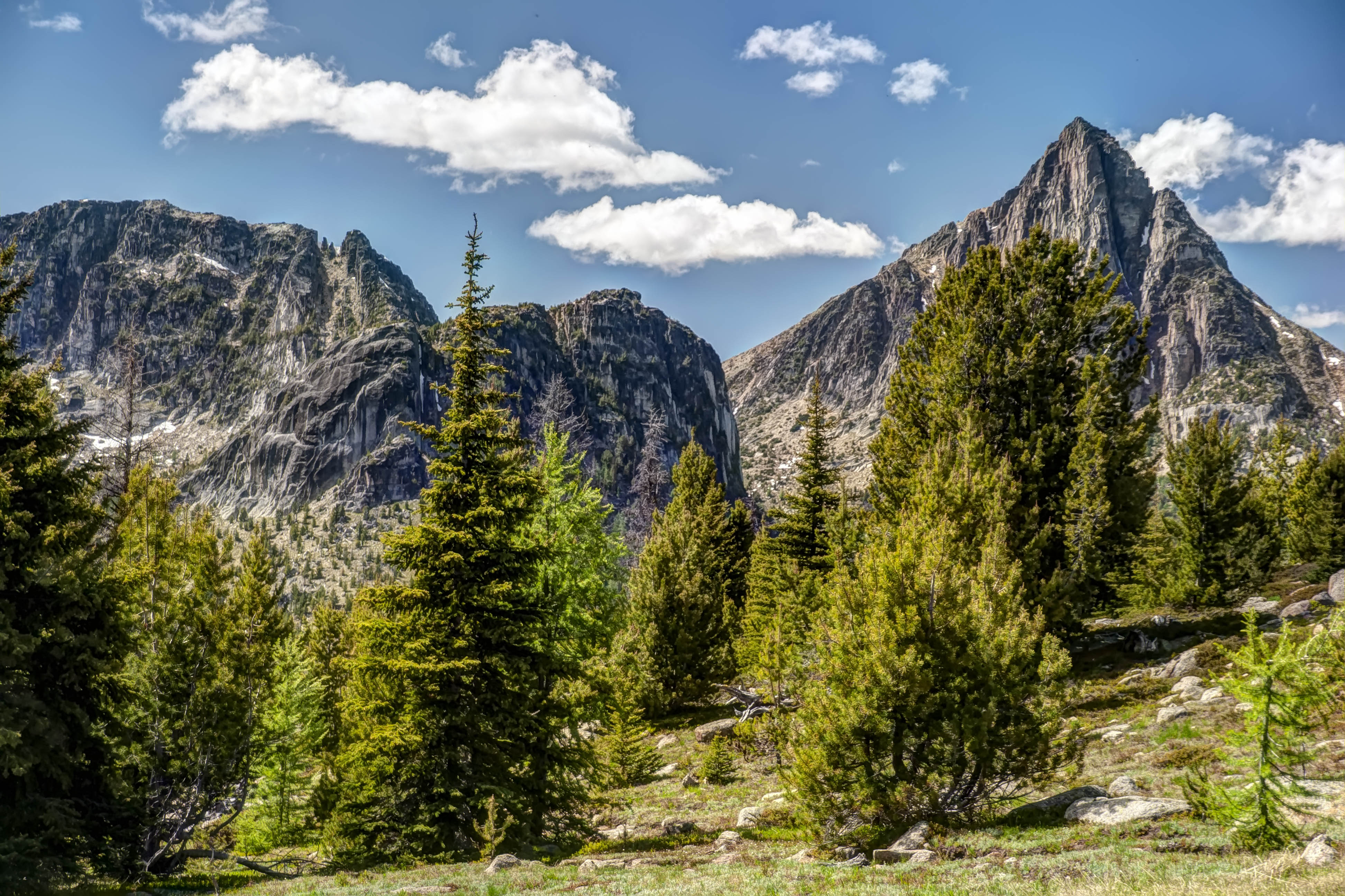
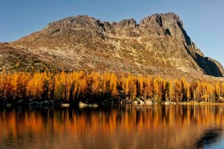
Finally for the 3rd Best Fall Hikes in the North Cascades…This last one is a bit further afield, its a long drive over to Eastern Washington, up through Omak, north of Tonasket and on to the Pasayten Wilderness. But the trail, though long, has minimal elevation change and the payoff, at Upper Cathedral Lake will only make you want to stay longer.
Upper Cathedral Lake, Pasayten Wilderness
In some places you’ll find Larch, often interspersed with other trees. Sort of sprinkled about. But here in the Upper Cathedral Lakes basin its almost solid larch. and as you are imagining, its like someone lit the place on fire.The trail takes you up to Sunny Pass, through Horseshoe Basin and along the Boundary Trail (the Canada Border is a stones throw away). This section of the trail is also part of the much longer Pacific Northwest Trail.
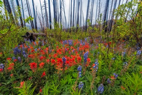
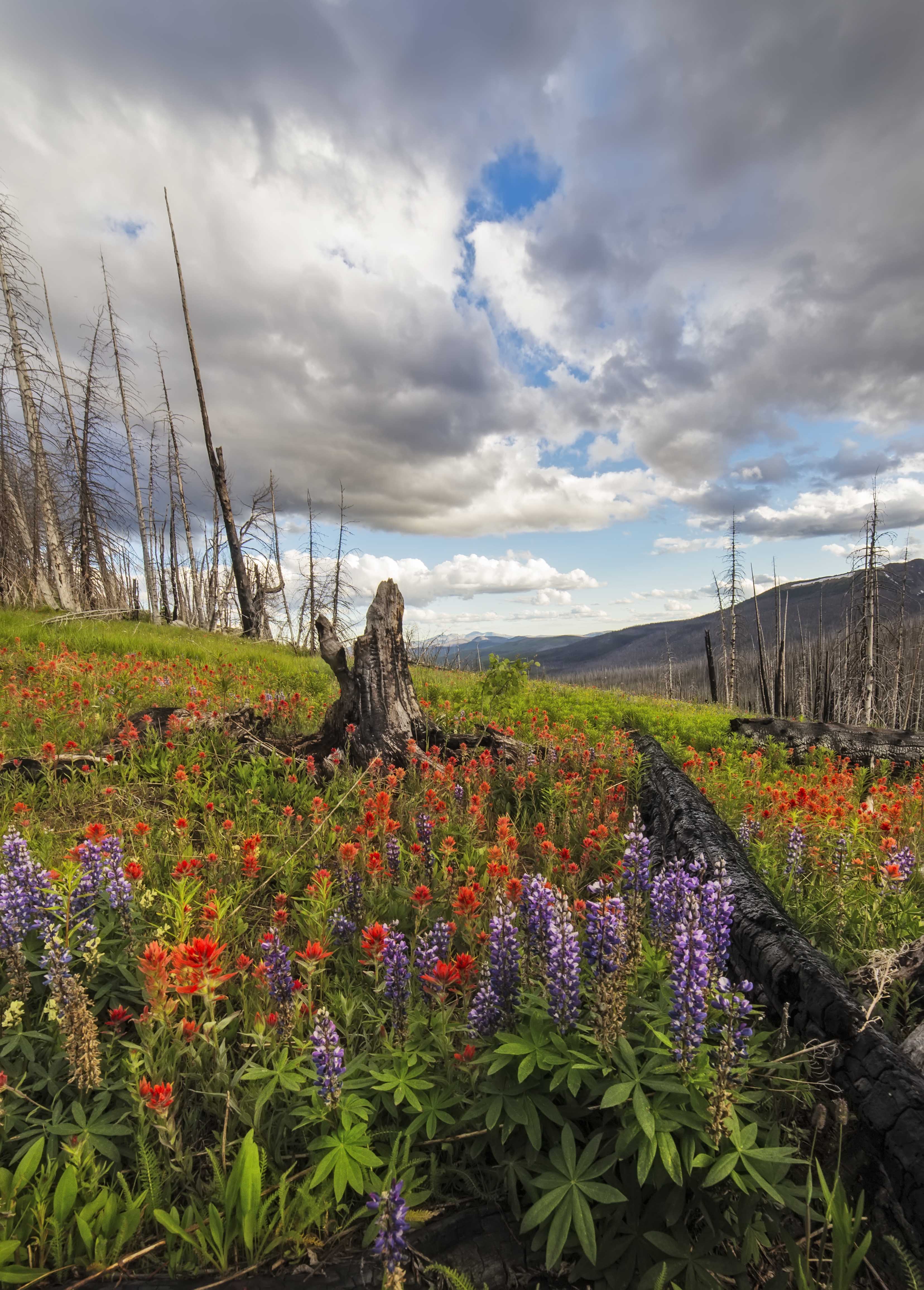
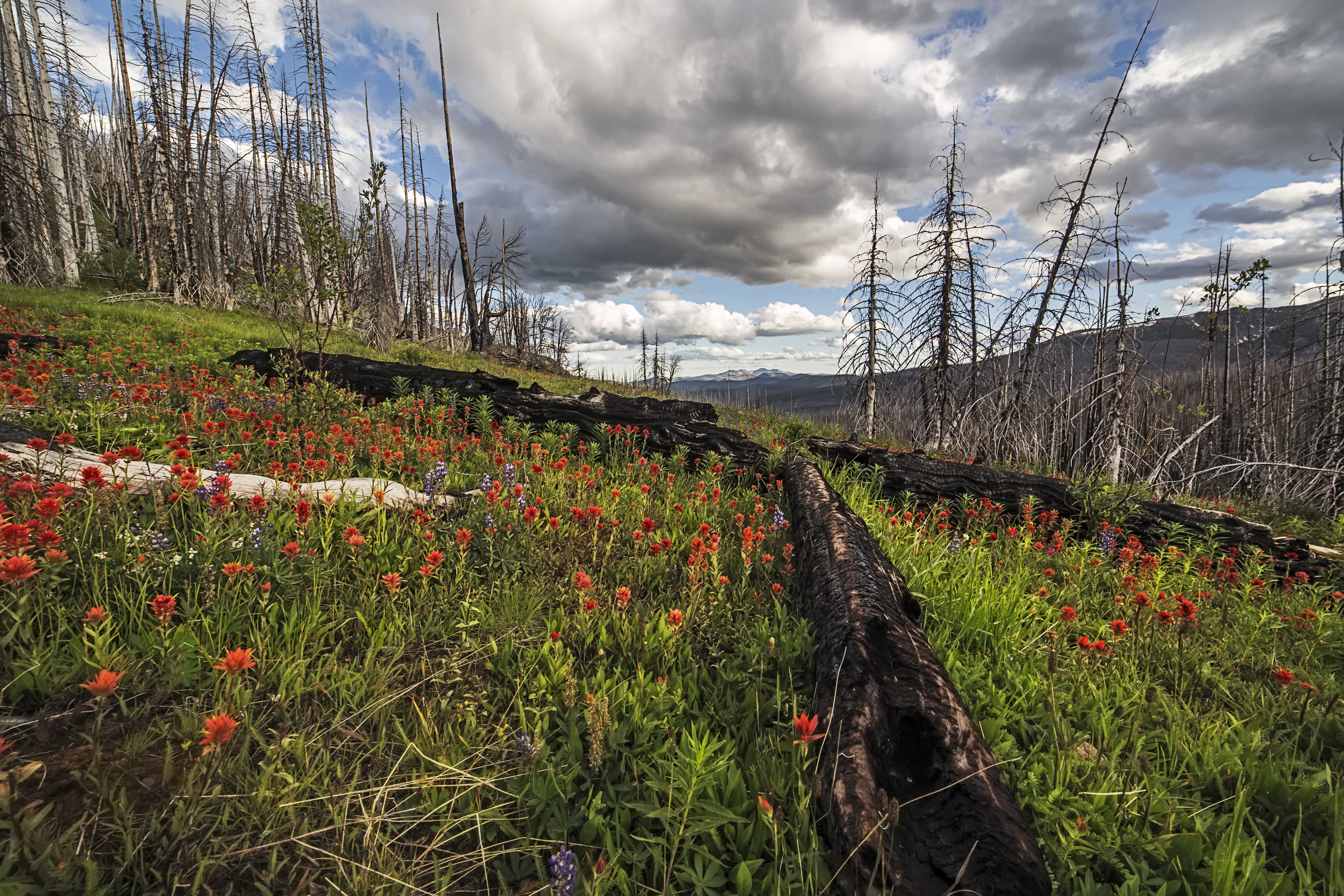
The Pasayten Wilderness is more than 500,000 acres of splendor: lush meadows, rugged peaks, sweeping vistas, deep valleys, thick forests and wildflowers…lots of wildflowers!
July brings an explosion of color, thickets of flowers bursting aloud, the bright colors of Indian Paint Brush and Lupine off setting each other in grand style.
Here, see what I mean:
These images are from a trip along the trail to Sunny Pass. From Tonasket take the road to Loomis, ascend along the Toats Coulee Road to the Iron Gate Trailhead and Camp. The flowers start not far from the trips start!
This is the tentative plan for backpacking trips in July and August. If you are interested in coming along for any, please let me know!
Amphitheater Mountain, Pasayten Wilderness
Cathedral Lake Trip – 6 days This trip is a 30 mile one way trip, to the eastern Pasayten Wilderness. The trailhead is at 6000+ feet, so its mostly a ridge hike, Lots of solitude and fantastic scenery. Here is a trip report from a July trip 5 years ago. This trip is planned to start right around July 4th (maybe July 2 or 3, or maybe July 5th) and return July 8, 9 or 10. This is one of the coolest hikes in Washington! And although the mileage is somewhat long its not very difficult.
Cathedral Peak, Pasayten Wilderness
Easy Pass – Park Creek Pass – Cascade Pass – 6 days I have had this trip on my radar for a while, the plan is to get dropped off at Easy Pass, hike through one of the more remote parts of North Cascades National Park ending at Cascade Pass, then hitch back to Sedro-Woolley.
Horseshoe basin
I have hiked almost every part of this trip many times, except Fisher Basin. This trip would include a few days of off trail travel and camping. Horseshoe Basin and Park Creek Pass are unbelievable places to visit. Trip planned for July 26- July 31
Spider Meadows – Upper Lyman Lake – 4 days I did this trip last year, its awesome! My plan this year is to hike into Spider Meadows, hike up and through Spider Gap, spend a day in the Upper Lyman Basin and then hike back. Check out the story and pics. Trip planned for Aug. 2 to Aug. 5
Upper Lyman Lake, Glacier Peak Wilderness
Spider Meadows, Glacier Peak Wilderness
If you have an interest in coming along on any of these trips, or have any questions, email me at: andyporterphotography@gmail.com
I have several extra backpacks, tents and all that stuff if anyone is lacking.
The Pacific Crest Trail is a 2,400 mile long foot trail stretching from the US border with Mexico through California, Oregon and Washington State to Canada.
Pacific Crest Trail, Pasayten Wilderness
Powder and Shull Mountains, from the Pacific Crest Trail, Pasayten Wilderness
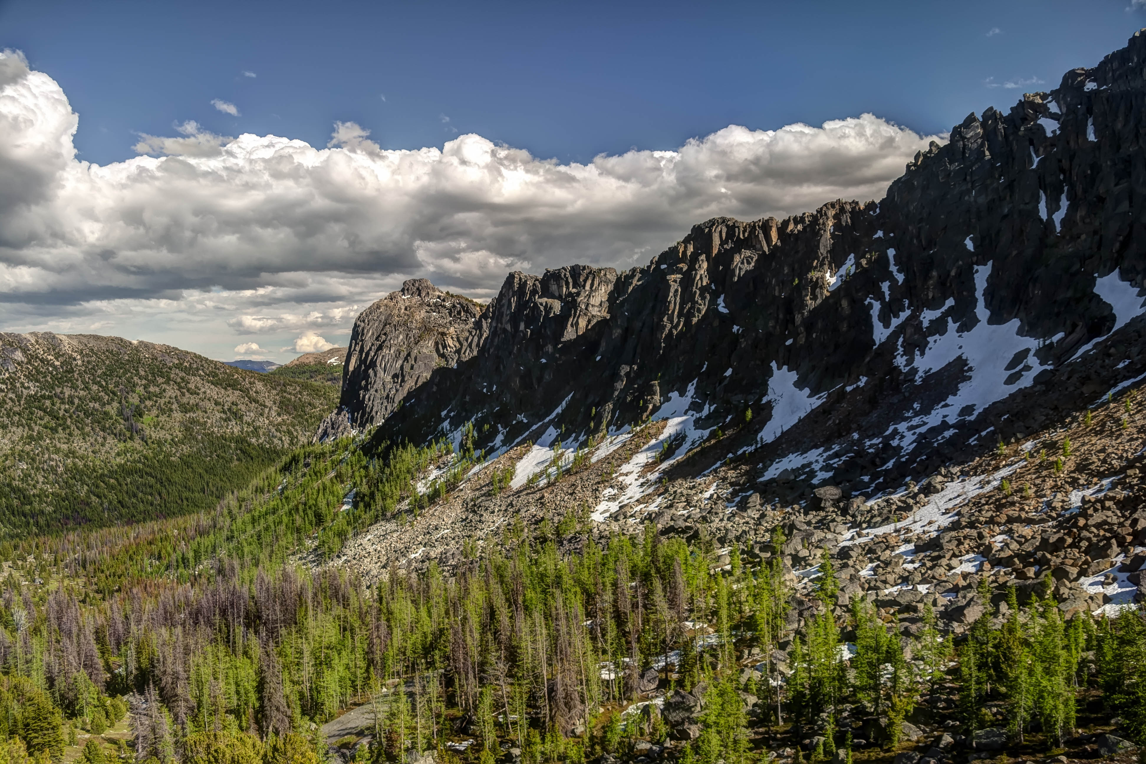
The northern most part of the PCT follows the Cascade Crest crossing Rock Pass, Woody Pass and then making a long gradual ascent of Lakeview Ridge.
Rock Pass, from Woody Pass
Here a more than 7,000 feet the views are breathtaking. Lining the international border are Hozomeen Mountain, Joker and Freezeout Mtns and Castle Peak. To the west the snowy dome of Mount Baker is clearly visible. Three Fools Peak dominates to the horizon to the south.
Three Fools Peak from the PCT on Lakeview Ridge
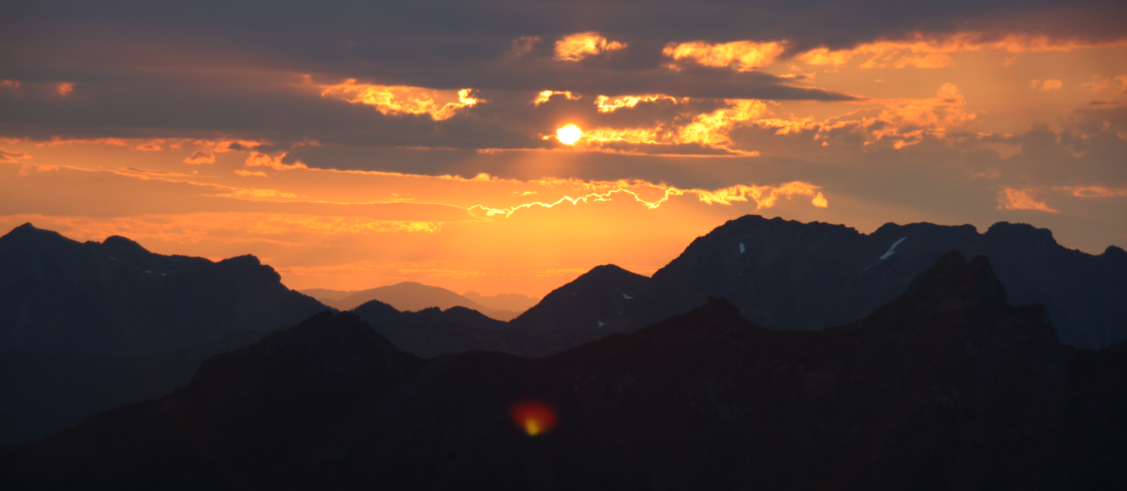
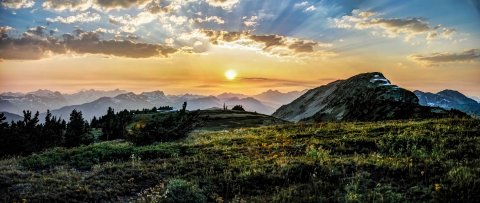
The grassy ridgetop is a fine place to camp. Snow lingers here, usually until August, providing water.
Lakeview Ridge at Sunset
Jack Mountain from Lakeview Ridge
The easiest way to get here is to drive to Mazama and take the road towards Harts Pass, up the steep valley and towards Slate Peak. The road (generally suitable for passenger vehicles) bisects the PCT just below the summit of Slate Peak. This it the highest point that can be reached by car in Washington. From here its about a 20 mile hike to the top of Lakeview Ridge.
On September 3rd, 1964 President Johnson signed into law the Wilderness Act. This watershed piece of legislation has been a cornerstone in preserving the wild lands of America.
The Wilderness Act provides a definition for wilderness: “A wilderness, in contrast with those areas where man and his own works dominate the landscape, is hereby recognized as an area where the earth and its community of life are untrammeled by man, where man himself is a visitor who does not remain.”
I have been lucky enough to visit many wilderness areas and enjoy their majesty and solitude. Here are a few images from my travels.
Sahale Camp, Steven Mather Wilderness
Pasayten Wilderness
Milky Way, Glacier Peak Wilderness
Point of the Arches, Olympic Wilderness
Mount Rainier and Avalanche Lillys, Goat Rock Wilderness
Left Fork Canyon, Zion Wilderness
Steeple Peak and Lost Temple Spire, Bridger-Teton Wilderness
Enchantments, Alpine Lakes Wilderness
Mount Olympus, Olympic Wilderness
Amphitheater Mountain, Pasayten Wilderness
Upper Lyman Lake, Glacier Peak Wilderness
Mount Baker and the Park Butte Lookout, Mount Baker Wilderness
Sunrise, Steven Mather Wilderness – This image will be displayed in the Smithsonian Museum as a part of the Wilderness 50 Celebration starting on Sept. 3rd, 2014