Pacific Crest Trail, Pasayten Wilderness

The Pacific Crest Trail is 2,650 miles long and ends at the Northern Terminus monument about two feet south of Boundary Monument 78 on the US/Canada border.

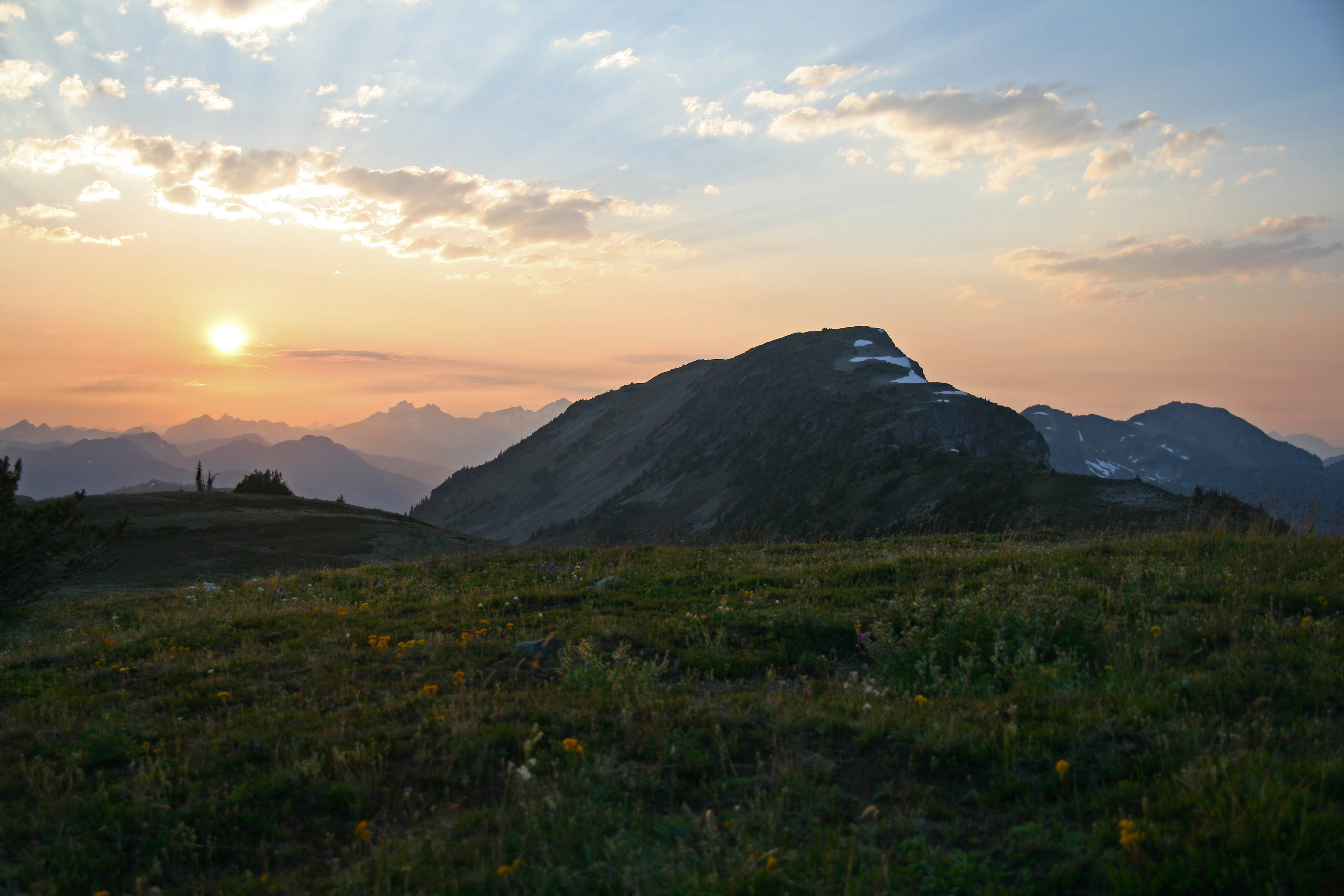
The northernmost section of the PCT passes through the Pasayten Wilderness, in Washington State. Its one of most magnificent sections of the trail.

One place to access the trail is at Slate Peak. This is the highest place, elevation-wise, that you drive a passenger car in State of Washington topping out at about 7,600 ft. Check the road conditions first, its a white-knuckler for sure.

Starting a hike at its highest point is always a bit strange, but it sure make the first days hiking easy, all down hill! On the first day we hiked from Slate peak and the parking area down to Holman Pass and then started back up.

Heading North from the Slate Peak parking area

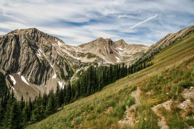
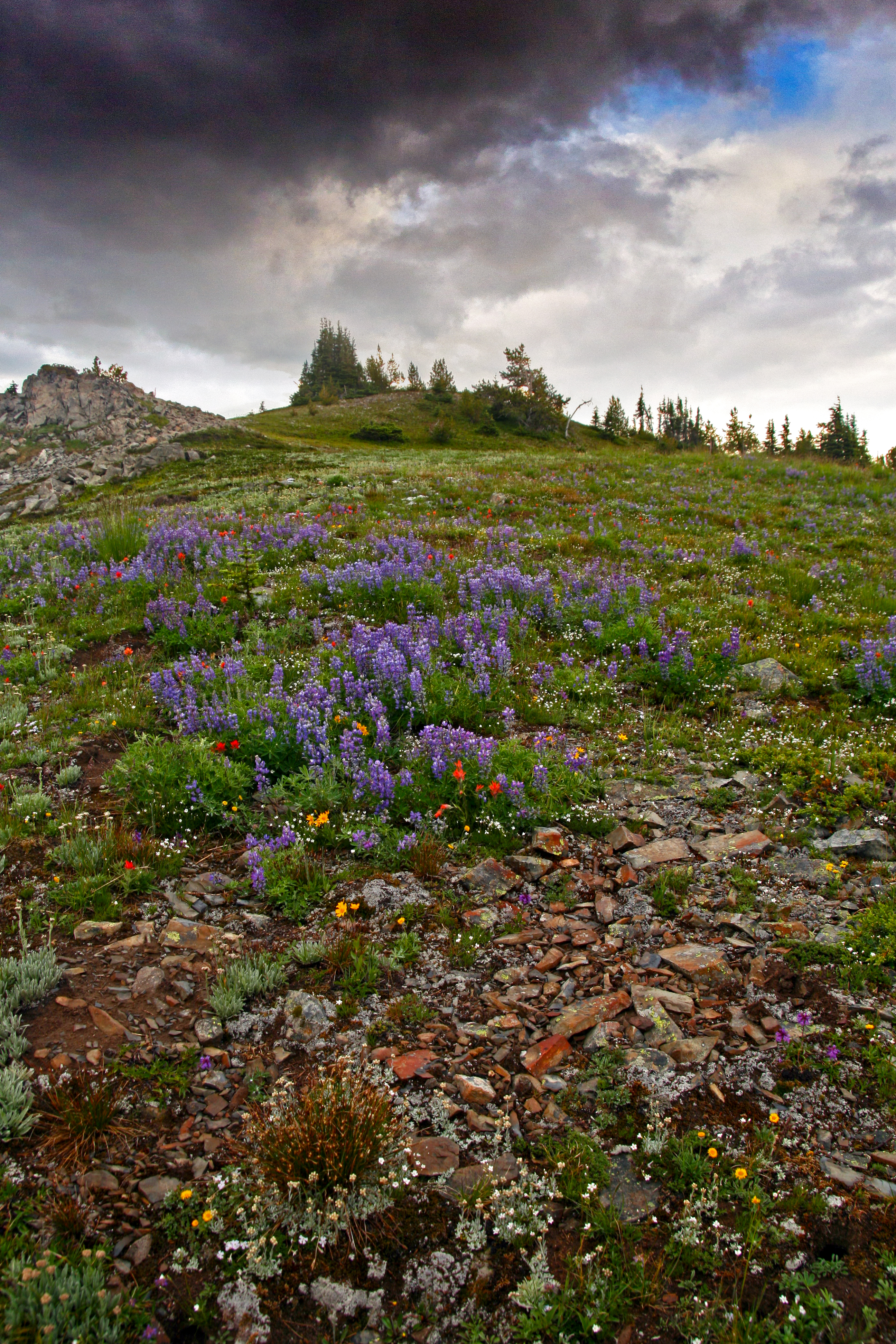
Here the trail passes through a glorious section on its way up to Rock Pass. The area is called the Parade Grounds, is a huge area, wide open meadows covered with flowers, interspersed with trees. There is a spring nearby and dispersed camping, and a short way off small Goat Lake.

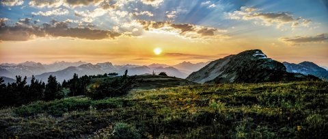
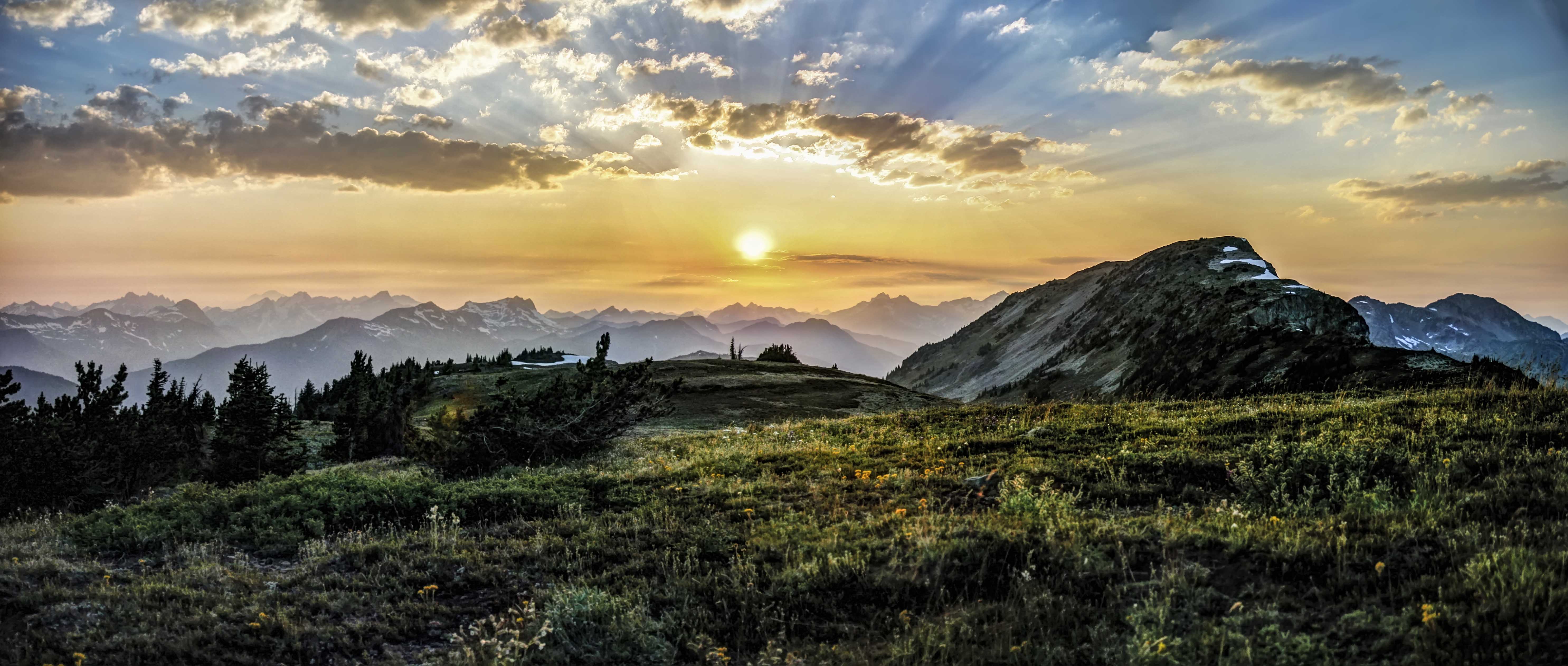
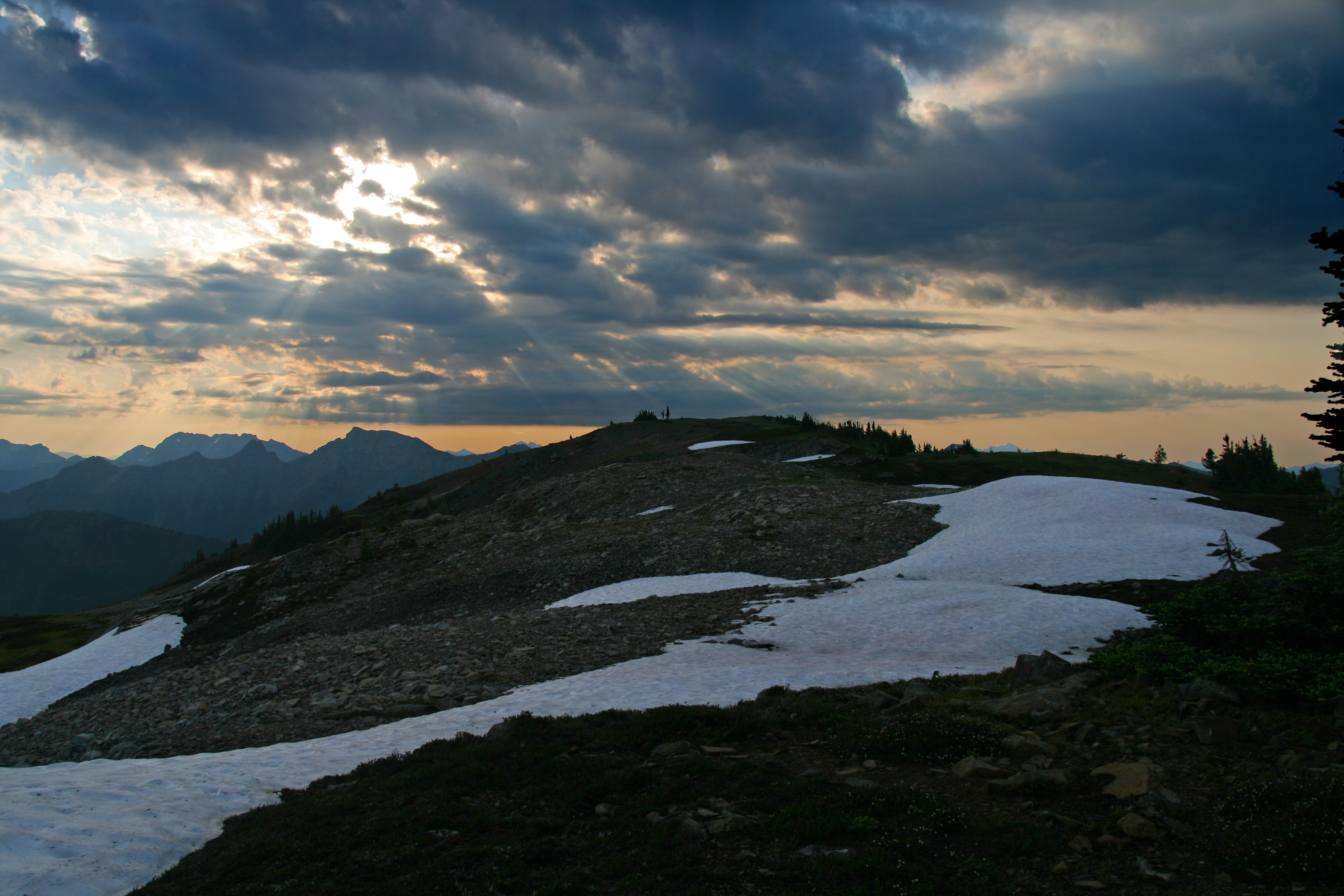
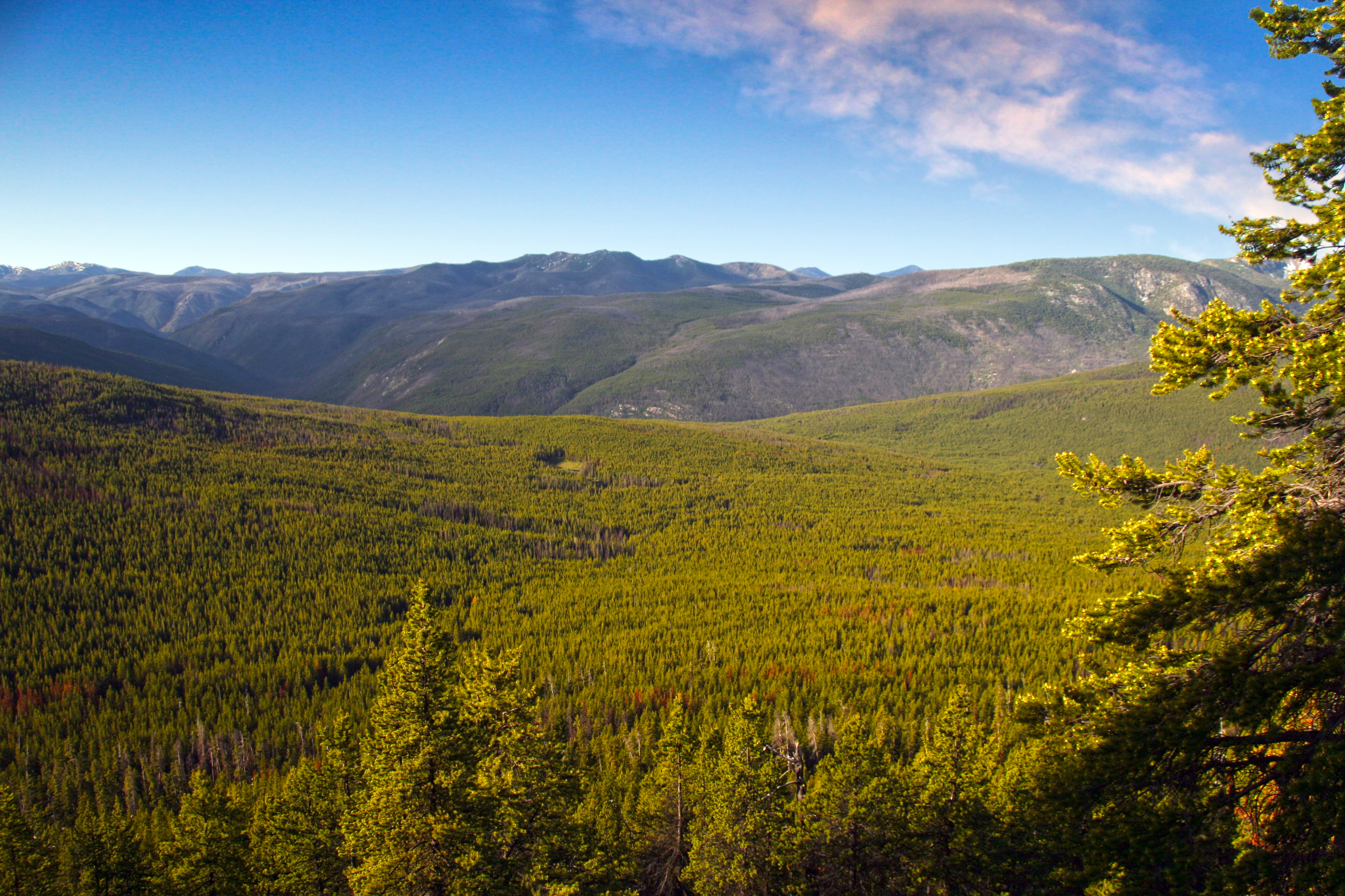
The crest of Rock Pass is truly stunning. The view below is looking north from Rock Pass. That’s Lakeview Ridge on the left. The PCT makes its way through Woody Pass (snow filled gap, left) crosses to the west side of Lakeview Ridge and continues north.

The PCT in past days traversed along the very top of the ridge here, from Rock Pass over to Woody Pass. But now the trail steeply switch backs down from Rock Pass, makes a creek crossing and then climbs laboriously back up to Woody Pass.

Pacific Crest Trail between Rock Pass and Woody Pass

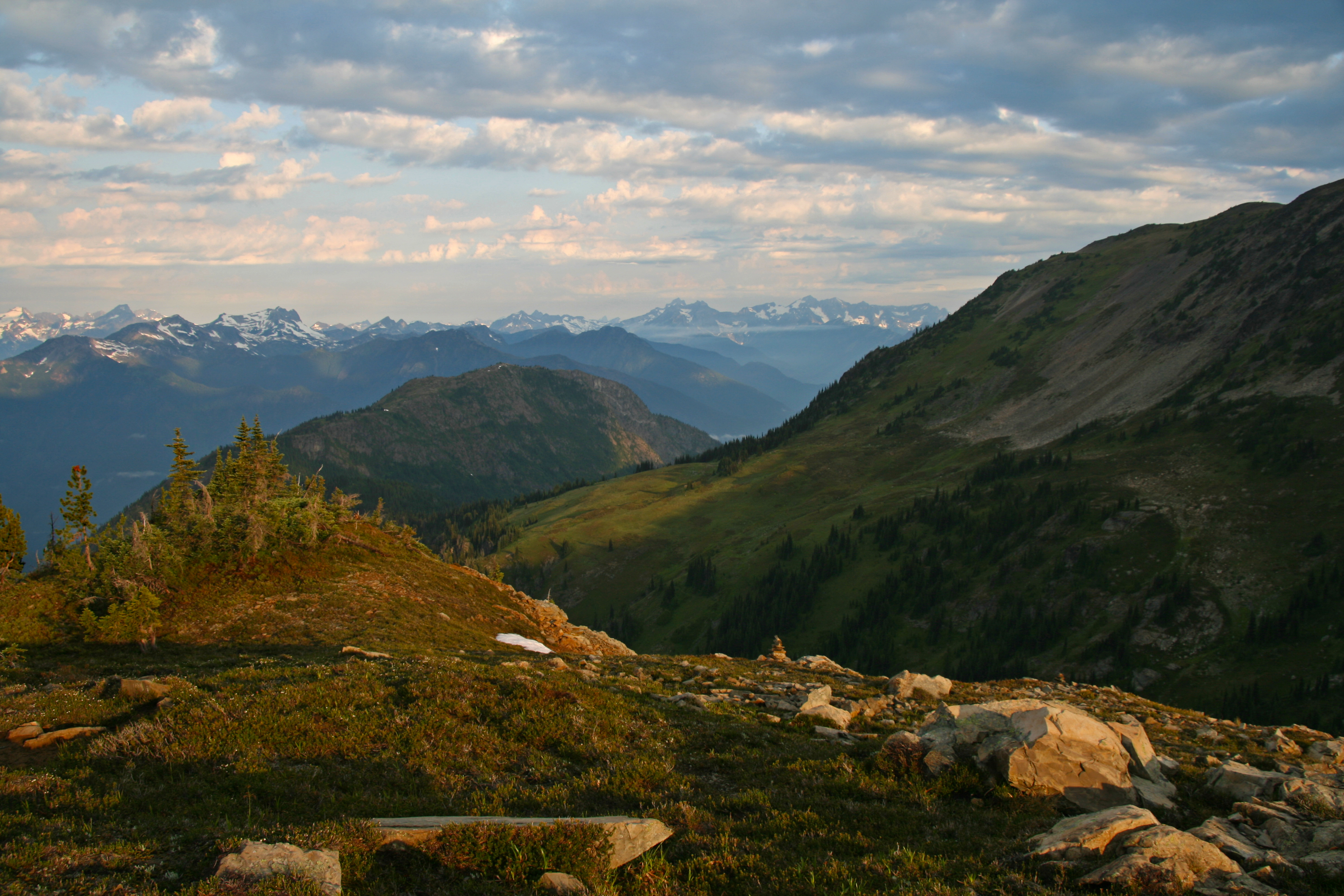
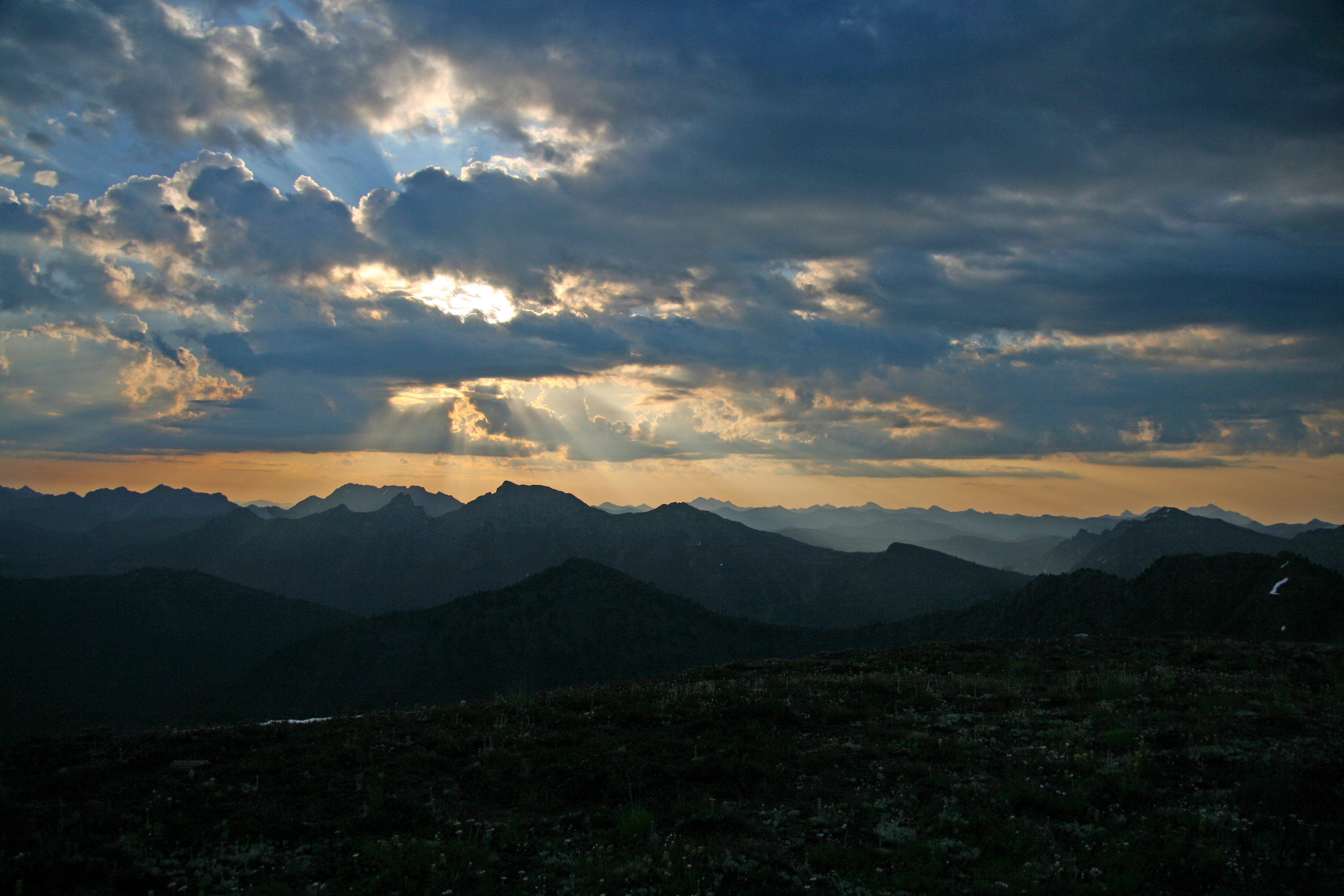
From Woody Pass the PCT swings along the west side of the Cascade Crest as it makes its way north.

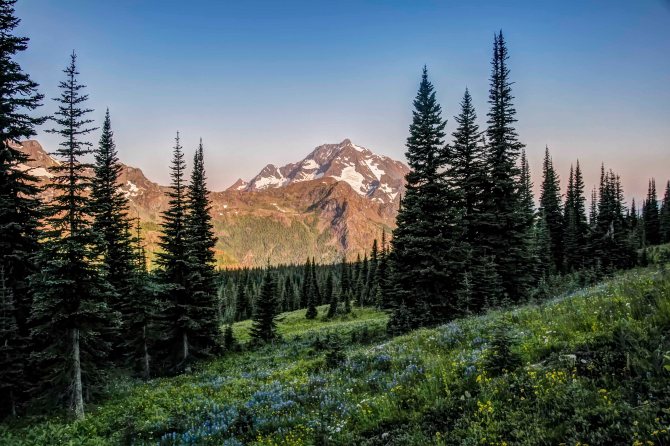
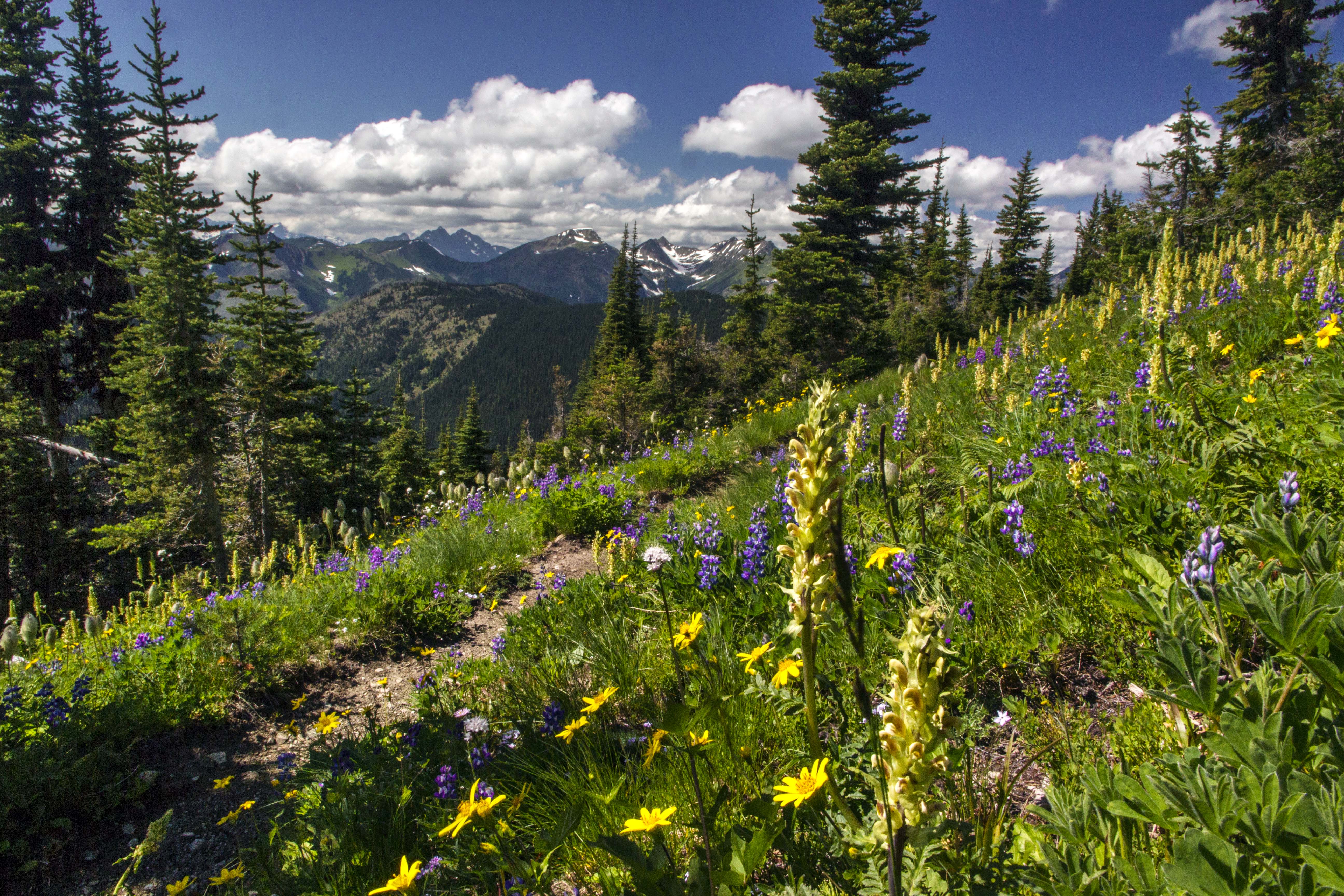
The ridge the trail follows is called Lakeview Ridge, and it offers some of the best views anywhere.

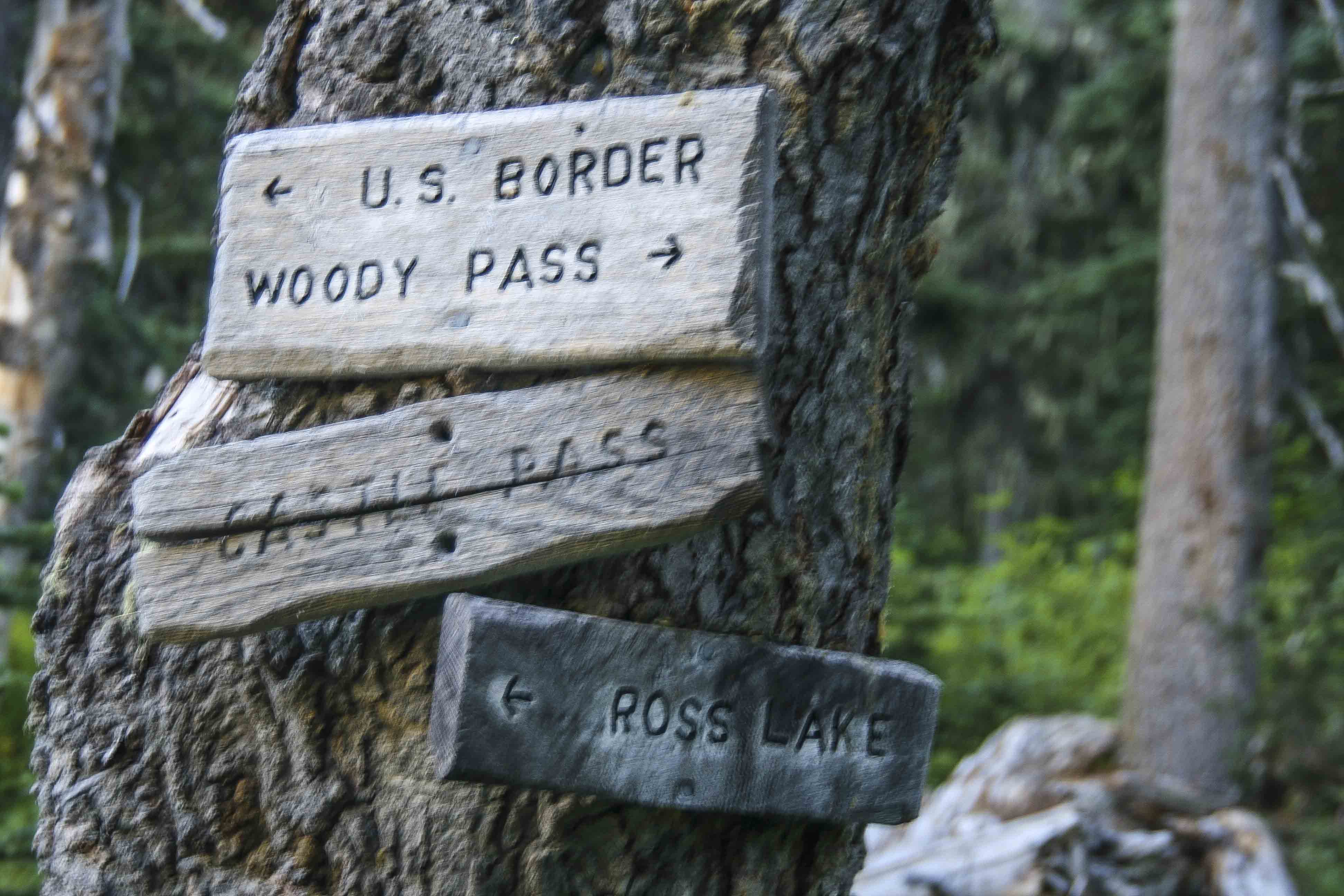
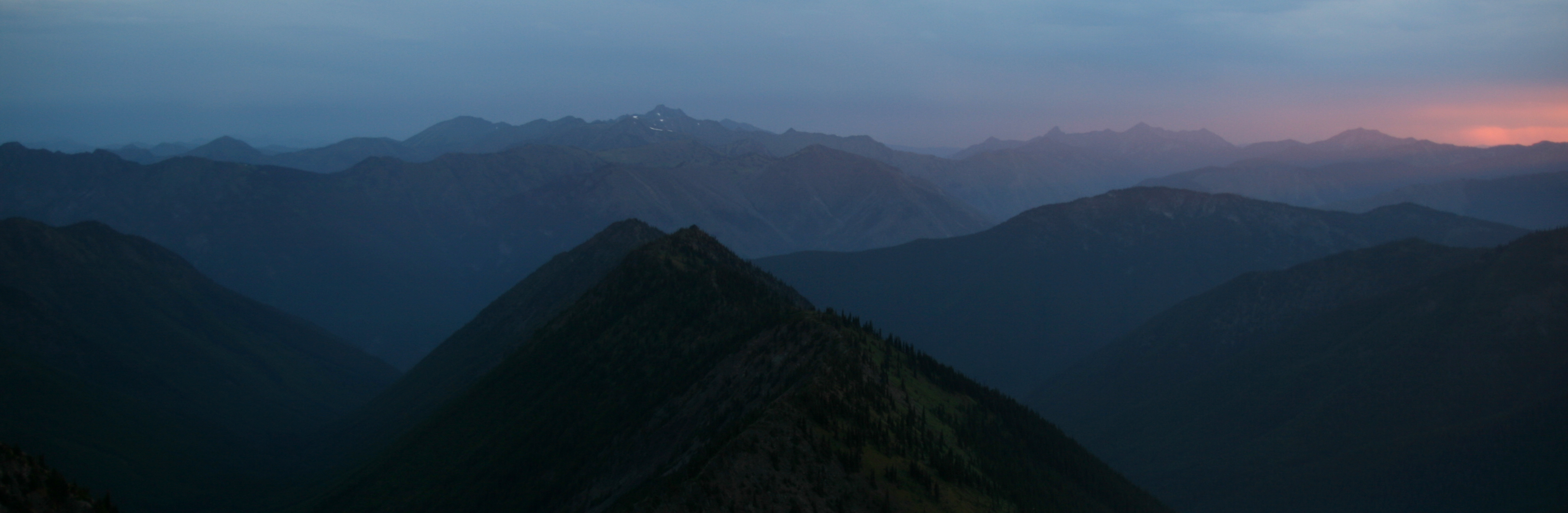
At the northern end of the ridge the trail descends the Devils Staircase to Hopkins Lake and then its only a few short, flat miles to Castle Pass and the Three Fools trail junction. The Canada Border lies just beyond.

Castle Pass

Jackita Ridge Trail, Devil’s Dome and the Three Fools Trail

One of the most fabulous backpacking loops I have ever done was in the Pasayten Wilderness.

We began at Canyon Creek trailhead, along Highway 20, hiked up the Jackita Ridge Trail, visited Devils Dome, then connected with the Pacific Crest Trail at Holman Pass and headed north. At Castle Pass we took the Three Fools Trail west, to Ross Lake, where we got the water taxi to Ross Dam and hitchhiked back home.

Here are a few pics from the trip.

Sunset atop Devils Dome, Pasayten Wilderness, North Cascades

Sunset atop Devils Dome, Pasayten Wilderness, North Cascades

This first one is a sunset from atop Devils Dome. We spent the night there, (08/08/08) and were observers of a spectacle of lightning storms that swept through that night, starting innumerable fires throughout the park. Like three fools we stayed there, atop the Devils Dome, mouths agape, as the night sky erupted and just watched.


Jack Mountain from Devils Dome, Pasayten Wilderness, North Cascades

Jack Mountain from Devils Dome, Pasayten Wilderness, North Cascades

This is Jack Mountain, from Devils Dome.  Hiking in the Pasayten Wilderness is wonderful, lots of views and flowers.

Cascade Crest from Jackita Ridge Trail, Pasayten Wilderness

Cascade Crest from Jackita Ridge Trail, Pasayten Wilderness

This was taken from the Jackita Ridge Trail, looking west – southwest. That long green meadow inviting you is Devils Garden.

Here is another view from the trail.

Jack Mountain, Pasayten Wilderness

Jack Mountain, Pasayten Wilderness

After Devils Dome we made our way to Holman Pass where we intersected the PCT and turned north. The image on the right is from a glorious meadow (with a spring) just before Rock Pass. And the Double Rainbows is at Rock Pass looking north. That’s Lakeview Ridge stretching to the distance.

The wildflowers are all over (assuming you’re there at the right time!)

The Three Fools Trail was a struggle. It hadn’t been maintained in more that a decade, there were more than 200 down trees between Elbow Basin and Three Fools Creek…it was brutal!

The sunsets, however, were magnificent. This is from Elbow Basin.

The Three Fools Trail lived up to its hype: Stunning scenery, no one to be seen anywhere and you’d have to be a fool to try!


Big Face Mountain from the Three Fools Trail, Pasayten Wilderness

Big Face Mountain from the Three Fools Trail, Pasayten Wilderness

Here is Big Face Mountain from the trail.


Ross Lake from the Lightning Creek Trail, North Cascades National Park

Ross Lake from the Lightning Creek Trail, North Cascades National Park

and lastly, Ross Lake, from the Lightning Creek Trail.

That was my first visit to the section of the PCT from Holman Pass, north to the border with Canada. I have revisited several times, access is not bad, at Slate Peak. You can park at a junction with the PCT, at 7,000 ft elevation to start your hike!

The views along Lakeview Ridge are to die for…that will be the subject of the next post!

Oh, the hitchhiking home part: When we debarked the water taxi and hiked up to Highway 20 we were more than a bit surprised to see hordes of cops. Not just regular ones, Border Patrol, guys in kevlar with nasty weapons, the place was swarming with them!

Eventually one of the cops came over to ID us sketchy looking hitchhikers and being polite and all the cop arranged a ride for us home. It turned out that a Park Employee had stumbled upon a huge marijuana farm, right there, near Ross Lake! So they came up with the swat team and got boats and went to raid the pot farm, but by the time they got there, the farmers had fled to parts unknown…

Pacific Crest Trail along Lakeview Ridge in the Pasayten Wilderness

Pacific Crest Trail on Lakeview Ridge, Pasayten Wilderness

Pacific Crest Trail on Lakeview Ridge, Pasayten Wilderness

A Stormy Night Atop Devils Dome

Devils Dome_Panorama 101m
We arrived atop Devils Dome late in the afternoon and set up camp. Devils Dome, Pasayten Wilderness
Though we were atop the peak snow fields nearby supplied us with water. The sunset was magnificent, but we watched it from inside our tent mesh because the mosquitoes were ravenous. Devils Dome Sunset
Devils Dome affords a 360 degree view of Jack Mountain, to the south, Hozomeen to the north, The glaciated peaks of North Cascades National Park to the west and a broad expanse of the Pasayten to the east. Devils Dome Sunset 5
Devils Dome Sunset 2
Devils Dome Sunset 10
After a wonderful dinner we quickly went to sleep excited about the beauty tomorrow promised.

Something woke me up. I lay for a moment with eyes closed, sensing. There was a stillness, which was odd seeing that I was camped on a mountain top, and the smell of rain in the air. Suddenly opening my eyes I saw that the sky was clouded over. I lay for another moment reluctantly picturing myself getting up and putting the rain fly on the tent when I saw the flicker of lightning in the eastern sky. I sat up looking…there was another flash…and another.

Quickly exiting the tent I stood scanning the sky. There was lightning to the east…then to the south, then again, to the west…the dark tumultuous sky was alive with flashes, the peaks briefly illuminated and then again black shapes…I looked on in wonder…and then it stated raining.

I quickly awoke my two companions and let them know that they needed to get up, get dressed and get out of the tent and give me a hand. At first they were both saying, “why don’t you just put on the rain fly and get back in, go back to sleep…” and I replied that if they stayed in the tent that they would miss the lightning show…that provided sufficient motivation and they were soon out of the tent, looking at the skies. The lightning was getting more intense, more frequent…we could see the glow of a fire to the west, over towards Ross Lake and the National Park boundary.

Devils Dome Sunset 6

My plan was simple: get the rain fly on the tent, throw all our stuff in it, don our rain gear and then lie on the grass and watch the show. But my two friends had other ideas. One strongly advised that we immediately depart and head down the mountain to find shelter from the lightning. My other friend insisted on a more simple approach: do nothing and simply enjoy the storm. I started with the rain fly and loading the tent and soon they came to assist me.

Some one came up with the idea of planting our trekking poles in the ground, well away from the tent, to act as lightning rods (!). And so, now somewhat content with our preparations, we all watched.

The rain started to come down now. The wind picked up, strong gusts blowing across the summit. The flashes became more insistent, more frequent. With each flash the ridges between us suddenly appeared out of darkness, and then…gone back to my imagination, leaving lasting imprints of what had just been illuminated. From our vantage point we could see what looked like 6 or so fires burning
Devils Dome Sunset 9
On three sides of us there were regular flashes, every few seconds, another, and then another. The wind and rain continued unabated. In fact they increased along with the regularity of the lightning, each building to a crescendo. The lightning now seemed to take on a reddish hue, then green or blue (was it just my imagination?)

Transfixed by the sheer beauty, we had front row seats for natures own fireworks show, the best we had ever seen. Just as I was starting to edge towards getting the hell out of there the tempest began to lessen, the wind shifted. The lightning to the west, which seemed to head towards us, stopped.
Devils Dome Sunset 4
And that was it! The storm cell had passed us by. The lightning to the east faded out and in its place we could now see the faint hint of the sun.

The date was 08/08/08. This was the opening night of the Olympics in Bejing, and we mused that the fireworks we had just seen surpassed theirs, hands down. It was also the scheduled date for the start up of the Large Hadron Collider and we considered that the lightning storm was a direct result of the resultant black holes now devouring earth. These points we avidly debated, but all agreed that the peak was rightly named: Devils Dome.
Devils Dome Sunset 8
As the excitement died down my friends retired to sleep and I ventured forth to catch some of the morning light.
Devils Dome Sunset 7
The Pasayten Wilderness is one of my favorite places in Washington, a land of mountains and rivers, steep valleys and meadows, wildflowers and zen like peace. This experience, on day 6 of our twelve day trek which started at the Canyon Creek Trail head on the North Cascades Highway.

Our journey was just getting started…
flowers and clouds 4

Amphitheater Mountain from Upper Cathedral Lake

amphitheater mountain from upper cathedral lake and sunset2em
Amphitheater Mountain from Upper Cathedral Lake, Pasayten Wilderness, on the Pacific Northwest Trail

Horseshoe Basin, Pasayten Wilderness

Horseshoe Basin, in the Pasayten Wilderness is one of the few places in the lower 48 states where you can find wide expanses of tundra. In July when the snow has just melted the basin is alive with myriad wildflowers sprouting out of the grass as far as you can see.
This first image is from the trail junction where the trail from Iron Gate meets the Boundary Trail (also known as the Pacific Northwest Trail).
horseshoe basin trail junction em
As you progress westward on the PNT through the glory of Horseshoe Basin you will soon encounter Louden Lake. If you visit here in the fall the lake is little more than a small mud pond, but in early summer the wide flat lake provides ideal reflective qualities! And hordes of mosquitoes!
Louden Lake em

Flowers of the Pasayten Wilderness

Pasayten Lupine
Lupine along the Boundary Trail

Pasayten Paintbrush
Paintbrush near Cathedral lake

Wildflower Rock Garden along the Pacific Northwest Trail

Windy Peak from the Boundary Trail, Pasayten Wilderness


Windy Peak from the Boundary Trail (Pacific Northwest Trail), Pasayten Wilderness