Visited Cypress Island this weekend. Took a few shots of the sun, moon and stars. Oh, and water and a few boats, too.


Visited Cypress Island this weekend. Took a few shots of the sun, moon and stars. Oh, and water and a few boats, too.
 Sunset from Copper Ridge
The trek started at the Hannegan Pass trail head. We arrived Friday morning to a full parking lot and sunny skies ready to tackle a hard 5-day loop through the North Cascades. Weather reports for the area called for dicey weather, partly sunny/cloudy with a high percentage of thundershowers. But like most fools I told myself that this forecast did not by some magical, mystical way, apply to me.
Actually the story started 7 years ago when I hiked the Copper Ridge trail forded the Chilliwack River and made acquaintance with a bunch of spawning salmon. The image of all those bright red salmon in the pristine waters, deep in the wilderness just pulled me back, that and the lure of making it to Tapto Lakes, above Whatcom Pass.
The first days hike took us up to Hannegan Pass and then, entering the North Cascades National Park, up to Selesia Camp on Copper Ridge. This is easily on my list of top 3 or 4 camp sites in the park, the views of Mount Shuksan, Ruth Mountain, Whatcom Peak and the Picket Range and many more are just breathtaking.
 The Picket Range under Storm Clouds
 Mount Shuksan from Selesia Camp
The night brought lightening and thunder and rain but the morning, to our surprise was clearing. We headed up to the Copper Ridge Lookout, at 6,600 ft the highest point along the trail. The park ranger was there to greet us and we toured the lookout while she pointed out the names of all the peak surrounding us. The trail ascending to the lookout from the north meanders through a bright green meadow in a sinuous s-curve just below the lookout. Years ago I captured a wonderful shot of a hiker climbing out of the abyss…
 Out of the abyss, Copper Ridge, North Cascades – 2006
 Hiker Approaching the Copper Ridge Lookout – 2013
Tanya, the Park Ranger commented that a lone hiker was approaching from Copper Lake and so now another chance was upon me to see about capturing again the silhouette against the backdrop of deep valleys.
Reluctantly departing from the views and company at the lookout we continued our ridge walk, descending to Copper Lake we stopped for lunch and a swim in its azure waters.
Surprisingly the weather held up and as we made the long traverse of the ridge the views were magnificent. Mount Redoubt and Bear Mountain stood out along the way.
 Copper Ridge Panorama
 Storm clouds over Mount Redoubt
Reaching the end of the ridge we started down the long, seemingly endless series of switch backs towards the ford of the Chilliwack River and Indian Creek. The changes in the flora were dramatic as we descended from a bare forest floor carpeted with pine needles into a real rainforest, lush and green and wet.
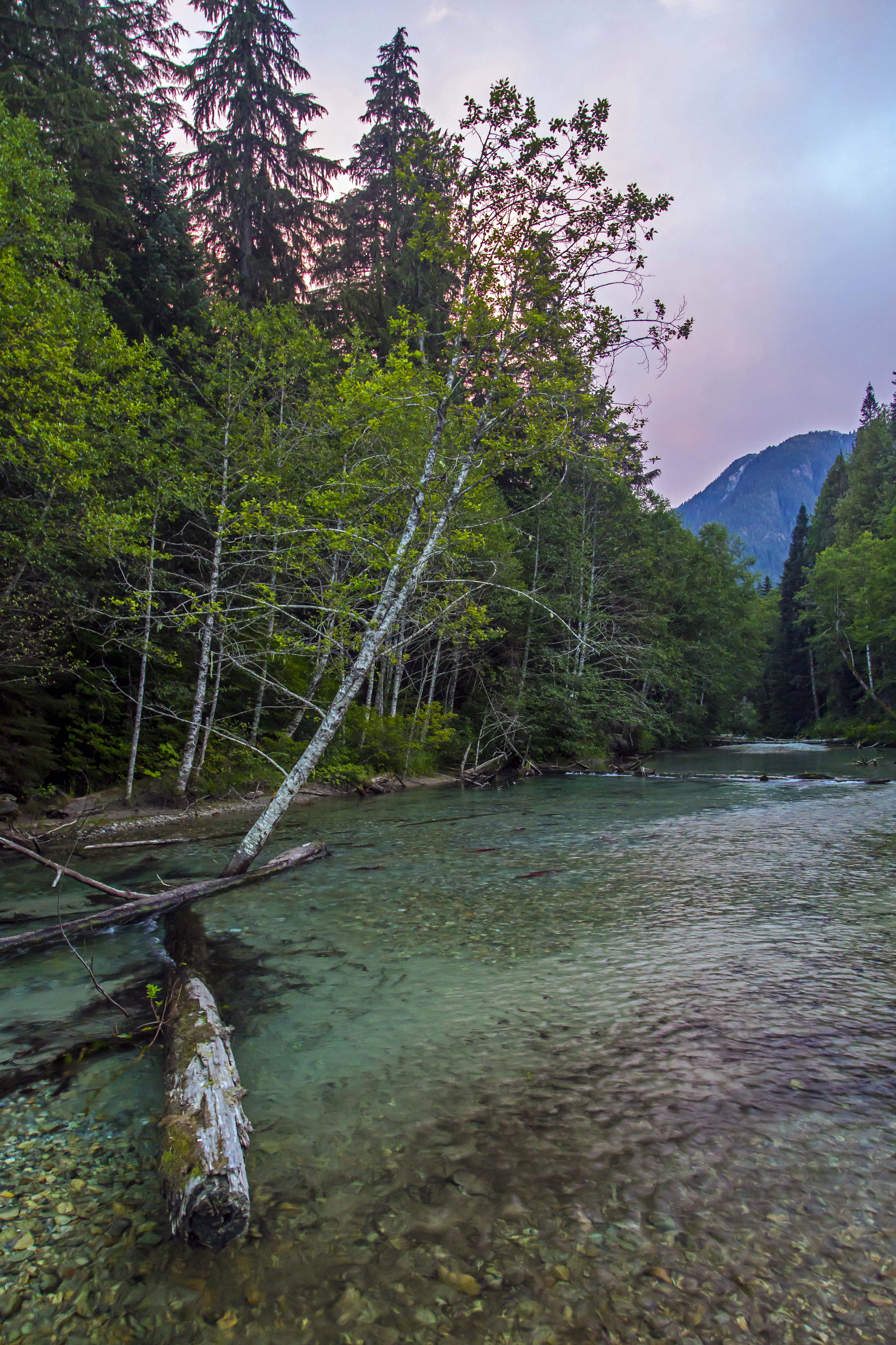
The two channels are parallel for a short time here, first crossing the Chilliwack and then a short section of forested river bed we came at last to Indian Creek and behold, the salmon were there, spawning in great numbers. Taking off shoes and socks again we looked for a ideal spot to rest and relax to enjoy the wonder of the place. a gravel bar at the point of confluence between the two streams was a perfect place.
Indian Creek is not a big stream, maybe 80 feet across here as it spreads out along the valley floor and shallow, knee-deep with some nooks where the water is as deep as 3 to 5 feet.
 Salmon in the Creek
The salmon were there, just as before. They were not headed anywhere, the group of 70 or so simply treading water, looking happy to finally be back home.
Clambering out along logs and snags I tried to capture shots of the scene. the bright color of the fish is so impressive, they seemed to hover in the sparkling clear waters, the colorful stones looking like the ground far below while the salmon soared through the sky above.
 Flying Fish
The place is so remote, the forest envelopes you and it is like having gone back in time. Deep in that valley was like being in a different life, on a different planet.
 Indian Creek Salmon
I bounced between standing still in wonder, trying to get some food, wanting to capture images and the strong desire to do something to take care of my aching feet. About 100 feet upstream a large brown/black bear appeared along the shore. we both froze, considering each other. As I started towards the camera a sharp noise frightened him back into the forest, my dreams of imaging the bear snacking on salmon vanished…
Sunset came swiftly. reds and blues and pinks and purples painting the waters with their fantastic hues.
 Sunset at Indian Creek
Night brought even harsher weather than the night before. The crashing of thunder now muted by the deepness of our camp in the forest. I was again happily surprised to awaken to clearing skies and spent the next hour or so back in the stream with the salmon. Morning fog made the scene even more ethereal.
 Morning fog over Indian Creek
It was a struggle to pull away and start the long slog up to Whatcom Pass.
The suspension bridge above Indian Creek sways as you cross, the views up stream were captivating, the water coursing down in the dark green forest.
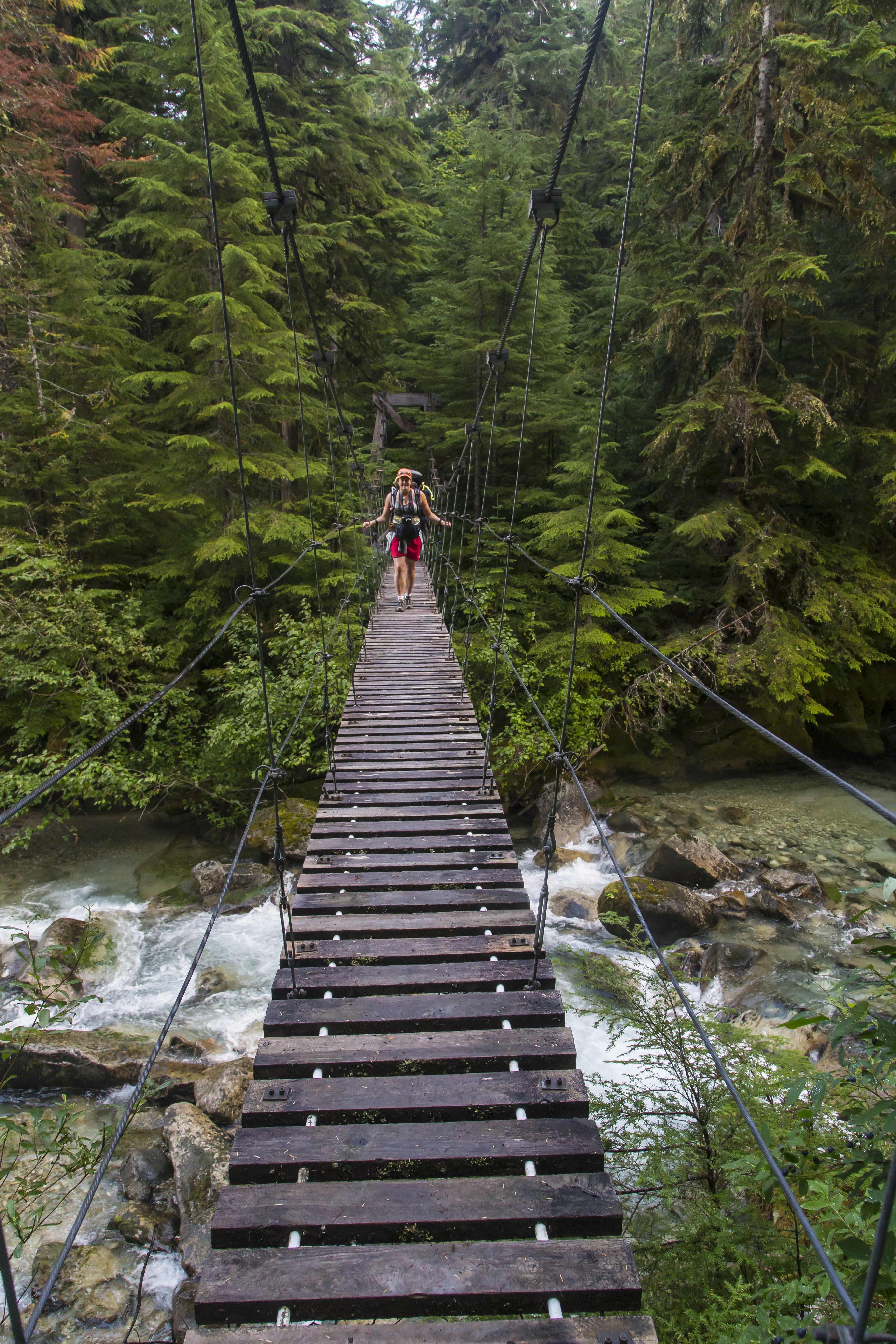 Suspension bridge over Indian Creek
 Indian Creek Waterfalls
During the days travel we encountered many people: day-hikers and mountaineers, young and old(er), lost and found. I advised one and all to make a point to take the time to go visit the salmon.
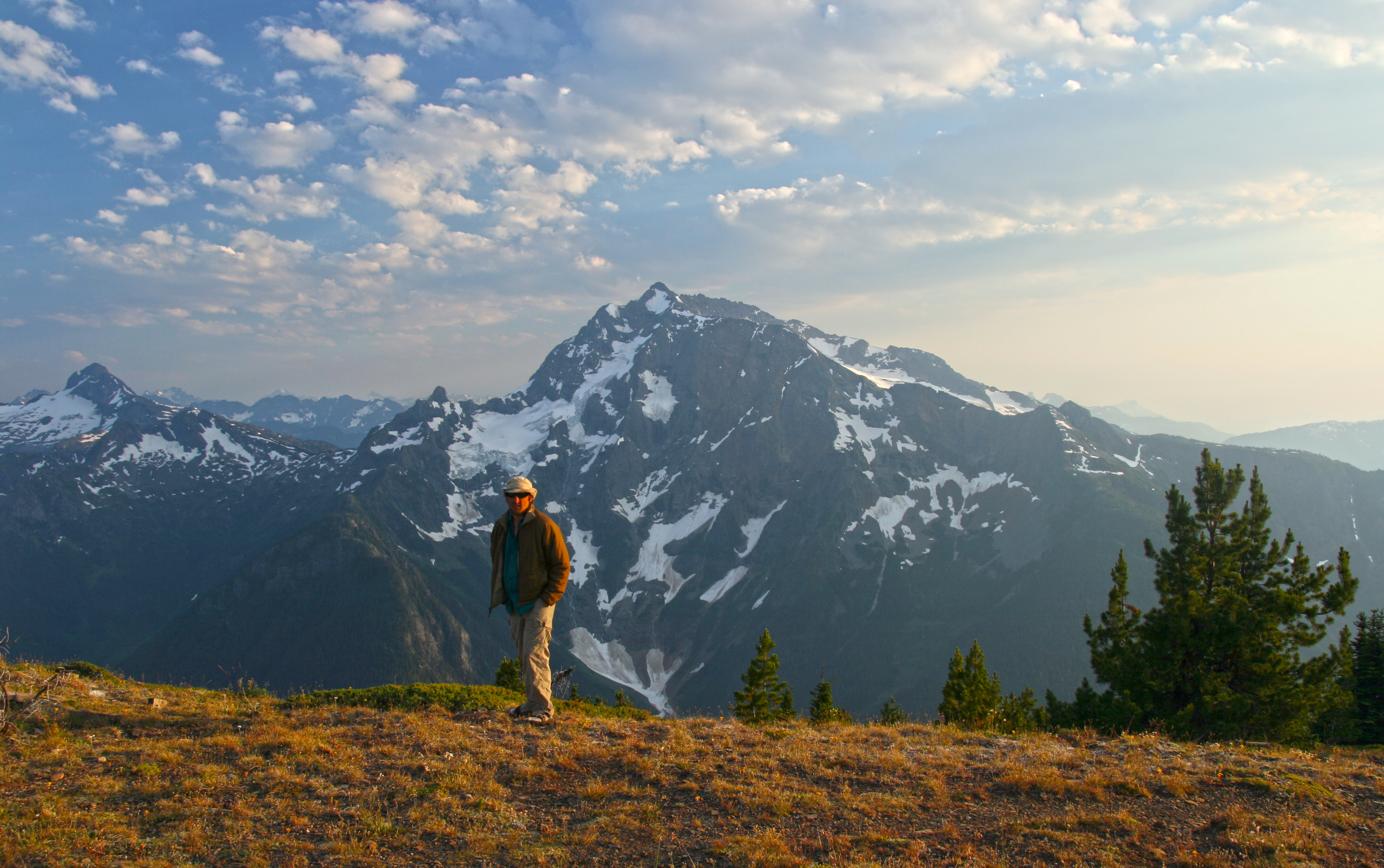
As we climbed up along Brush Creek the weather got gloomier and as we made it to the final climb at the valley head rain started. Our goal was Tapto Lakes that night, another hard 1,000 feet above the pass, but when we made it to Whatcom Camp the rains were pounding. Cold and wet we hurriedly set up the tent. Dry clothes, warm sleeping bags and hot food tend to improve the spirits quickly.
That night the storms really pounded. The tent was alight with flashes, the thunder and lightening coming simultaneously. Protected somewhat by the trees and the fact that we were a quarter mile down from the pass we lived through it, and awoke to an almost complete white out.
 Mt Challenger lost in clouds
My desire to hike another 1,000 vertical feet evaporated and I headed down the trail, back towards the Chilliwack.
Once back at the junction we’d passed the day before my path turned upstream, headed to Hannegan Pass to complete the loop. Fording the Chilliwack is now a more daunting proposition, the valley steeper and more narrow. Hikers are afforded two choices: to ford the waist-deep waters or to pull yourself across in an aerial cable-car!
 Chilliwack Cable Car
That choice was easy1 The cable car is in great shape, holding up to two backpackers (and their gear) the pulley system makes it easy to make the crossing, gliding 100 feet above the river below.
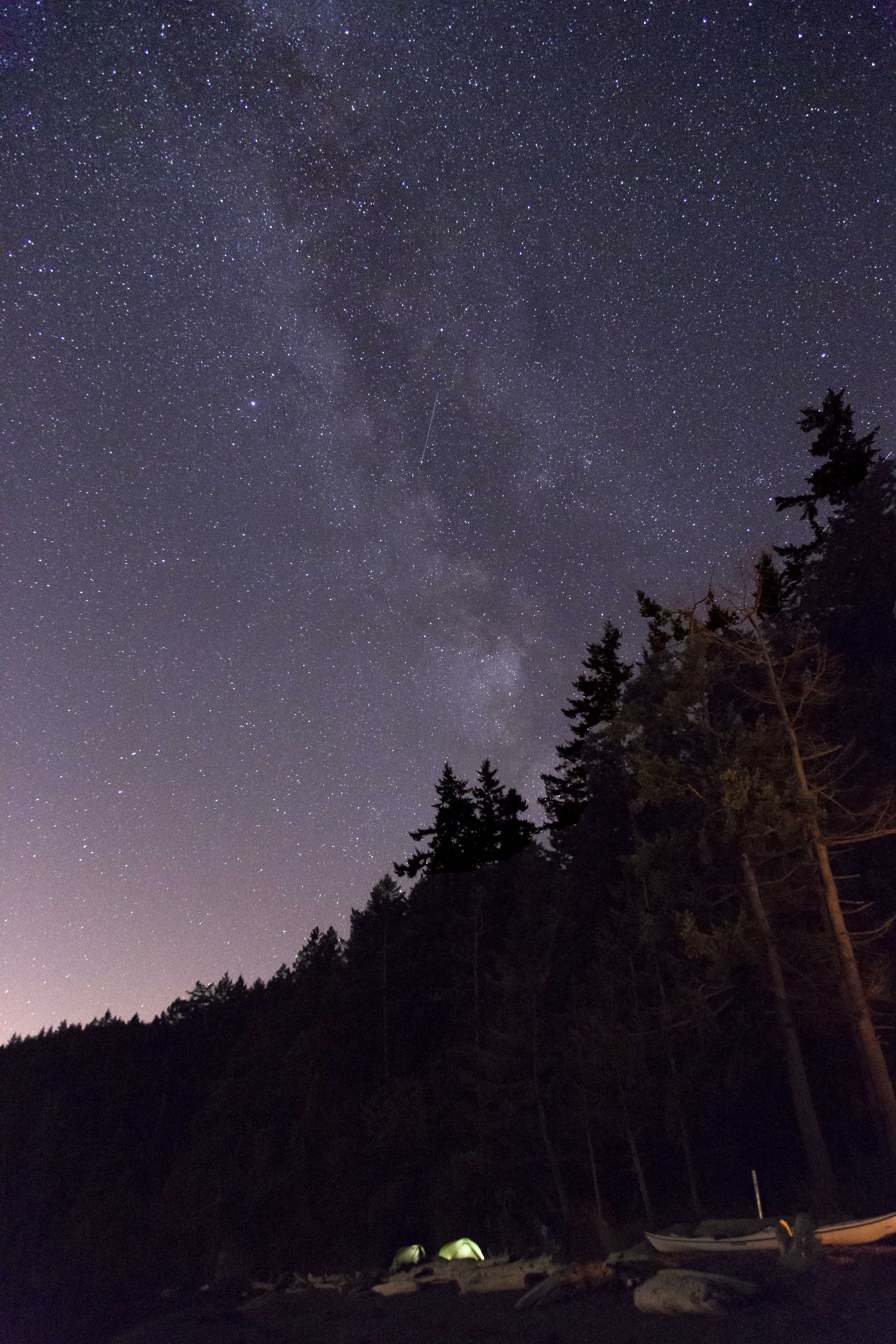
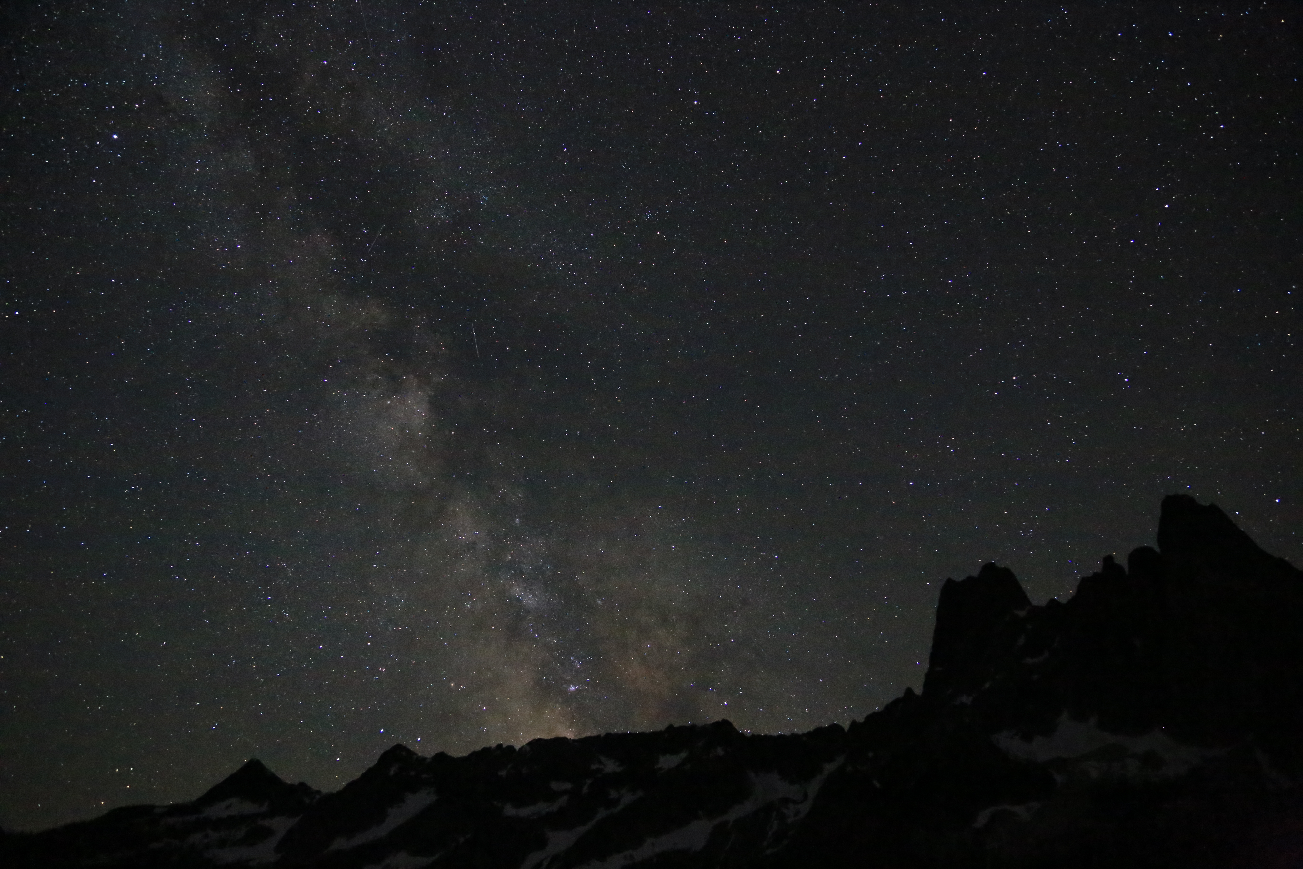
The last nights camp was at the Copper Creek camp, hoping to get a glimpse of meteors above we perched ourselves on the stones with w pie-sliced view of the heavens.
 Stars along the Chilliwack River
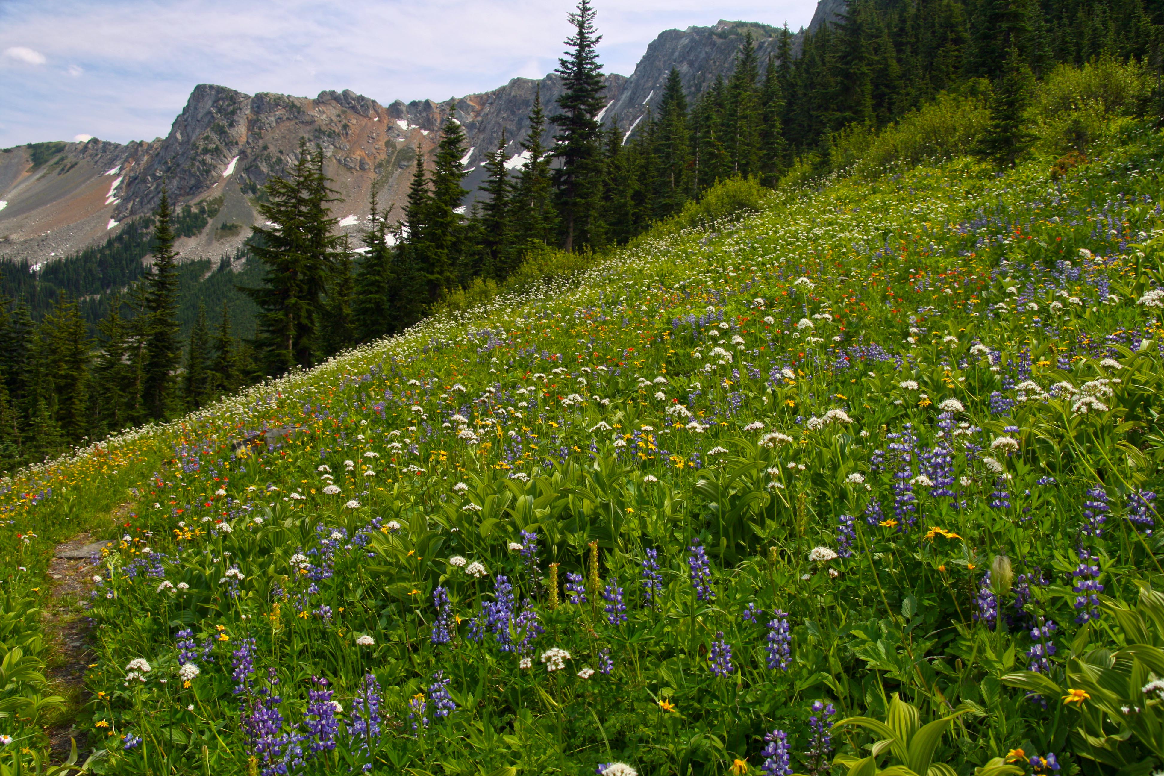
The last days hike up and over Hannegan Pass and back to the car was completed before lunch, the trails edge bordered with a carpet of herbaceous wildflowers.
As always my feelings are mixed at trips end: relief at the prospect of real food, a warm shower, soft bed and time off my throbbing feet but as we jump in the car for the drive back my heart is already longing for the cool, clear waters of the Chilliwack…
 Copper Ridge Panorama
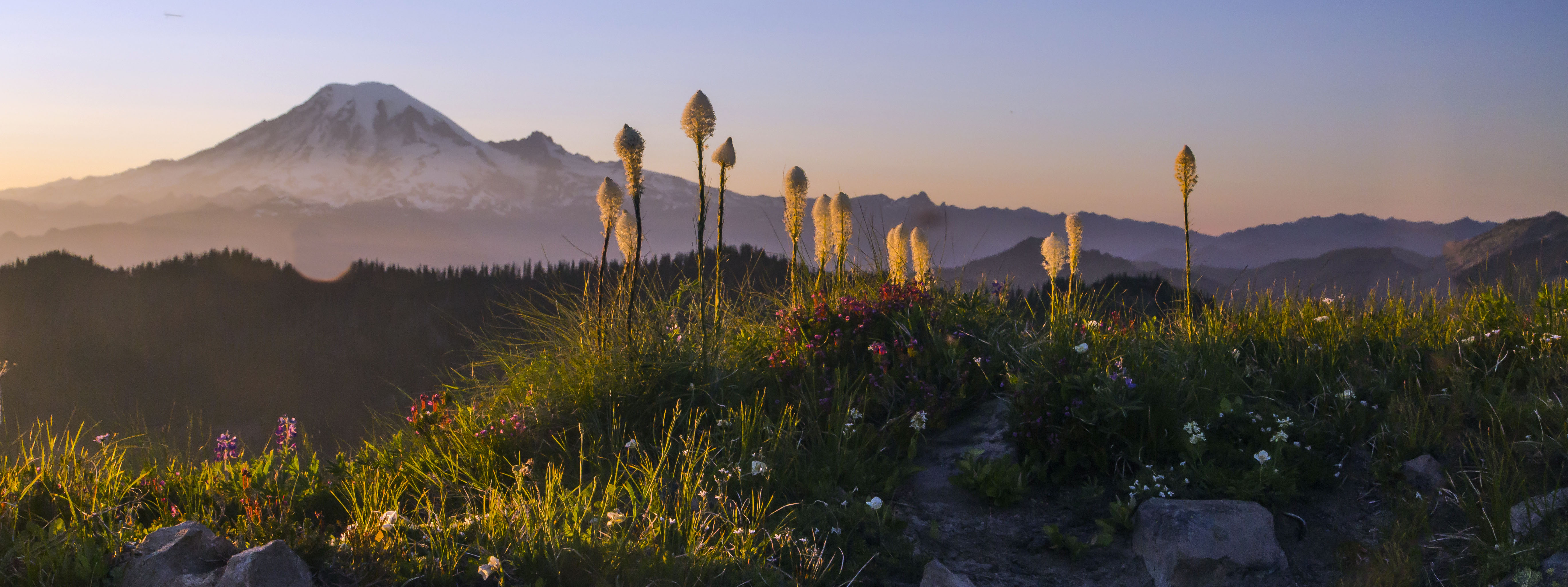
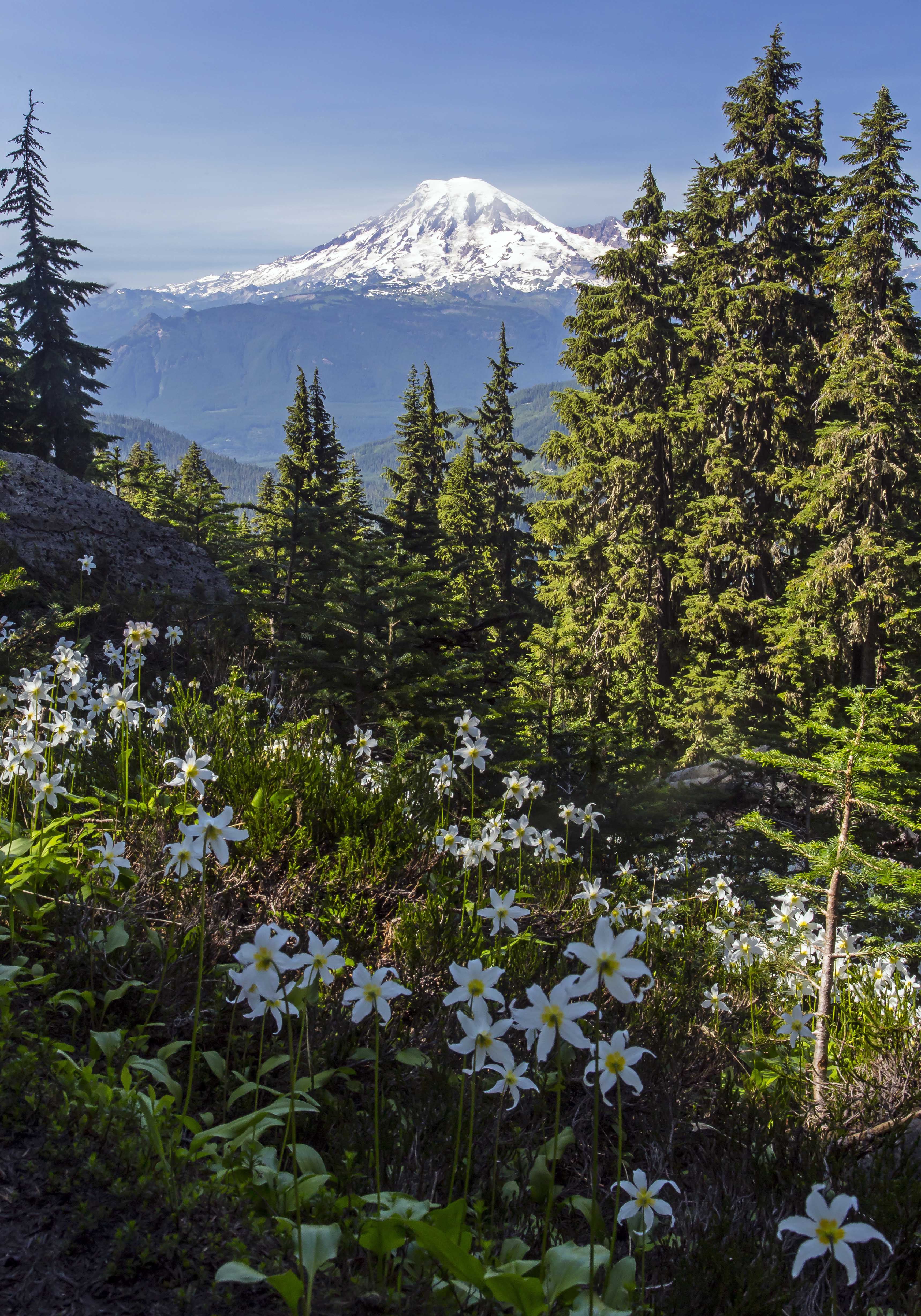
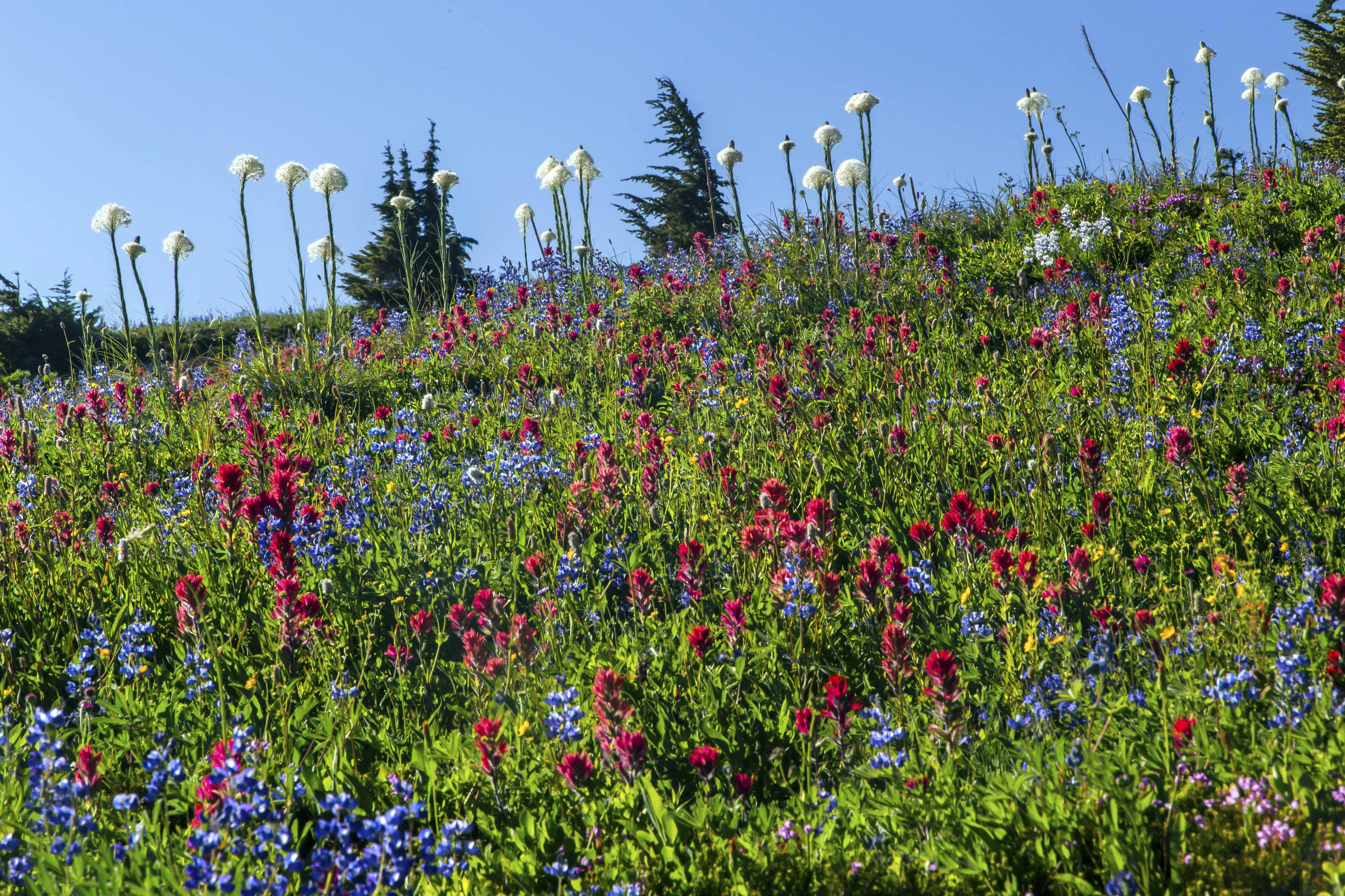
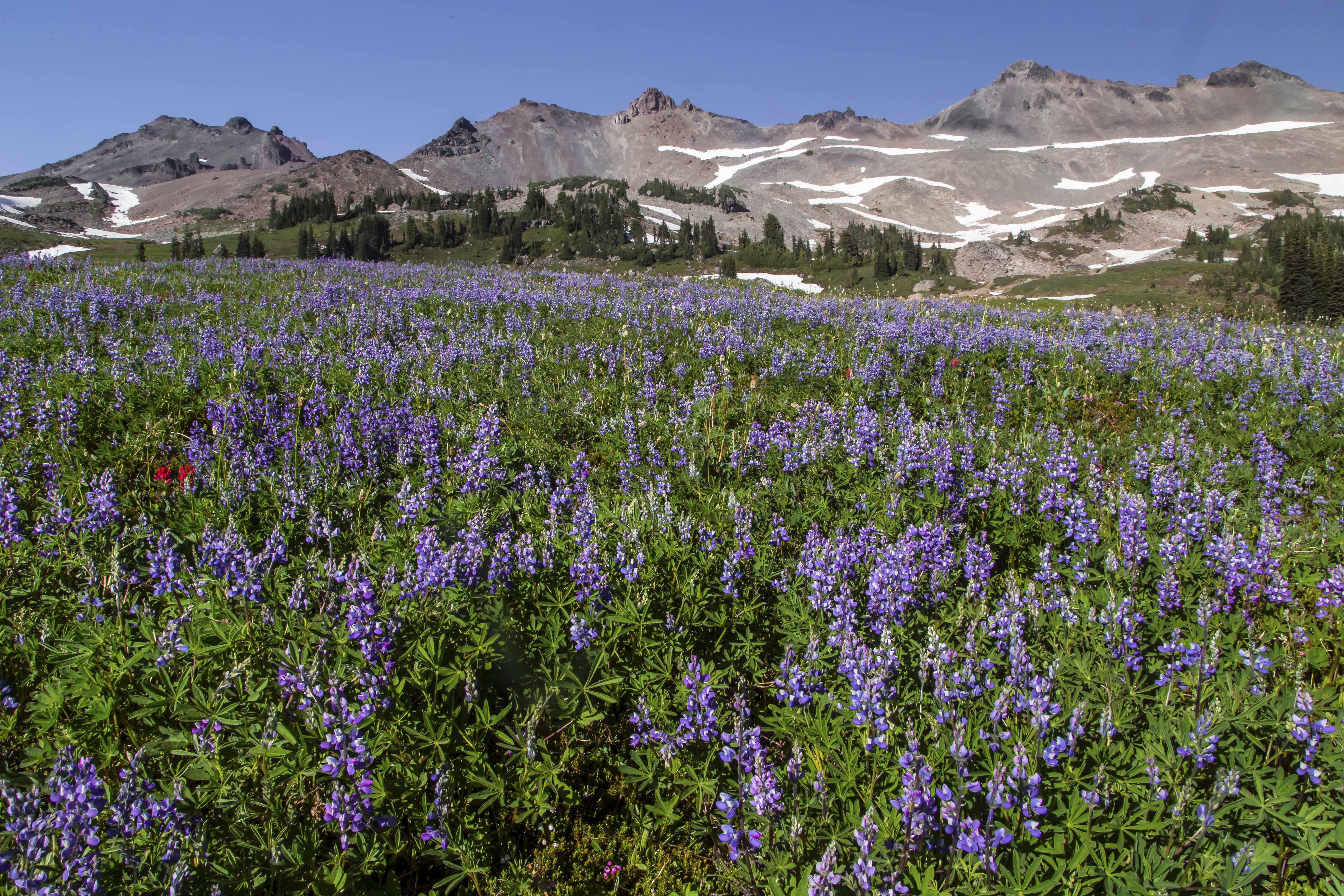
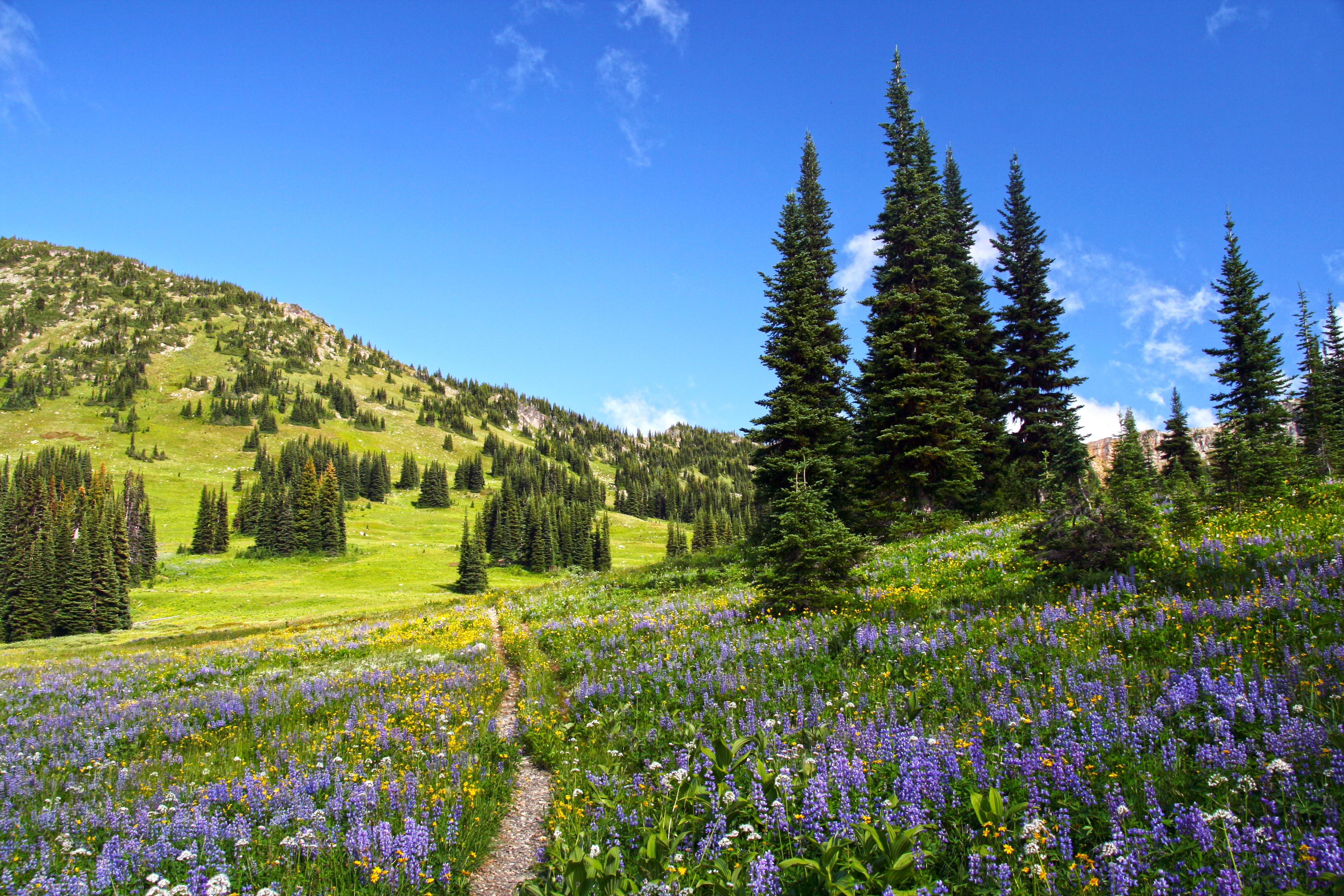
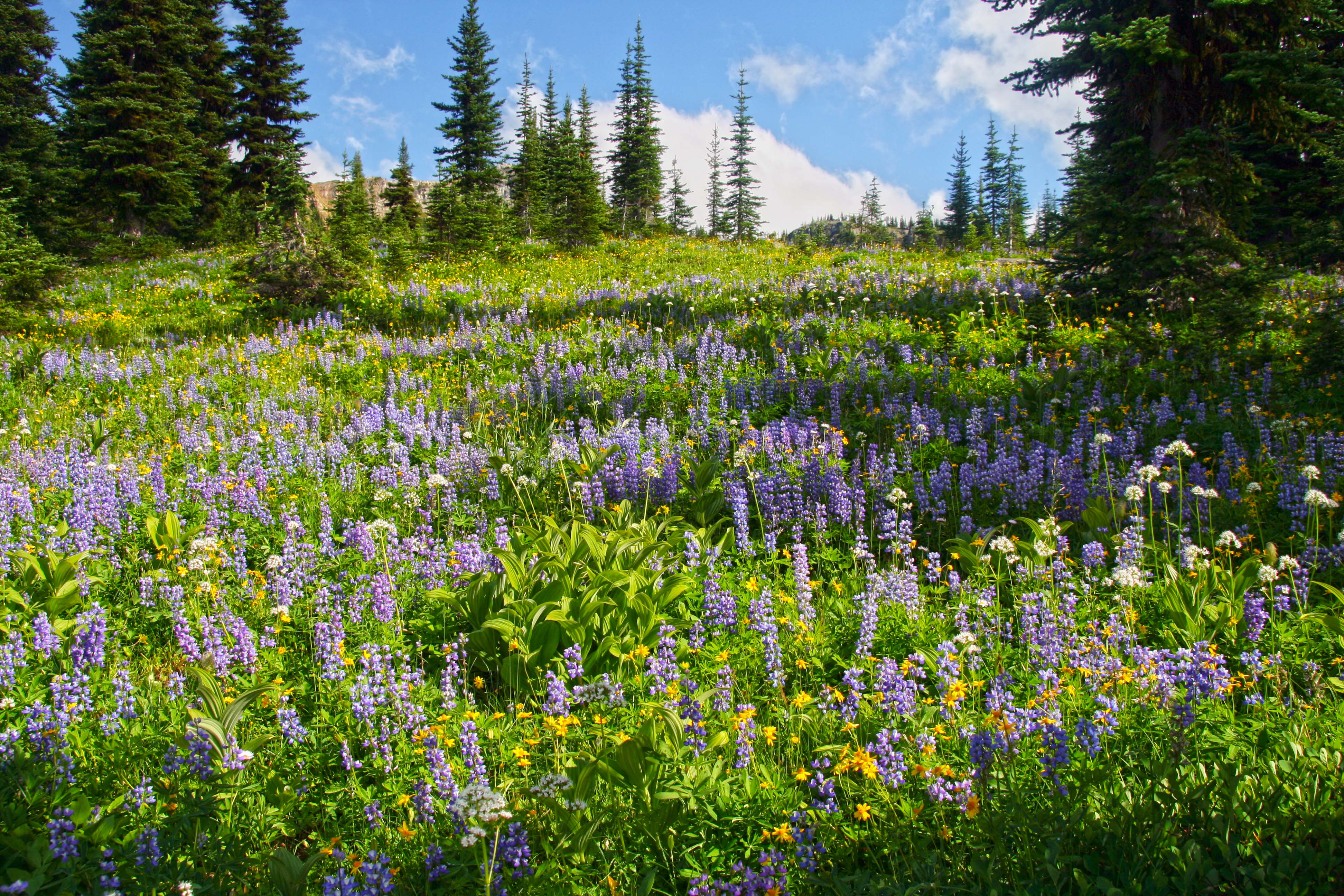
The Goat Rocks Wilderness is located in South-Central Washington along the spine of the Cascades Mountains. The Goat Rocks are the remains of a volcano, their jagged peaks jutting above the forest. With Mount Adams to the south and Mount Rainier to the north, the views are always awesome!
July brings snow melt and wildflowers. The wilderness is easy to access, camp sites abound and no permits are needed! Here are a few pictures!


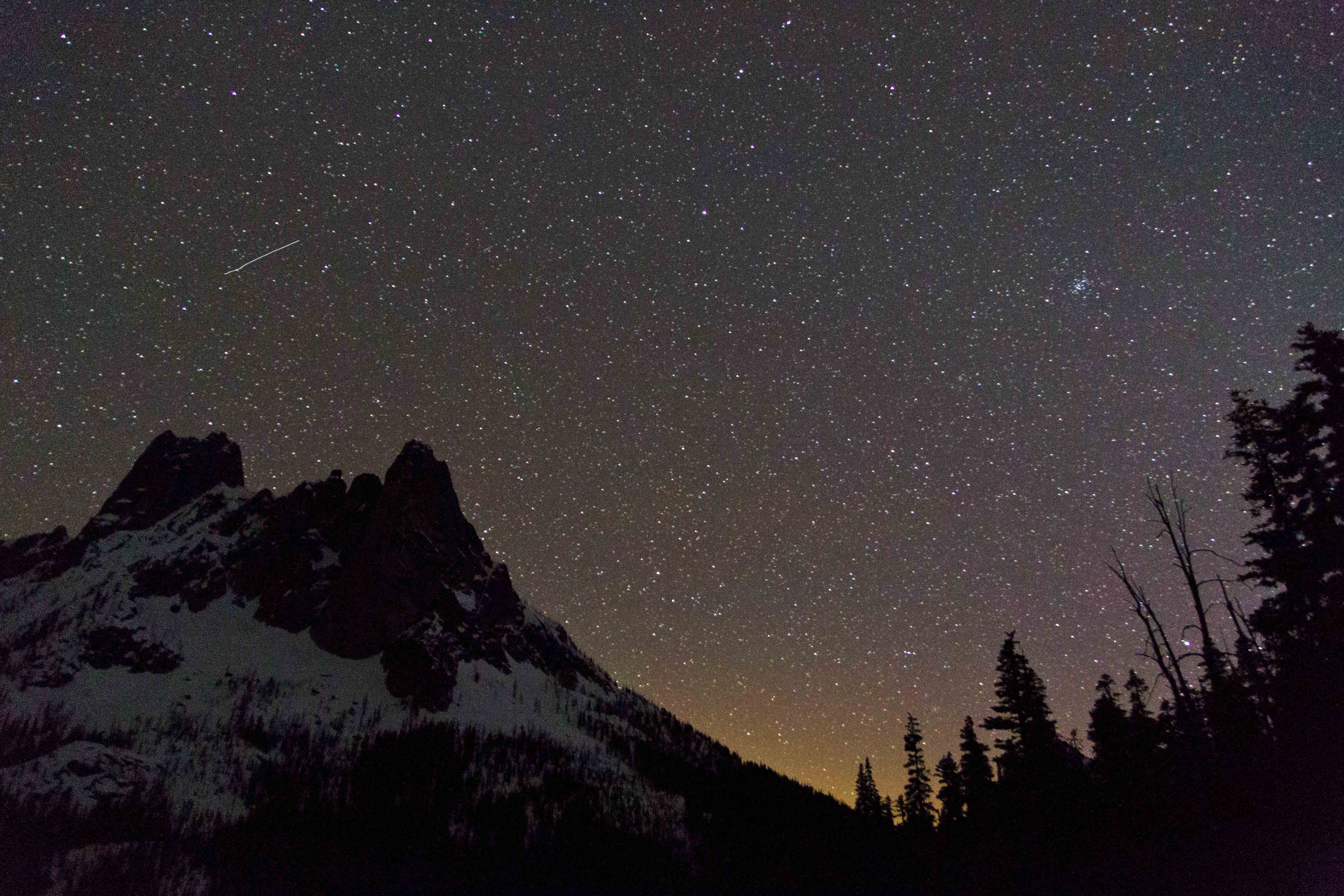
I have been working on nighttime imaging for a while, trying different exposures and post-capture processing.
This image was one of my first attempts. I hiked in to a location with very little ambient light, actually I went there to capture meteor images last August. I shot this at f3.5 at 30 sec and 800 ISO, using a Canon t2i and an 15-85mm lens. I tried using various settings of ISO, but had the idea that I should not get much above 800-1200iso. 
The image was shot in the RAW format, opening it in Photoshop I made several changes:
The noise reduction and sharpening was used heavily to reduce the graininess
Lens distortion correction
Fill light was used to brighten the image and Recovery to decrease the brightness on the tent
Vibrance, Clarity and Contrast were also significantly increased.
I saved the image as a jpeg and opened it in PS (I was using CS5 for this image) and went on to select the sky, and using Levels brought out the contrast by moving the slider to the right (to the start of the peak) and to the left down to 220. here is the result:

This year I got myself a new Canon 6D and went to Washington Pass, along the North Cascades Highway to take pictures. I was careful to choose a night with clear skies and very little moon.
This image was shot at 8sec, f4.0 and 25,600 iso. There is a setting on the camera for “High ISO Noise Reduction” and I set this to high. I tried to keep the shutter speed low, 10 sec or less, to make sure there was no blur from movement of the earth, etc.
Again, I shot this in the RAW format. Photoshop CS5 was not able to open the RAW images I shot with the new Canon 6D, so I had to upgrade to CS 6…
Here are the basic modifications made to the RAW image:
The sharpening was used heavily, BUT no Noise Reduction
Lens distortion correction
I increased Vibrance, Saturation and Highlights
Here is the result:

Going back to the image later I felt that there was still to much graininess and so I went back to the RAW image and greatly increased the Noise Reduction, then I saved the image as a jpeg and opened it in PS (I was using CS6 for this image) and went on to select the sky, and using Levels brought out the contrast by moving the slider to the right (to the start of the peak) and to the left down to 220. Here is the result:

I am much more satisfied with the version.
Please feel free to let me know which variation you like the most, and if you can, why!
And if you have any ideas, tips or suggestions, I am very interested.
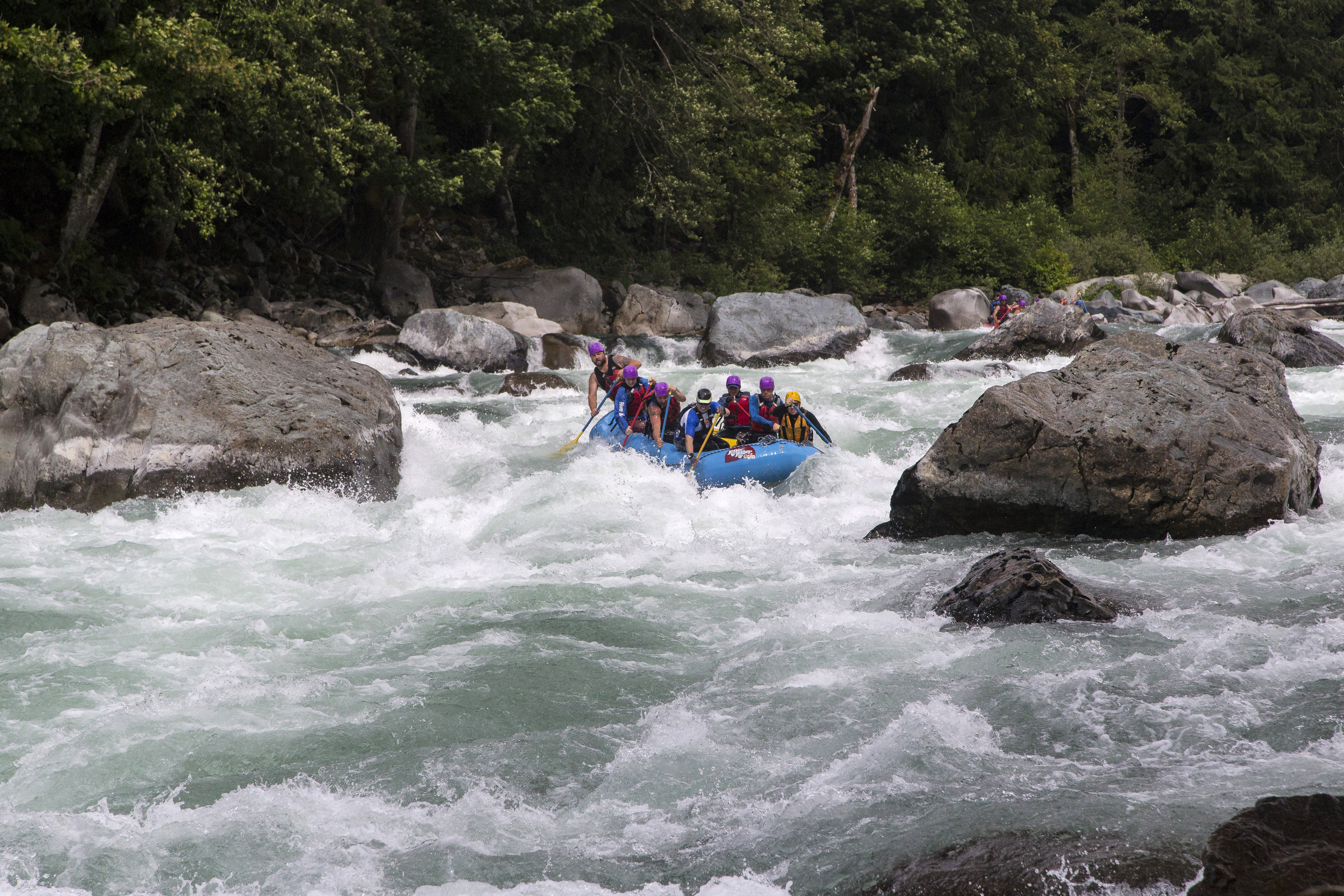
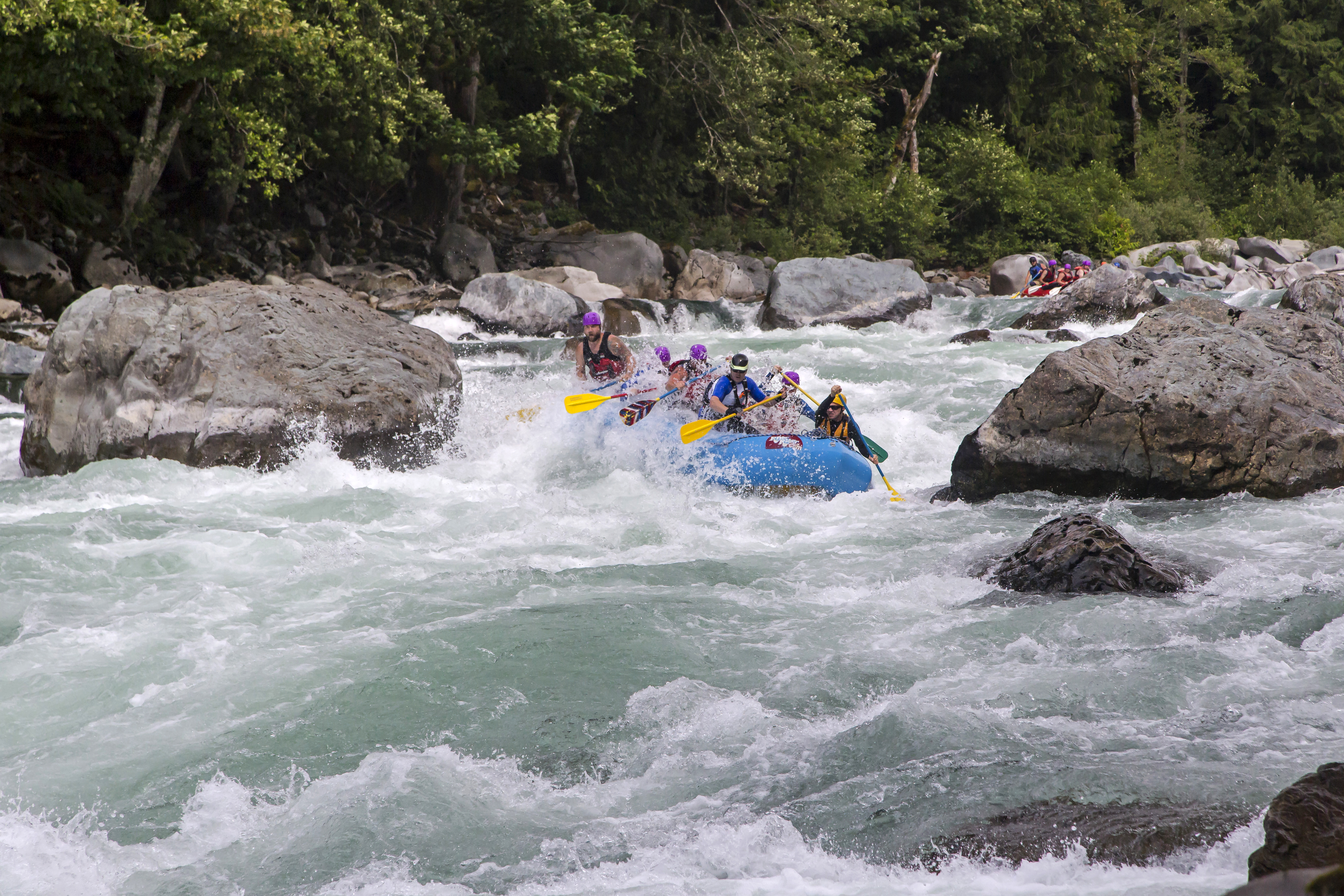
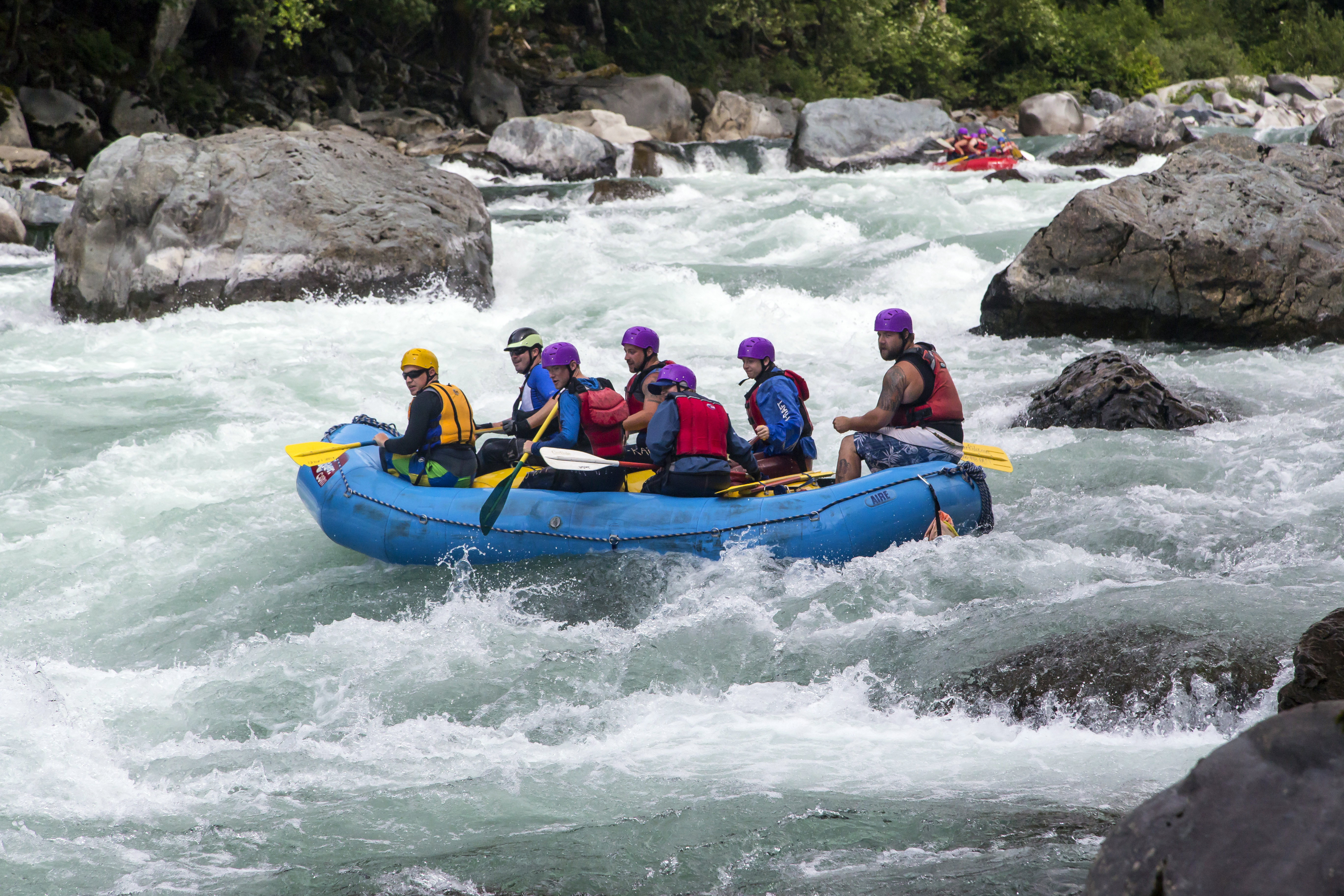
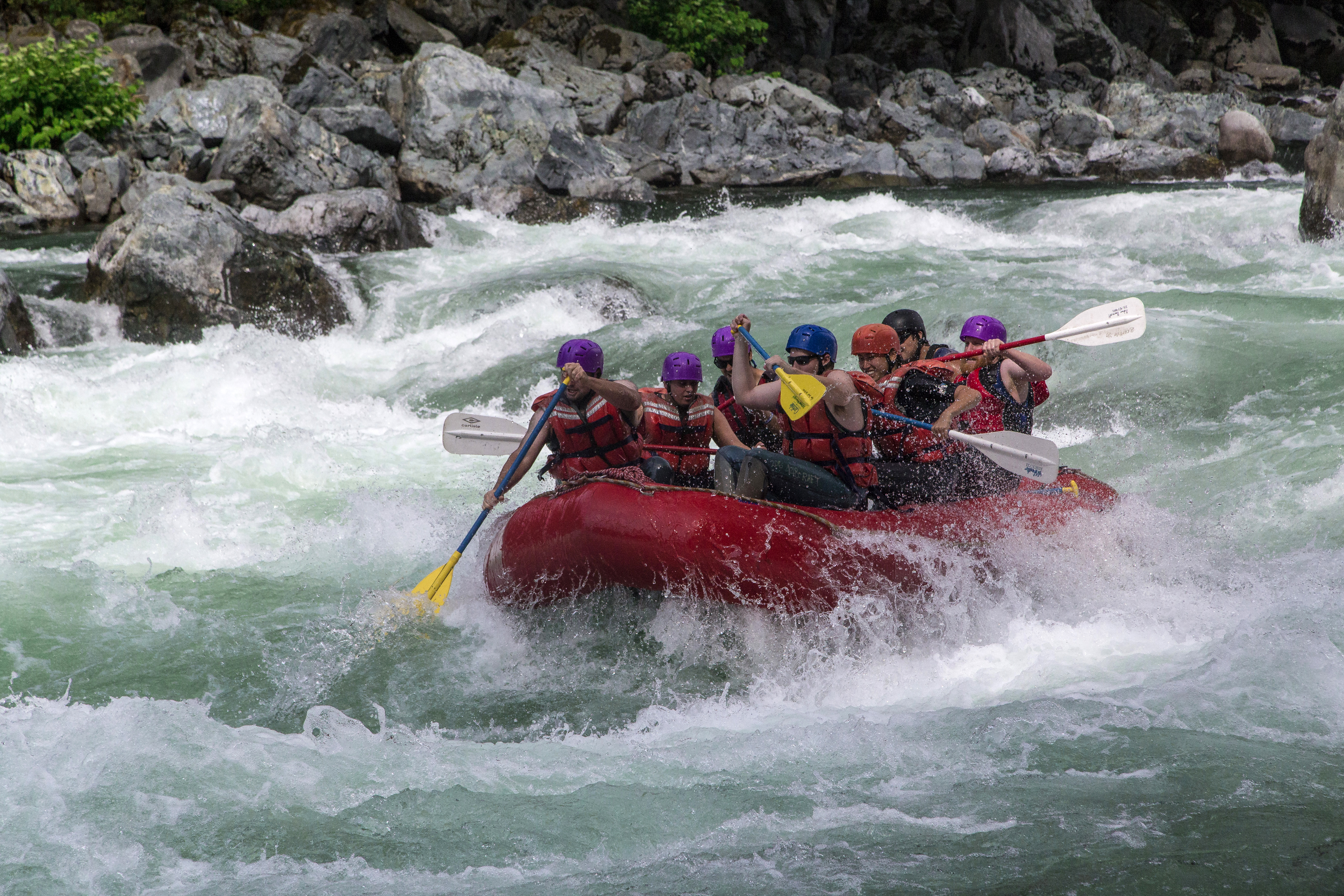
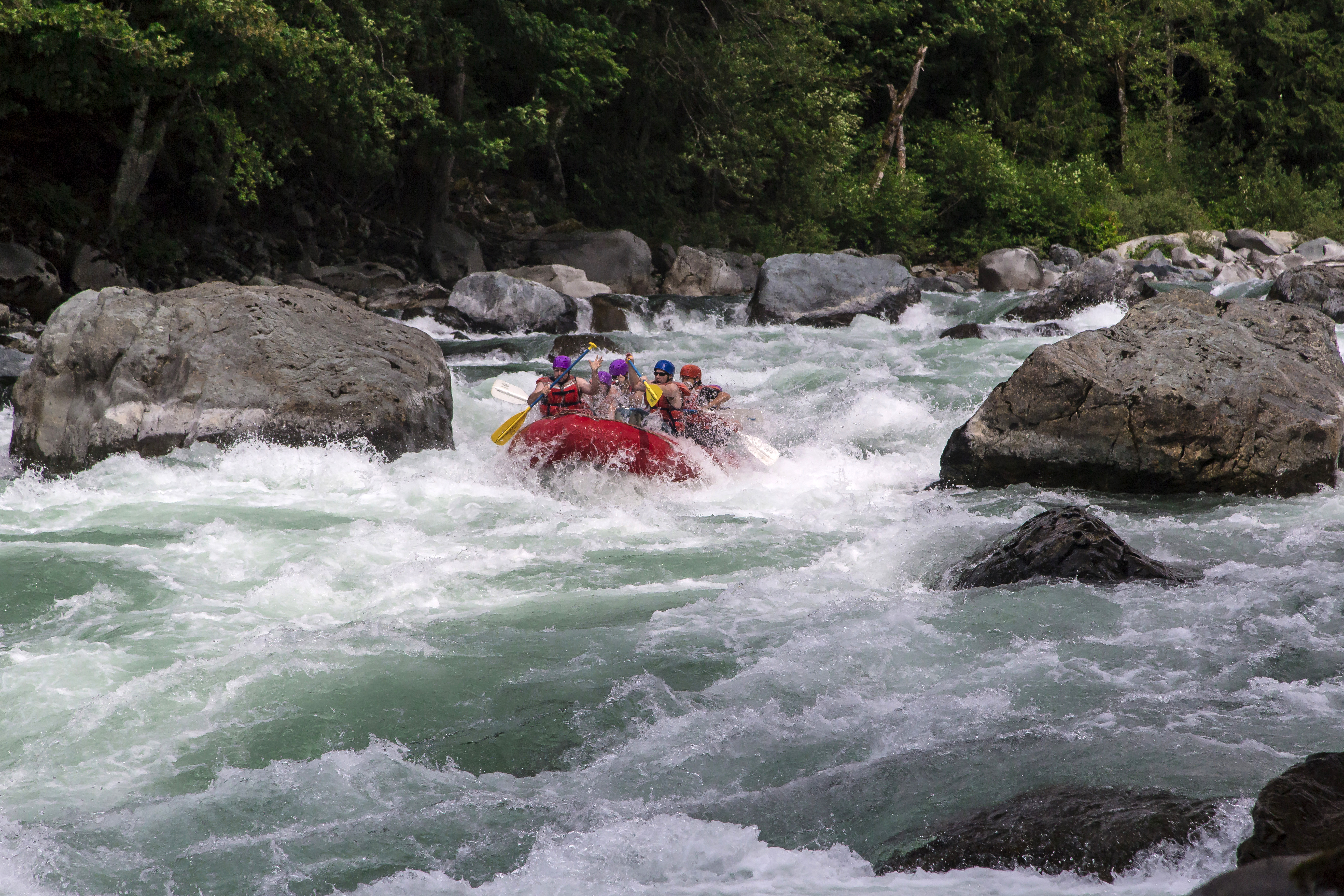
Boulder Drop is a Class V rapid on the Skykomish River. Located at mile marker 34 on Highway 2, east of Everett these rapids provide excitement and fun photo opportunities, as you can see here! I captured these images last Sunday (07/07/13) while on assignment at the Sky River Fest in Index…


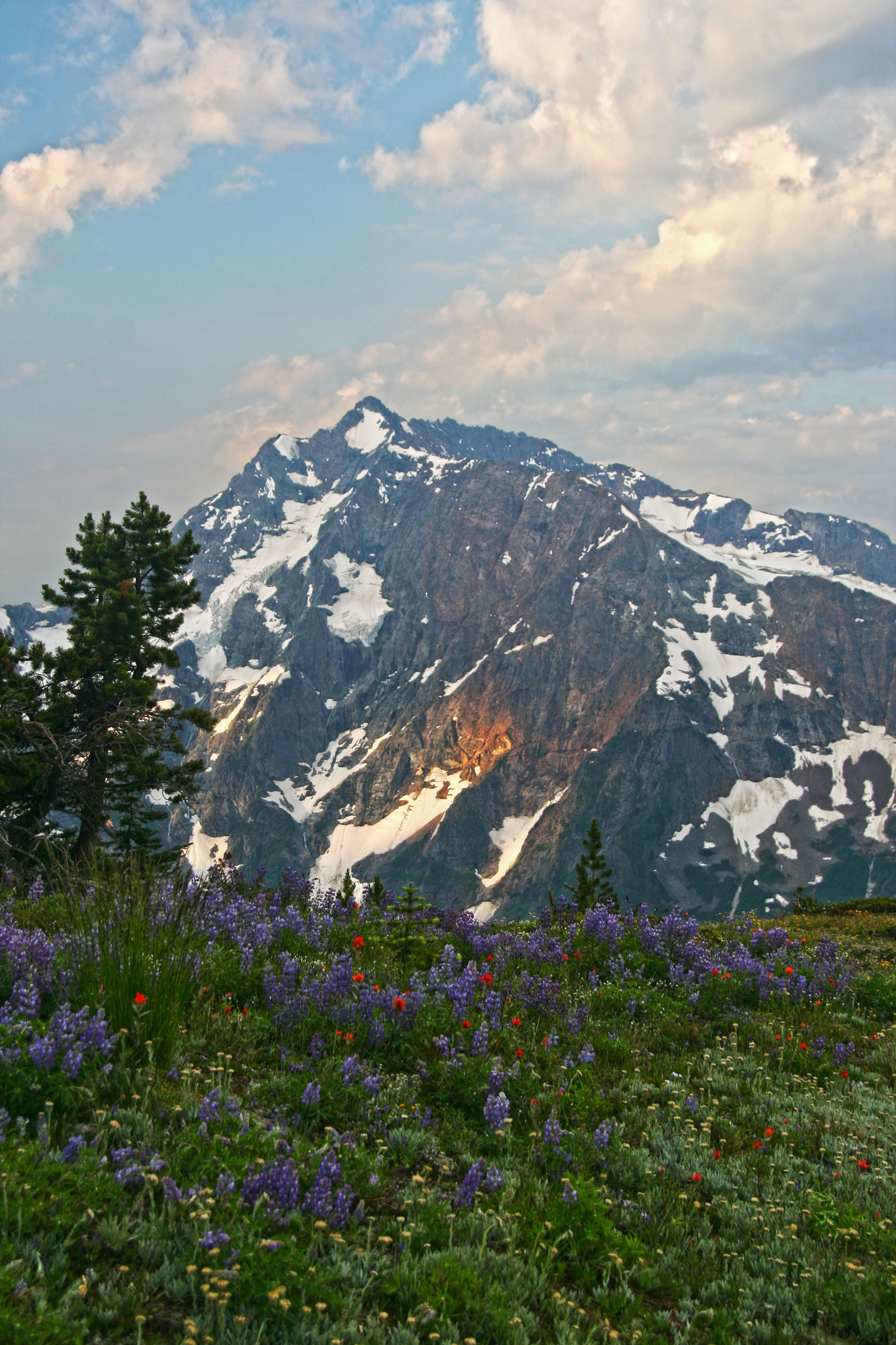
The Pasayten Wilderness is located in Washington State along the Canadian Border. Stretching east from Ross Lake the mountains here are drier than the North Cascades National Park, on the other side of the lake. Long ridges, endless meadows filled with wildflowers and solitude is what you’ll find here in the Pasayten.
Here are a few images from an earlier trip…cant wait until July when I’ll be headed back out there on another long trek…
 Pasayten Wilderness Wildflowers on the Pacific Crest Trail
 Jack Mountain and wildflowers from Devils Dome
 Pasayten Wilderness Wildflowers on the PCT
 Pasayten Wilderness Wildflowers
 Pasayten Wilderness Wildflowers
 Em and Jack Mountain
 Joker Mountain from the Three Fools Trail
 Ross Lake from the Lightning Creek Trail

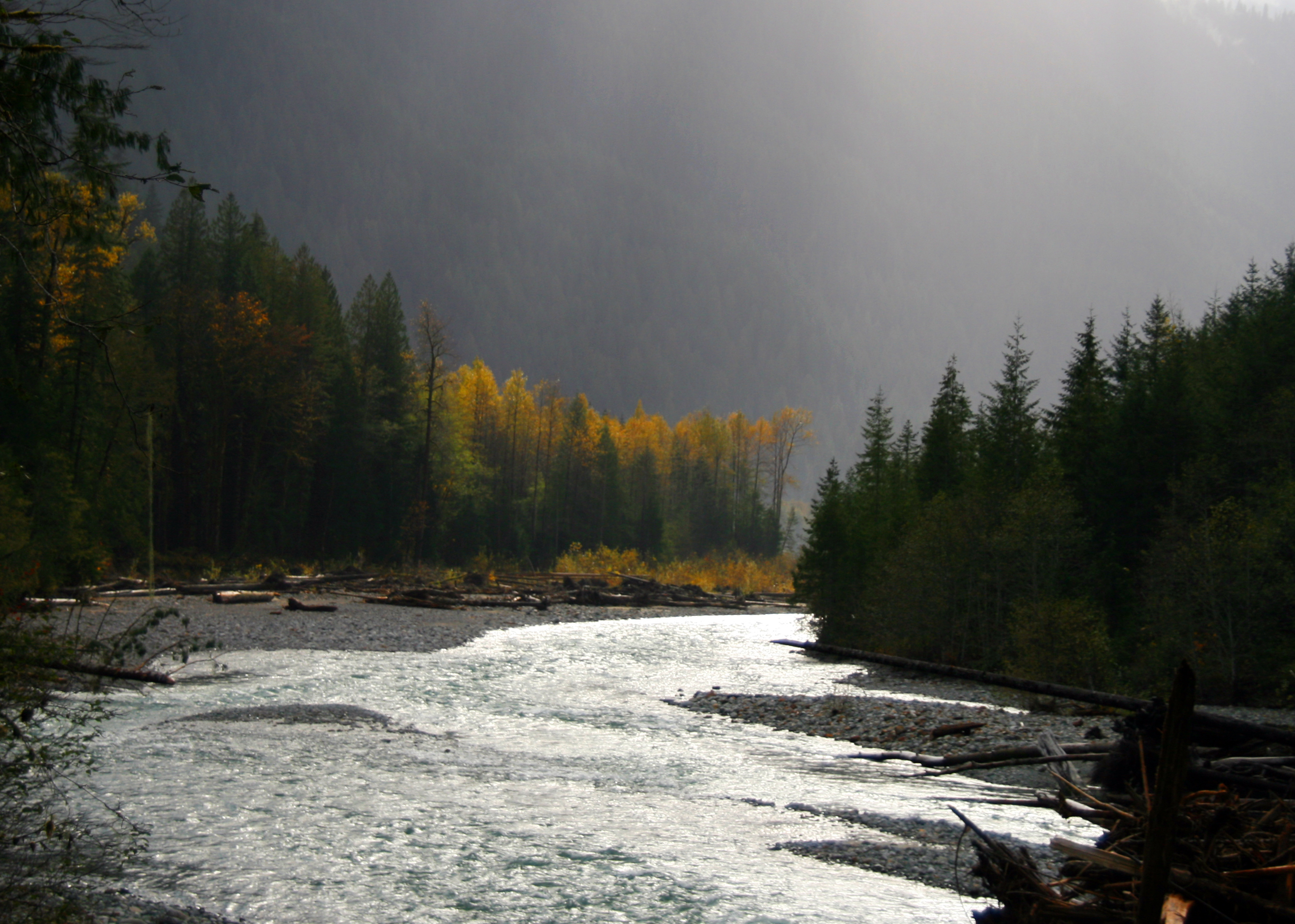 Baker River, fall
The Baker River flows south into the Skagit draining the western slopes of the North Cascades. There are two dams along the river, the largest of which forms Baker Lake.
 Baker Lake
On the North Cascades Highway (Hwy 20) drive about 15 miles east of Sedro-Woolley to the Baker Lake Road. The road heads north-east following along side of tiny Grandy Lake, then passing Lake Shannon and then skirting the west side of Baker Lake. There are numerous campsites along the way and many logging roads branching off. There is a large concrete bridge crossing Park Creek providing great views of Mount Baker.

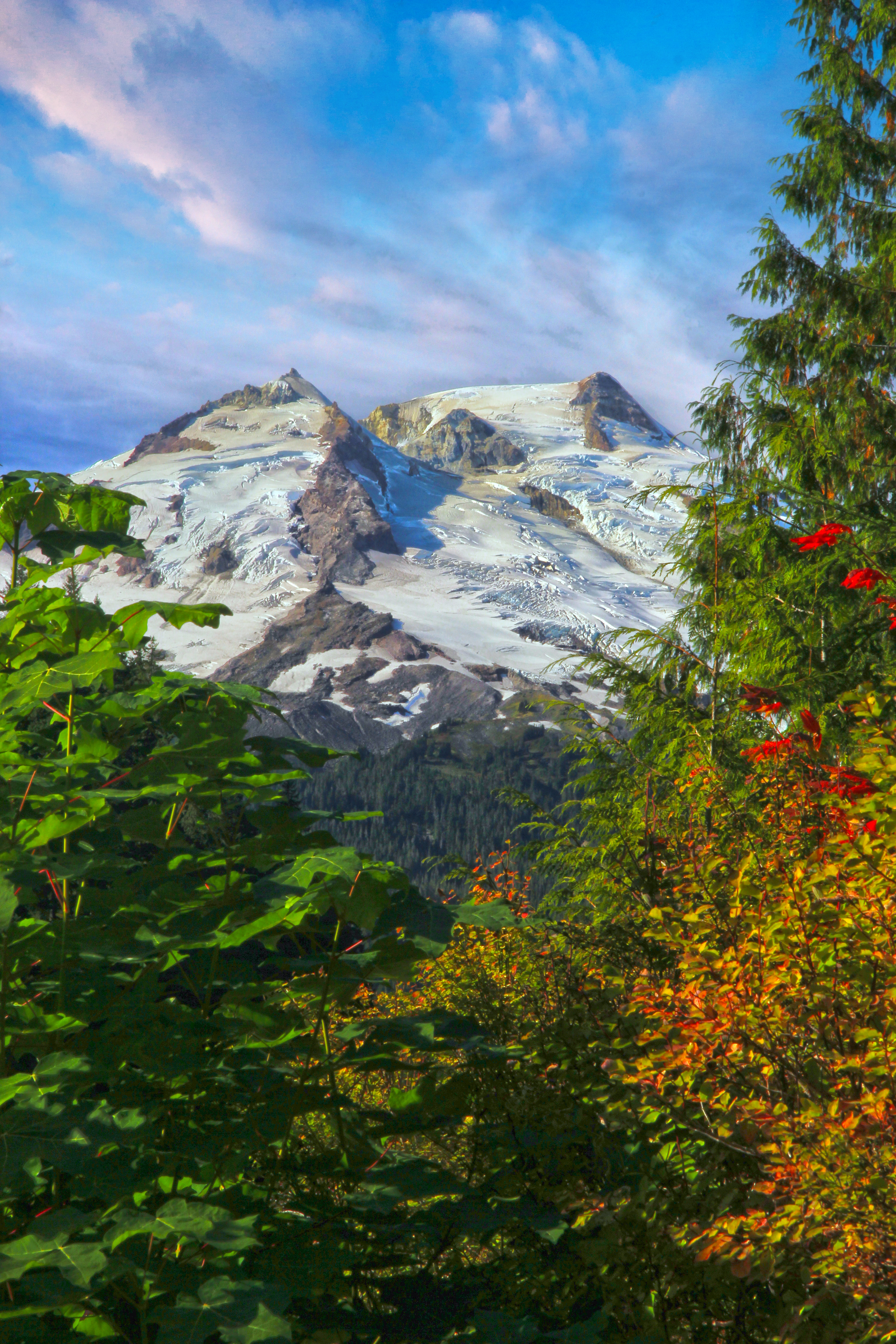 Mt Baker from the Baker Lake Road
After 20 miles of good paved road you’ll pass Shannon Creek Campground. From here on the road is gravel as it winds the last 5 miles along side the upper reaches of Baker Lake. Depending on the season of your visit and the water level in the lake one can see numerous stumps along the edge of this man-made lake. In the fall when the water level is low there are beautiful marshes along the lakes northern end.
 North end of Baker Lake
The road ends at a large parking area where there are bathrooms and to the right a trail head. You can scramble down to the gravel bar and have a look at the river here.
It is required to have a Northwest Forest pass to park, these can be obtained at the Baker Lake Grocery store, back on Highway 20 or in Sedro-Woolley at the Forest Service national park Headquarters.
The trail is in both the North Cascades National Park and the Mount Baker National Forest. Here is a link to a web site describing the trail.
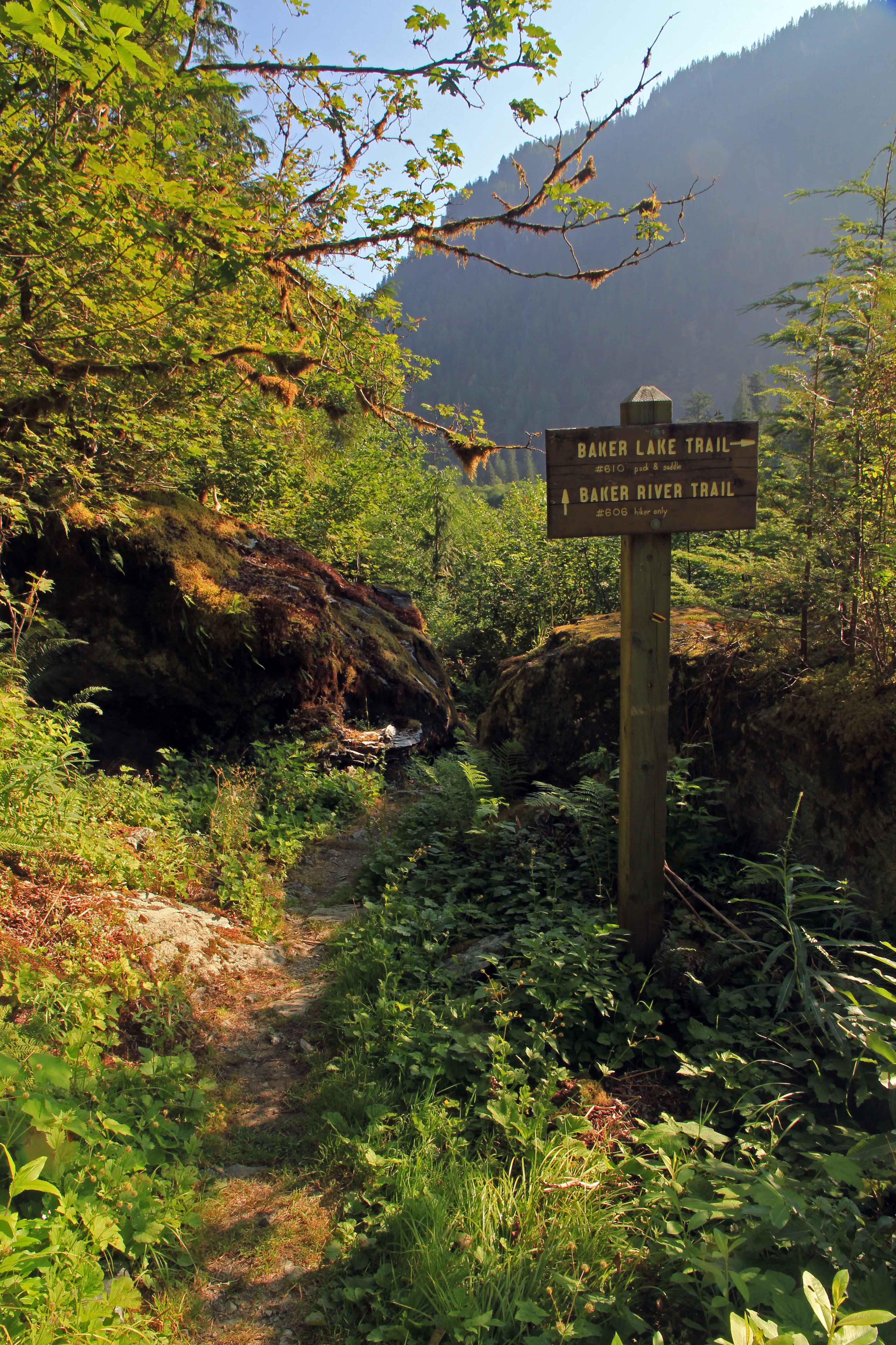
At the edge of the parking area there a big wooden reader board and from there the wide trail passes a few campsites and between two big boulders.
 The trail starts here…
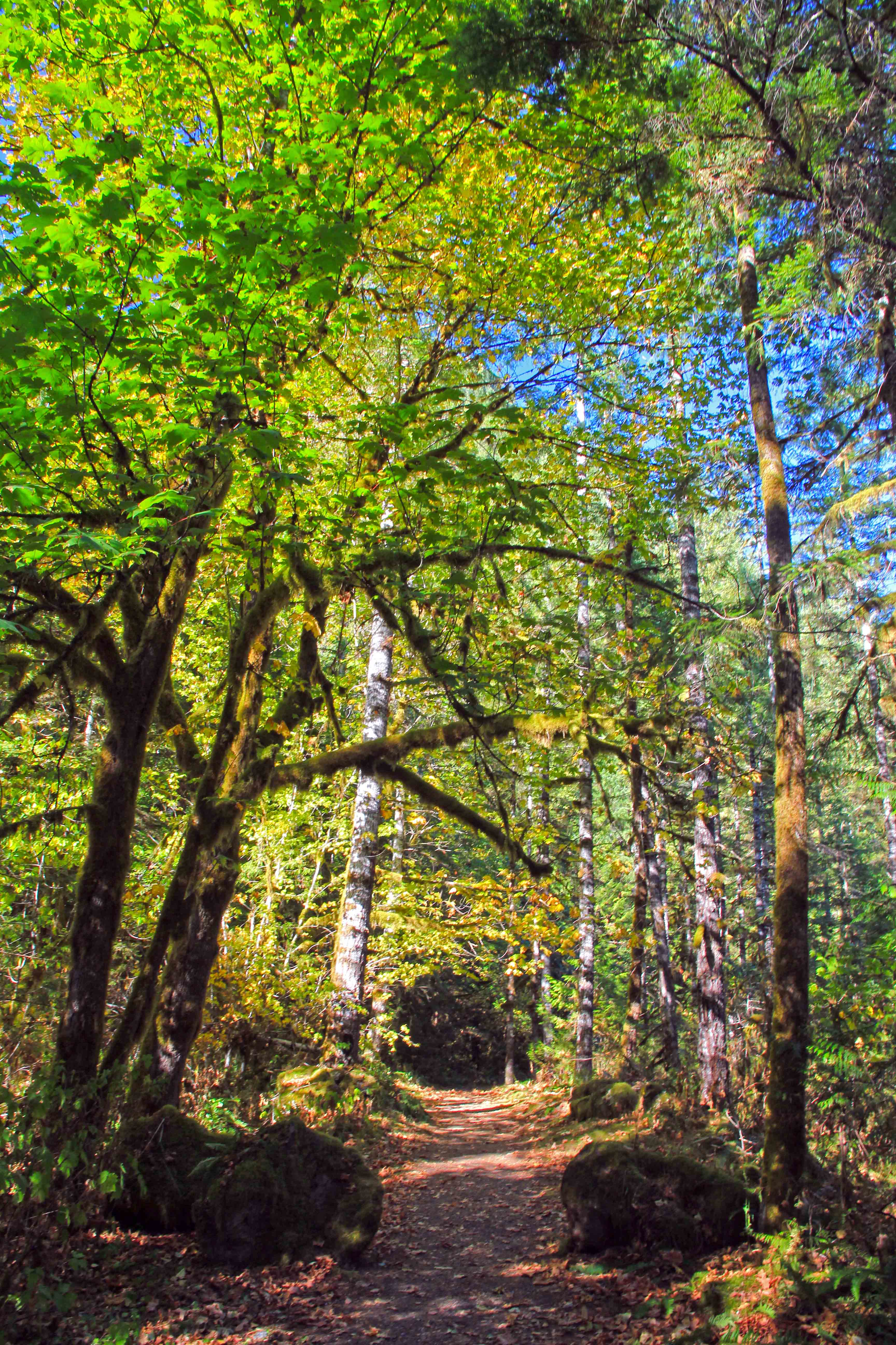
Passing through the forest there are more camps and an old horse corral between the trail and the river and soon the trail arcs east and views of the river and mountains appear.
 Baker River Trees
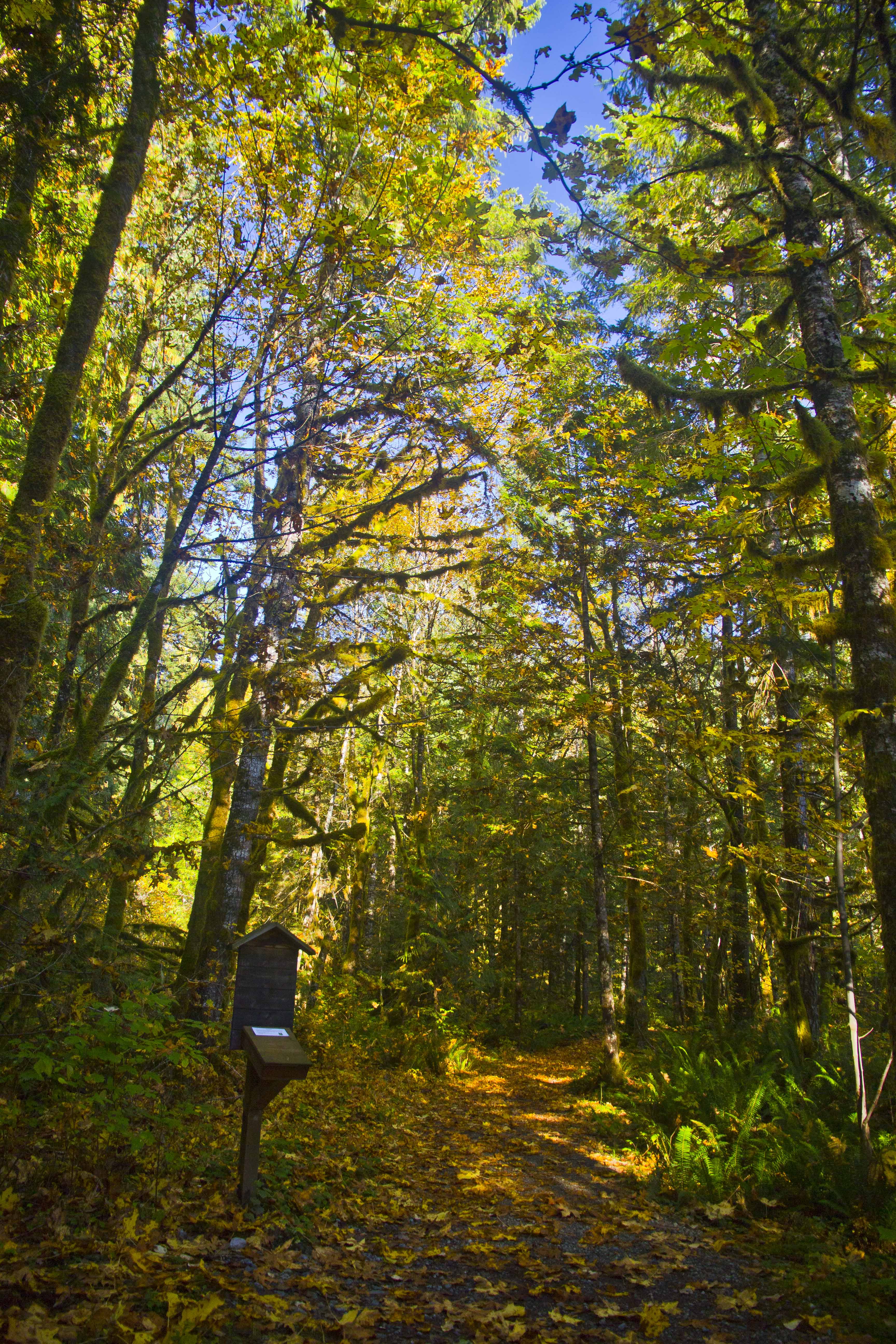
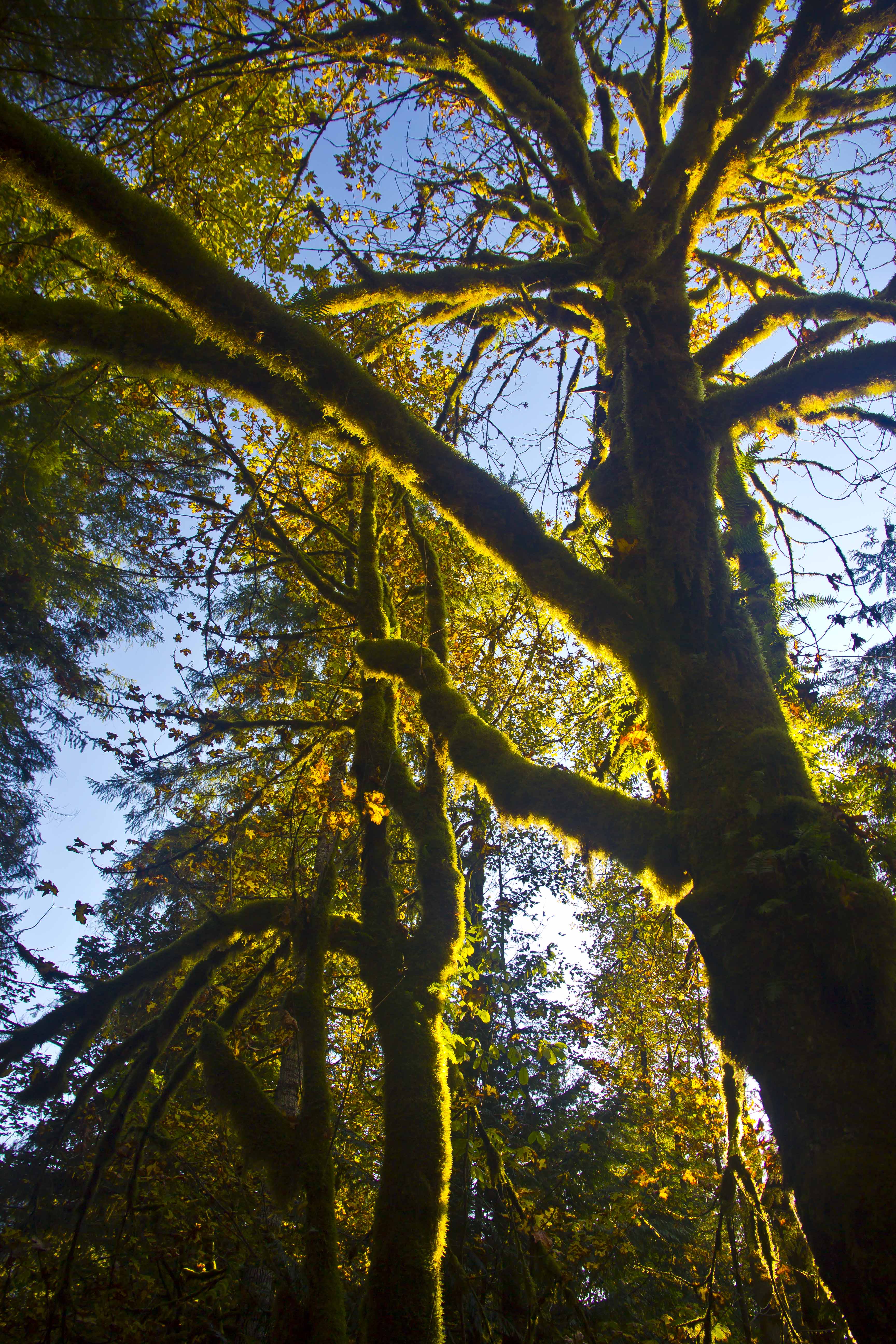
Now the pathway re-enters the canopy.
 Green Moss and Blue skies
And passes a sign in box for the hike.
 Sign-in box
Skirting along side the river you pass several mammoth old-growth trees.
 Old Growth
The greens are rich and bright.
 Mount Baker Forest
About half a mile from the parking area a suspension bridge appears on the right, spanning the river.
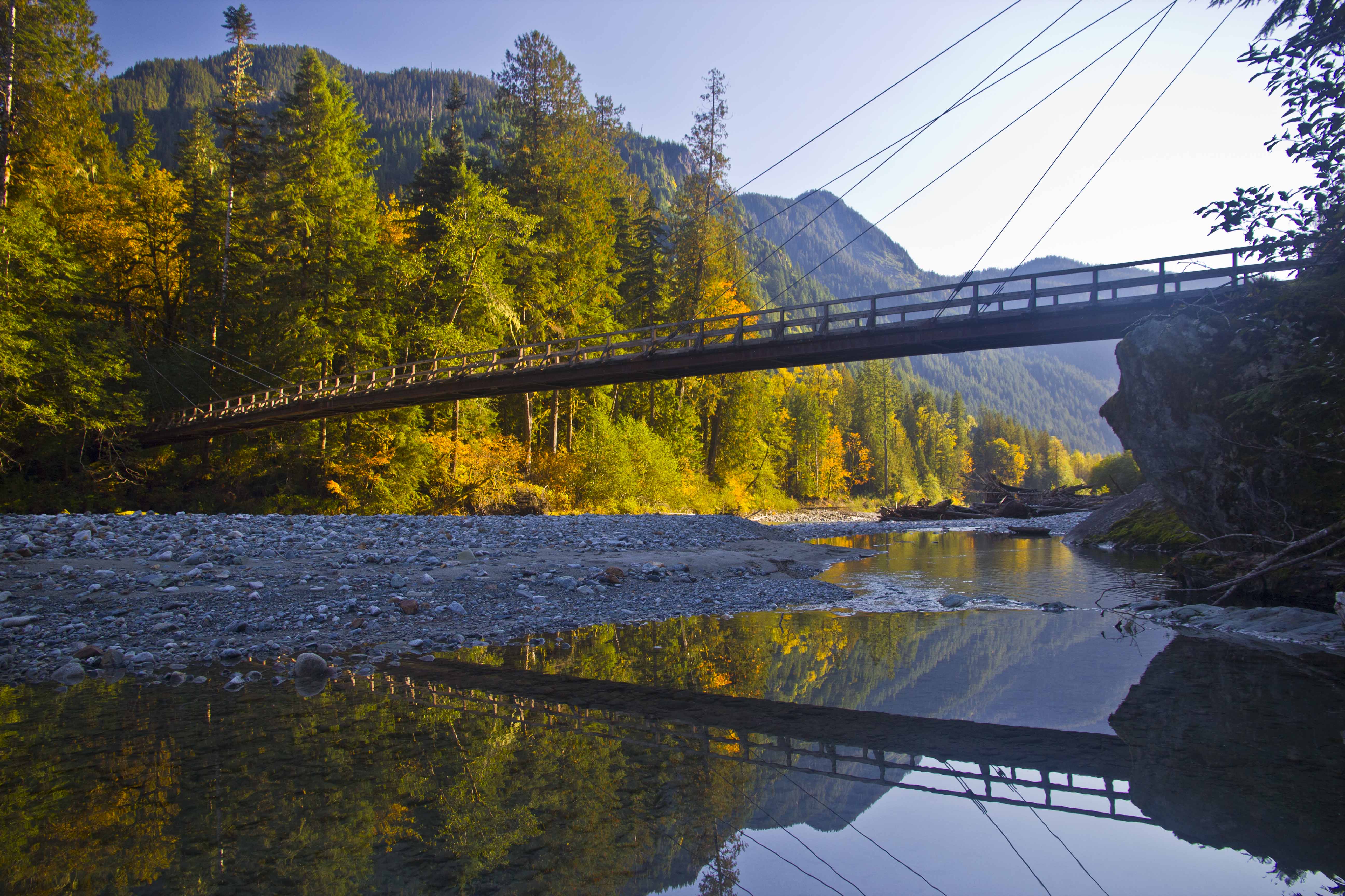 Baker River Bridge
The Baker River Trail continues along the west side of the river while the east bank trail crosses the bridge heading back south along the river and along the shore of Baker Lake.
 Trail junction
 Blum Creek
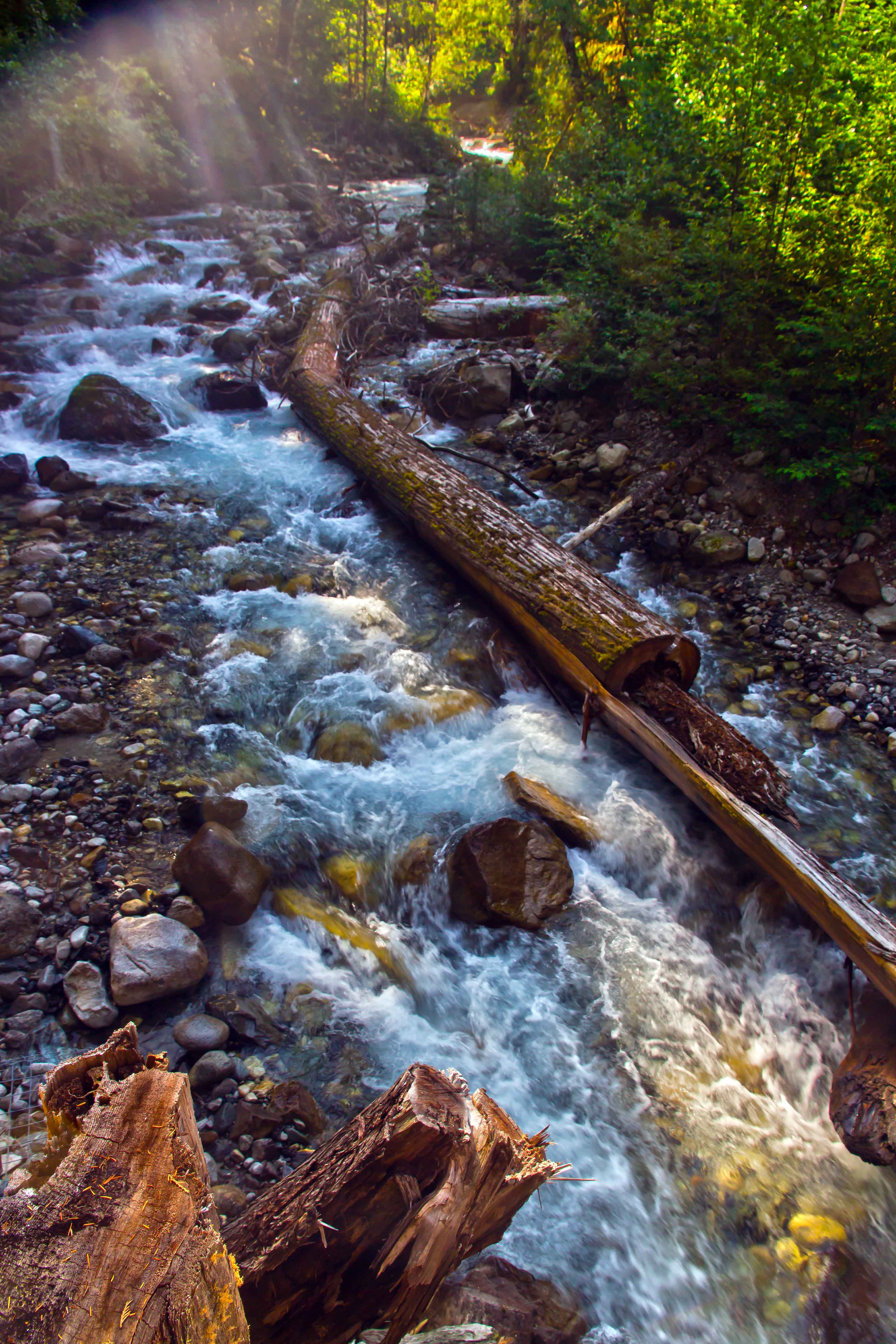
Free of dams and roads the river regains its wild countenance. There are gravel bars and huge snags of trees along the shore.
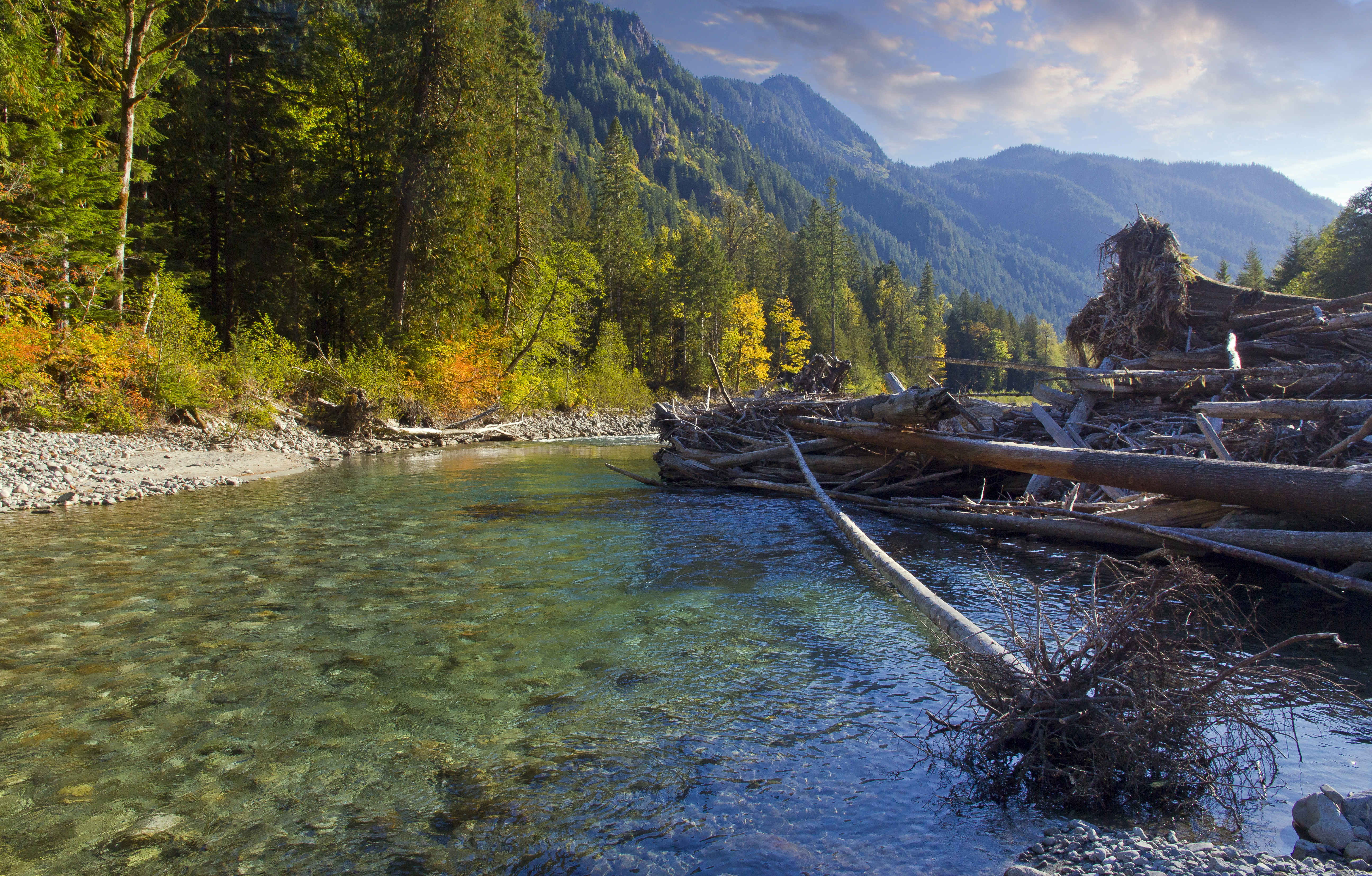 Baker River
The trail is accessible year round. Fall and spring are great times for a visit. And the trail is perfect for young children.
 Bridge Running
Fall colors are my favorite
 Fall River
Staying on the main trail, you soon pass several huge jumbles of boulders on the left, forming all sorts of caves and cool places to explore. My favorite place along the trail soon appears on the right, a short scramble down to the river bed and bushwack through brush out onto the gravel bar. The river makes a long sweeping curve.
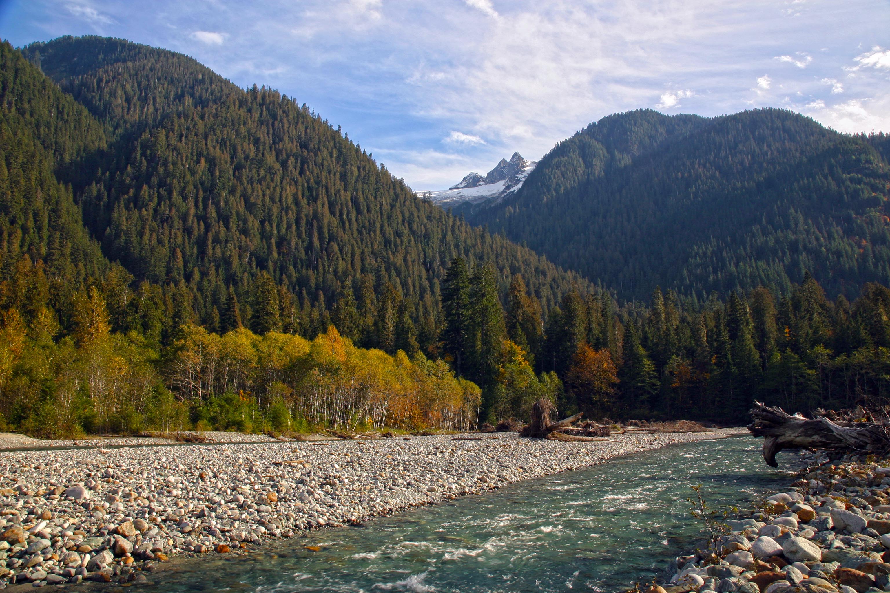 Baker River and Hagan Mountain
Across the river rises the jagged summit of Hagan Mountain. Looking upstream is Jagged Ridge extending from the summit of Mount Shuksan.
 Jagged Ridge
This is a perfect place to play. the gravel bar is wide and a great place to camp. There are fire rings and many huge logs and debris for building forts and side channels for swimming.
 Autumn Fun along Baker River
This stretch of the river is in the National Forest and no permit is needed for camping.
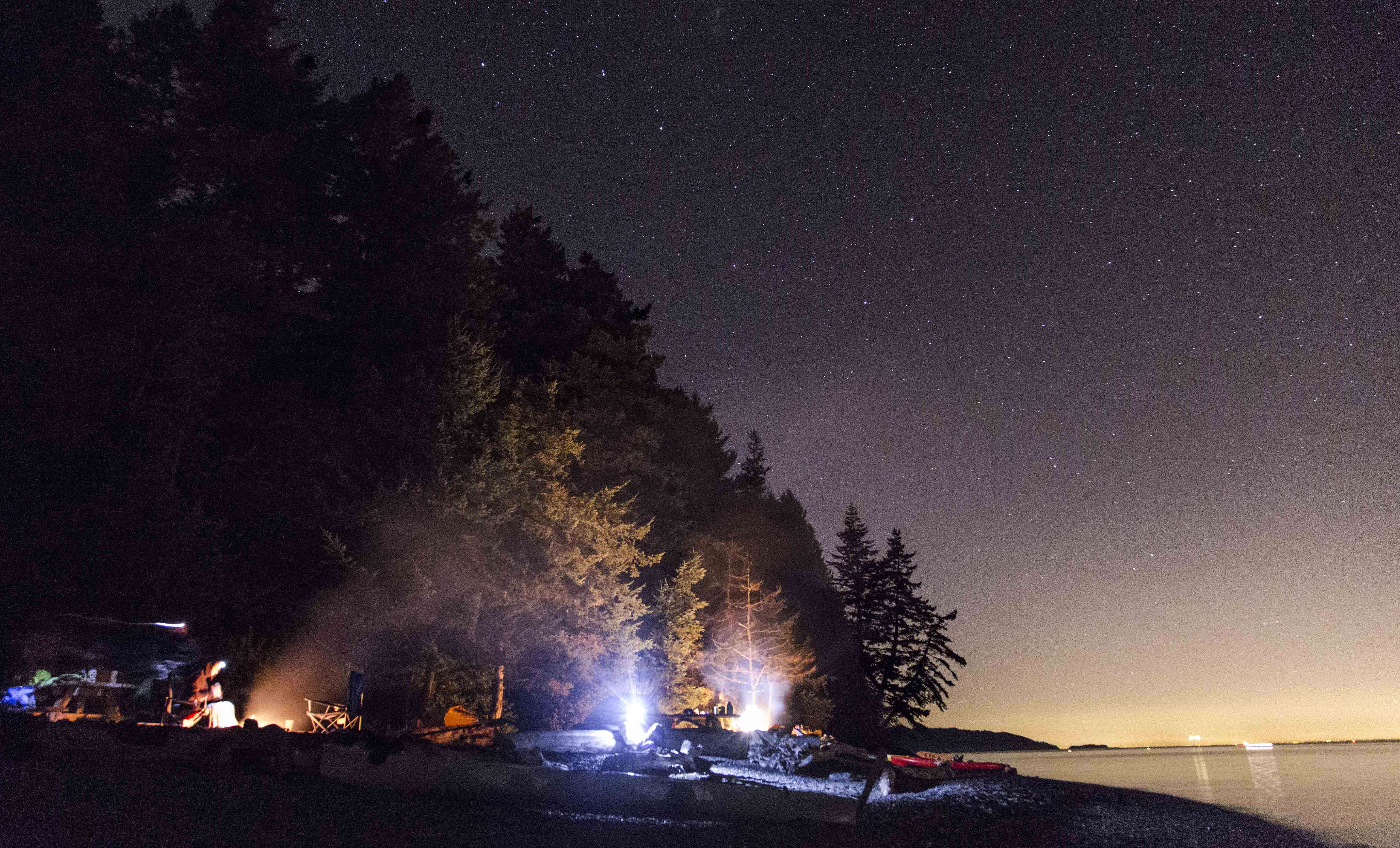
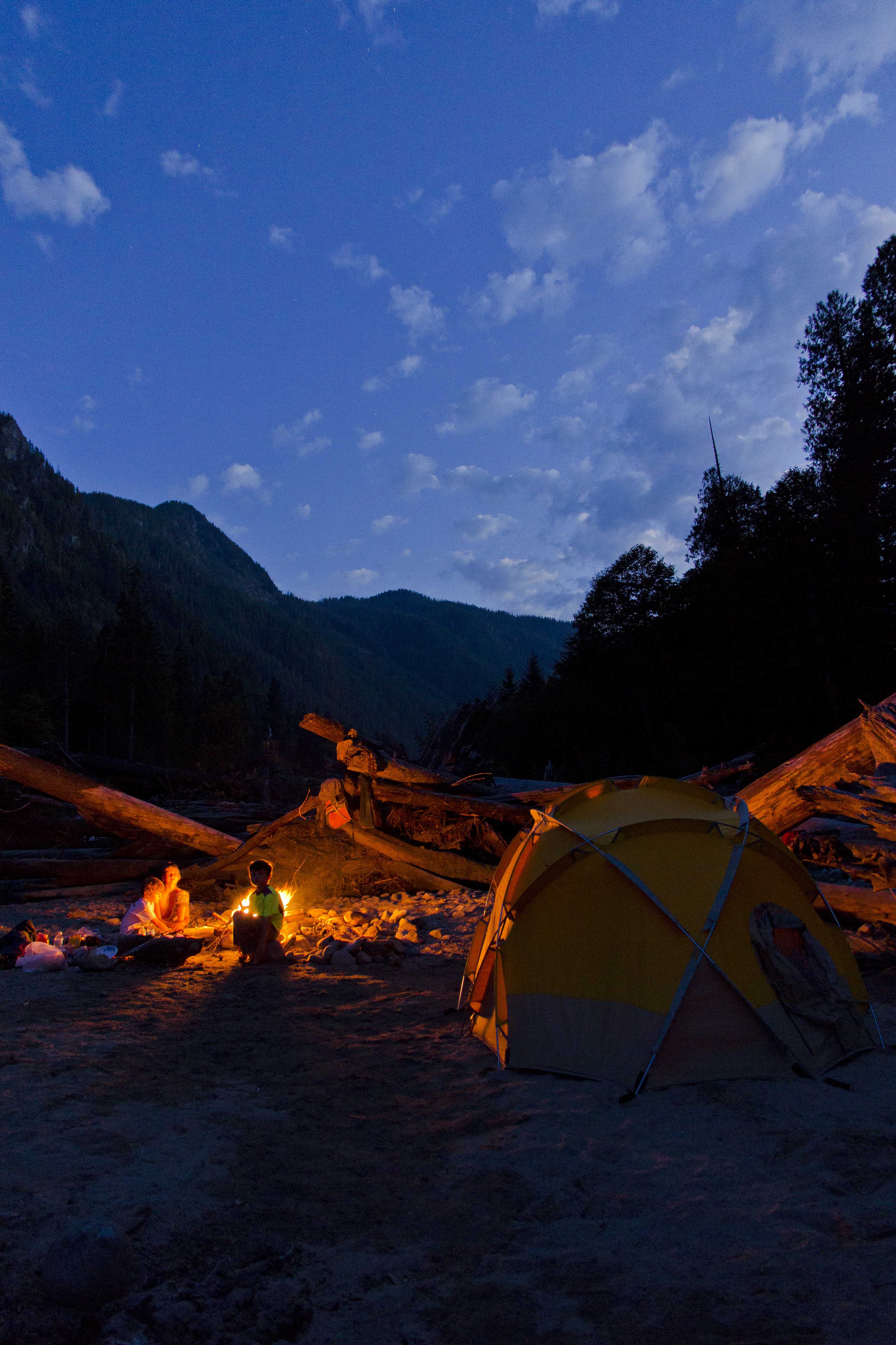 Camped along the river
 Tent and Stars, Baker River
The suspension bridge is a wonderful photographic subject!
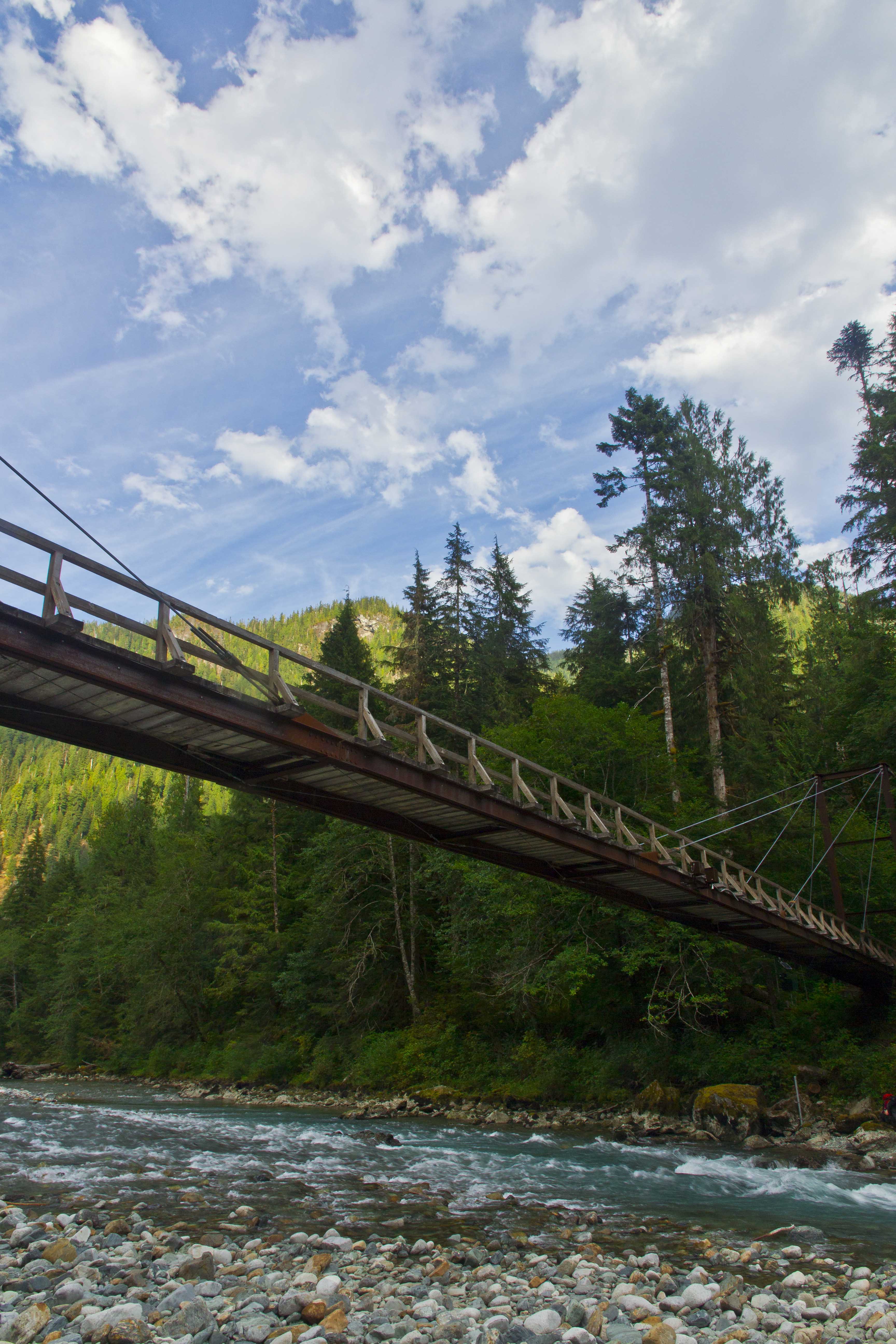
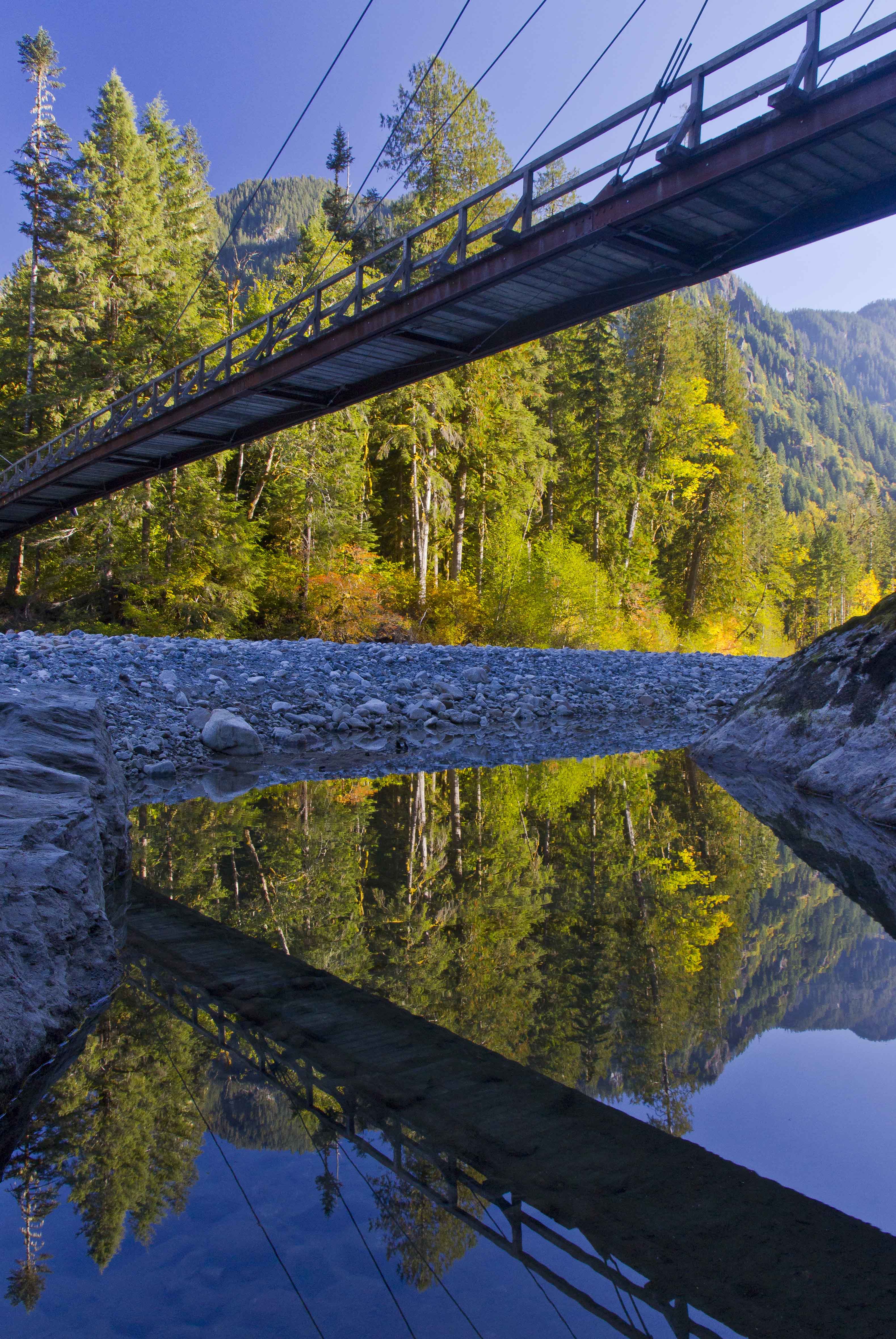 Baker River Bridge
 Looking up Blum Creek
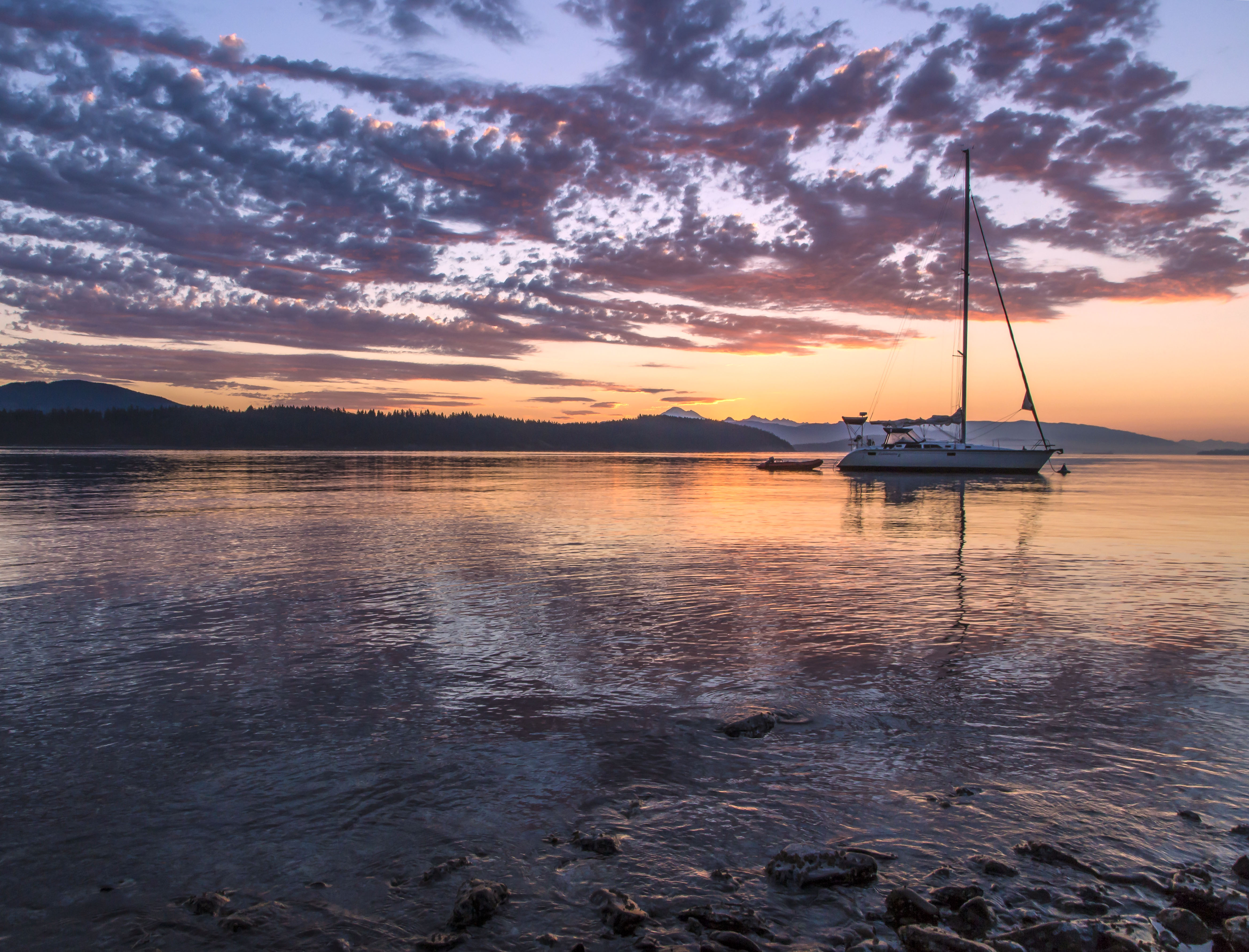
 Sunset along the northern end of Baker Lake
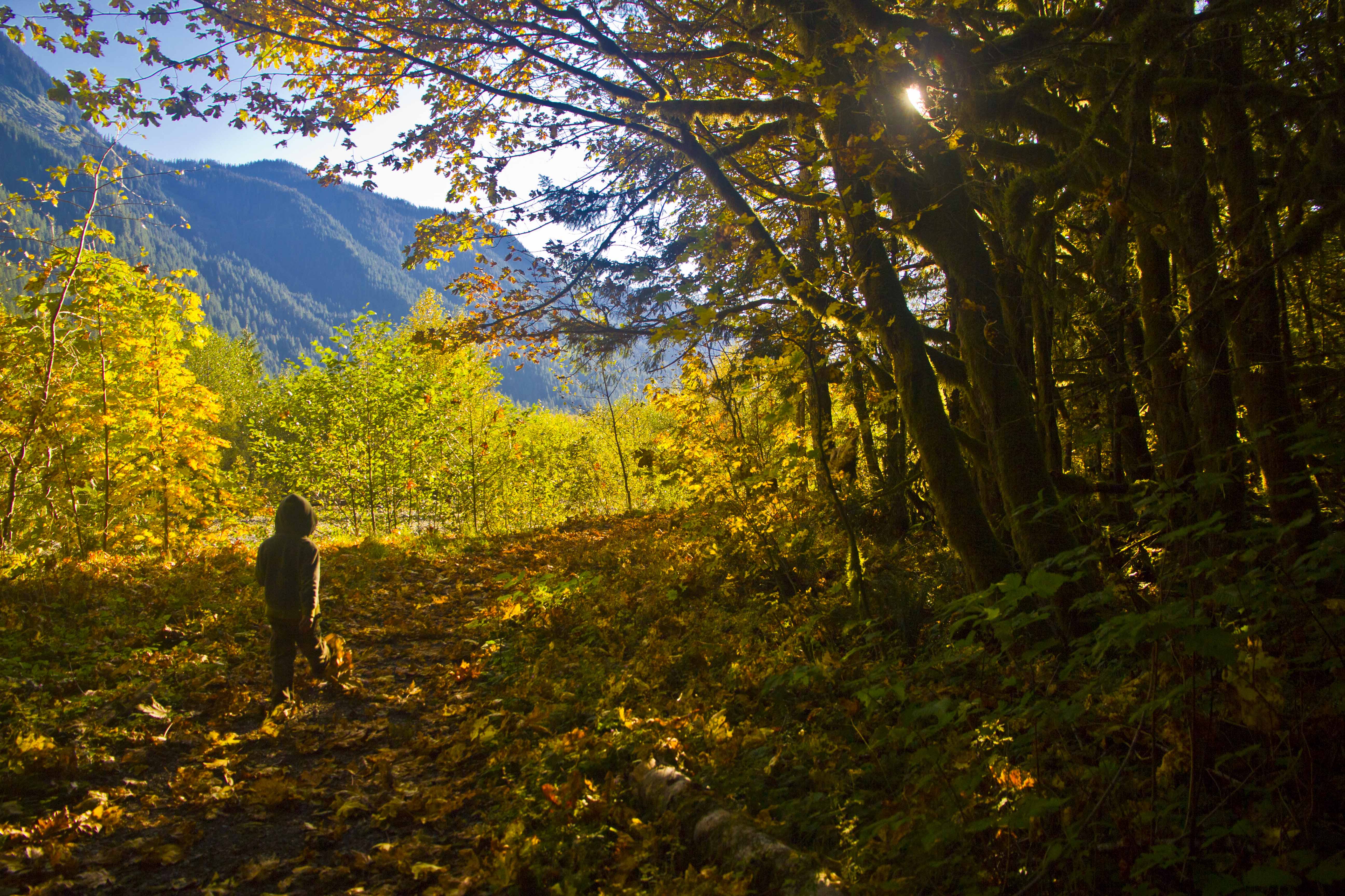 On the trail, headed home
The Wind River Range is in Wyoming, south of Jackson. The closest town is Pinedale. It’s an easy place to drive to and so has many visitors. The Cirque of the Towers is a sweeping arc of sheer granite pinnacles along the spine of the continental divide. Here are a few images:
 Cirque of the Towers Panorama from Jackass Pass
 Pingora Peak in the Morning Light
 Steeple Peak and Lost Temple Spire from the trail to Deep Lake
 Cirque of the Towers and wildflowers
 Warrior Peak in the Moonlight
 Pingora Peak Close-up
 Warbonnet Peak from Jackass Pass
 Pingora Peak and Lonesome Lake from Jackass Pass
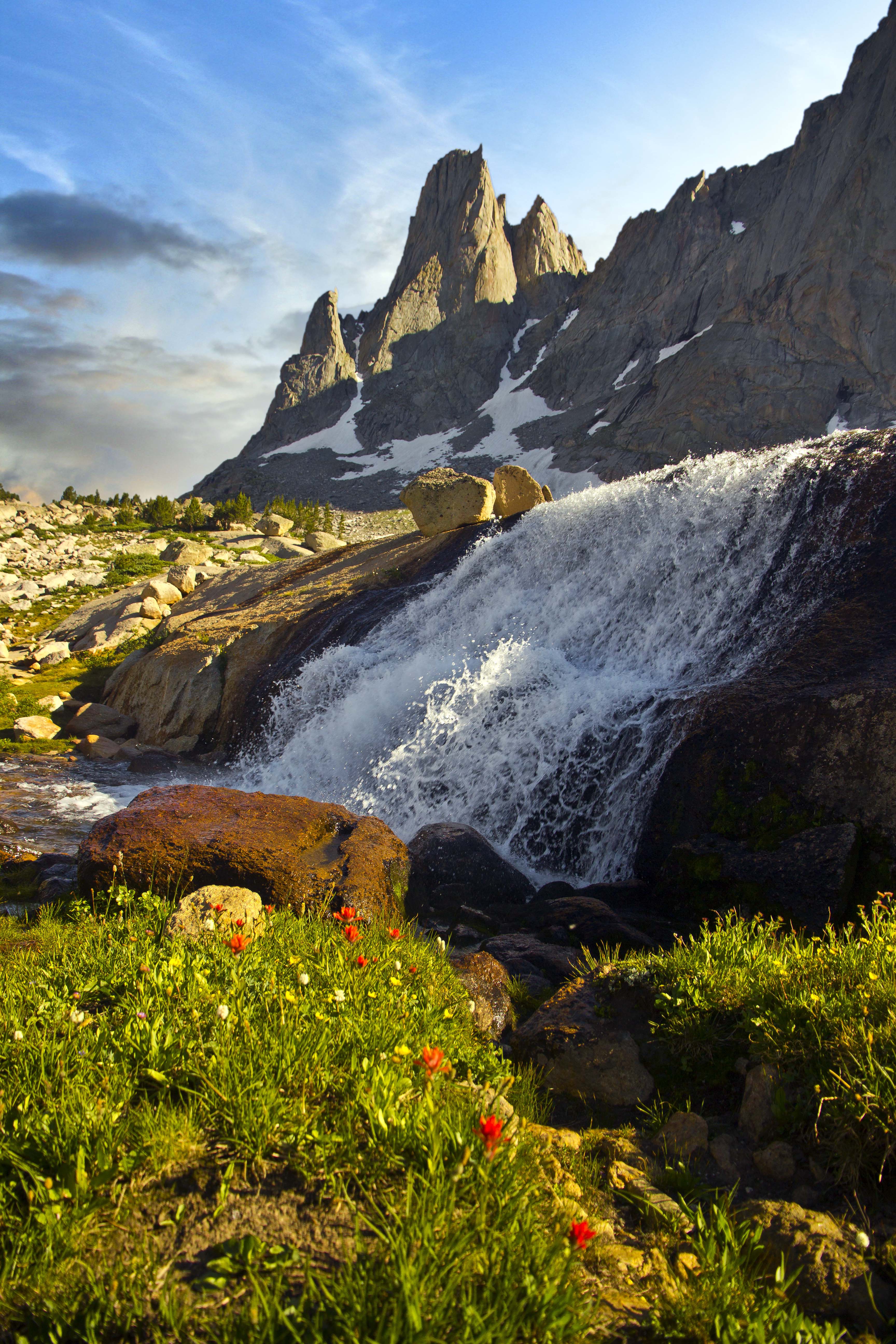 Warbonnet Peak and Waterfall from the upper cirque basin