Ever since my first visit to the North Fork Meadows I have been dreaming about my return…
The trip is not that long. The guide book says that the hike to the meadows provides the best scenery for the least amount of effort. Not sure if the part about effort is true but the scenery is magnificent.
The trip starts at the Bridge Creek Trail head on highway 20 (North Cascades Highway) between Rainy Pass and Washington Pass. The first 10 miles are mostly down, gradually loosing elevation until reaching a junction with the trail to North Fork Meadows.
From here its a mere 7 mile hike to the end of the trail, amidst towering spires, lush green meadows and waterfalls. 
We started the first days hike at 3pm and had to hurry to get to the camp site near the trail junction before dark. The trail from Highway 20 to the junction is actually part of the famed Pacific Crest Trail. The trail is well-maintained and easy to follow.
The next morning we were off early headed now up to the meadows. The first 3 miles are easy. The further along you get the brushier the trail becomes. Passing Walker Park Camp we soon came to a ford of Grizzly Creek. There are three braids of the stream to cross, the first no higher than your shoe tops, the second to my knees and the third braid almost to my waist.
Crossing a glacier fed stream in sandals is one way to remind yourself that your alive.
Once past the ford the trail becomes a veritable jungle. the brush is so thick in places that its a struggle to push through with a heavy pack. Choked with branches and small trees, covered with grass and filled with rocks of all sizes the trail (better to call it an obstacle course) is a challenge. Adding to the fun are stinging nettles and the fact that in several places the trail has become a stream. There is no way to hike this trail and not get soaked.
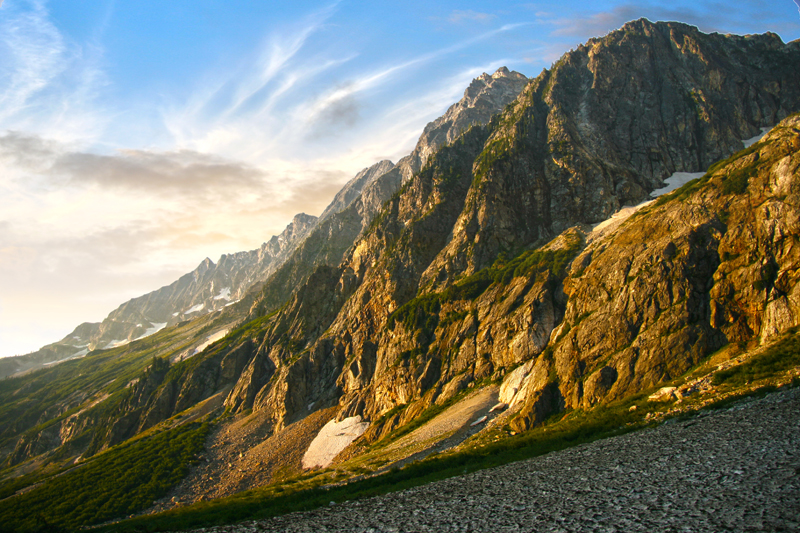
After a few miles of this the thickets give way to a gravel bar and awesome views of Melamoosa Ridge and Goode Mountain.
Goode Mountain
Time for lunch!

North Fork Bridge Creek Valley
Then its back to the bushwhacking for a while as the trail climbs to the headwaters of North Fork.
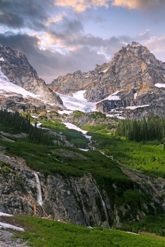
Soon the trail emerges for good from the jungle and there you are, in the meadows!

North Fork Meadows
Now the trail meanders up the valley. Waterfalls are visible on 3 sides, I lost count at 20…
Finally beneath three huge cascades streaming down from the glaciers that trail ends at the foot of a gorgeous cataract on the North Fork itself.

Mount Logan and Waterfall

Looking back down the valley

Storm King

At the end of the trail, looking further up the valley

Mt Logan in the Morning Light
Infinitely worth the effort.
Only now we have to hike back…