Welcome to North Cascades Photography
Each week we will visit some place in the North Cascades. The best camp sites; day hikes and overnight trips; lookout towers, the best locations for sunrises, sunsets and night sky imaging. Whether you’re into a week long trip, or the best place for a drive-in view, I will cover the best times to go and How To Tips ranging from How to set exposure for the Milky Way to Where to see Mountain Goats?
North Cascades Highway
The North Cascades Highway (Highway 20) follows the Skagit River from the Puget Sound deep into the mountains, reaching its highest point at Washington Pass, 100 miles east of I-5, before it drops down to the Methow Valley.
-

- Skagit River from Sauk Mtn
-

- Washington Pass
-

- Pacific Crest Trail, Pasayten Wilderness
In winter (usually at the end of November) the highway is closed due to heavy snow. The highway is gated on the west side at milepost 134, east of Diablo, and on the east side at milepost 171, 14 miles west of Mazama. Reopening in the spring is usually accomplished by early May.
In Sedro-Woolley the National Park Service and Forest Service share an office, right along the highway. You can stop in for maps and parking passes. They can also give you all sorts of great advice about where to go, current conditions, and all that.
As you head east towards the mountains you’ll pass through Marblemount. If you are planning to camp over night on the North Cascades National Park, you’ll need a permit, and this is the place to get it, the Marblemount Wilderness Information Center. This is also the last town to resupply anything for about 70 miles, so fill up!
The Diablo Lake Overlook (milepost 132) is a wonderful vista point to stop when driving. There are rest rooms and lots of parking. The view is amazing: late afternoon is the best light.
-
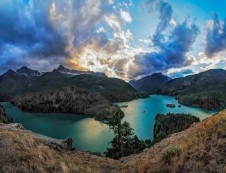
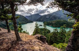
- Diablo Lake
-
- Diablo Overlook
-

- North Cascades Highway at Diablo Overlook
This is also a wonderful location for capturing images of the night sky.
-

- Diablo Lake at Night
-

- North Cascades Highway, Diablo Overlook
Rainy Pass at 4,833 feet (milepost 157) is where the PCT crosses the North Cascades Highway. There are trailheads on either side of the highway:
- On the north is the trail head for the Pacific Crest Trail, headed north to Cutthroat Pass and then onto Canada.
-

- Sunset at Cutthroat Pass
-

- Cutthroat Pass
-
- Cutthroat Peak
-
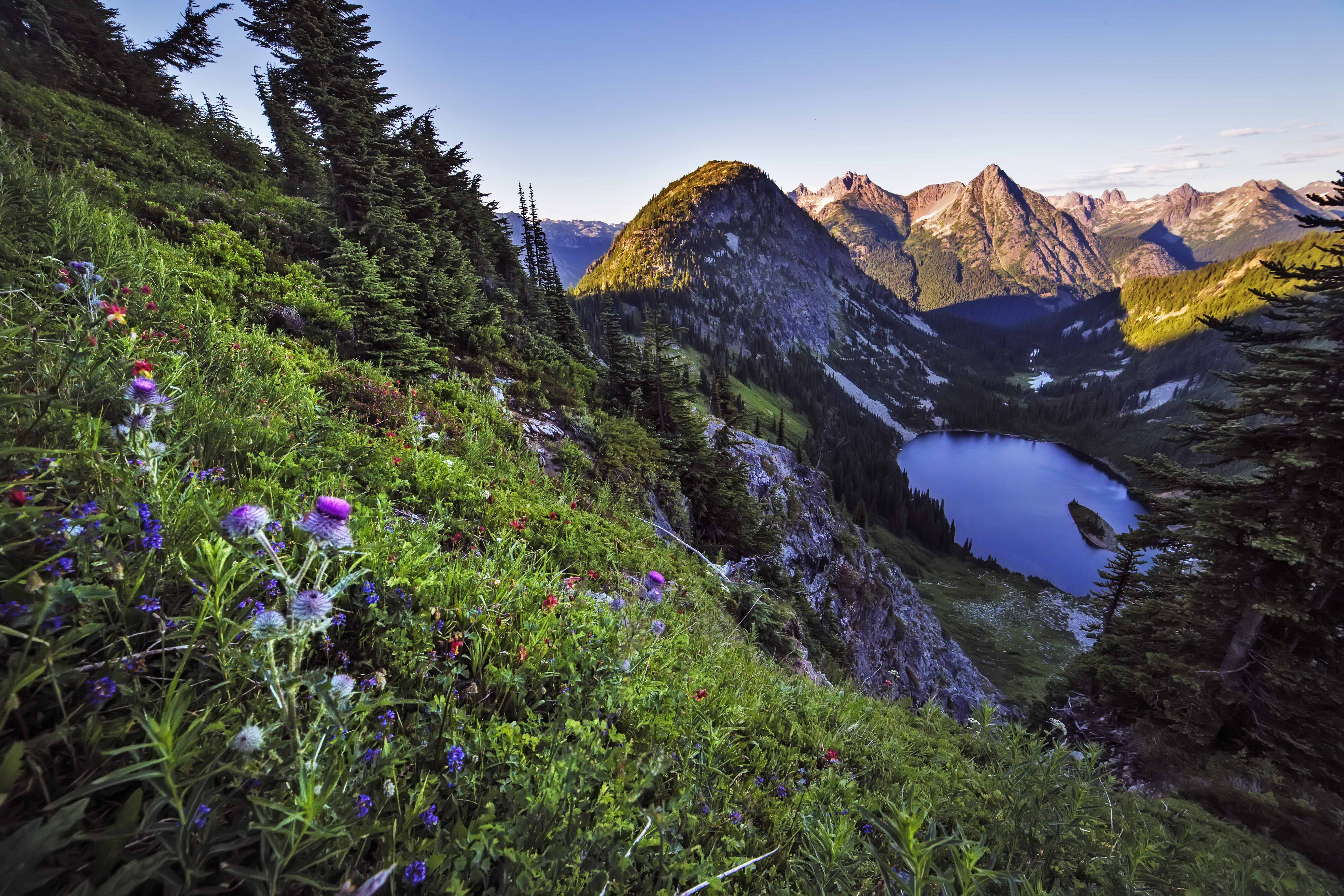
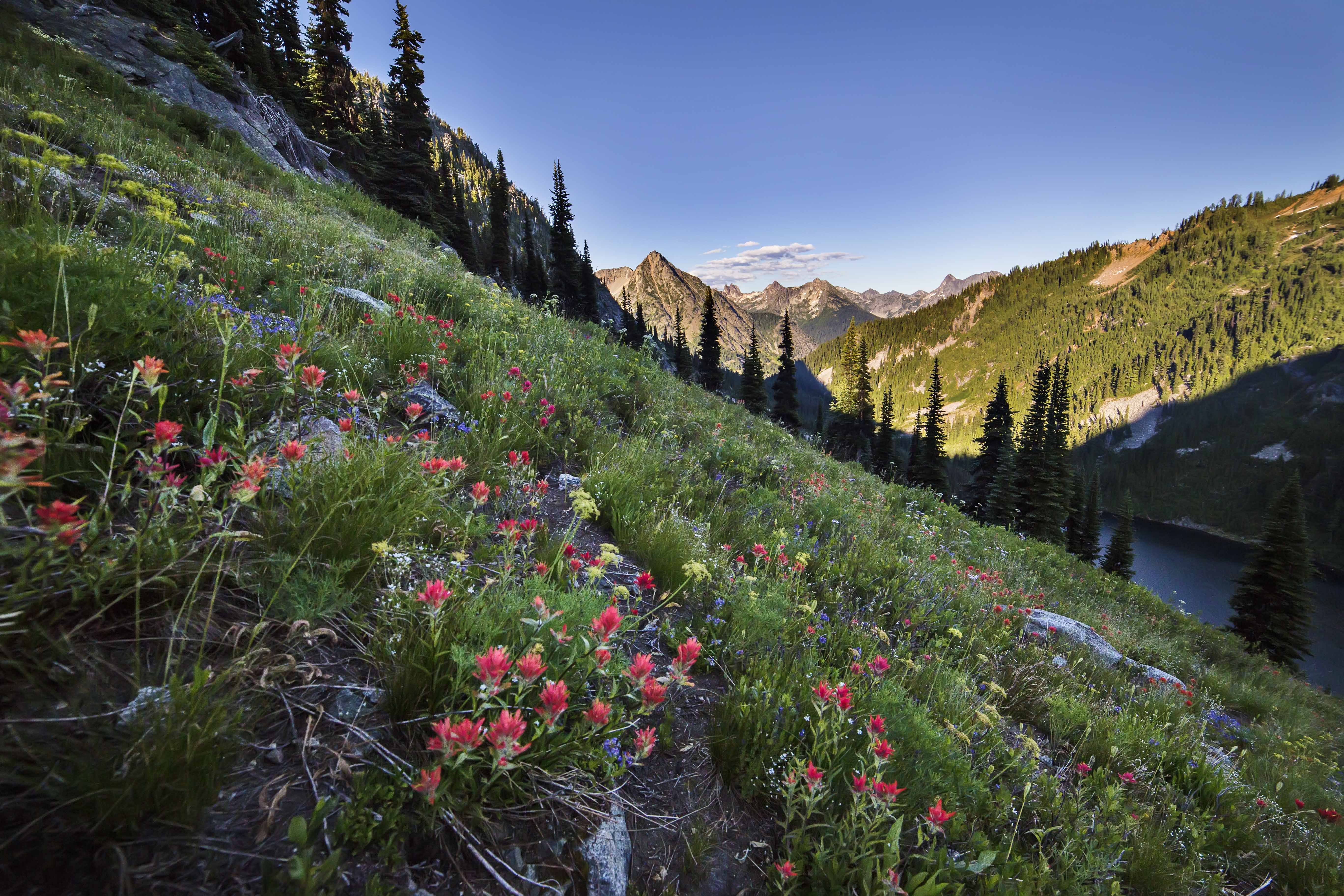
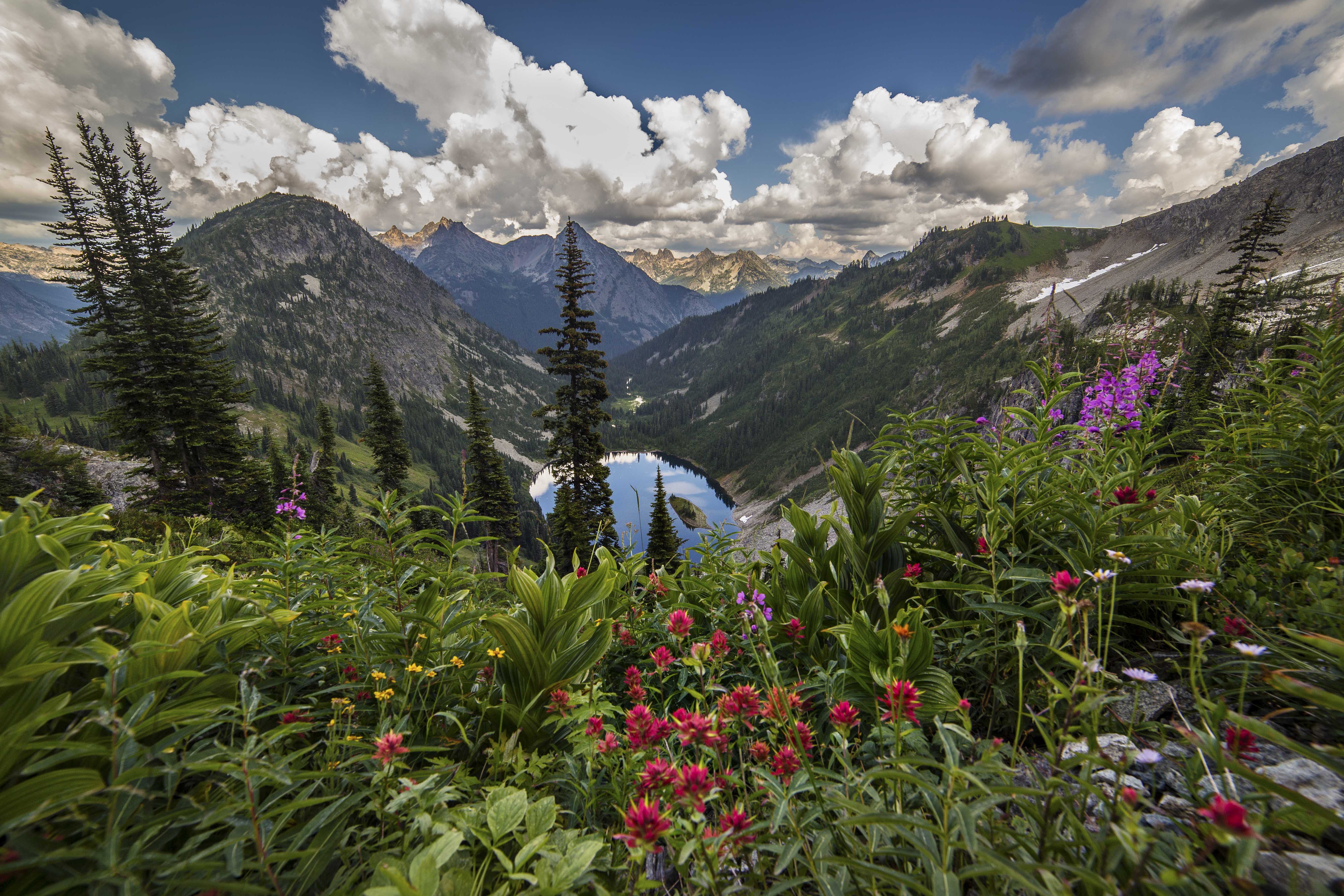
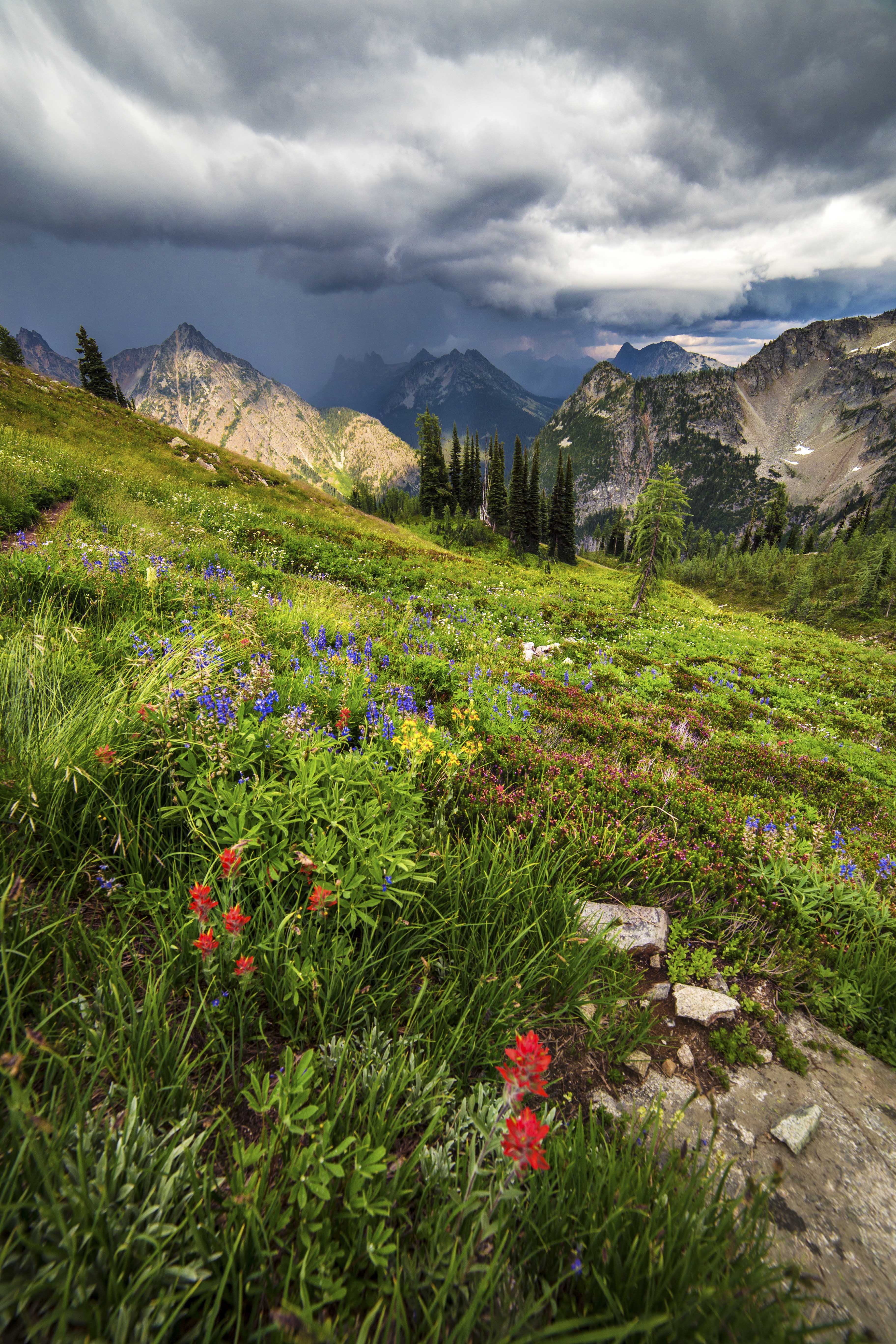
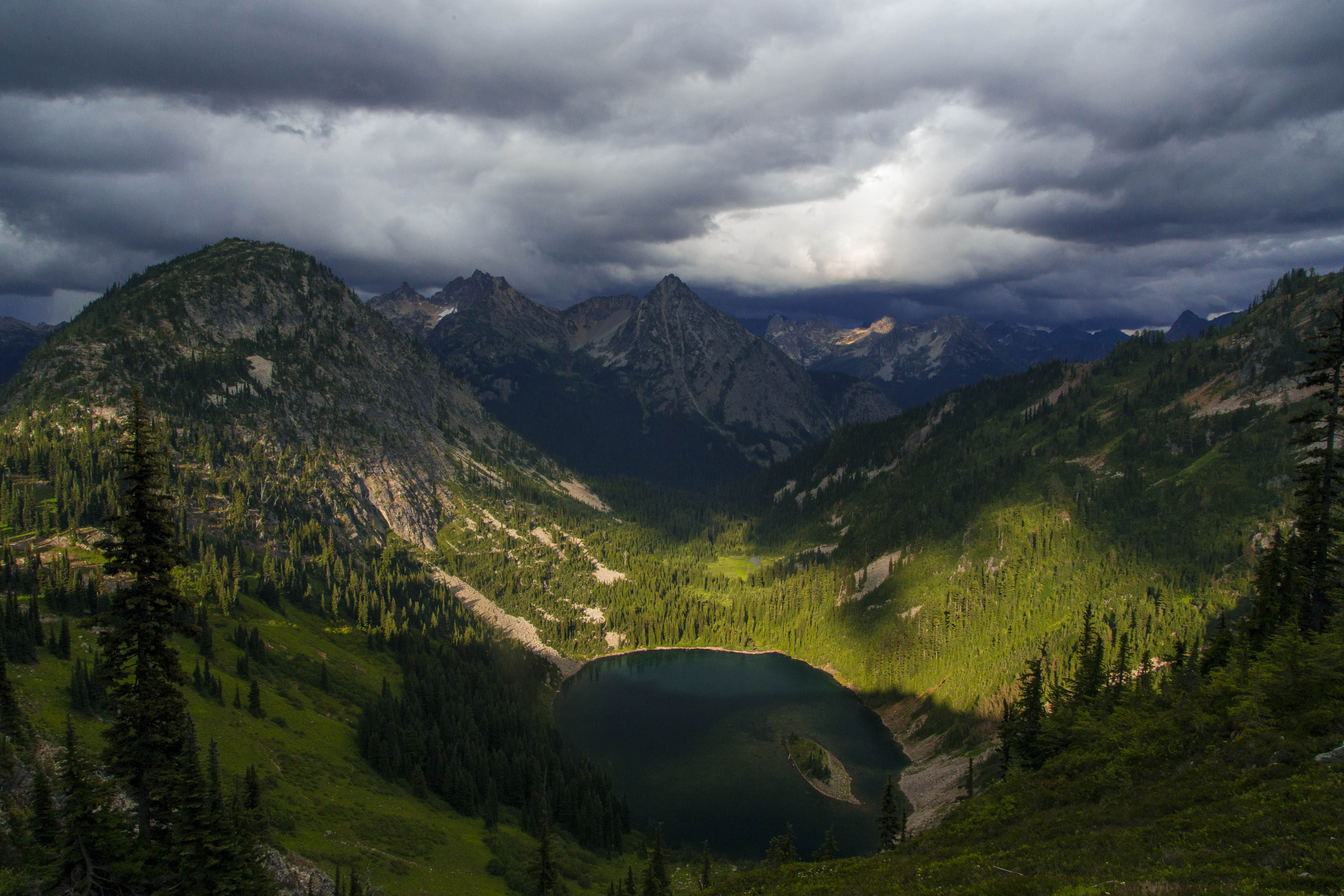
- To the south the parking area is to access the Maple Pass – Lake Ann Loop trail (one of my favorites), and the paved Rainy Lake trail.
Lots more on these trails later!
-
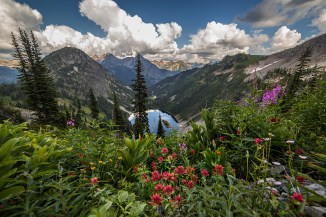
- Lake Ann from the Maple Pass Trail
-

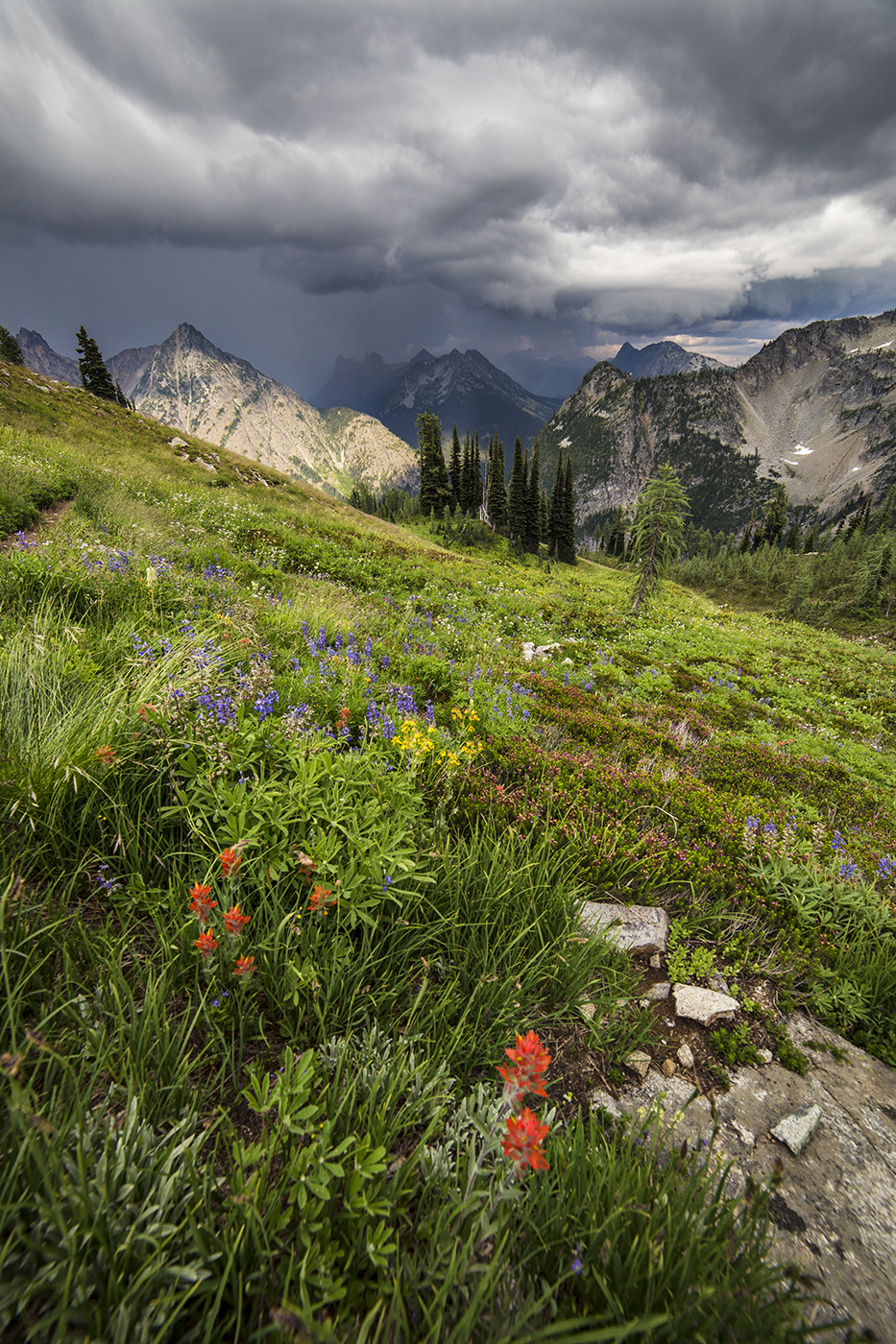
- Darkening clouds at Maple Pass
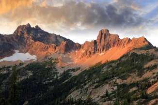
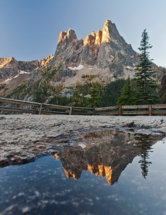
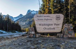
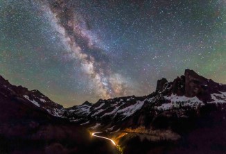
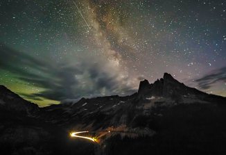
Washington Pass Overlook (milepost 163) is at the highest point along the highway, at 5,477 feet. There is a paved spur road to parking, restrooms and a pathway to the overlook. Liberty Bell is the massive slab towering above. Sunrise is the time for the best light on the peak.
The long curve of the highway below makes for some sweet shots at night. This is one of the best spots for capturing images of the Milky Way.
-
- Liberty Bell
-
- Washington Pass Overlook
-
- Washington Pass Overlook, North Cascades Highway
-
- North Cascades Highway
The North Cascades Highway is a part of the Cascade Loop Scenic Byway. This 440 mile loop crosses the Cascade Range twice and visits some of the most stunning scenery in the USA. Visit their web site to earn EVERYTHING you need to make your trip a huge success.